![]()
![]()
Status: Replaced by a new bridge
Location: 46.452222,-113.225000
Carries CR 008 over Boulder Creek
Design: truss/pony
Design Details: Pony truss
Total Length: 45.9 Feet
Span Length: 44.6 Feet
Overview: Pony truss bridge over Boulder Creek on CR 008
History: Built 1935
Built: 1935
Location: Granite County
View Bridge Information In Wayback Machine
![]()
![]()
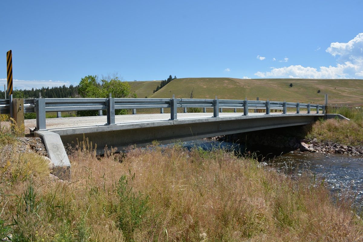
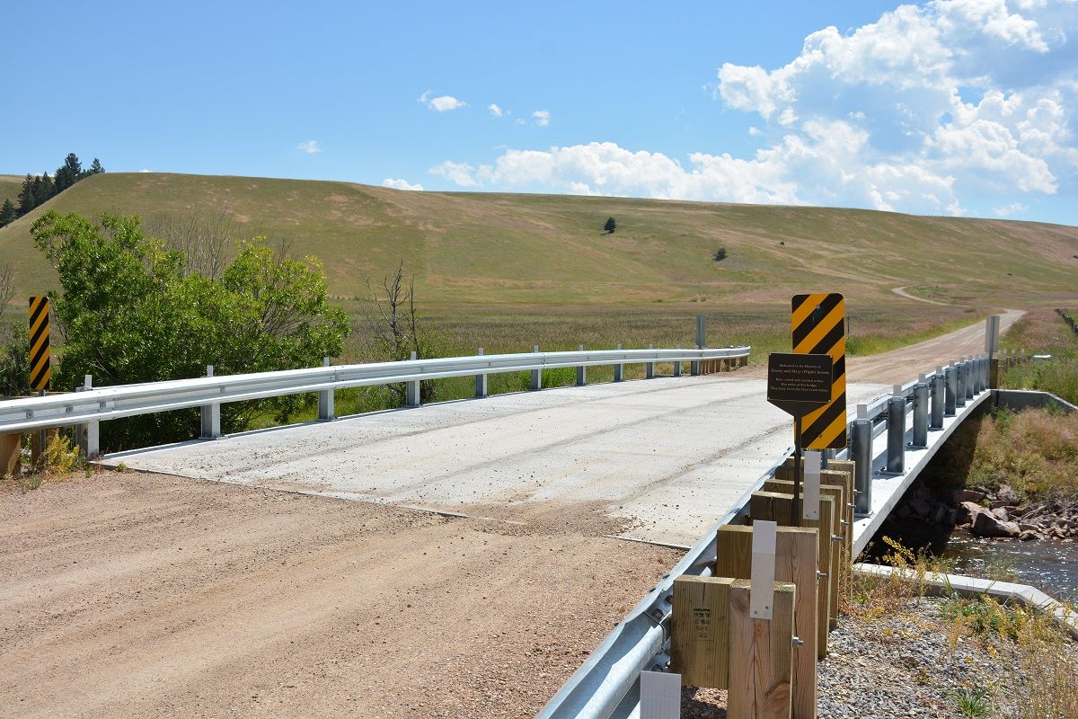
Status: Replaced by a new bridge
Location: 46.550197,-113.215258
Carries CR 044 over Flint Creek
Design: truss/bedstead/warren
Design Details: Bedstead Warren pony truss
Total Length: 46.9 Feet
Span Length: 46.9 Feet
Overview: Lost Bedstead Warren pony truss bridge over Flint Creek on CR 044
History: Built 1955
Built: 1955
Location: Granite County
View Bridge Information In Wayback Machine
![]()
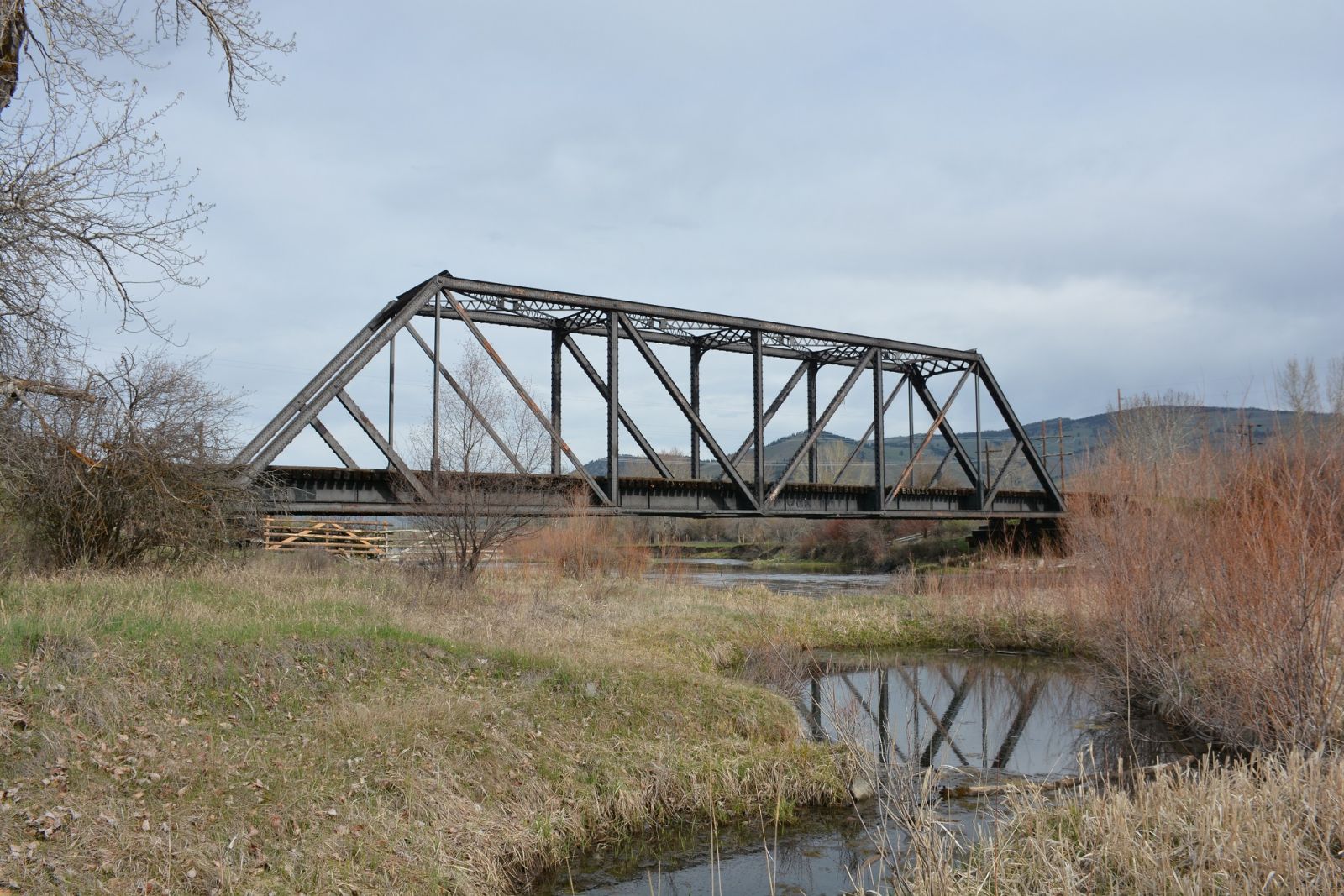
392246
Replaced Flint Creek Bridge
View from the west
Photo taken by David Jones in July 2016
392247
Replaced Flint Creek Bridge
Northwestern portal
Photo taken by David Jones in July 2016
![]()
Status: No longer exists
Location: 46.348889,-113.605556
Carries CR 002 over Stony Creek
Design: truss/pony
Design Details: Pony truss
Total Length: 26.2 Feet
Span Length: 24.9 Feet
Overview: Lost pony truss bridge over Stony Creek on CR 002
History: Built 1945; replaced 1999
Built: 1945
Location: Granite County
View Bridge Information In Wayback Machine
![]()
![]()
Status: Abandoned with one span removed/destroyed by flooding
Location: 46.706444,-113.508685
Carries Railroad (MILW) over Clark Fork River
Design: girder/pony/plate
Design Details: Pony plate girder
Total Length: 0.0 Feet
Span Length: 0.0 Feet
Overview: Abandoned pony/through plate girder bridge over Clark Fork River on Railroad (MILW)
History: Built 1908
Built: 1908
Location: Granite County
View Bridge Information In Wayback Machine
![]()
266523
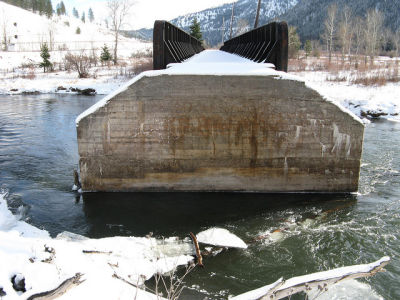
Photo taken by montanatom1950
![]()
Status: Open to pedestrians only
Location: 46.560171,-113.704190
Carries pedestrian pathway over Rock Creek
Design: suspension/wire
Design Details: Wire/cable suspension
Total Length: 0.0 Feet
Span Length: 0.0 Feet
Overview: Wire swinging suspension footbridge over Rock Creek on pedestrian pathway
History:
Built:
Location: Granite County
View Bridge Information In Wayback Machine
![]()
![]()
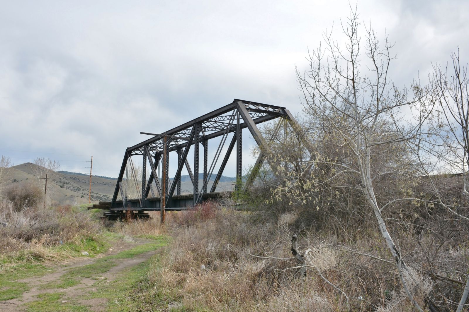
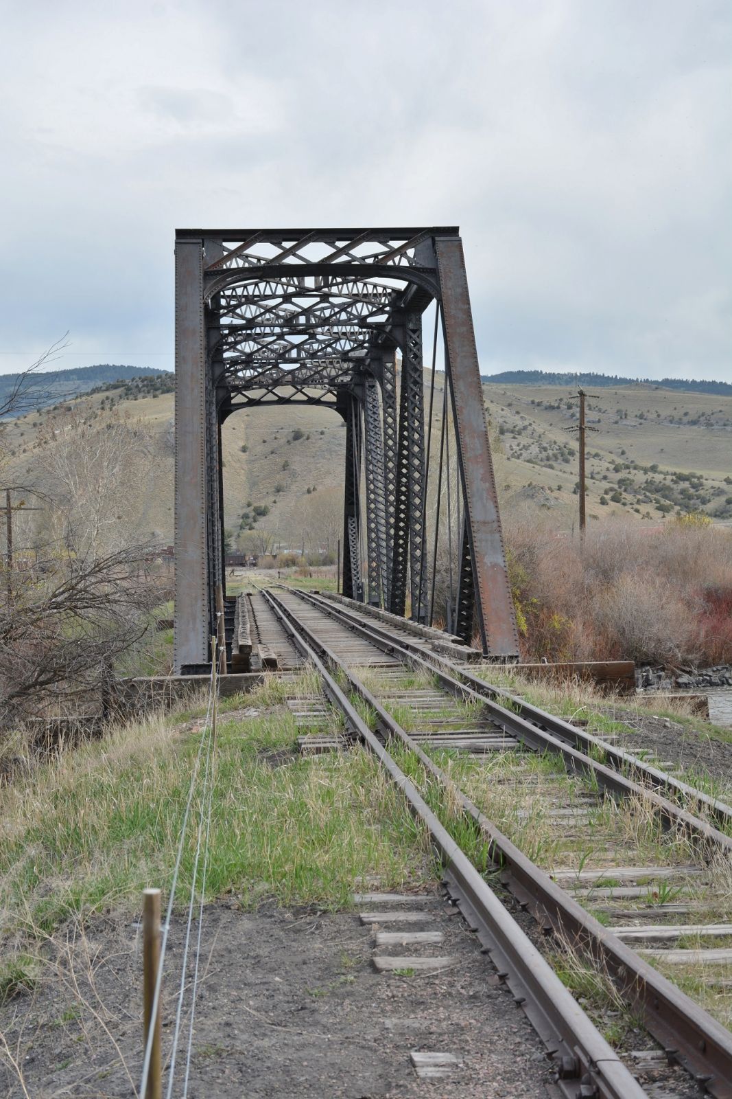
Status: Intact but closed to all traffic
Location: 46.660011,-113.146133
Carries BN/NP Phillipsburg Branch over Clark Fork
Design: truss/through/pratt
Design Details: Pratt through truss
Total Length: 0.0 Feet
Span Length: 0.0 Feet
Overview: Through truss bridge over Clark Fork on BN/NP Phillipsburg Branch
History: Built 1952
Built: 1952
Location: Granite County
View Bridge Information In Wayback Machine
![]()
353790
BN Philipsburg Branch Clark Fork Bridge
View looking west
Photo taken by David Jones in April 2016
353791
BN Philipsburg Branch Clark Fork Bridge
View looking northeast
Photo taken by David Jones in May 2016
353792
BN Philipsburg Branch Clark Fork Bridge
Photo taken by David Jones in May 2016
449953
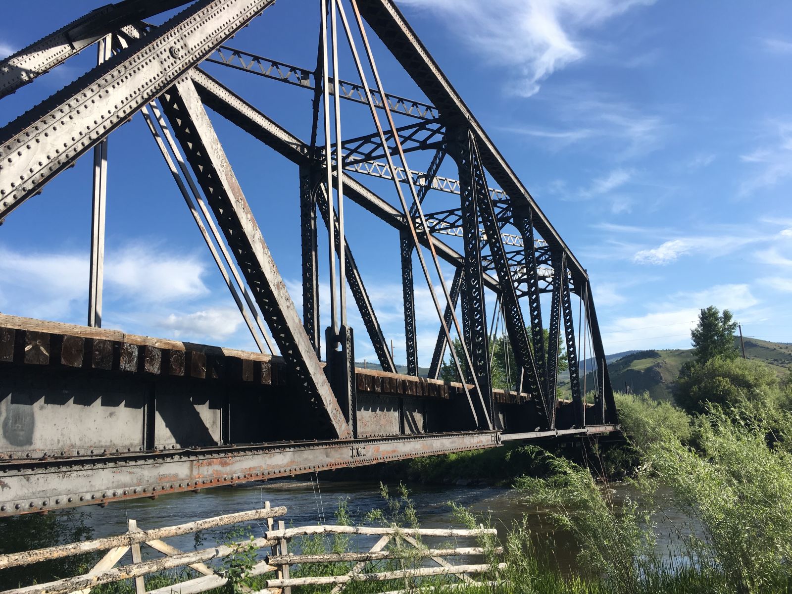
Photo taken by John Bernhisel in June 2019
449954
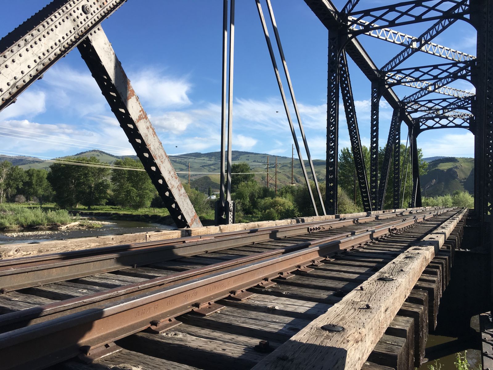
Photo taken by John Bernhisel in June 2019
449955
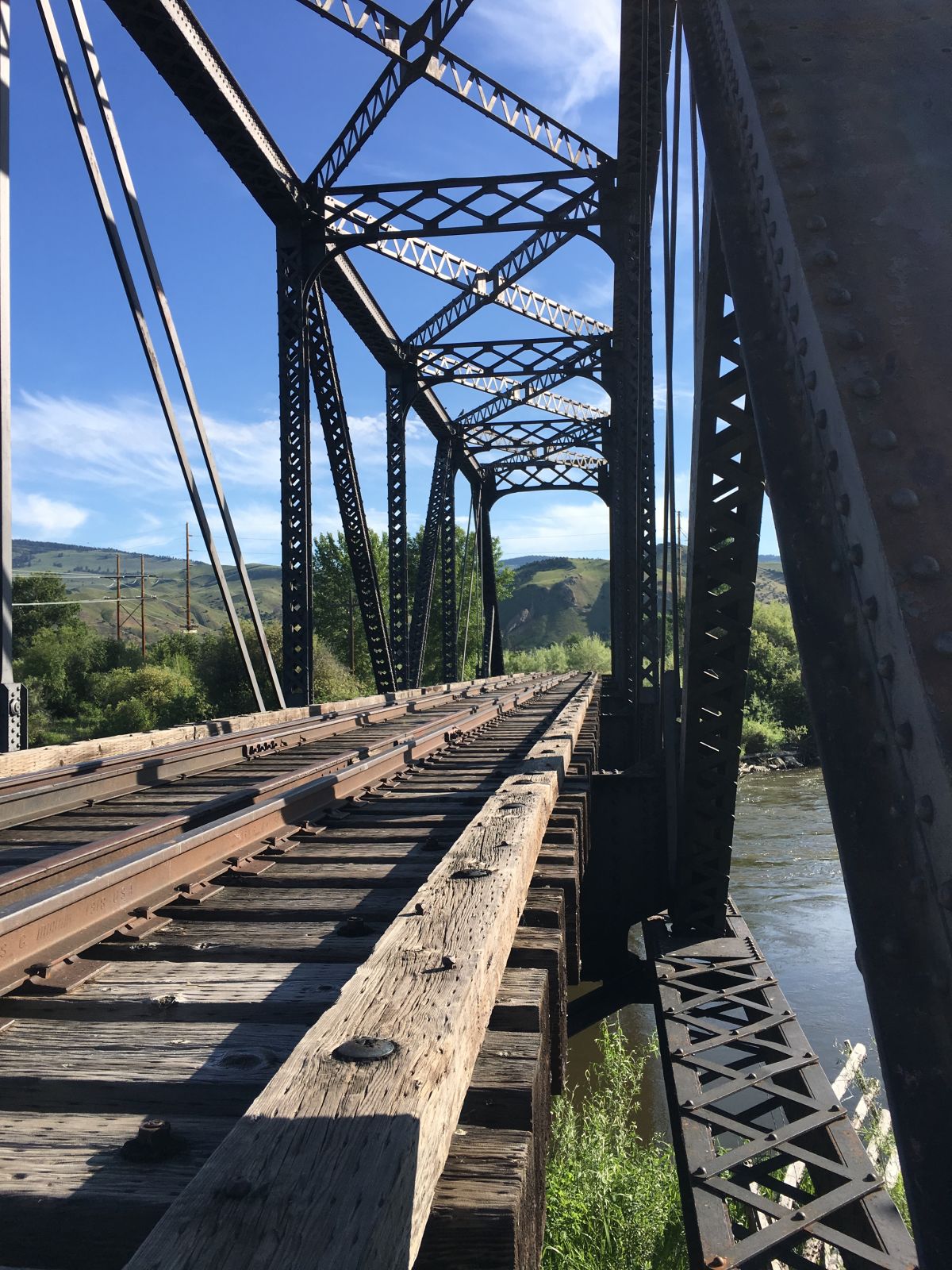
Photo taken by John Bernhisel in June 2019
449956
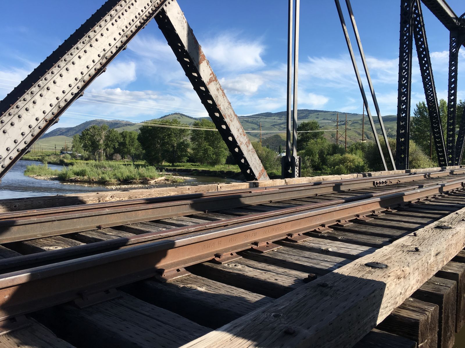
Photo taken by John Bernhisel in June 2019
449957
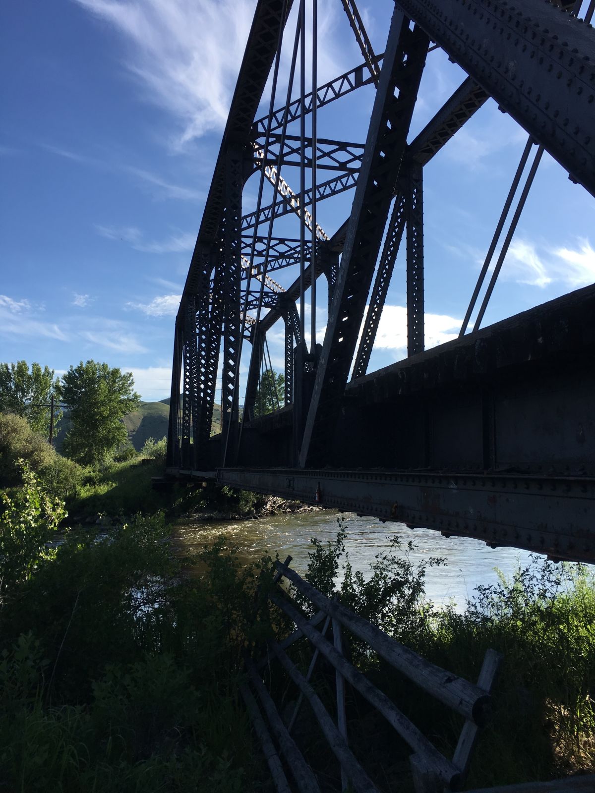
Photo taken by John Bernhisel in June 2019
![]()
Status: Derelict/abandoned
Location: 46.708588,-113.512909
Carries Chicago, Milwaukee, St. Paul & Pacific Railway over
Design: tunnel
Design Details: Tunnel
Total Length: 1157.0 Feet
Span Length: 0.0 Feet
Overview: Abandoned tunnel on Chicago, Milwaukee, St. Paul & Pacific Railway
History: Built 1908, abandoned 1980
Built: 1908
Location: Granite County
View Bridge Information In Wayback Machine
![]()
316110
West Portal
Photo taken by Montanatom
316111
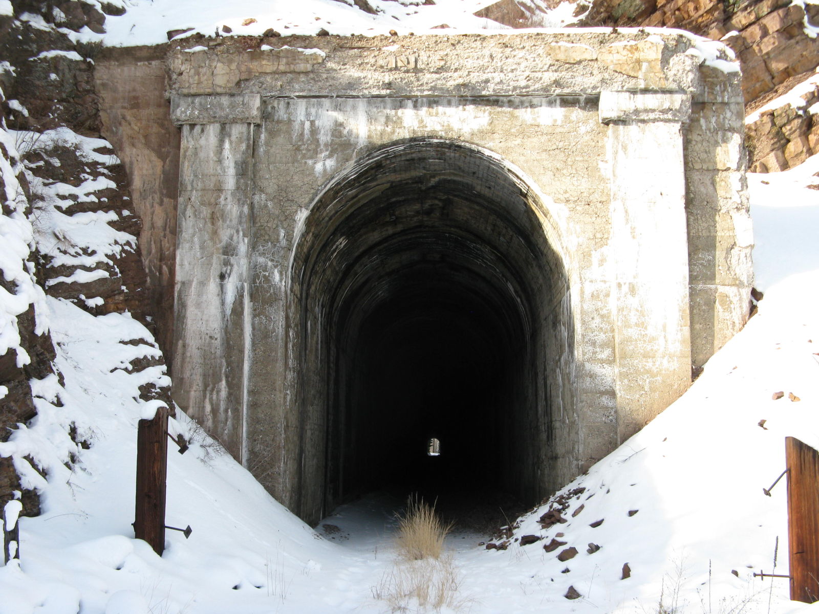
East Portal
Photo taken by Montanatom
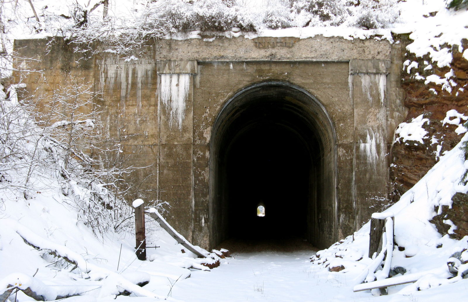
![]()
Status: Open to traffic
Location: 46.708986,-113.512180
Carries Montana Rail Link over
Design: tunnel
Design Details: Tunnel
Total Length: 909.0 Feet
Span Length: 0.0 Feet
Overview: Tunnel on Montana Rail Link
History: Built 1882, widened 1909
Built: 1882
Location: Granite County
View Bridge Information In Wayback Machine
![]()
353782
MRL - Nimrod Tunnel
East End
Photo taken by David Jones in May 2016
353783
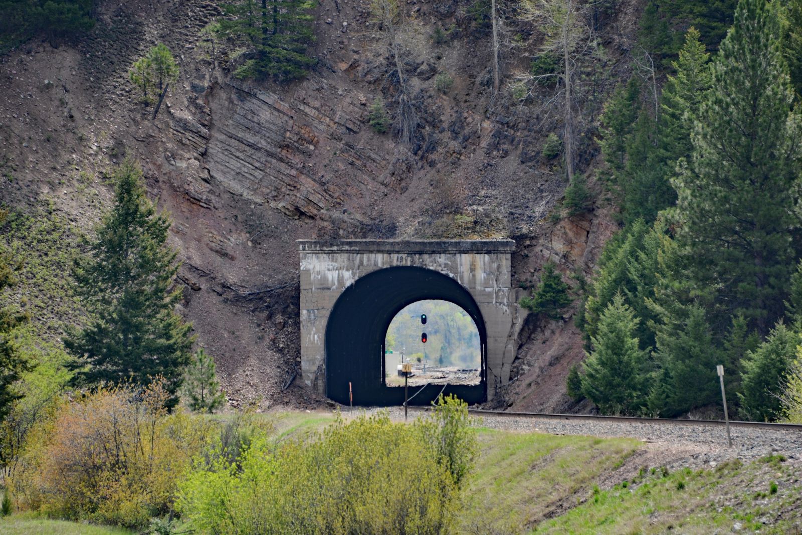
MRL - Nimrod Tunnel
West end
Photo taken by David Jones in May 2016
![]()
Status: Open to traffic
Location: 46.666653,-113.147292
Carries Main Street over Bergman Slough 019
Design: beam/stringer/wood
Design Details: Timber stringer
Total Length: 25.9 Feet
Span Length: 24.9 Feet
Overview: Timber stringer bridge over Bergman Slough 019 on Main Street
History: Built 1934
Built: 1934
Location: Granite County
View Bridge Information In Wayback Machine
![]()
![]()
Status: Open to traffic
Location: 46.295853,-113.316036
Carries S 1 over Fred Burr Creek
Design: beam/tee
Design Details: Concrete tee beam
Total Length: 63.0 Feet
Span Length: 30.8 Feet
Overview: Concrete tee beam bridge over Fred Burr Creek on S 1
History: Built 1931; rehabilitated 1956
Built: 1931
Location: Granite County
View Bridge Information In Wayback Machine
![]()
![]()
Status: Replaced by a new bridge
Location: 46.700085,-113.446776
Carries Northern Pacific Railroad over Clark Fork
Design: girder/pony/plate
Design Details: Pony plate girder
Total Length: 309.0 Feet
Span Length: 70.0 Feet
Overview: Lost Pony/through plate girder bridge over Clark Fork on Northern Pacific Railroad
History: Built 1902; Replaced 1908-09 during a double tracking project and relocated
Built: 1902
Location: Granite County
View Bridge Information In Wayback Machine
![]()
![]()
Status: Open to traffic
Location: 46.700105,-113.446759
Carries Montana Rail Link over Clark Fork
Design: girder/pony/plate
Design Details: Pony plate girder
Total Length: 309.0 Feet
Span Length: 73.0 Feet
Overview: Pony/through plate girder bridge over Clark Fork on Montana Rail Link
History: Built 1909
Built: 1909
Location: Granite County
View Bridge Information In Wayback Machine
![]()
Special Bridge Conditions Legend: R - Former location of relocated bridge. ! - At risk for demolition or destruction. X - Confirmed demolished or collapsed. S - Dismantled and/or in storage. L - Severe loss of historic integrity due to alteration.
![]()

![]()