![]()
![]()
Status: Replaced by a new bridge
Location: 41.552851,-96.354195
Carries CR 20 over Bell Creek
Design: truss/pony
Design Details: Pony truss
Total Length: 61.0 Feet
Span Length: 60.0 Feet
Overview: Lost pony truss bridge over Bell Creek on CR 20, 1 mi. north and 3.7 mi. east of Fontanelle
History: Built ca. 1935; replaced 2006
Built: ca. 1935
Location: Washington County
View Bridge Information In Wayback Machine
![]()
![]()
Status: Open to traffic
Location: 41.494722,-96.349167
Carries COLL 7944 over Bell Creek
Design: truss/pony
Design Details: Pony truss
Total Length: 70.9 Feet
Span Length: 69.9 Feet
Overview: Pony truss bridge over Bell Creek on COLL 7944, 2.5 mi. north of Arlington
History: Built 1955
Built: 1955
Location: Washington County
View Bridge Information In Wayback Machine
![]()
![]()
Status: Replaced by a new bridge
Location: 41.458526,-96.347461
Carries CR P32 over Bell Creek
Design: truss/pony
Design Details: Pony truss
Total Length: 101.1 Feet
Span Length: 100.1 Feet
Overview: Lost pony truss bridge over Bell Creek on CR P32
History: Built 1930; replaced 2005
Built: 1930
Location: Washington County
View Bridge Information In Wayback Machine
![]()
![]()
Status: Open to traffic
Location: 41.408333,-96.190000
Carries COUNTY ROAD 40 over Big Papillion Creek
Design: truss/pony
Design Details: Pony truss
Total Length: 101.1 Feet
Span Length: 100.1 Feet
Overview: Pony truss bridge over Big Papillion Creek on a county road, .5 mi. north and .7 mi. east of Washington
History: Built 1930
Built: 1930
Location: Washington County
View Bridge Information In Wayback Machine
![]()
![]()
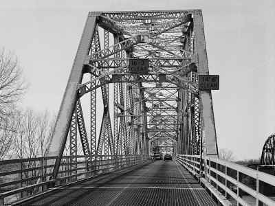
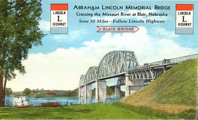
Status: Replaced by a modern bridge
Location: 41.551110,-96.096230
Carries US 30 over Missouri River
Design: truss/through/pennsylvania
Design Details: Pennsylvania through truss
Total Length: 1340.0 Feet
Span Length: 333.0 Feet
Overview: Lost three-span through truss bridge over the Missouri River on US 30 east of Blair
History: Built 1928-29; tolls removed 1962; replaced 1991
Built: 1929
Location: Washington County
View Bridge Information In Wayback Machine
![]()
108038
Overview
Photos taken November 1986 by Clayton B. Fraser for the Historic American Engineering Record
108039
One span
108040
View from below
108041
Deck truss approach span
108042
East portal
108043
Deck view
108044
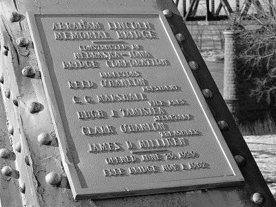
Plaque
417679
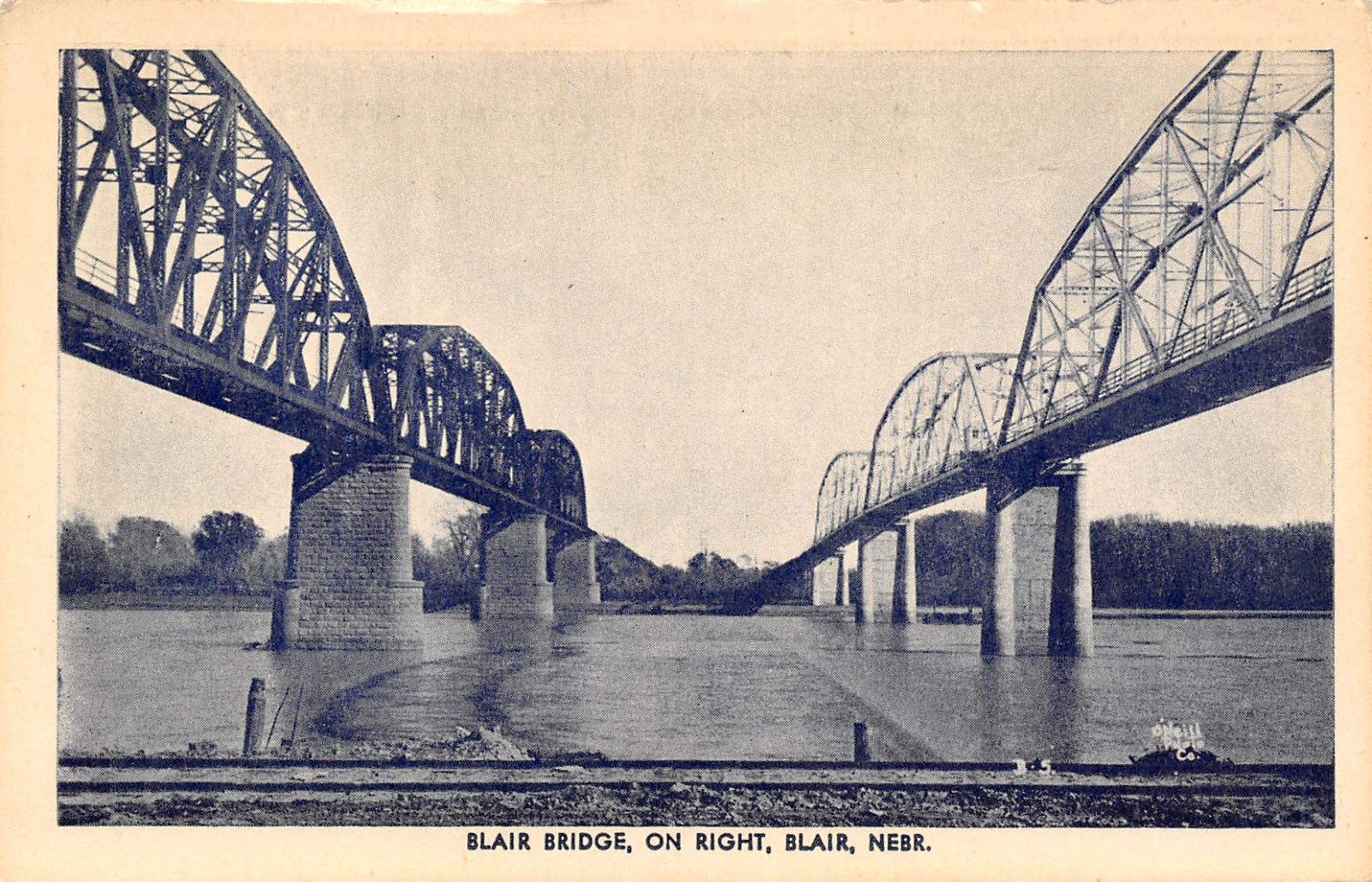
Blair Bridge
On Right, Blair, Nebraska
1940s Postcard Image proved by David Shedlock
459854
Blair Bridge
Photo from old postcard
459855

Blair Bridge 1
Photo taken by Geoff Hubbs
![]()
Status: Replaced by a new bridge
Location: 41.581924,-96.425959
Carries CR 16 over Brown Creek
Design: truss/pony
Design Details: Pony truss
Total Length: 45.9 Feet
Span Length: 44.9 Feet
Overview: Lost pony truss bridge over Brown Creek on CR 16, 3 mi. north of Fontanelle
History: Built 1955; replaced 2005
Built: 1955
Location: Washington County
View Bridge Information In Wayback Machine
![]()
![]()
Status: Open to traffic
Location: 41.566667,-96.406667
Carries COUNTY ROAD 18 over Brown Creek
Design: truss/pony
Design Details: Pony truss
Total Length: 41.0 Feet
Span Length: 40.0 Feet
Overview: Pony truss bridge over Brown Creek on a county road, 2 mi. north and .7 mi. east of Fontanelle
History: Built 1955
Built: 1955
Location: Washington County
View Bridge Information In Wayback Machine
![]()
![]()
Status: Replaced by a new bridge
Location: 41.509357,-96.379020
Carries CR 26 over Brown Creek
Design: truss/pony
Design Details: Pony truss
Total Length: 50.9 Feet
Span Length: 49.9 Feet
Overview: Lost pony truss bridge over Brown Creek on CR 26, 3.5 mi. north and .6 mi. west of Arlington
History: Built ca. 1935; replaced 2010
Built: ca. 1935
Location: Washington County
View Bridge Information In Wayback Machine
![]()
![]()
Status: Open to traffic
Location: 41.556667,-96.405000
Carries CR 20 over Brown Creek
Design: truss/pony
Design Details: Pony truss
Total Length: 56.1 Feet
Span Length: 55.1 Feet
Overview: Pony truss bridge over Brown Creek on CR 20, 1 mi. east and 1.5 mi. north of Fontanelle
History: Built 1955
Built: 1955
Location: Washington County
View Bridge Information In Wayback Machine
![]()
![]()
Status: Open to traffic
Location: 41.523333,-96.336667
Carries COUNTY ROAD 11 over Little Bell Creek
Design: truss/pony
Design Details: Pony truss
Total Length: 65.9 Feet
Span Length: 49.9 Feet
Overview: Pony truss bridge over Little Bell Creek on a township road, .4 mi. east and 4.5 mi. north of Arlington
History: Built ca. 1935
Built: ca. 1935
Location: Washington County
View Bridge Information In Wayback Machine
![]()
![]()
Status: Replaced by a new bridge
Location: 41.498100,-96.059592
Carries CR P26 over Mill Creek
Design: truss/pony
Design Details: Pony truss
Total Length: 111.9 Feet
Span Length: 80.1 Feet
Overview: Lost pony truss bridge over Mill Creek on CR P26, 2.3 mi. north and 1.5 mi. west of Fort Calhoun
History: Built ca. 1935; replaced 2016
Built: ca. 1935
Location: Washington County
View Bridge Information In Wayback Machine
![]()
![]()
Status: Open to traffic
Location: 41.493333,-96.098333
Carries COUNTY ROAD 37 over Mill Creek
Design: truss/pony
Design Details: Pony truss
Total Length: 103.0 Feet
Span Length: 80.1 Feet
Overview: Pony truss bridge over Mill Creek on a township road, 1 mi. east and 2 mi. south of Blair
History: Built 1945; rehabilitated 1970
Built: 1945
Location: Washington County
View Bridge Information In Wayback Machine
![]()
![]()
Status: Open to traffic
Location: 41.474295,-96.031515
Carries County Road P43 over Moors Creek
Design: truss/pony
Design Details: Pony truss
Total Length: 70.9 Feet
Span Length: 69.9 Feet
Overview: Pony truss bridge over Moors Creek on County Road P43, 1 mi. north of Fort Calhoun
History: Built ca. 1935
Built: ca. 1935
Location: Washington County
View Bridge Information In Wayback Machine
![]()
![]()
Status: Open to traffic
Location: 41.662186,-96.209536
Carries CR P4 over New York Creek
Design: truss/pony
Design Details: Pony truss
Total Length: 110.9 Feet
Span Length: 49.9 Feet
Overview: Pony truss bridge over New York Creek on CR P4, .7 mi. south and .2 mi. east of Herman
History: Built ca. 1935
Built: ca. 1935
Location: Washington County
View Bridge Information In Wayback Machine
![]()
![]()
Status: Open to traffic
Location: 41.615000,-96.280000
Carries COUNTY ROAD P19 over New York Creek
Design: truss/pony
Design Details: Pony truss
Total Length: 100.1 Feet
Span Length: 81.0 Feet
Overview: Pony truss bridge over New York Creek on a county road, 3.5 mi. south and 3.5 mi. west of Herman
History: Built ca. 1935
Built: ca. 1935
Location: Washington County
View Bridge Information In Wayback Machine
![]()
![]()
Status: Open to traffic
Location: 41.615000,-96.270000
Carries NEW YORK CREEK LN over New York Creek
Design: truss/pony
Design Details: Pony truss
Total Length: 74.2 Feet
Span Length: 50.9 Feet
Overview: Pony truss bridge over New York Creek on a county road
History: Built ca. 1935
Built: ca. 1935
Location: Washington County
View Bridge Information In Wayback Machine
![]()
![]()
Status: Replaced by a new bridge
Location: 41.498233,-96.386560
Carries CR 7 over Ray Creek
Design: truss/pony
Design Details: Pony truss
Total Length: 50.9 Feet
Span Length: 50.9 Feet
Overview: Lost pony truss bridge over Ray Creek on CR 7, 2.8 mi. north and 1 mi. west of Arlington
History: Built 1925; replaced 2004
Built: 1925
Location: Washington County
View Bridge Information In Wayback Machine
![]()
![]()
Status: Replaced by a new bridge
Location: 41.683667,-96.432099
Carries CR A/CR 2 over Branch of Clark Creek
Design: truss/pony
Design Details: Pony truss
Total Length: 50.9 Feet
Span Length: 49.9 Feet
Overview: Pony truss bridge a branch of Clark Creek on CR A/CR 2
History: Built ca. 1935; replaced 2011
Built: ca. 1935
Location: Washington County
View Bridge Information In Wayback Machine
![]()
![]()
Status: Replaced by a new bridge
Location: 41.523775,-96.236560
Carries CR 24 over Branch of Big Papillion Creek
Design: truss/pony
Design Details: Pony truss
Total Length: 50.9 Feet
Span Length: 49.9 Feet
Overview: Pony truss bridge over a branch of Big Papillion Creek on CR 24, 3.5 mi. west of Blair
History: Built ca. 1935; replaced 2015
Built: ca. 1935
Location: Washington County
View Bridge Information In Wayback Machine
![]()
![]()
Status: Replaced by a new bridge
Location: 41.523654,-96.199356
Carries CR 24 over Branch of Big Papillion Creek
Design: truss/pony
Design Details: Pony truss
Total Length: 50.9 Feet
Span Length: 49.9 Feet
Overview: Lost pony truss bridge over a branch of Big Papillion Creek on CR 24, 1.7 mi. west of Blair
History: Built ca. 1935; replaced 2014
Built: ca. 1935
Location: Washington County
View Bridge Information In Wayback Machine
![]()
![]()
Status: Replaced by a new bridge
Location: 41.477706,-96.194159
Carries CR 27 over East Fork Big Papillion Creek
Design: truss/pony
Design Details: Pony truss
Total Length: 70.9 Feet
Span Length: 69.9 Feet
Overview: Lost pony truss bridge over East Fork Big Papillion Creek on CR 27, .3 mi. east of Kennard
History: Built 1955; replaced 2009
Built: 1955
Location: Washington County
View Bridge Information In Wayback Machine
![]()
![]()
Status: Replaced by a new bridge
Location: 41.413333,-96.155000
Carries CR 31 over Butter Flat Creek
Design: truss/pony
Design Details: Pony truss
Total Length: 61.0 Feet
Span Length: 61.0 Feet
Overview: Lost pony truss bridge over Butter Flat Creek on CR 31, 3.5 mi. east and 1 mi. north of Washington
History: Built 1955; replaced 2005
Built: 1955
Location: Washington County
View Bridge Information In Wayback Machine
![]()
![]()
Status: Open to traffic
Location: 41.480000,-96.258333
Carries COUNTY ROAD 30 over TRIB NW BR BIG PAPILLION
Design: truss/pony
Design Details: Pony truss
Total Length: 50.9 Feet
Span Length: 49.9 Feet
Overview: Pony truss bridge over an unnamed stream on a county road, 2.6 mi. west of Kennard
History: Built 1955
Built: 1955
Location: Washington County
View Bridge Information In Wayback Machine
![]()
![]()
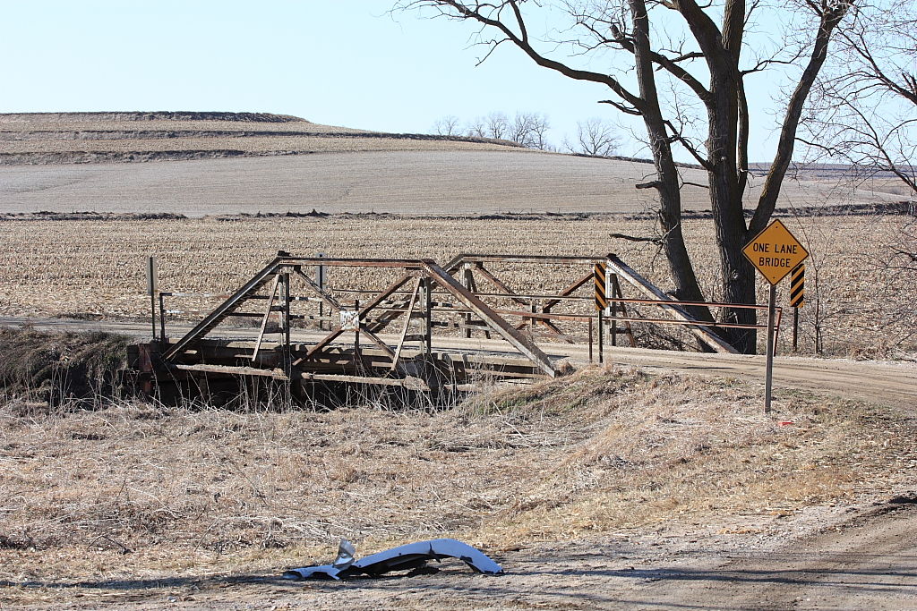
Status: Bridge is now closed to traffic.
Location: 41.465601,-96.213140
Carries CR 32 over Southwest branch Papillion Creek
Design: truss/pony/queenpost
Design Details: Queenpost pony truss
Total Length: 50.9 Feet
Span Length: 49.9 Feet
Overview: Pony truss bridge over Southwest branch Papillion Creek on CR 32, .3 mi. south and .4 mi. west of Kennard
History: Built 1956
Built: 1956
Location: Washington County
View Bridge Information In Wayback Machine
![]()
159677
Washington county bridge.
This Bridge is still in use. There is no name or time plate on Bridge.
Photo taken by Allan Love Jr in March 2010
![]()
Status: Open to traffic
Location: 41.681667,-96.173333
Carries COUNTY ROAD P29 over Unnamed stream
Design: truss/pony
Design Details: Pony truss
Total Length: 81.0 Feet
Span Length: 80.1 Feet
Overview: Pony truss bridge over an unnamed stream on a township road, 2 mi. east and .4 mi. north of Herman
History: Built ca. 1935
Built: ca. 1935
Location: Washington County
View Bridge Information In Wayback Machine
![]()
![]()
Status: Replaced by a new bridge
Location: 41.422303,-96.146350
Carries CR 38 over Butter Flat Creek
Design: truss/pony
Design Details: Pony truss
Total Length: 81.0 Feet
Span Length: 80.1 Feet
Overview: Lost pony truss bridge over Butter Flat Creek on CR 38, 1.5 mi. north and 3 mi. east of Washington
History: Built ca. 1935; replaced 2007
Built: ca. 1935
Location: Washington County
View Bridge Information In Wayback Machine
![]()
![]()
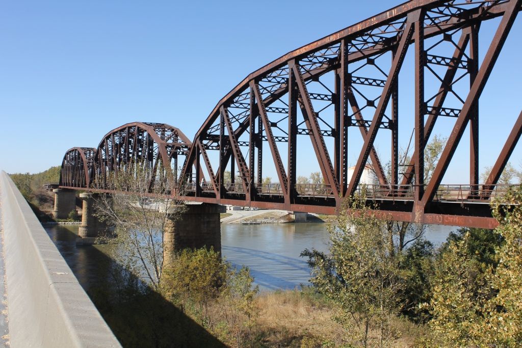
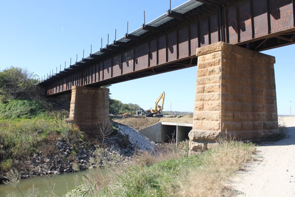
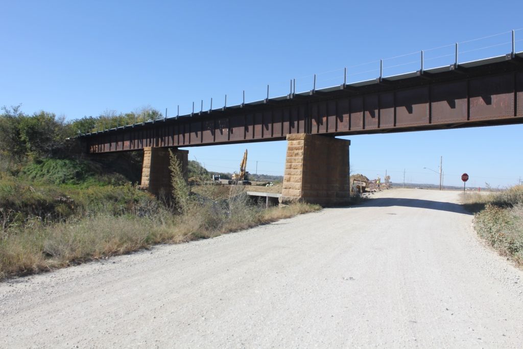
Status: Open to traffic
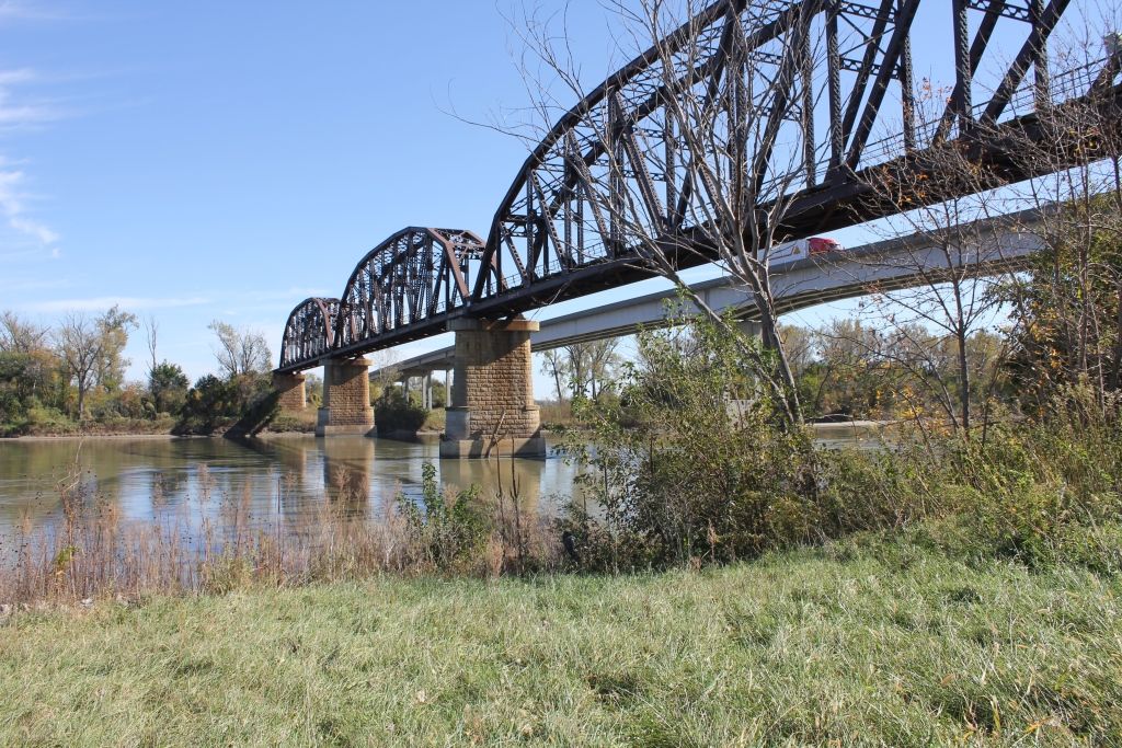
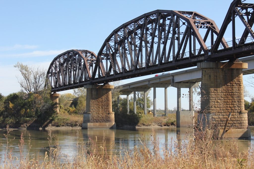
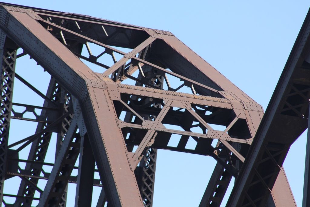
Reportedly a second bridge is to be built adjacent to this one in order to increase traffic capacity, the line is single track at present.
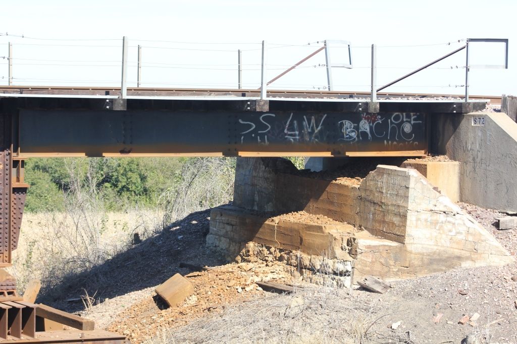
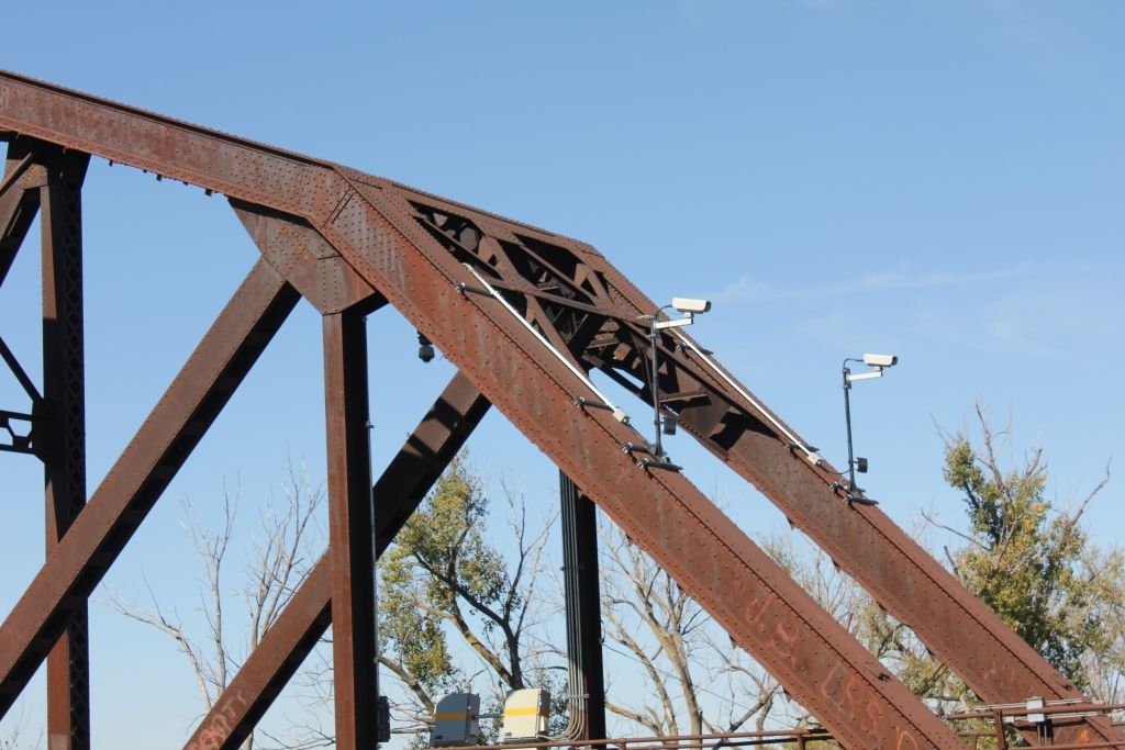
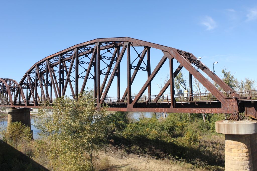
Location: 41.551403,-96.095489
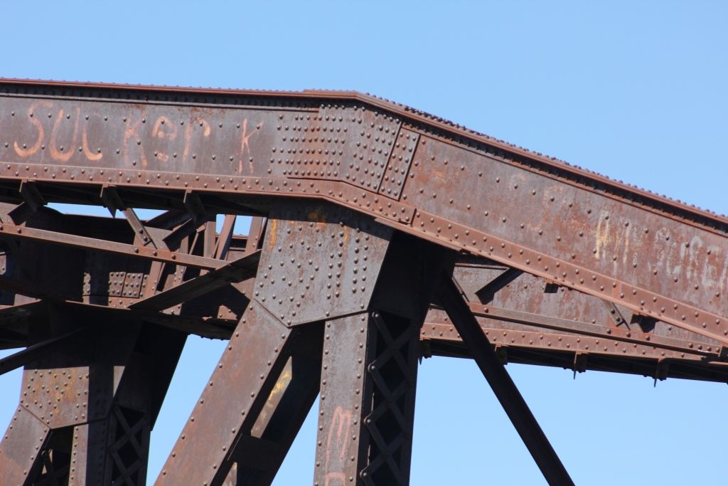
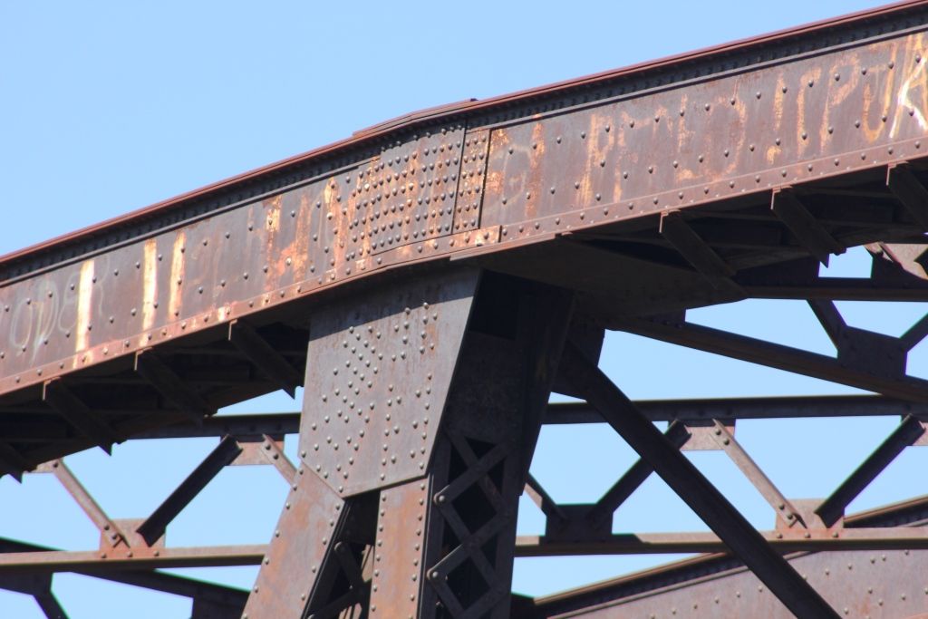
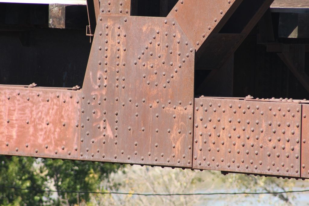
Carries Union Pacific Railroad over Missouri River
Design: truss/through/parker
Design Details: Three Parker through trusses
Total Length: 1335.0 Feet
Span Length: 335.0 Feet
Overview: Through truss bridge over Missouri River on Union Pacific Railroad
History: Built 1924 by the American Bridge Co.
Built: 1924
Location: Washington County
View Bridge Information In Wayback Machine
![]()
150471
UP Missouri River Bridge
UP Missouri River Bridge - Blair, NE
Photo taken by Brad J Williams in June 2009
339917

Blair Rail Bridge
Overview
Photo taken by John Marvig in October 2015
339918
Blair Rail Bridge
East Abutment and old East Abutment
Photo taken by John Marvig in October 2015
339919
Blair Rail Bridge
East Approach
Photo taken by John Marvig in October 2015
339920
Blair Rail Bridge
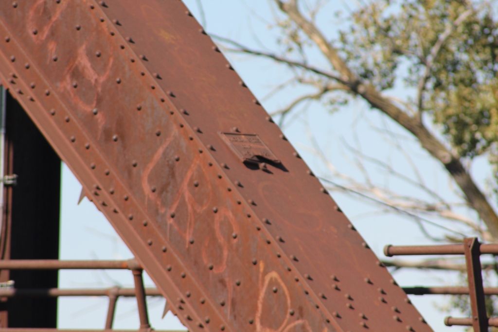
Plate
Photo taken by John Marvig in October 2015
339921
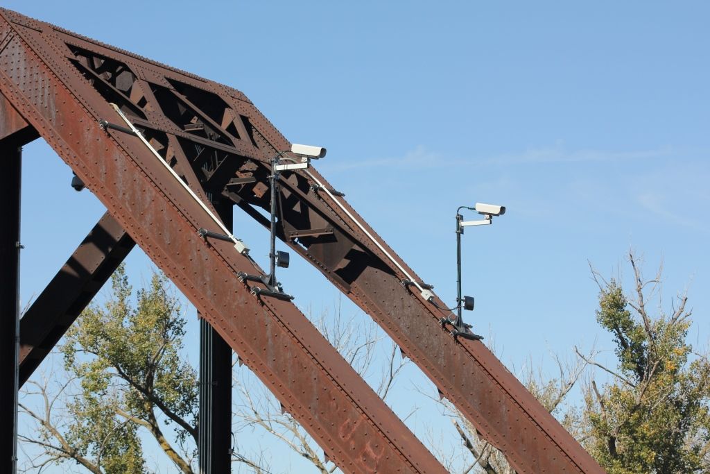
Blair Rail Bridge
Cameras
Photo taken by John Marvig in October 2015
339922
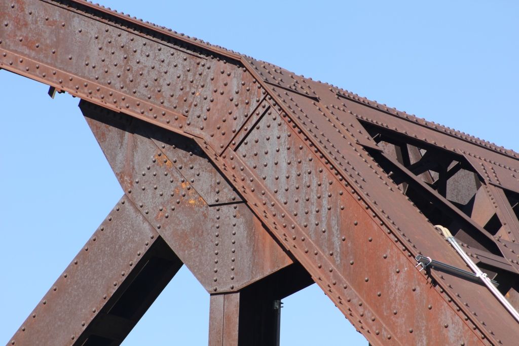
Blair Rail Bridge
Upper Angle Connection
Photo taken by John Marvig in October 2015
339923
Blair Rail Bridge
Upper Connection
Photo taken by John Marvig in October 2015
339924
Blair Rail Bridge
Upper Connection
Photo taken by John Marvig in October 2015
339925
Blair Rail Bridge
Lower Connection
Photo taken by John Marvig in October 2015
339926
Blair Rail Bridge
East Approach
Photo taken by John Marvig in October 2015
339927
Blair Rail Bridge
East Approach
Photo taken by John Marvig in October 2015
339928
Blair Rail Bridge
Eastern Pier
Photo taken by John Marvig in October 2015
339929
Blair Rail Bridge
Portal
Photo taken by John Marvig in October 2015
339930
Blair Rail Bridge
Eastern Span
Photo taken by John Marvig in October 2015
339931
Blair Rail Bridge
Eastern Pier
Photo taken by John Marvig in October 2015
339932
Blair Rail Bridge
Sway Bracing
Photo taken by John Marvig in October 2015
339933
Blair Rail Bridge
From Highway 30
Photo taken by John Marvig in October 2015
339934
Blair Rail Bridge
East Approach
Photo taken by John Marvig in October 2015
339935
Blair Rail Bridge
Overview from Nebraska End
Photo taken by John Marvig in October 2015
339936
Blair Rail Bridge
Western Span
Photo taken by John Marvig in October 2015
339937
Blair Rail Bridge
Center Span
Photo taken by John Marvig in October 2015
339938
Blair Rail Bridge
Overview
Photo taken by John Marvig in October 2015
339939
Blair Rail Bridge
West Approach
Photo taken by John Marvig in October 2015
339940
Blair Rail Bridge
West Pier
Photo taken by John Marvig in October 2015
339941
Blair Rail Bridge
Looking East
Photo taken by John Marvig in October 2015
339942
Blair Rail Bridge
West Abutment
Photo taken by John Marvig in October 2015
339943
Blair Rail Bridge
Ice Deflector
Photo taken by John Marvig in October 2015
339944
Blair Rail Bridge
Looking East
Photo taken by John Marvig in October 2015
339945
Blair Rail Bridge
Tower Base
Photo taken by John Marvig in October 2015
339946
Blair Rail Bridge
West Abutment
Photo taken by John Marvig in October 2015
339947
Blair Rail Bridge
Pier #2 from West
Photo taken by John Marvig in October 2015
339948
Blair Rail Bridge
Overview
Photo taken by John Marvig in October 2015
339949
Blair Rail Bridge
Eastern Spans
Photo taken by John Marvig in October 2015
339950
Blair Rail Bridge
Portal Bracing
Photo taken by John Marvig in October 2015
339951
Blair Rail Bridge
East Span
Photo taken by John Marvig in October 2015
339952
Blair Rail Bridge
Overview
Photo taken by John Marvig in October 2015
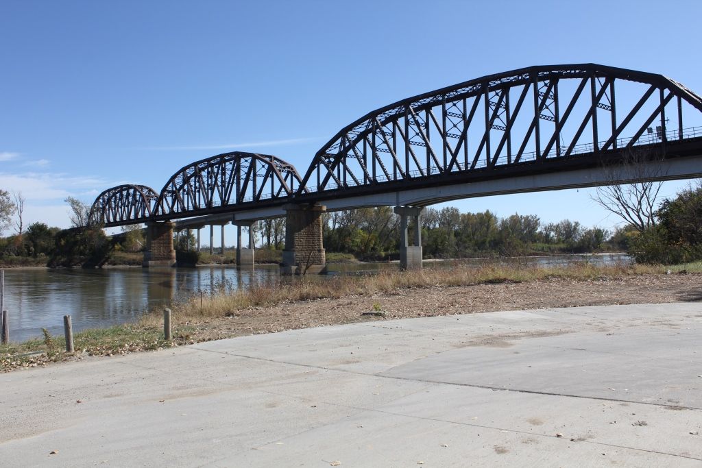
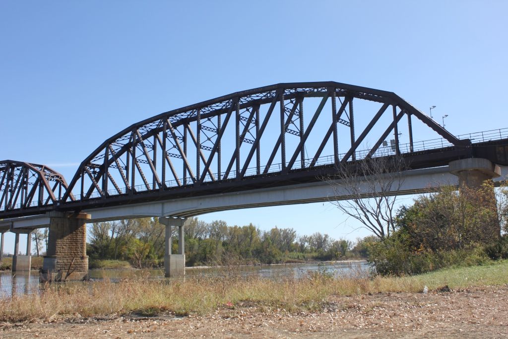
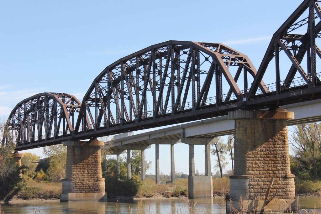
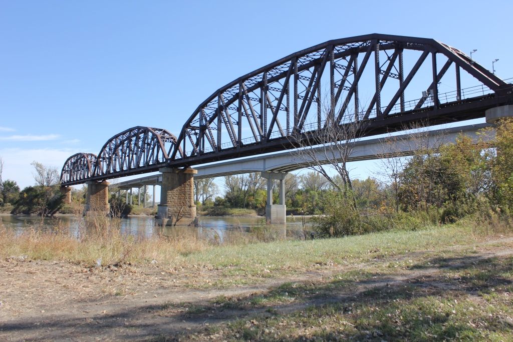
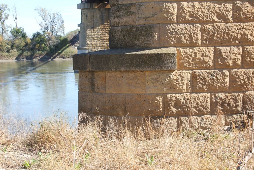
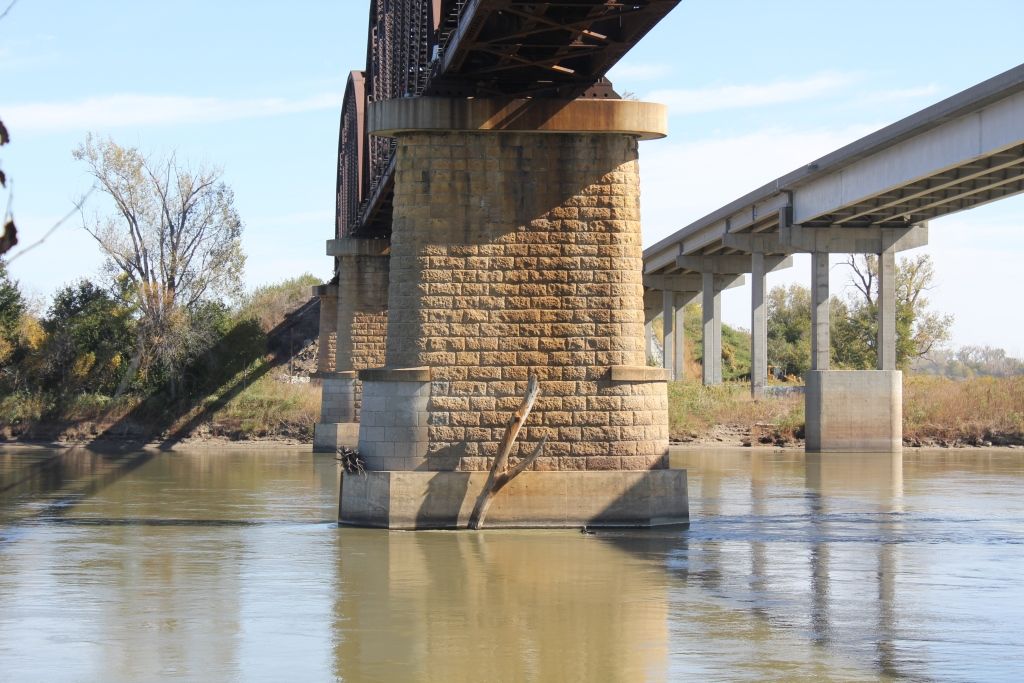
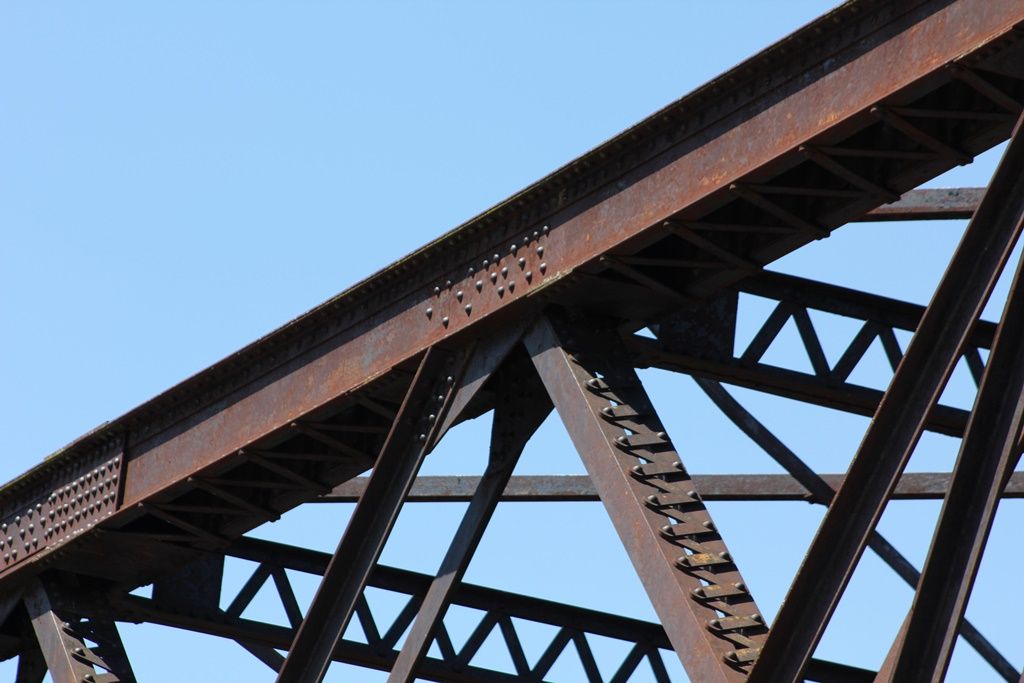
![]()
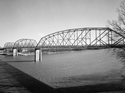
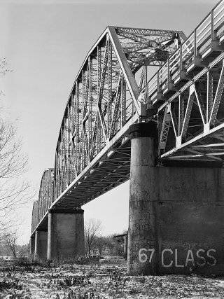
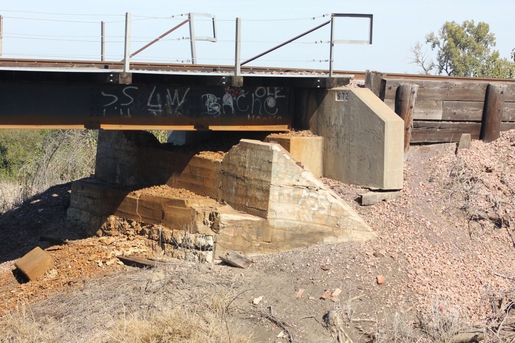
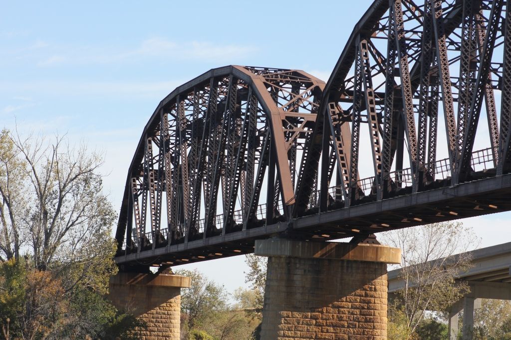
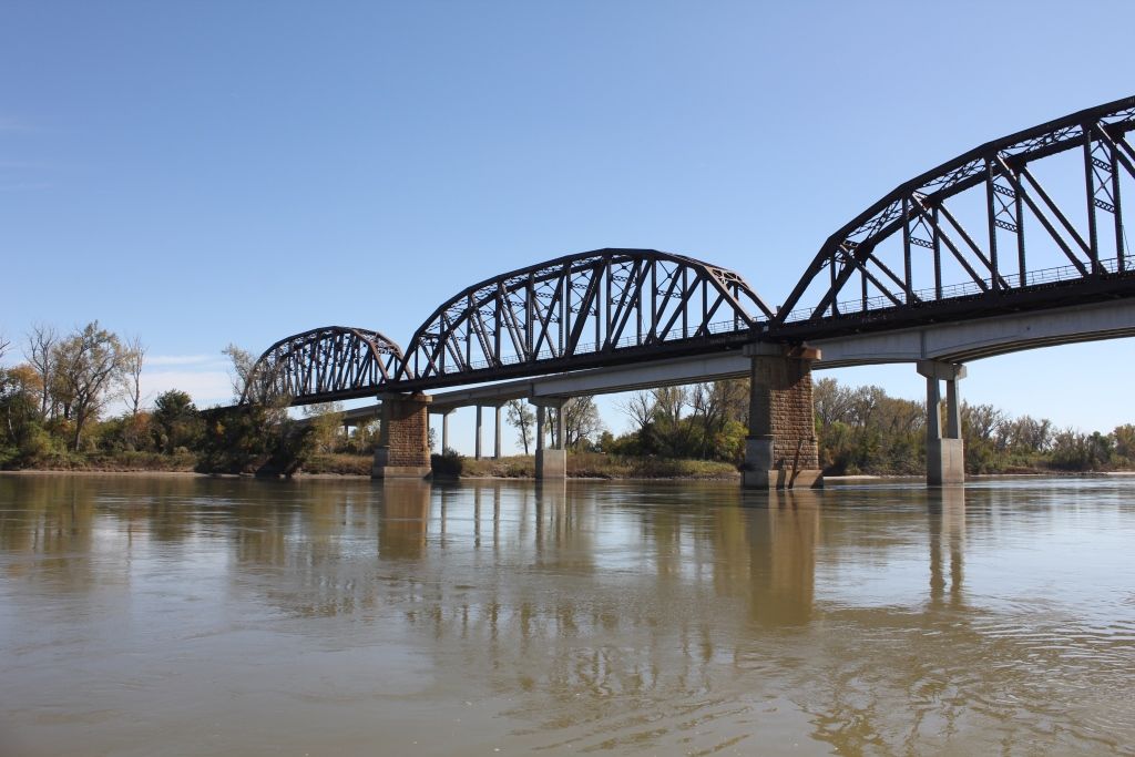
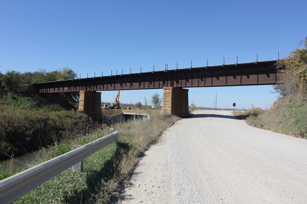
Status: Superstructure replaced
Location: 41.551074,-96.094344
Carries Union Pacific Railroad over Missouri River
Design: truss/through/whipple
Design Details: Main spans: Three Whipple through trusses
Total Length: 0.0 Feet
Span Length: 330.0 Feet
Overview: Lost Whipple through truss bridge over Missouri River on Union Pacific Railroad
History: Built 1883; superstructure replaced 1923-24; spans relocated to cross Wind River in Wyoming
Built: 1883
Location: Washington County
View Bridge Information In Wayback Machine
![]()
158072
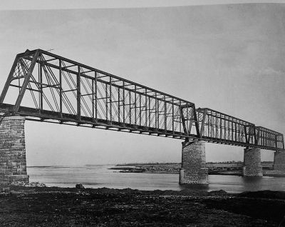
Photocopy From George S. Morison's The Blair Crossing Bridge, 1886. Photographer Unknown, Circa 1883. South Web And West Portal Of Bridge
Photo collected by Historic American Engineering Record
158073
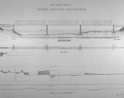
Photocopy From George S. Morison's The Blair Crossing Bridge, 1886. General Elevation, Plan, And Profile Of Bridge
Photo collected by Historic American Engineering Record
459952
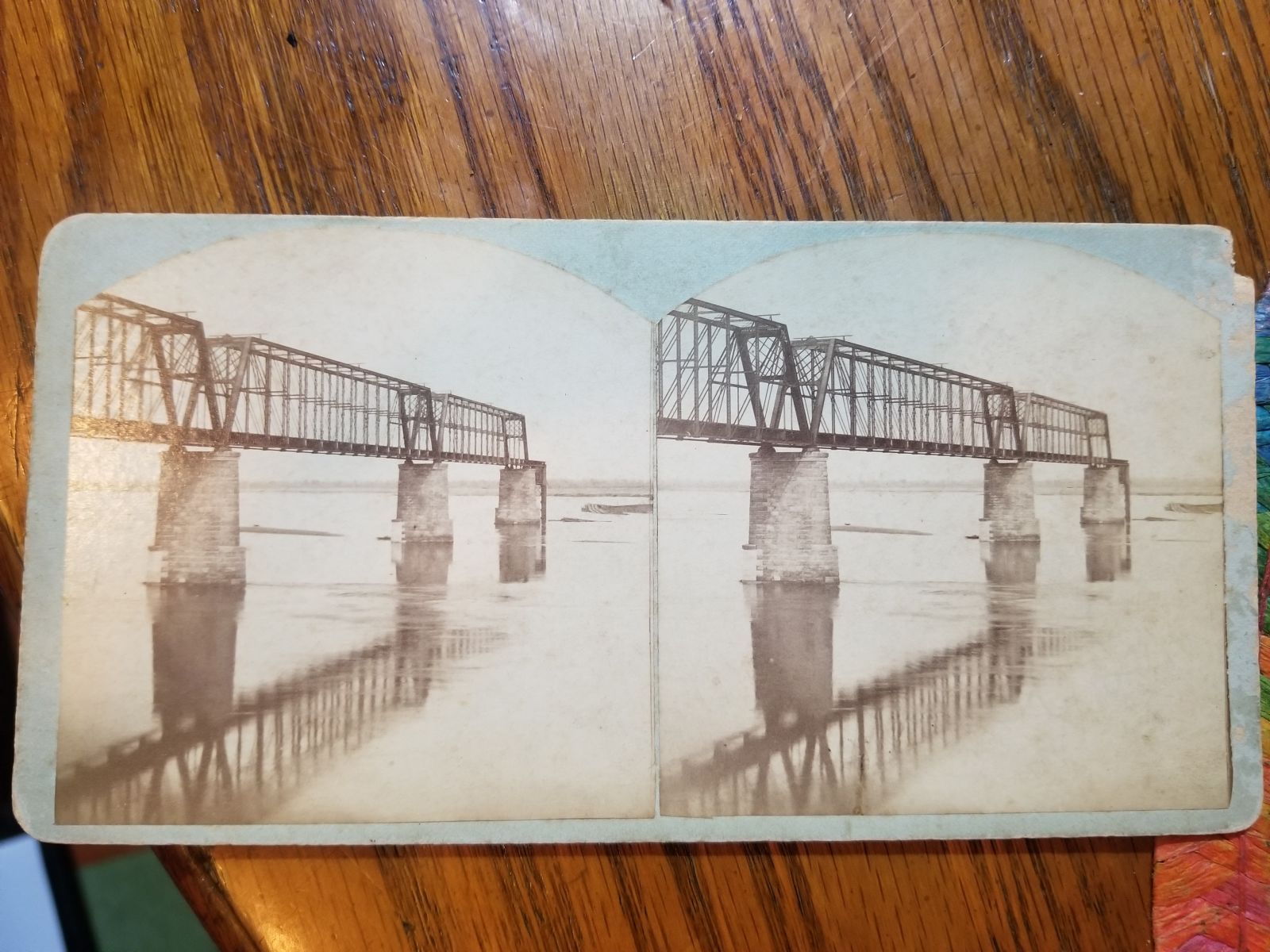
Photo taken by Nick Schmiedeler in November 2019
459953
Photo taken by Nick Schmiedeler in November 2019
![]()
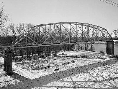
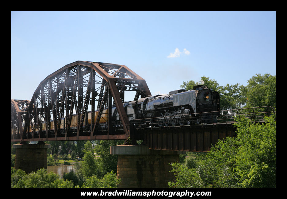
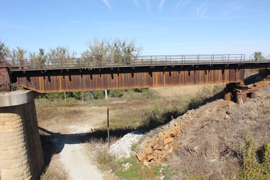
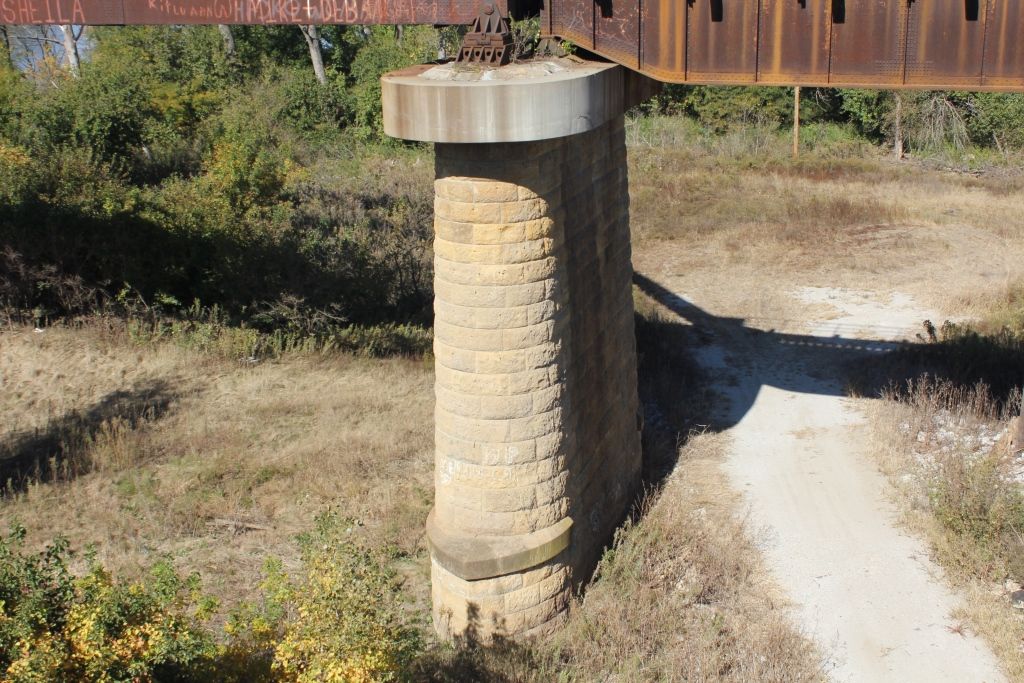
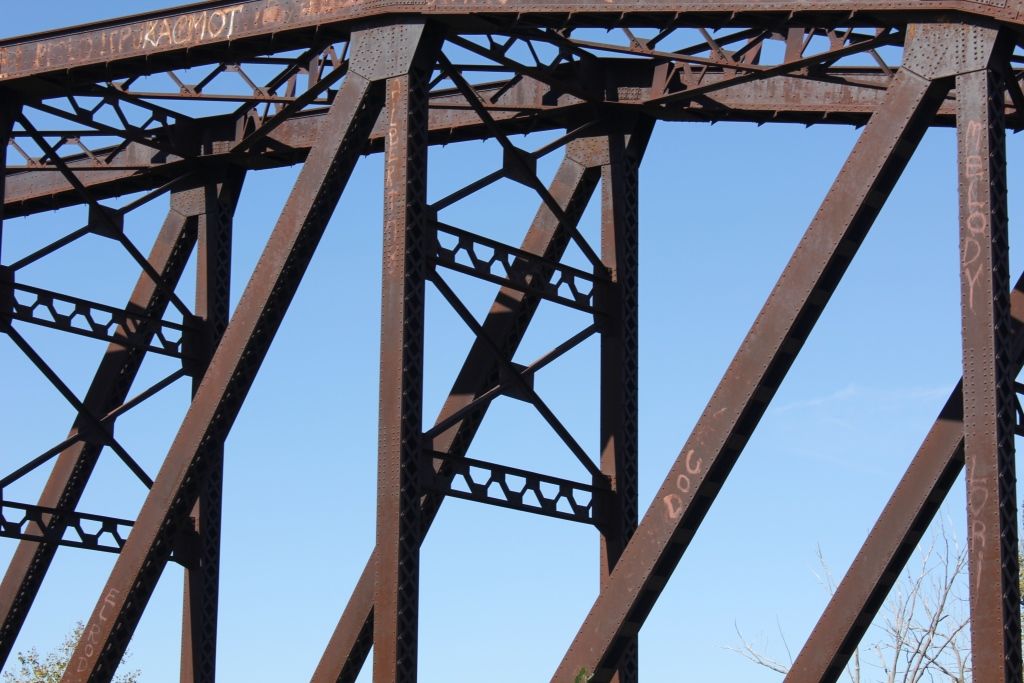
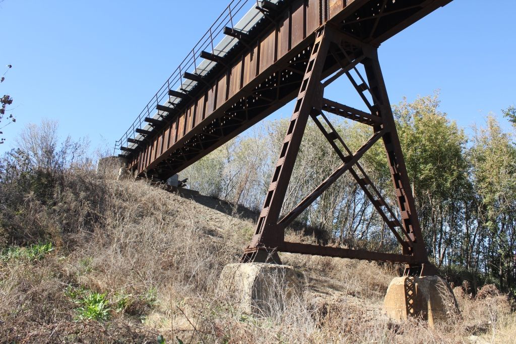
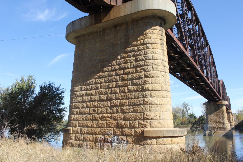
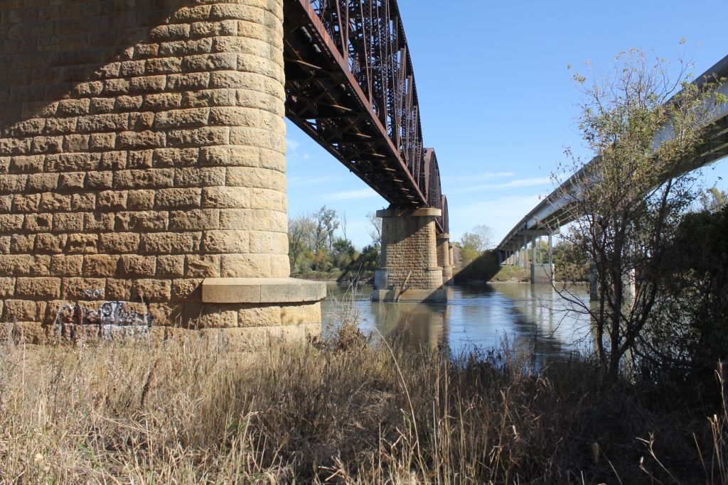
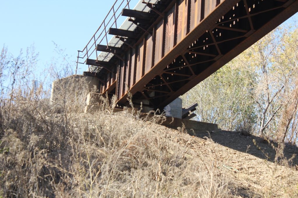
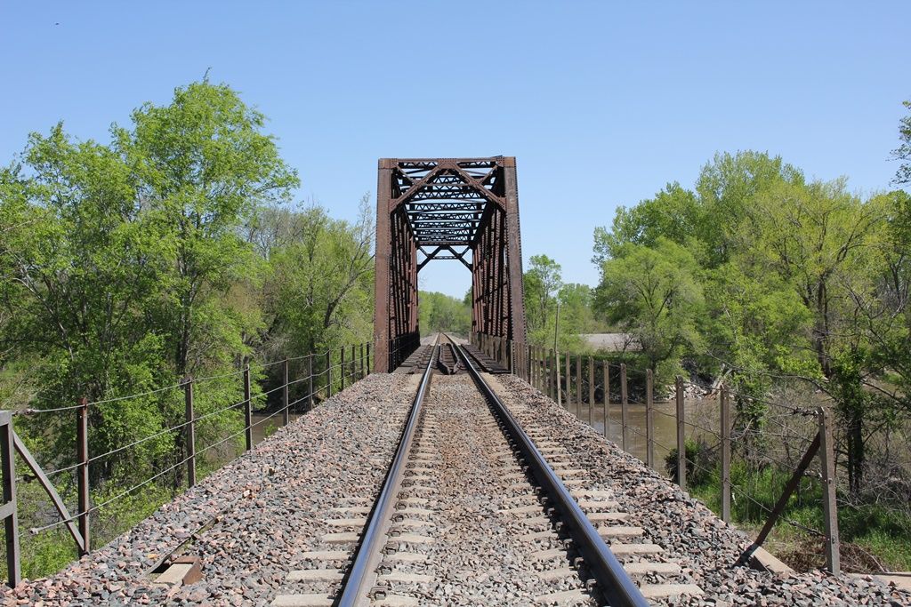
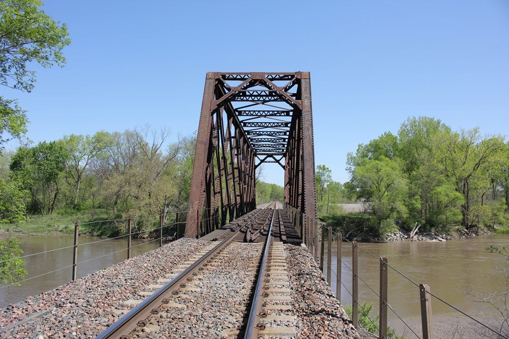
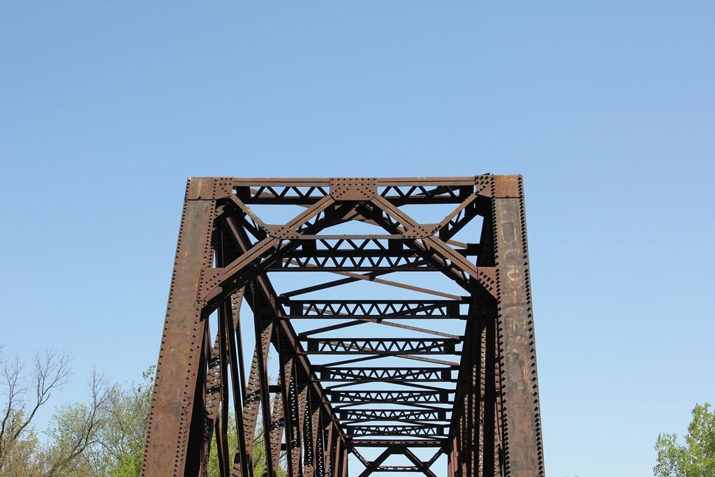
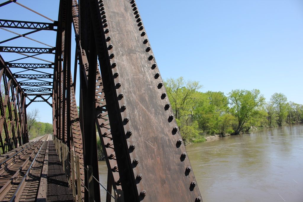
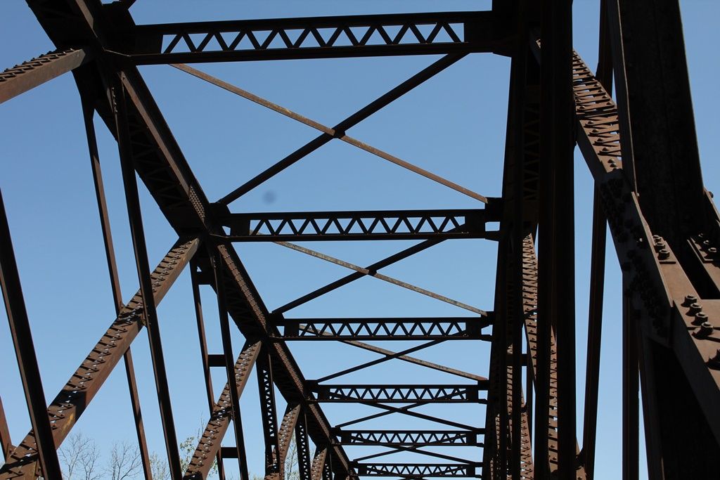
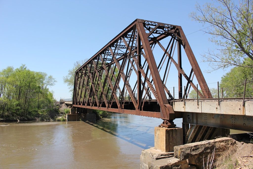
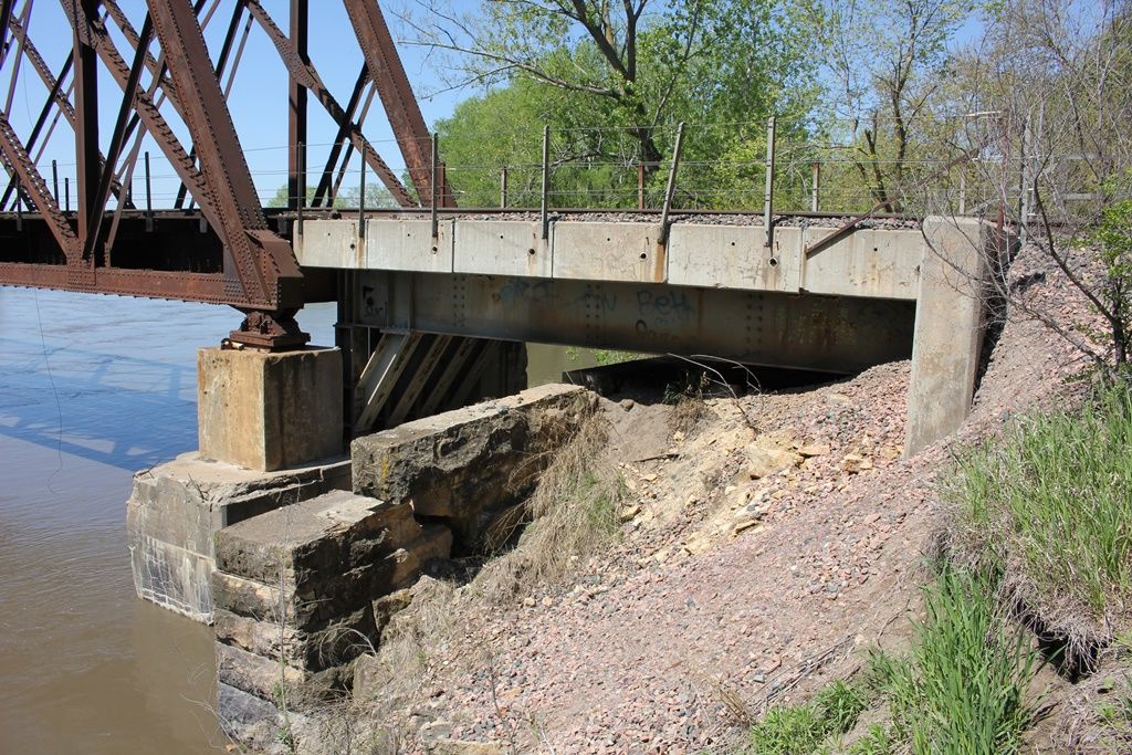
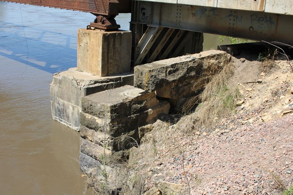
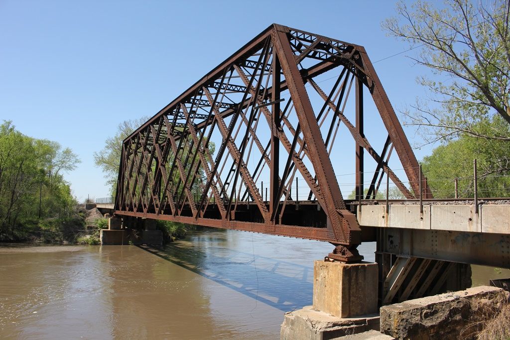
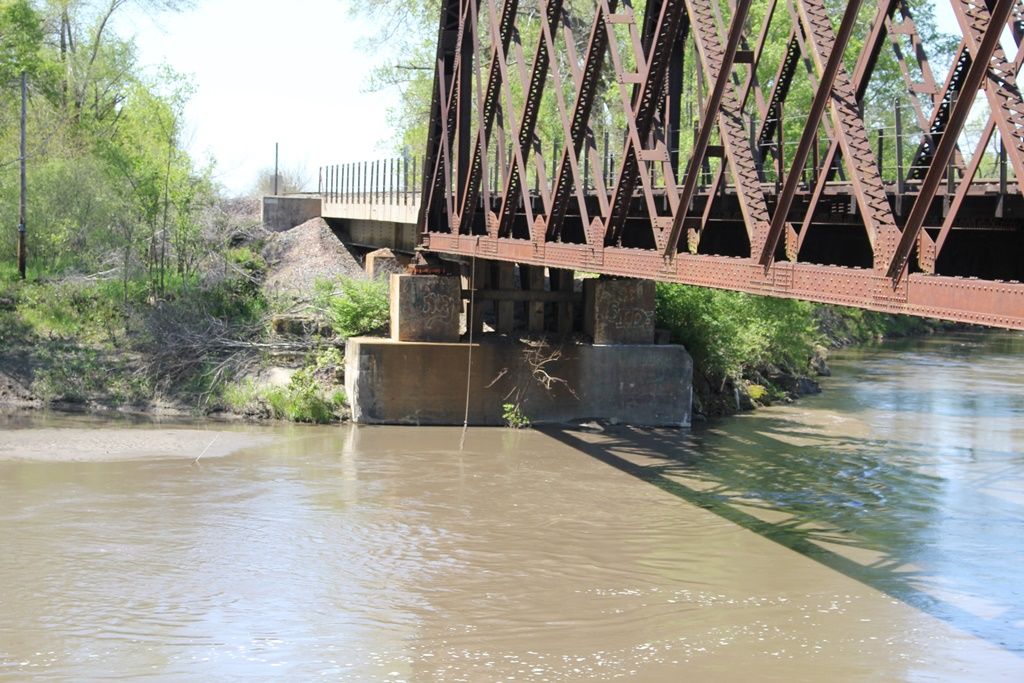
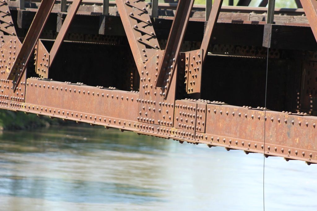
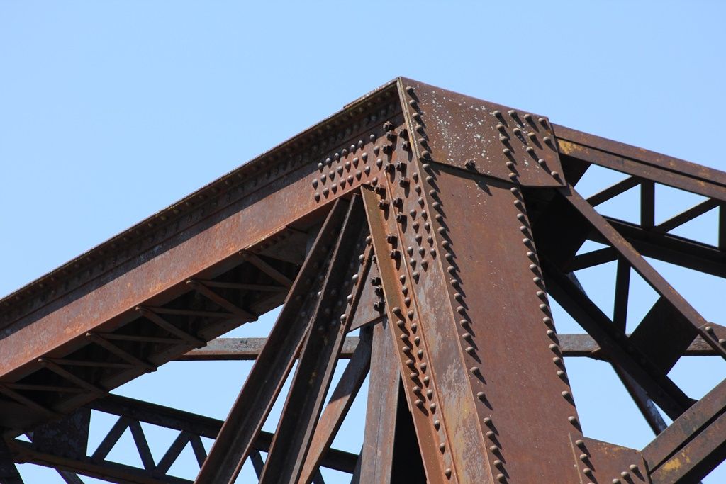
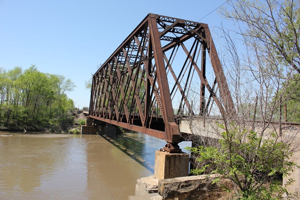
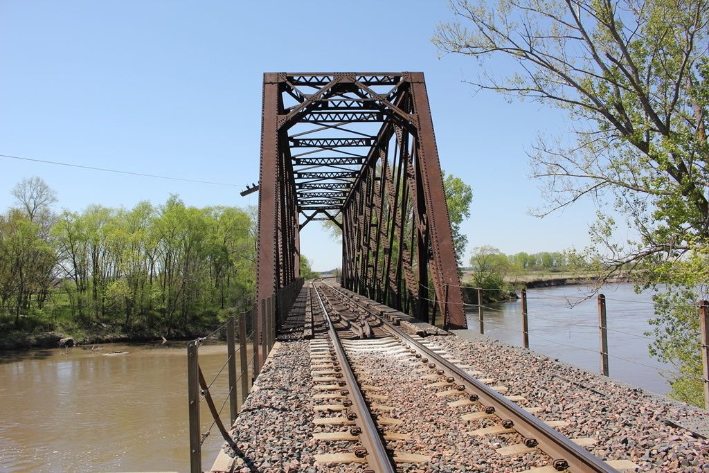
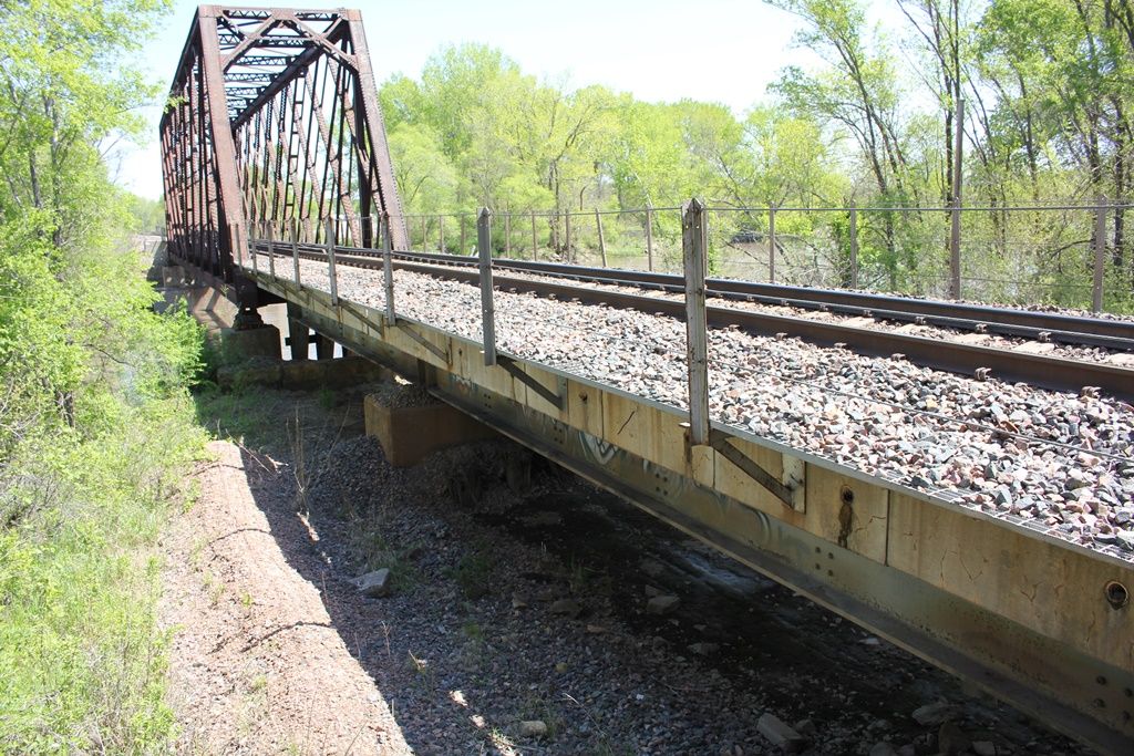
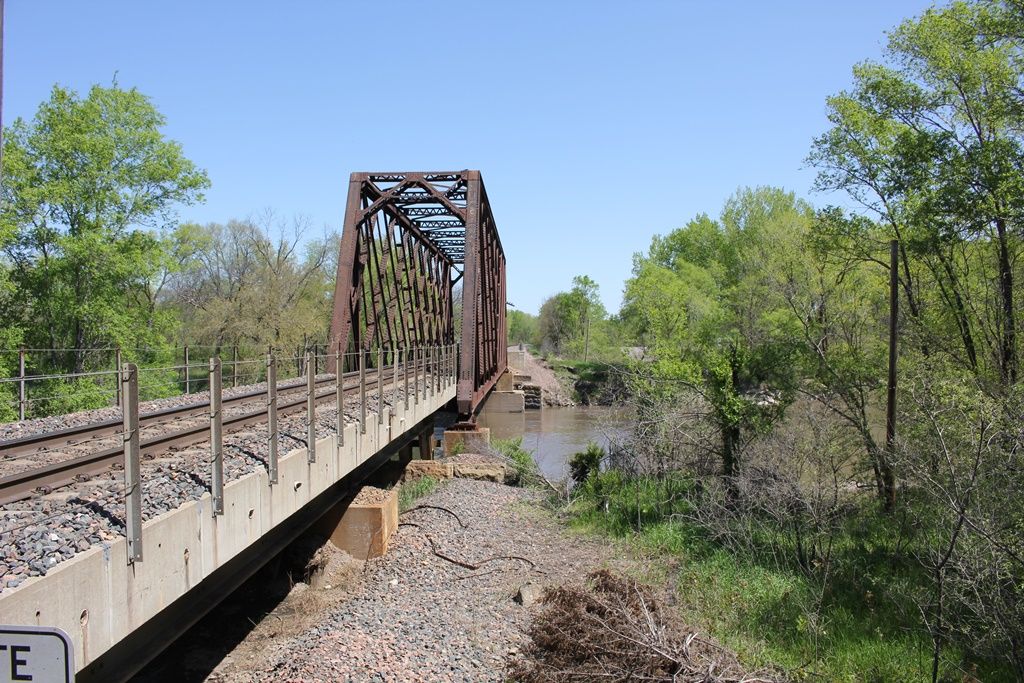
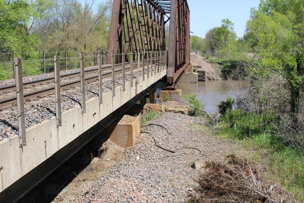
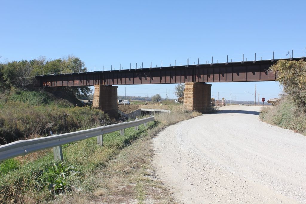
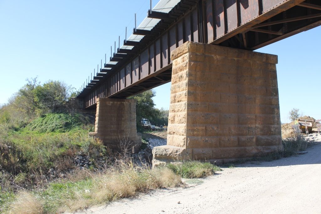
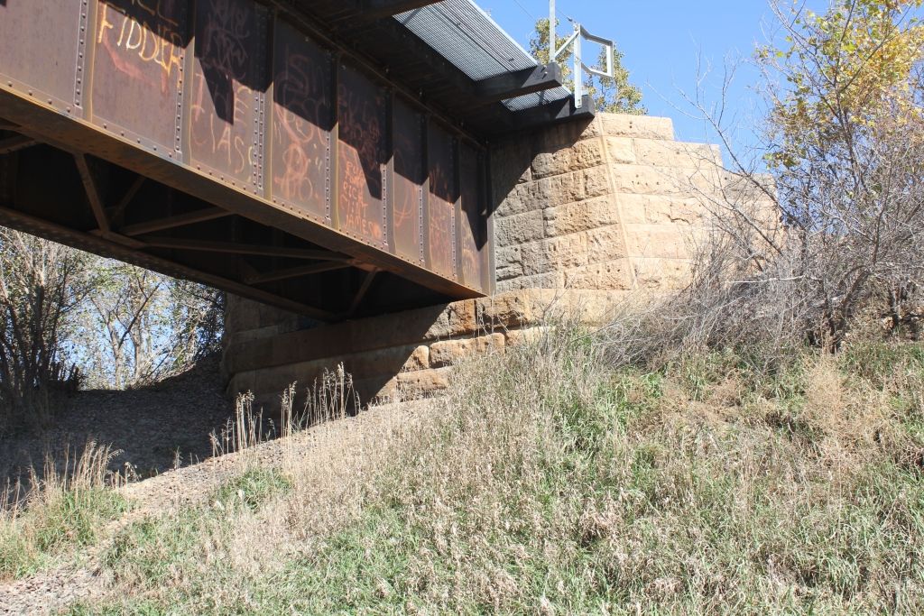
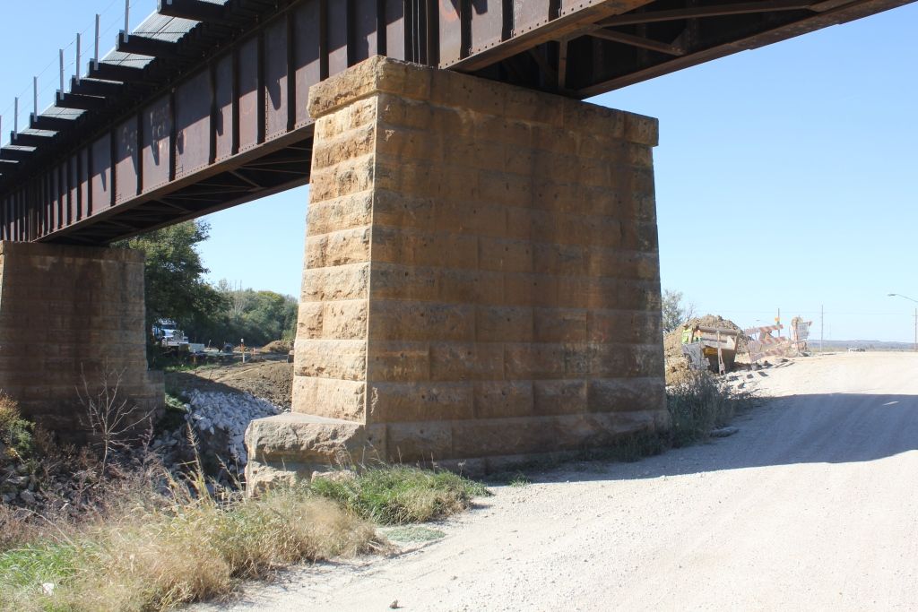
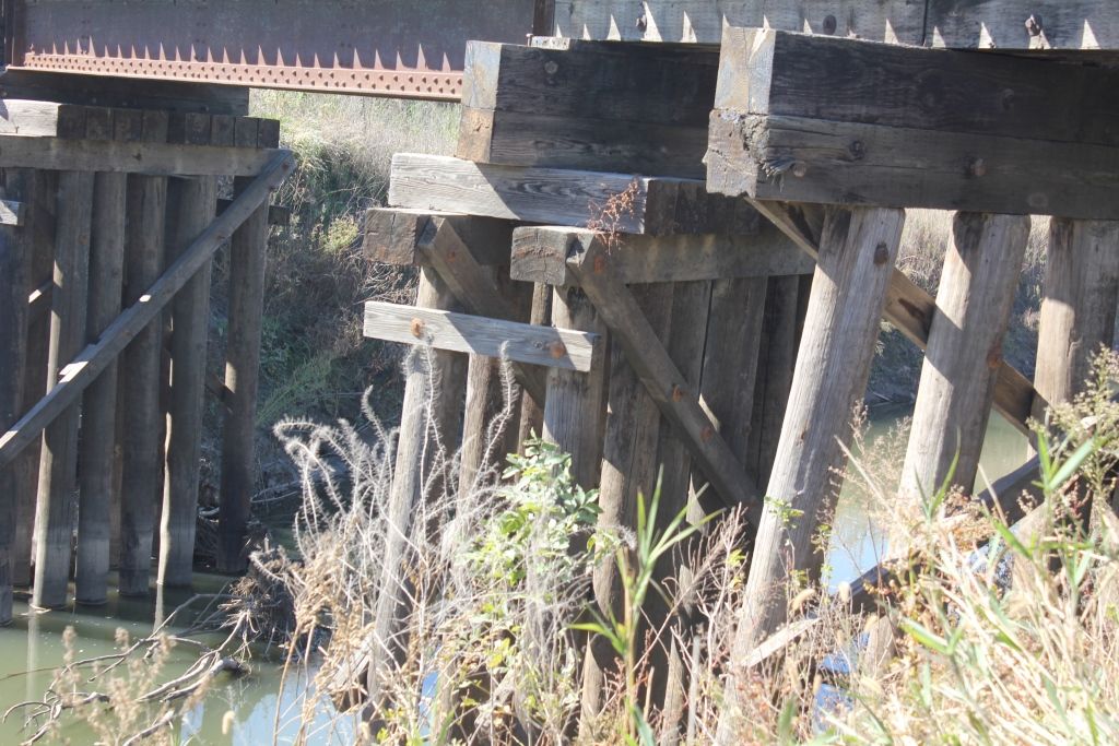
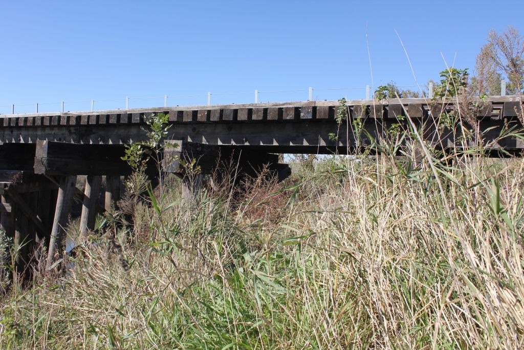
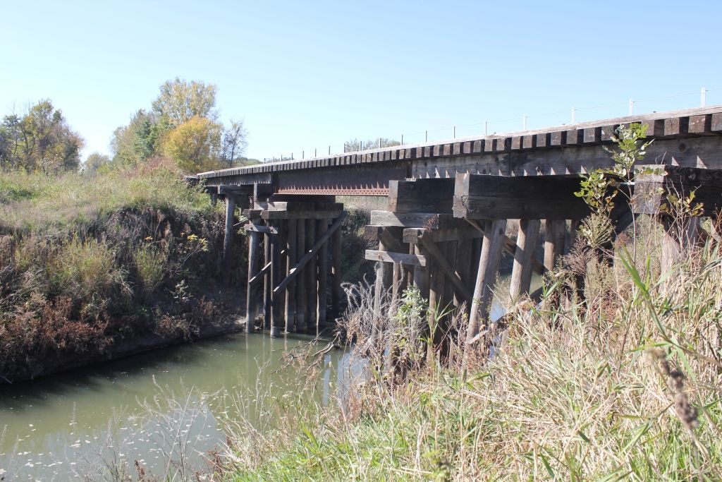
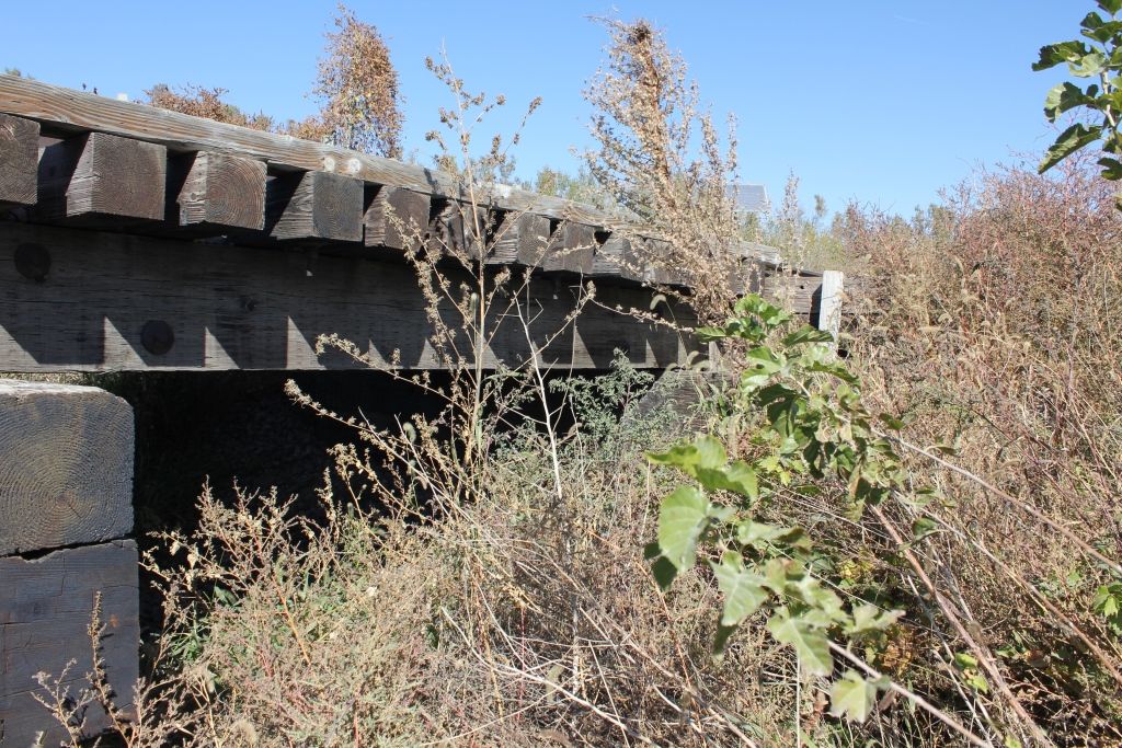
Status: Open to traffic
Location: 41.443093,-96.364368
Carries Union Pacific Railroad over Elkhorn River
Design: truss/through/lattice/quadrangular
Design Details: Quadrangular lattice through truss
Total Length: 285.0 Feet
Span Length: 160.0 Feet
Overview: Quadrangular lattice through truss bridge over Elkhorn River on Union Pacific Railroad
History: Built 1902, Approach Rebuilt 1964
Built: 1902
Location: Washington County
View Bridge Information In Wayback Machine
![]()
241437
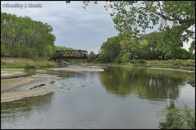
Photo taken by Bradley J. Grefe
244888
Photo taken by Bradley J. Grefe
391149
Arlington Rail Bridge
Looking East
Photo taken by John Marvig in May 2017
391150
Arlington Rail Bridge
Looking East
Photo taken by John Marvig in May 2017
391151
Arlington Rail Bridge
Portal Bracing
Photo taken by John Marvig in May 2017
391152
Arlington Rail Bridge
Reinforced
Photo taken by John Marvig in May 2017
391153
Arlington Rail Bridge
Sway Bracing
Photo taken by John Marvig in May 2017
391154
Arlington Rail Bridge
Overview
Photo taken by John Marvig in May 2017
391155
Arlington Rail Bridge
East Approach
Photo taken by John Marvig in May 2017
391156
Arlington Rail Bridge
East Pier
Photo taken by John Marvig in May 2017
391157
Arlington Rail Bridge
Overview
Photo taken by John Marvig in May 2017
391158
Arlington Rail Bridge
West End
Photo taken by John Marvig in May 2017
391159
Arlington Rail Bridge
Lower Connection
Photo taken by John Marvig in May 2017
391160
Arlington Rail Bridge
Upper Angle Connection
Photo taken by John Marvig in May 2017
391161
Arlington Rail Bridge
Upper Connection
Photo taken by John Marvig in May 2017
391162
Arlington Rail Bridge
West Pier
Photo taken by John Marvig in May 2017
391163
Arlington Rail Bridge
Looking West
Photo taken by John Marvig in May 2017
391164
Arlington Rail Bridge
Looking West
Photo taken by John Marvig in May 2017
391165
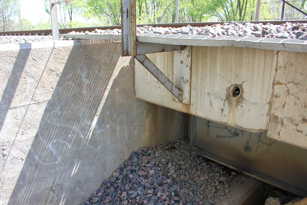
Arlington Rail Bridge
East Abutment
Photo taken by John Marvig in May 2017
391166
Arlington Rail Bridge
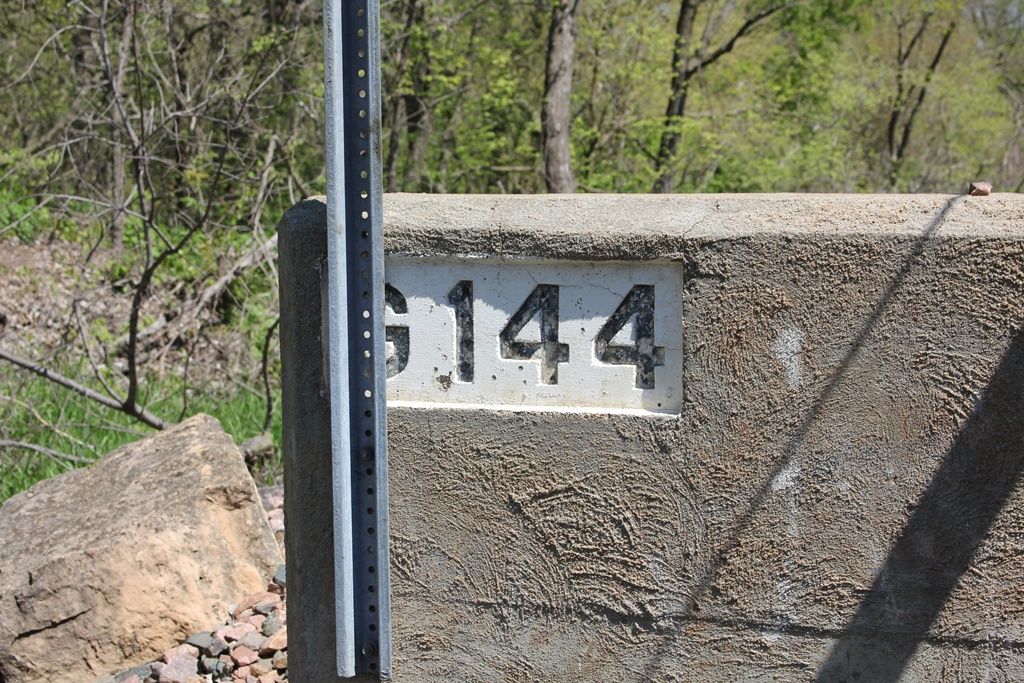
Bridge Number
Photo taken by John Marvig in May 2017
391167
Arlington Rail Bridge
Looking East
Photo taken by John Marvig in May 2017
391168
Arlington Rail Bridge
West Approach
Photo taken by John Marvig in May 2017
391169
Arlington Rail Bridge
Looking East
Photo taken by John Marvig in May 2017
391170
Arlington Rail Bridge
West Approach
Photo taken by John Marvig in May 2017
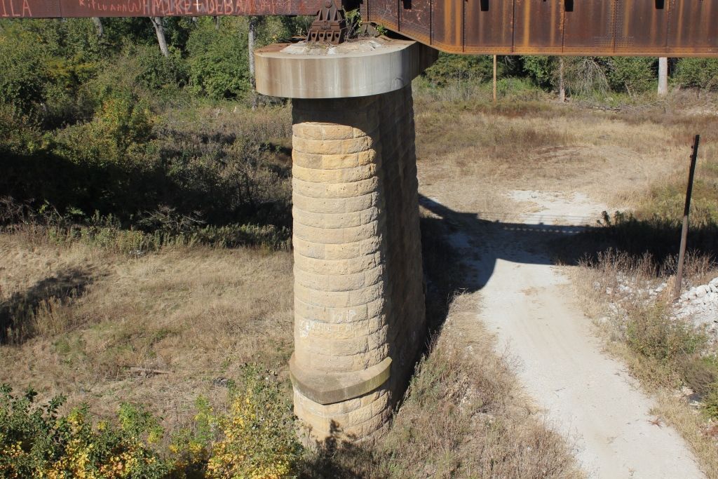
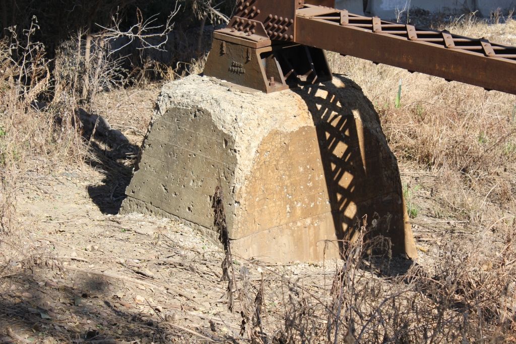
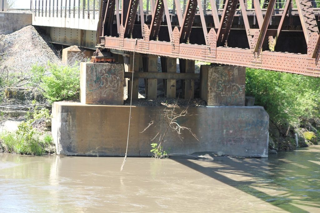
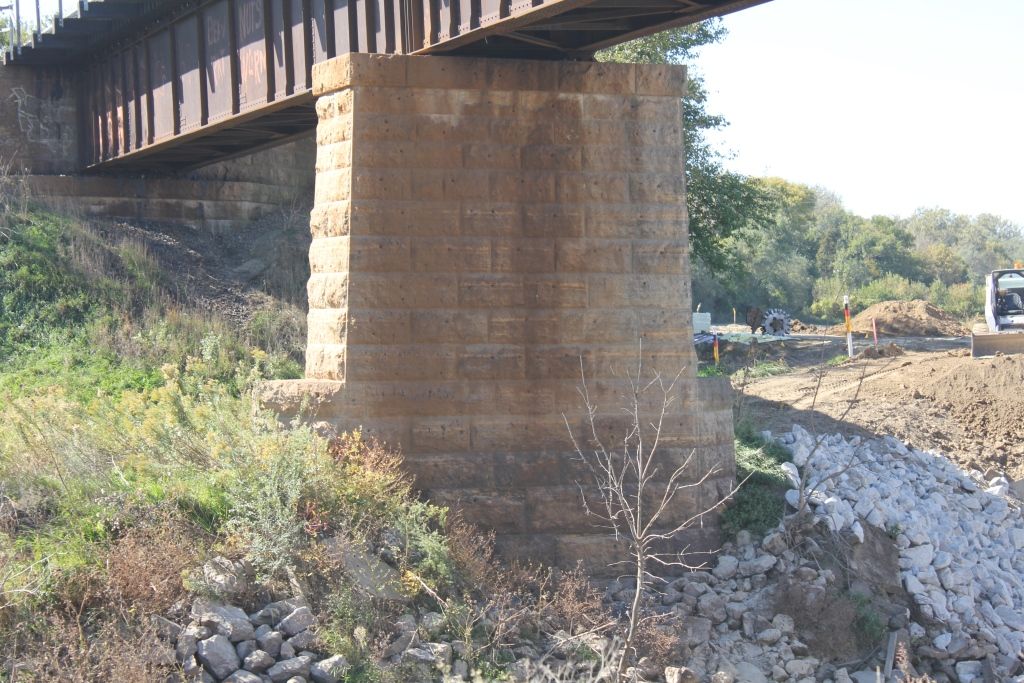
![]()
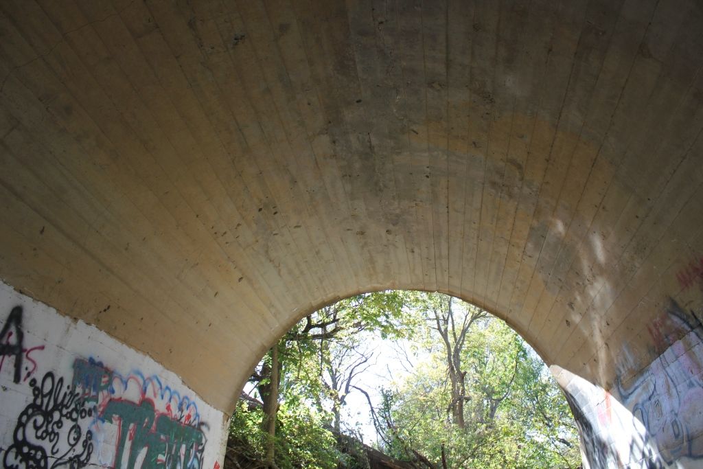
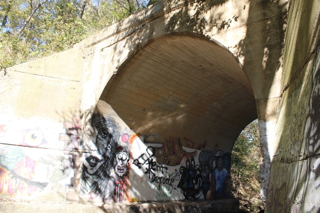
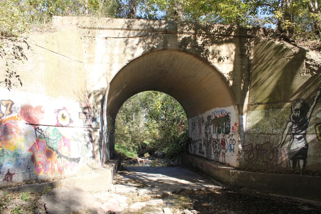
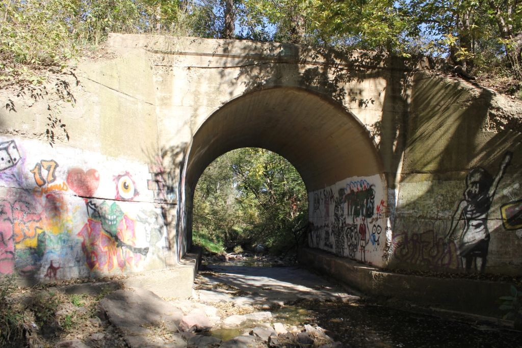
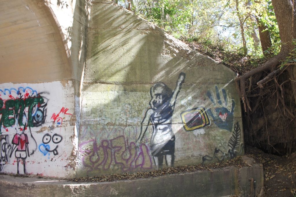
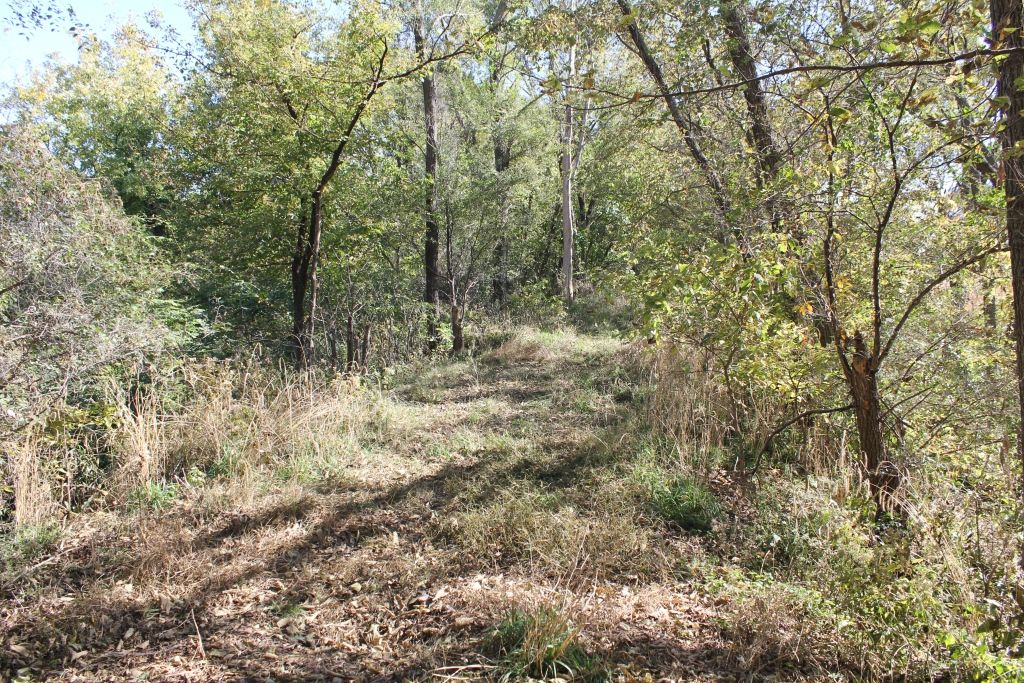
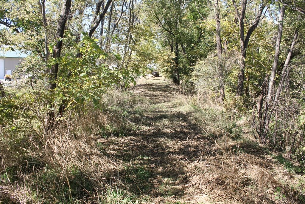
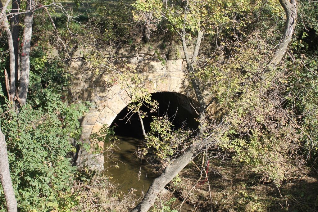
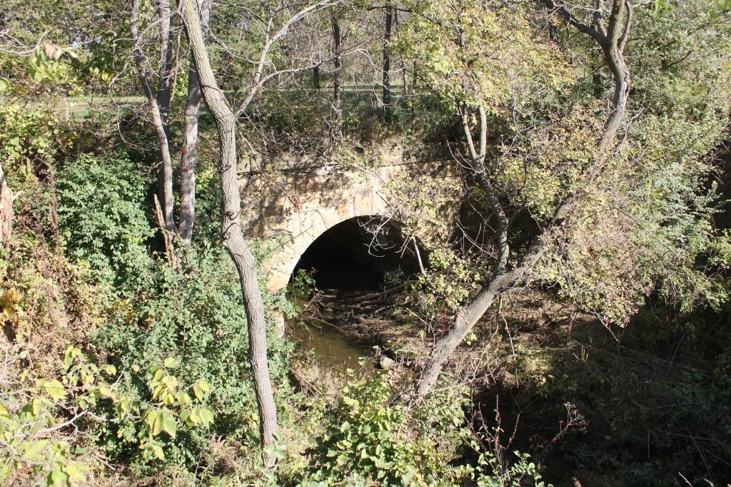
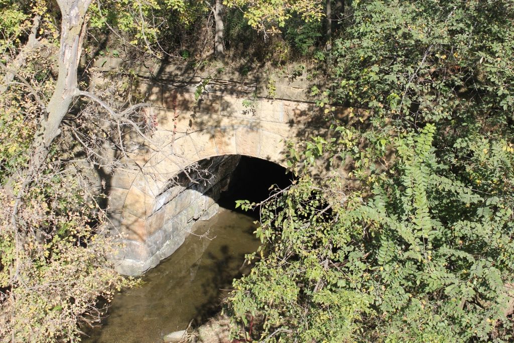
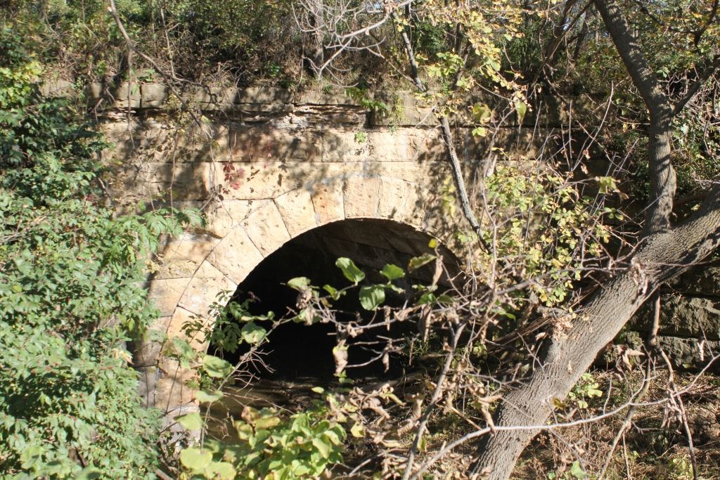
Status: Removed but not replaced
Location: 41.539269,-96.125424
Carries Chicago & North Western Railway over Tributary of Cameron Ditch
Design: arch/deck/closed
Design Details: Closed-spandrel arch
Total Length: 16.0 Feet
Span Length: 16.0 Feet
Overview: Abandoned closed-spandrel arch bridge over Tributary of Cameron Ditch on Private Road (Former C&NW Railway)
History: Built 1914
Built: 1914
Location: Washington County
View Bridge Information In Wayback Machine
![]()
339381
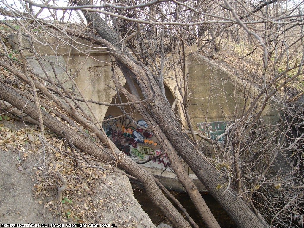
Photo taken by Allan Love Jr.
339969
Abandoned Cameron Ditch Bridge
Overview. Bridge was accessed with permission by a local lawn care company. The owner was more than thrilled to see someone taking an interest in the structure.
Photo taken by John Marvig in October 2015
339970

Abandoned Cameron Ditch Bridge
South Abutment
Photo taken by John Marvig in October 2015
339971
Abandoned Cameron Ditch Bridge
Under Bridge
Photo taken by John Marvig in October 2015
339972
Abandoned Cameron Ditch Bridge
Overview
Photo taken by John Marvig in October 2015
339973
Abandoned Cameron Ditch Bridge
Overview
Photo taken by John Marvig in October 2015
339974

Abandoned Cameron Ditch Bridge
North Abutment
Photo taken by John Marvig in October 2015
339975
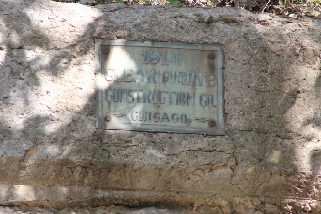
Abandoned Cameron Ditch Bridge
Plate
Photo taken by John Marvig in October 2015
339976
Abandoned Cameron Ditch Bridge
Overview
Photo taken by John Marvig in October 2015
339977
Abandoned Cameron Ditch Bridge
Wing
Photo taken by John Marvig in October 2015
339978
Abandoned Cameron Ditch Bridge
Looking South
Photo taken by John Marvig in October 2015
339979
Abandoned Cameron Ditch Bridge
Looking North
Photo taken by John Marvig in October 2015
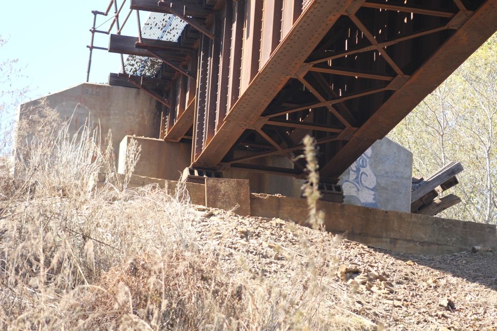
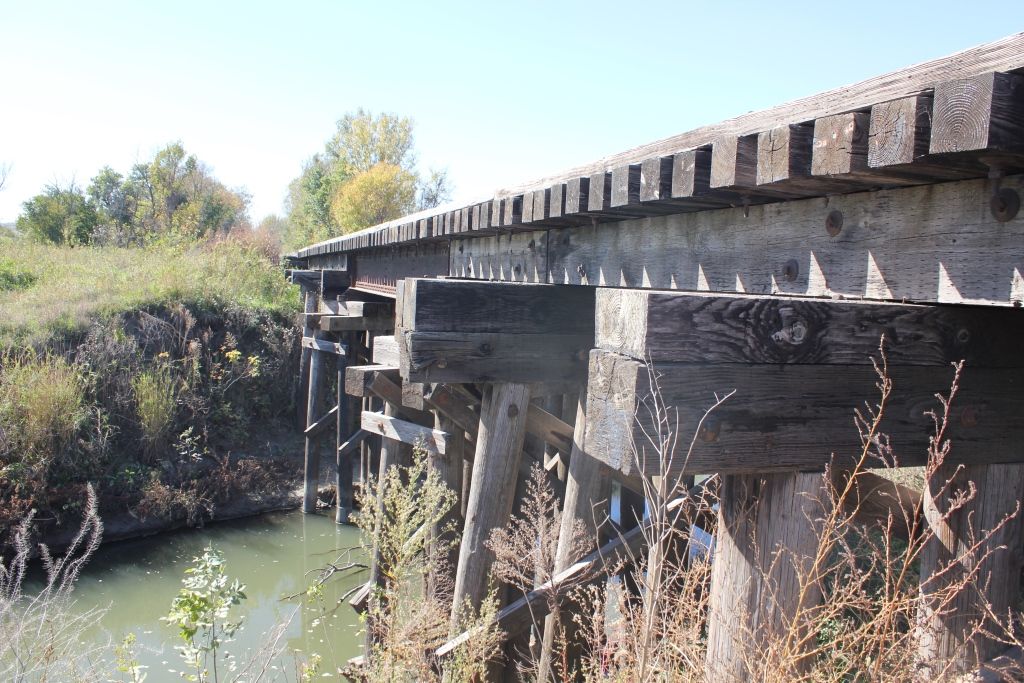
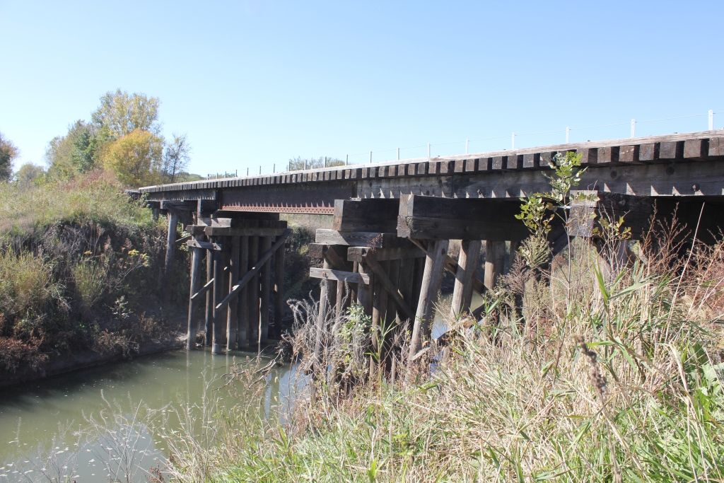
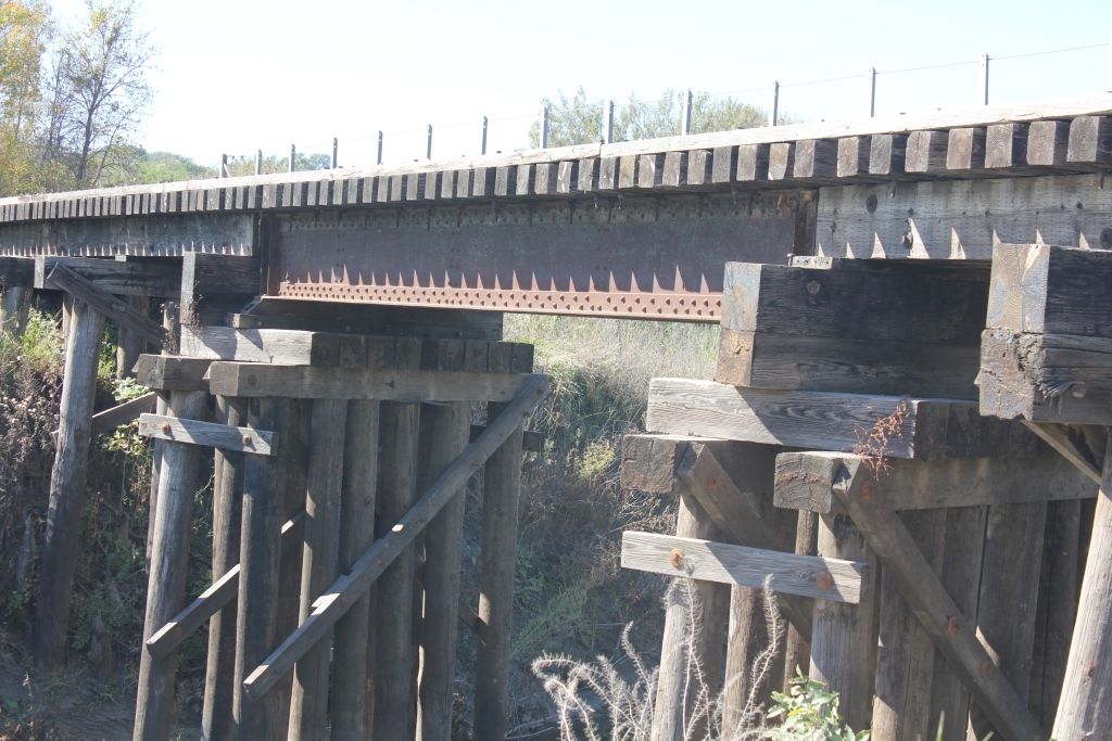
![]()
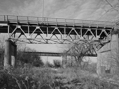
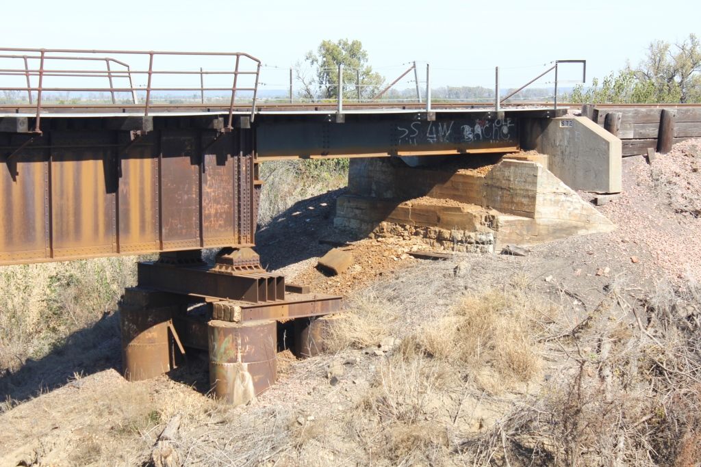
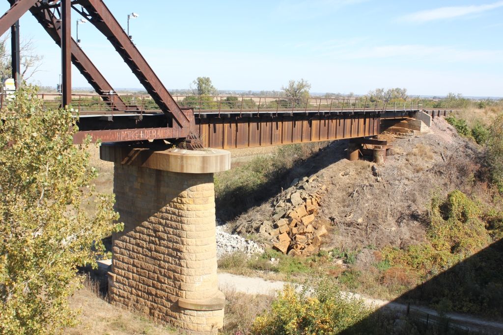
Status: Open to traffic
Location: 41.551057,-96.105502
Carries Union Pacific Railroad over Fish Creek and Longview Drive
Design: girder/deck/plate
Design Details: Deck plate girder
Total Length: 250.0 Feet
Span Length: 95.0 Feet
Overview: Deck plate girder bridge over Fish Creek and Longview Drive on Union Pacific Railroad
History: Built 1904
Built: 1904
Location: Washington County
View Bridge Information In Wayback Machine
![]()
339953
UP Fish Creek Bridge
Overview
Photo taken by John Marvig in October 2015
339954
UP Fish Creek Bridge
Overview
Photo taken by John Marvig in October 2015
339955
UP Fish Creek Bridge
East Abutment
Photo taken by John Marvig in October 2015
339956
UP Fish Creek Bridge
East Pier
Photo taken by John Marvig in October 2015
339957
UP Fish Creek Bridge
West Pier
Photo taken by John Marvig in October 2015
339958
UP Fish Creek Bridge
Overview
Photo taken by John Marvig in October 2015
339959
UP Fish Creek Bridge
West Abutment
Photo taken by John Marvig in October 2015
339960
UP Fish Creek Bridge
Overview
Photo taken by John Marvig in October 2015
339961
UP Fish Creek Bridge
Overview
Photo taken by John Marvig in October 2015
![]()
Status: Open to traffic
Location: 41.550607,-96.104815
Carries Union Pacific Railroad over Fish Creek
Design: beam/stringer/steel
Design Details: Steel stringer
Total Length: 125.0 Feet
Span Length: 35.0 Feet
Overview: Steel stringer bridge over Fish Creek on Union Pacific Railroad
History: Built Ca. 1930
Built: 1930
Location: Washington County
View Bridge Information In Wayback Machine
![]()
339962
UP Fish Creek Bridge (2)
Looking West
Photo taken by John Marvig in October 2015
339963
UP Fish Creek Bridge (2)
Overview
Photo taken by John Marvig in October 2015
339964
UP Fish Creek Bridge (2)
Main Span
Photo taken by John Marvig in October 2015
339965
UP Fish Creek Bridge (2)
East Pier
Photo taken by John Marvig in October 2015
339966
UP Fish Creek Bridge (2)
East Approach
Photo taken by John Marvig in October 2015
339967
UP Fish Creek Bridge (2)
Overview
Photo taken by John Marvig in October 2015
339968
UP Fish Creek Bridge (2)
East Abutment
Photo taken by John Marvig in October 2015
![]()
Status: Intact but closed to all traffic
Location: 41.419538,-95.995203
Carries Chicago & North Western Railway over Deer Creek
Design: arch/deck/stone
Design Details: Stone arch
Total Length: 16.0 Feet
Span Length: 16.0 Feet
Overview: Stone arch bridge over Deer Creek on Abandoned Chicago & North Western Railway
History: Built 1899
Built: 1899
Location: Washington County
View Bridge Information In Wayback Machine
![]()
339980
Abandoned Deer Creek Bridge
Limited Angles
Photo taken by John Marvig in October 2015
339981
Abandoned Deer Creek Bridge
Overview
Photo taken by John Marvig in October 2015
339982
Abandoned Deer Creek Bridge
Overview
Photo taken by John Marvig in October 2015
339983
Abandoned Deer Creek Bridge
Overview
Photo taken by John Marvig in October 2015
![]()
Status: Removed but not replaced
Location: 41.443142,-96.363990
Carries S 8th Street over Elkhorn River
Design: truss/through/parker
Design Details: Parker through truss
Total Length: 0.0 Feet
Span Length: 180.0 Feet
Overview: Lost Parker through truss bridge over Elkhorn River on S 8th Street
History: Built 1913
Built: 1913
Location: Washington County
View Bridge Information In Wayback Machine
![]()
366625
Published prior to 1923
![]()
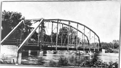
Status: Replaced by a new bridge
Location: 41.654603,-96.405598
Carries CR 5 or CR 6 over Branch of Bell Creek
Design: beam/stringer/steel
Design Details: Steel rolled-beam bridge with jack-arch deck
Total Length: 32.2 Feet
Span Length: 30.8 Feet
Overview: Steel stringer bridge over Branch of Bell Creek on CR 5 or CR 6
History: Built 1955; replaced 2017
Built: 1955
Location: Washington County
View Bridge Information In Wayback Machine
![]()
![]()
Status: Replaced by a new bridge
Location: 41.443144,-96.363962
Carries West Drive CO P9 over Elkhorn River
Design: truss/through
Design Details: Through truss
Total Length: 0.0 Feet
Span Length: 0.0 Feet
Overview: Lost Through truss bridge over Elkhorn River on West Drive CO P9
History:
Built:
Location: Washington County
View Bridge Information In Wayback Machine
![]()
512428
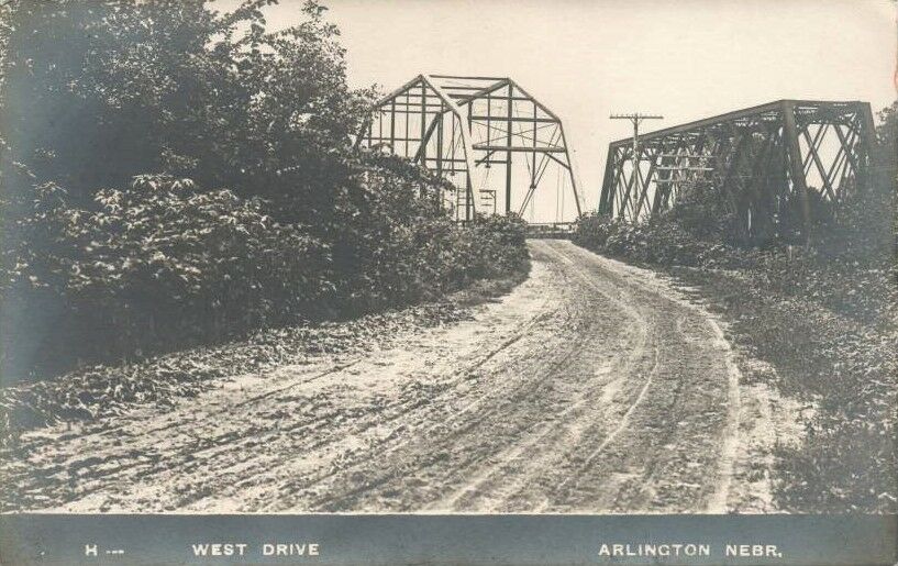
West Drive Bridge
looking southwest c1910; C&NW bridge on right
Photo from old postcard
Special Bridge Conditions Legend: R - Former location of relocated bridge. ! - At risk for demolition or destruction. X - Confirmed demolished or collapsed. S - Dismantled and/or in storage. L - Severe loss of historic integrity due to alteration.
![]()

![]()