Bridges Found: 18
![]()
Camp Creek Bridge
Status: Open to traffic
Location: 35.978056,-81.918889
Carries Blue Ridge Parkway over Camp Creek
Design: arch/deck
Design Details: Arch
Total Length: 45.9 Feet
Span Length: 45.9 Feet
Overview: Concrete arch bridge over Camp Creek on Blue Ridge Parkway
History: Built 1939
Built: 1939
Location: Burke County
View Bridge Information In Wayback Machine
![]()
![]()
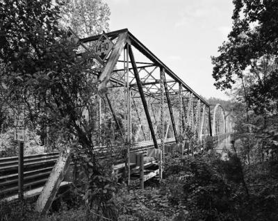
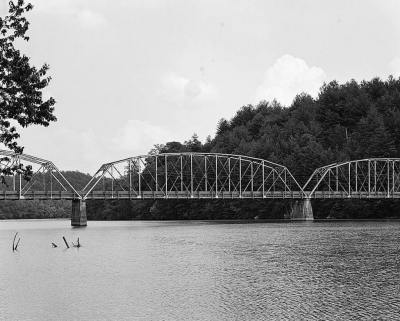
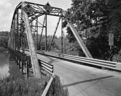
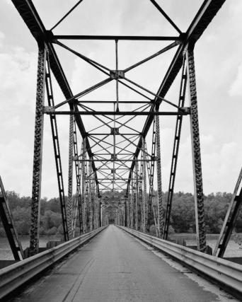
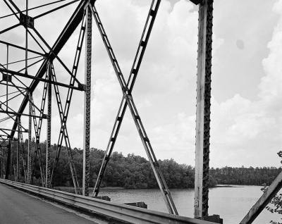
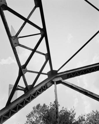
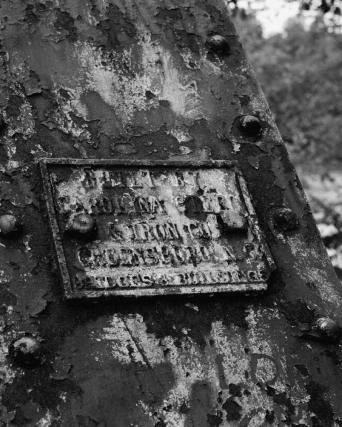
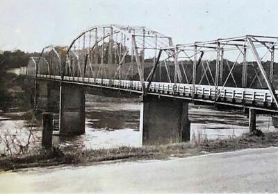
Huffman Bridge
Status: Replaced by new bridge
Location: 35.786944,-81.620278
Carries NC 1501 over Catawba River
Design: truss/through/parker
Design Details:
Three riveted, 9-panel Parker through trusses (each 203 ft.)
One riveted, 8-panel Pratt through truss (150 ft.)
Total Length: 759.0 Feet
Span Length: 203.0 Feet
Overview: Lost four-span through truss bridge over Catawba River on NC 1501
History: Built ca. 1925 by the Carolina Steel & Iron Co.; replaced 1986
Built: ca. 1925
Location: Burke County
View Bridge Information In Wayback Machine
![]()
127981
View Of Bridge From North
Photo taken by Historic American Engineering Record
127982
View Of Bridge From Northwest
Photo taken by Historic American Engineering Record
127983
View Of Bridge From Southwest
Photo taken by Historic American Engineering Record
127984
Barrel View Of Bridge, Looking North
Photo taken by Historic American Engineering Record
127985
View Of Truss Panel
Photo taken by Historic American Engineering Record
127986
Detail View Of Truss
Photo taken by Historic American Engineering Record
127987
View Of Bridge Plate
Photo taken by Historic American Engineering Record
511886
Huffman Bridge
Photo from the Biddix Family Archives
Photo provided by Jill Read
511887
George Edwin Biddix
Photo from the Biddix Family Archives
Photo provided by Jill Read
![]()
Camp Creek Bridge
Status: Open to traffic
Location: 35.570556,-81.552222
Carries Sr1924 over Camp Creek
Design: girder/pony/concrete
Design Details: Concrete pony/through girder
Total Length: 26.9 Feet
Span Length: 25.9 Feet
Overview: Concrete pony/through girder bridge over Camp Creek on Sr1924
History: Built 1923
Built: 1923
Location: Burke County
View Bridge Information In Wayback Machine
![]()
![]()
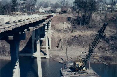
Henry River Road Bridge
Status: Open to traffic
Location: 35.694167,-81.429722
Carries NC-1002 (Henry River Road) over Henry River
Design: beam/stringer/steel
Design Details: Steel stringer
Total Length: 458.0 Feet
Span Length: 105.0 Feet
Overview: Steel stringer bridge over Henry River on NC-1002 (Henry River Road)
History: Built 1959
Built: 1959
Location: Burke County
View Bridge Information In Wayback Machine
![]()
230184
Historical Photo of Bridge Construction
Source: Craig Lynn
230185
Portal View.
2010.
Source: Mel Newton
![]()
Old Henry River Road Bridge
Status: Replaced by new bridge
Location: 35.695731,-81.426762
Carries Henry River Road (Old Alignment) over Henry River
Design: truss/deck/pratt
Design Details: Six panel pin-connected Pratt deck truss.
Total Length: 0.0 Feet
Span Length: 0.0 Feet
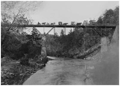
Overview: Lost Pratt deck truss bridge over Henry River on Henry River Road (Old Alignment)
History: Built 1912
Built: 1912
Location: Burke County
View Bridge Information In Wayback Machine
![]()
230186
Historical Photo of Bridge
Elevation.
Source: Mel Newton
![]()
Paddy Creek Bridge
Status: Open to traffic
Location: 35.753258,-81.891758
Carries Lake James State Park Road over Paddys Creek
Design: arch/through/wood
Design Details: Timber through arch
Total Length: 102.0 Feet
Span Length: 102.0 Feet
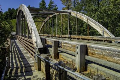
Overview: Modern through arch bridge over Paddys Creek on Lake James State Park Road
History: Built 2010
Built: 2010
Location: Burke County
View Bridge Information In Wayback Machine
![]()
478917
Paddy Creek Bridge
Photo from The News-Herald
![]()
Linville River Bridge
Status: Replaced by a new bridge
Location: 35.795347,-81.890286
Carries Nc126 over Linville River
Design: beam/stringer/steel
Design Details: Steel stringer
Total Length: 276.9 Feet
Span Length: 40.0 Feet
Overview: Steel stringer bridge over Linville River on Nc126
History: Built 1940
Built: 1940
Location: Burke County
View Bridge Information In Wayback Machine
![]()
![]()
Caldwell County Railroad Bridge
Status: Open to traffic
Location: 35.757964,-81.401055
Carries CWCYRR over Trib. of Catawba River
Design: girder/pony/plate
Design Details: Pony plate girder
Total Length: 72.0 Feet
Span Length: 72.0 Feet
Overview: Pony/through plate girder bridge over Trib. of Catawba River on CWCYRR
History:
Built:
Location: Burke County
View Bridge Information In Wayback Machine
![]()
![]()
Catawba River Caldwell County Railroad Bridge
Status: Open to traffic
Location: 35.765348,-81.408614
Carries CWCYRR over Catawba River
Design: truss/through/warren/verticals
Design Details: Warren through truss with all verticals
Total Length: 596.0 Feet
Span Length: 150.0 Feet
Overview: Warren through truss with all verticals bridge over Catawba River on CWCYRR
History:
Built:
Location: Burke County
View Bridge Information In Wayback Machine
![]()
![]()
Bethel Park Bridge
Status: Open to pedestrians only
Location: 35.739433,-81.659562
Carries Pedestrian Path over East Prong Hunting Creek
Design: truss/through/bowstring
Design Details: Bowstring through truss
Total Length: 31.0 Feet
Span Length: 31.0 Feet
Overview: Bowstring through truss bridge over East Prong Hunting Creek on Pedestrian Path
History:
Built:
Location: Burke County
View Bridge Information In Wayback Machine
![]()
![]()
Hunting Creek Norfolk Southern Railway Bridge
Status: Open to traffic
Location: 35.751628,-81.658269
Carries NSRR over Hunting Creek
Design: truss/through/pratt
Design Details: Pratt through truss
Total Length: 132.0 Feet
Span Length: 132.0 Feet
Overview: Pratt through truss bridge over Hunting Creek on NSRR
History: Built 1910
Built: 1910
Location: Burke County
View Bridge Information In Wayback Machine
![]()
![]()
Western North Carolina Railroad Bridge
Status: Derelict/abandoned
Location: 35.751548,-81.658054
Carries RR over Hunting Creek
Design: arch/deck/stone
Design Details: Stone arch
Total Length: 130.0 Feet
Span Length: 130.0 Feet
Overview: Abandoned stone arch bridge over Hunting Creek on RR
History: Built ca 1857
Built: 1858
Location: Burke County
View Bridge Information In Wayback Machine
![]()
![]()
East Union Street Southern Railway Bridge
Status:
Location: 35.753445,-81.656807
Carries SOURR/NSRR over E Union St
Design: beam/stringer/steel
Design Details: Steel stringer
Total Length: 110.9 Feet
Span Length: 44.0 Feet
Overview: Steel stringer bridge over E Union St on SOURR/NSRR
History:
Built: 1947
Location: Burke County
View Bridge Information In Wayback Machine
![]()
![]()
Silver Creek Bridge
Status: Open to traffic
Location: 35.729676,-81.720054
Carries NSRR over Silver Creek
Design: truss/through/warren/verticals
Design Details: Warren through truss with all verticals
Total Length: 132.0 Feet
Span Length: 132.0 Feet
Overview: Warren through truss with all verticals bridge over Silver Creek on NSRR
History: Built 1919
Built: 1919
Location: Burke County
View Bridge Information In Wayback Machine
![]()
![]()
Muddy Creek Bridge
Status: Open to traffic
Location: 35.712464,-81.851646
Carries NSRR over Muddy Creek
Design: truss/through/warren/verticals
Design Details: Warren through truss with all verticals
Total Length: 133.0 Feet
Span Length: 130.0 Feet
Overview: Warren through truss with all verticals bridge over Muddy Creek on NSRR
History:
Built:
Location: Burke County
View Bridge Information In Wayback Machine
![]()
![]()
Muddy Creek Old N C Highway 70 Bridge
Status: Removed but not replaced
Location: 35.711857,-81.854138
Carries over Muddy Creek
Design: unknown
Design Details:
Total Length: 0.0 Feet
Span Length: 0.0 Feet
Overview: Lost Bridge over Muddy Creek
History:
Built:
Location: Burke County
View Bridge Information In Wayback Machine
![]()
![]()
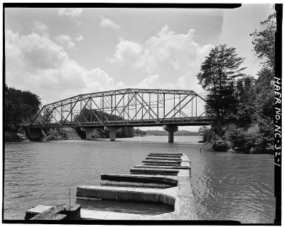
NC 126 Lake James Canal Bridge
Status: Replaced by a new bridge
Location: 35.742548,-81.884136
Carries NC 126 over Lake James Canal
Design: truss/through
Design Details: Pratt through truss
Total Length: 0.0 Feet
Span Length: 0.0 Feet
Overview: Lost Through truss bridge over Lake James Canal on NC 126
History: Built in 1919 for the Southern Power Company; replaced in 1981
Built: 1919
Location: Burke County
View Bridge Information In Wayback Machine
![]()
472977
NC 126 Lake James Canal Bridge
HAER Photo by Rick Lanier
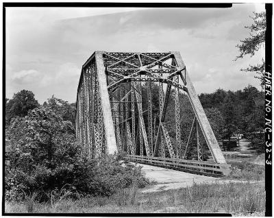
472978
NC 126 Lake James Canal Bridge
HAER Photo by Rick Lanier
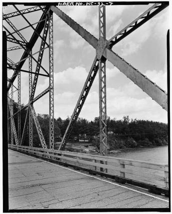
472979
NC 126 Lake James Canal Bridge
HAER Photo by Rick Lanier
![]()
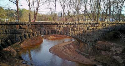
SOU - Hunting Creek Stone Bridge
Status: Derelict/abandoned
Location: 35.751374,-81.658233
Carries Southern Railway over Hunting Creek
Design: arch/deck/stone
Design Details: Stone arch
Total Length: 130.0 Feet
Span Length: 0.0 Feet
Overview: Abandoned stone arch bridge over Hunting Creek on Southern Railway
History: Built 1860
Built: 1860
Location: Burke County
View Bridge Information In Wayback Machine
![]()
482095
SOU - Hunting Creek Bridge
Photo taken by Tonyleeglenn
Special Bridge Conditions Legend: R - Former location of relocated bridge. ! - At risk for demolition or destruction. X - Confirmed demolished or collapsed. S - Dismantled and/or in storage. L - Severe loss of historic integrity due to alteration.
![]()
About - Contact
![]()

