![]()
![]()
Status: Open to traffic
Location: 35.522222,-97.909167
Carries Elm Street (E1030) over Sixmile Creek
Design: truss/pony
Design Details: Pony truss
Total Length: 60.0 Feet
Span Length: 60.0 Feet
Overview: Pony truss bridge over Sixmile Creek on Elm Street (E1030) in El Reno
History: Built 1917
Built: 1917
Location: Canadian County
View Bridge Information In Wayback Machine
![]()
![]()
Status: Intact but closed to all traffic
Location: 35.562540,-97.959277
Carries N2830 (Old US 81) over North Canadian River
Design: truss/through/pratt
Design Details: Pratt through truss
Total Length: 490.2 Feet
Span Length: 122.1 Feet
Overview: Through truss bridge over North Canadian River on N2830 (Old US 81) in El Reno
History: Built 1925
Built: 1925
Location: Canadian County
View Bridge Information In Wayback Machine
![]()
132037

Photo taken by Jeff McNeiland
132038
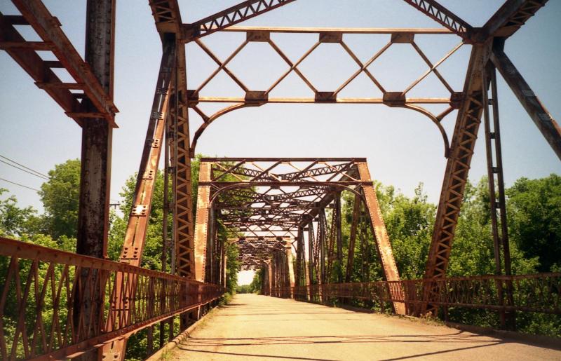
Photo taken by Jeff McNeiland
132039
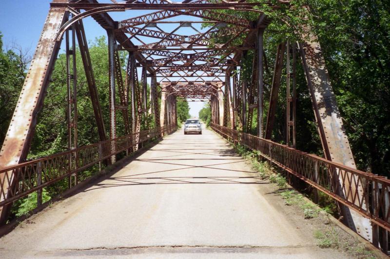
Photo taken by Jeff McNeiland
132040
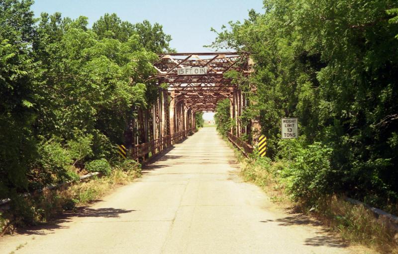
Photo taken by Jeff McNeiland
![]()
Status: Open to traffic
Location: 35.696667,-98.278333
Carries FAS 0931 over North Canadian River
Design: truss/through
Design Details: Through truss
Total Length: 173.9 Feet
Span Length: 160.1 Feet
Overview: Through truss bridge over North Canadian River on FAS 0931
History: Built ca. 1930
Built: ca. 1930
Location: Canadian County
View Bridge Information In Wayback Machine
![]()
![]()
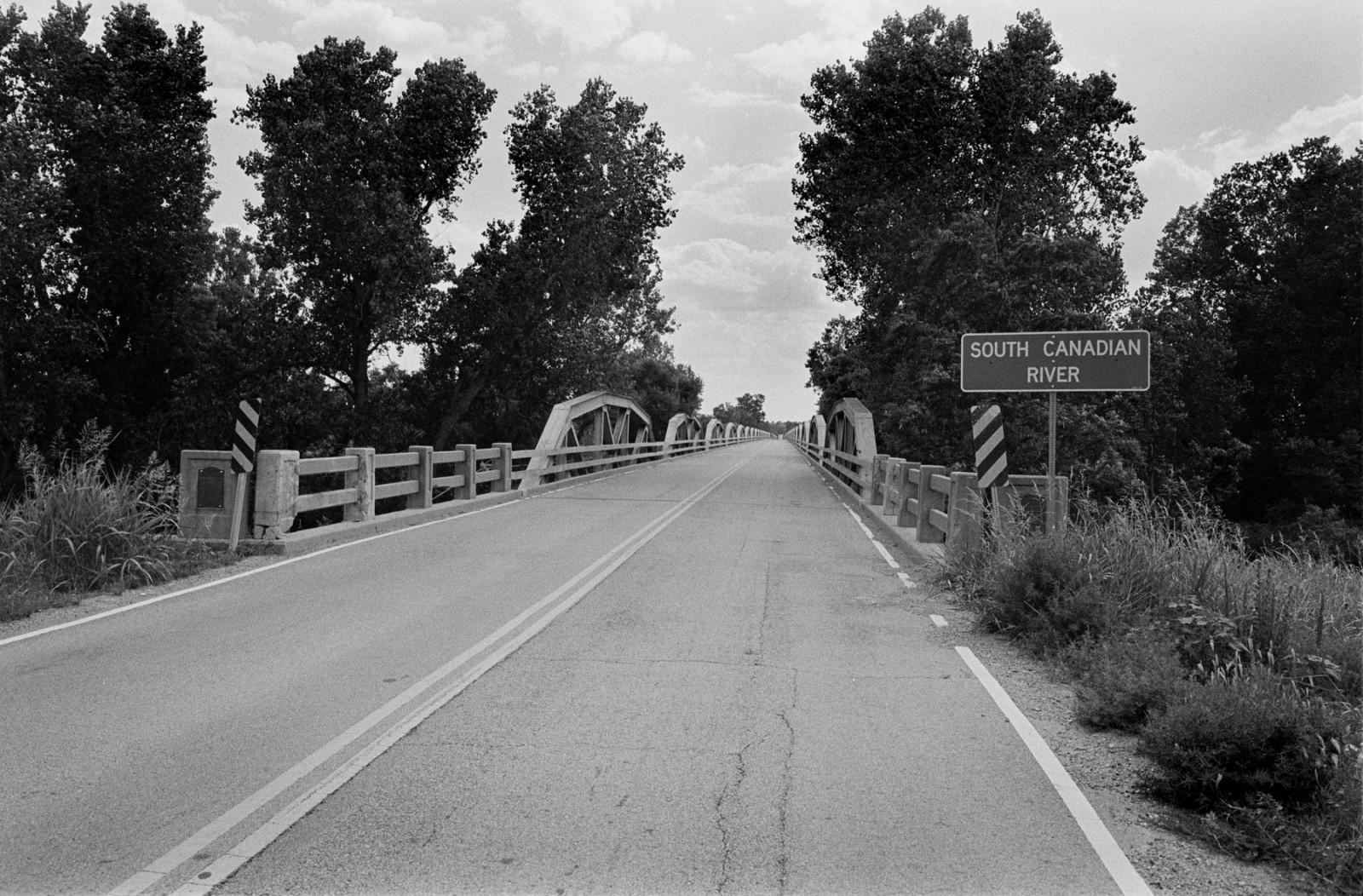
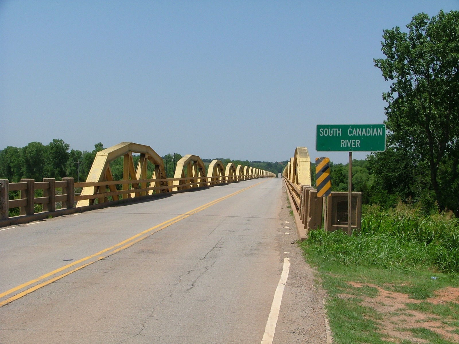
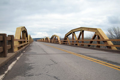
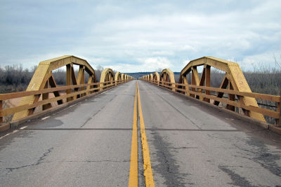
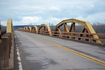
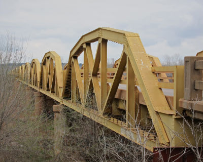
Status: Open to traffic
Slated to have its truss spans converted to decorative elements alongside a replacement superstructure.
Location: 35.543444,-98.317847
Carries US 281 (Old US 66) over South Canadian River
Design: truss/pony/pratt
Design Details: 38-span Camelback Pratt pony truss highway bridge.
Total Length: 3944.3 Feet
Span Length: 100.1 Feet
Overview: 38-span pony truss bridge over South Canadian River on US 281
History: Built 1933
Built: 1933
Location: Canadian County
View Bridge Information In Wayback Machine
![]()
129361
Difficult to tell how long this is, from this view.
Photo taken by Gene McCluney in August 2006
132075
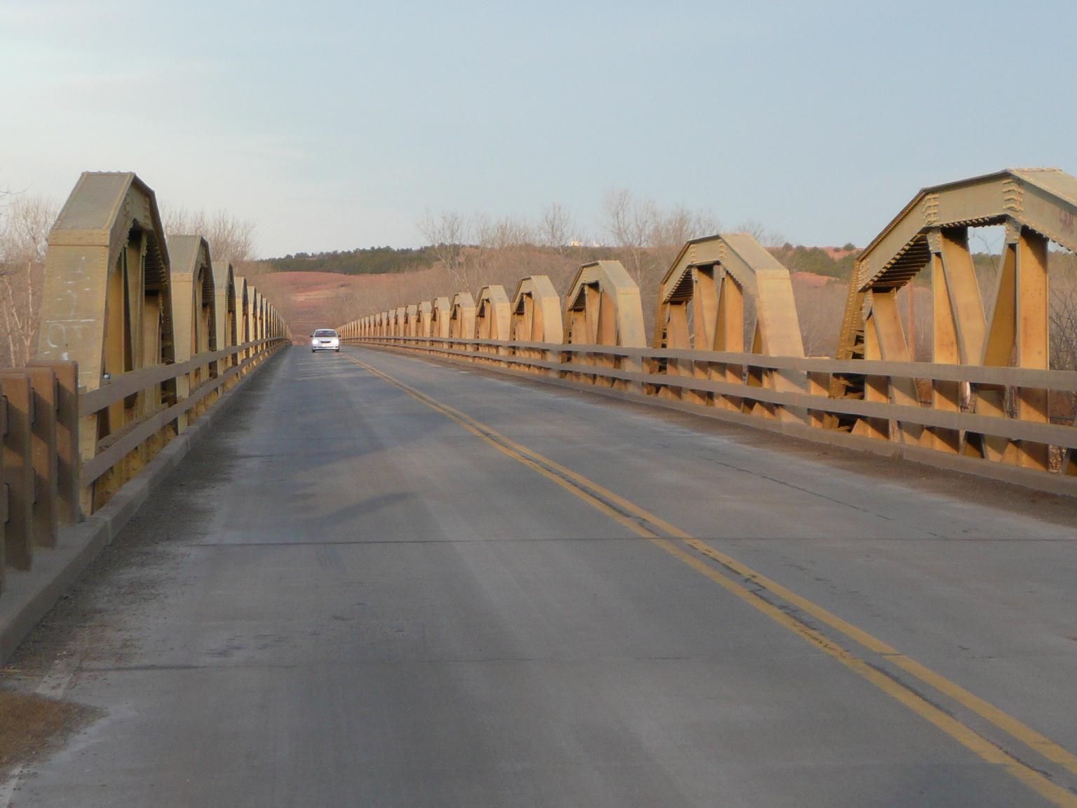
Photo taken by Jeff McNeiland
220356

Photo taken by Steve Conro in September 2009
220357
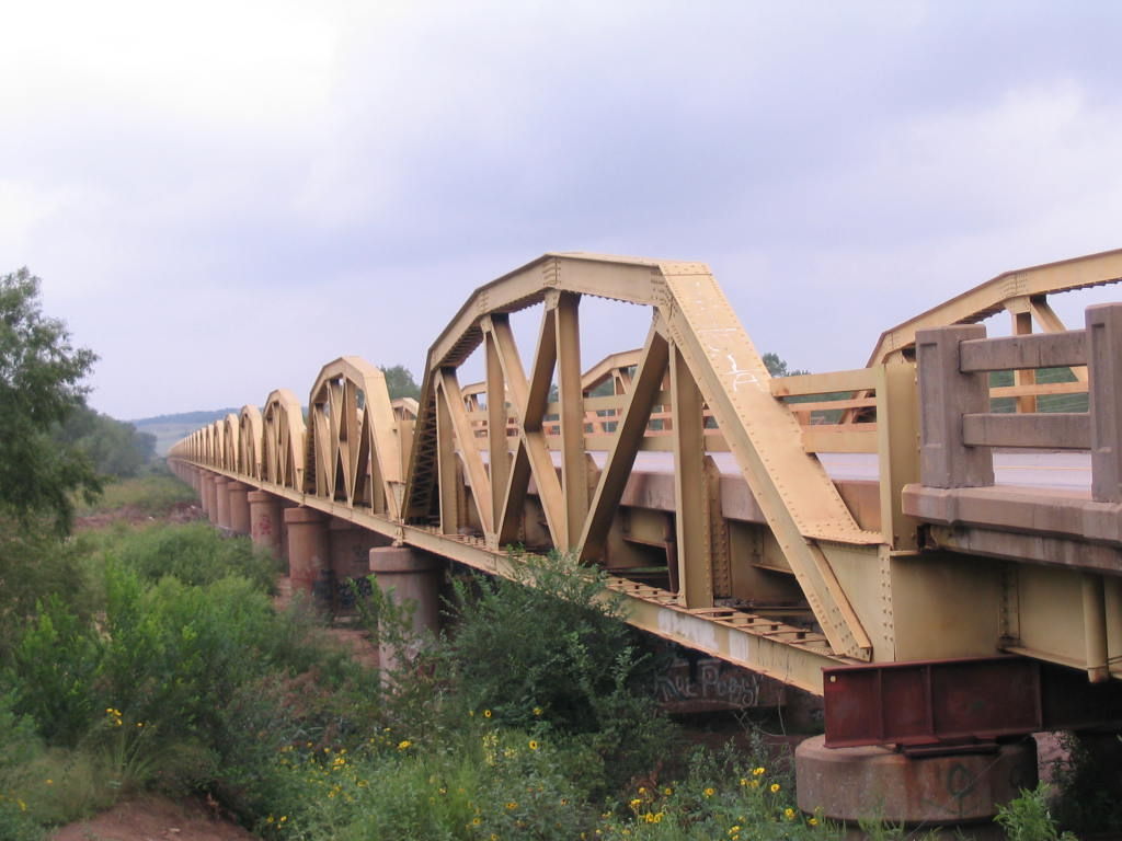
Photo taken by Steve Conro in September 2009
220358
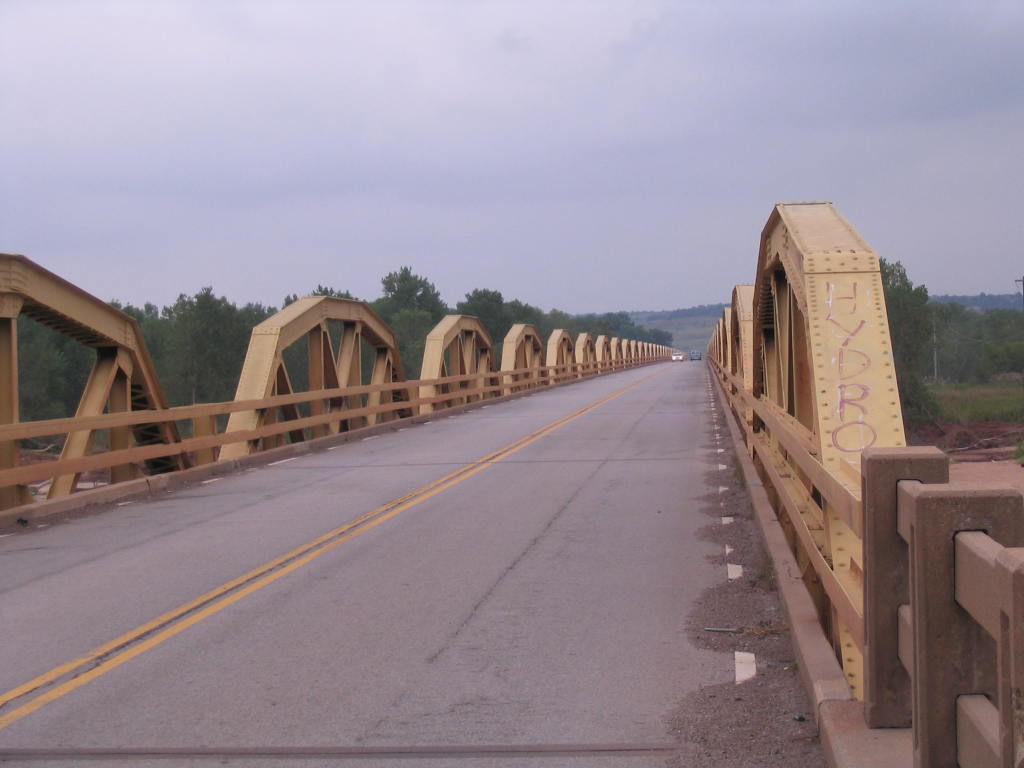
Photo taken by Steve Conro in September 2009
220359
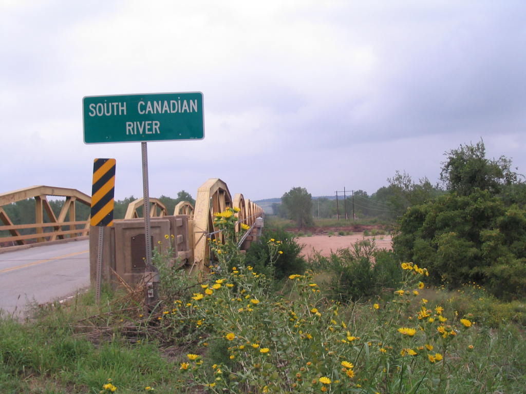
Photo taken by Steve Conro in September 2009
220360
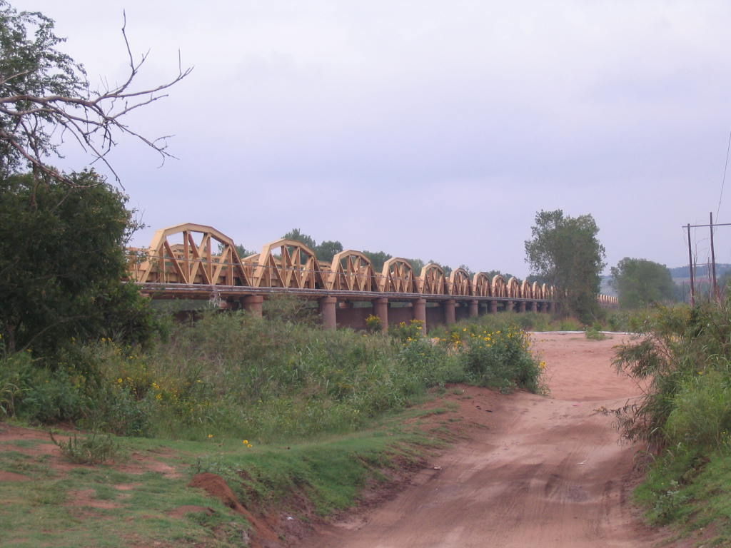
Photo taken by Steve Conro in September 2009
276090
William H Murray Bridge
Photo taken by Jack Schmidt June 2009
358246
2013 photo
Jim Grey
358247
2013 photo
Jim Grey
358248
2013 photo
Jim Grey
358249
2013 photo
Jim Grey
448509
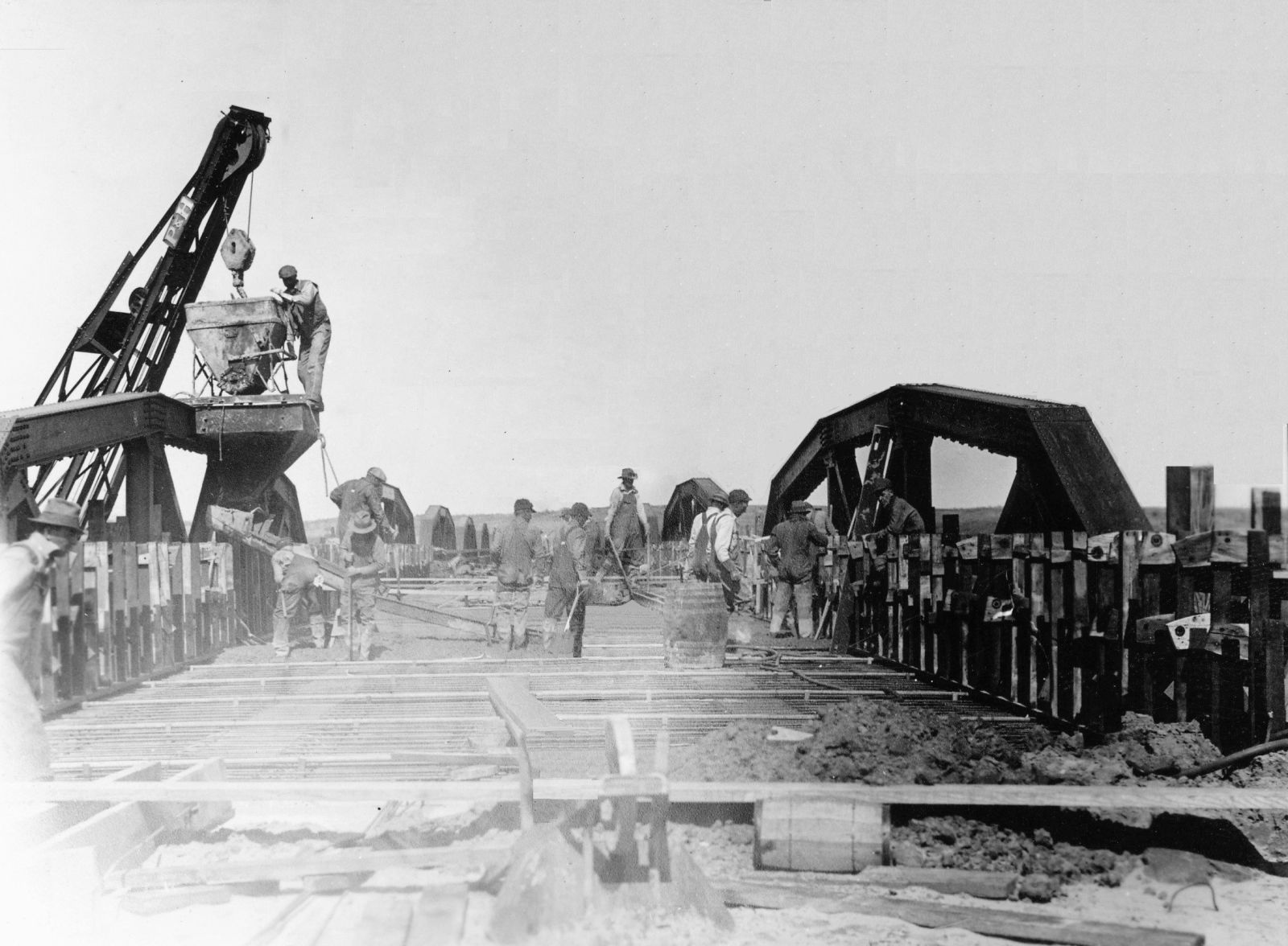
Photo taken by Joe Sonderman in December 2017
448510
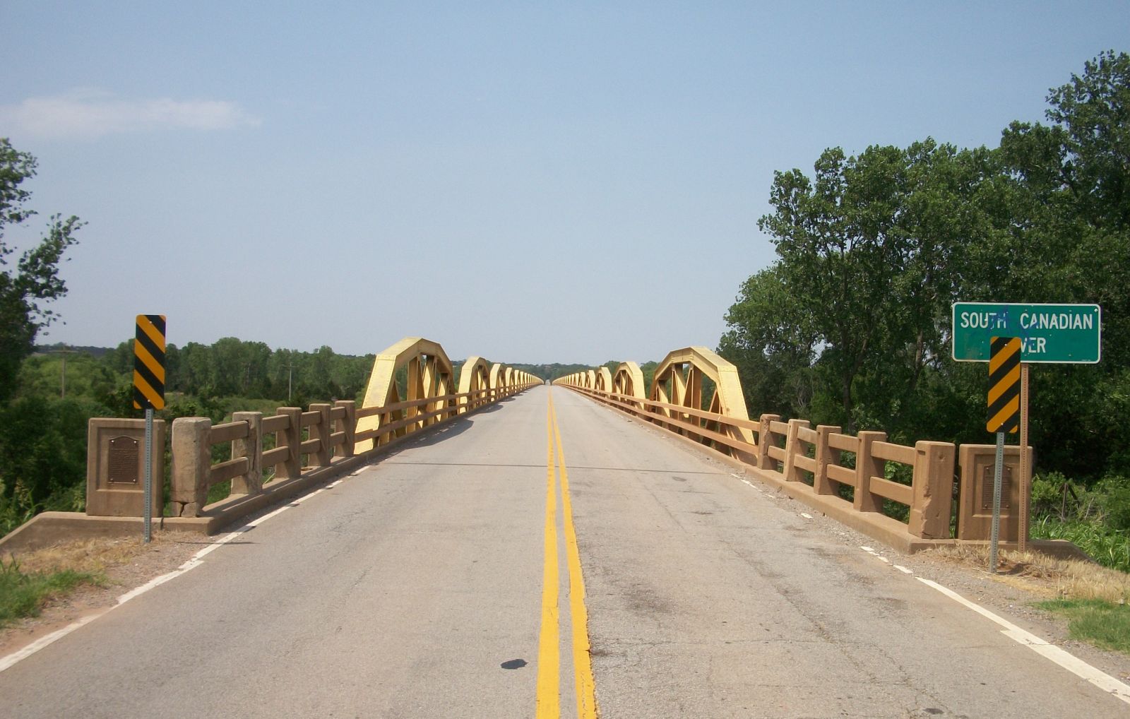
Photo taken by Joe Sonderman in January 2008
448511
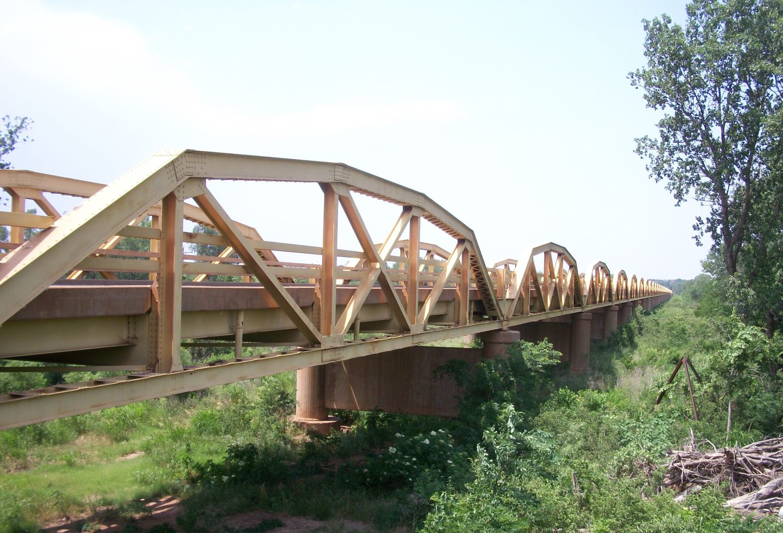
Photo taken by Joe Sonderman in January 2008
448512
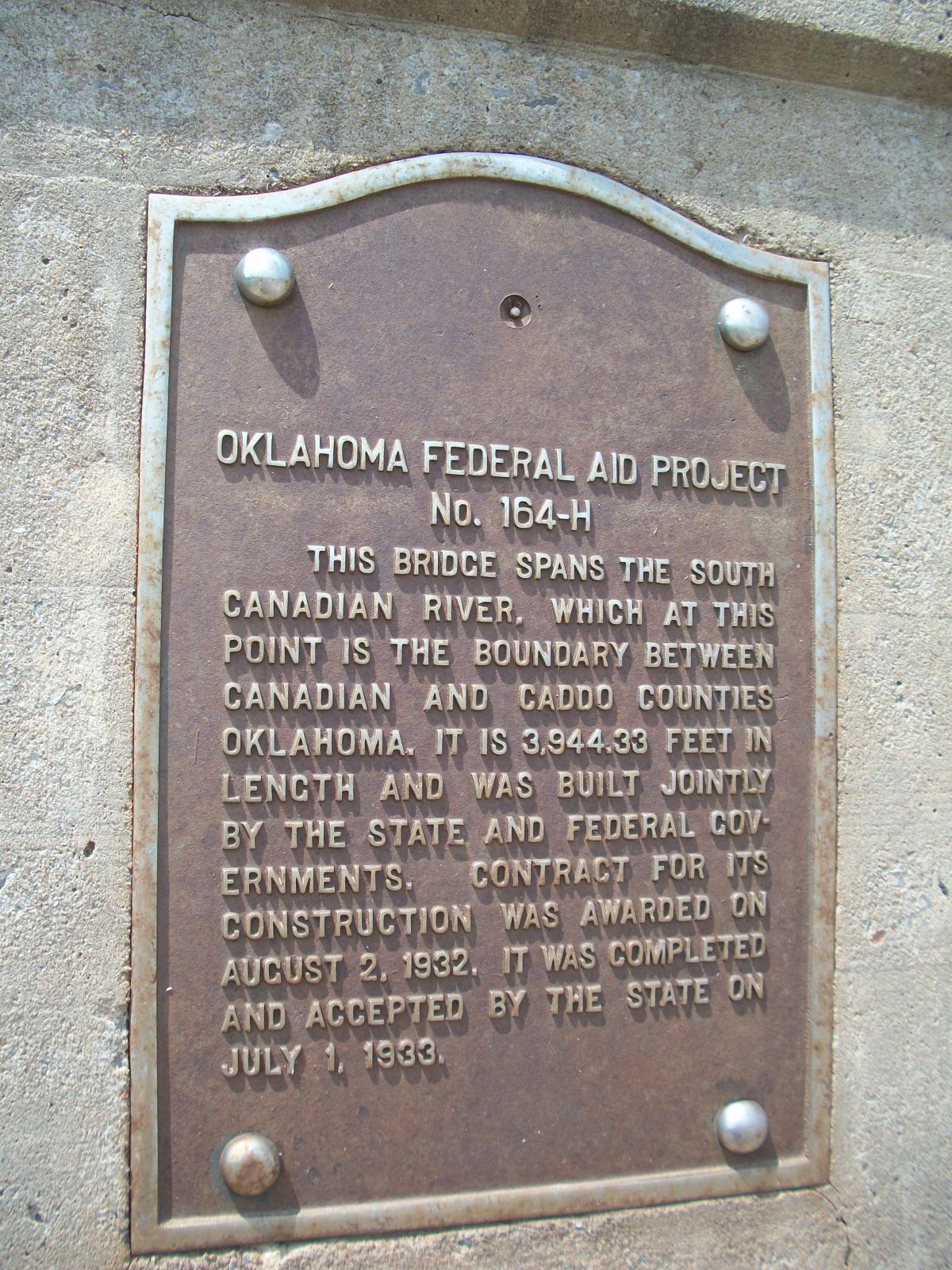
Photo taken by Joe Sonderman in January 2008
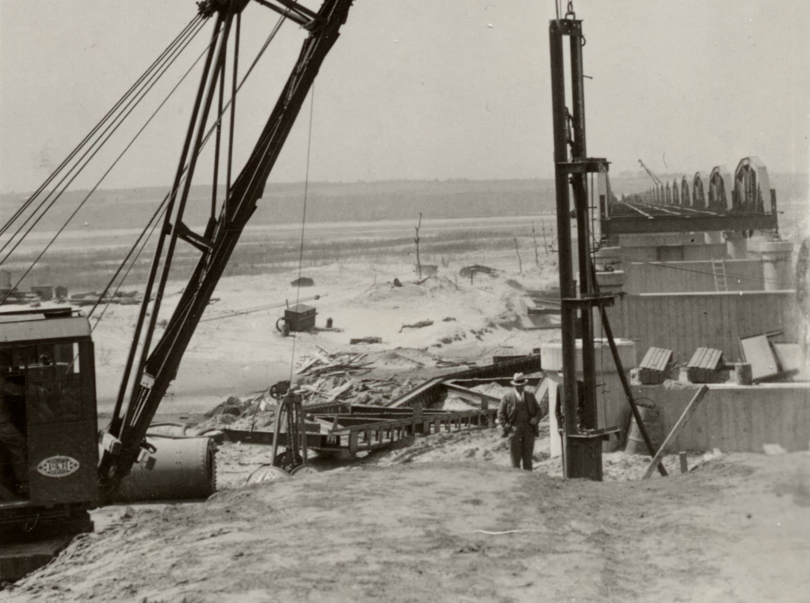
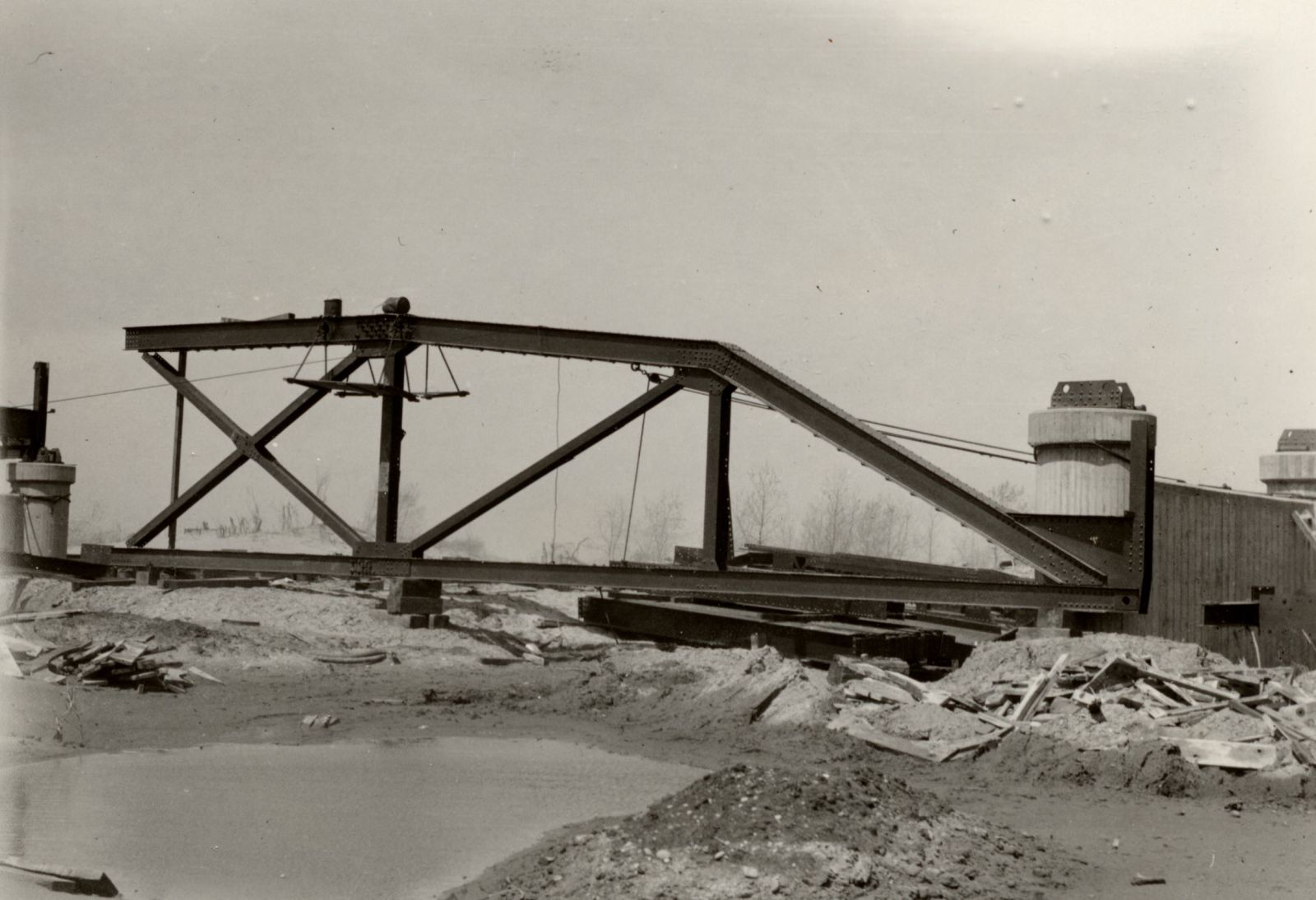
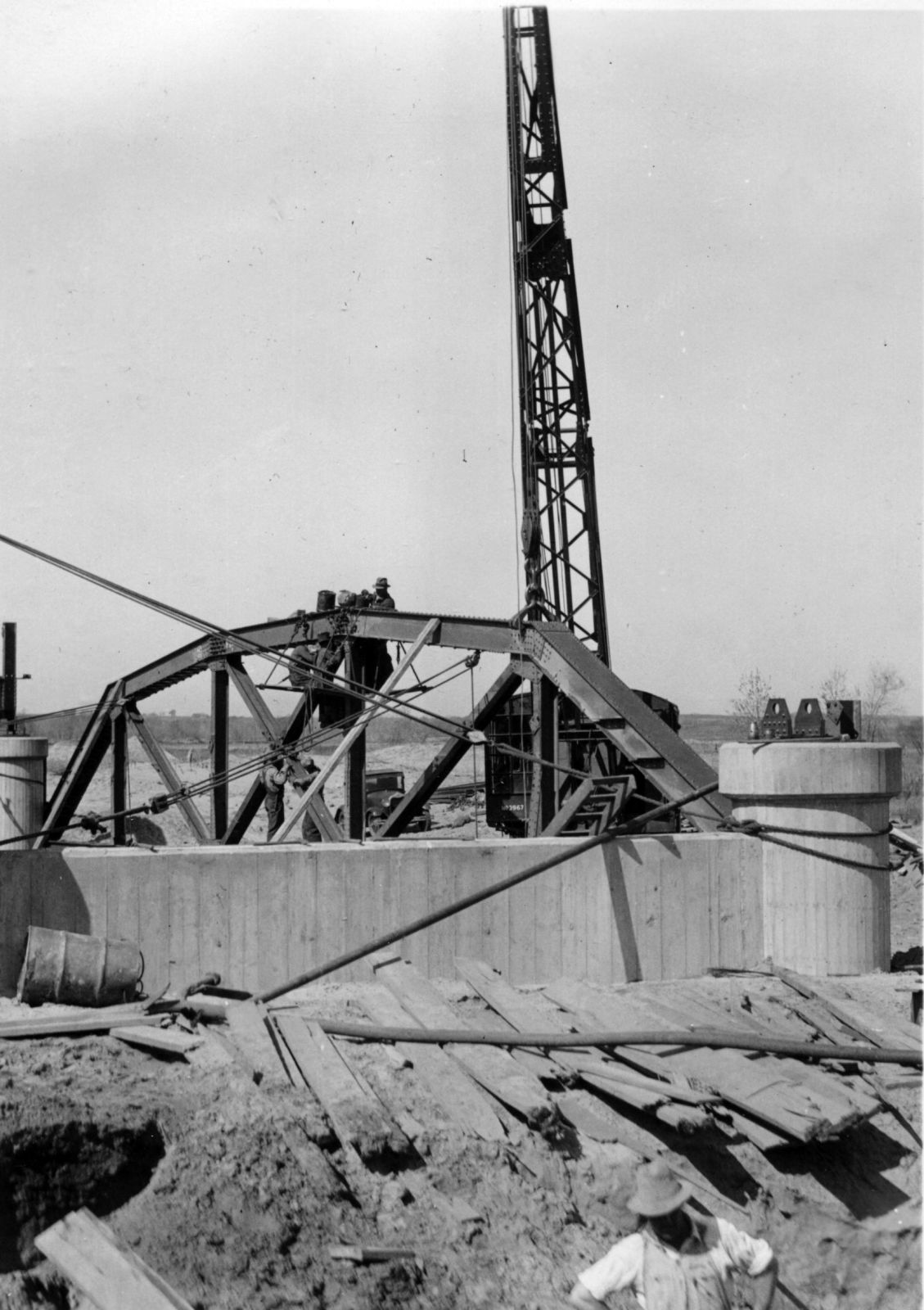
448513
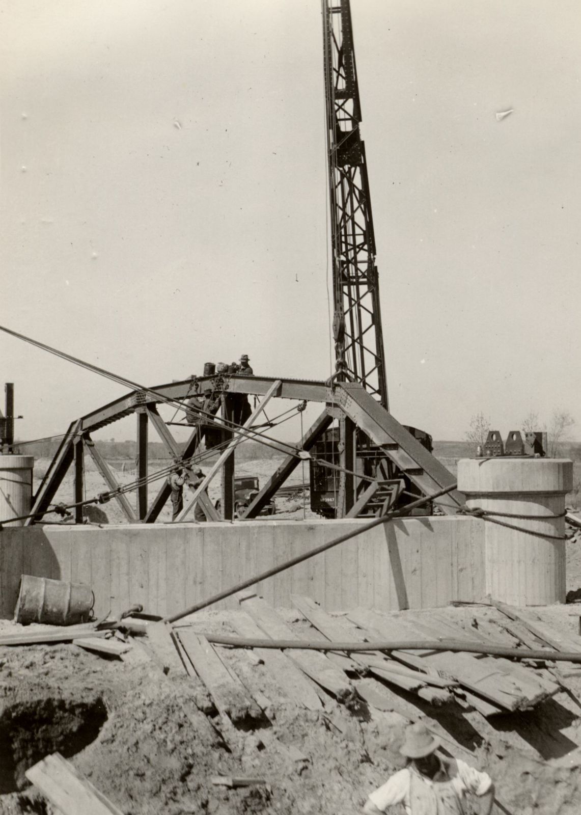
William H. Murray Bridge
Construction photo
ODOT
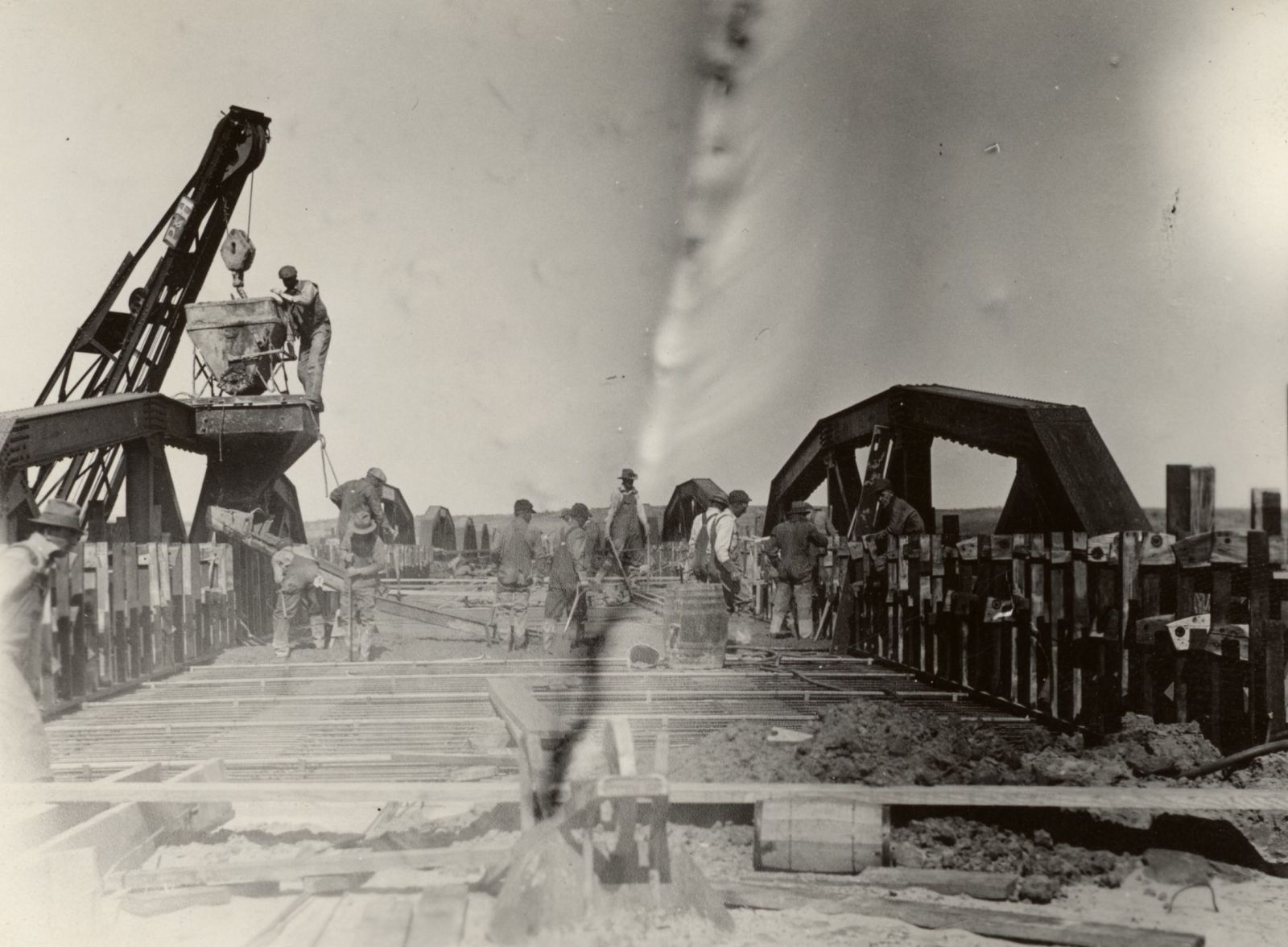
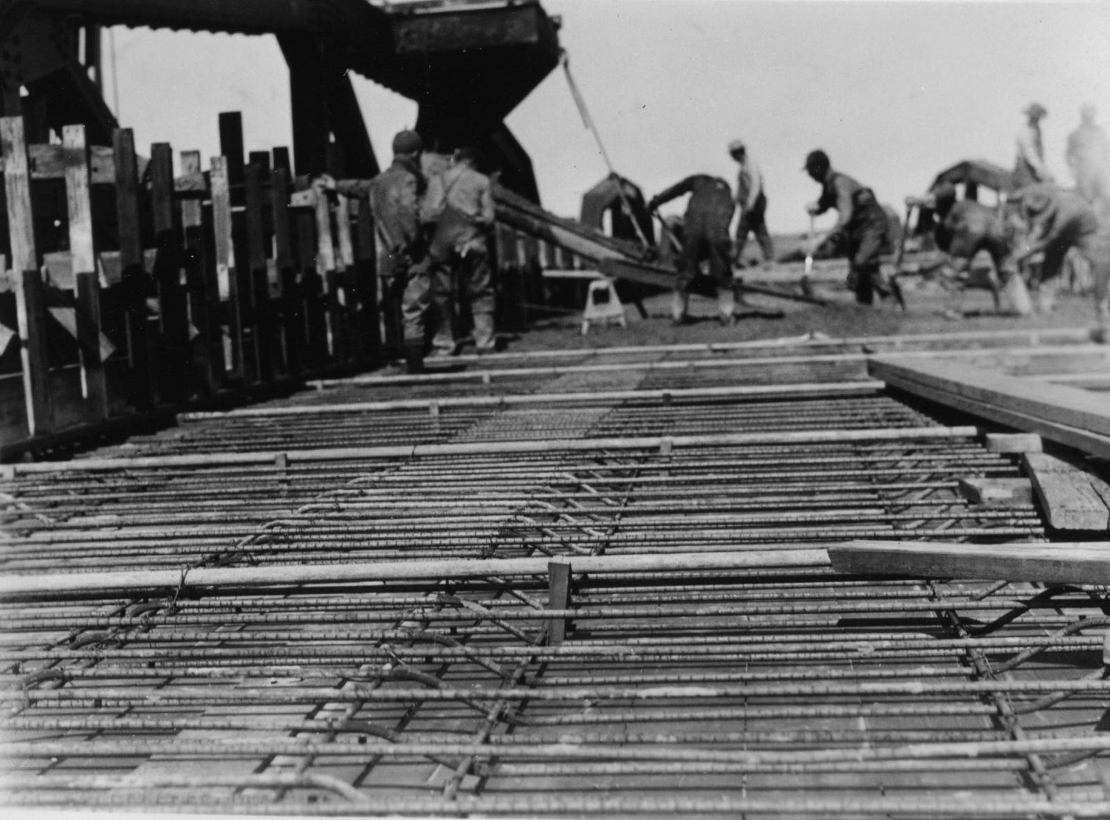
448514
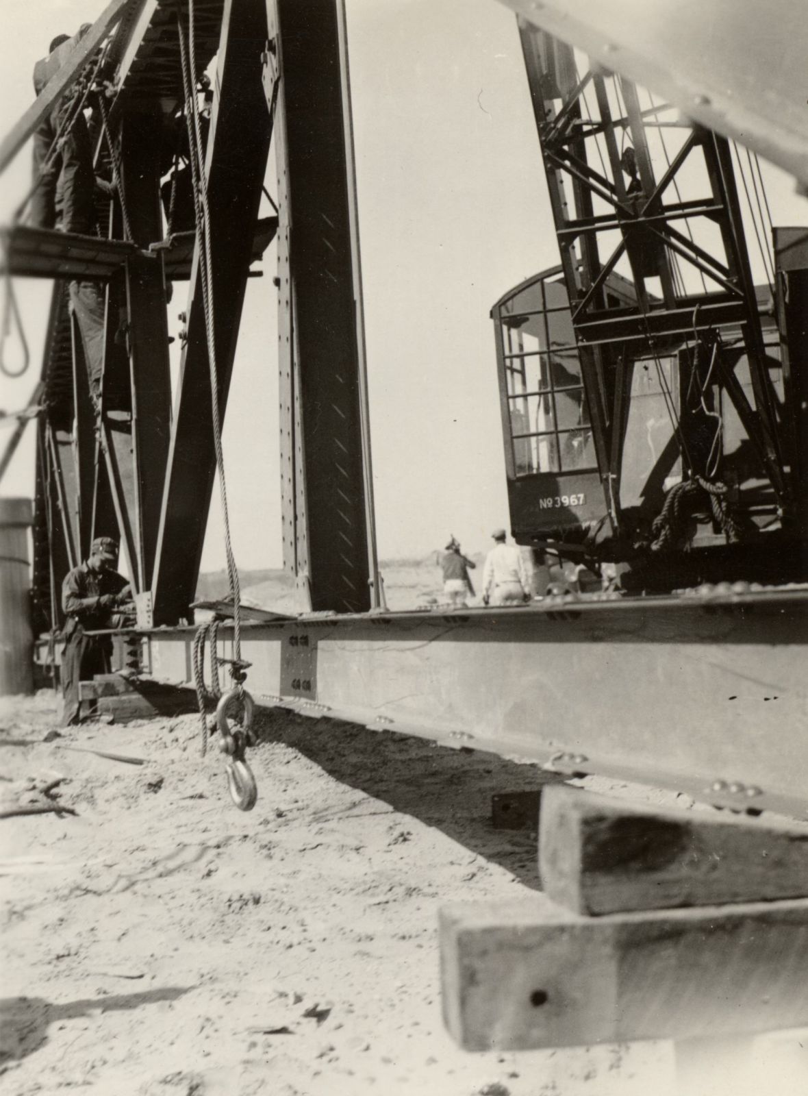
William H. Murray Bridge
Construction photo
ODOT
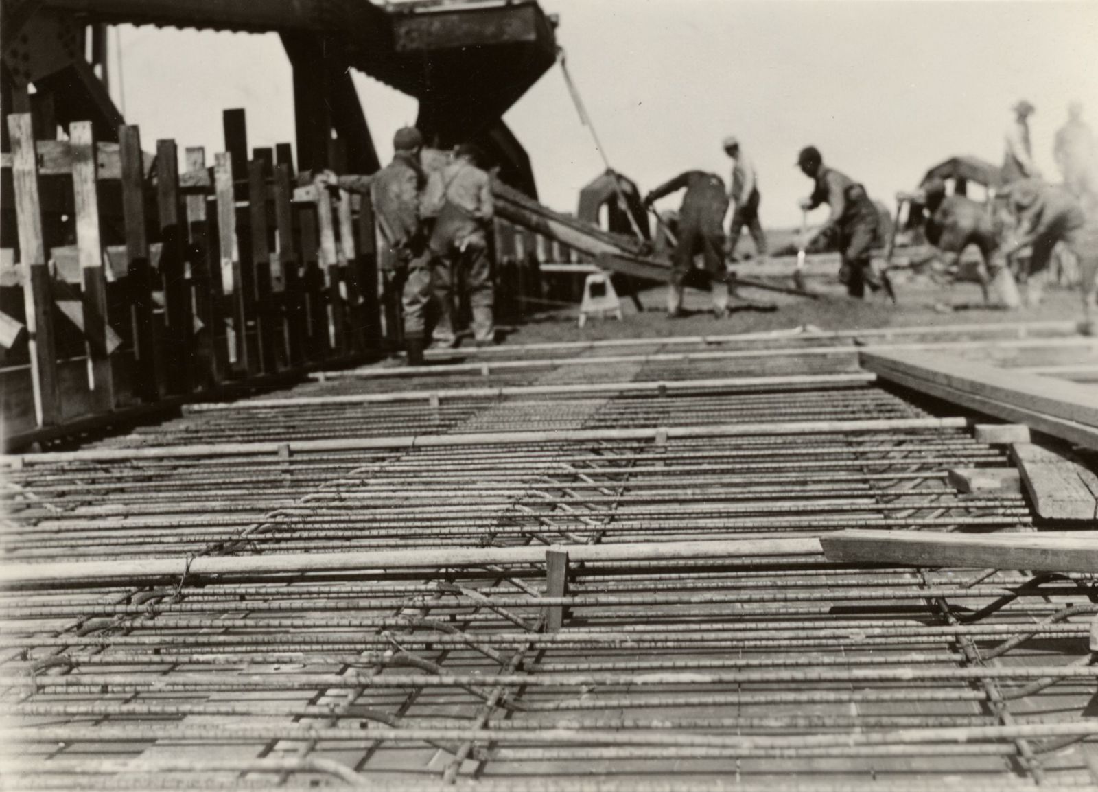
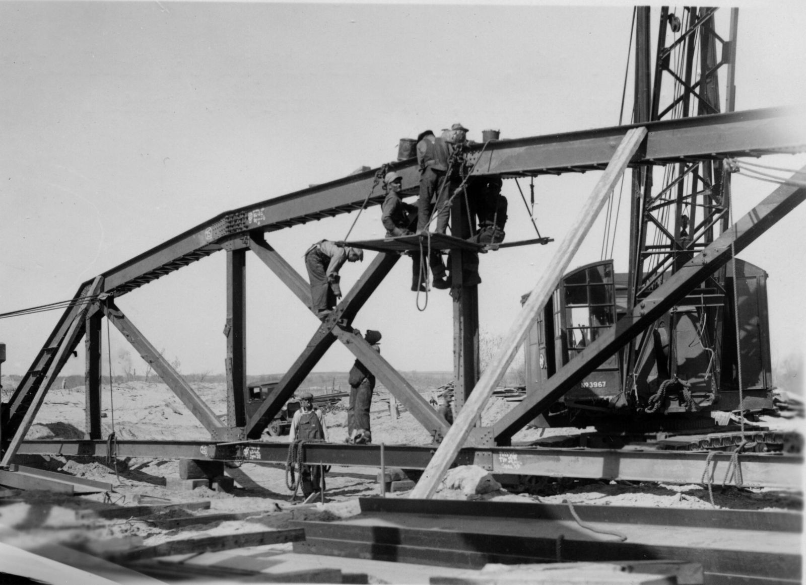
448515
William H. Murray Bridge
Construction
ODOT
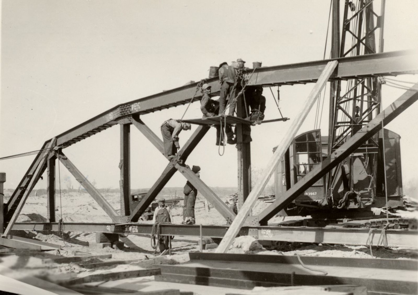
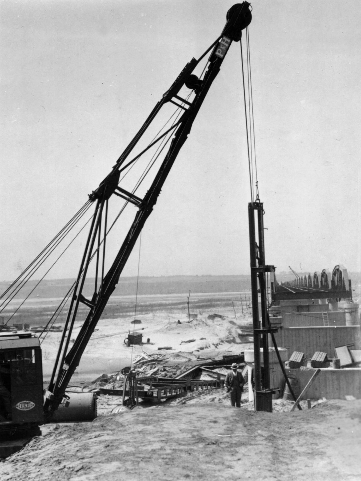
448516
William H. Murray Bridge
Construction
ODOT
448517
William H. Murray Bridge
Construction
ODOT
448518
William H. Murray Bridge
Construction
ODOT
448519
William H. Murray Bridge
Construction
ODOT
448520
William H. Murray Bridge
Construction
ODOT
448521
William H. Murray Bridge
Construction
ODOT
448522
William H. Murray Bridge
Construction
ODOT
448523
William H. Murray Bridge
Construction
ODOT
![]()
Status: Closed to all traffic
Location: 35.695000,-97.798333
Carries N. Richland Rd. (N2920 Rd.) over Cottonwood Creek
Design: truss/pony
Design Details: Pony truss
Total Length: 44.9 Feet
Span Length: 42.0 Feet
Overview: Pony truss bridge over Cottonwood Creek on N. Richland Rd. in Piedmont
History: Built 1907
Built: 1907
Location: Canadian County
View Bridge Information In Wayback Machine
![]()
![]()
Status: Intact but closed to all traffic
Location: 35.682111,-97.921785
Carries E0920 (206th Street NE) over Branch of Uncle Johns Creek
Design: truss/pony
Design Details: Pony truss
Total Length: 69.9 Feet
Span Length: 40.0 Feet
Overview: Pony truss bridge over a branch of Uncle Johns Creek on E0920 (206th Street NE)
History: Built 1909; bypassed by new bridge in 2014
Built: 1909
Location: Canadian County
View Bridge Information In Wayback Machine
![]()
![]()
Status: Replaced by a new bridge
Location: 35.711667,-97.915000
Carries E0900 Rd. over Uncle John Creek
Design: truss/through/pratt
Design Details: Pin-connected, 6-panel Pratt through truss
Total Length: 195.9 Feet
Span Length: 100.1 Feet
Overview: Lost Through truss bridge over Uncle John Creek on E0900 Rd.
History: Built 1921; replaced 2016
Built: 1921
Location: Canadian County
View Bridge Information In Wayback Machine
![]()
132069
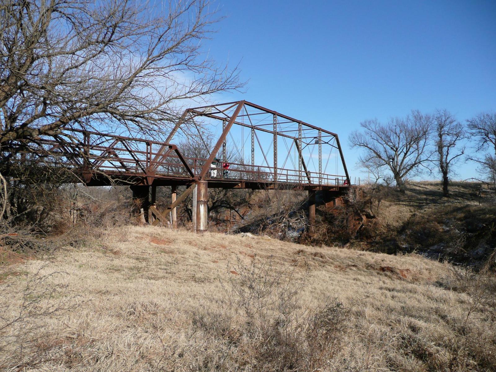
Photo taken by Jeff McNeiland
132070
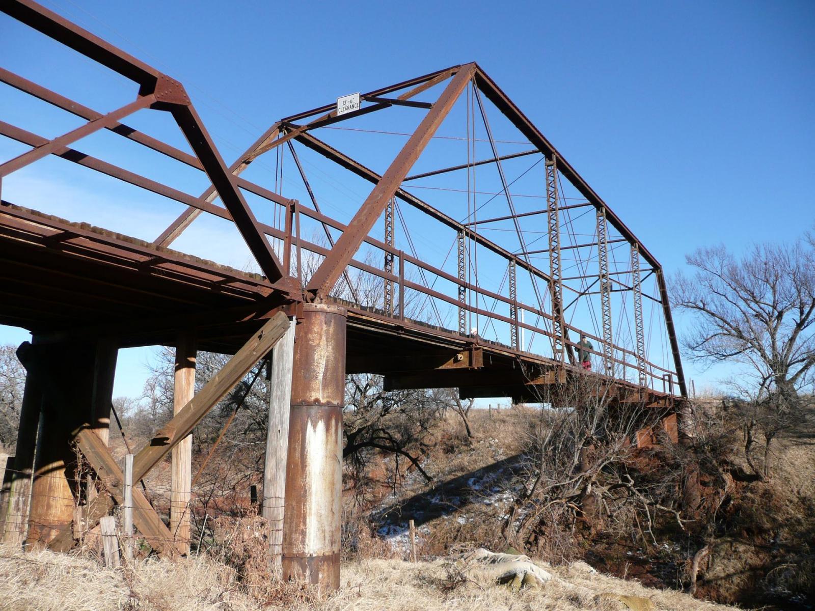
Photo taken by Jeff McNeiland
132071
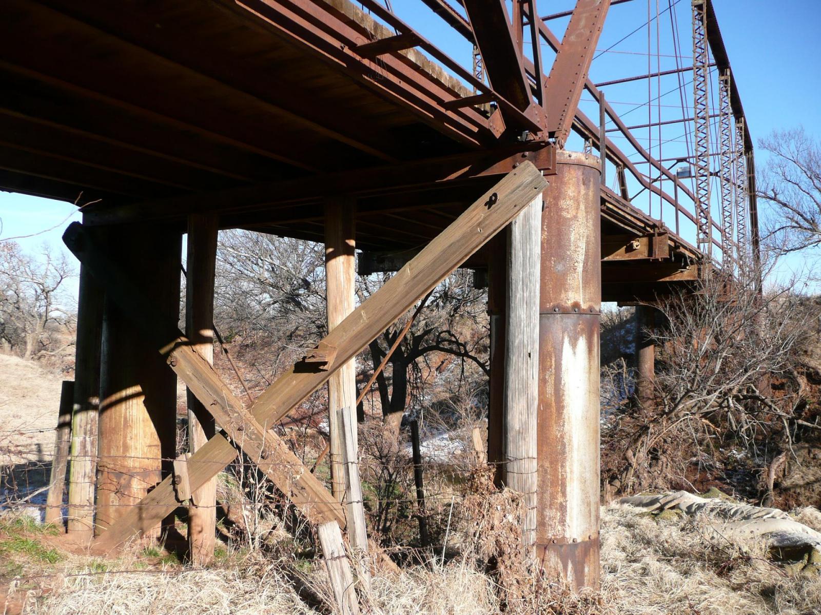
Photo taken by Jeff McNeiland
132072
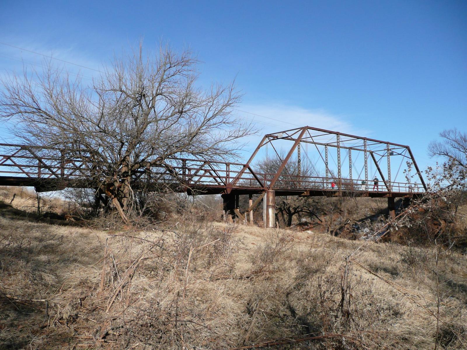
Photo taken by Jeff McNeiland
132073
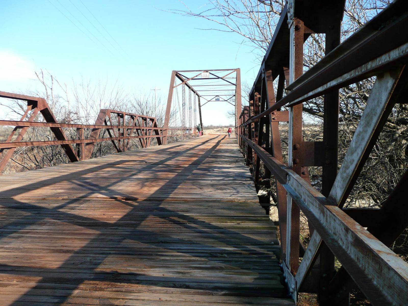
Photo taken by Jeff McNeiland
132074
Photo taken by Jeff McNeiland
151497
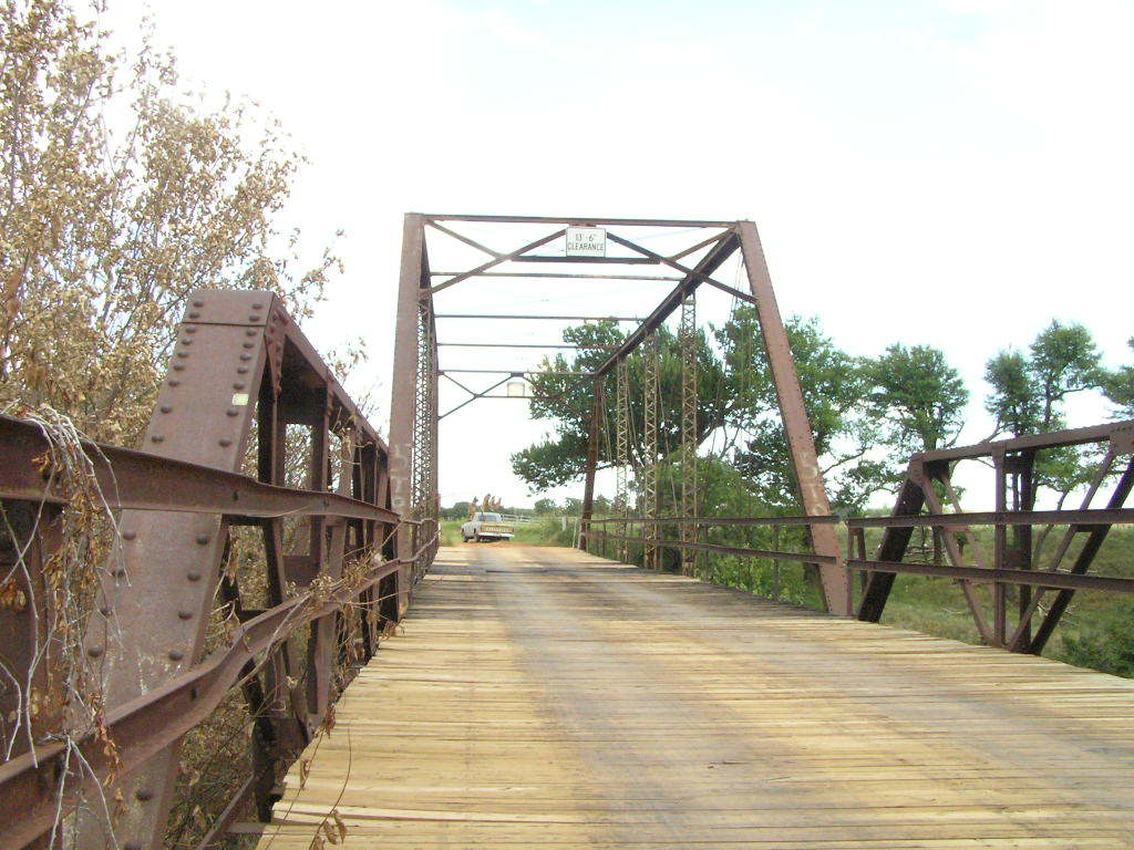
Photo taken by Wes Kinsler
![]()
Status: Replaced by a new bridge
Location: 35.608889,-97.725000
Carries E0970 (W. Memorial Road) over Branch of Deer Creek
Design: truss/pony
Design Details: Pony truss
Total Length: 44.9 Feet
Span Length: 44.9 Feet
Overview: Pony truss bridge over an unnamed creek on E0970 in Oklahoma City
History: Built ca. 1920; replaced 1997
Built: ca. 1920
Location: Canadian County
View Bridge Information In Wayback Machine
![]()
![]()
Status: Replaced by new bridge
Location: 35.626423,-97.833912
Carries N2900 over Unnamed creek
Design: truss/pony
Design Details: Pony truss
Total Length: 45.9 Feet
Span Length: 45.9 Feet
Overview: Lost pony truss bridge over an unnamed creek on N2900, 5.0 mi. west and .8 mi. south of Piedmont
History: Built 1921; replaced 1998
Built: 1921
Location: Canadian County
View Bridge Information In Wayback Machine
![]()
![]()
Status: Open to traffic
Location: 35.507778,-97.790556
Carries S.H. 66 over Shell Creek
Design: beam/stringer/steel
Design Details: Steel stringer
Total Length: 162.1 Feet
Span Length: 40.0 Feet
Overview: Steel stringer bridge over Shell Creek on S.H. 66
History: Built 1951
Built: 1951
Location: Canadian County
View Bridge Information In Wayback Machine
![]()
![]()
Status: Open to traffic
Location: 35.507500,-97.790833
Carries S.H. 66 over Shell Creek
Design: beam/stringer/steel
Design Details: Steel stringer
Total Length: 162.1 Feet
Span Length: 40.0 Feet
Overview: Steel stringer bridge over Shell Creek on S.H. 66
History: Built 1951
Built: 1951
Location: Canadian County
View Bridge Information In Wayback Machine
![]()
![]()
Status: Open to traffic
Location: 35.507778,-97.899444
Carries S.H. 66 over Unnamed creek
Design: culvert
Design Details: Culvert
Total Length: 20.7 Feet
Span Length: 9.8 Feet
Overview: Culvert bridge over Unnamed creek on S.H. 66
History: Built 1928; rehabilitated 1940
Built: 1928
Location: Canadian County
View Bridge Information In Wayback Machine
![]()
![]()
Status: Open to traffic
Location: 35.507778,-97.894444
Carries S.H. 66 over Unnamed creek
Design: culvert
Design Details: Culvert
Total Length: 20.7 Feet
Span Length: 9.8 Feet
Overview: Culvert bridge over Unnamed creek on S.H. 66
History: Built 1928; rehabilitated 1940
Built: 1928
Location: Canadian County
View Bridge Information In Wayback Machine
![]()
![]()
Status: Open to traffic
Location: 35.536667,-98.081667
Carries 0922c over Unnamed creek
Design: culvert
Design Details: Culvert
Total Length: 33.1 Feet
Span Length: 9.8 Feet
Overview: Culvert bridge over Unnamed creek on 0922c
History: Built 1928
Built: 1928
Location: Canadian County
View Bridge Information In Wayback Machine
![]()
![]()
Status: Open to traffic
Location: 35.536944,-98.067778
Carries 0922c over Unnamed creek
Design: culvert
Design Details: Culvert
Total Length: 33.1 Feet
Span Length: 9.8 Feet
Overview: Culvert bridge over Unnamed creek on 0922c
History: Built 1928
Built: 1928
Location: Canadian County
View Bridge Information In Wayback Machine
![]()
![]()
Status: Open to traffic
Location: 35.536389,-98.200833
Carries 0922c over Powder Face Creek
Design: slab
Design Details: Slab
Total Length: 111.9 Feet
Span Length: 22.0 Feet
Overview: Slab bridge over Powder Face Creek on 0922c
History: Built 1928
Built: 1928
Location: Canadian County
View Bridge Information In Wayback Machine
![]()
432565
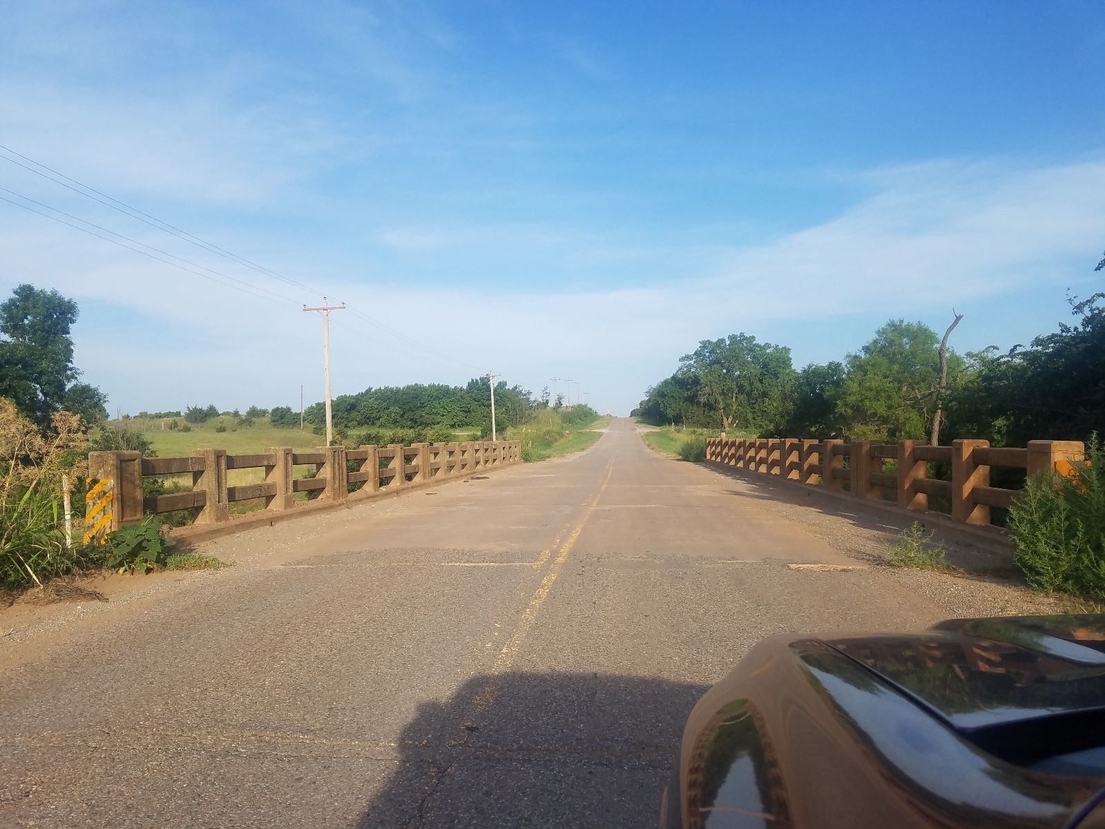
Photo taken by James McCray in July 2018
![]()
Status: Open to traffic
Location: 35.536389,-98.221389
Carries 0922c over Unnamed creek
Design: beam/stringer/steel
Design Details: Steel stringer
Total Length: 62.0 Feet
Span Length: 57.1 Feet
Overview: Steel stringer bridge over Unnamed creek on 0922c
History: Built 1934
Built: 1934
Location: Canadian County
View Bridge Information In Wayback Machine
![]()
![]()
Status: Open to traffic
Location: 35.555552,-97.974272
Carries Union Pacific Railroad over North Canadian River
Design: truss/through/warren/sub-panels
Design Details: 1 Sp. 153' Subdivided Warren Through Truss
1 Sp. 150' Subdivided Warren Through Truss
Total Length: 303.0 Feet
Span Length: 153.0 Feet
Overview: Warren through truss bridge over North Canadian River on Union Pacific Railroad
History:
Built:
Location: Canadian County
View Bridge Information In Wayback Machine
![]()
![]()
Status: Open to traffic
Location: 35.512274,-97.687657
Carries Overholser over Lake
Design: beam/stringer/steel
Design Details: Steel stringer
Total Length: 214.9 Feet
Span Length: 43.0 Feet
Overview: Steel stringer bridge over Lake on Overholser
History: Built 1935
Built: 1935
Location: Canadian County
View Bridge Information In Wayback Machine
![]()
456149
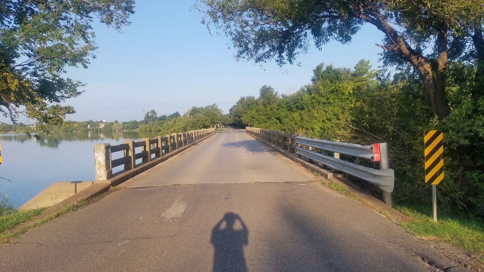
Photo taken by James McCray in September 2019
456150
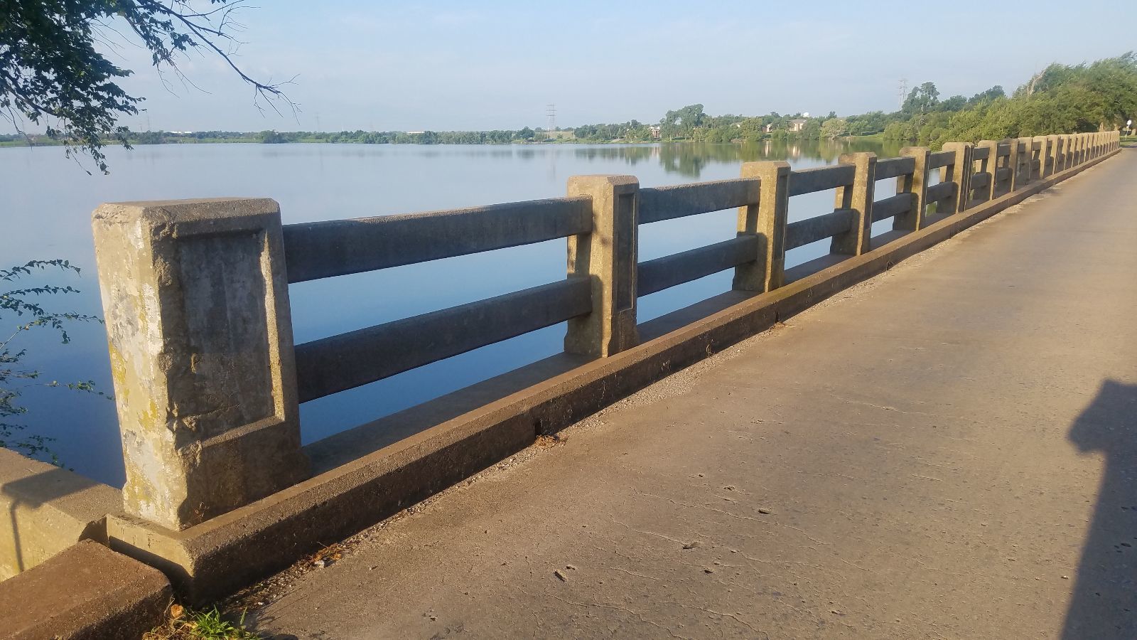
Photo taken by James McCray in September 2019
456151
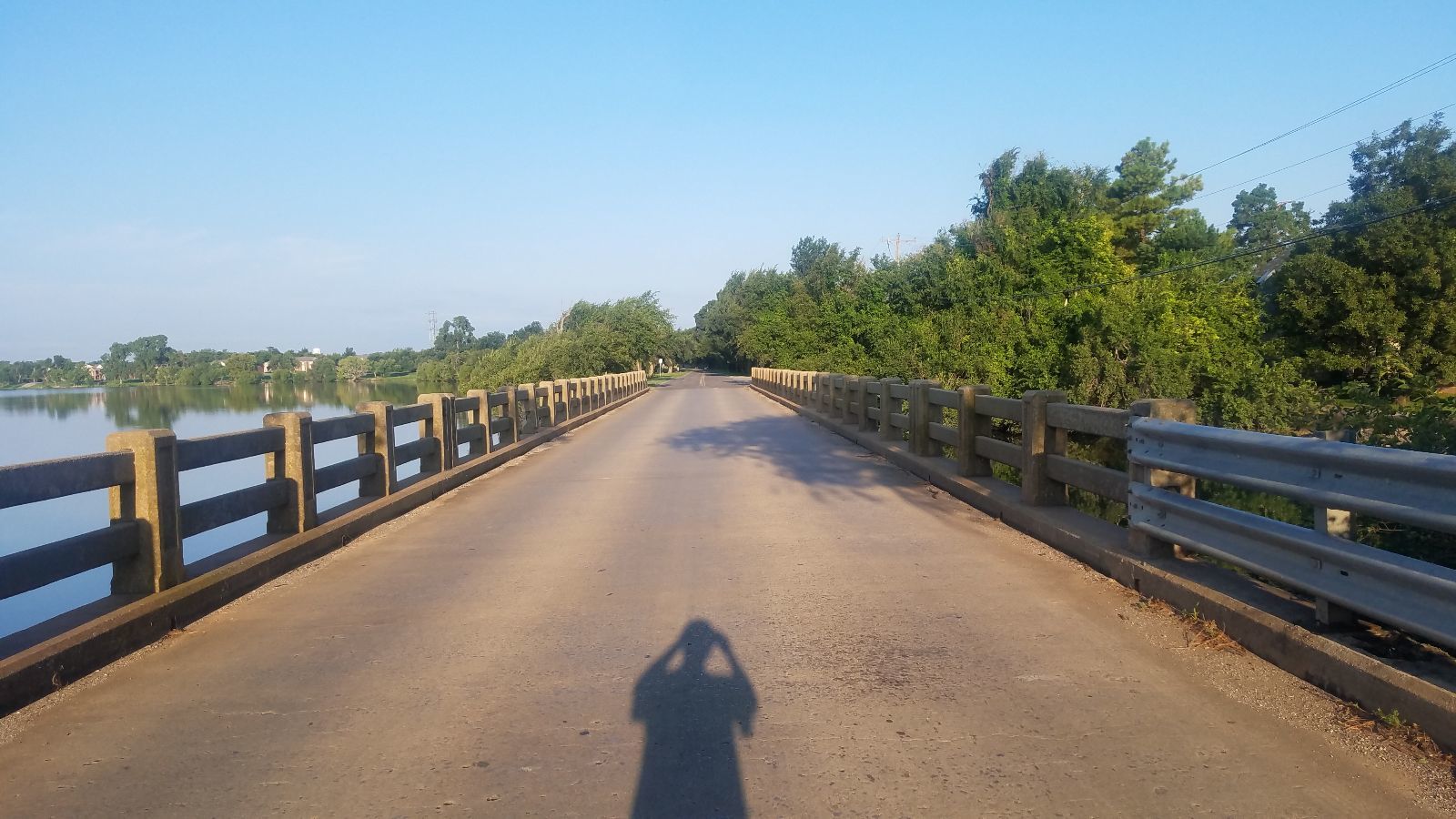
Photo taken by James McCray in September 2019
456152

Photo taken by James McCray in September 2019
456153
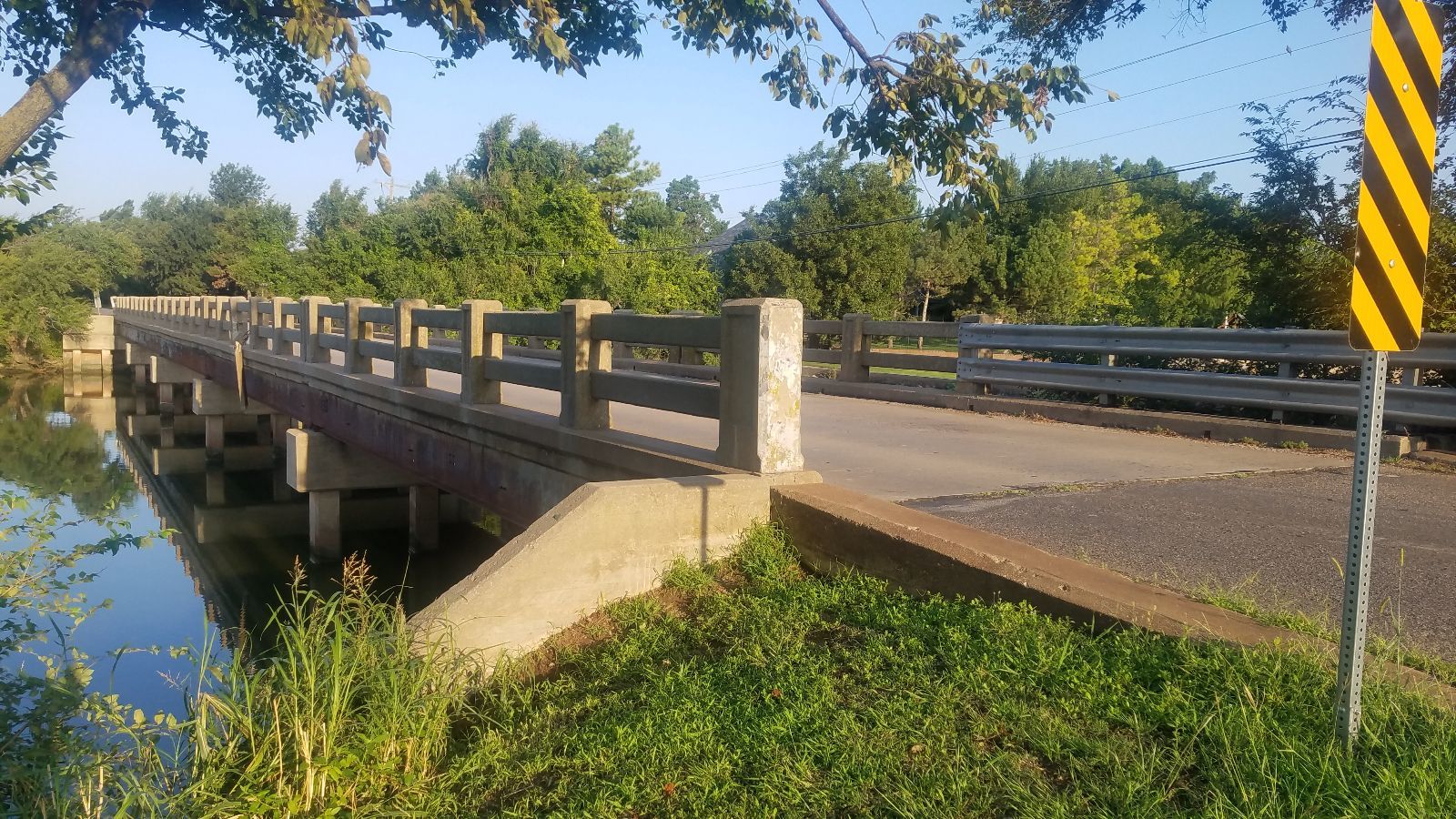
Photo taken by James McCray in September 2019
![]()
Status: Open to traffic
Location: 35.340424,-97.761346
Carries Burlington Northern and Santa Fe Railway over Canadian River
Design: truss/through/pratt
Design Details: Pratt through truss
Total Length: 0.0 Feet
Span Length: 0.0 Feet
Overview: Pratt through truss bridge over Canadian River on Burlington Northern and Santa Fe Railway
History:
Built:
Location: Canadian County
View Bridge Information In Wayback Machine
![]()
![]()
Status: Unknown status
Location: 35.527739,-97.943950
Carries Up R.R. over Fau 3870 Jenkins Under
Design: beam/stringer/steel
Design Details: Steel stringer
Total Length: 26.9 Feet
Span Length: 26.9 Feet
Overview: Steel stringer bridge over Fau 3870 Jenkins Under on Up R.R.
History: Built 1920
Built: 1920
Location: Canadian County
View Bridge Information In Wayback Machine
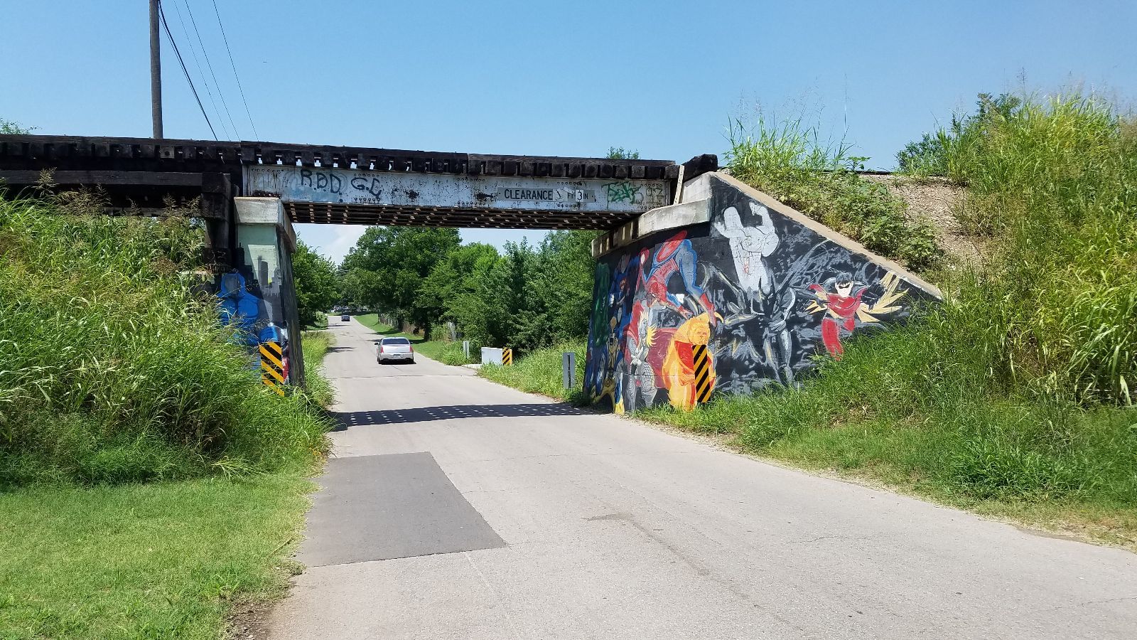
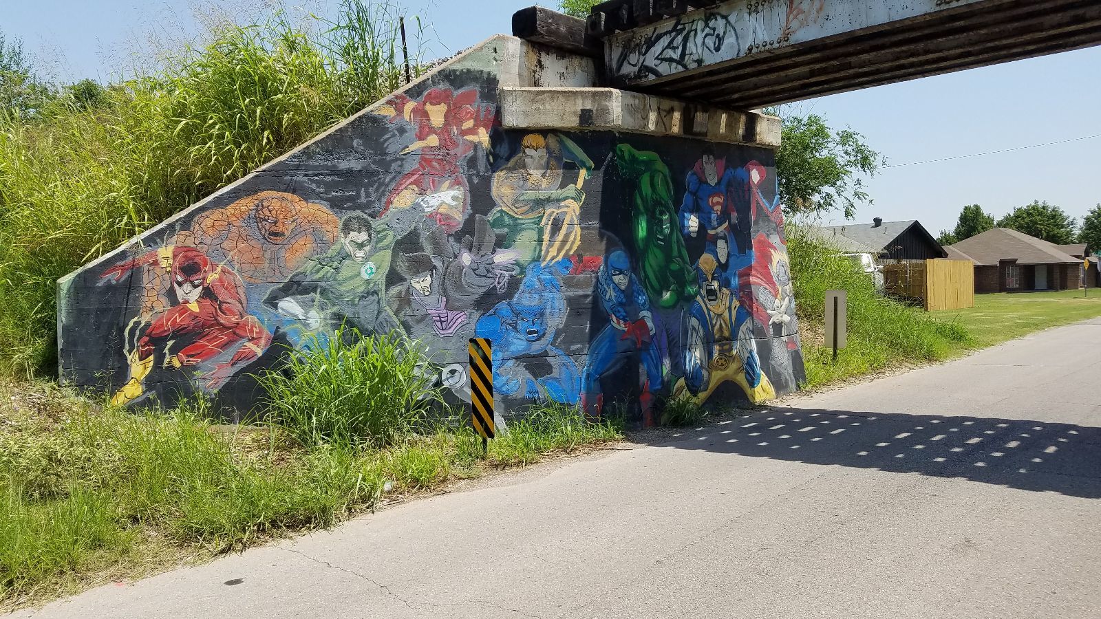
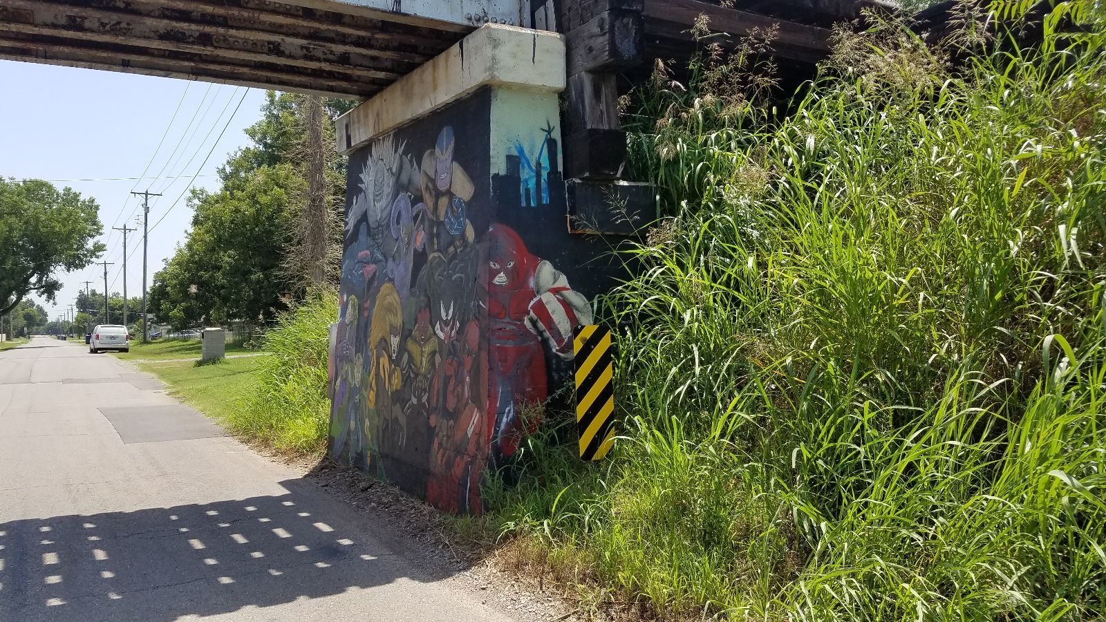
![]()
![]()
Status: Open to traffic
Location: 35.525928,-97.945267
Carries Union Pacific Railroad over Cavanaugh St
Design: beam/stringer/steel
Design Details: Steel stringer
Total Length: 63.0 Feet
Span Length: 32.2 Feet
Overview: Steel stringer bridge over Cavanaugh St on Union Pacific Railroad
History: Built 1920
Built: 1920
Location: Canadian County
View Bridge Information In Wayback Machine
![]()
![]()
Status: Open
Location: 35.529661,-97.943531
Carries Up R.R. over E Watts St
Design: beam/stringer/steel
Design Details: Steel stringer
Total Length: 48.9 Feet
Span Length: 26.9 Feet
Overview: Steel stringer bridge over E Watts St on Up R.R.
History: Built 1920
Built: 1920
Location: Canadian County
View Bridge Information In Wayback Machine
![]()
431828
Looking West
Photo taken by David Backlin in July 2018
431829
North Embankment Wall
Photo taken by David Backlin in July 2018
431830
Looking East
Photo taken by David Backlin in July 2018
431831
South Embankment Wall
Photo taken by David Backlin in July 2018
![]()
Status: Open to traffic
Location: 35.536781,-97.962603
Carries UP R.R. over Foreman Rd
Design: beam/stringer/steel
Design Details: Steel stringer
Total Length: 39.0 Feet
Span Length: 39.0 Feet
Overview: Steel stringer bridge over Foreman Rd on UP R.R.
History: Built 1930
Built: 1930
Location: Canadian County
View Bridge Information In Wayback Machine
![]()
![]()
Status: Unknown status
Location: 35.532197,-97.959875
Carries Union Pacific Railroad over Route 66/Sunset Drive/I-40 Business
Design: girder
Design Details: Girder
Total Length: 66.9 Feet
Span Length: 65.0 Feet
Overview: Girder bridge over Route 66/Sunset Drive/I-40 Business on Union Pacific Railroad
History: Built 1928
Built: 1928
Location: Canadian County
View Bridge Information In Wayback Machine
![]()
![]()
Status: Open to traffic
Location: 35.519486,-97.951164
Carries I-40 Bus. over Up R.R. Under
Design: beam/stringer/steel
Design Details: Steel stringer
Total Length: 537.1 Feet
Span Length: 66.9 Feet
Overview: Steel stringer bridge over Up R.R. Under on I-40 Bus.
History: Built 1942
Built: 1942
Location: Canadian County
View Bridge Information In Wayback Machine
![]()
Special Bridge Conditions Legend: R - Former location of relocated bridge. ! - At risk for demolition or destruction. X - Confirmed demolished or collapsed. S - Dismantled and/or in storage. L - Severe loss of historic integrity due to alteration.
![]()

![]()