![]()
![]()
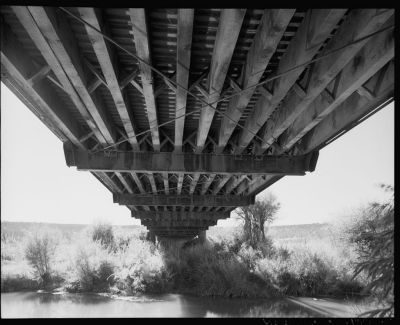
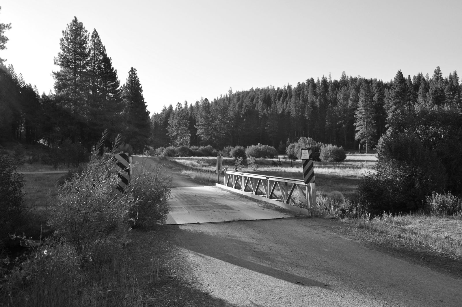
Status: Replaced by a pre-cast girder bridge in 2008.
Location: 44.368711,-120.537031
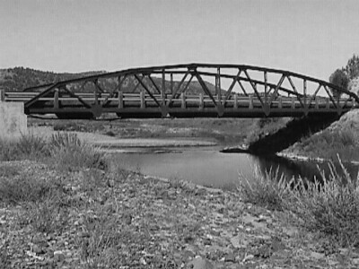
Carries US 26 over Marks Creek
Design: beam/stringer/wood
Design Details: Timber stringer
Total Length: 70.9 Feet
Span Length: 70.9 Feet
Overview: Wooden bridge over Marks Creek on US 26
History: Built 1939, Replaced 2008
Built: 1939
Location: Crook County
View Bridge Information In Wayback Machine
![]()
![]()
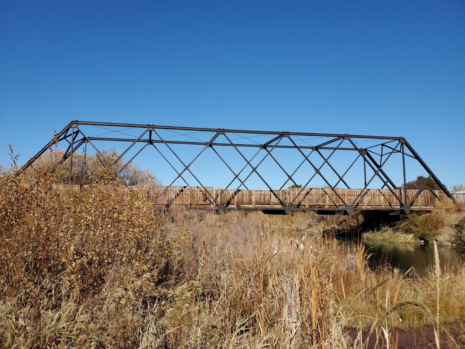
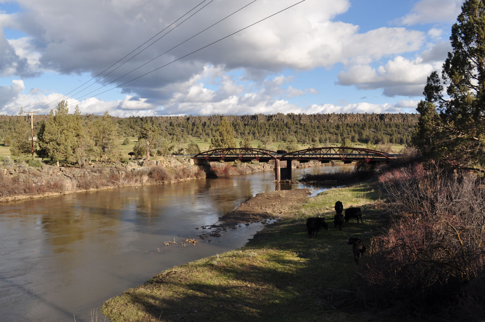
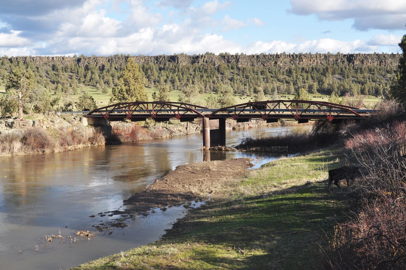
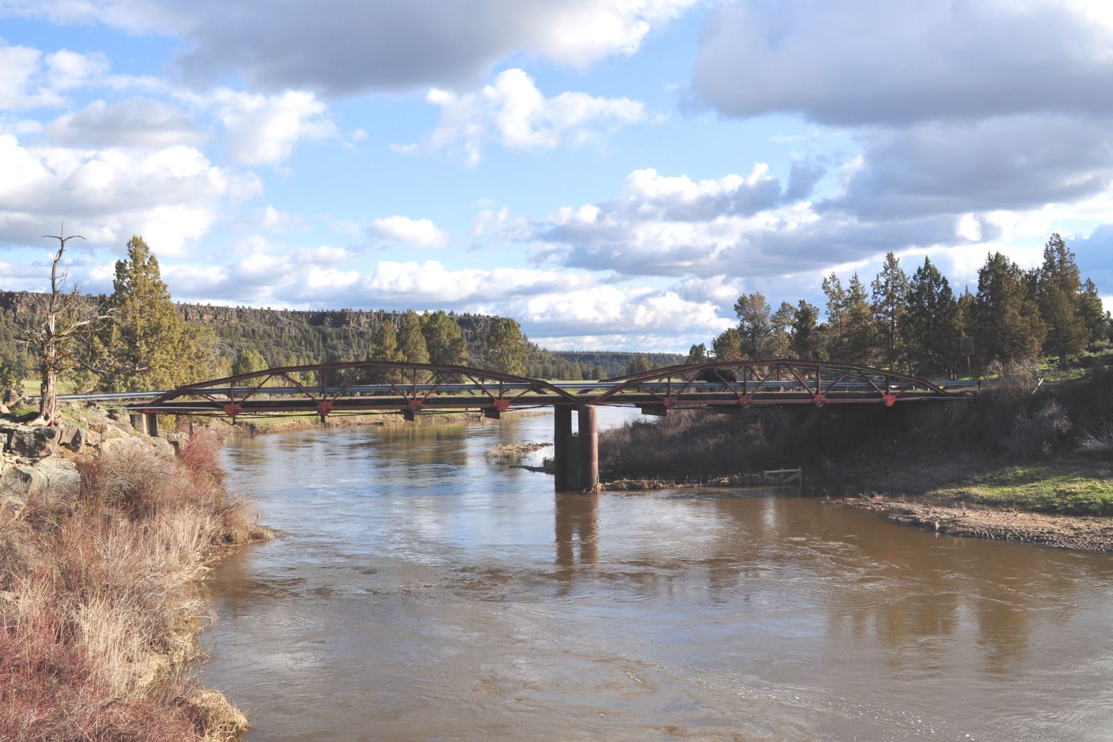
Status: Replaced by a pre-cast concrete girder bridge in 2003
Location: 44.336667,-120.926667
Carries Elliot Lane over Crooked River
Design: truss/through/double-warren
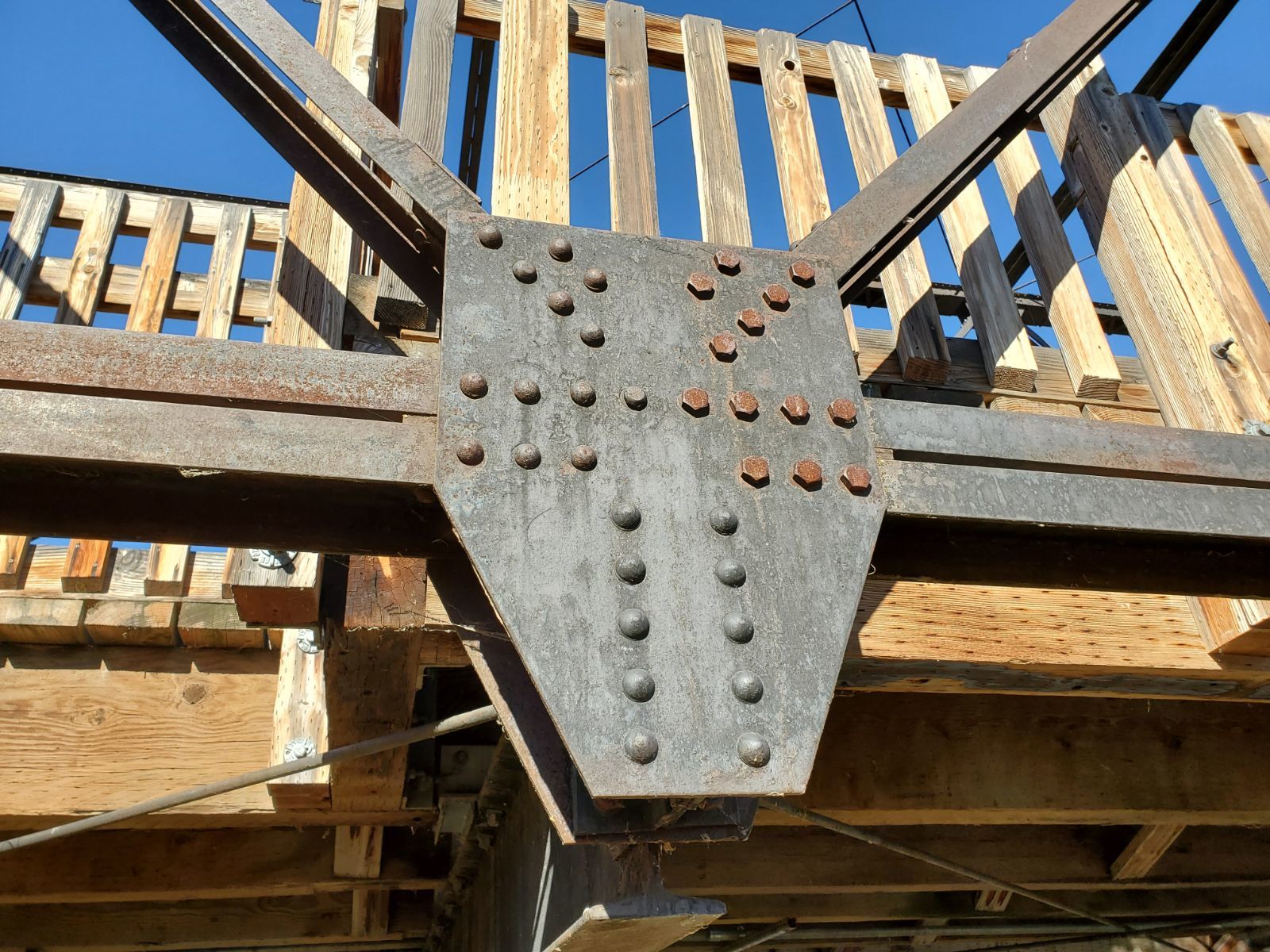
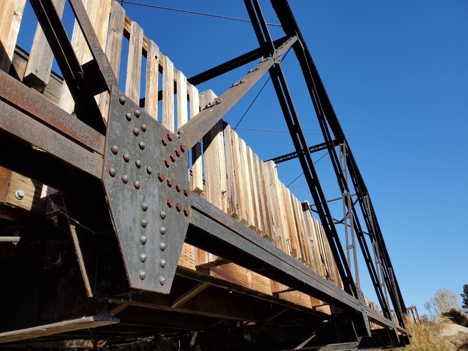
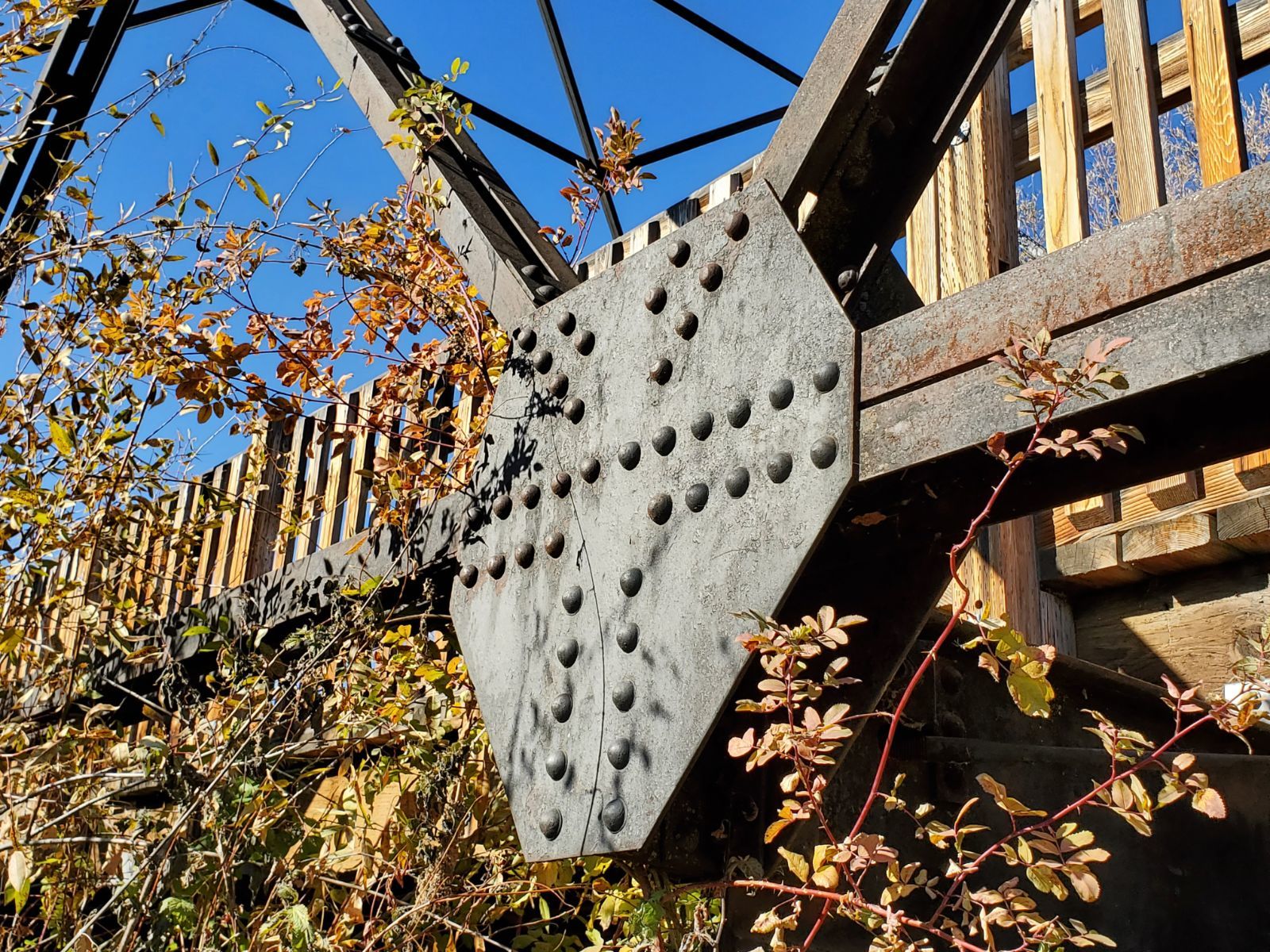
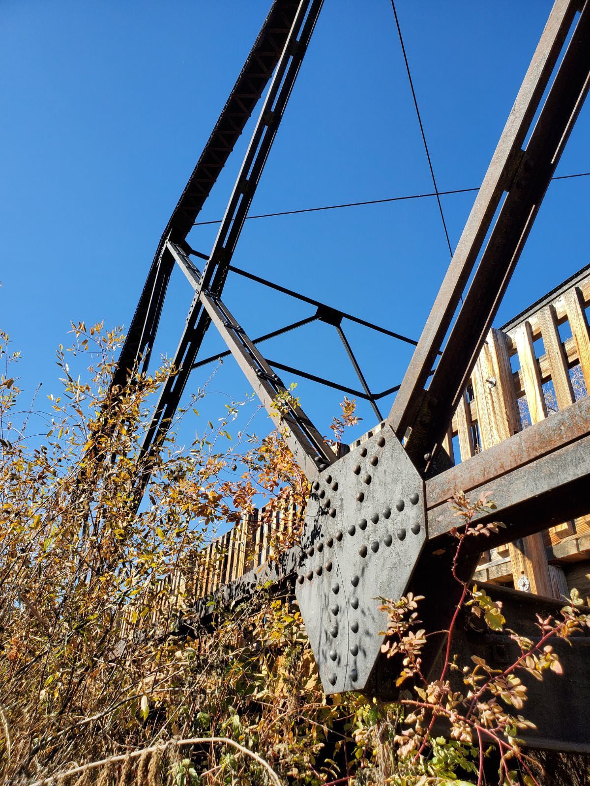
Design Details: The Crooked River Bridge is a rare example of a Double Intersection Warren Through Truss (the main span), with a secondary span comprised of a Warren Pony Truss with Polygonal Upper Chords. Both spans are of riveted steel construction. The through truss main span was relocated to its current site in the 1930's, and attached to the pony truss span to accommodate the width of the Crooked River at this crossing. The two-span structure has an overall length of 206 feet, and overall width of 18.5 feet. The vertical clearance of the through truss span is 16 feet. The Warren double-intersection truss is one of two remaining of this type in the State of Oregon.
(HAER OR-133)
Total Length: 206.0 Feet
Span Length: 125.0 Feet
Overview: Lost double intersection Warren through truss bridge over Crooked River on Elliot Lane
History: Built 1936, Replaced 2003
Built: 1936
Location: Crook County
View Bridge Information In Wayback Machine
![]()
138606
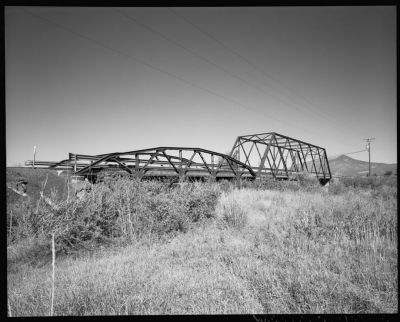
General Perspective View Of The Elliot Lane Bridge, View Looking Northwest
Photo taken by Historic American Engineering Record
138607
General Perspective View Of The Elliot Lane Bridge, View Looking Southwest
Photo taken by Historic American Engineering Record
138608
General Perspective View Of The Elliot Lane Bridge, View Looking Northeast
Photo taken by Historic American Engineering Record
138609
Approach View Of The Elliot Lane Bridge, View Looking North
Photo taken by Historic American Engineering Record
138610
Substructure View Of The Elliot Lane Bridge
Photo taken by Historic American Engineering Record
138611
Detail View Of Riveted Gusset Plate Connection On Pony Truss Span
Photo taken by Historic American Engineering Record
138612
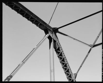
Detail View Of Riveted Gusset Plate Connections And Latticed Upper Chords Of The Double Intersection Warren Through Truss Span
Photo taken by Historic American Engineering Record
138613
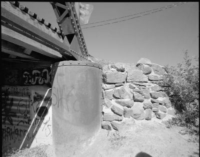
Detail View Of The Metal Caisson And Masonry Abutment At North End Of Through Truss Span
Photo taken by Historic American Engineering Record
![]()
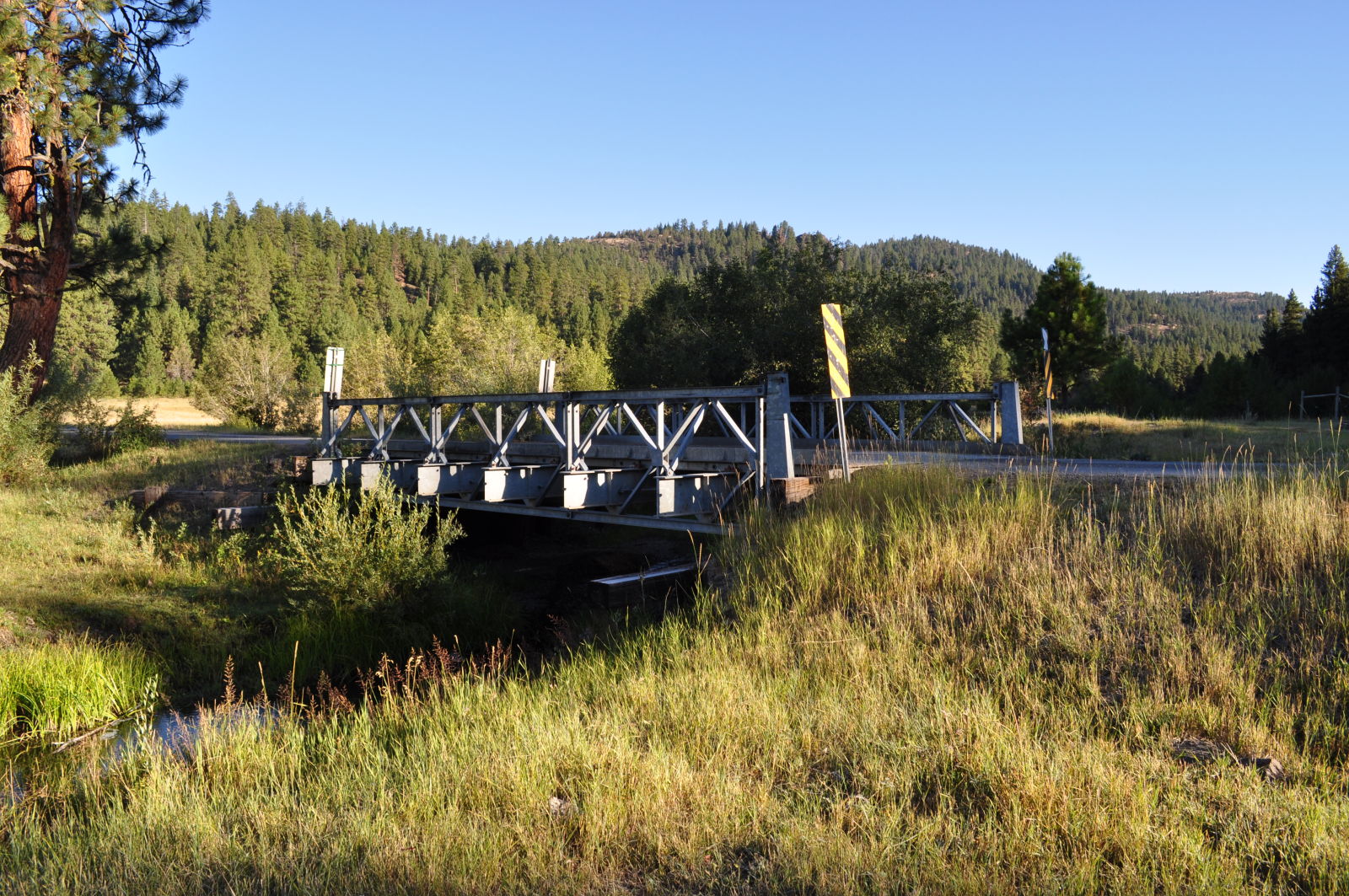
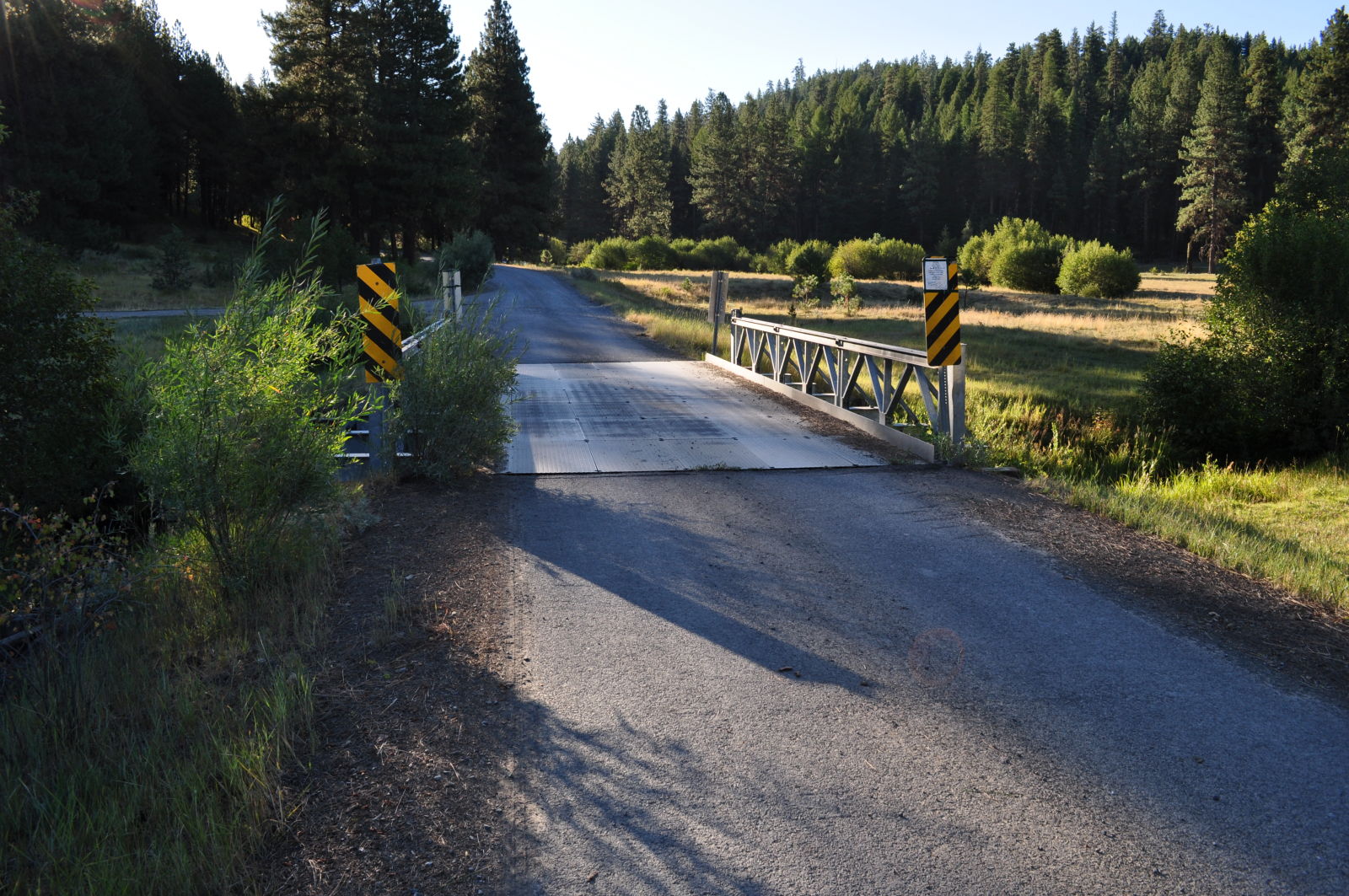
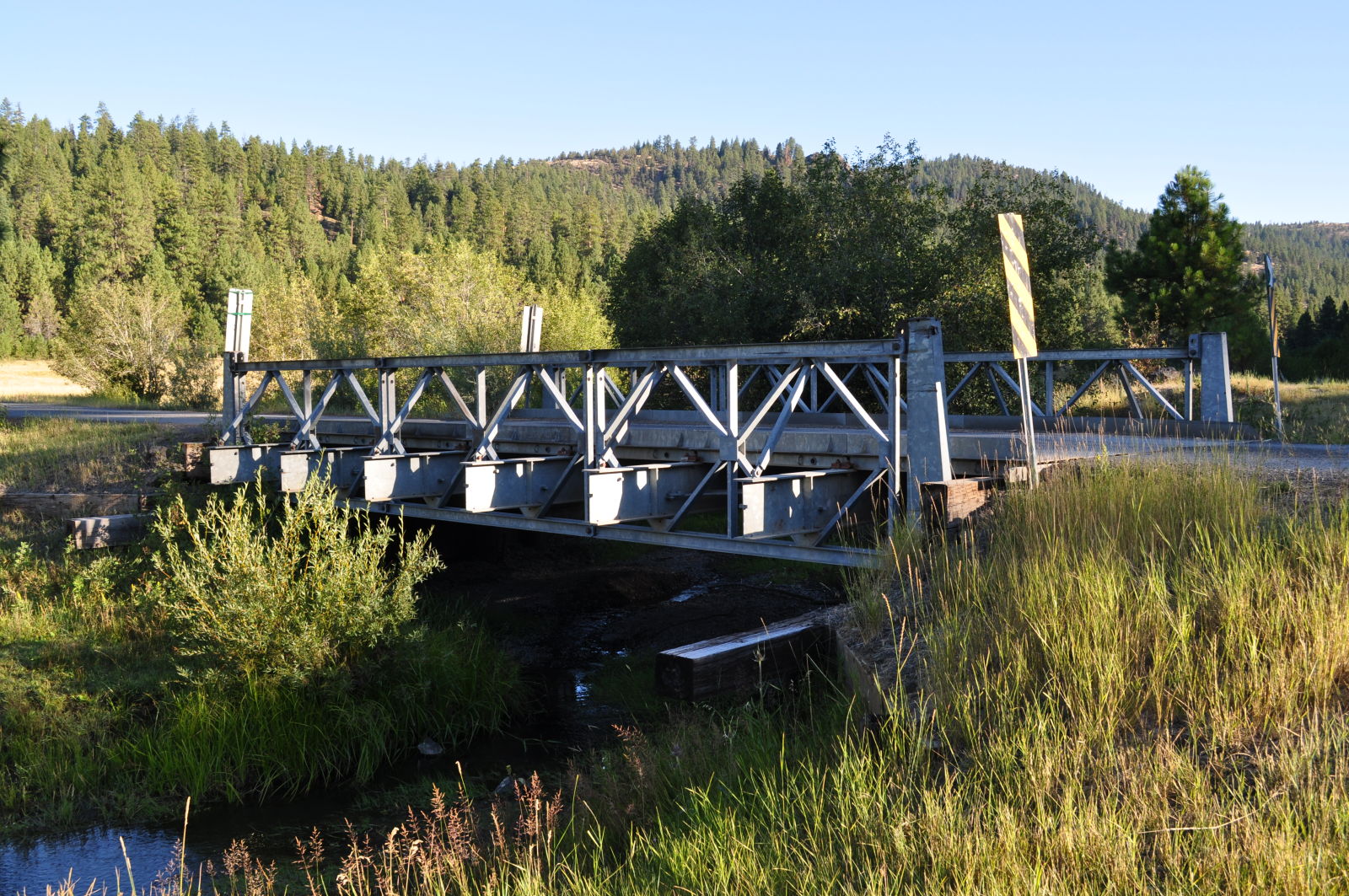
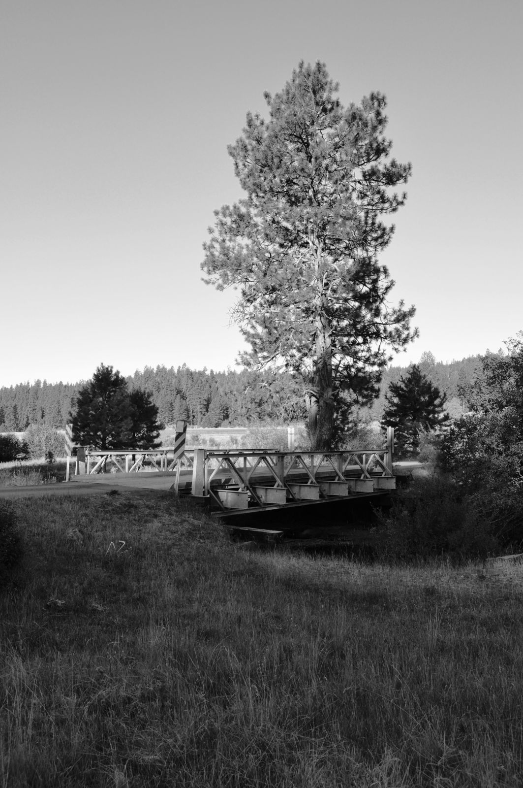
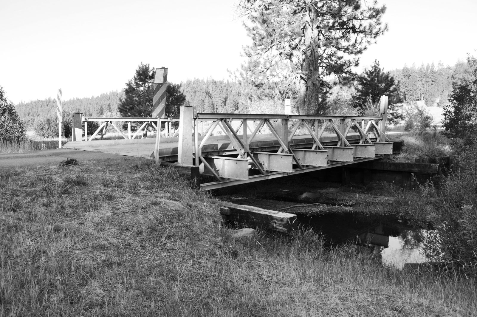
Status: Open to traffic
Location: 44.413691,-120.496143
Carries U.S.F.S. 2610 over Marks Creek
Design: truss/pony/bailey
Design Details: Bailey single-single pony truss
Total Length: 30.0 Feet
Span Length: 30.0 Feet
Overview: Bailey pony truss bridge over Marks Creek on U.S.F.S. 2610
History:
Built:
Location: Crook County
View Bridge Information In Wayback Machine
![]()
217838
Marks Creek Bridge
Photo taken by Michael Goff in September 2011
217839
Marks Creek Bridge
Photo taken by Michael Goff in September 2011
217840
Marks Creek Bridge
Photo taken by Michael Goff in September 2011
217841
Marks Creek Bridge
Photo taken by Michael Goff in September 2011
217842
Marks Creek Bridge
Photo taken by Michael Goff in September 2011
217843
Marks Creek Bridge
Photo taken by Michael Goff in September 2011
![]()
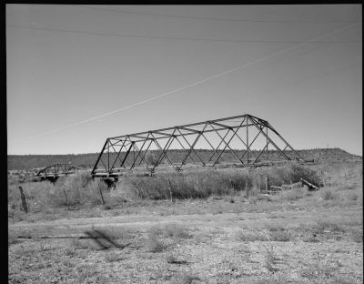
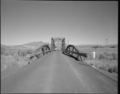
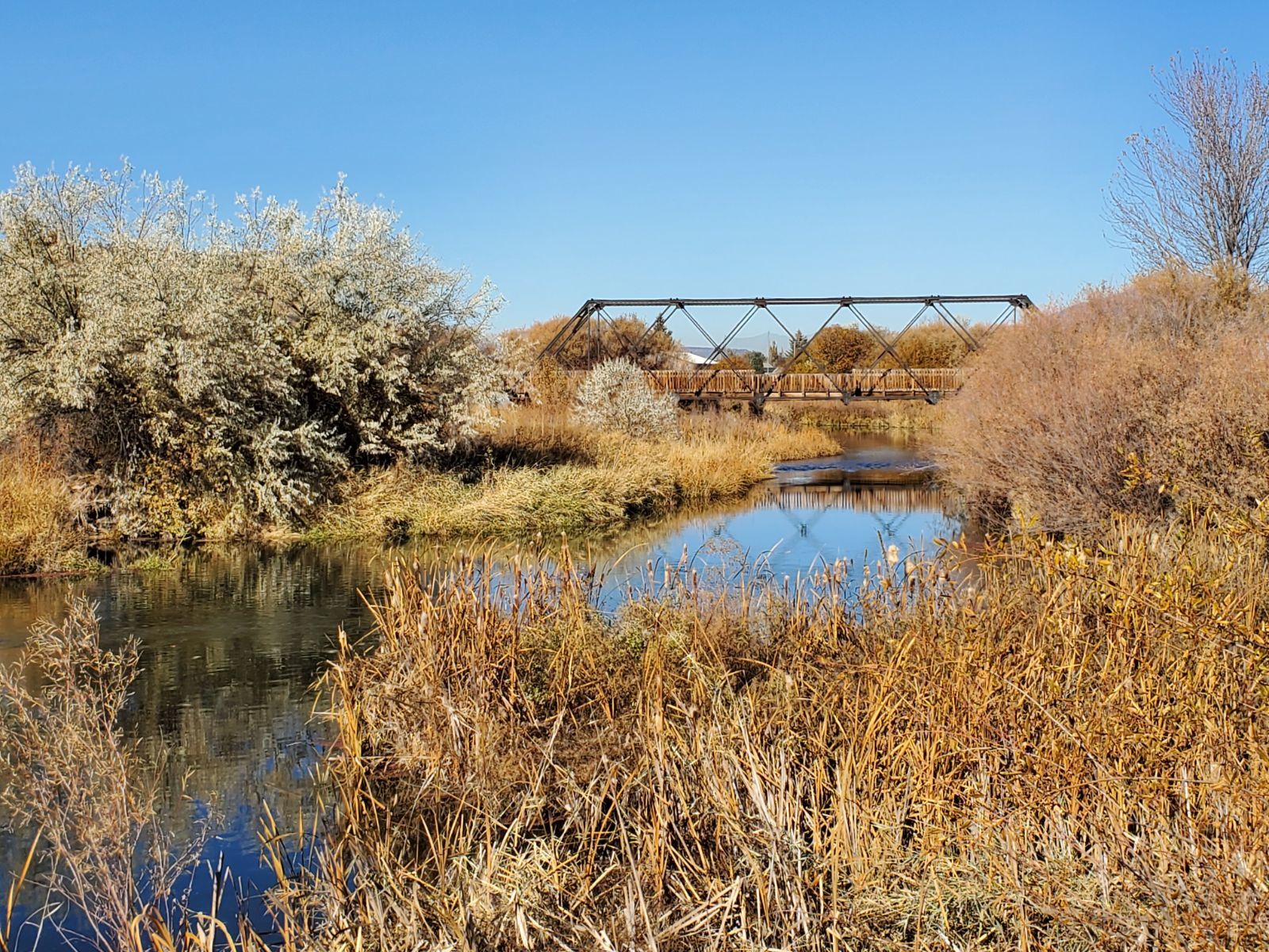
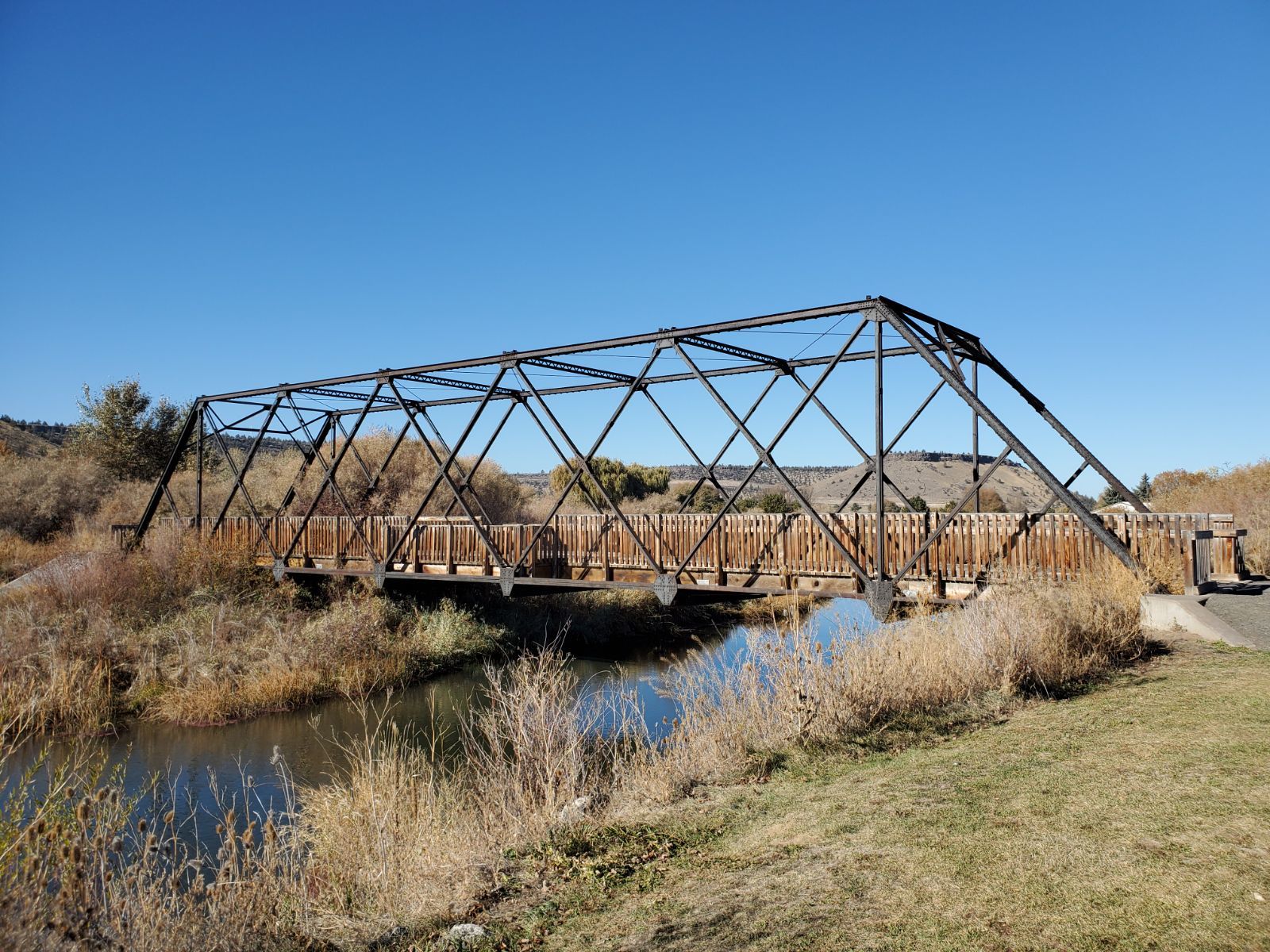
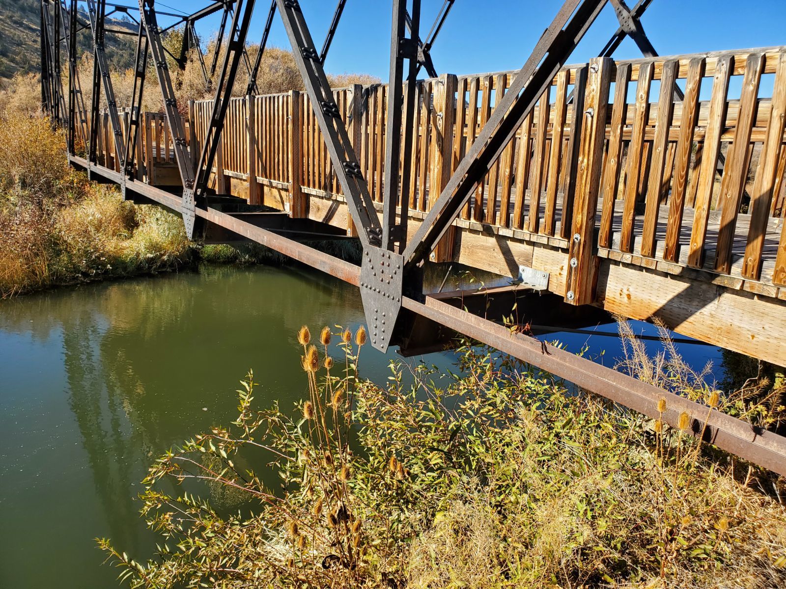
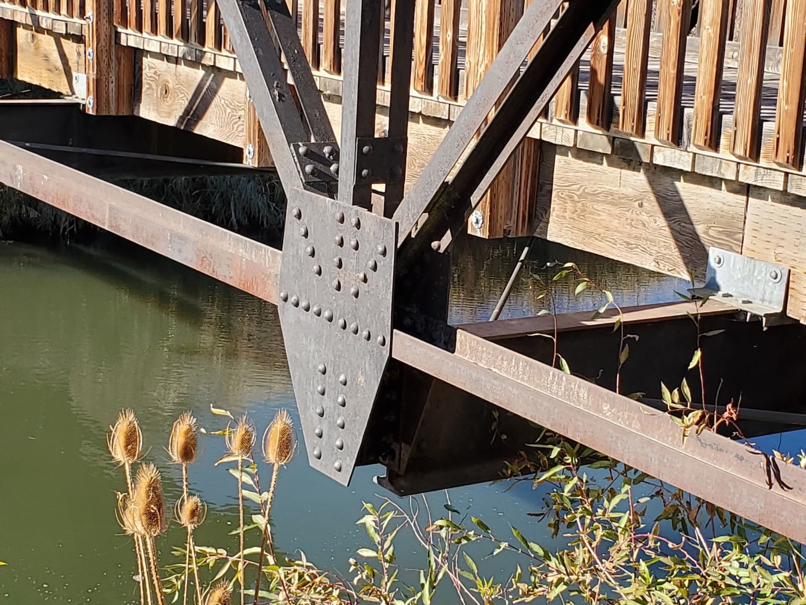
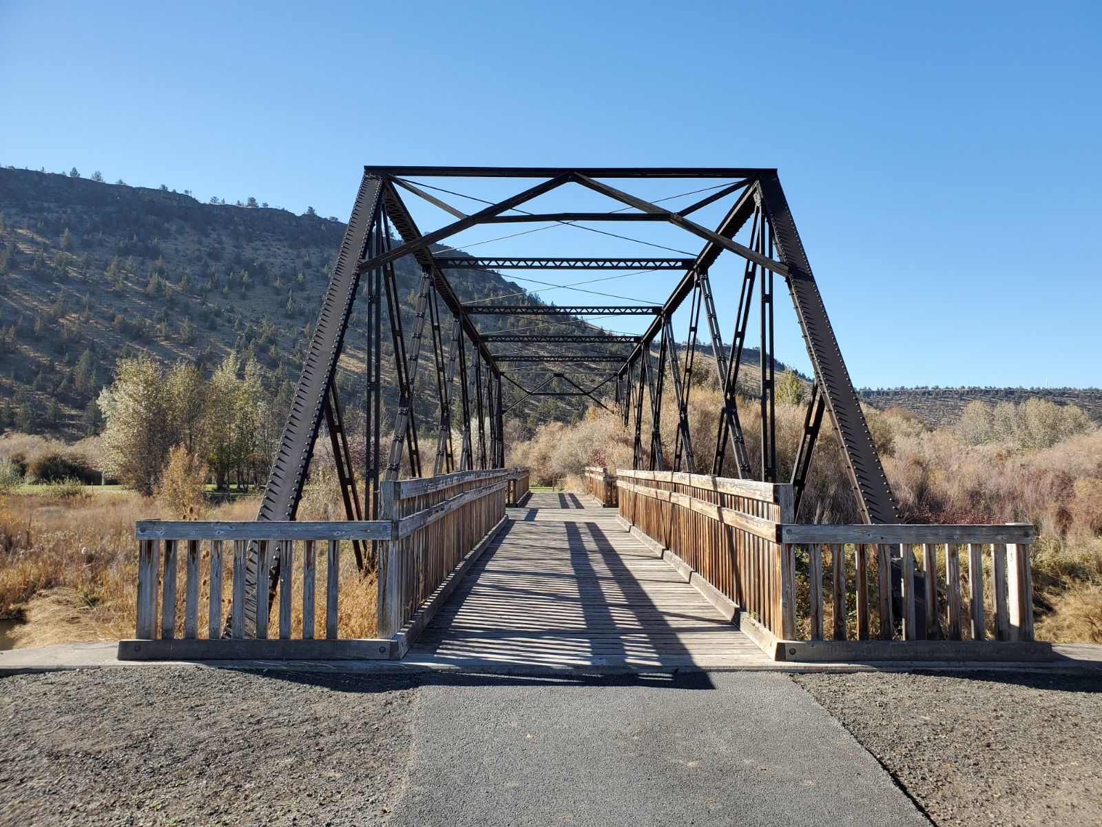
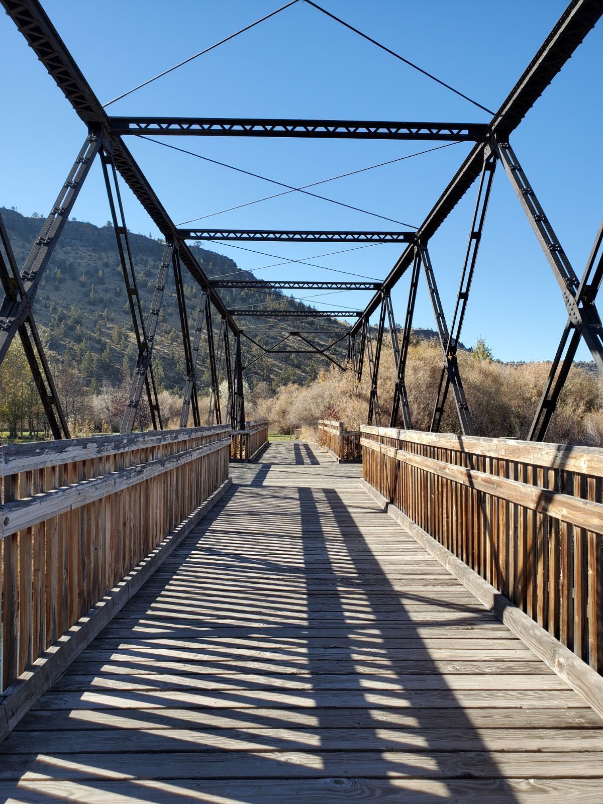
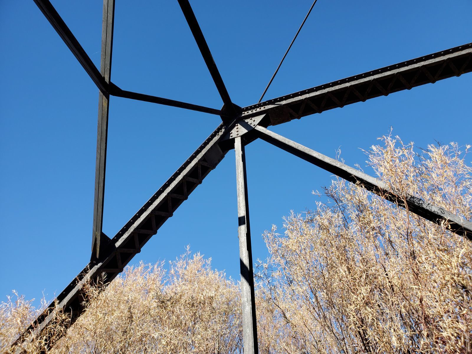
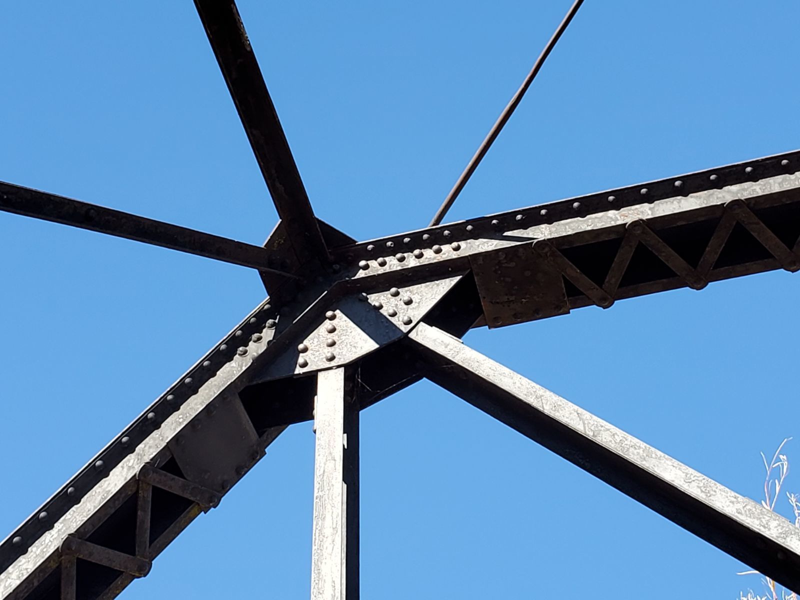
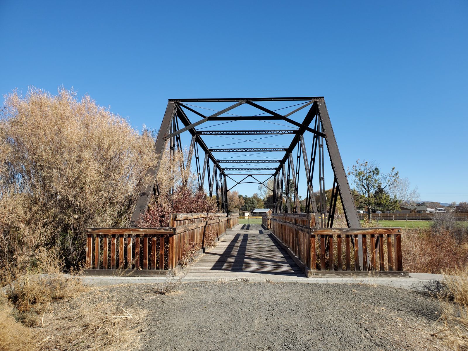
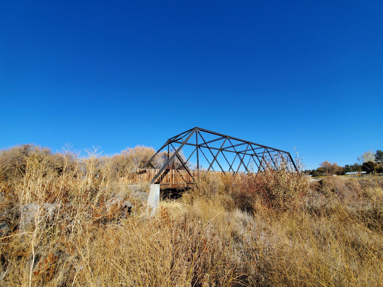
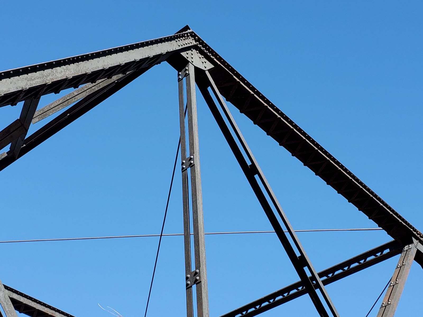
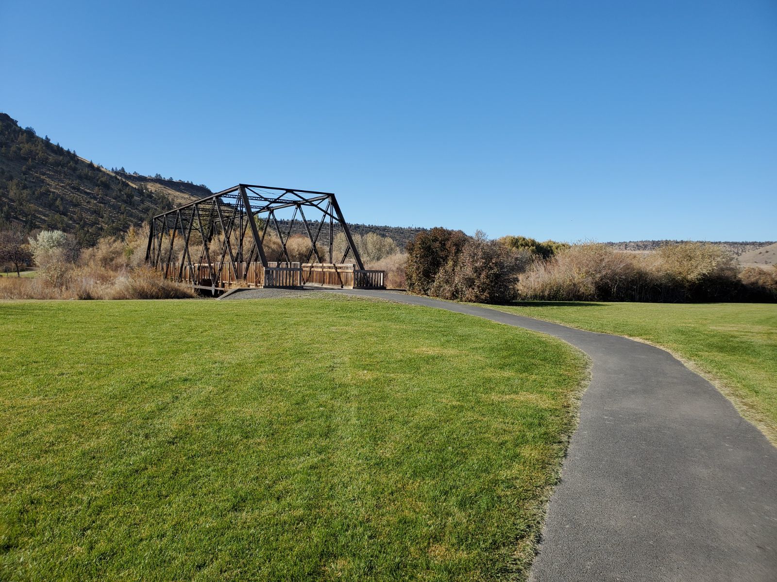
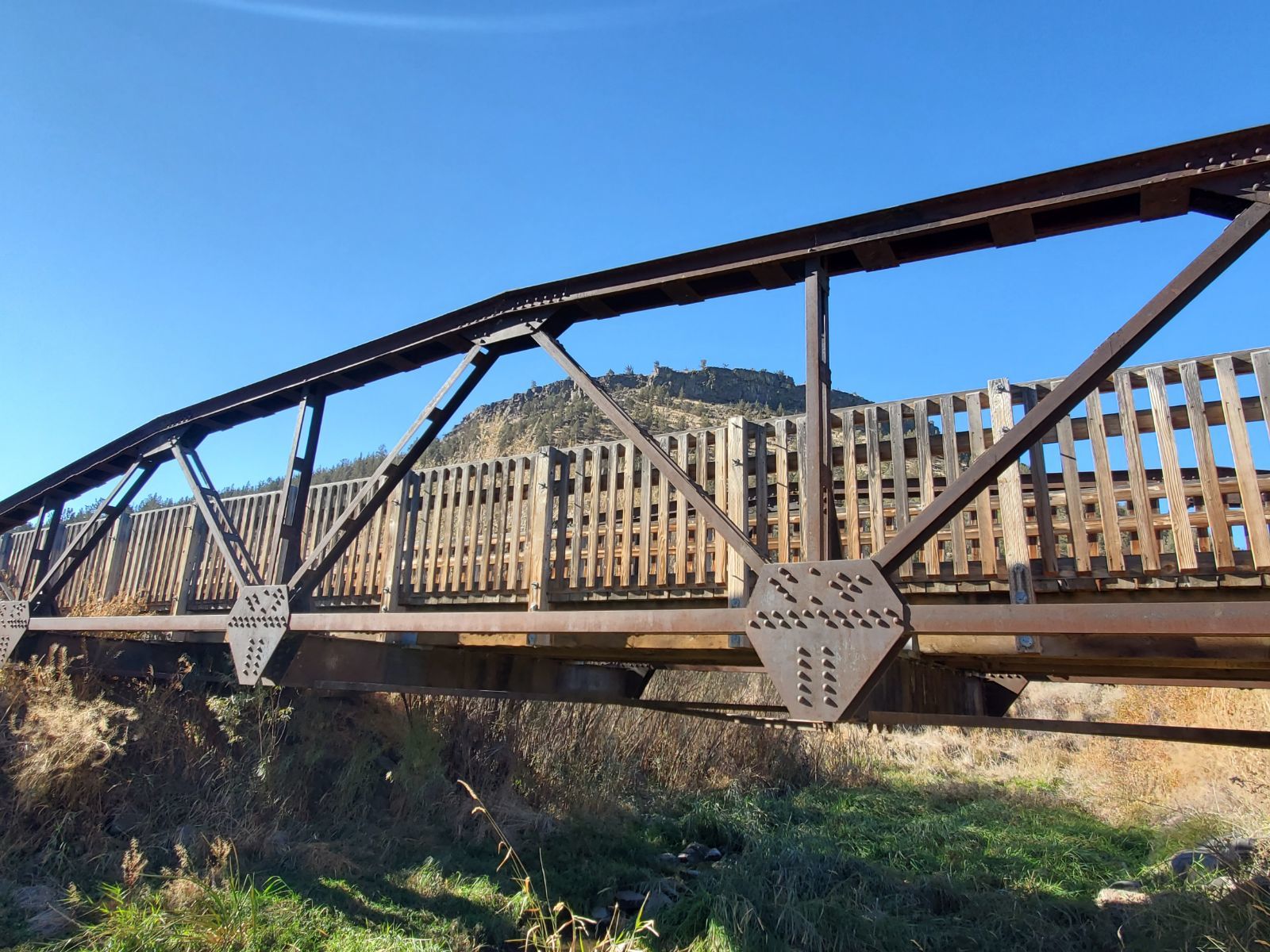
Status: Open to pedestrians only
Location: 44.292893,-120.847957
Carries Pedestrian trail over Crooked River
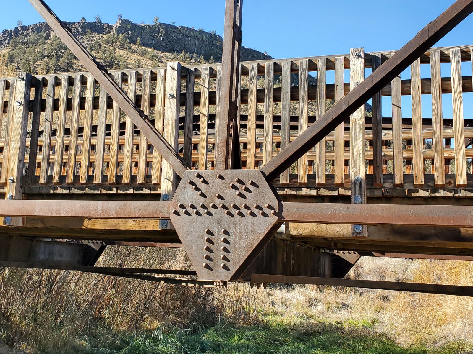
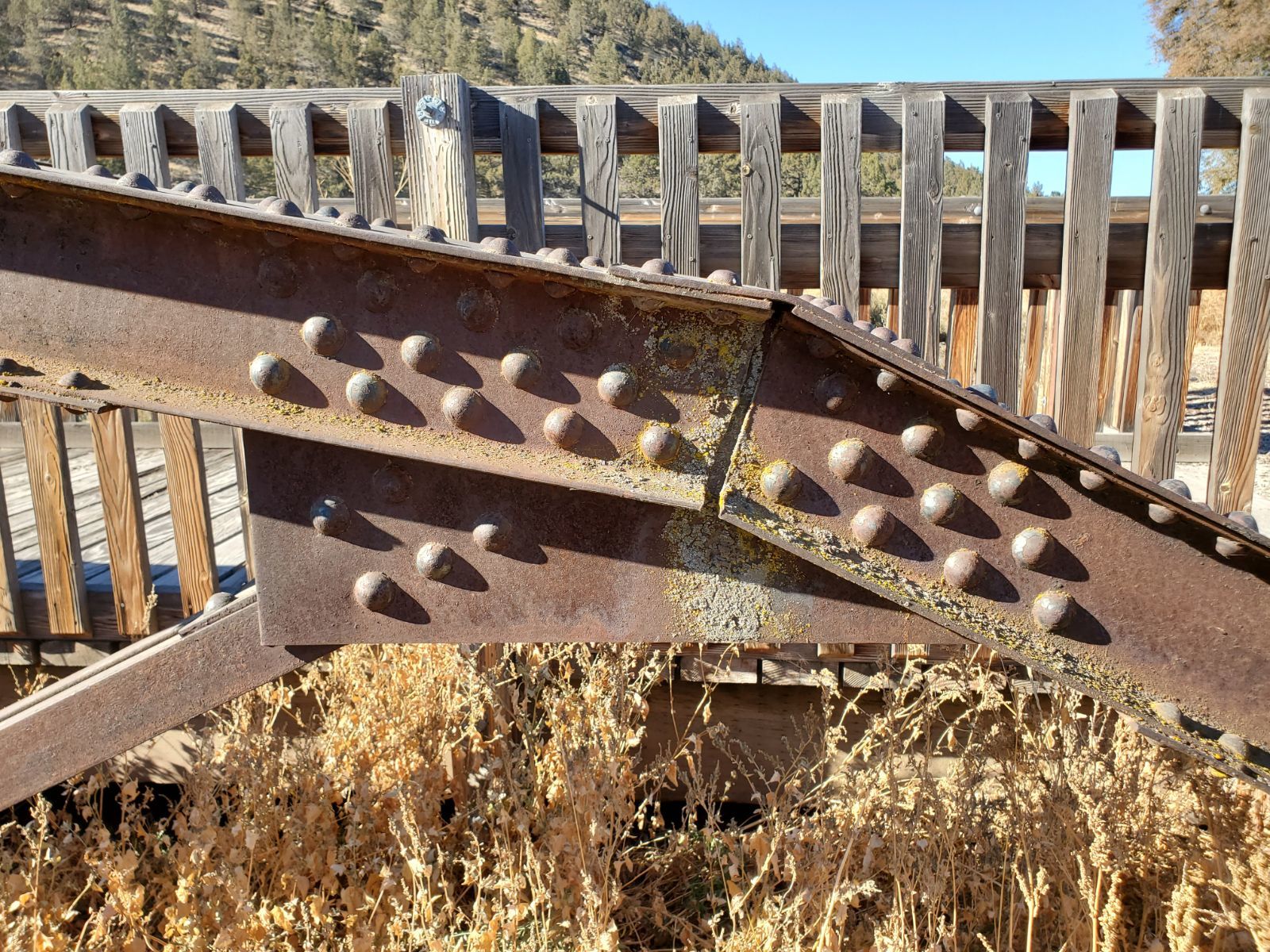
Design: truss/through/double-warren
Design Details: Double-intersection Warren through truss
Total Length: 125.0 Feet
Span Length: 125.0 Feet
Overview: Double-intersection Warren through truss bridge over Crooked River on Pedestrian trail
History:
Built:
Location: Crook County
View Bridge Information In Wayback Machine
![]()
476414
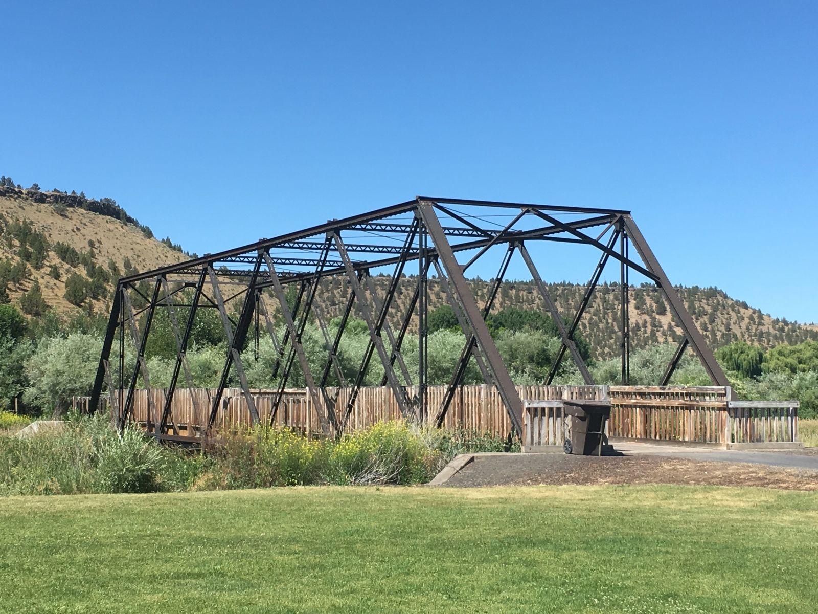
Photo taken by Patrick Gurwell in July 2017
476415
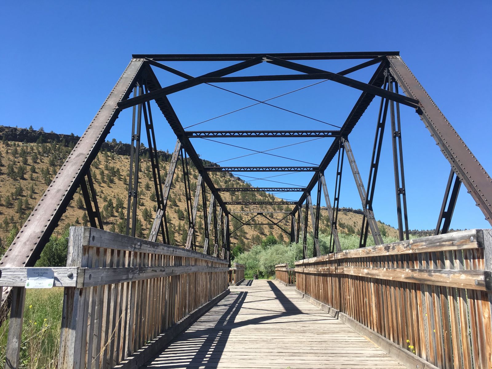
Photo taken by Patrick Gurwell in July 2017
485095
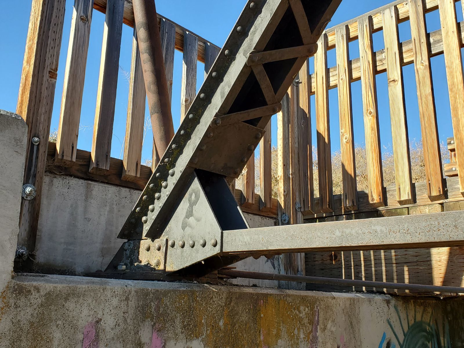
Prineville Through Truss Bridge
Side elevation from the south.
Photo taken by Mike Goff in November 2020
485096
Prineville Through Truss Bridge
Side elevation from the southeast.
Photo taken by Mike Goff in November 2020
485097
Prineville Through Truss Bridge
Bottom chord details.
Photo taken by Mike Goff in November 2020
485098
Prineville Through Truss Bridge
Bottom chord detail.
Photo taken by Mike Goff in November 2020
485099
Prineville Through Truss Bridge
Portal view from the east.
Photo taken by Mike Goff in November 2020
485100
Prineville Through Truss Bridge
Deck view.
Photo taken by Mike Goff in November 2020
485101
Prineville Through Truss Bridge
Upper truss and portal details.
Photo taken by Mike Goff in November 2020
485102
Prineville Through Truss Bridge
Upper chord connection detail.
Photo taken by Mike Goff in November 2020
485103
Prineville Through Truss Bridge
Portal view from the west.
Photo taken by Mike Goff in November 2020
485104
Prineville Through Truss Bridge
Side elevation from the southwest.
Photo taken by Mike Goff in November 2020
485105
Prineville Through Truss Bridge
Bearing area detail.
Photo taken by Mike Goff in November 2020
485106
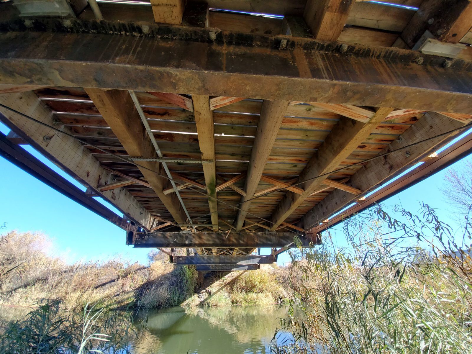
Prineville Through Truss Bridge
Floor system details.
Photo taken by Mike Goff in November 2020
485107
Prineville Through Truss Bridge
Bottom chord connection detail.
Photo taken by Mike Goff in November 2020
485108
Prineville Through Truss Bridge
Bottom chord connection detail.
Photo taken by Mike Goff in November 2020
485109
Prineville Through Truss Bridge
Bottom chord connection detail.
Photo taken by Mike Goff in November 2020
485110
Prineville Through Truss Bridge
Bottom chord and truss details.
Photo taken by Mike Goff in November 2020
485111
Prineville Through Truss Bridge
Truss details.
Photo taken by Mike Goff in November 2020
485112
Prineville Through Truss Bridge
Side elevation from the south.
Photo taken by Mike Goff in November 2020
485113

Prineville Through Truss Bridge
Double intersection detail.
Photo taken by Mike Goff in November 2020
485114
Prineville Through Truss Bridge
View for bridge from the park.
Photo taken by Mike Goff in November 2020
![]()
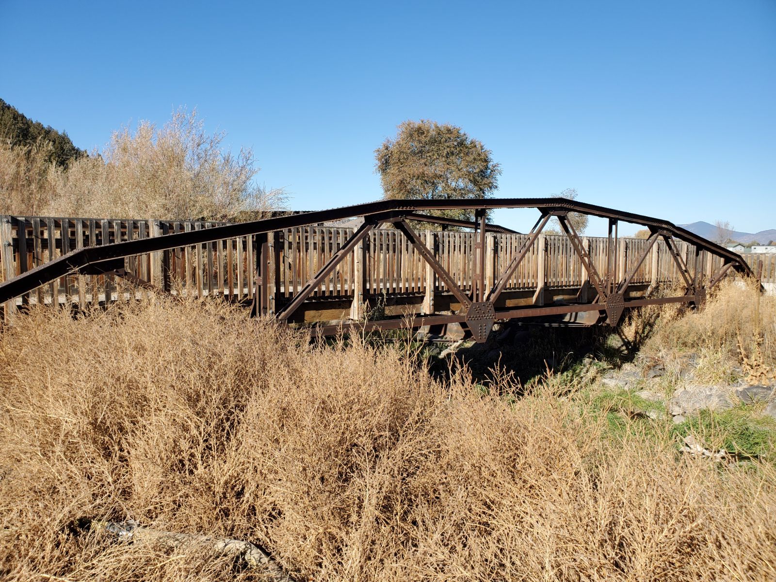
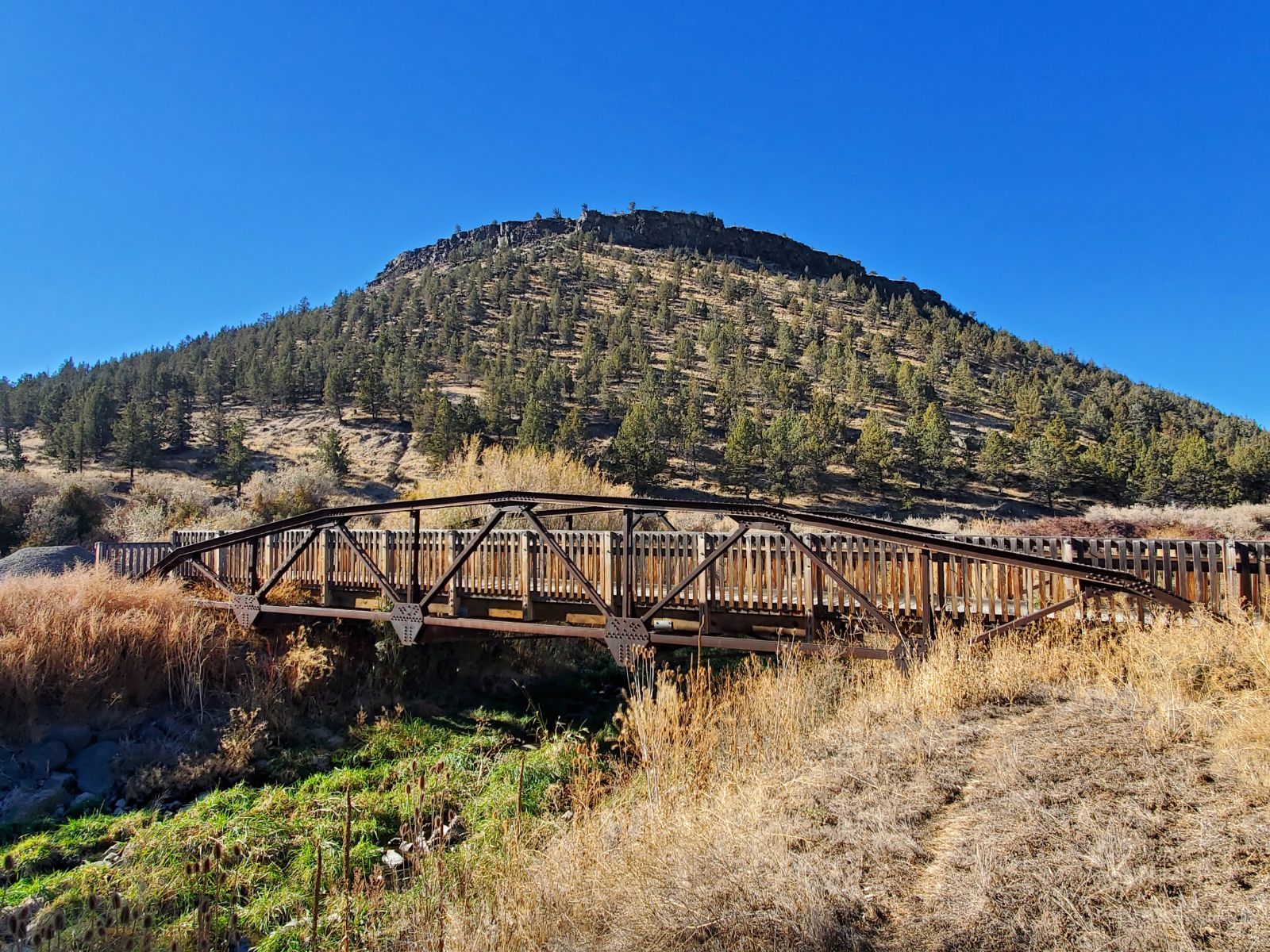
Status: Open to pedestrians only
Location: 44.290514,-120.846097
Carries Pedestrian trail over Branch of Crooked River
Design: truss/pony/polygonal
Design Details: Polygonal Warren pony truss
Total Length: 80.0 Feet
Span Length: 80.0 Feet
Overview: Polygonal Warren pony truss bridge over Branch of Crooked River on Pedestrian trail
History:
Built:
Location: Crook County
View Bridge Information In Wayback Machine
![]()
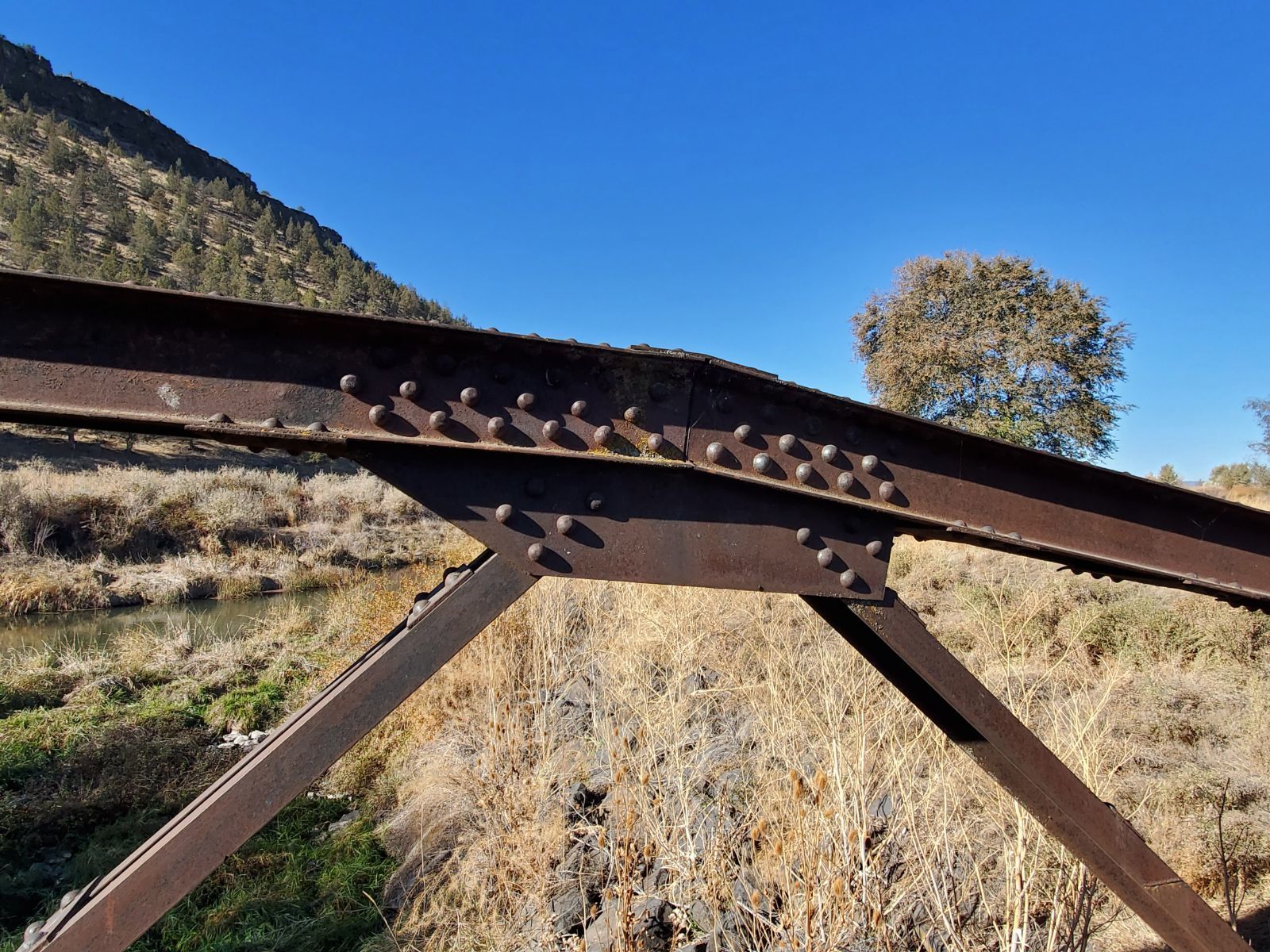
485115
Crooked River Park Bridge
Side elevation from the south east.
Photo taken by Mike Goff in November 2020
485116
Crooked River Park Bridge
Bottom chord connection detail.
Photo taken by Mike Goff in November 2020
485117
Crooked River Park Bridge
Upper chord connection detail.
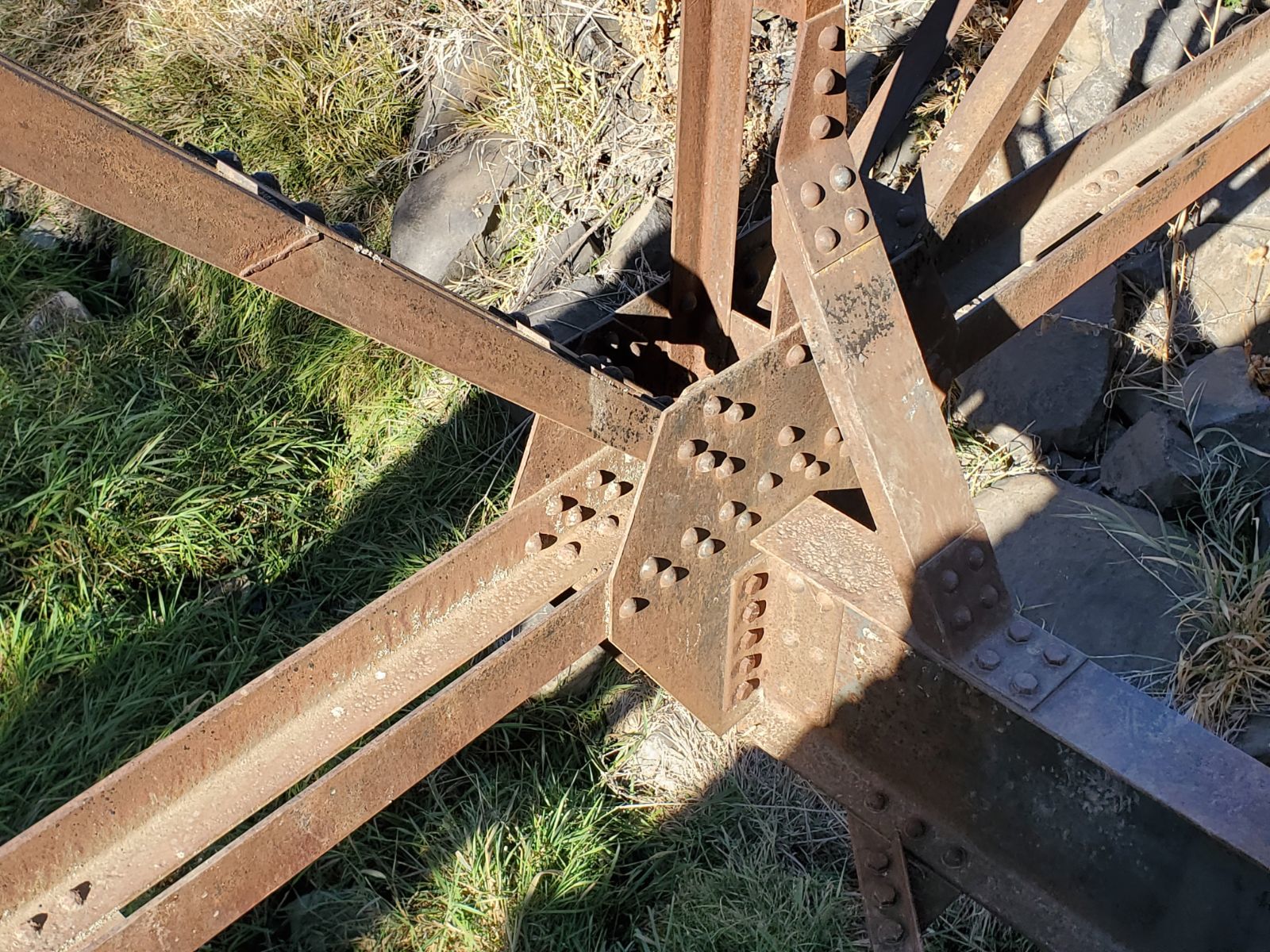
Photo taken by Mike Goff in November 2020
485118
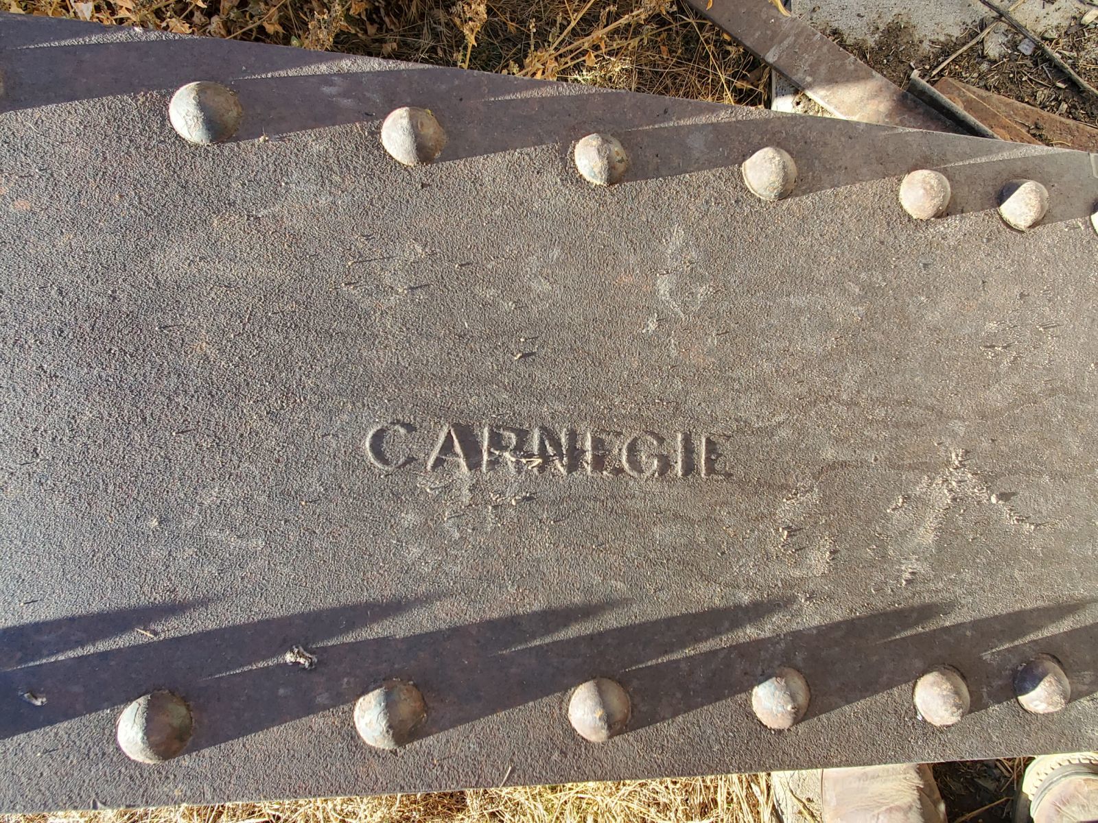
Crooked River Park Bridge
Steel stamp "Carnegie".
Photo taken by Mike Goff in November 2020
485119
Crooked River Park Bridge
Side elevation from the east.
Photo taken by Mike Goff in November 2020
485120
Crooked River Park Bridge
Truss details.
Photo taken by Mike Goff in November 2020
485121
Crooked River Park Bridge
Bottom chord connection detail.
Photo taken by Mike Goff in November 2020
485122
Crooked River Park Bridge
Upper chord connection detail.
Photo taken by Mike Goff in November 2020
![]()
Status: Open to traffic
Location: 44.348739,-120.915189
Carries City of Prineville Railway over US 26
Design: beam
Design Details: Beam
Total Length: 127.0 Feet
Span Length: 44.9 Feet
Overview: Beam bridge over US 26 on City of Prineville Railway
History: Built 1946
Built: 1946
Location: Crook County
View Bridge Information In Wayback Machine
![]()
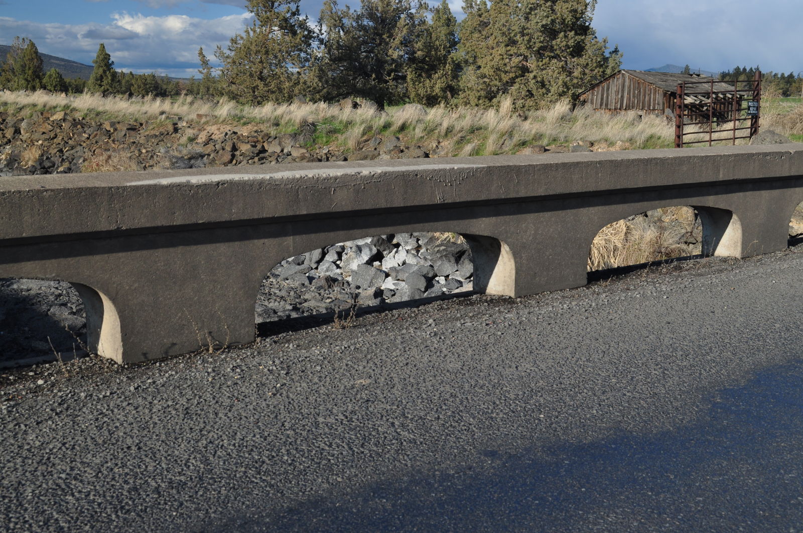
![]()
Status: Open to traffic
Planned to be replaced 2016
Location: 44.301319,-120.826986
Carries Hwy 380 over Ochoco Creek
Design: beam/stringer/steel
Design Details: Steel stringer
Total Length: 34.1 Feet
Span Length: 34.1 Feet
Overview: Lost steel stringer bridge over Ochoco Creek on Hwy 380
History: Unknown when built; widened 1955, Replaced 2016
Built:
Location: Crook County
View Bridge Information In Wayback Machine
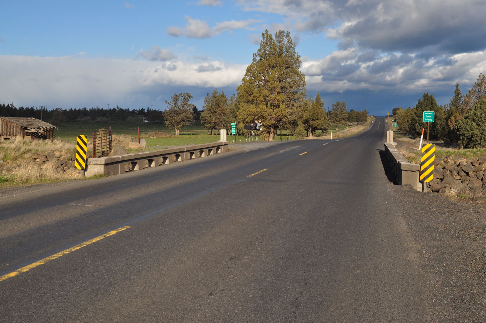
![]()
![]()
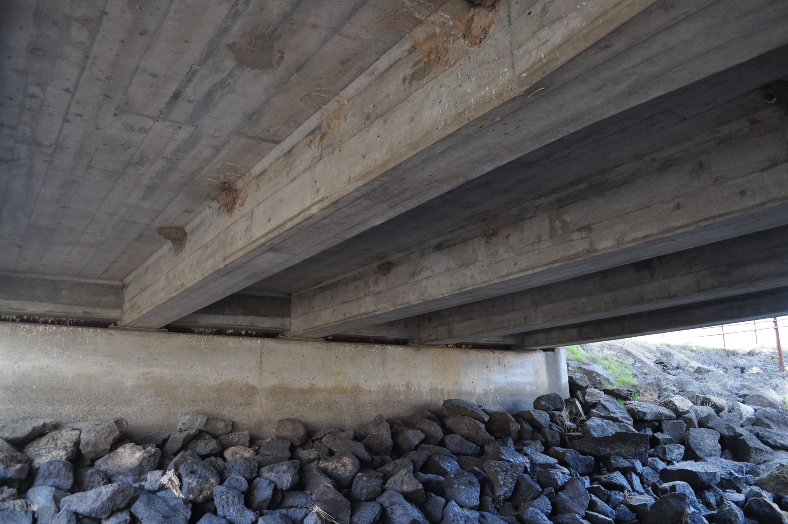
Status: Open to traffic
Location: 44.327181,-121.107719
Carries Hwy 370 over North Unit Canal
Design: beam/stringer
Design Details: Stringer
Total Length: 49.9 Feet
Span Length: 24.0 Feet
Overview: Stringer bridge over North Unit Canal on Hwy 370
History: Built 1945
Built: 1945
Location: Crook County
View Bridge Information In Wayback Machine
![]()
385534
North Unit Canal Bridge
Concrete girder details.
Photo taken by Mike Goff in March 2017
385533
North Unit Canal Bridge
Rail detail.
Photo taken by Mike Goff in March 2017
385532
North Unit Canal Bridge
Roadway view from the west.
Photo taken by Mike Goff in March 2017
385531
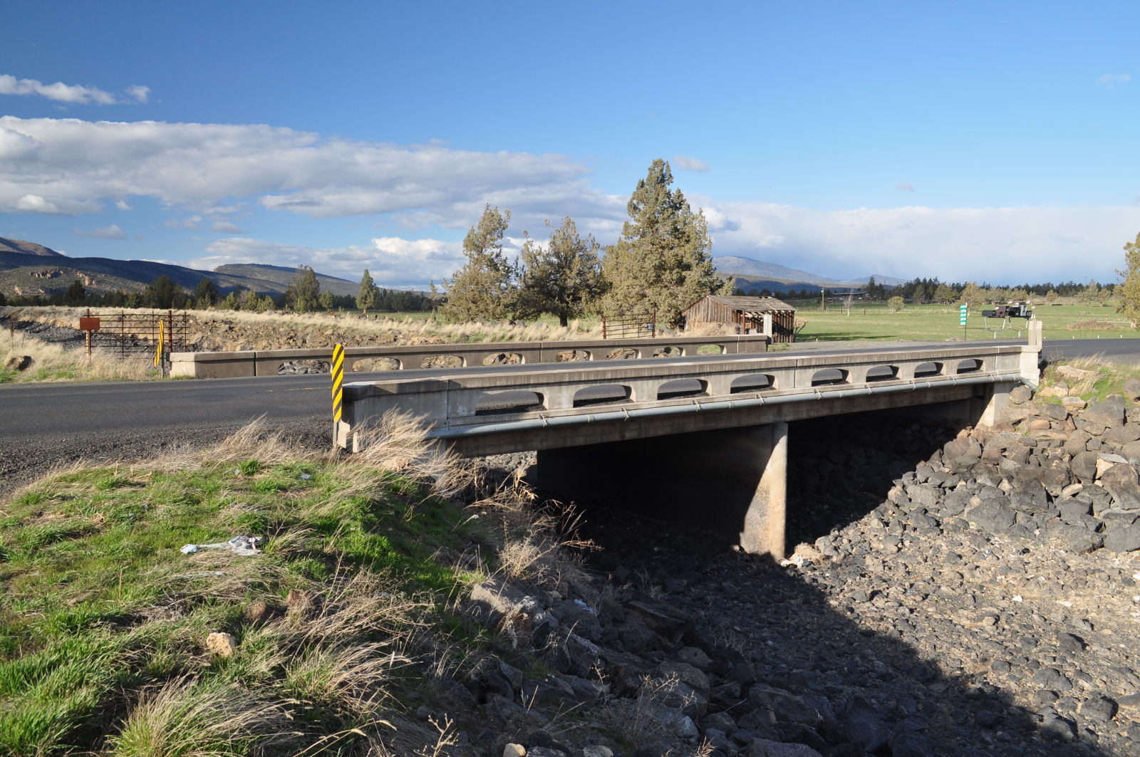
North Unit Canal Bridge
Side view from the southwest.
Photo taken by Mike Goff in March 2017
385530
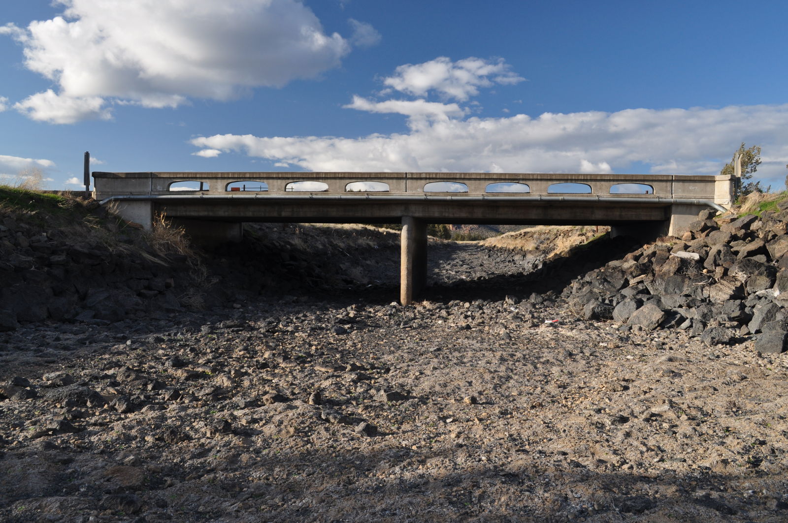
North Unit Canal Bridge
Side elevation from the south.
Photo taken by Mike Goff in March 2017
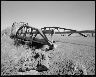
![]()
Status: Open to ranch traffic only
Current bypass bridge was built in 1987, currently used by local ranch.
Location: 44.348496,-121.081726
Carries Old Lone Pine Road Alignment over Crooked River
Design: truss/through/polygonal/alt-verticals
Design Details: Polygonal Warren through truss with alternating verticals
Total Length: 0.0 Feet
Span Length: 0.0 Feet
Overview: Abandoned polygonal Warren through truss with alternating verticals bridge over Crooked River on Old Lone Pine Road Alignment
History:
Built:
Location: Crook County
View Bridge Information In Wayback Machine
![]()
385548
Crooked River Bridge (Abandoned)
From the current roadway bridge to the northwest.
Photo taken by Mike Goff in March 2017
385547
Crooked River Bridge (Abandoned)
From the northwest on the current roadway bridge.
Photo taken by Mike Goff in March 2017
385546
Crooked River Bridge (Abandoned)
From the northeast.
Photo taken by Mike Goff in March 2017
![]()
Status: Replaced by a new bridge
Location: 44.172657,-120.541923
Carries Conant Basin Road over Crooked River
Design: truss/pony/polygonal/alt-verticals
Design Details: Polygonal Warren pony truss with alternating verticals
Total Length: 112.9 Feet
Span Length: 109.9 Feet
Overview: Lost pony truss bridge over Crooked River on Conant Basin Road
History: Built 1955; rehabilitated 1983, Replaced 2002
Built: 1955
Location: Crook County
View Bridge Information In Wayback Machine
![]()
501528
Conant Basin Road Bridge
Photo courtesy of the Oregon Department of Transportation
501529
Conant Basin Road Bridge
Photo courtesy of the Oregon Department of Transportation
Special Bridge Conditions Legend: R - Former location of relocated bridge. ! - At risk for demolition or destruction. X - Confirmed demolished or collapsed. S - Dismantled and/or in storage. L - Severe loss of historic integrity due to alteration.
![]()

![]()