![]()
![]()
Status: Closed to all traffic
Location: 32.934444,-99.224444
Carries CR 188 over Clear Fork Brazos River
Design: truss/through/pratt
Design Details: Pin-connected, 6-panel Pratt through truss
Total Length: 311.0 Feet
Span Length: 108.9 Feet
Overview: Through truss bridge over Clear Fork Brazos River on CR 188
History: Built 1885 by the King Bridge Co.
Built: 1885
Location: Shackelford County
View Bridge Information In Wayback Machine
![]()
118912
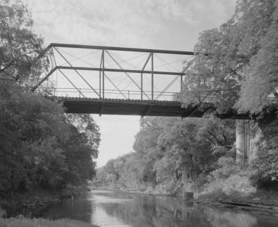
Photo taken by Historic American Engineering Record
118913
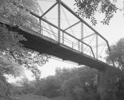
Photo taken by Historic American Engineering Record
118914
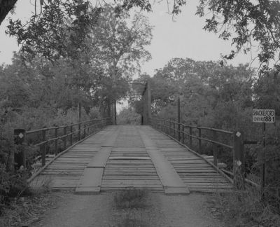
Photo taken by Historic American Engineering Record
118915
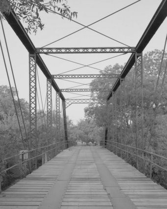
Photo taken by Historic American Engineering Record
118916
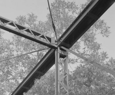
Photo taken by Historic American Engineering Record
118917
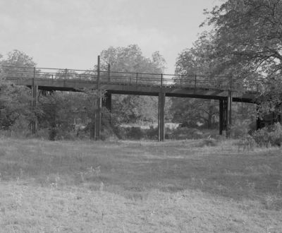
Photo taken by Historic American Engineering Record
118918
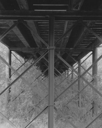
Photo taken by Historic American Engineering Record
118919
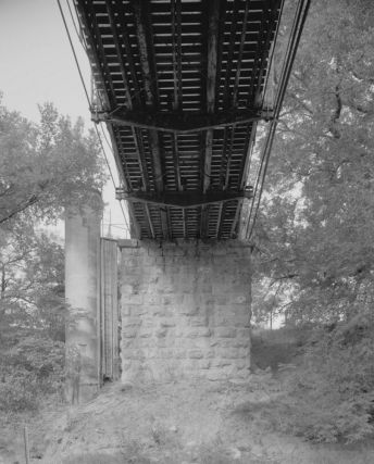
Photo taken by Historic American Engineering Record
118920
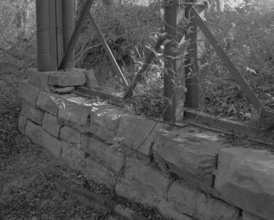
Photo taken by Historic American Engineering Record
249891
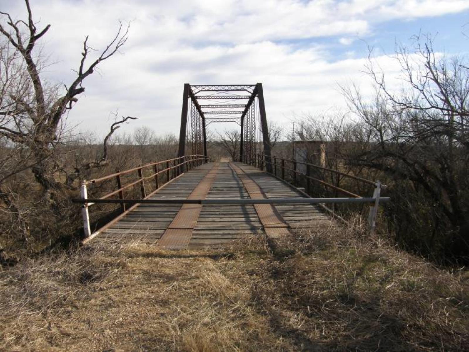
Photo taken by Barclay Gibson
249892
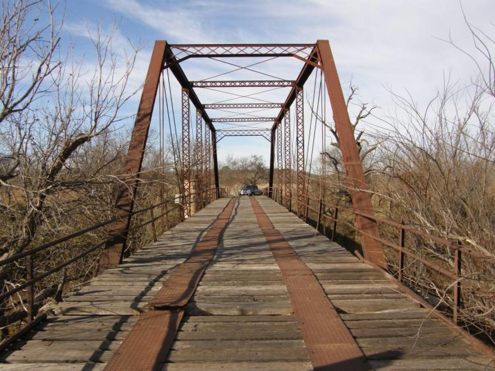
Photo taken by Barclay Gibson
249893
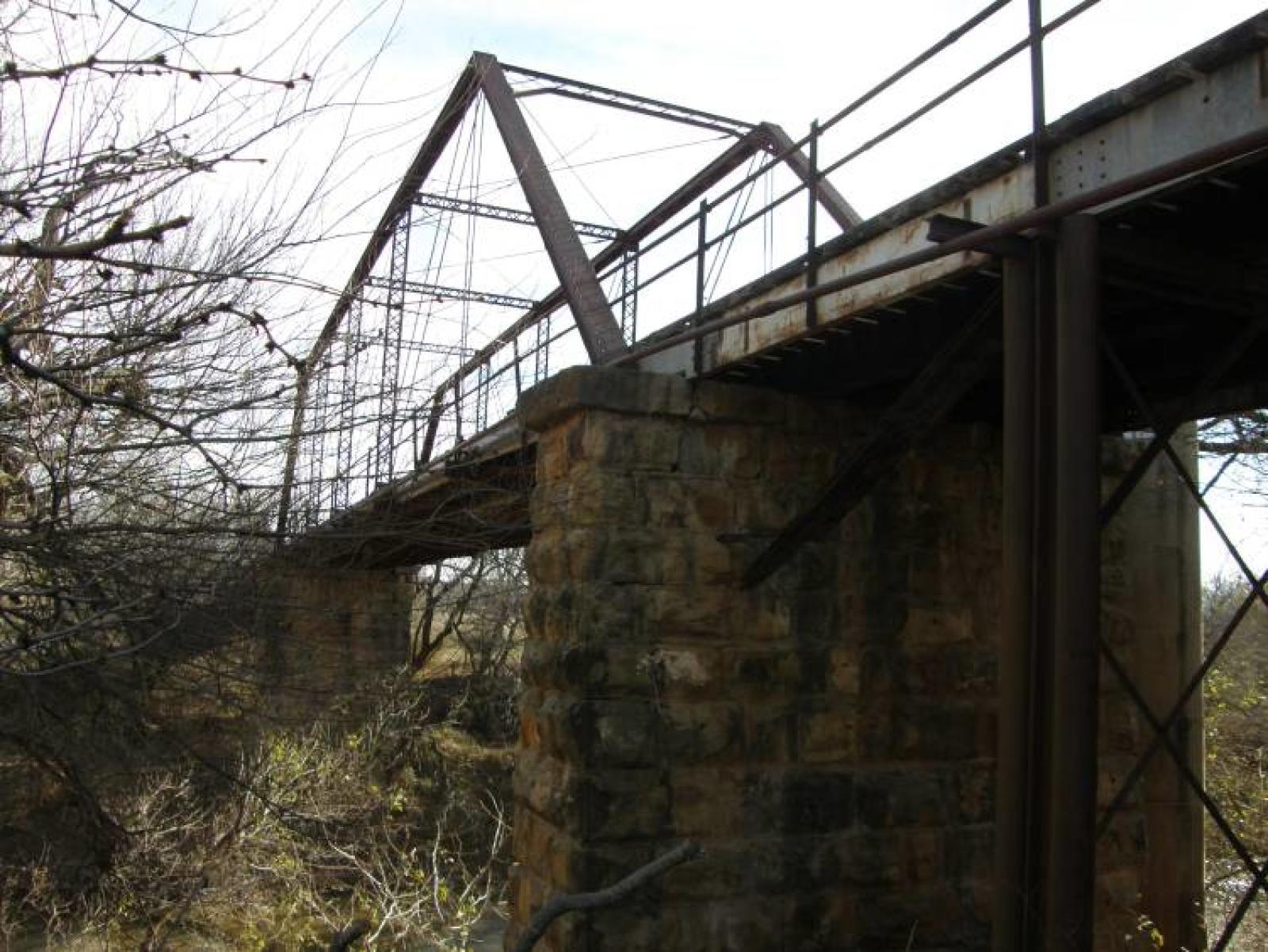
Photo taken by Barclay Gibson
249894
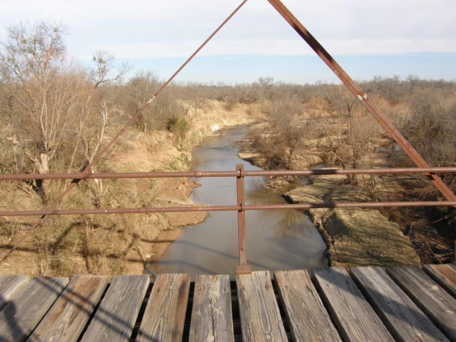
Photo taken by Barclay Gibson
![]()
Status: Open to traffic
Location: 32.690278,-99.164722
Carries FM 601 over Hubbard Creek
Design: truss/through/pratt
Design Details: 8-panel Pratt through truss
Total Length: 265.1 Feet
Span Length: 149.9 Feet
Overview: Through truss bridge over Hubbard Creek on FM 601
History: Built 1930
Built: 1930
Location: Shackelford County
View Bridge Information In Wayback Machine
![]()
205983
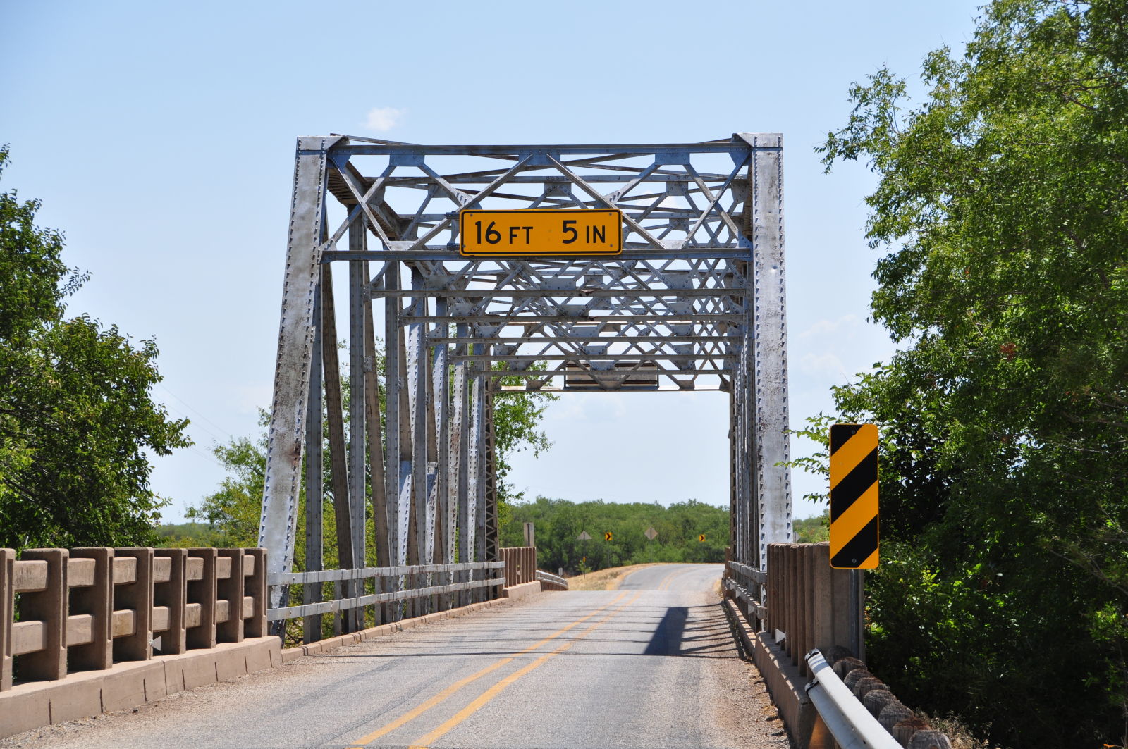
Photo taken by Linda Thaxton in July 2011
205984
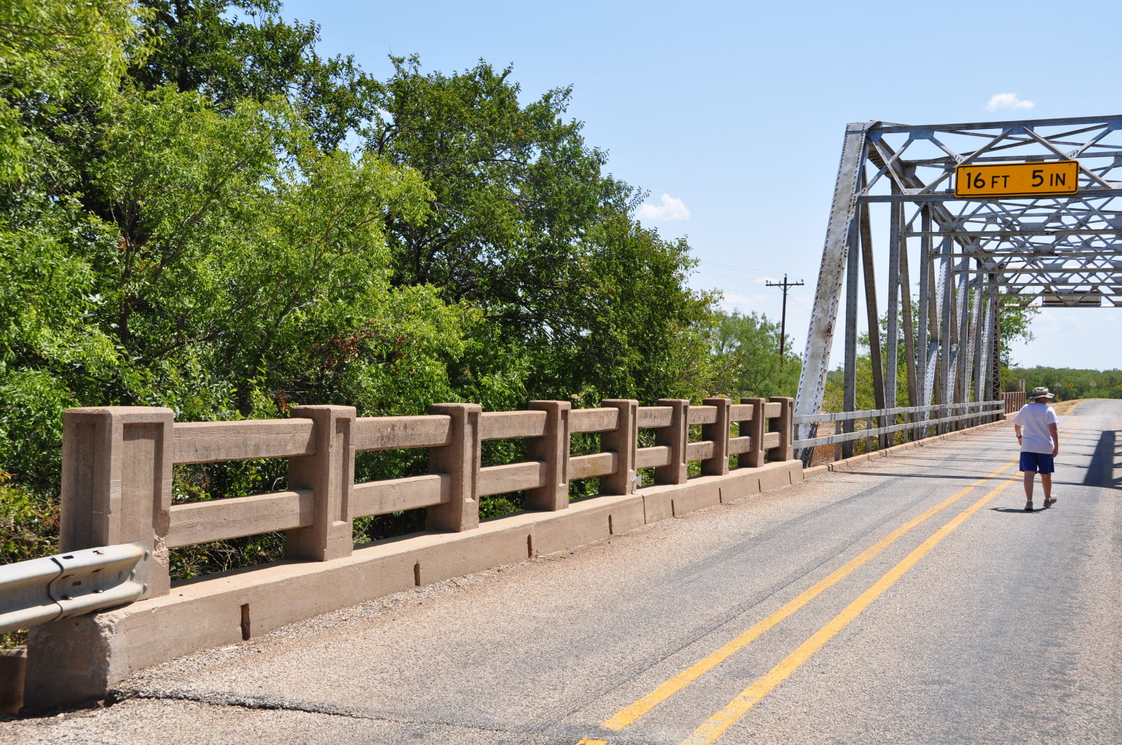
Photo taken by Linda Thaxton in July 2011
205985

Photo taken by Linda Thaxton in July 2011
205986
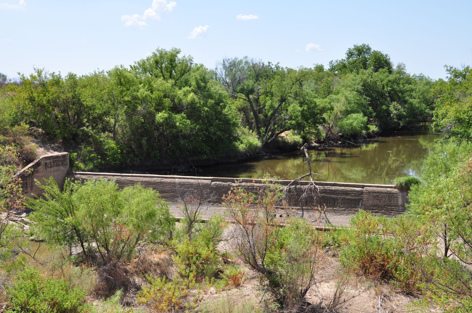
concrete dam on Hubbard Creek south of bridge.
Photo taken by Linda Thaxton in July 2011
205987
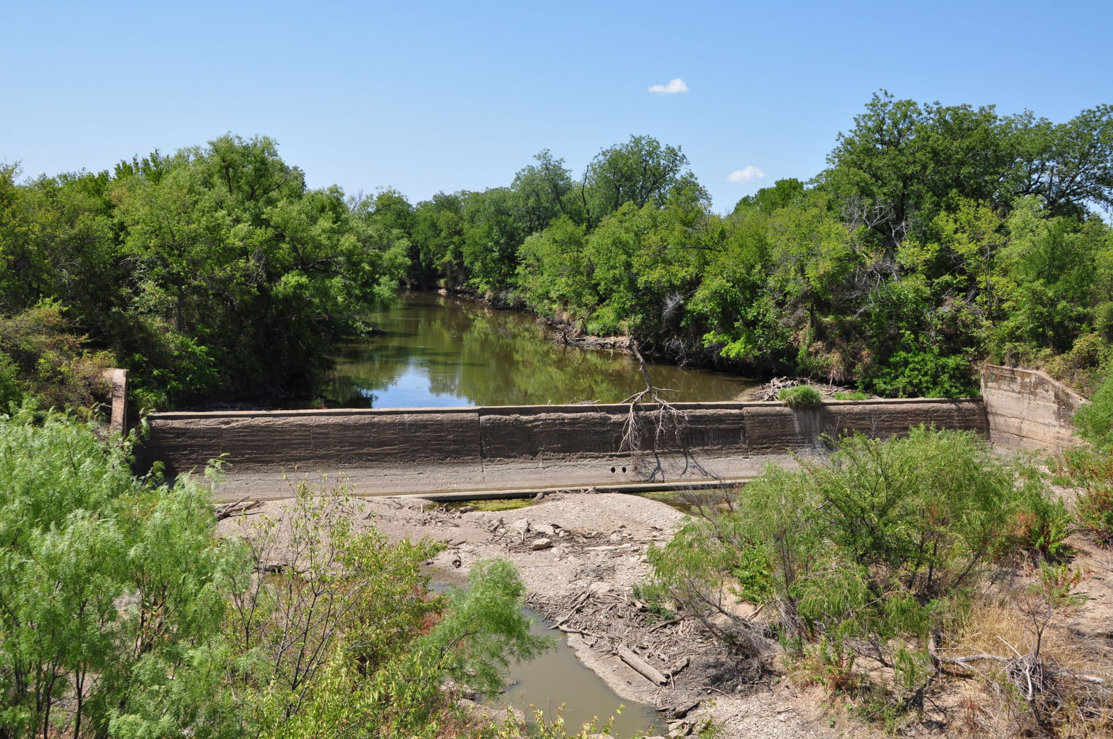
concrete dam on Hubbard Creek south of bridge.
Photo taken by Linda Thaxton in July 2011
205988

Photo taken by Linda Thaxton in July 2011
205989
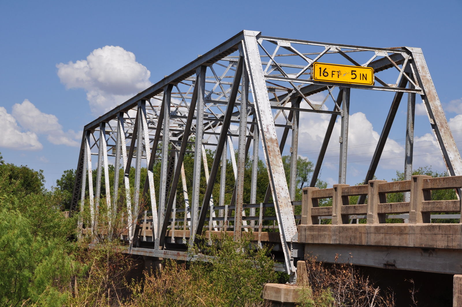
Photo taken by Linda Thaxton in July 2011
![]()
Status: No longer exists
Location: 32.877778,-99.582222
Carries CR 164 over Pinto Creek
Design: truss
Design Details: Truss
Total Length: 100.1 Feet
Span Length: 100.1 Feet
Overview: Lost truss bridge over Pinto Creek on CR 164
History: Built 1928; replaced 2004
Built: 1928
Location: Shackelford County
View Bridge Information In Wayback Machine
![]()
![]()
Status: Closed to all traffic
Location: 32.679167,-99.275000
Carries CR 121 over Salt Prong
Design: truss/pony
Design Details: Pony truss
Total Length: 88.9 Feet
Span Length: 88.9 Feet
Overview: Pony truss bridge over Salt Prong on CR 121
History: Built 1935; rehabilitated 1955
Built: 1935
Location: Shackelford County
View Bridge Information In Wayback Machine
![]()
![]()
Status: Open to pedestrians
Location: 32.933110,-99.215230
Carries U.S. 283 over Clear Fork Brazos River
Design: truss/through/parker
Design Details: Parker through truss
Total Length: 0.0 Feet
Span Length: 0.0 Feet
Overview: Parker through truss bridge over Clear Fork Brazos River
History: Built 1929
Built: 1929
Location: Shackelford County
View Bridge Information In Wayback Machine
![]()
204134
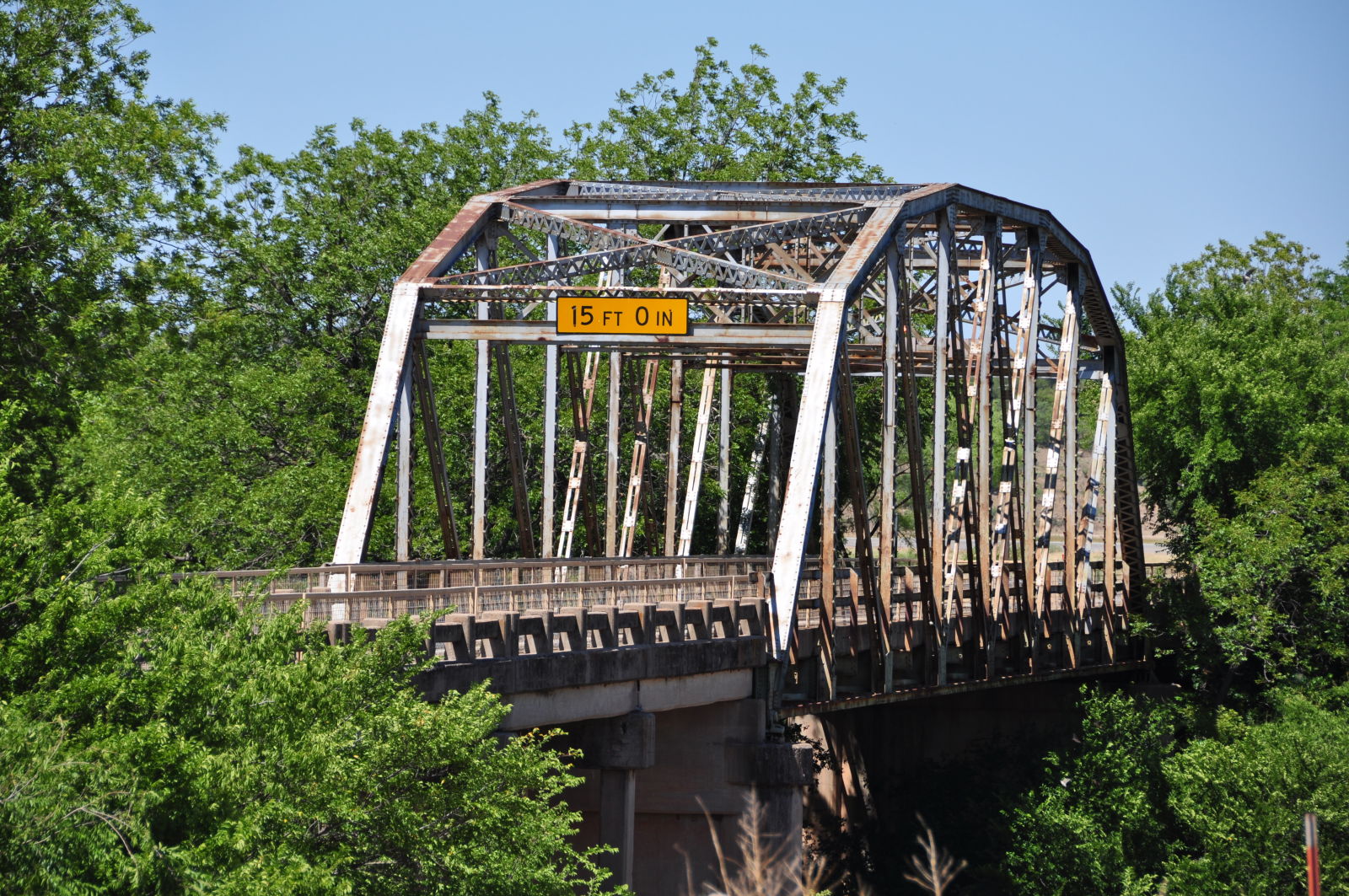
Photo taken by Linda Thaxton in June 2011
204135
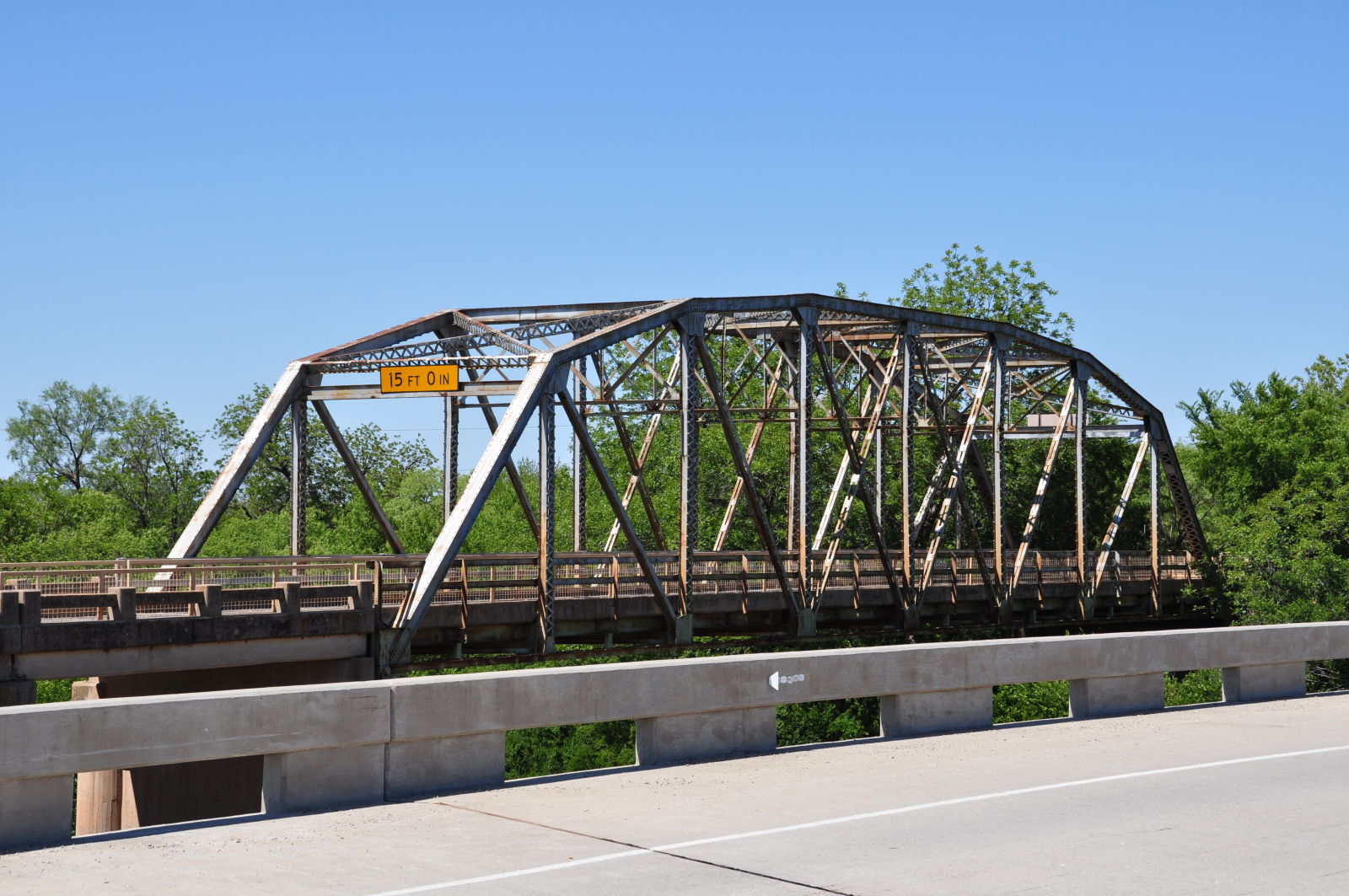
Photo taken by Linda Thaxton in June 2011
![]()
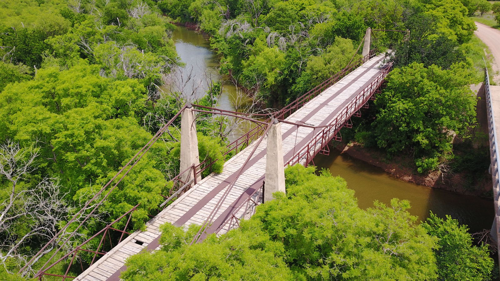
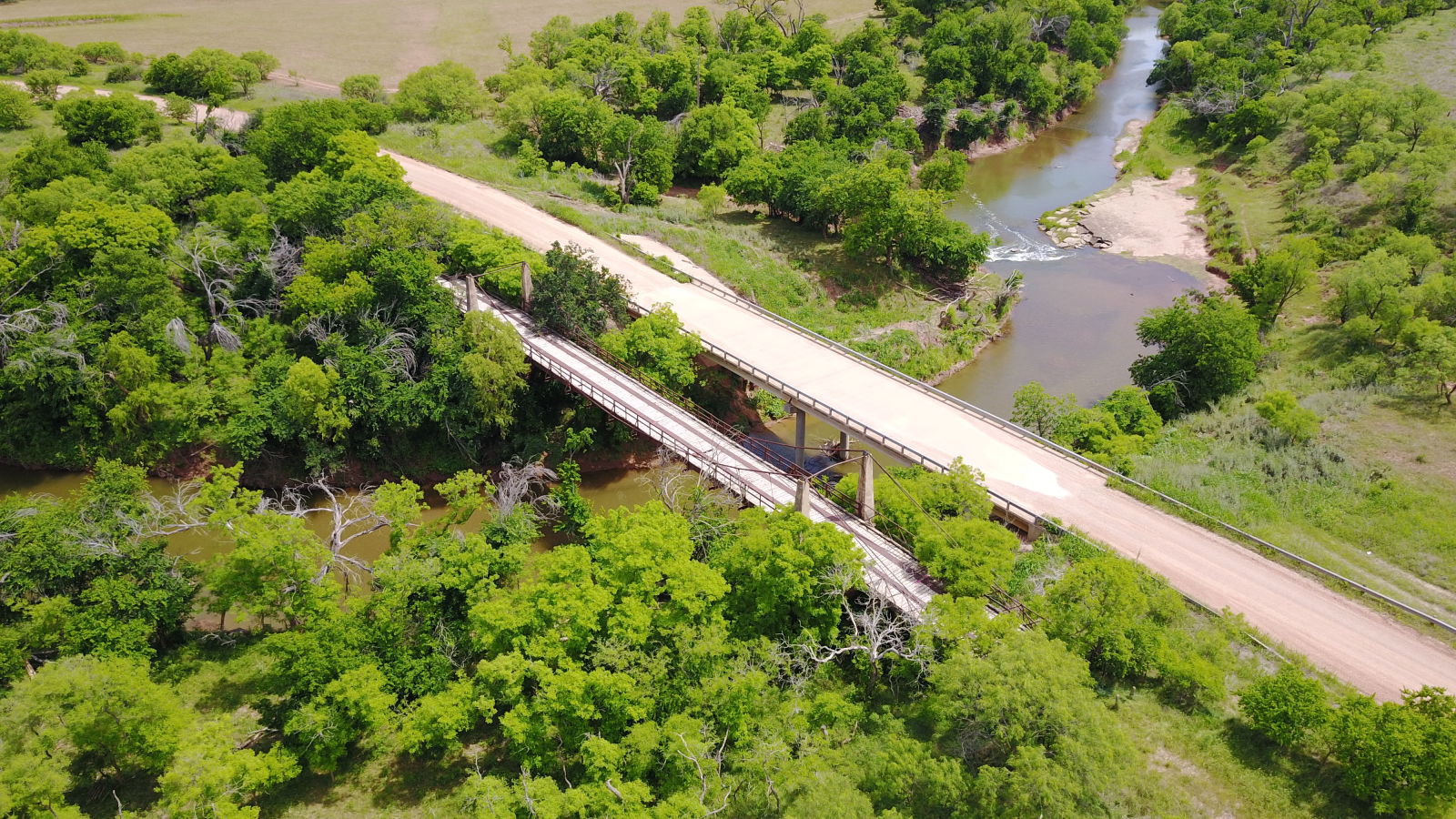
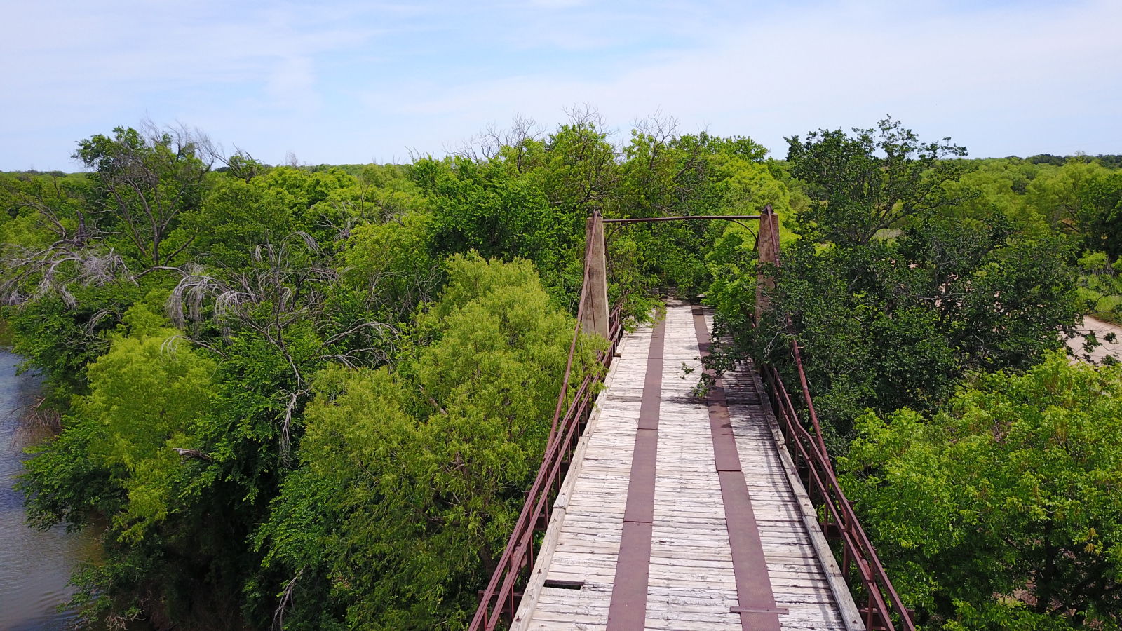
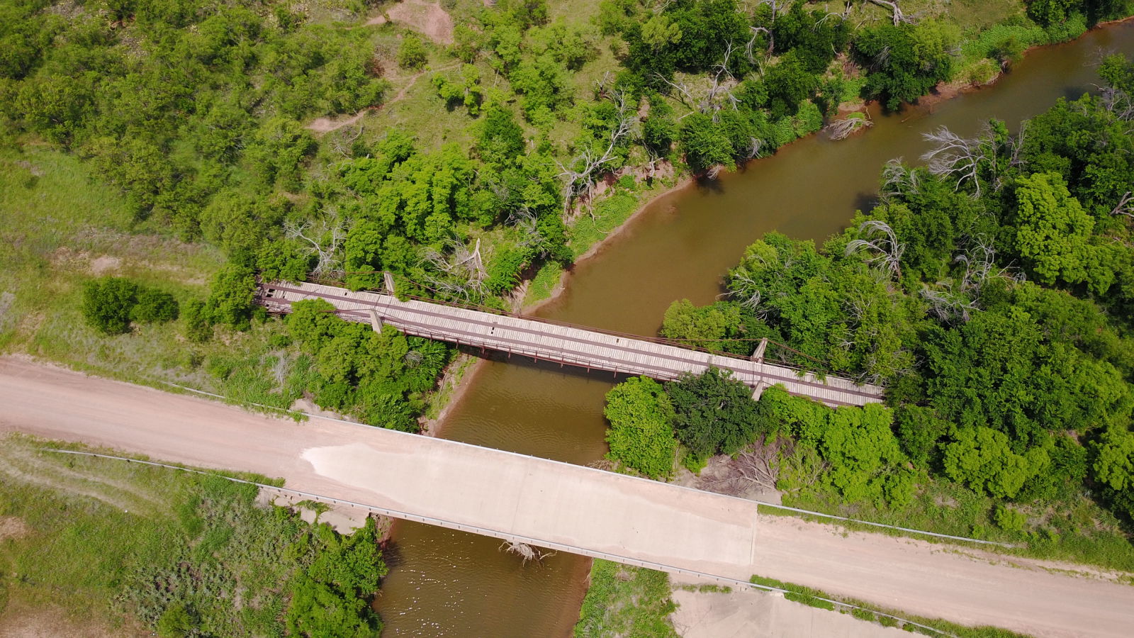
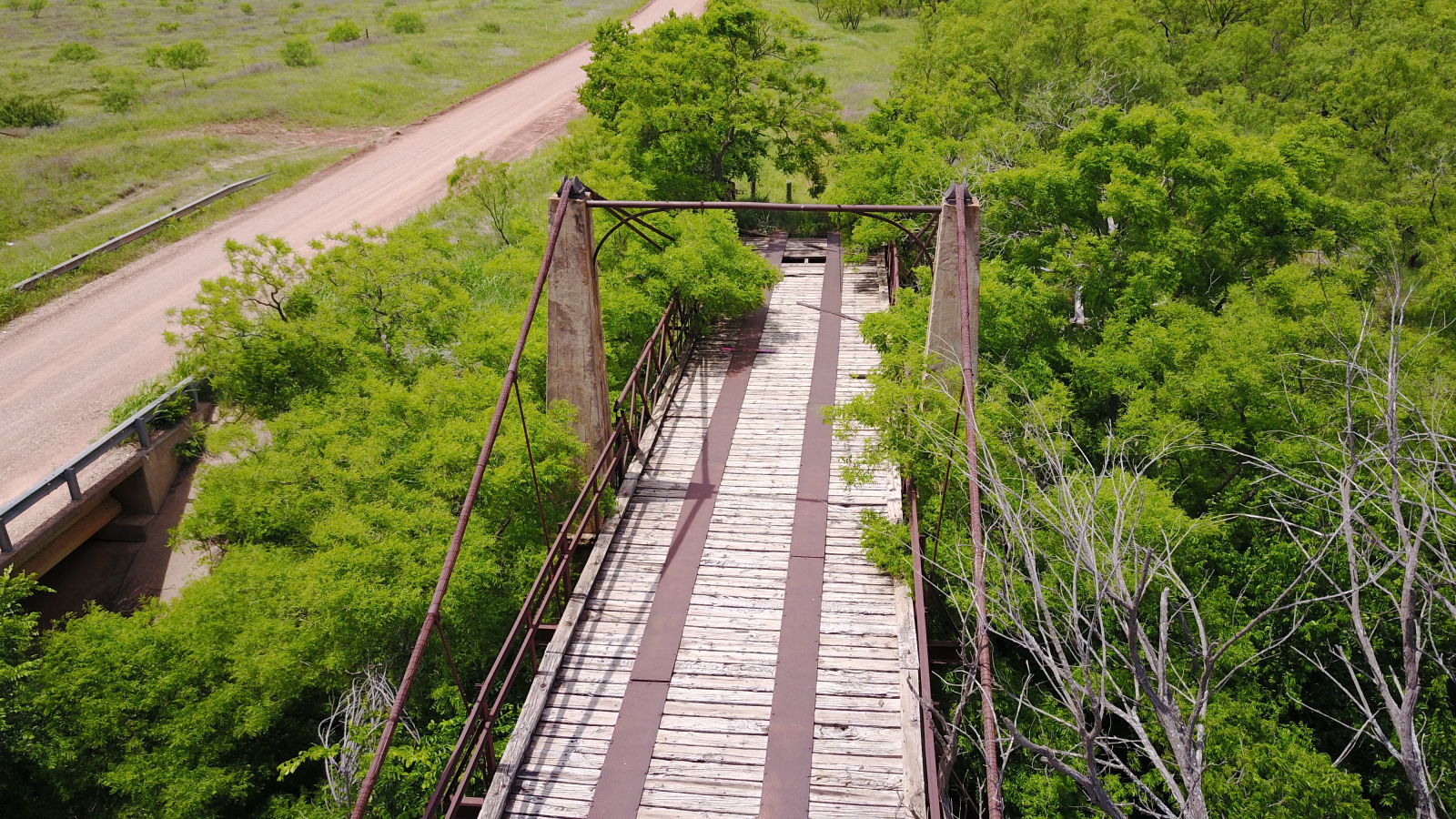
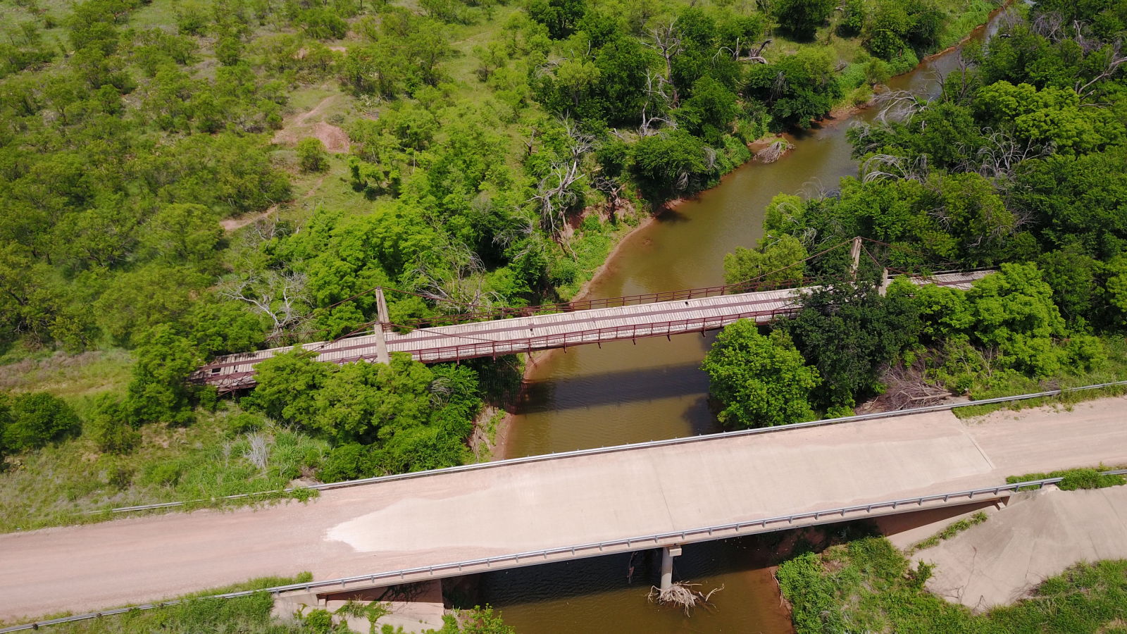
Status: Closed to all traffic
Location: 32.921367,-99.167870
Carries CR 179 over Clear Fork Brazos River
Design: suspension/wire
Design Details: Catenary Wire suspension
Total Length: 312.0 Feet
Span Length: 140.0 Feet
Overview: Wire suspension bridge over Clear Fork Brazos River
History: Built 1896. Remodeled in 1926 by Austin Bridge Co.
Built: 1896
Location: Shackelford County
View Bridge Information In Wayback Machine
![]()
388508
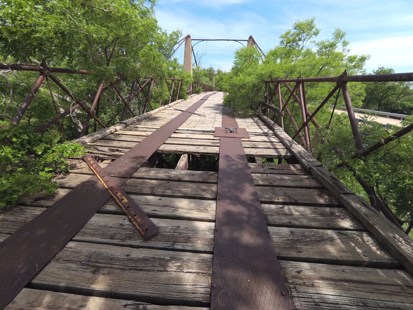
Photo taken by Dwayne Dove in March 2014
388509
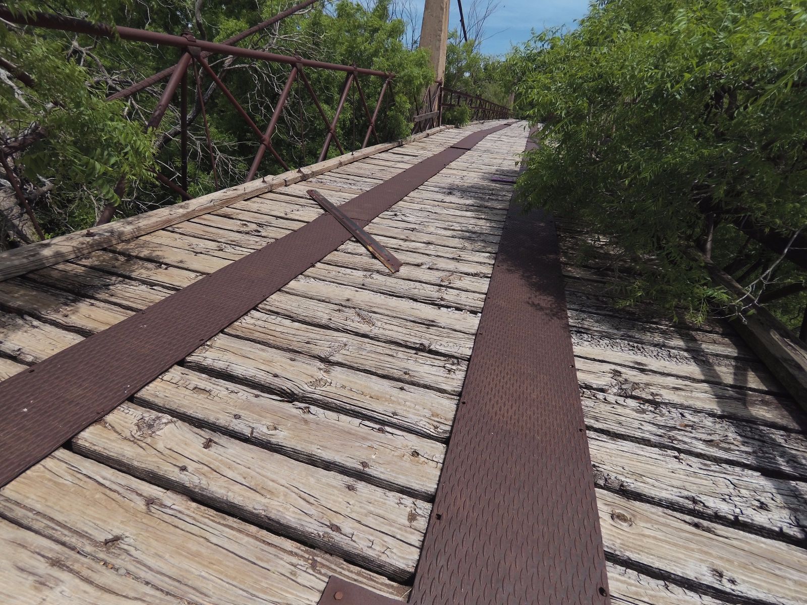
Photo taken by Dwayne Dove in March 2014
388506
Looking north-east
Photo taken by Dwayne Dove in April 2017
388507
Looking south-east
Photo taken by Dwayne Dove in April 2017
388504
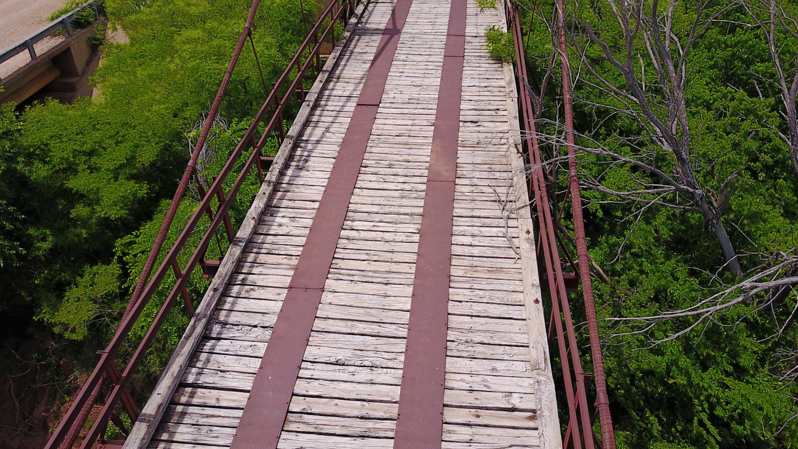
Photo taken by Dwayne Dove in April 2017
388505
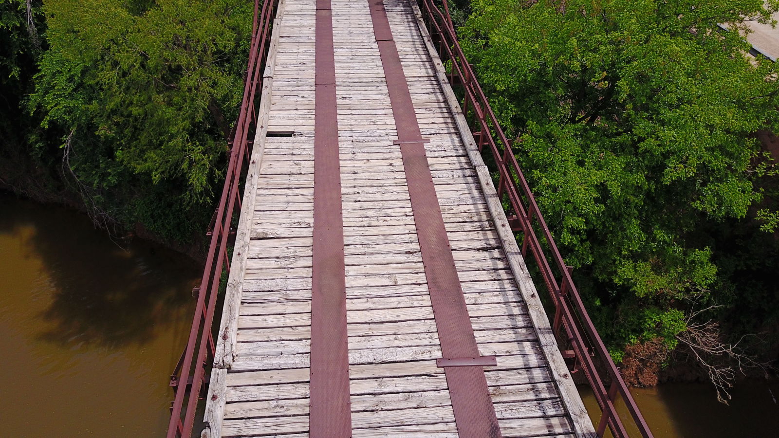
Photo taken by Dwayne Dove in April 2017
388502
Looking east
Photo taken by Dwayne Dove in April 2017
388503
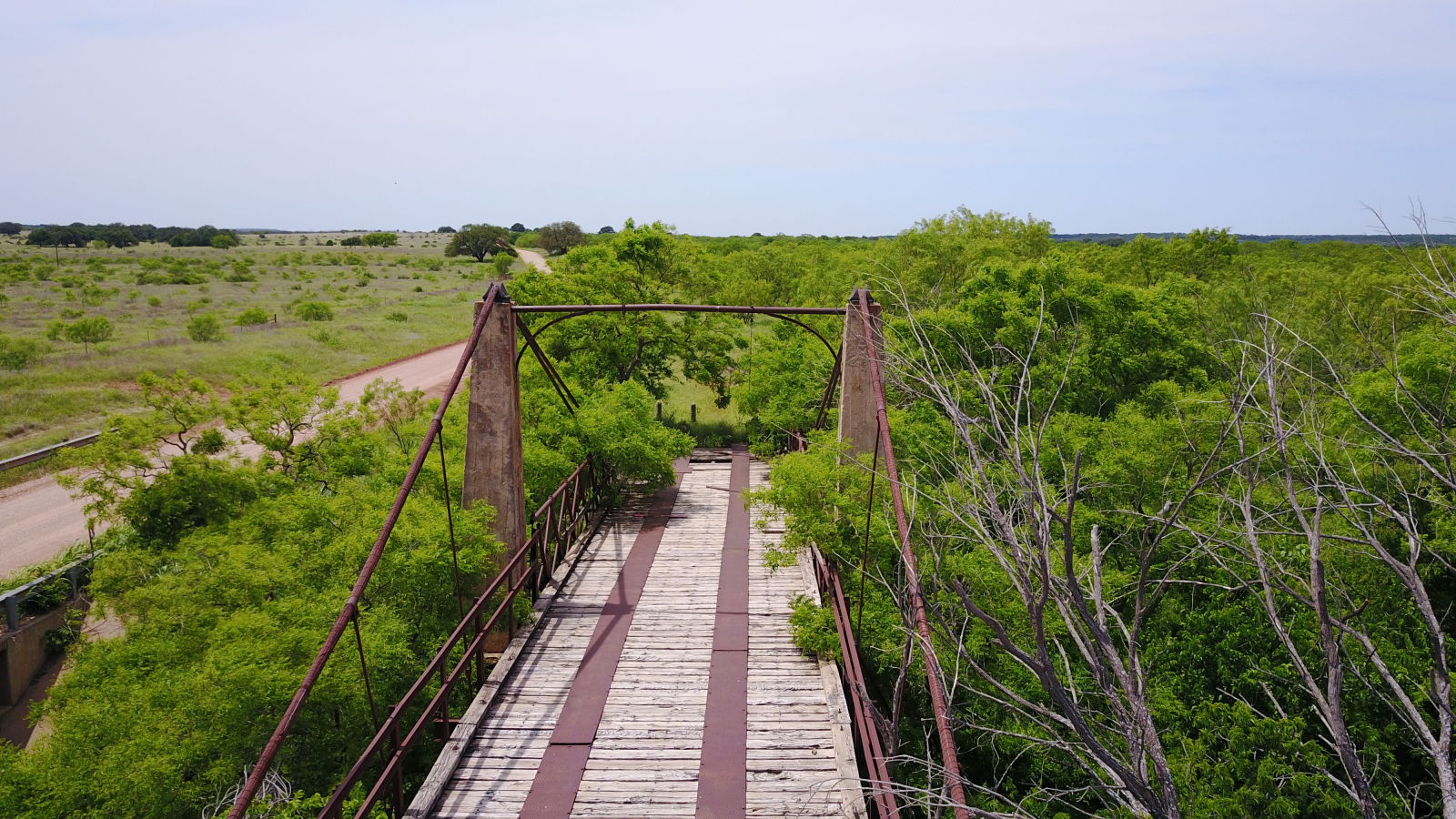
Photo taken by Dwayne Dove in April 2017
388500
Looking north-west
Photo taken by Dwayne Dove in April 2017
388501
Looking west
Photo taken by Dwayne Dove in April 2017
388499
Looking north
Photo taken by Dwayne Dove in April 2017
205990
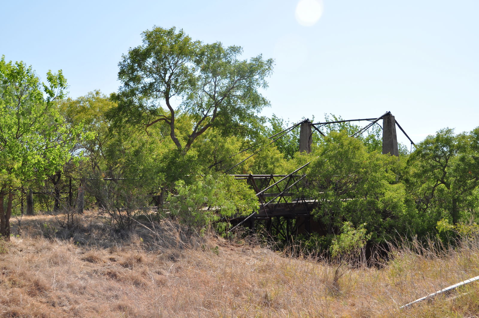
Photo taken by Linda Thaxton in July 2011
205991
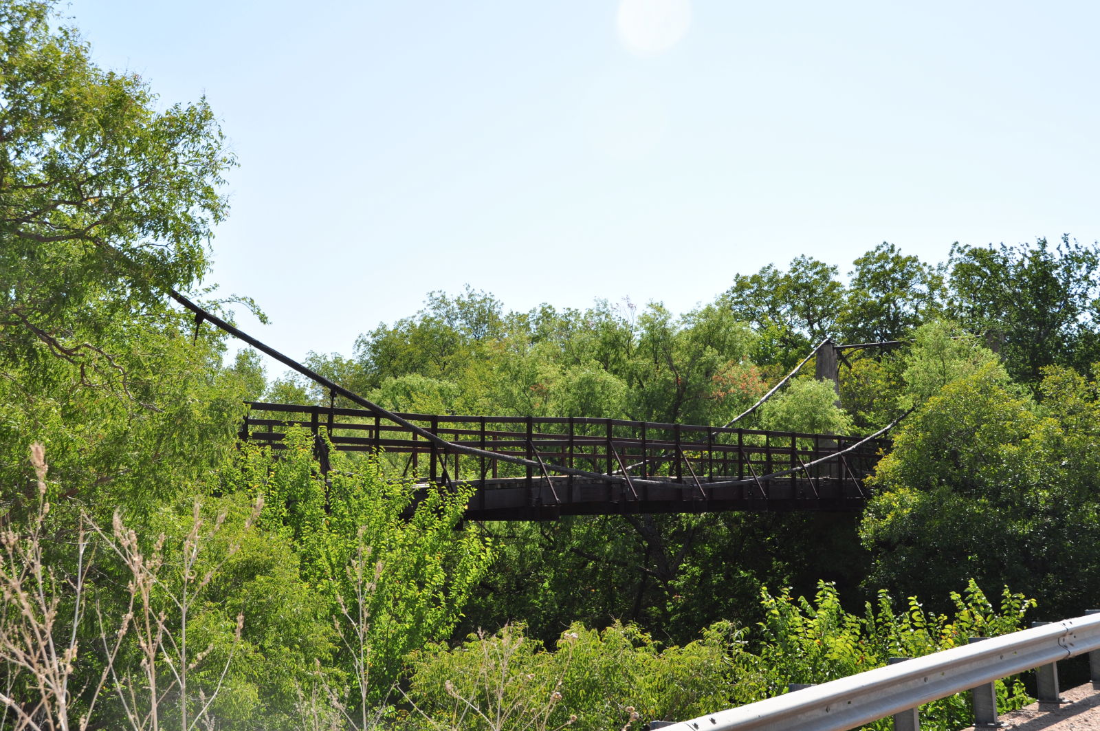
Photo taken by Linda Thaxton in July 2011
205992
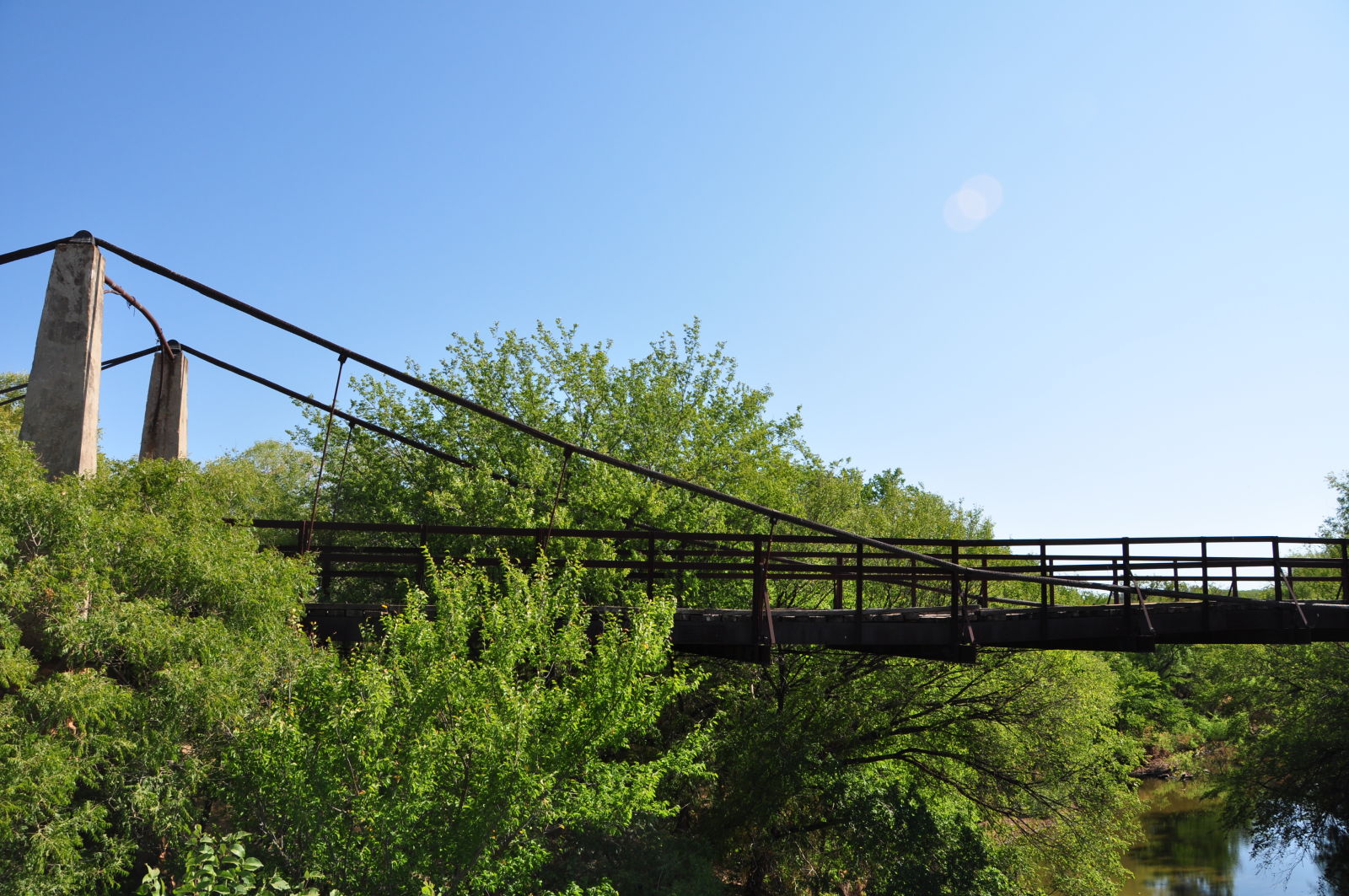
Photo taken by Linda Thaxton in July 2011
205993
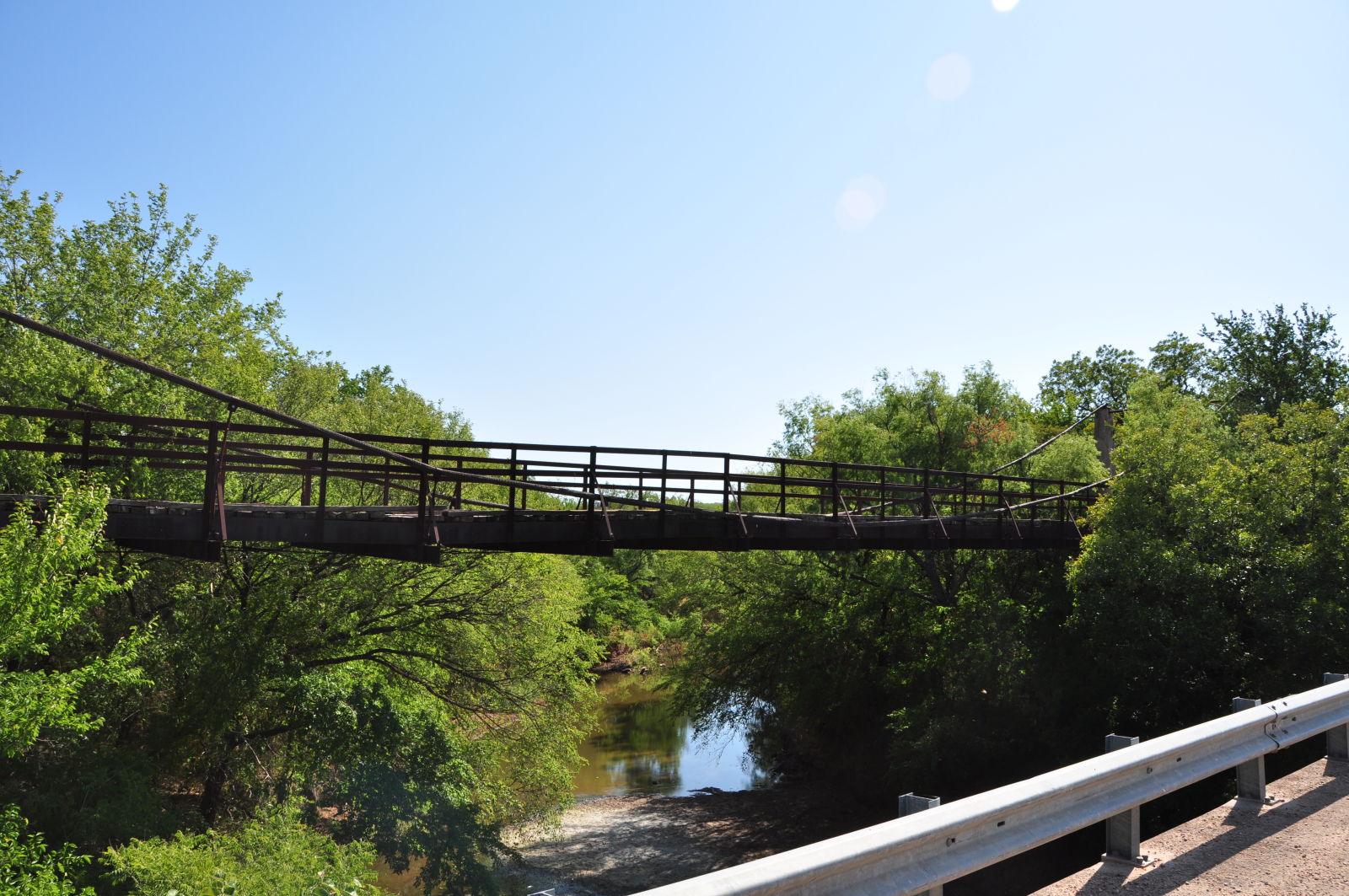
Photo taken by Linda Thaxton in July 2011
205994
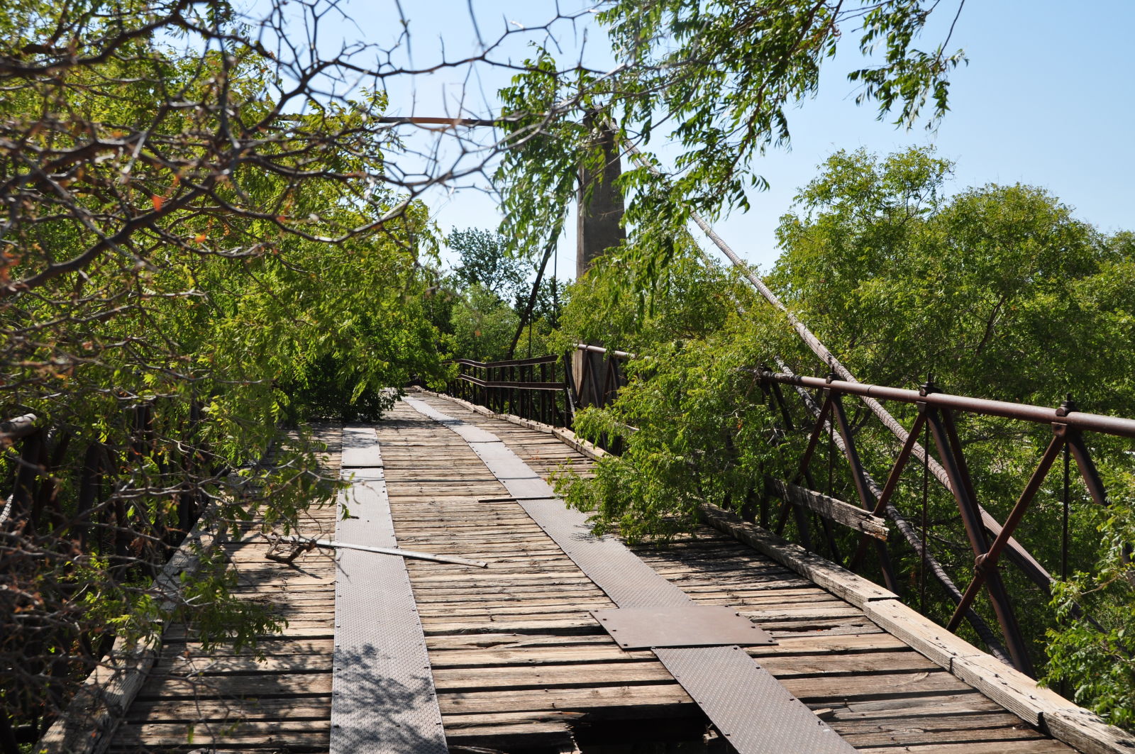
Photo taken by Linda Thaxton in July 2011
205995
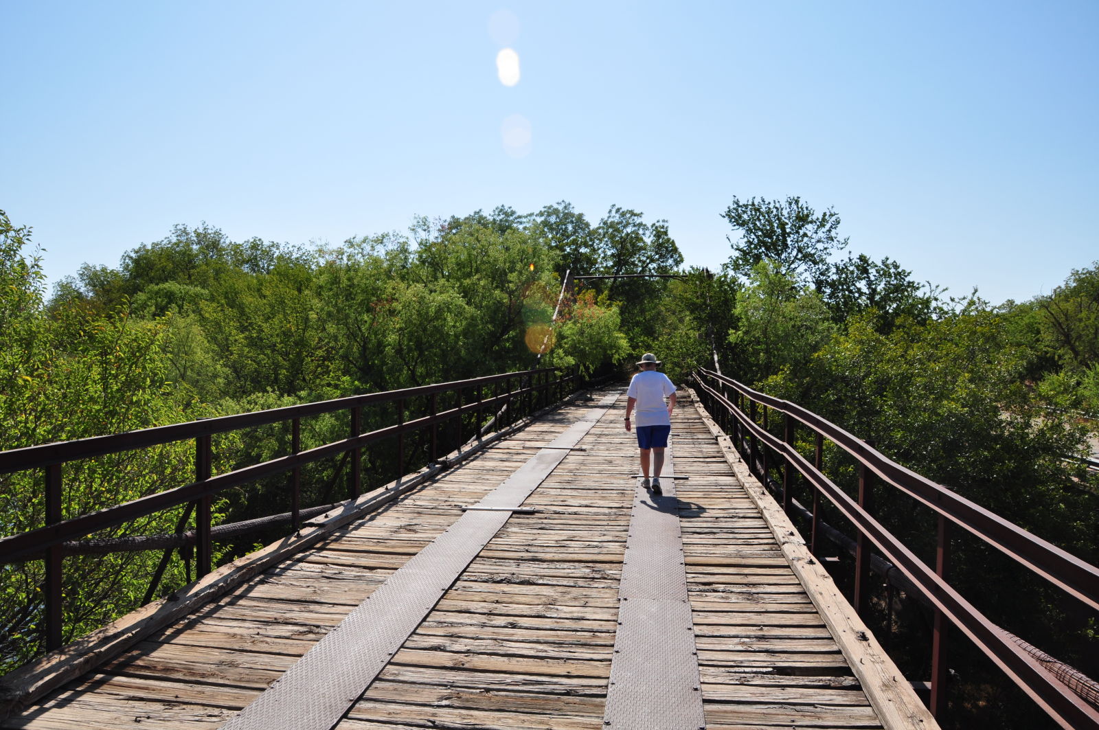
Photo taken by Linda Thaxton in July 2011
205996
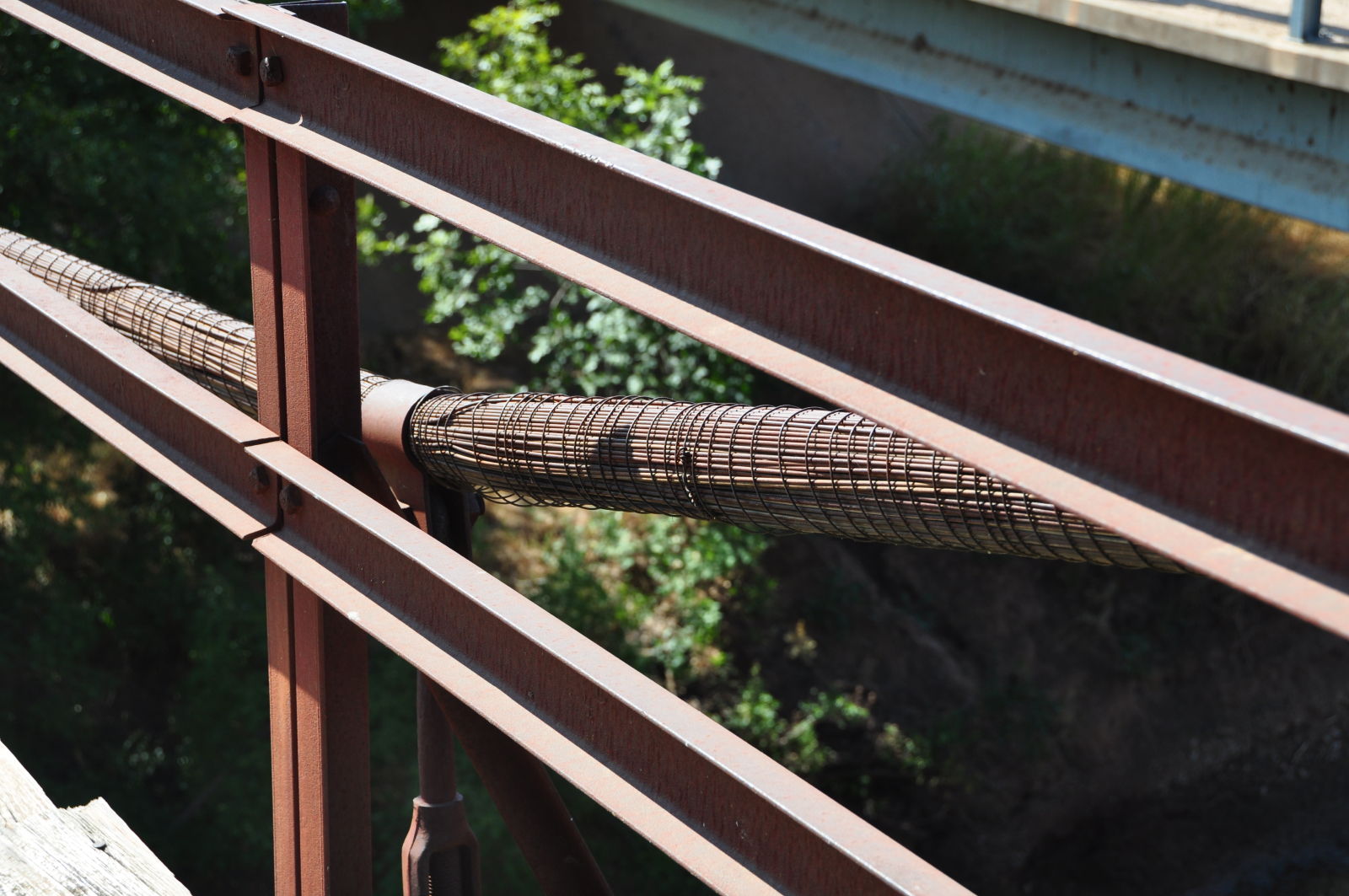
Photo taken by Linda Thaxton in July 2011
205997
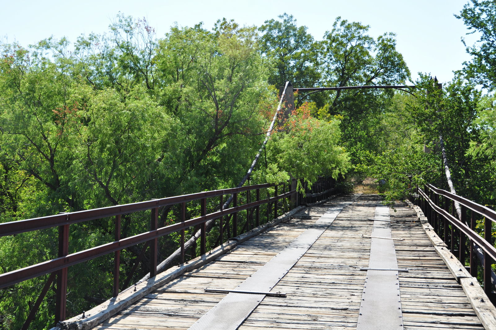
Photo taken by Linda Thaxton in July 2011
205998
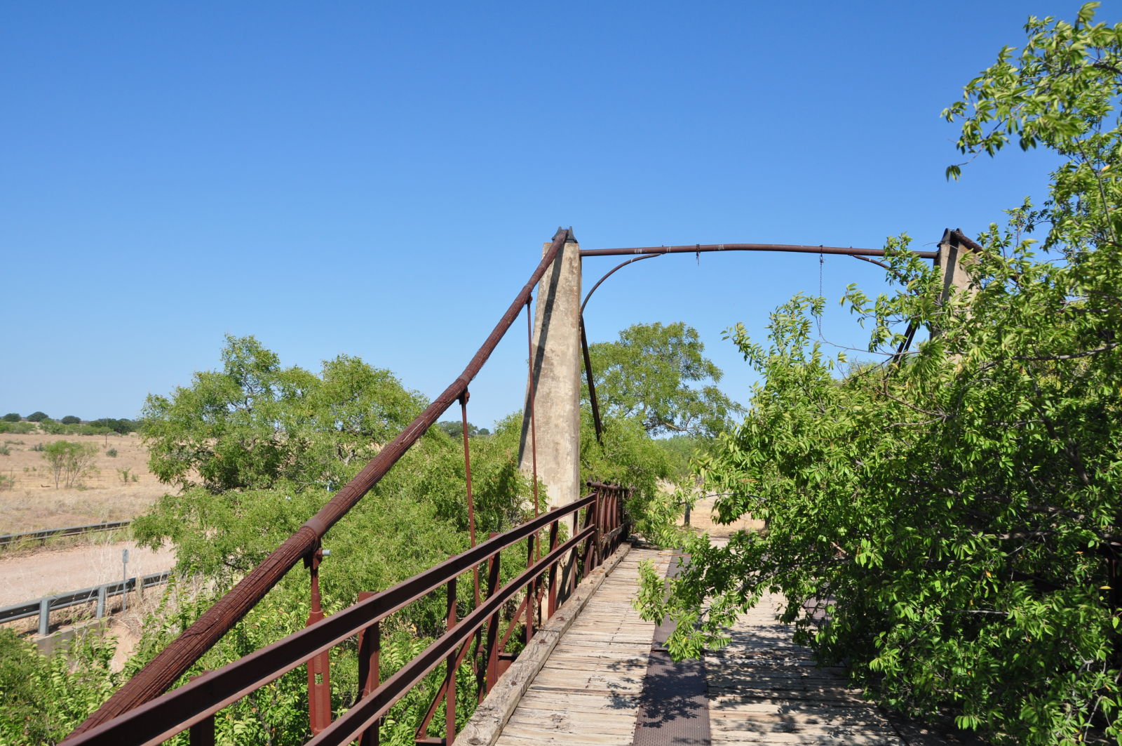
Photo taken by Linda Thaxton in July 2011
205999
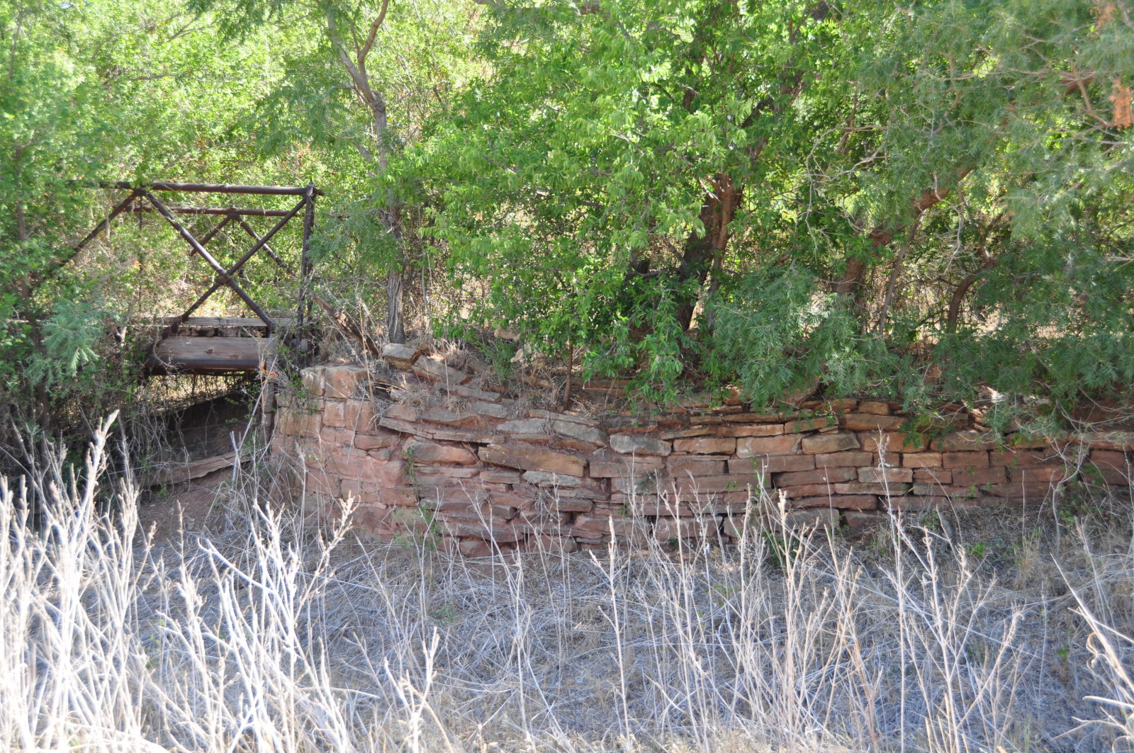
Photo taken by Linda Thaxton in July 2011
251872
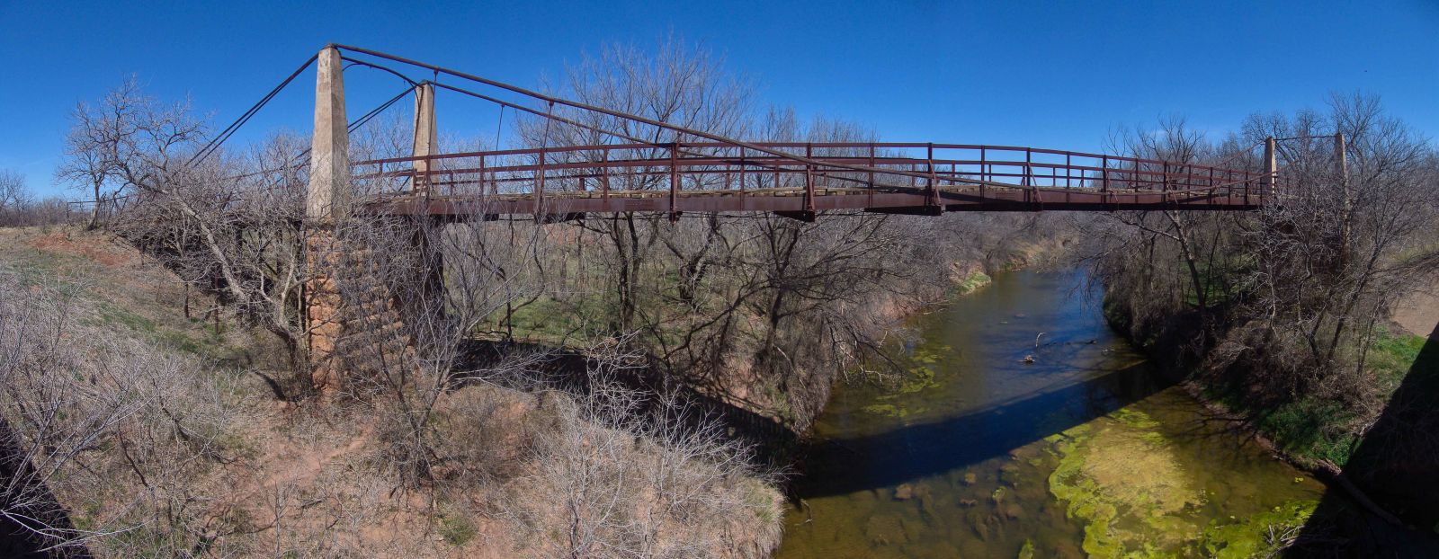
Panoramic view
Photo taken by John Albert Fehr
![]()
Status: Replaced by new bridge
Location: 32.700510,-99.212373
Carries FM 601 over Salt Prong Hubbard Creek
Design: truss/through
Design Details: Through truss
Total Length: 0.0 Feet
Span Length: 0.0 Feet
Overview: Lost Through truss bridge over Salt Prong Hubbard Creek on FM 601
History:
Built:
Location: Shackelford County
View Bridge Information In Wayback Machine
![]()
206000
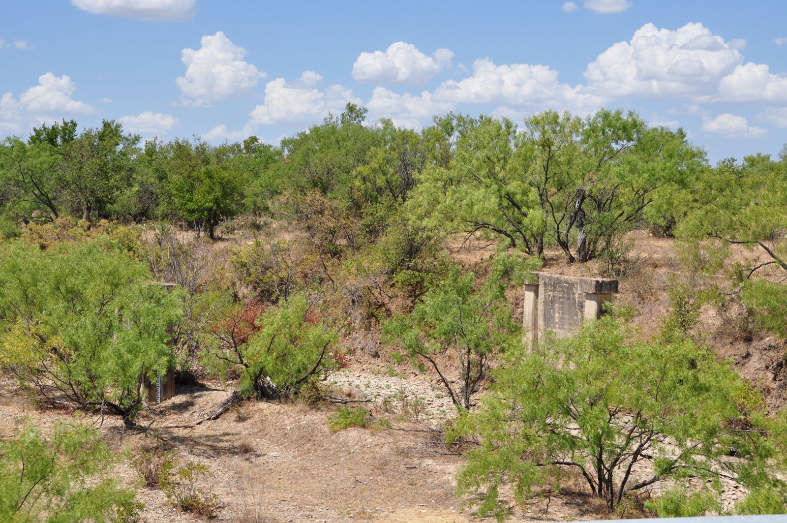
Photo taken by Linda Thaxton in July 2011
206001
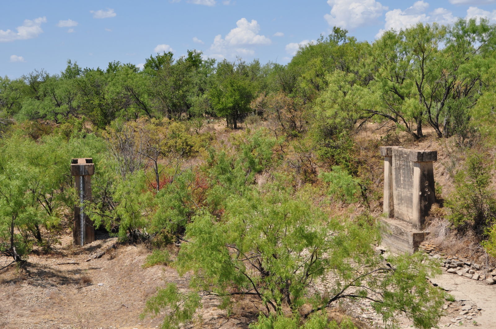
Photo taken by Linda Thaxton in July 2011
Special Bridge Conditions Legend: R - Former location of relocated bridge. ! - At risk for demolition or destruction. X - Confirmed demolished or collapsed. S - Dismantled and/or in storage. L - Severe loss of historic integrity due to alteration.
![]()

![]()