![]()
![]()
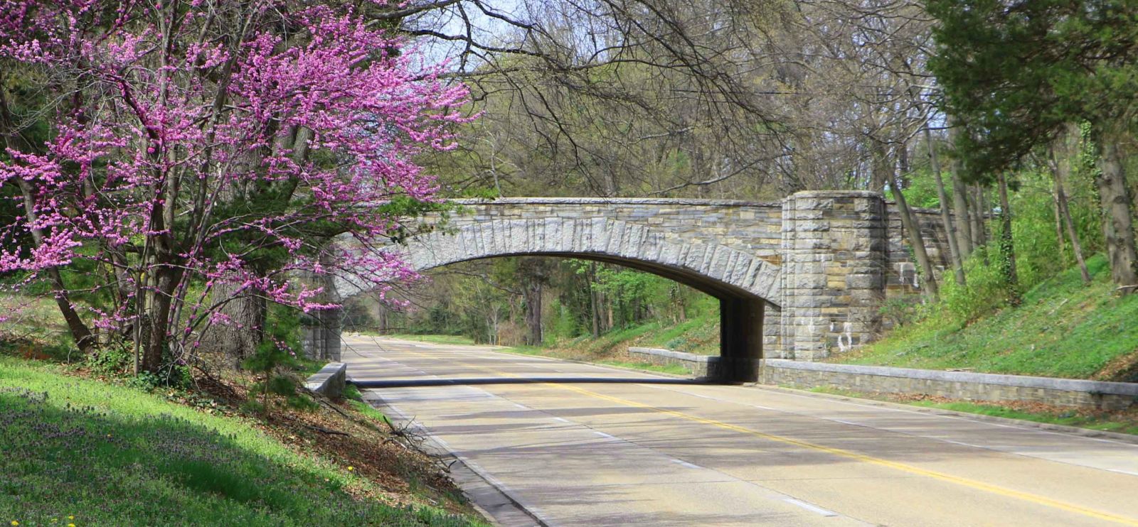
Status: Open to traffic
Location: 38.746713,-77.048853
Carries Alexandria Avenue over GWMP
Design: arch/deck
Design Details: Arch
Total Length: 45.9 Feet
Span Length: 45.9 Feet
Overview: Concrete arch bridge over GWMP on Alexandria Avenue
History: Built 1932
Built: 1932
Location: Fairfax County
View Bridge Information In Wayback Machine
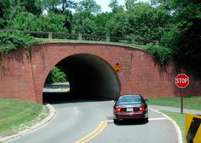
![]()
469149
Alexandria Avenue Bridge
Photo from National Park Service
![]()
Status: Open to traffic
Location: 0.000000,0.000000
Carries George Washington Memorial Parkway over Alexandria Avenue
Design: arch/deck
Design Details: Arch
Total Length: 54.1 Feet
Span Length: 54.1 Feet
Overview: Concrete arch bridge over Alexandria Avenue on George Washington Memorial Parkway
History: Built 1932
Built: 1932
Location: Fairfax County
View Bridge Information In Wayback Machine
![]()
![]()
Status: Open to traffic
Location: 38.789833,-77.362330
Carries Norfolk Southern Railway over Colchester Road
Design: arch/deck/closed
Design Details: Closed-spandrel arch
Total Length: 14.1 Feet
Span Length: 14.1 Feet
Overview: Concrete arch bridge over Colchester Road on the Norfolk Southern Railway
History: Built 1932
Built: 1932
Location: Fairfax County
View Bridge Information In Wayback Machine
![]()
469150
NS - Colchester Road Overpass
Photo taken by Katie Prescott
![]()
Status: Open to traffic
Location: 38.842527,-77.145222
Carries Columbia Pike over Holmes Run
Design: arch/deck
Design Details: Deck arch
Total Length: 68.9 Feet
Span Length: 68.9 Feet
Overview: Rainbow arch bridge over Holmes Run on Columbia Pike in Arlington
History: Built 1961
Built: 1961
Location: Fairfax County
View Bridge Information In Wayback Machine
![]()
![]()
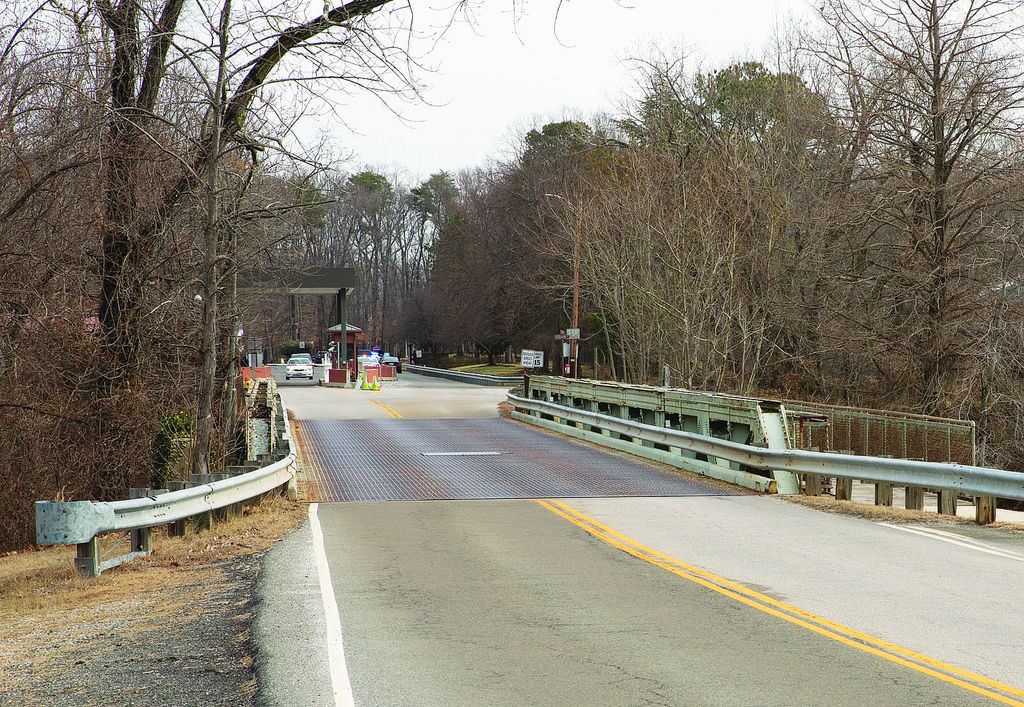
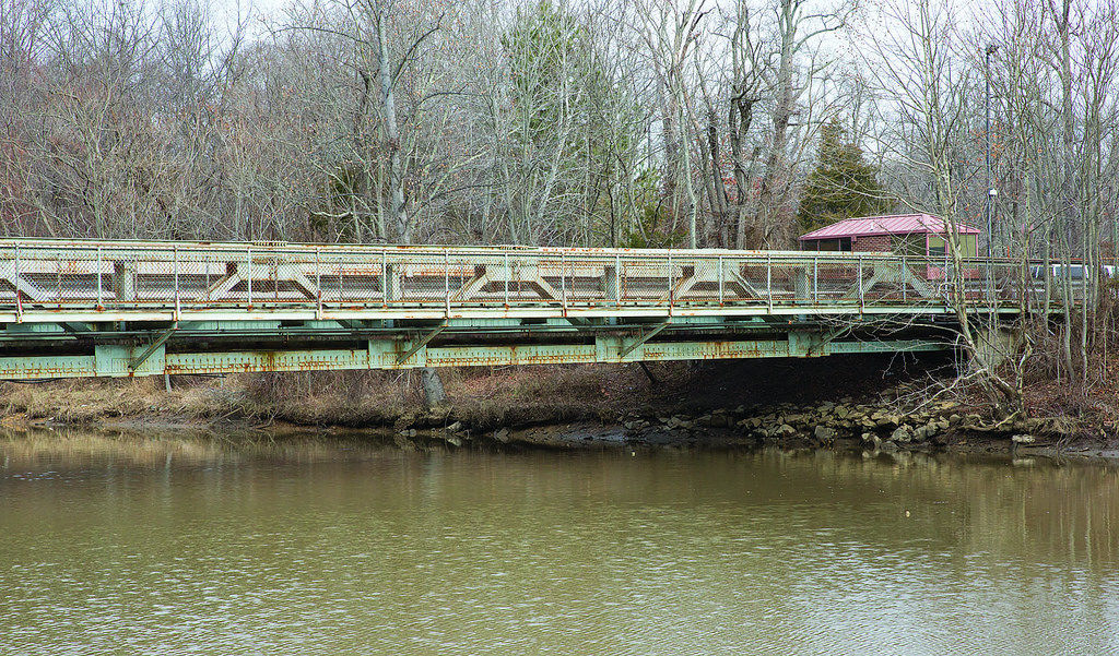
Status: Open to authorized vehicles only
Location: 38.709167,-77.132222
Carries Mt. Vernon Road over Dogue Creek
Design: truss/pony
Design Details: Pony truss
Total Length: 160.1 Feet
Span Length: 0.0 Feet
Overview: Pony truss bridge over Dogue Creek on Mt. Vernon Road in Fort Belvoir
History: Built 1959; rehabilitated 1979
Built: 1959
Location: Fairfax County
View Bridge Information In Wayback Machine
![]()
433497
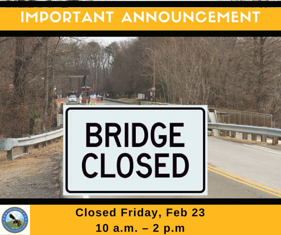
Photo taken by Fort Belvoir
433498
Shows up in Google Images linking to a Flickr archival claiming the image to be from the base's Flickr account. Image neither appears on said archival site nor the base's Flickr account, suggesting they've deleted the image. Same image as the one that was used as the background for the base's bridge closure notification post on Facebook.
Photo taken by Fort Belvoir
433499
Shows up in Google Images linking to a Flickr archival site, but neither appears on said archival site nor the base's Flickr account
Photo taken by Fort Belvoir
433500
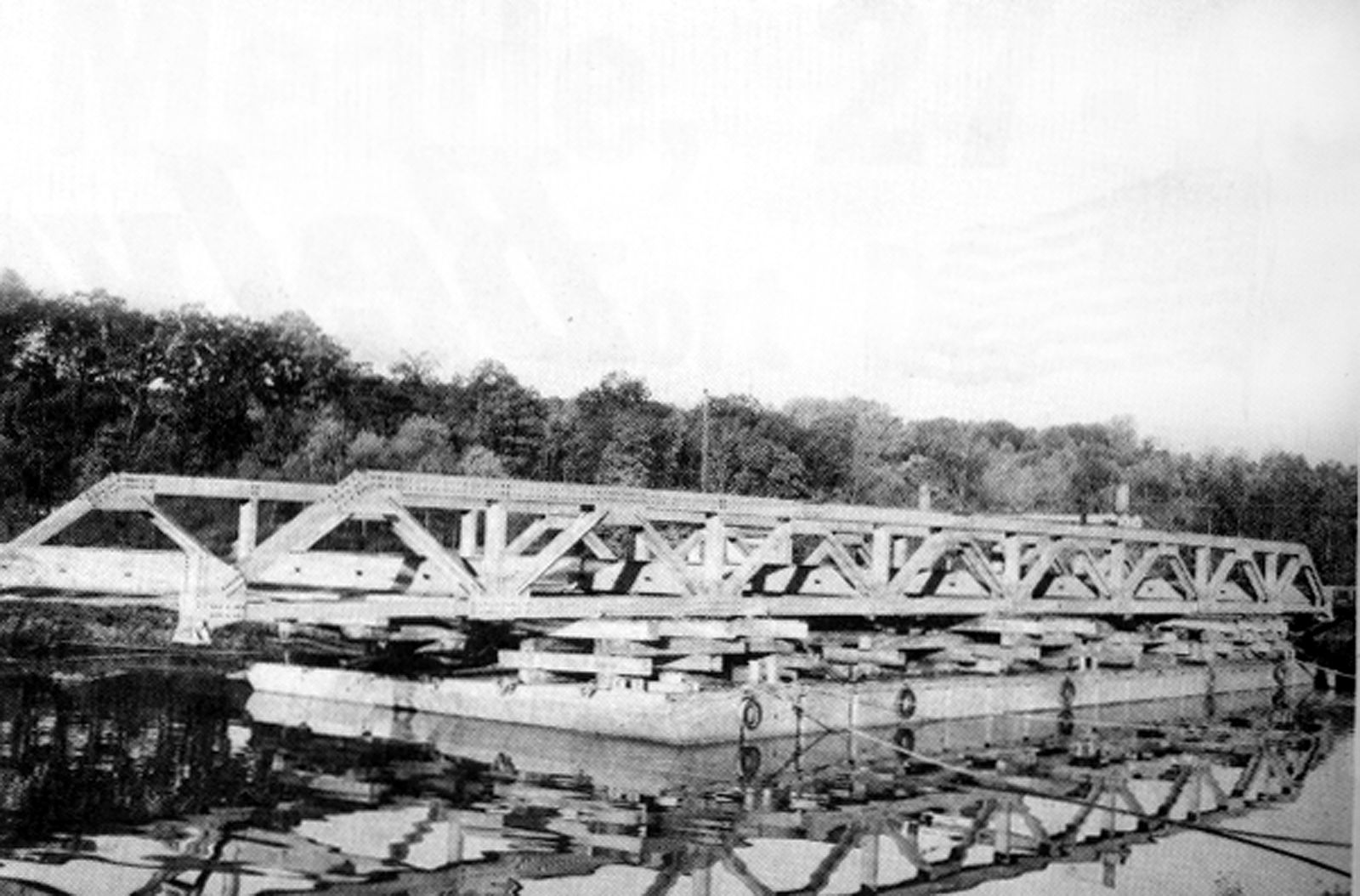
Floating on a Barge
Photo taken by Fort Belvoir
433501
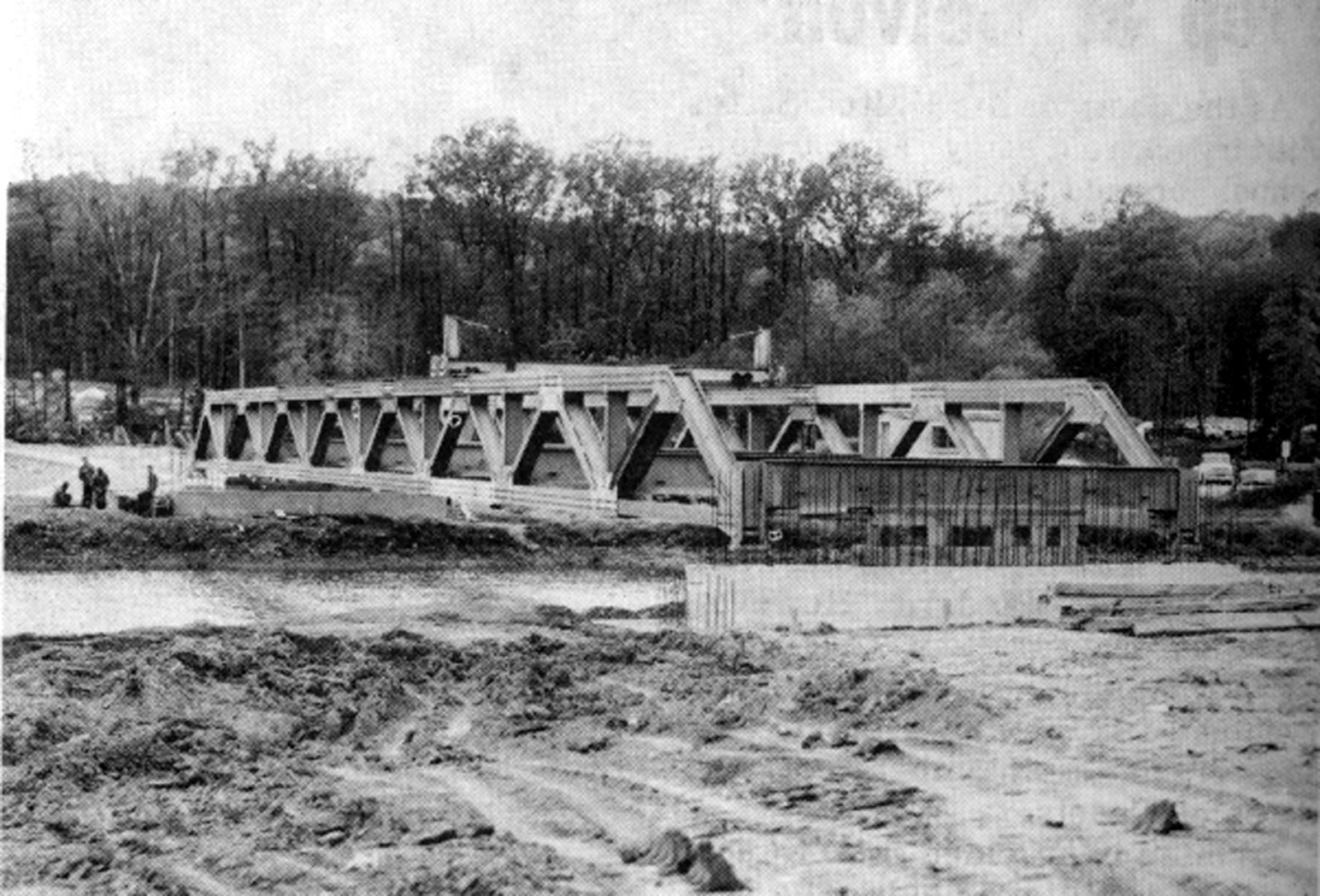
Installation
Photo taken by Fort Belvoir
![]()
Status: Unknown status
Location: 38.714671,-77.046779
Carries George Washington Memorial Parkway over Fort Hunt Access Road
Design: arch/deck/closed
Design Details: Closed-spandrel arch
Total Length: 32.2 Feet
Span Length: 32.2 Feet
Overview: Concrete arch bridge over Fort Hunt Access Road on the George Washington Memorial Parkway
History: Built 1932
Built: 1932
Location: Fairfax County
View Bridge Information In Wayback Machine
![]()
469153
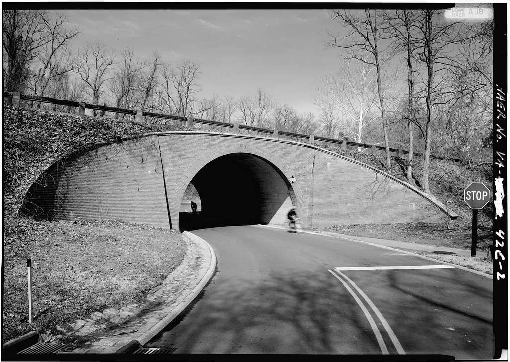
Fort Hunt Access Road Bridge
HAER Photo by Jet Lowe
469154
Fort Hunt Access Road Bridge
Photo from National Park Service
![]()
Status: Open to traffic
Location: 38.789914,-77.051389
Carries George Washington Memorial Parkway over Hunting Creek
Design: arch/deck/closed
Design Details: Closed-spandrel arch
Total Length: 138.1 Feet
Span Length: 44.0 Feet
Overview: Concrete arch bridge over Hunting Creek on George Washington Memorial Parkway
History: Built 1932; rehabilitated 1975
Built: 1932
Location: Fairfax County
View Bridge Information In Wayback Machine
![]()
469155
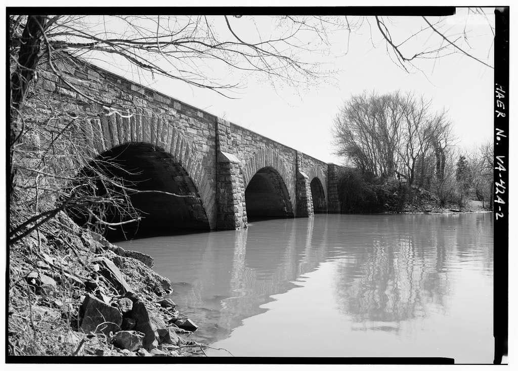
Hunting Creek Bridge
HAER Photo by Jet Lowe
![]()
Status: Open to traffic
Location: 38.712817,-77.074099
Carries George Washington Memorial Parkway over Little Hunting Creek
Design: arch/deck/closed
Design Details: Closed-spandrel arch
Total Length: 71.9 Feet
Span Length: 66.9 Feet
Overview: Concrete arch bridge over Little Hunting Creek on George Washington Memorial Parkway
History: Built 1932
Built: 1932
Location: Fairfax County
View Bridge Information In Wayback Machine
![]()
469151
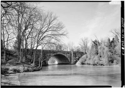
Little Hunting Creek Bridge
looking southwest
HAER Photo by Jet Lowe
469152
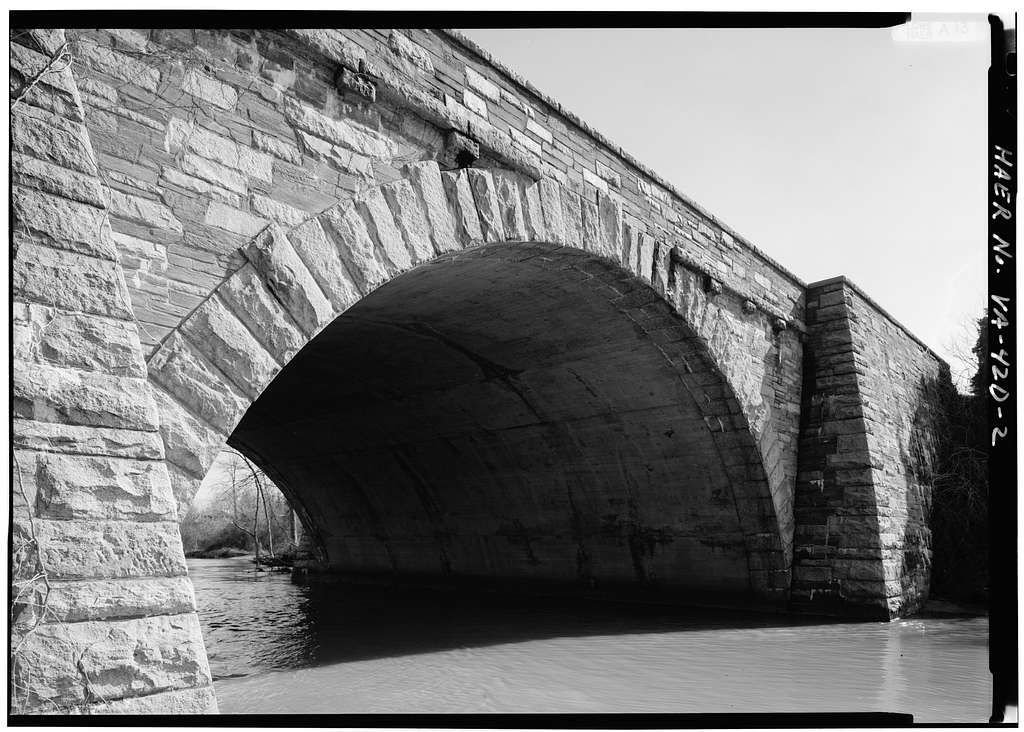
Little Hunting Creek Bridge
looking southwest
HAER Photo by Jet Lowe
![]()
Status: Open to traffic
Location: 38.789444,-77.050833
Carries Mount Vernon Memor over Hunting Creek
Design: arch/deck
Design Details: Arch
Total Length: 152.9 Feet
Span Length: 53.2 Feet
Overview: Concrete arch bridge over Hunting Creek on Mount Vernon Memor in Alexandria
History: Built 1932; rehabilitated 1975
Built: 1932
Location: Fairfax County
View Bridge Information In Wayback Machine
![]()
![]()
Status: Open to traffic
Location: 38.712778,-77.073889
Carries Mount Vernon Memor over Little Hunting Creek
Design: arch/deck
Design Details: Arch
Total Length: 71.9 Feet
Span Length: 66.9 Feet
Overview: Concrete arch bridge over Little Hunting Creek on Mount Vernon Memor
History: Built 1932
Built: 1932
Location: Fairfax County
View Bridge Information In Wayback Machine
![]()
![]()
Status: Open to traffic
Location: 38.715000,-77.046944
Carries Mount Vernon Memorial Road over Fort Hunt Access Road
Design: arch/deck
Design Details: Arch
Total Length: 32.2 Feet
Span Length: 32.2 Feet
Overview: Concrete arch bridge over Fort Hunt Access Road on Mount Vernon Memorial Road in Fort Hunt
History: Built 1932
Built: 1932
Location: Fairfax County
View Bridge Information In Wayback Machine
![]()
![]()
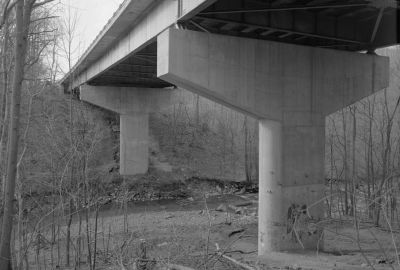
Status: Unknown status
Location: 38.853350,-77.197169
Carries Annandale Road over Holmes Run
Design: beam/tee
Design Details: Tee beam
Total Length: 104.0 Feet
Span Length: 24.9 Feet
Overview: Concrete Tee beam over Holmes Run on Annandale Road
History: Built 1926
Built: 1926
Location: Fairfax County
View Bridge Information In Wayback Machine
![]()
![]()
Status: Open to traffic
Location: 38.964339,-77.174128
Carries George Washington Memorial Parkway over Dead Run
Design: girder/deck/plate
Design Details: Continuous Deck plate girder
Total Length: 307.8 Feet
Span Length: 112.9 Feet
Overview: Deck plate girder bridge over Dead Run on George Washington Memorial Parkway
History: Built 1963
Built: 1963
Location: Fairfax County
View Bridge Information In Wayback Machine
![]()
312584
Underside View With Piers And Steel Girders From Below Looking Northwest
Photo taken for the Historic American Engineering Record
312585
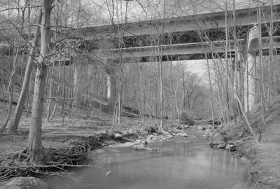
South Elevation From Dead Run Below Looking North
Photo taken for the Historic American Engineering Record
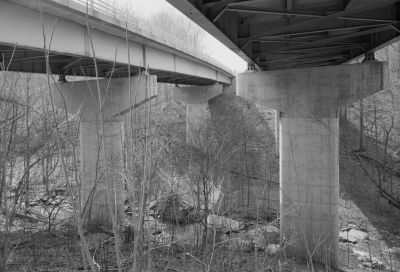
![]()
Status: Open to traffic
Location: 38.963500,-77.157778
Carries Gwmp over Turkey Run & Park Access
Design: girder/deck/plate
Design Details: Deck plate girder
Total Length: 404.9 Feet
Span Length: 107.9 Feet
Overview: Deck plate girder bridge over Turkey Run & Park Access on Gwmp
History: Built 1961; rehabilitated 1998
Built: 1961
Location: Fairfax County
View Bridge Information In Wayback Machine
![]()
312586
Southwest Side And Underside Looking Northeast From Turkey Run Access Road Below
Photo taken for the Historic American Engineering Record
![]()
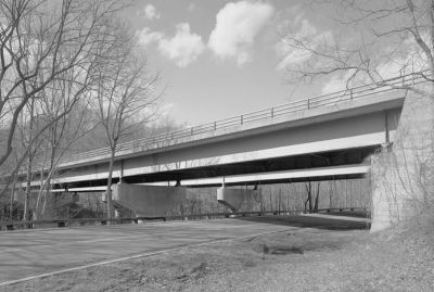
Status: Open to traffic
Location: 38.939083,-77.134056
Carries Va Route 123 over Gwmp
Design: beam/stringer/concrete
Design Details: Concrete stringer
Total Length: 169.3 Feet
Span Length: 111.9 Feet
Overview: Concrete stringer bridge over Gwmp on Va Route 123
History: Built 1959; rehabilitated 1985
Built: 1959
Location: Fairfax County
View Bridge Information In Wayback Machine
![]()
312587
Southwest Elevation Looking Northeast From George Washington Memorial Parkway
Photo taken for the Historic American Engineering Record
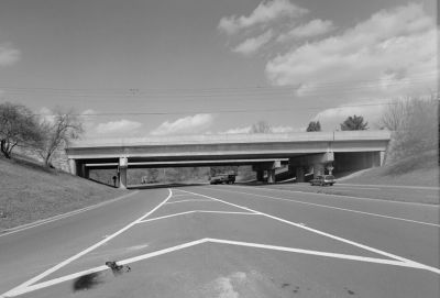
![]()
Status: Open to traffic
Location: 38.931944,-77.124111
Carries Gwmp over Pimmit Run
Design: girder/deck/plate
Design Details: Continuous Deck plate girder
Total Length: 353.0 Feet
Span Length: 130.9 Feet
Overview: Deck plate girder bridge over Pimmit Run on Gwmp
History: Built 1959; rehabilitated 1993
Built: 1959
Location: Fairfax County
View Bridge Information In Wayback Machine
![]()
312588
Underside Of Bridge And Piers Looking Northwest With Pimmit Run
Photo taken for the Historic American Engineering Record
![]()
Status: Open to pedestrians only
Location: 38.705129,-77.247453
Carries Old Furnace Road over Cross County Trail
Design: arch/deck/brick
Design Details: Brick arch
Total Length: 0.0 Feet
Span Length: 0.0 Feet
Overview: Brick arch bridge over Cross County Trail on Old Furnace Road
History: Built 1946
Built: 1946
Location: Fairfax County
View Bridge Information In Wayback Machine
![]()
470700
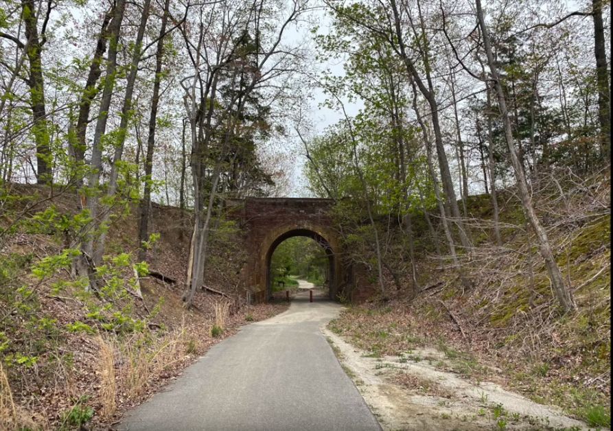
Lorton Barrel Arch Bridge
Screenshot from video by Garret Blum
Photo taken by Garret Blum
![]()
Status: Derelict/abandoned
Location: 38.713441,-77.159505
Carries Former Military Railroad over Beulah Street and Mason Run
Design: arch/deck/closed
Design Details: Closed-spandrel concrete arch
Total Length: 104.0 Feet
Span Length: 24.9 Feet
Overview: Abandoned closed-spandrel arch bridge over Beulah Street on Former Military Railroad
History: Built 1928; Abandoned since 1993
Built: 1928
Location: Fairfax County
View Bridge Information In Wayback Machine
![]()
492892
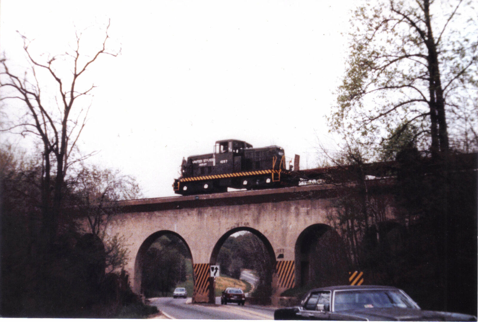
Beulah St Railroad Overpass
US Army loco 1657 takes empties bac to the interchange at Newington, Va. in the 1980s.
Photo taken by Daniel Seymour
![]()
Status: Removed but not replaced
Location: 38.708611,-77.154658
Carries USAX over Route 1
Design: beam/stringer/steel
Design Details: Steel stringer
Total Length: 100.1 Feet
Span Length: 100.1 Feet
Overview: Lost Steel stringer bridge over Route 1 on USAX
History: Built 1935; Removed 2014
Built: 1935
Location: Fairfax County
View Bridge Information In Wayback Machine
![]()
![]()
Status: Abandoned
Location: 38.732708,-77.184654
Carries USAX over Cinder Bed Road
Design: beam/stringer/steel
Design Details: Steel stringer
Total Length: 0.0 Feet
Span Length: 0.0 Feet
Overview: Abandoned steel stringer bridge over Cinder Bed Road on USAX
History: Built 1942
Built: 1942
Location: Fairfax County
View Bridge Information In Wayback Machine
![]()
492898
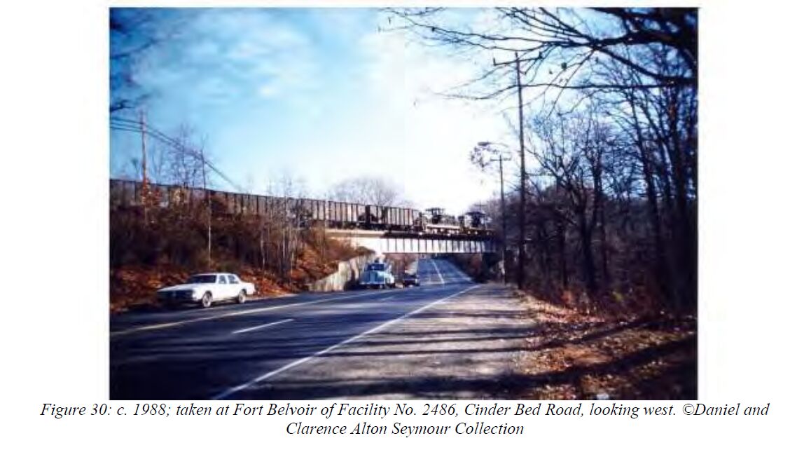
Photo taken by Daniel Seymour; Courtesy of the Virginia Department of Historic Resources
492899
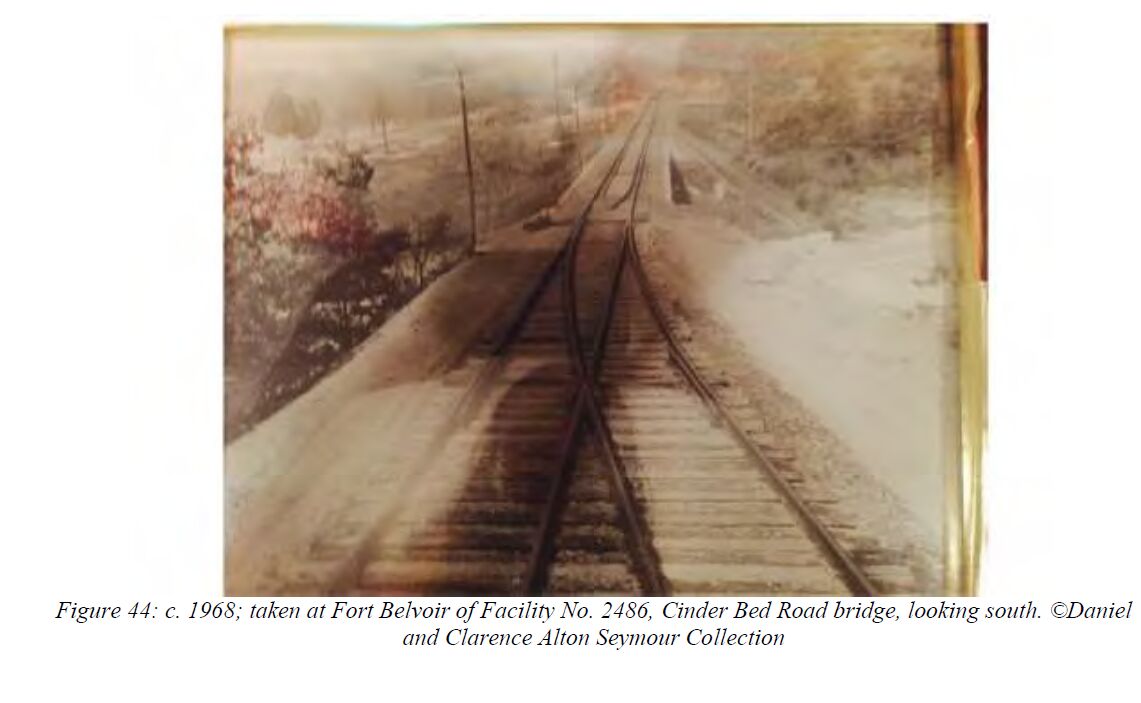
Photo taken by Daniel Seymour; Courtesy of the Virginia Department of Historic Resources
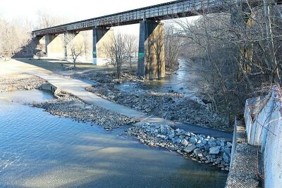
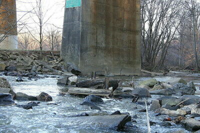
![]()
Status: Open to traffic
Location: 38.796601,-77.183132
Carries Norfolk Southern Railroad over Backlick Run
Design: unknown
Design Details:
Total Length: 0.0 Feet
Span Length: 0.0 Feet
Overview: Bridge over Backlick Run on Norfolk Southern Railroad
History:
Built:
Location: Fairfax County
View Bridge Information In Wayback Machine
![]()
512303
File:Backlick Run upstream rail bridge 2020.jpg
Antony-22
![]()
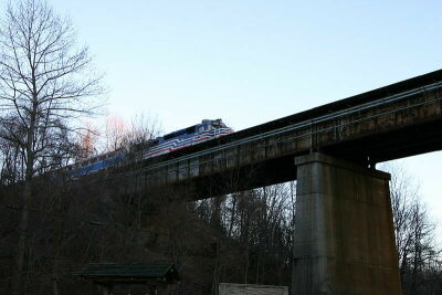
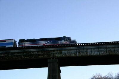
Status: Open to traffic
Location: 38.792709,-77.218382
Carries Norfolk Southern Railroad over Accotink Creek
Design: girder/deck/plate
Design Details: Deck plate girder
Total Length: 0.0 Feet
Span Length: 0.0 Feet
Overview: Deck plate girder bridge over Accotink Creek on Norfolk Southern Railroad
History:
Built:
Location: Fairfax County
View Bridge Information In Wayback Machine
![]()
512304
File:Accotink Creek O&A Trestle 2020.jpg
Antony-22
512305

Accotink Loop Trail lower crossing 2021.jpg
Antony-22
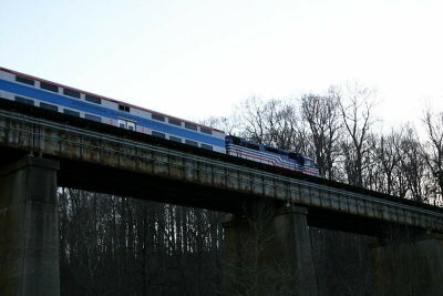
512306

C&O George Washington on Accotink Creek bridge, November 16, 1969 (24833080774).jpg
Roger Puta
512307

Lake Accotink IMG 9302 (2265501531).jpg
Antony-22
512308

Lake Accotink IMG 9303 (2266292250).jpg
Antony-22
512309

Lake Accotink IMG 9308 (2266286140).jpg
Antony-22
512310

Lake Accotink IMG 9309 (2265496557).jpg
Antony-22
512311

Lake Accotink IMG 9310 (2265495533).jpg
Antony-22
512312
File:Lake Accotink IMG 9302 (2265501531).jpg
Jimsohn1
512313
File:Accotink Loop Trail lower crossing 2021.jpg
Antony-22
512314

File:C&O George Washington on Accotink Creek bridge, November 16, 1969 (24833080774).jpg
Roger Puta
512315
File:Lake Accotink IMG 9303 (2266292250).jpg
Jimsohn-1
512316
File:Lake Accotink IMG 9308 (2266286140).jpg
Jimsohn1
512317
File:Lake Accotink IMG 9309 (2265496557).jpg
Jimsohn1
512318
File:Lake Accotink IMG 9310 (2265495533).jpg
Jimsohn1
Special Bridge Conditions Legend: R - Former location of relocated bridge. ! - At risk for demolition or destruction. X - Confirmed demolished or collapsed. S - Dismantled and/or in storage. L - Severe loss of historic integrity due to alteration.
![]()

![]()