![]()
![]()
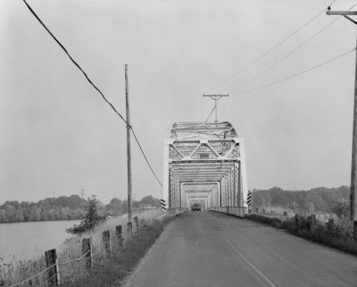
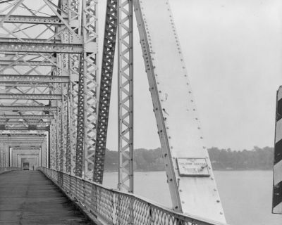
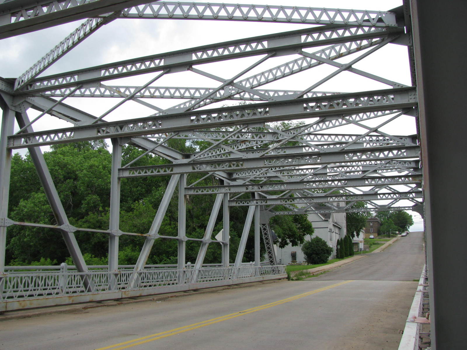
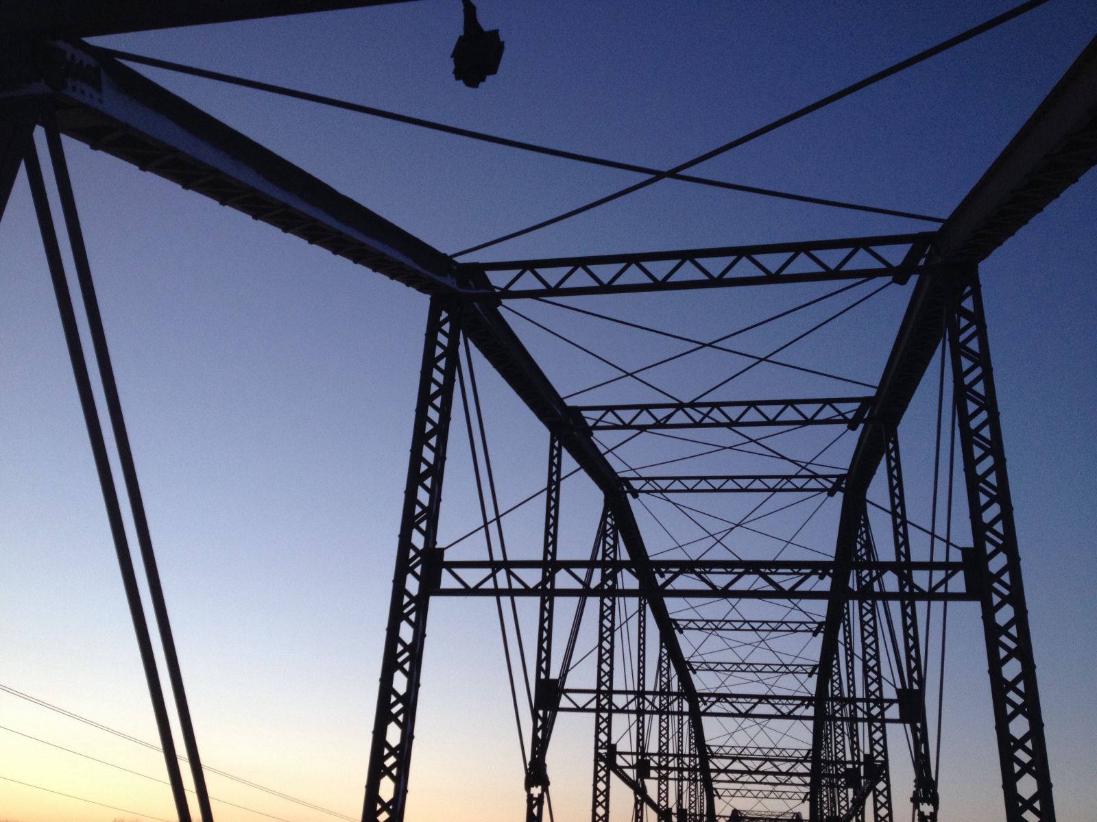
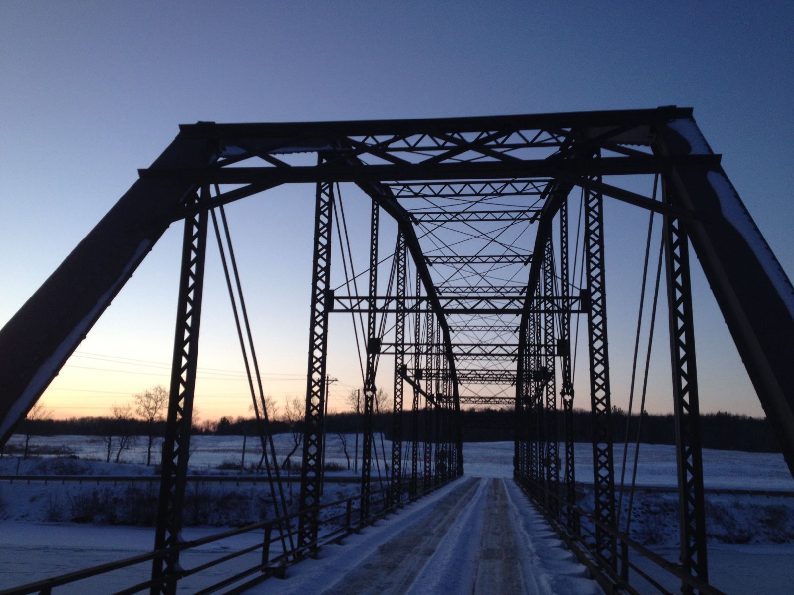
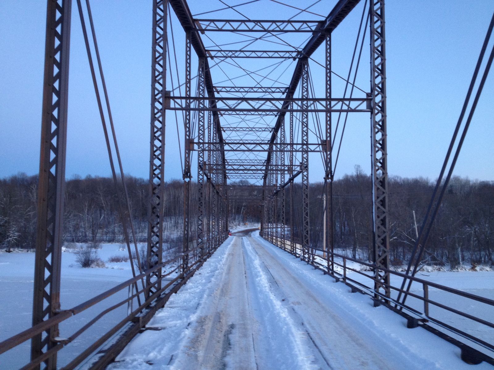
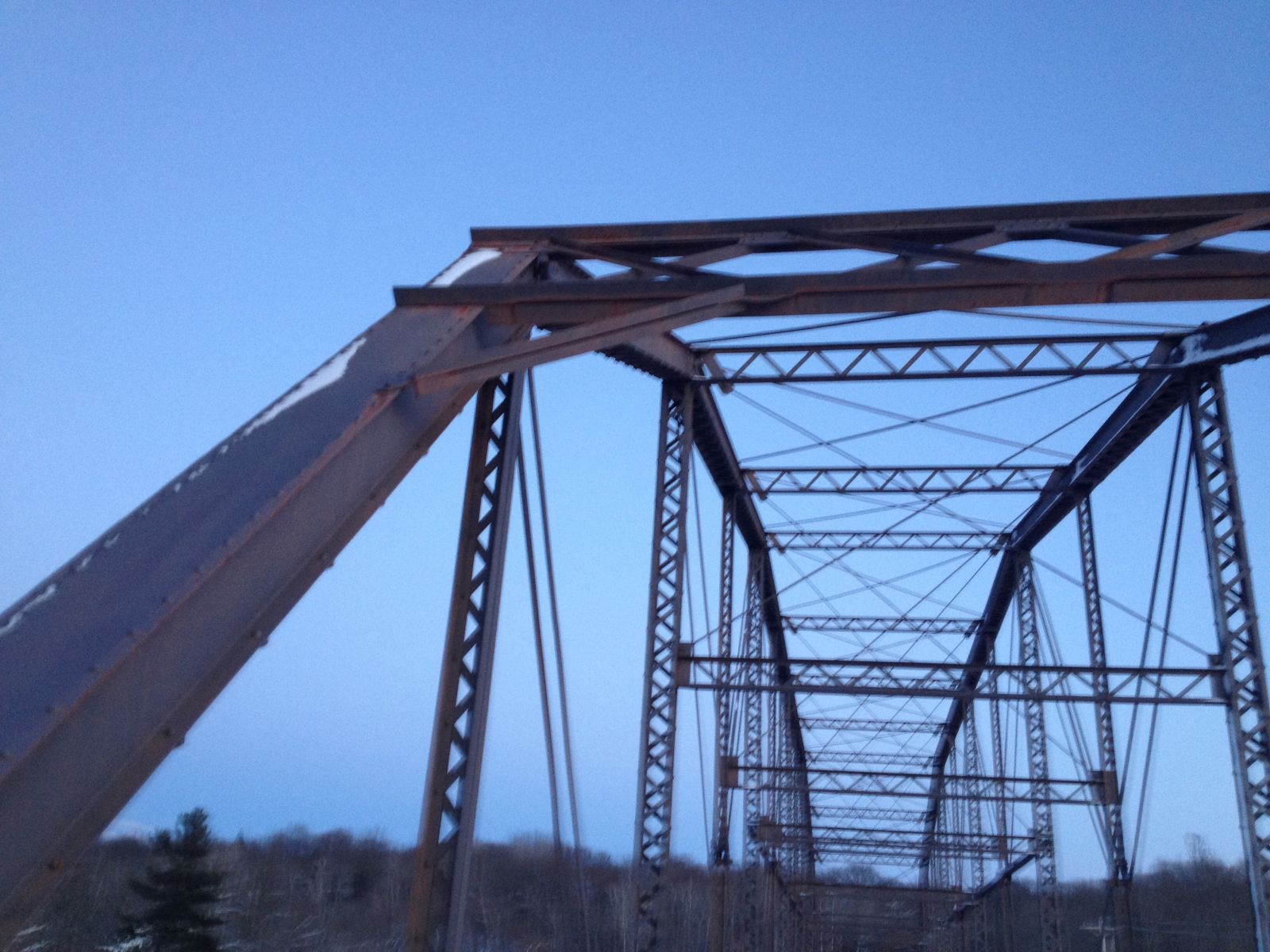
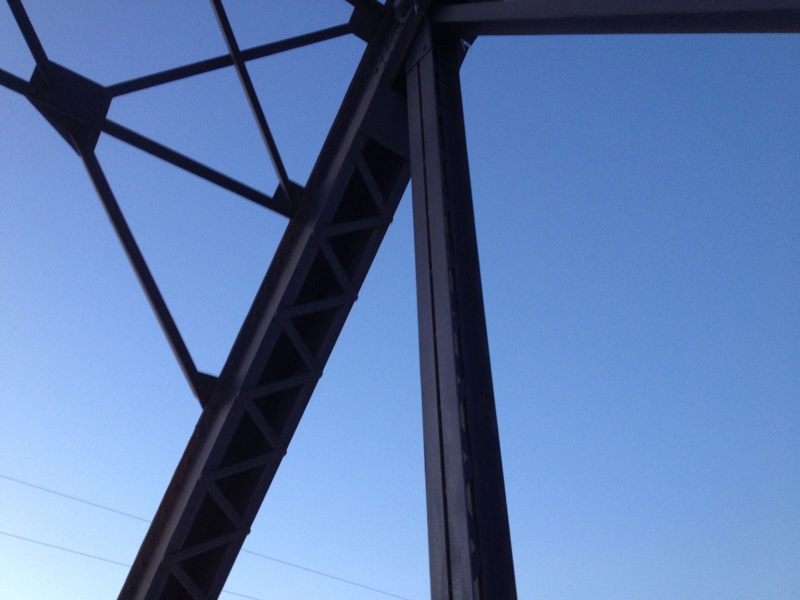
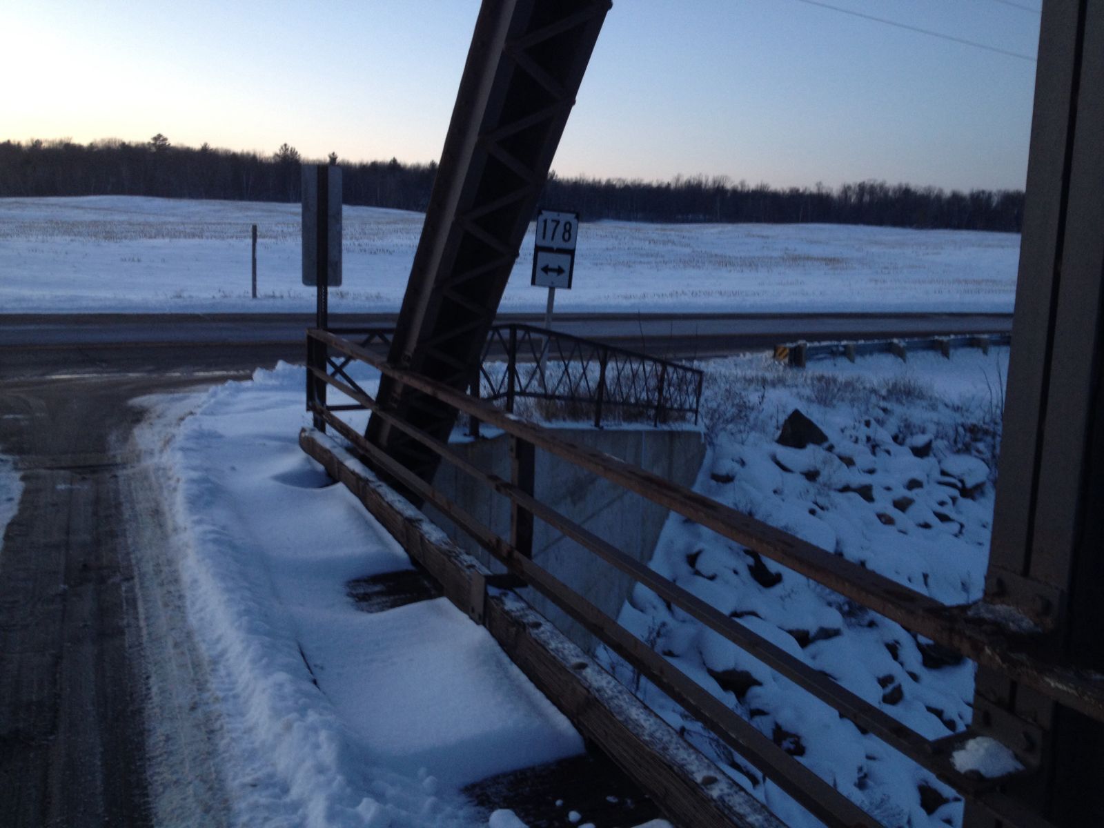
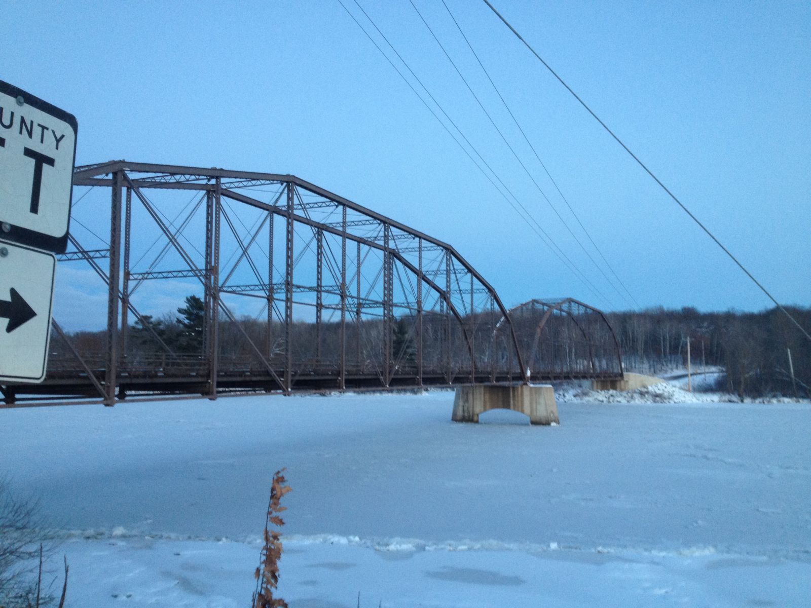
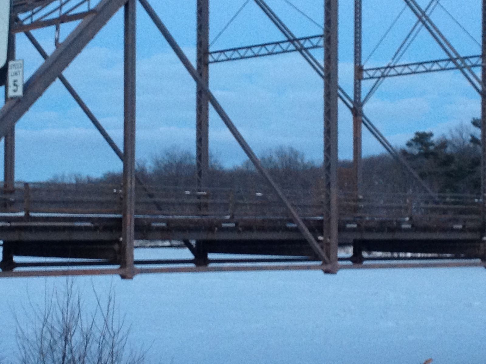
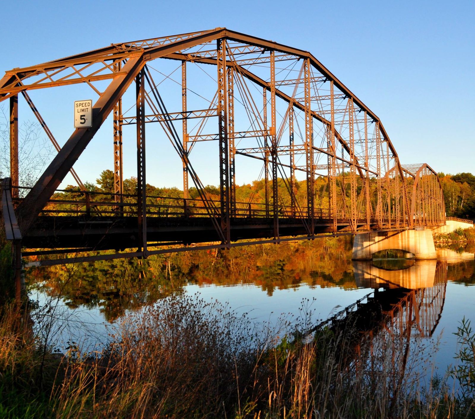
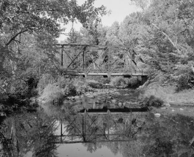
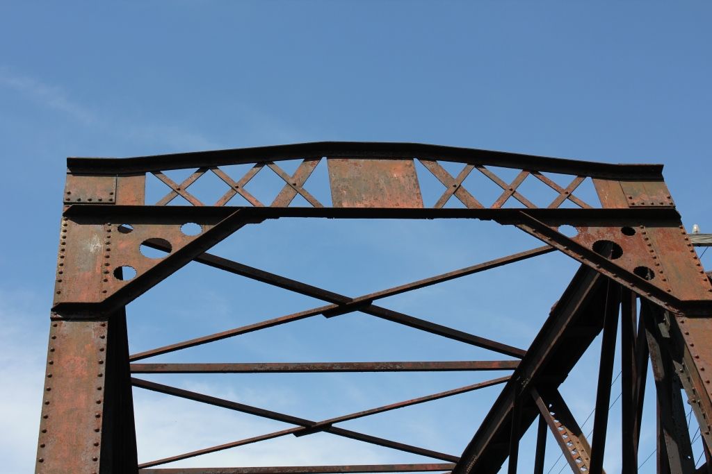
Status: Replaced by new bridge
Location: 44.976000,-91.342450
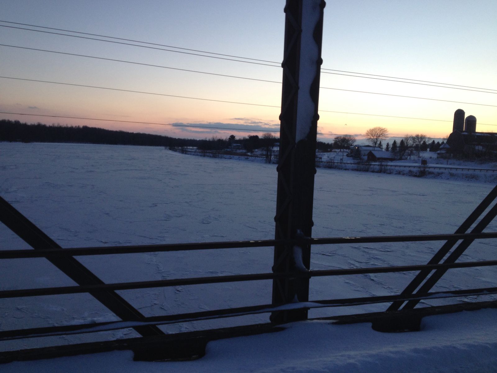
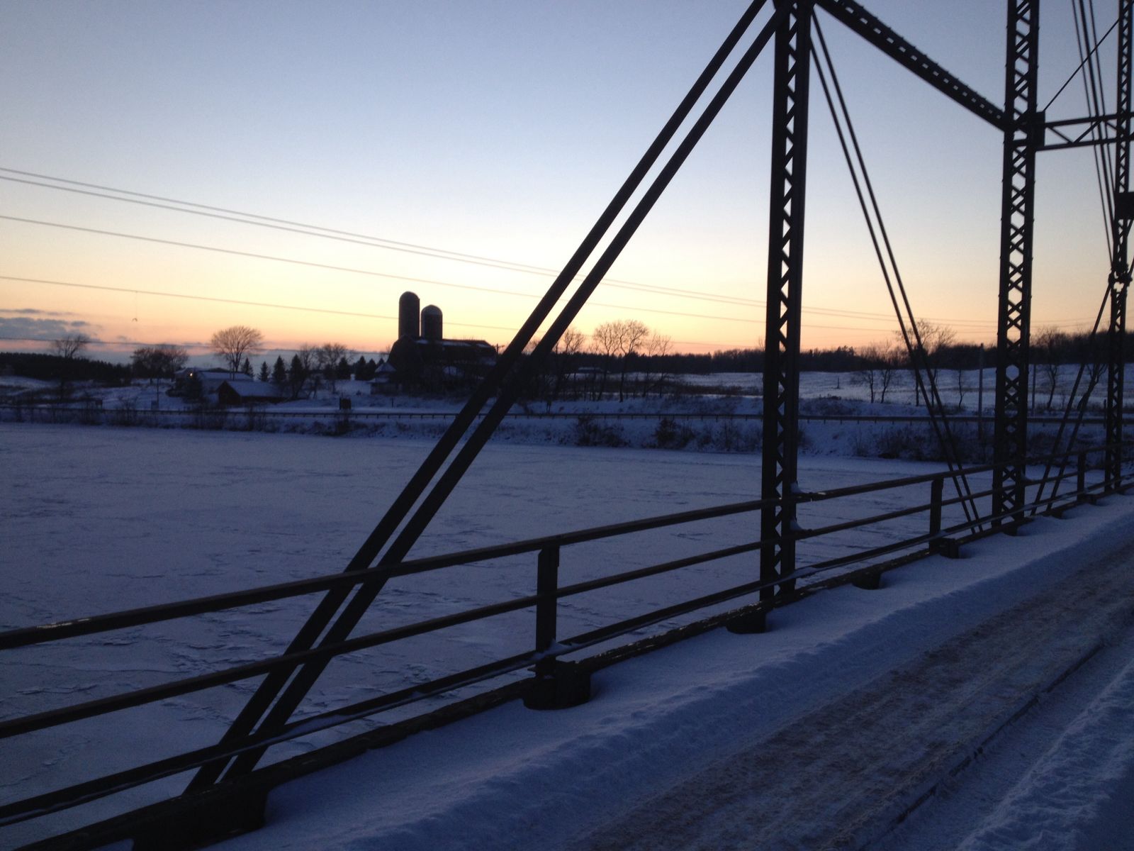
Carries CTH S over Lake Wissota
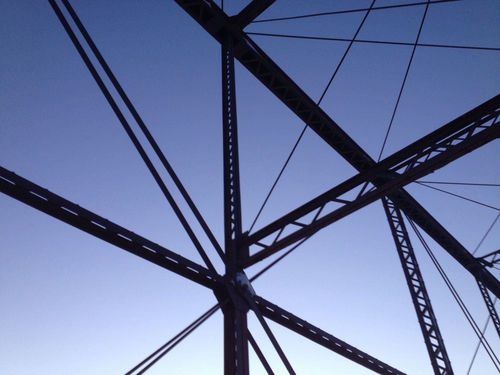
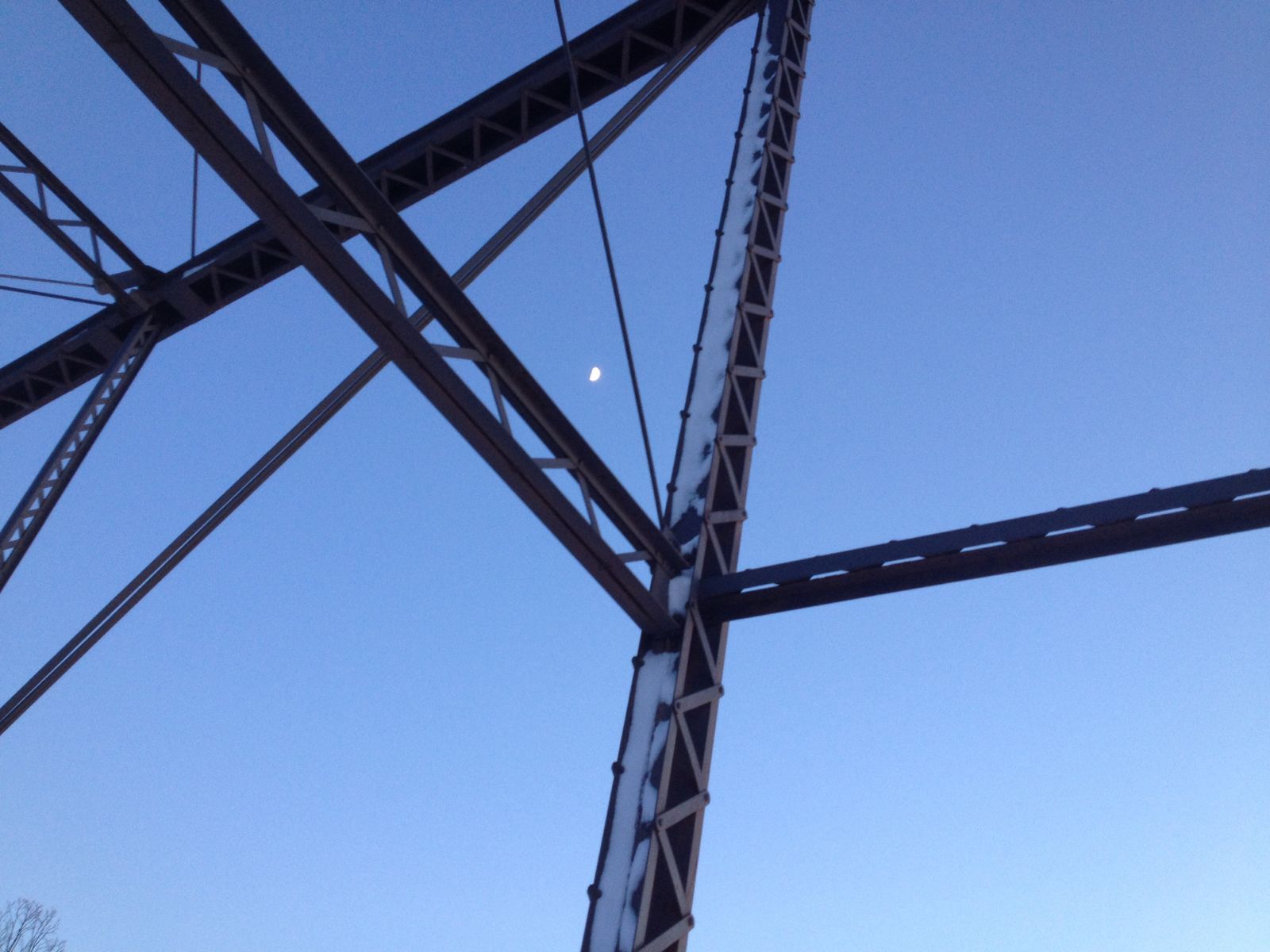
Design: truss/through/parker
Design Details: Four span riveted Parker overhead truss bridge.
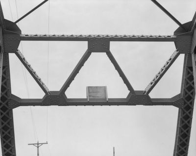
"The four-span Lake Wissota Bridge, built in 1916, was the oldest of the seventeen Parker overhead trusses with riveted connections and built-up members identified in a 1982 survey. Of these Parker trusses, the Lake Wissota Bridge was the only one with roller-nest expansion bearings."
Thanks to R.S. Newbery, Wisconsin DOT.
Trivia: Lake Wissota is mentioned by the main character in the movie Titanic which is an anachronism because the dam that formed Lake Wissota was not constructed until 1918.
Total Length: 745.5 Feet
Span Length: 185.0 Feet
Overview: Lost Parker through truss bridge over Lake Wissota on CTH S near Chippewa Falls
History: Built 1916 by Toldeo Bridge & Crane Co.; Replaced 1986
Built: 1916
Location: Chippewa County
View Bridge Information In Wayback Machine
![]()
119700
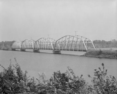
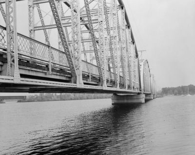
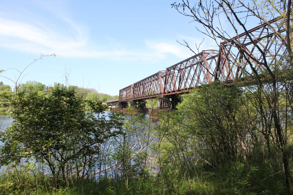
General Setting Looking Northeast From South Shore
Photo taken by Mary Sanford, Sept. 1983 for HAER
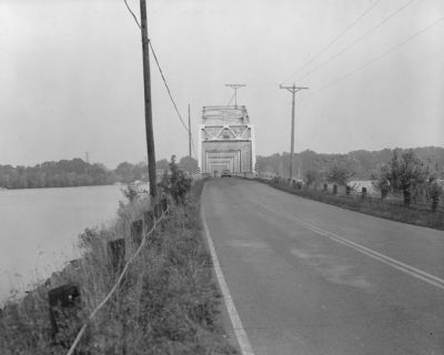
119701
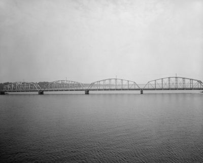
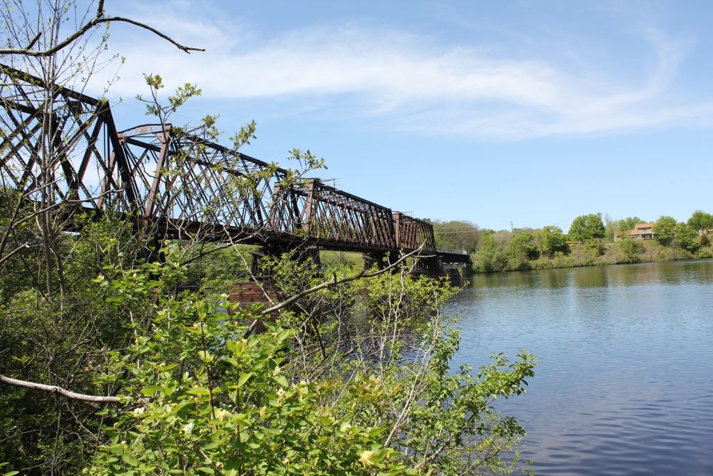
General Setting Looking E-Ne From Railroad Trestle
Photo taken by Mary Sanford, Sept. 1983 for HAER
119702
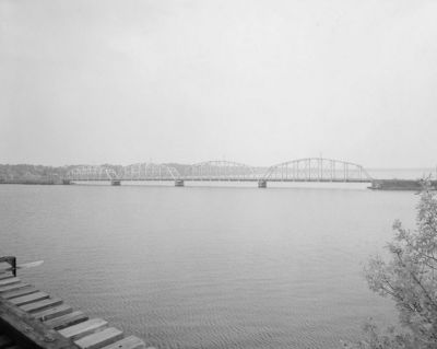
General Setting Looking East From Railroad Trestle
Photo taken by Mary Sanford, Sept. 1983 for HAER
119703
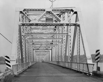
Close-Up Barrel View Looking North
Photo taken by Mary Sanford, Sept. 1983 for HAER
119704
Barrel View Looking North From South Approach
Photo taken by Mary Sanford, Sept. 1983 for HAER
119705
Distant Barrel View Looking North
Photo taken by Mary Sanford, Sept. 1983 for HAER
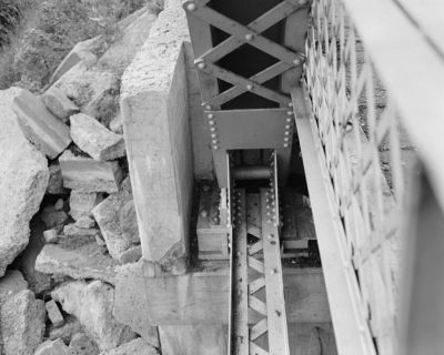
119706
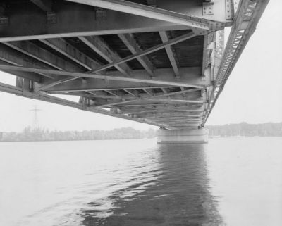
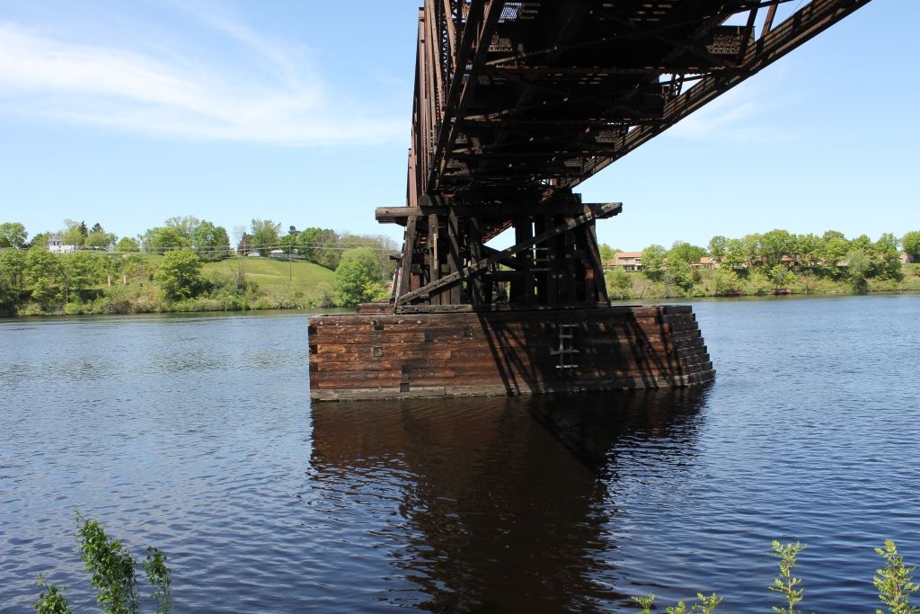
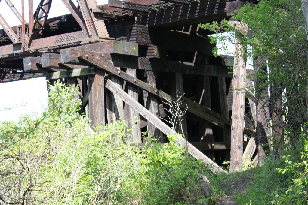
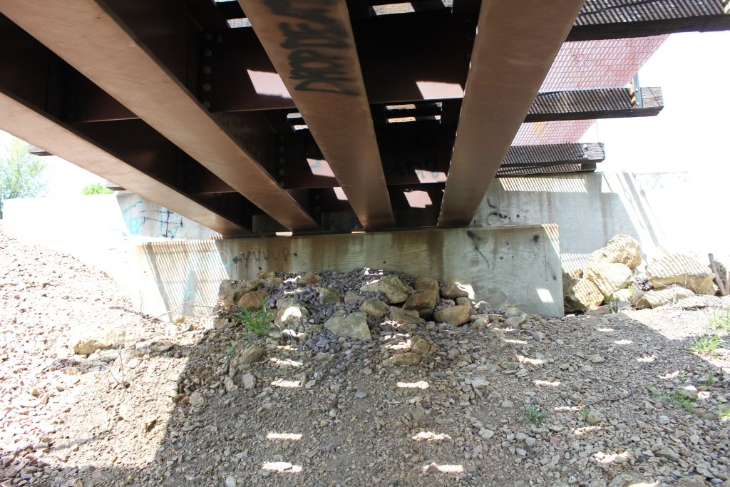
Underside, Looking North From South Abutment
Photo taken by Mary Sanford, Sept. 1983 for HAER
119707
Detail Of East Lower Chord, Looking North
Photo taken by Mary Sanford, Sept. 1983 for HAER
119708
South End Sway Bracing, Looking South
Photo taken by Mary Sanford, Sept. 1983 for HAER
119709
Detail Of West Top Chord, Center Of Span, Looking Nw
Photo taken by Mary Sanford, Sept. 1983 for HAER
119710
Detail Of Top Chord, South End, Looking Southwest
Photo taken by Mary Sanford, Sept. 1983 for HAER
119711
Detail Of West Top Chord, Looking West
Photo taken by Mary Sanford, Sept. 1983 for HAER
119712
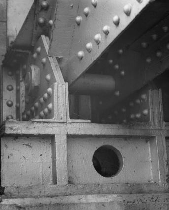
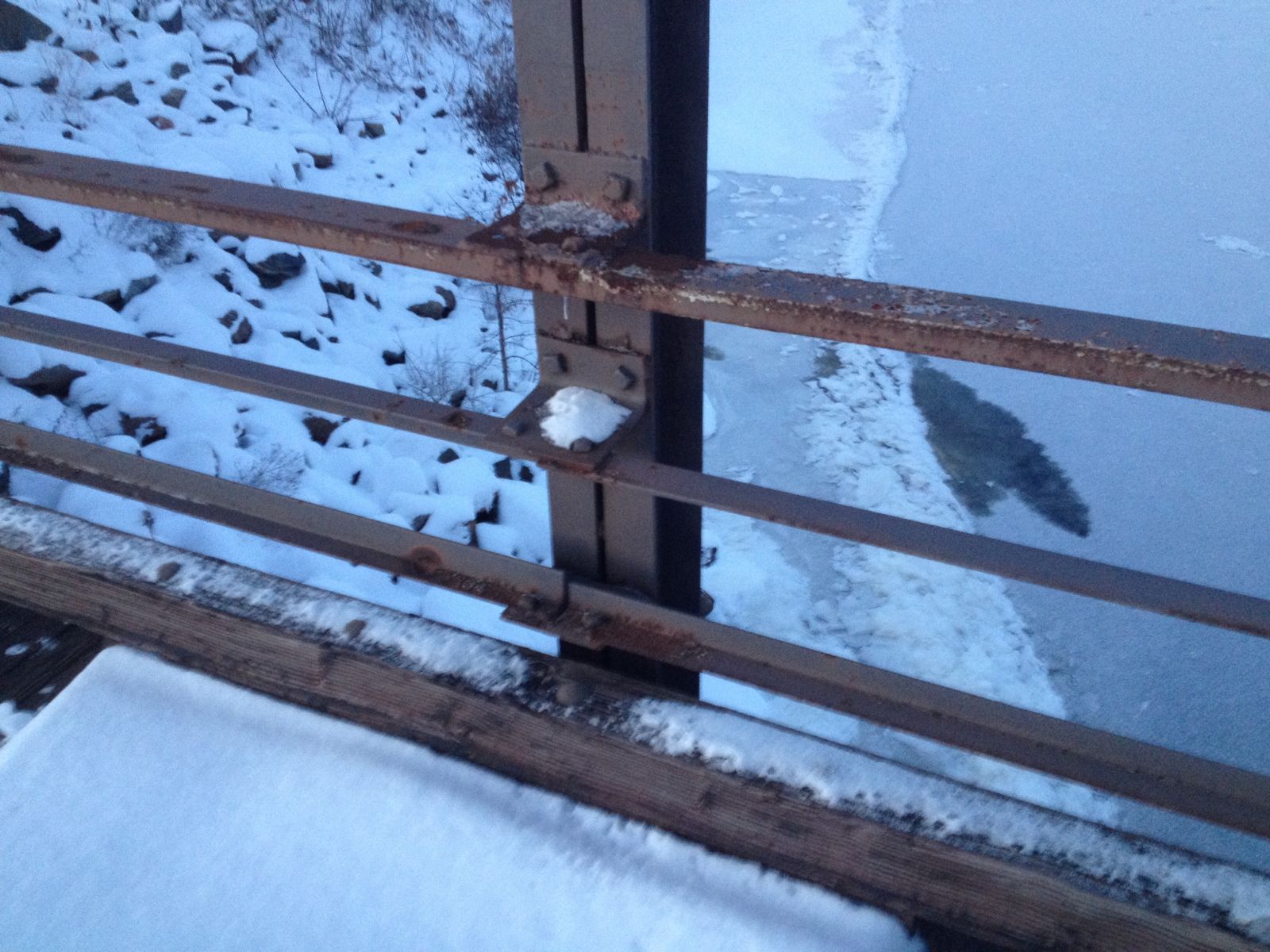
Detail Of Se Expansion Bearing, Looking South
Photo taken by Mary Sanford, Sept. 1983 for HAER
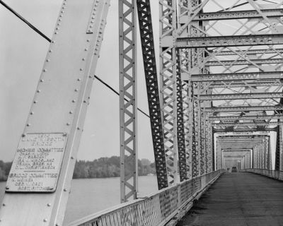
119713
General View, East Side, Looking North-Northwest
Photo taken by Mary Sanford, Sept. 1983 for HAER
119714
Southeast Bearing And Lower Chord, Looking South
Photo taken by Mary Sanford, Sept. 1983 for HAER
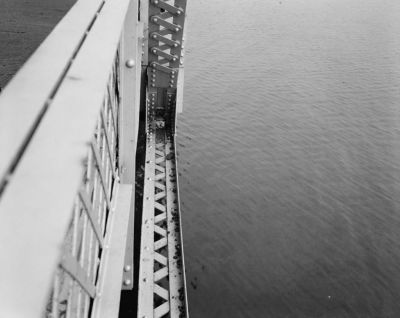
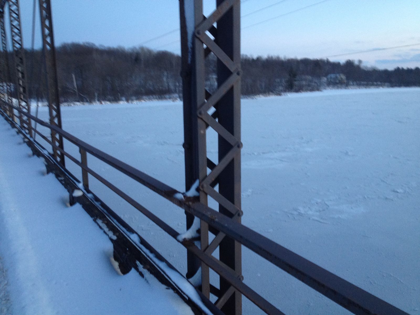
119715
Close-Up View, West Railing Looking North-Northwest
Photo taken by Mary Sanford, Sept. 1983 for HAER
119716
Close-Up View, East Railing Looking North-Northeast
Photo taken by Mary Sanford, Sept. 1983 for HAER
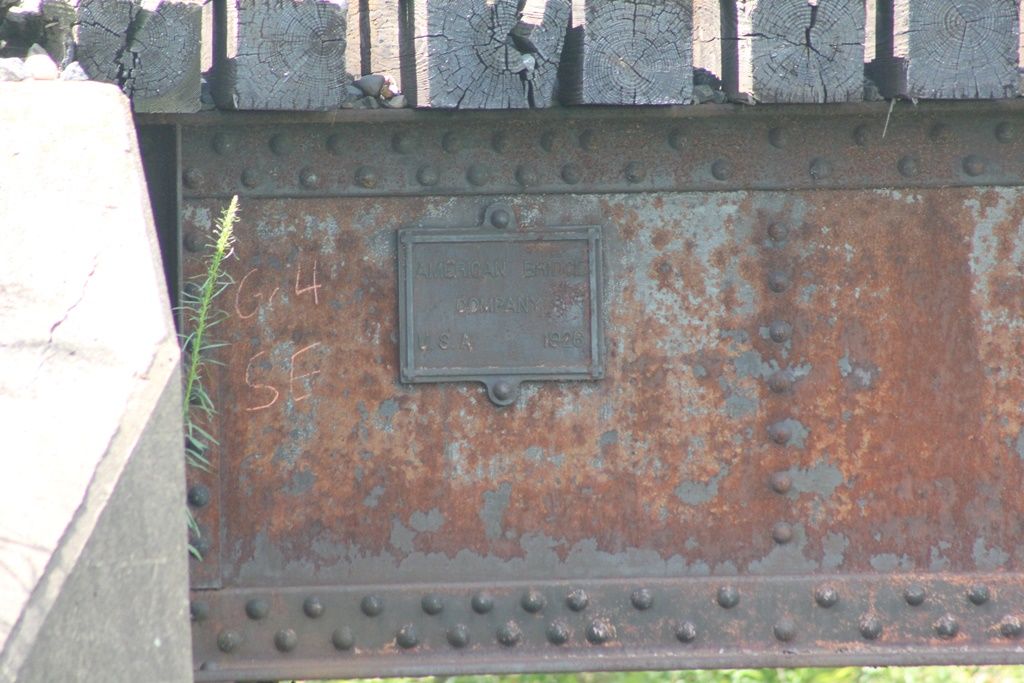
501591

Anson Bridge
Photo from old postcard
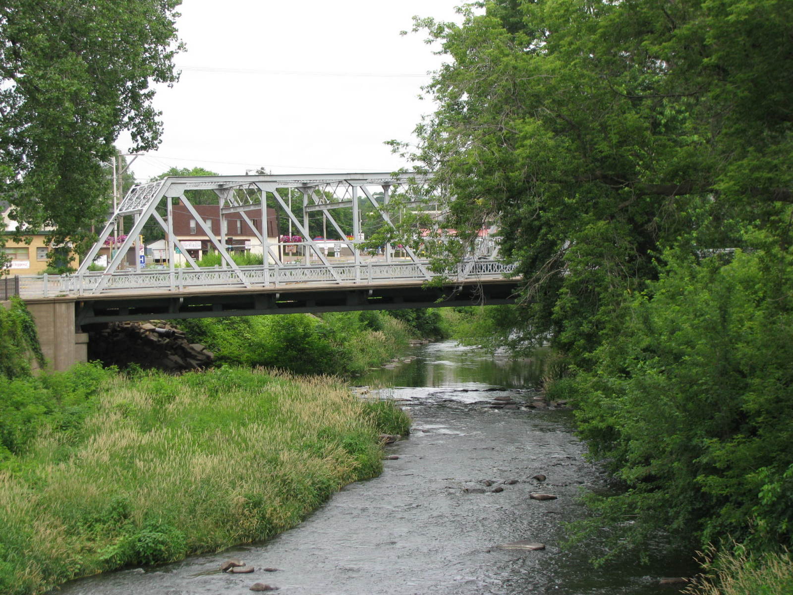
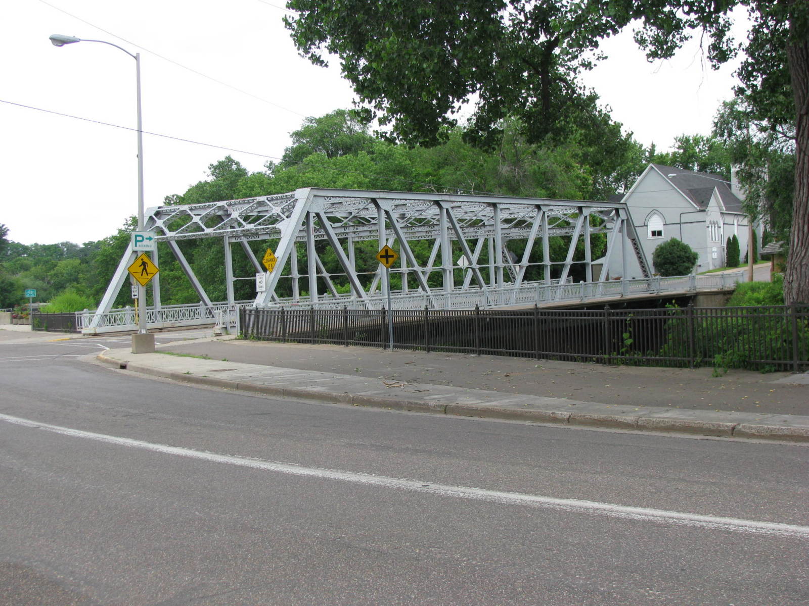
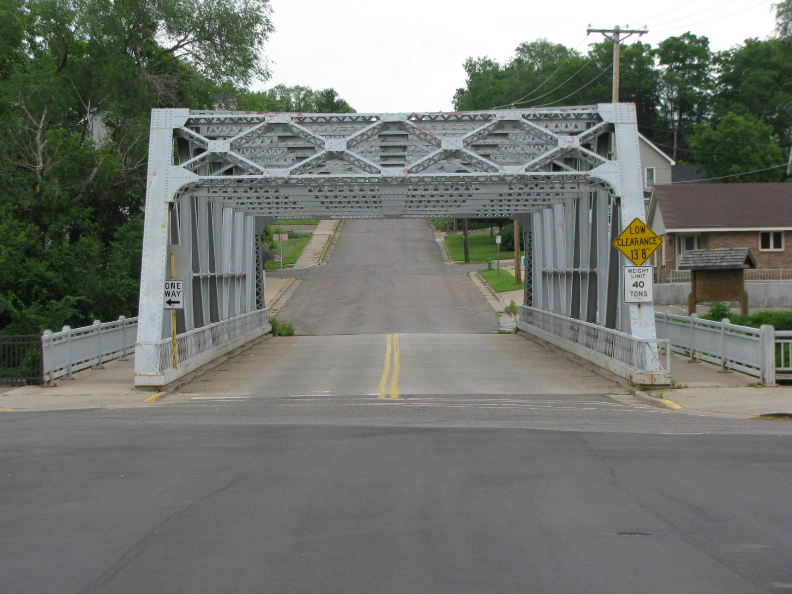
![]()
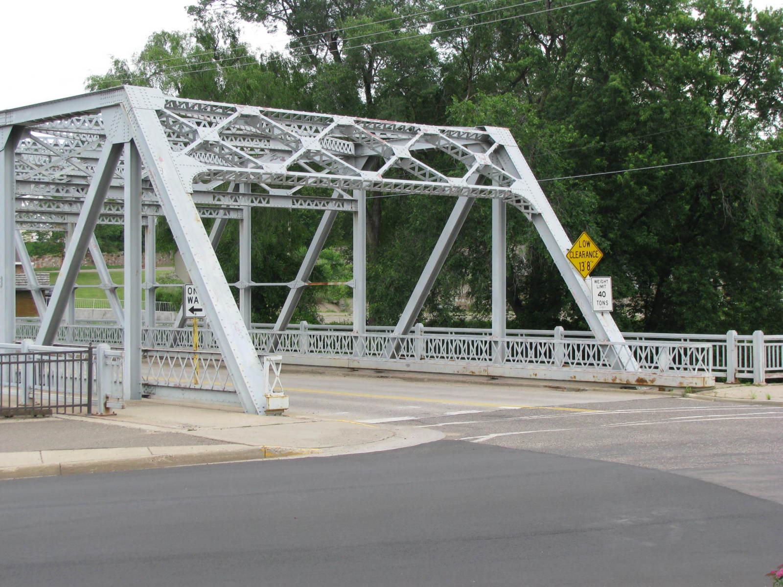
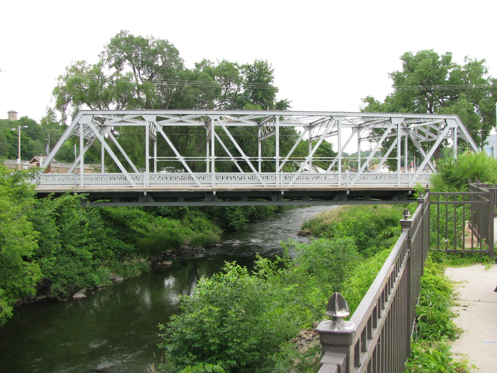
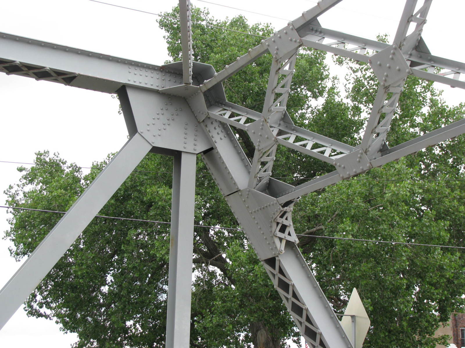
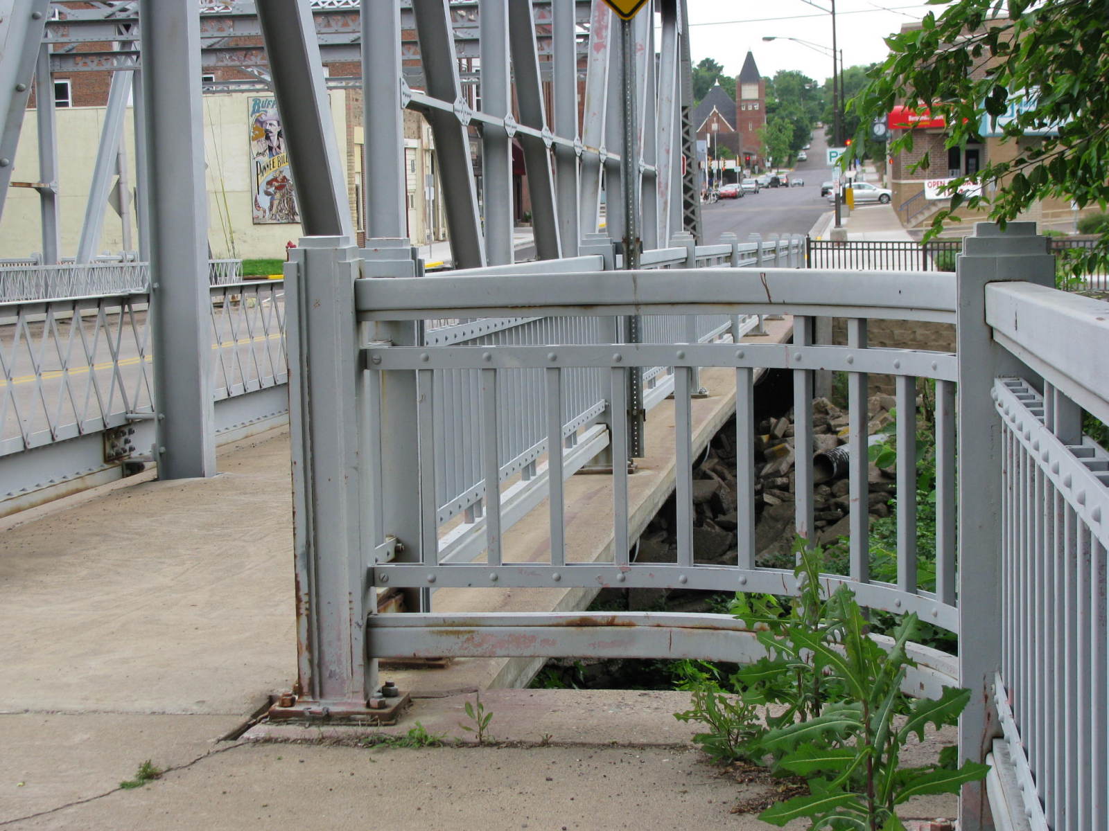
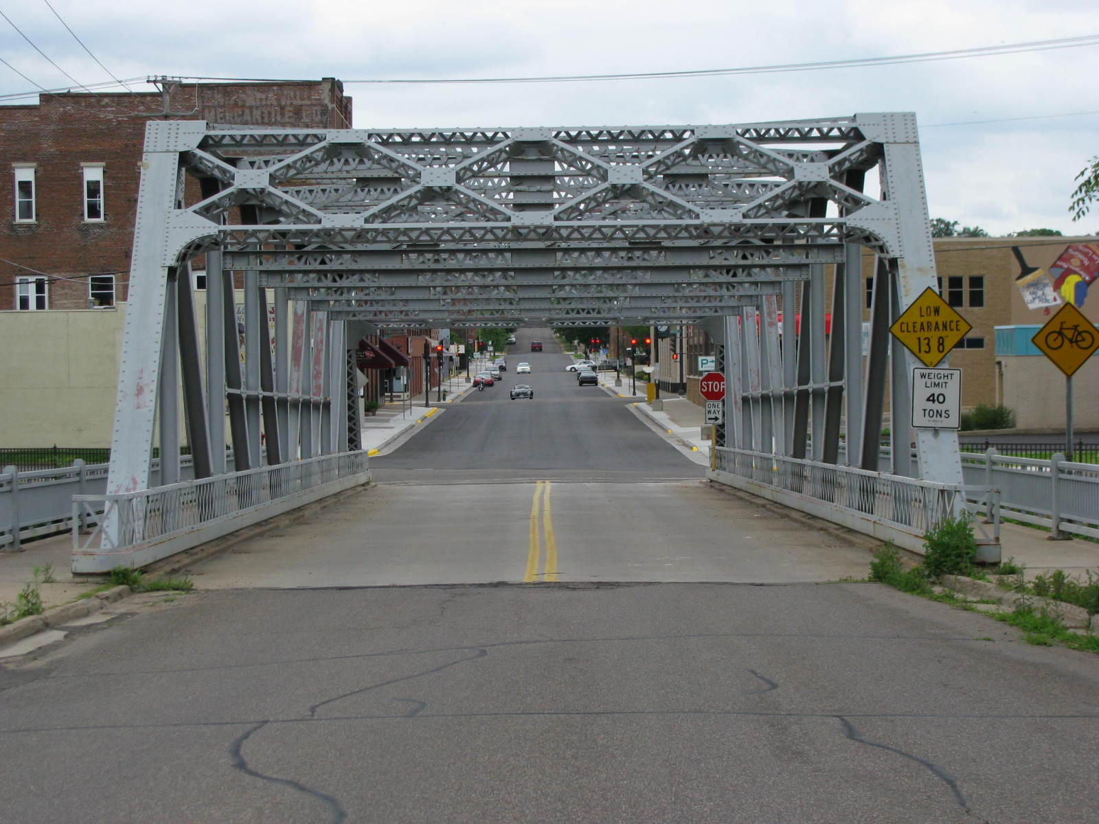
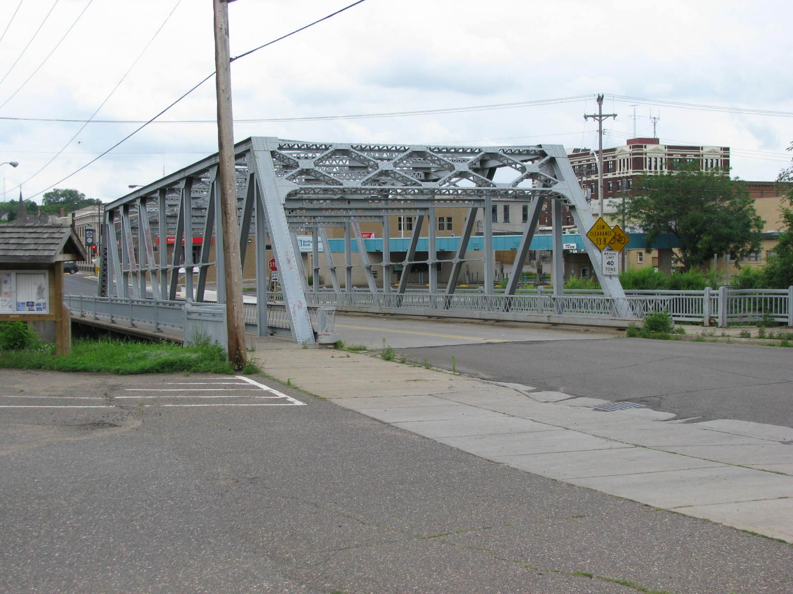
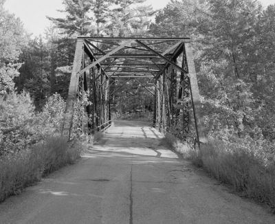
Status: Open to traffic
Location: 44.937120,-91.391220
Carries Central Street over Duncan Creek
Design: truss/through/pratt
Design Details: Riveted, 8-panel Pratt through truss
Total Length: 134.8 Feet
Span Length: 130.3 Feet
Overview: Through truss bridge over Duncan Creek on Central Street in Chippewa Falls
History: Built 1934
Built: 1934
Location: Chippewa County
View Bridge Information In Wayback Machine
![]()
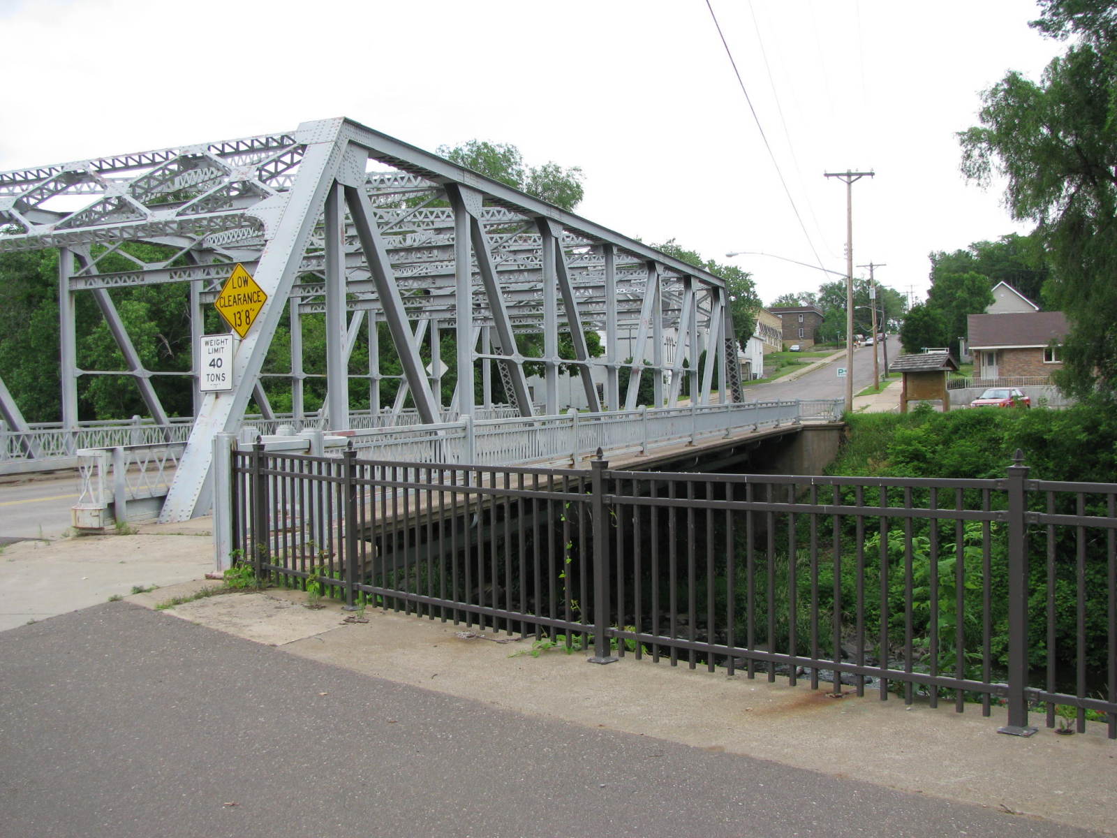
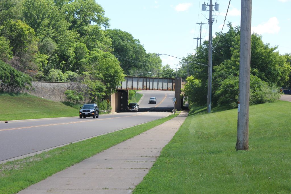
142436
South Elevation
Photo taken by J.R. Manning in July 2009
142437
Oblique View Looking Northeast
Photo taken by J.R. Manning in July 2009
142438
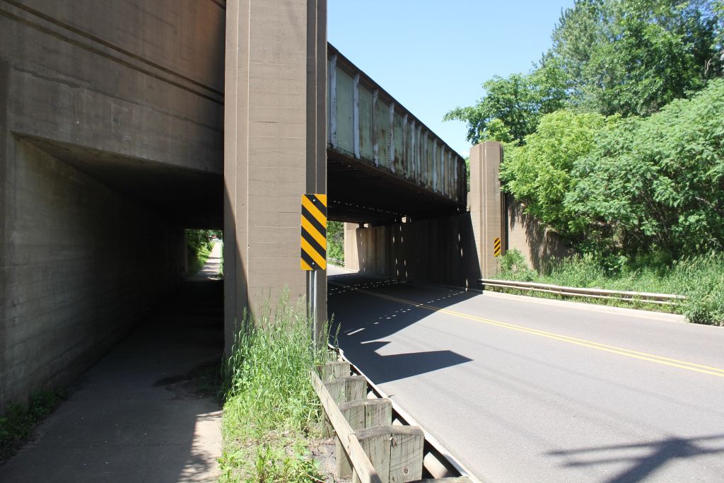
Barrel Shot Looking East
Photo taken by J.R. Manning in July 2009
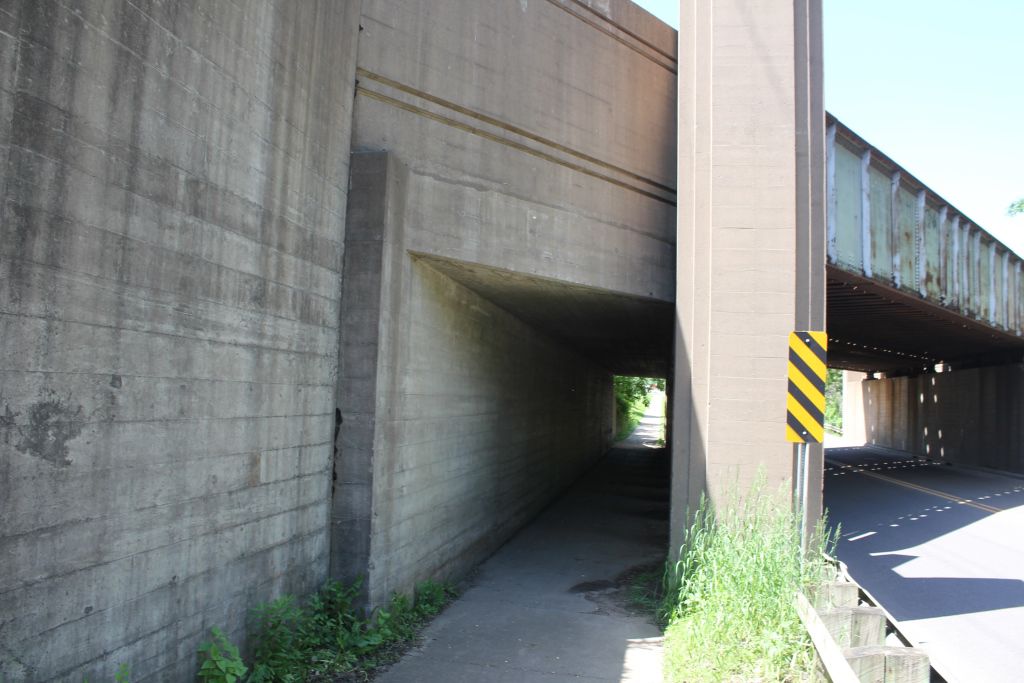
142439
West Portal Looking Southeast
Photo taken by J.R. Manning in July 2009
142440
South Face
Photo taken by J.R. Manning in July 2009
142441
Portal Detail
Photo taken by J.R. Manning in July 2009
142442
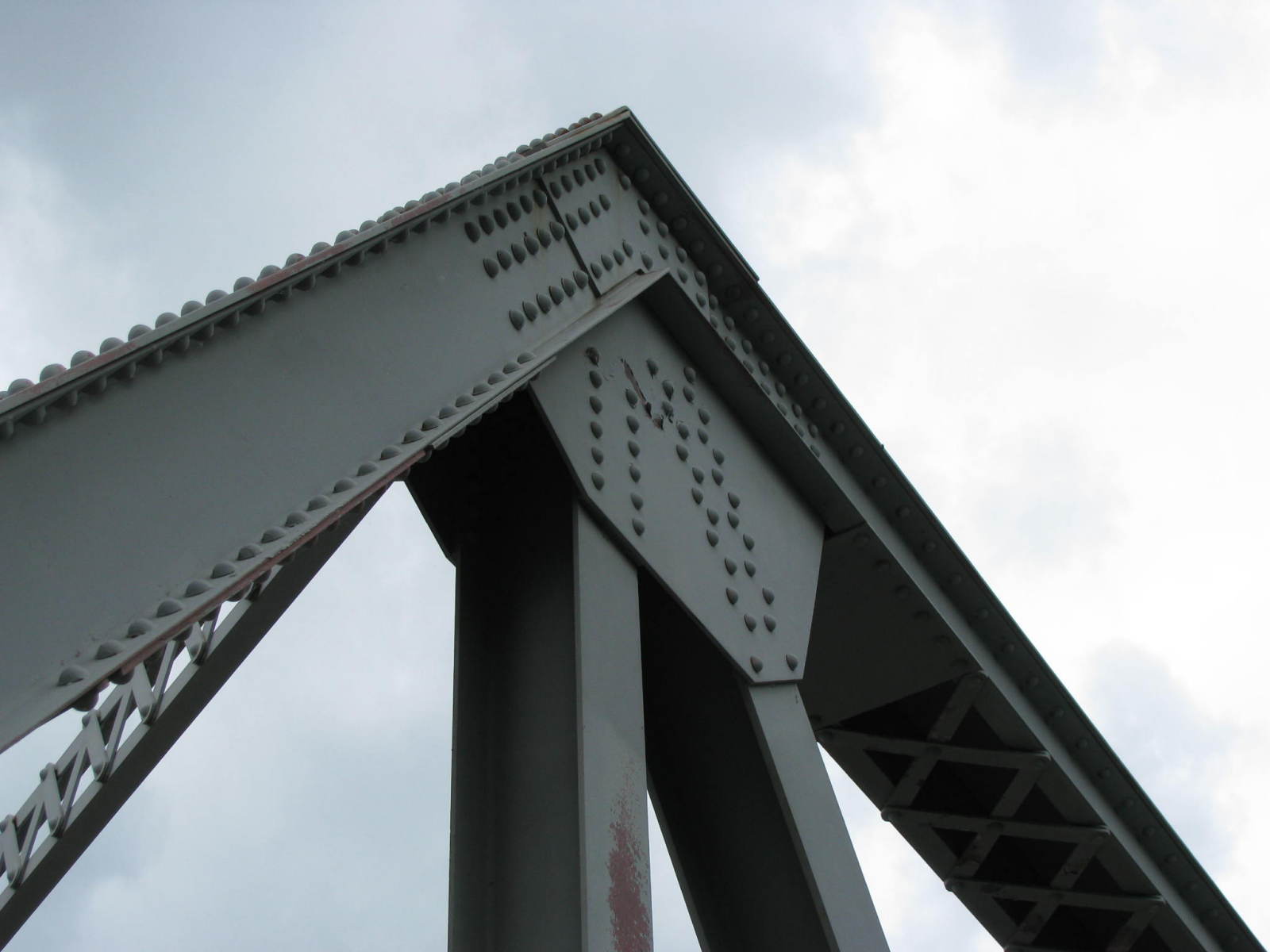
Upper Chord/Portal Joint
Photo taken by J.R. Manning in July 2009
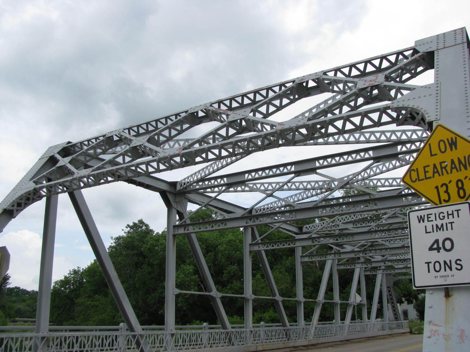
142443
Overhead Truss Detail
Photo taken by J.R. Manning in July 2009
142444
North Elevation
Note the arch of the Spring Street (Marsh Arch) Bridge just one block south.
Photo taken by J.R. Manning in July 2009
142445
Pedestrian Walkway Outrigger
Photo taken by J.R. Manning in July 2009
142446
Bracing Detail
Photo taken by J.R. Manning in July 2009
142447
Portal/Upper Chord Joint
Photo taken by J.R. Manning in July 2009
142448
Railing Detail
Photo taken by J.R. Manning in July 2009
142449
Barrel Shot Looking West
Photo taken by J.R. Manning in July 2009
142450
Oblique View Looking Northwest
The building to the right of the tree is the Chippewa Falls Technology Museum, featuring displays of products "Made in Chippewa Falls" including B.A.Mason Shoes, Leinenkugel's Beer and Cray Supercomputers.
Photo taken by J.R. Manning in July 2009
![]()
Status: Replaced by a new bridge
Location: 44.999257,-91.352206
Carries Chippewa City Drive over O'neil Creek
Design: truss/through/pratt
Design Details: Pratt through truss
Total Length: 73.2 Feet
Span Length: 72.5 Feet
Overview: Pratt through truss bridge over O'neil Creek on Chippewa City Drive
History: Built 1903, Replaced 2003
Built: 1903
Location: Chippewa County
View Bridge Information In Wayback Machine
![]()
![]()
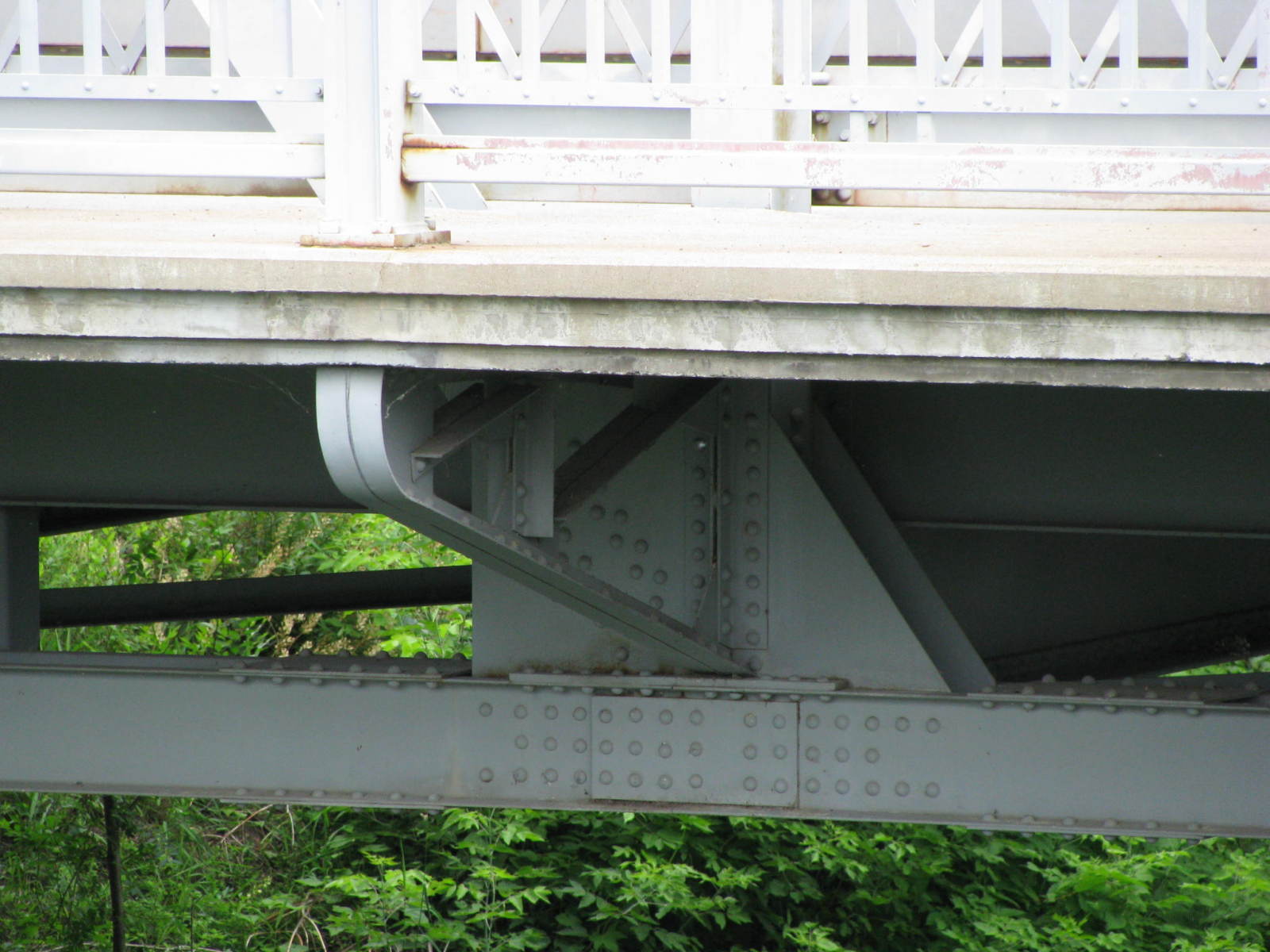
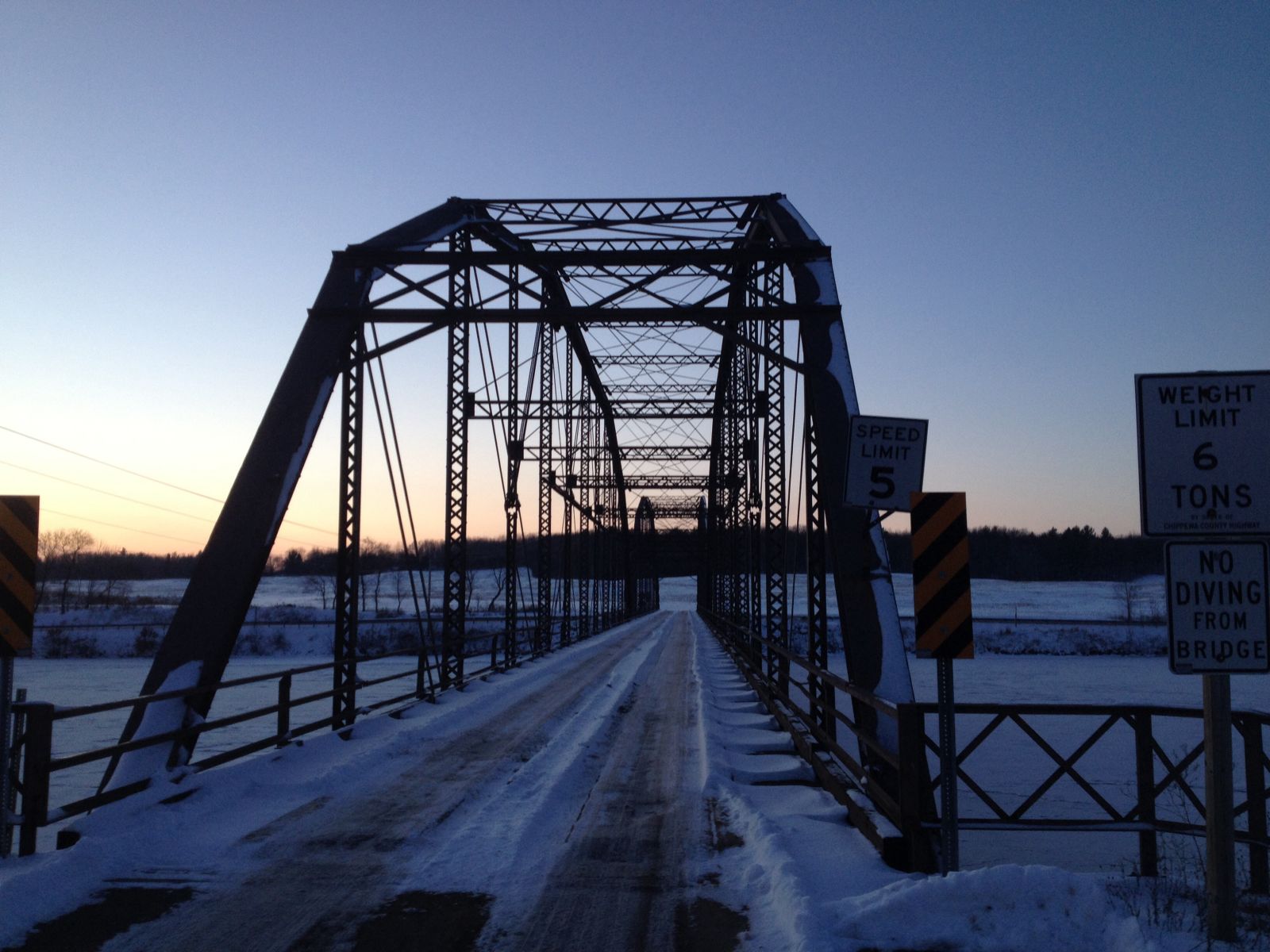
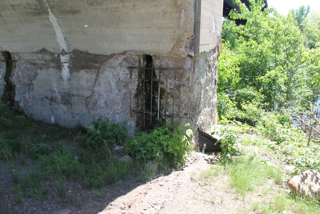
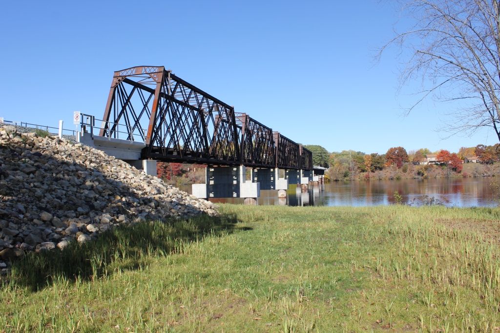
Status: Open to traffic
Location: 45.227600,-91.121000
Carries CTH M over Chippewa River
Design: truss/pony/warren
Design Details: Through truss
Total Length: 797.9 Feet
Span Length: 132.9 Feet
Overview: Continuous Warren pony truss bridge over Chippewa River on CTH M
History: Built 1950
Built: 1950
Location: Chippewa County
View Bridge Information In Wayback Machine
![]()
321147
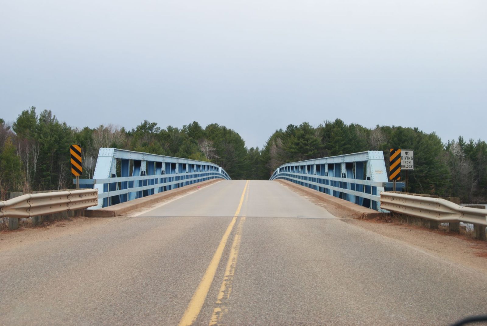
Facing North
Photo taken by Max Koehn in April 2015
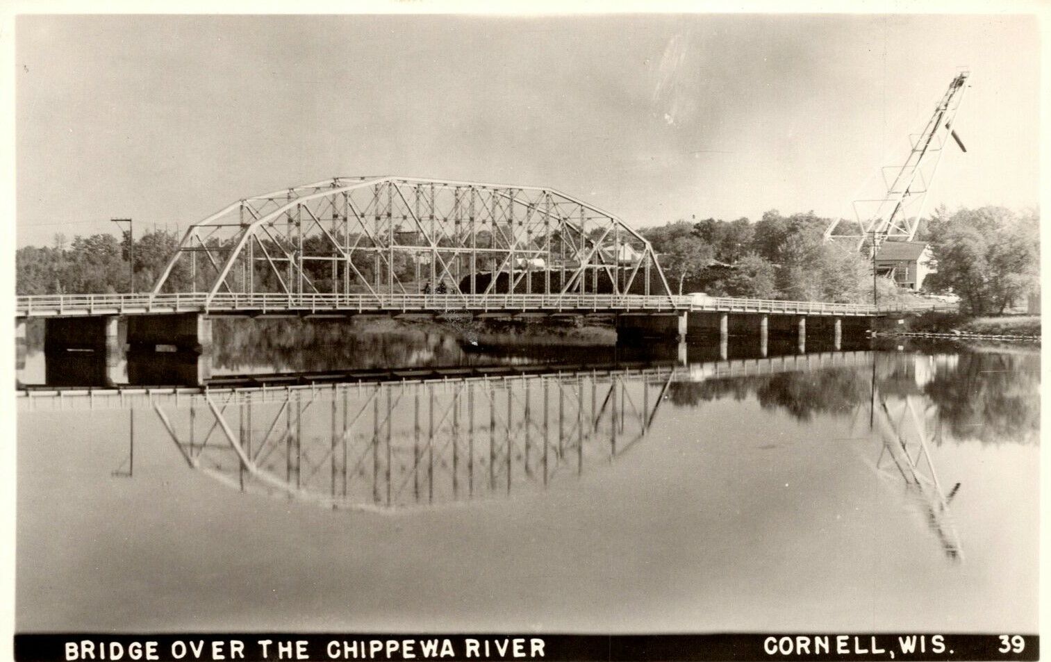
![]()
Status: Open to traffic
Location: 45.165278,-91.158611
Carries Bridge Street (WI 64) over Chippewa River
Design: arch/through/steel
Design Details: Steel through arch
Total Length: 490.2 Feet
Span Length: 484.9 Feet
Overview: Steel through arch bridge over Chippewa River on Bridge Street (WI 64) in Cornell
History: Built 1971
Built: 1971
Location: Chippewa County
View Bridge Information In Wayback Machine
![]()
282232
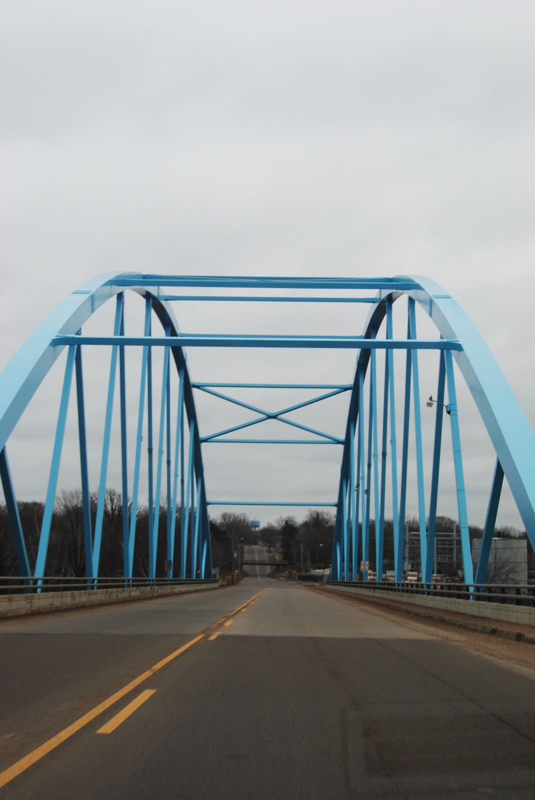
Entering the west portal going east
Photo taken by Max Koehn in April 2014
282233
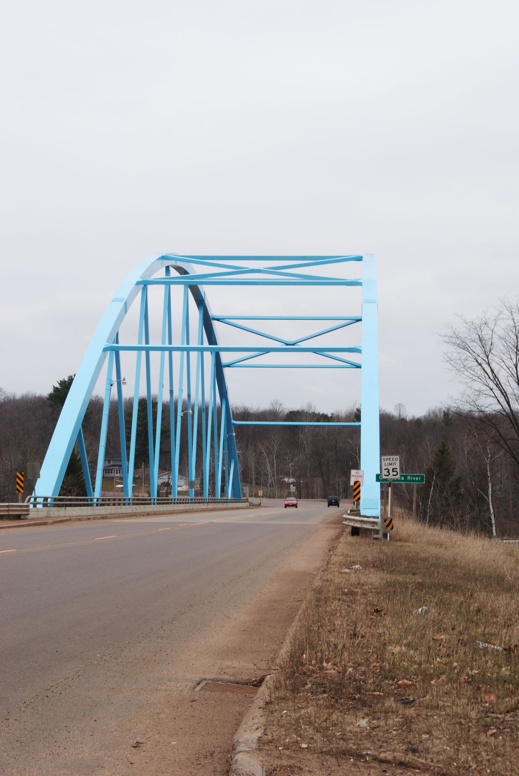
Eastward portal
Photo taken by Max Koehn in April 2014
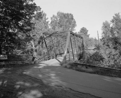
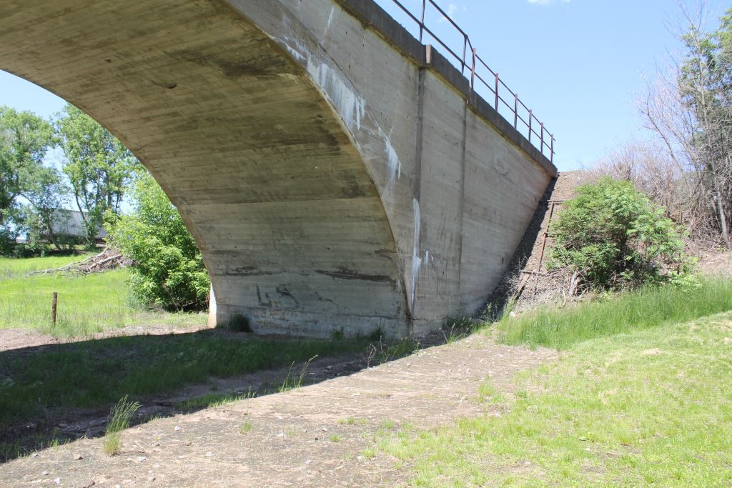
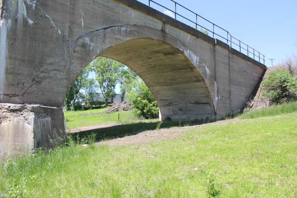
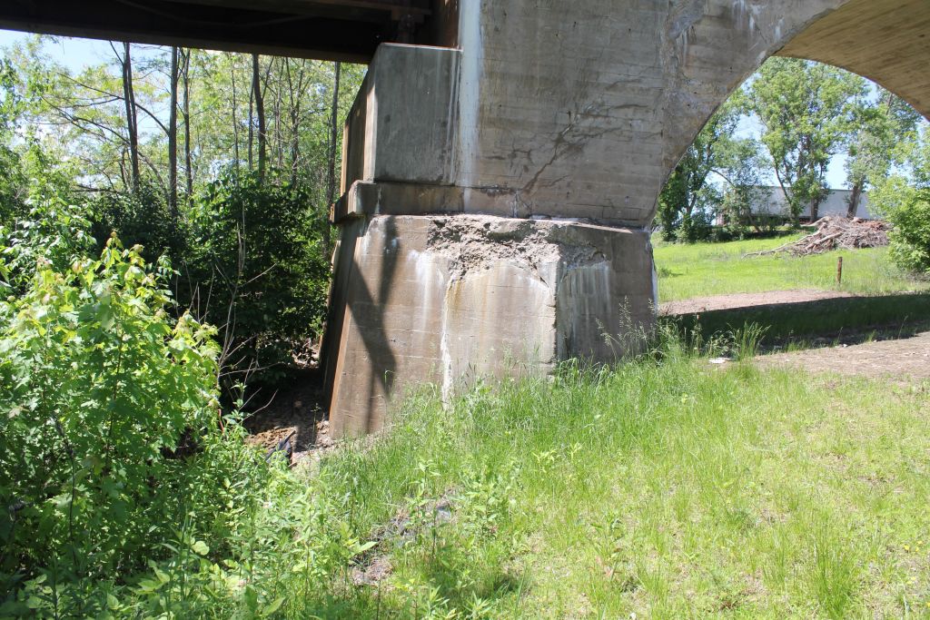
![]()
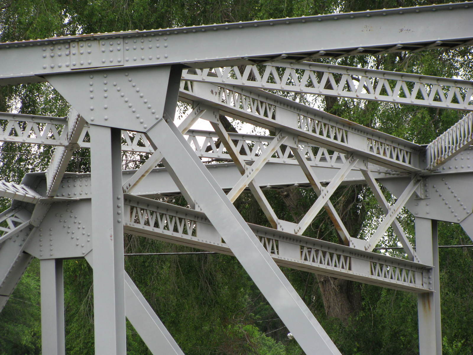
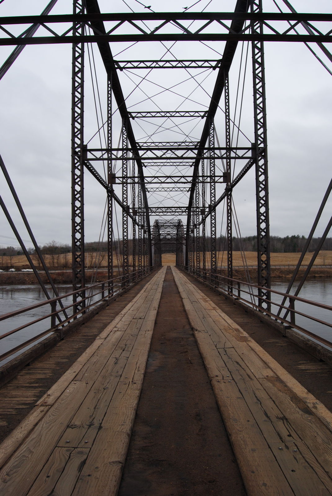
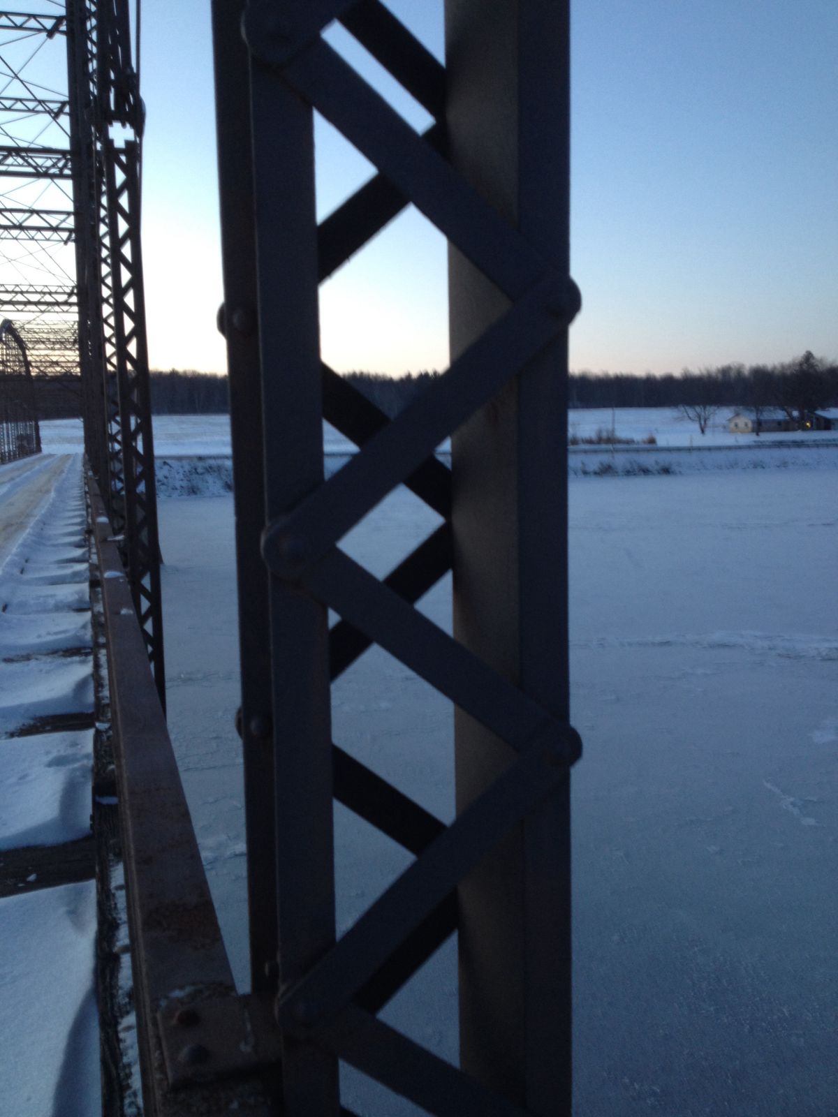
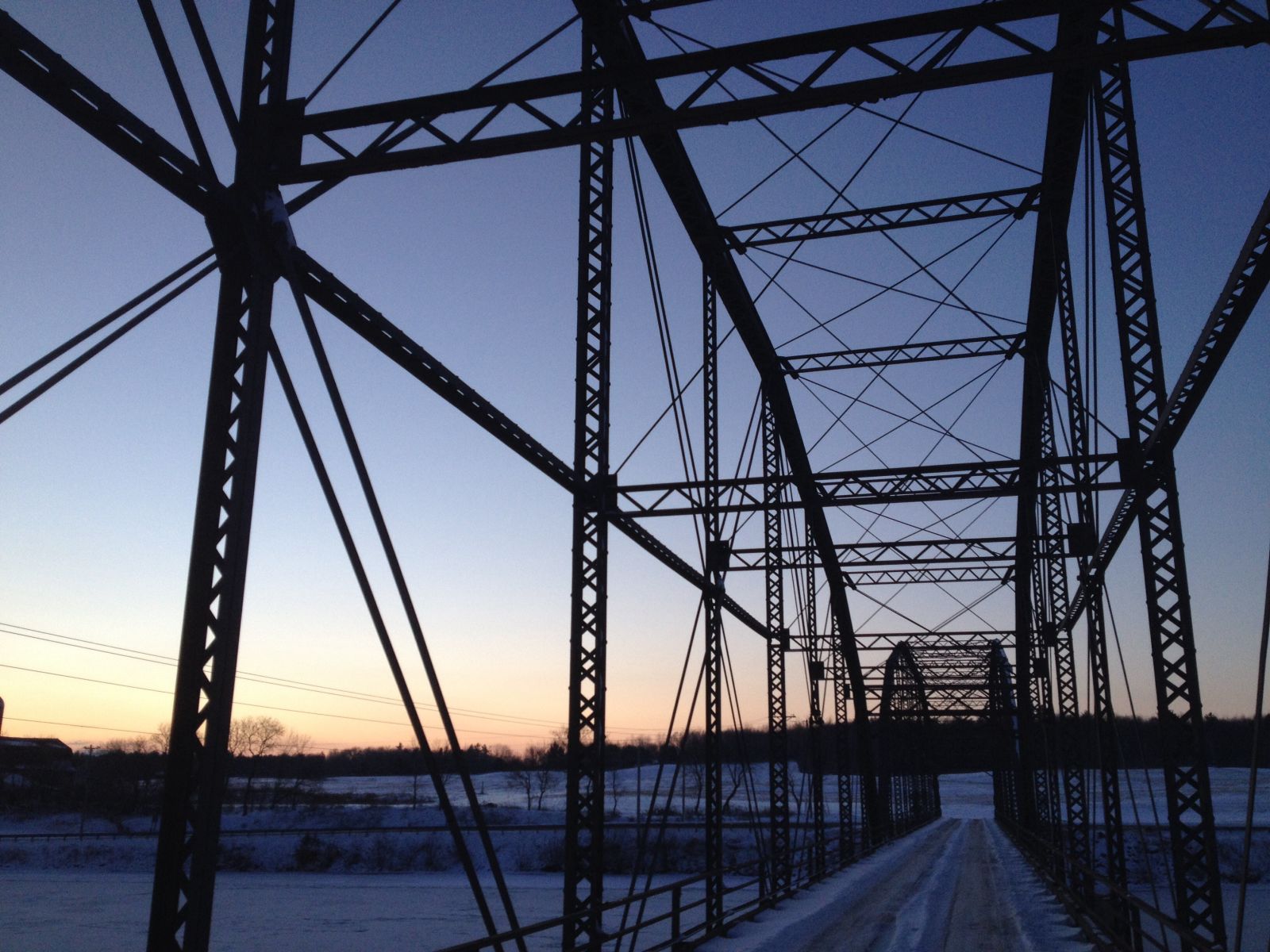
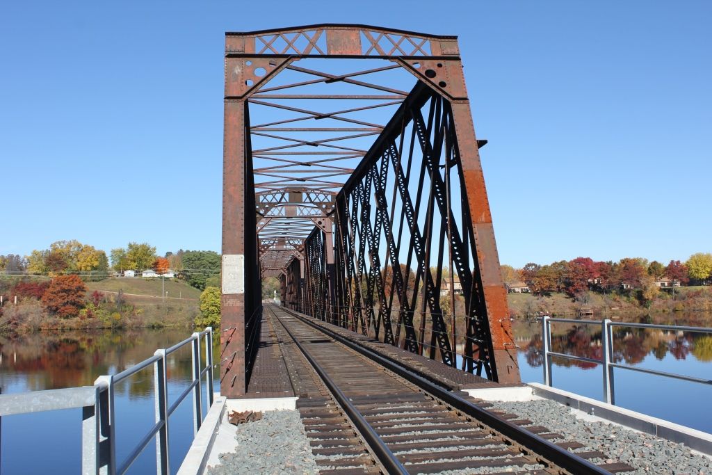
Status: Intact but closed to all traffic
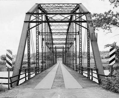
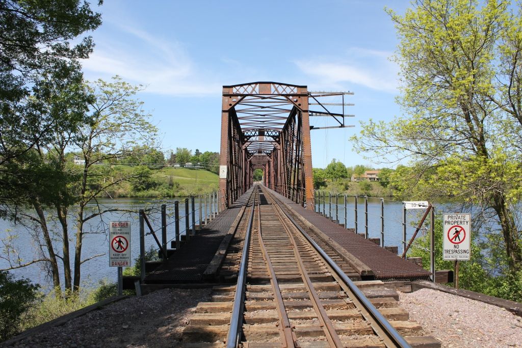
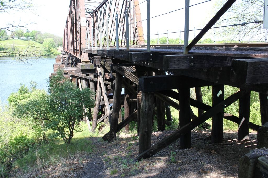
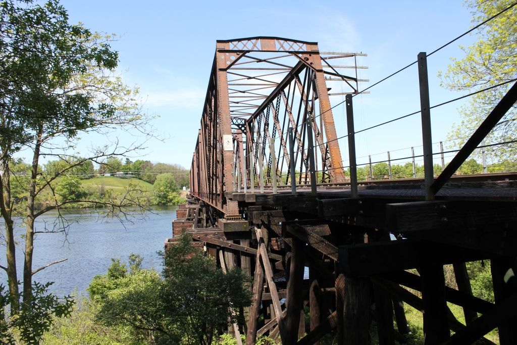
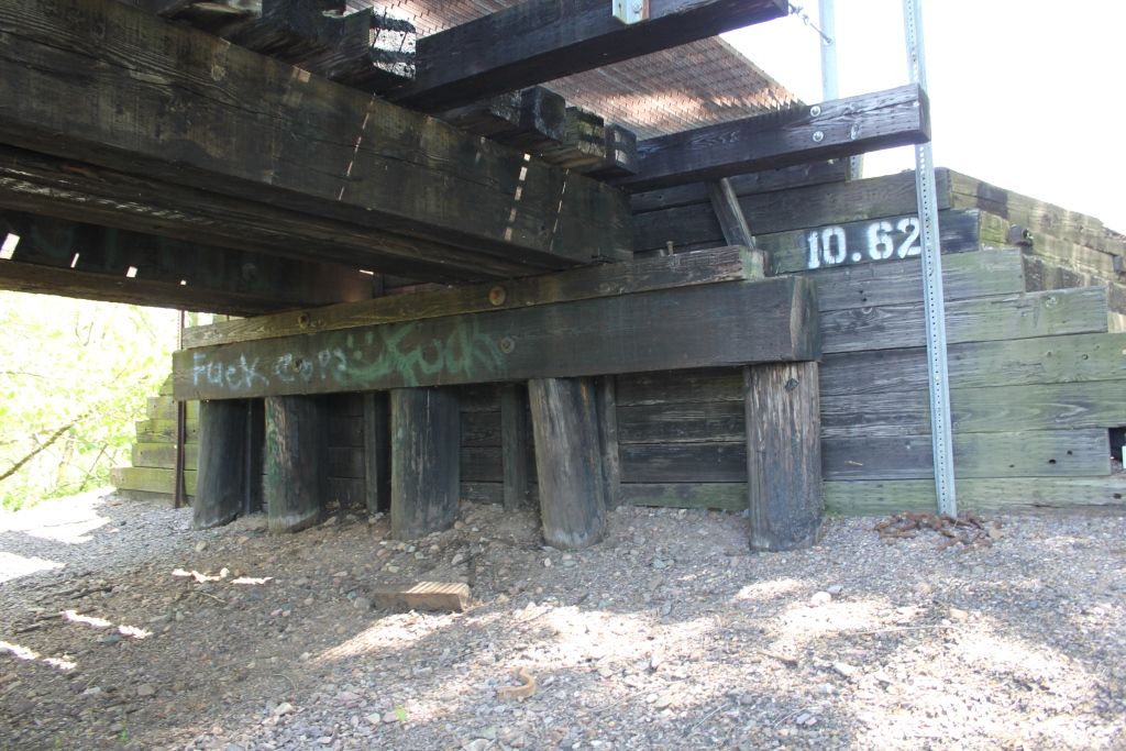
Location: 45.107070,-91.208550
Carries CTH T over Chippewa River
Design: truss/through/pennsylvania
Design Details: Two span, pin-connected Pennsylvania steel overhead truss. The two spans are identical.
NOTE: With the destruction of the remaining Pennsylvania truss bridges in Wisconsin, these spans are the last surviving Pennsylvania truss spans in the state.
Total Length: 486.5 Feet
Span Length: 241.2 Feet
Overview: Pennsylvania through truss bridge over Chippewa River on CTH T
History: Built in 1908; Moved 15 miles upriver to avoid inundation, 1918-19; rehabilitated 1995
Built: 1908
Location: Chippewa County
View Bridge Information In Wayback Machine
![]()
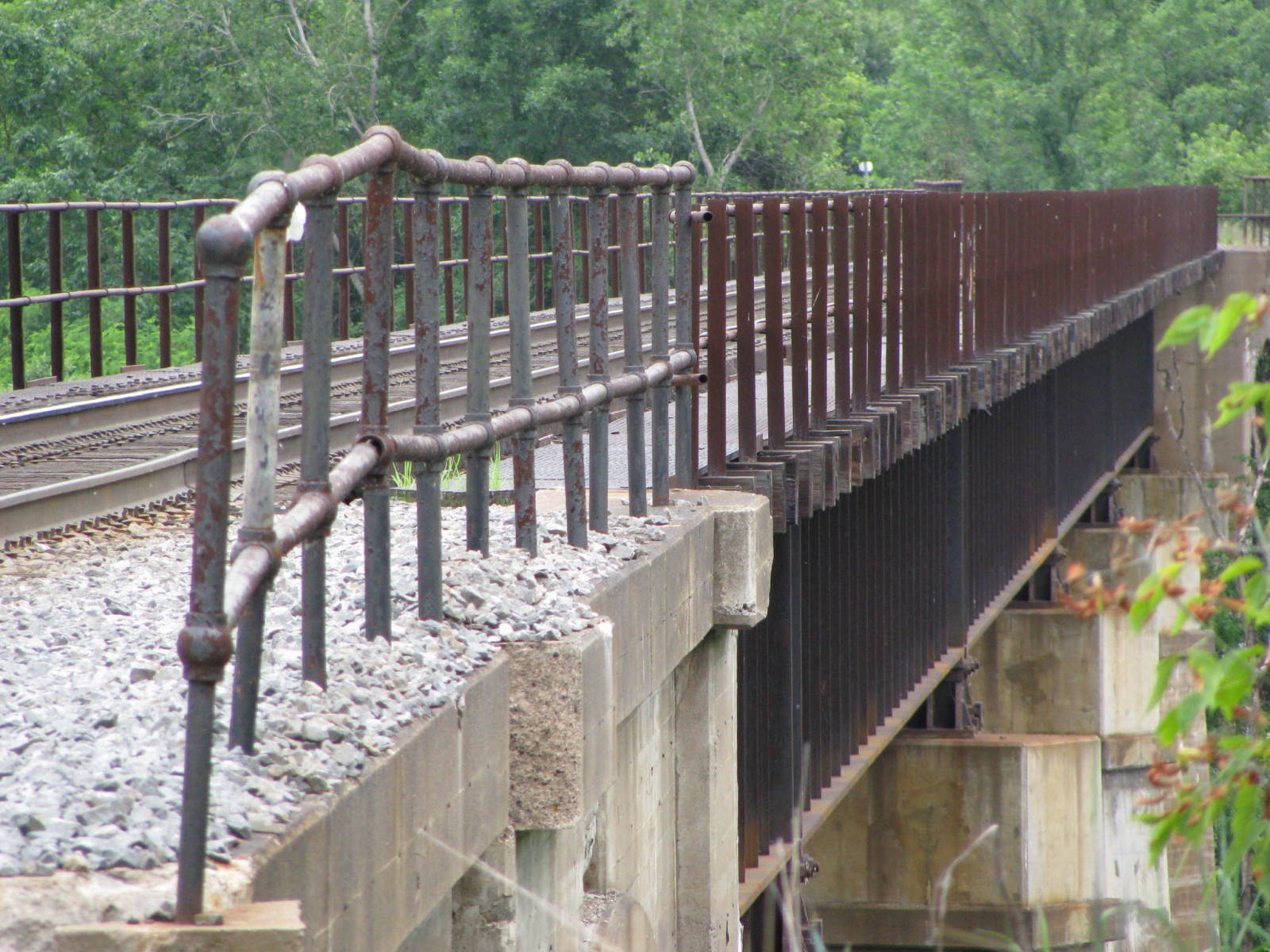
119696
Long View Of Bridge, Looking South
Photo taken by Martin Stupich, June 25, 1987 for HAER
119697
Elevation, Looking West
Photo taken by Martin Stupich, June 25, 1987 for HAER
119698
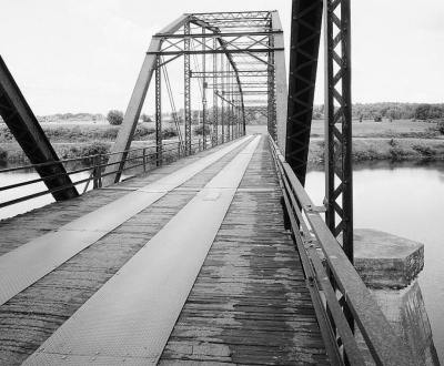
View Of Bridge From Mid-Deck, Looking West
Photo taken by Martin Stupich, June 25, 1987 for HAER
119699
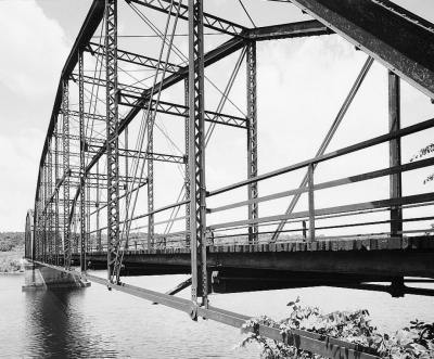
Oblique View Of Bridge, Looking West
Photo taken by Martin Stupich, June 25, 1987 for HAER
216831
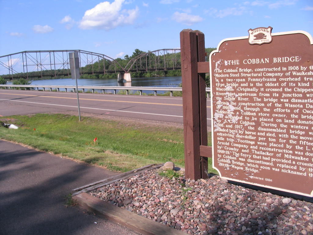
Photo taken by Steve Conro in July 2009
216832
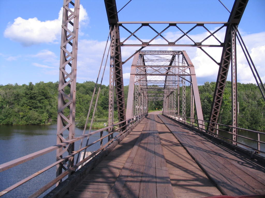
Photo taken by Steve Conro in July 2009
216833
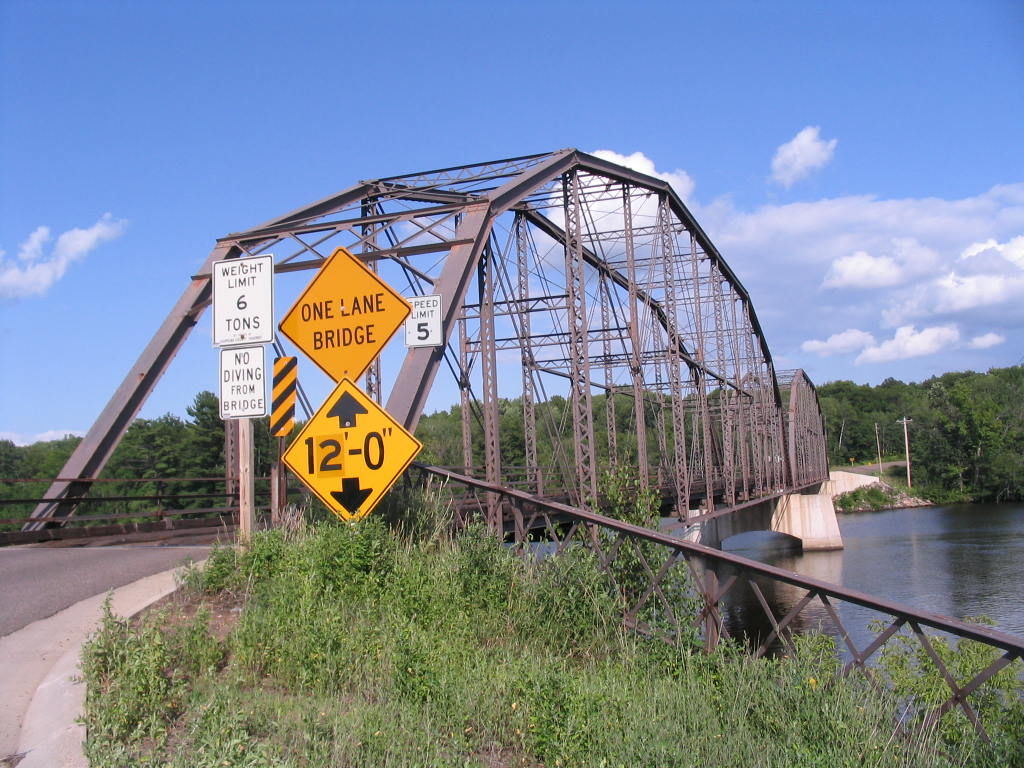
Photo taken by Steve Conro in July 2009
282231
An additional look at the inner truss design
Photo taken by Max Koehn in April 2014
311145
Portal view looking west
Photo taken by Matt Lohry
311146
Sway bracing
Photo taken by Matt Lohry
311147
Inside looking west
Photo taken by Matt Lohry
311148
Closeup of vertical
Photo taken by Matt Lohry
311149
Inside view of truss
Photo taken by Matt Lohry
311150
Main truss/sway bracing connection
Photo taken by Matt Lohry
311151
North truss/sway bracing
Photo taken by Matt Lohry
311152
Chippewa River looking south
Photo taken by Matt Lohry
311153
Oblique of south truss
Photo taken by Matt Lohry
311154
Portal looking west
Photo taken by Matt Lohry
311155
Inside view looking east
Photo taken by Matt Lohry
311156
Upward view of portal bracing
Photo taken by Matt Lohry
311157
Portal/knee bracing
Photo taken by Matt Lohry
311158
Railing
Photo taken by Matt Lohry
311159
Closeup of railing
Photo taken by Matt Lohry
311160
Vertical
Photo taken by Matt Lohry
311161
Elevation
Photo taken by Matt Lohry
311162
Closer elevation
Photo taken by Matt Lohry
311163
Elevation of both truss spans
Photo taken by Matt Lohry
345117
View Beside Bridge
Photo taken by Theresa Catherine
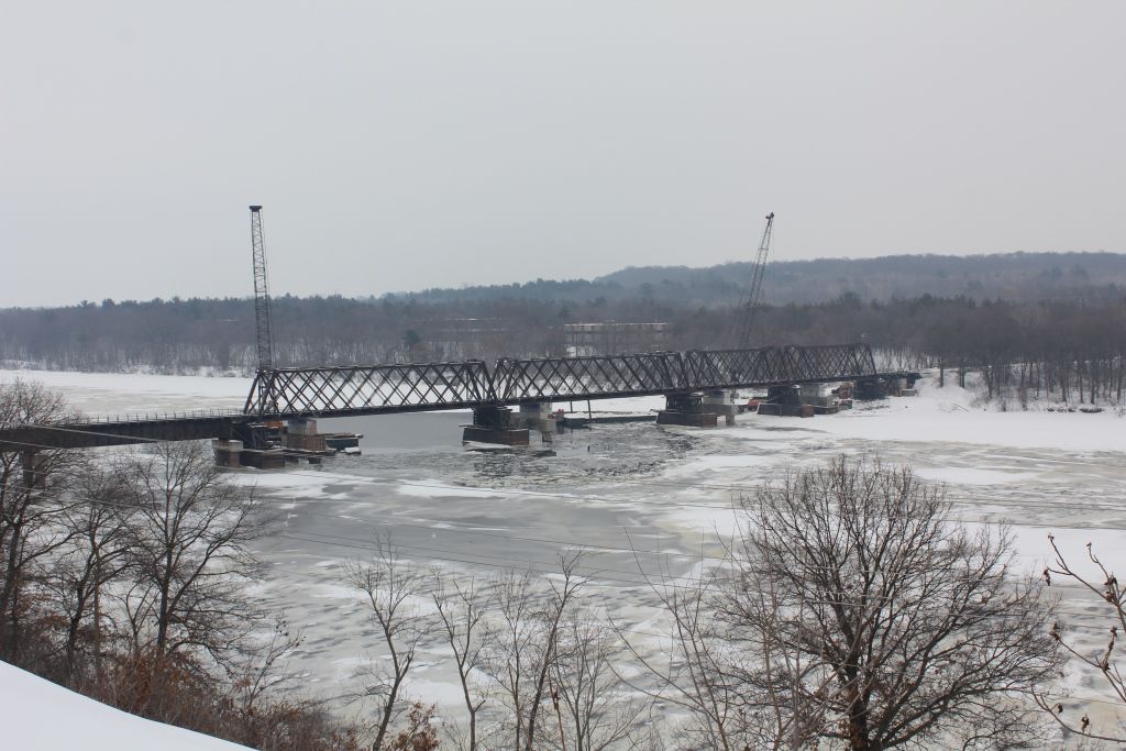
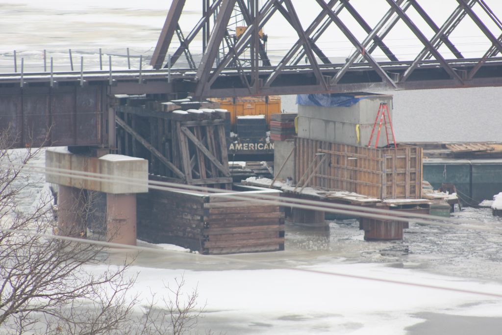
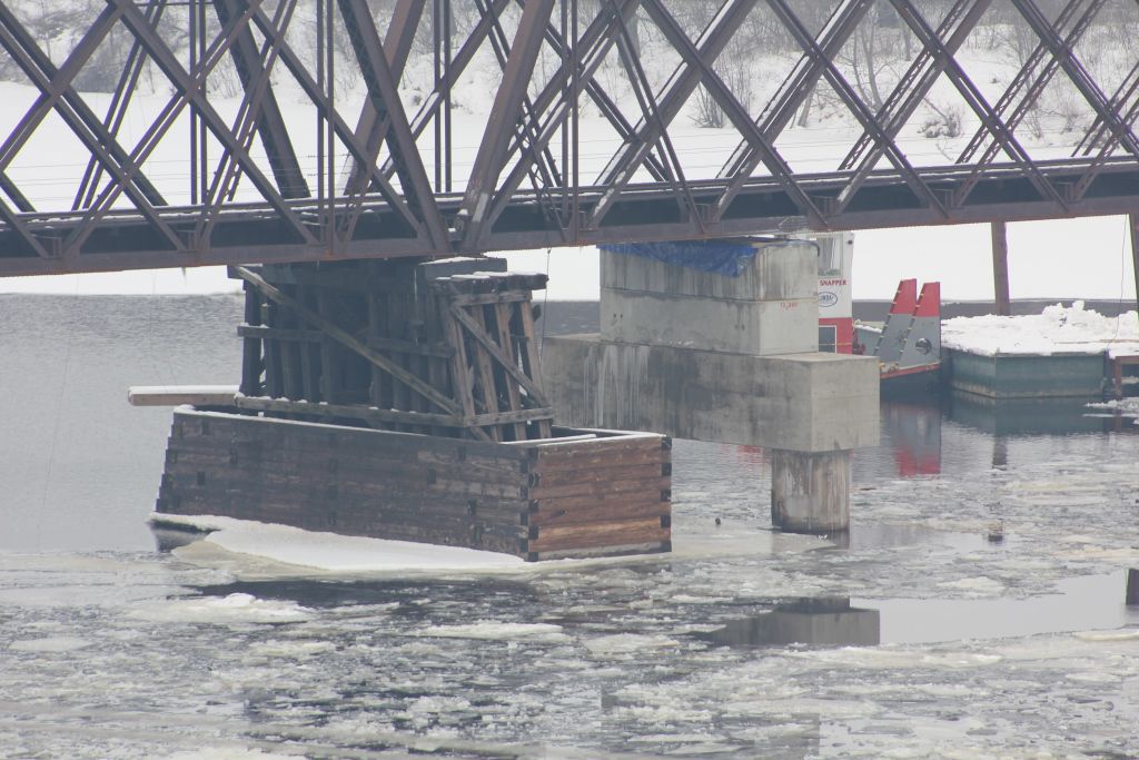
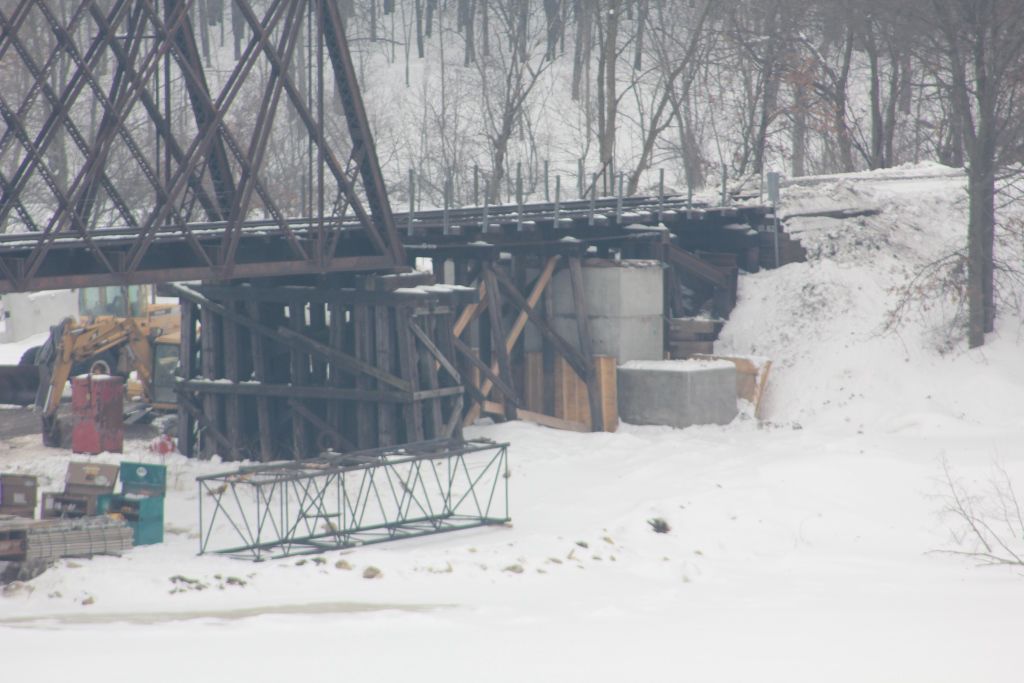
![]()
Status: Replaced by a new bridge
Location: 45.222216,-91.110150
Carries WI 27 over Fisher River
Design: truss/through
Design Details: Through truss
Total Length: 104.7 Feet
Span Length: 100.1 Feet
Overview: Lost through truss bridge over Fisher River on WI 27
History: Built 1936; rehabilitated 1967
Built: 1936
Location: Chippewa County
View Bridge Information In Wayback Machine
![]()
![]()
Status: Replaced by a new bridge
Location: 45.248560,-90.956380
Carries CTH M over Fisher River
Design: truss
Design Details: Truss
Total Length: 83.0 Feet
Span Length: 83.0 Feet
Overview: Lost truss bridge over Fisher River on CTH M
History: Built 1930
Built: 1930
Location: Chippewa County
View Bridge Information In Wayback Machine
![]()
![]()
Status: Replaced by a new bridge
Location: 45.272718,-91.110557
Carries WI 27 over Holcombe Flowage
Design: truss/pony/warren
Design Details: Continuous Warren pony truss
Total Length: 462.0 Feet
Span Length: 170.9 Feet
Overview: Lost Continuous Warren pony truss bridge over Holcombe Flowage on WI 27
History: Built 1948; rehabilitated 1987, replaced 2009
Built: 1948
Location: Chippewa County
View Bridge Information In Wayback Machine
![]()
321146

Facing north
Photo taken by Max Koehn in April 2015
![]()
Status: Demolished, Replaced by UCEB 2004
Location: 44.954169,-91.397443
Carries Bear Den Road over Duncan Creek
Design: truss/through/pratt
Design Details: Truss
Total Length: 92.9 Feet
Span Length: 92.9 Feet
Overview: Lost pratt truss bridge over Duncan Creek on Bear Den Road in Chippewa Falls
History: Unknown Build date; Moved to Irvine Park 1940; Replaced 2004
Built: 1936
Location: Chippewa County
View Bridge Information In Wayback Machine
![]()
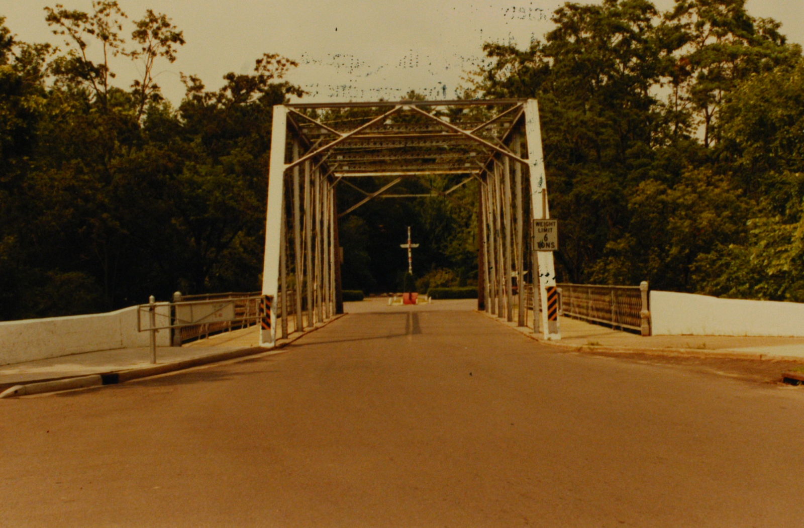
142295
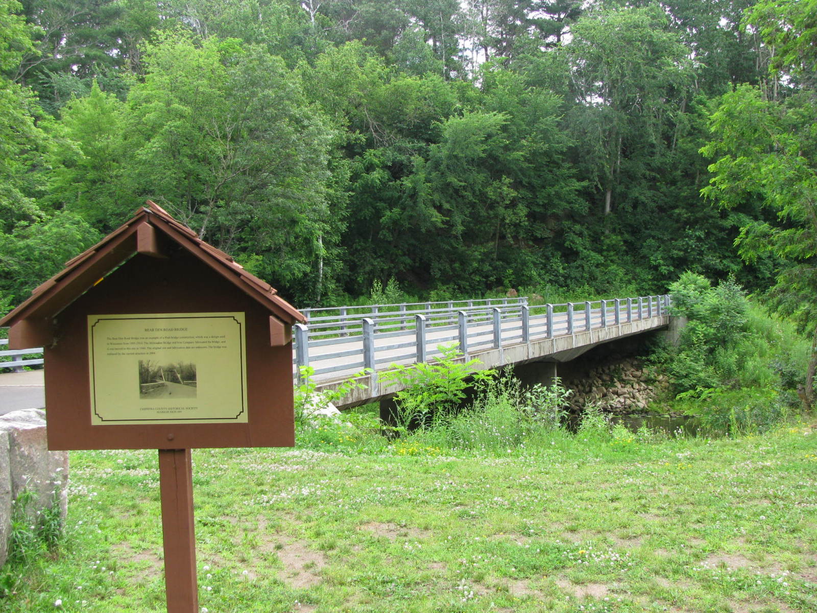
Replacement Bridge and Historical Marker
Photo taken by J.R. Manning in July 2009
142296

Historical Marker
BEAR DEN ROAD BRIDGE The Bear Den Road Bridge was an example of a Pratt bridge construction, which was a design used in Wisconsin from 1895-1910. The Milwaukee Bridge and Iron Company fabricated the bridge, and it was moved to this site in 1940. The original site and fabrication date are unknown. The bridge was replaced by the current structure in 2004.
Photo taken by J.R. Manning in July 2009
![]()
Status: Replaced by a new bridge
Location: 44.947270,-91.400200
Carries Irvine Park Road over Duncan Creek
Design: truss
Design Details: Truss
Total Length: 103.7 Feet
Span Length: 103.7 Feet
Overview: Lost truss bridge over Duncan Creek on Irvine Park Road in Chippewa Falls
History: Built 1936; Replaced ca. 2004
Built: 1936
Location: Chippewa County
View Bridge Information In Wayback Machine
![]()
190758
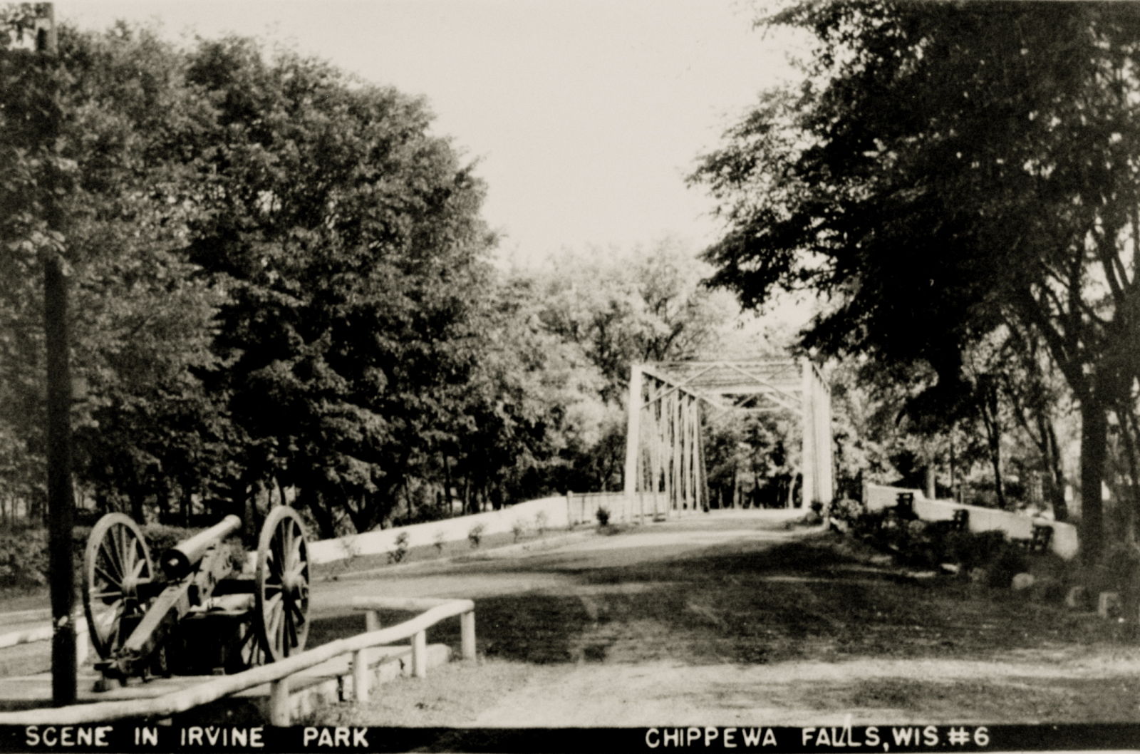
Overview Looking South
This is the view you would see exiting the park.
Postcard Image Provided by Gary Spaeth
190759
East Elevation
Postcard Image Provided by Gary Spaeth
190760
Barrel Shot Looking North
Entering the park.
Postcard Image Provided by Gary Spaeth
190761
Looking South
This is the view you would see exiting the park. The view is not much different from the view in Photo 1.
Postcard Image Provided by Gary Spaeth
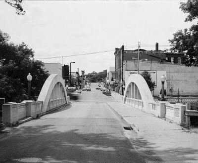
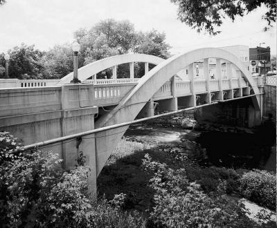
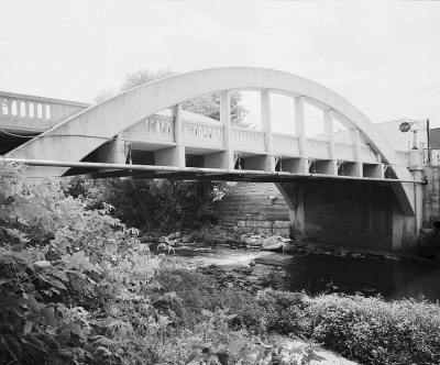
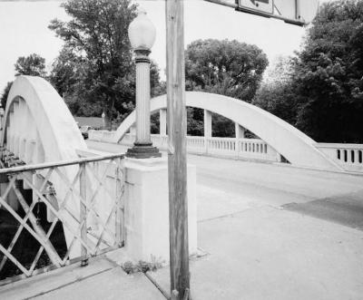
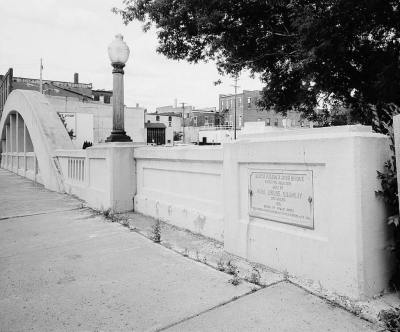
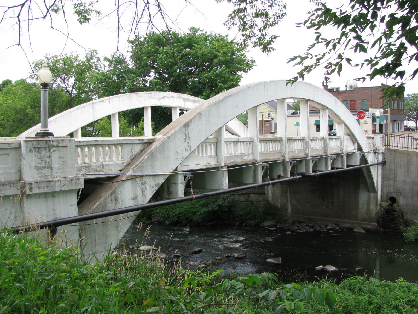
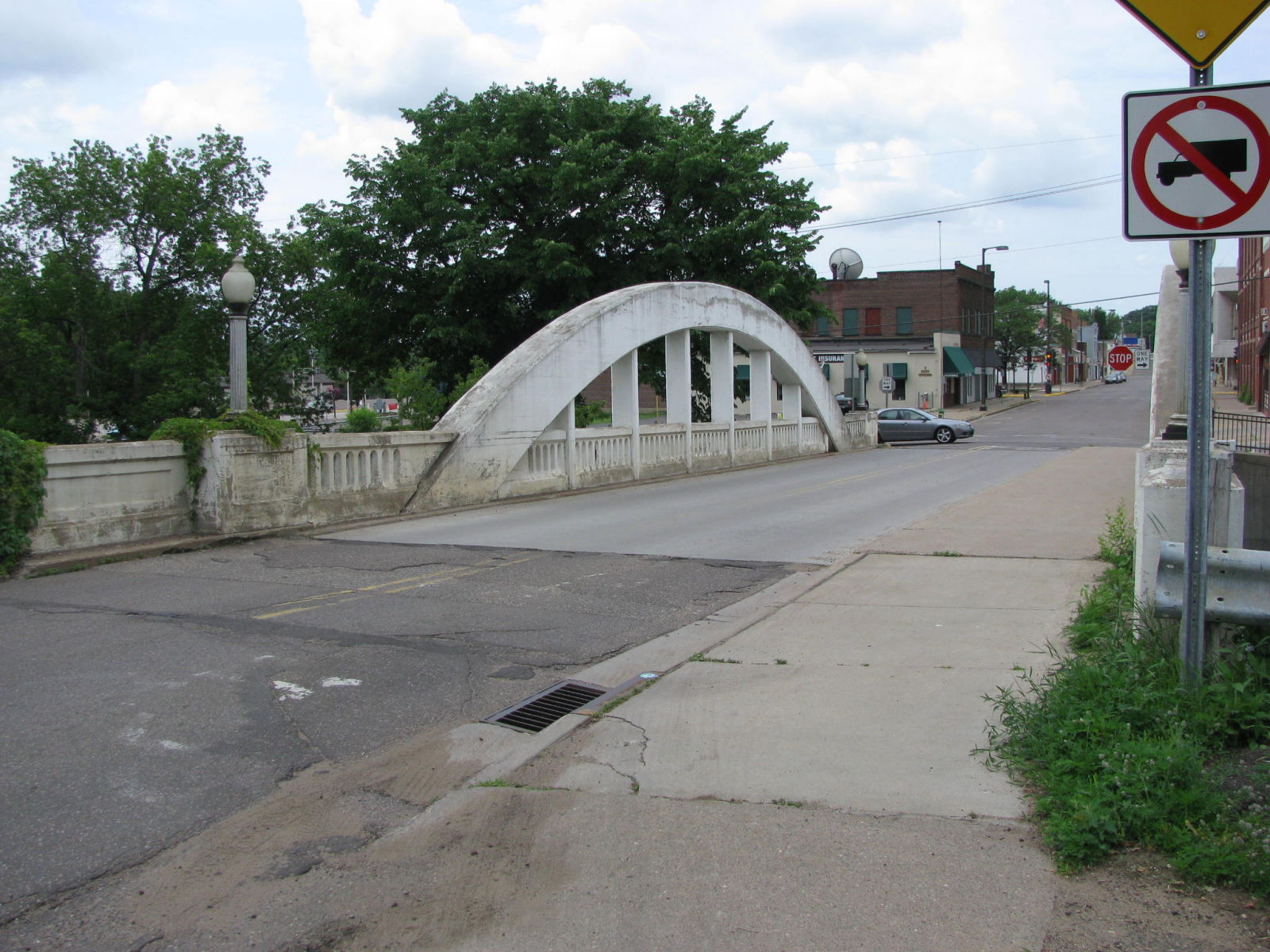
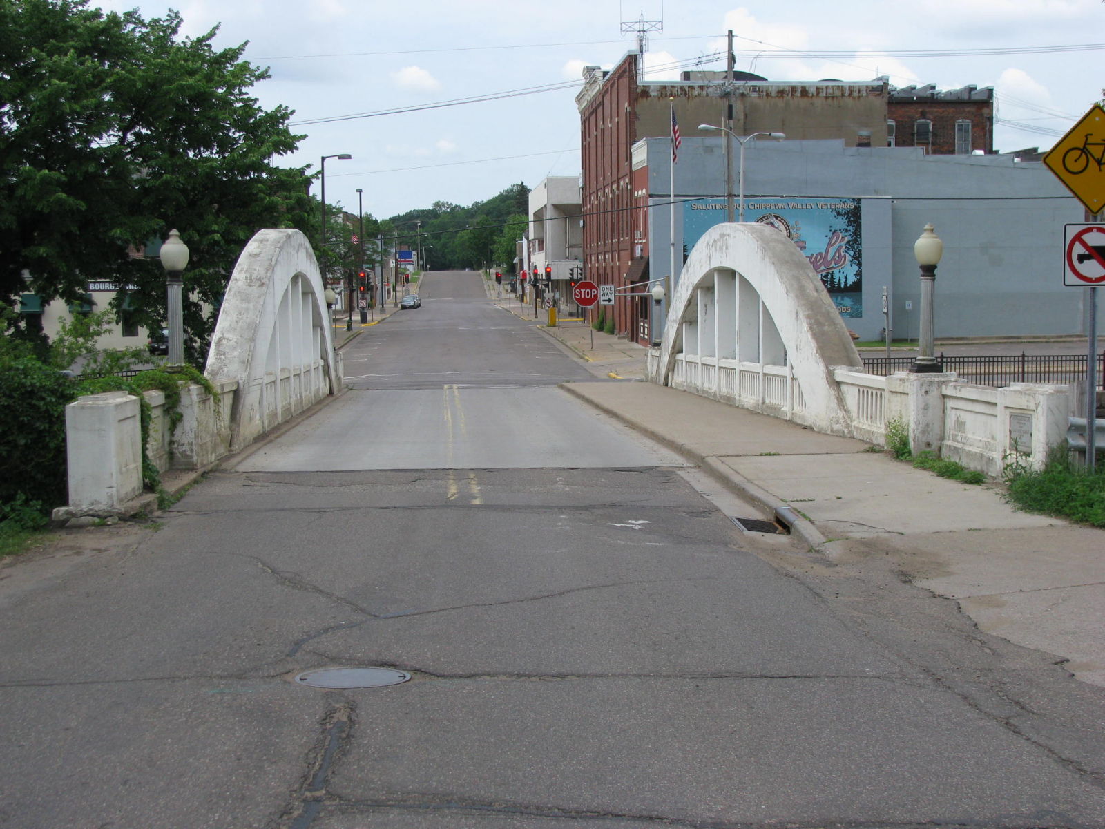
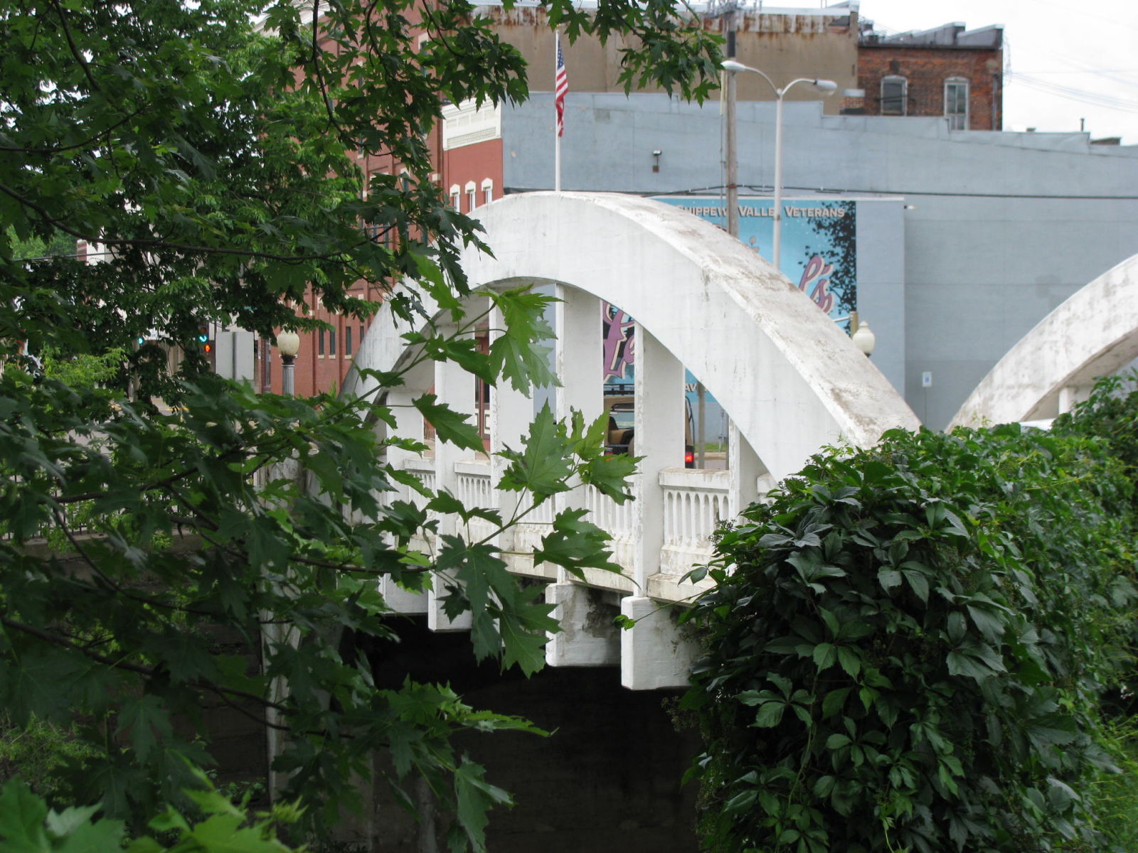
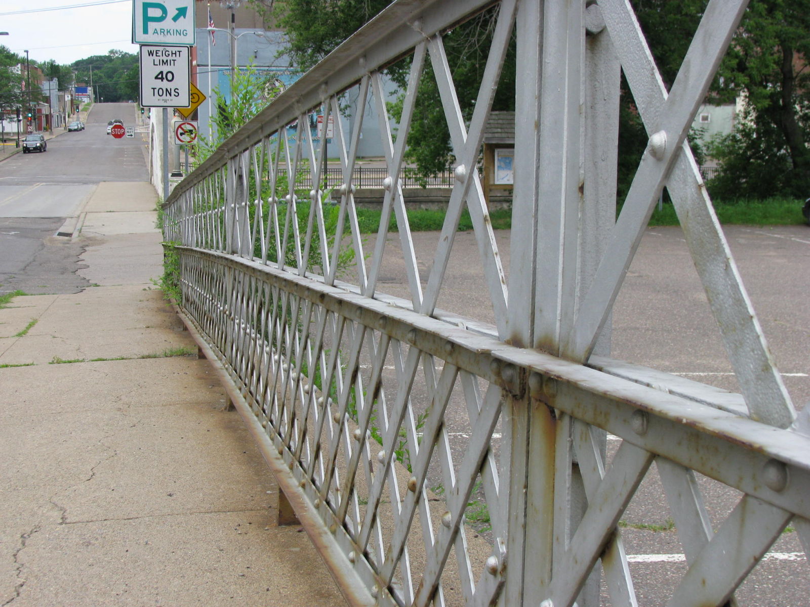
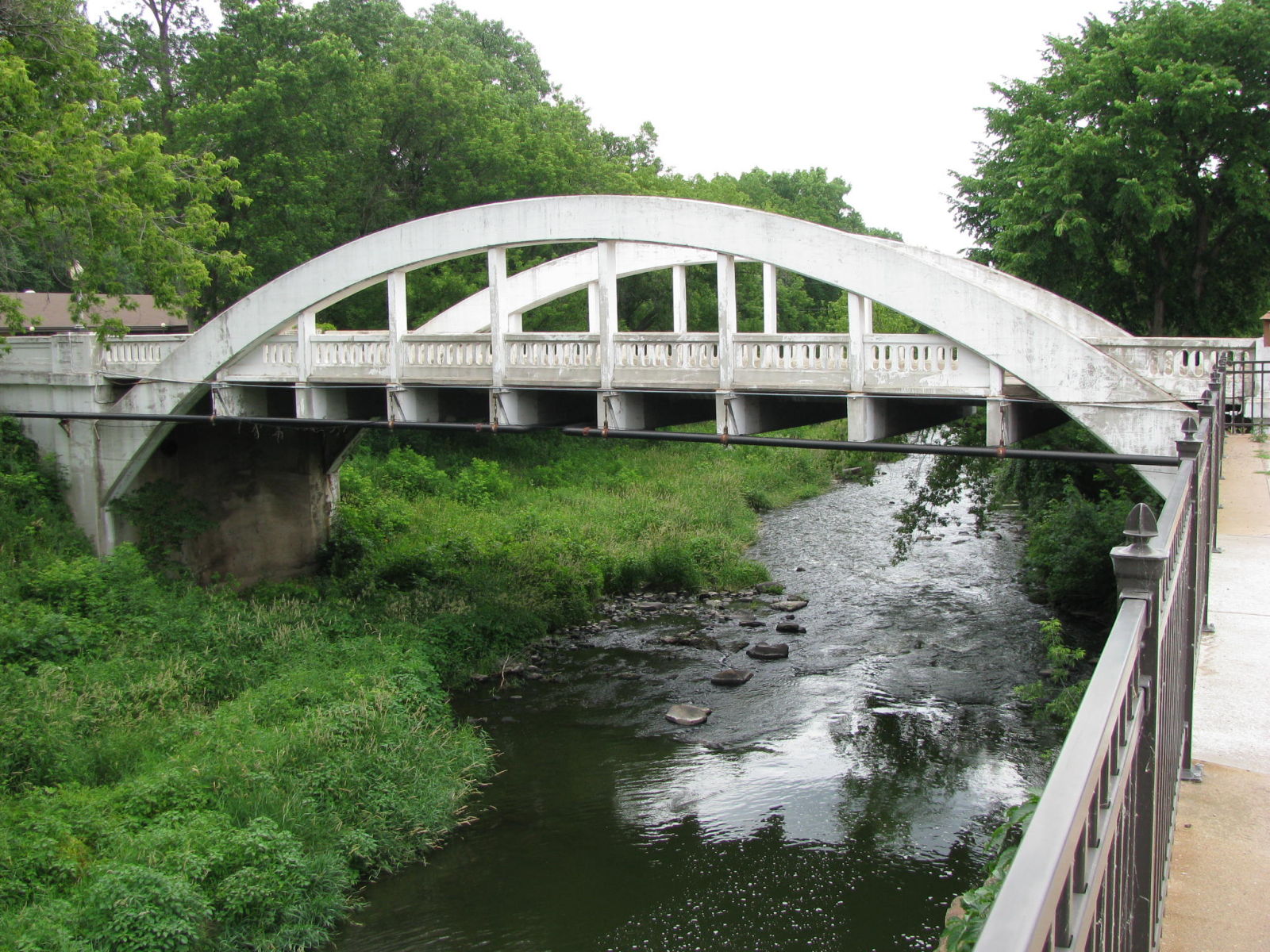
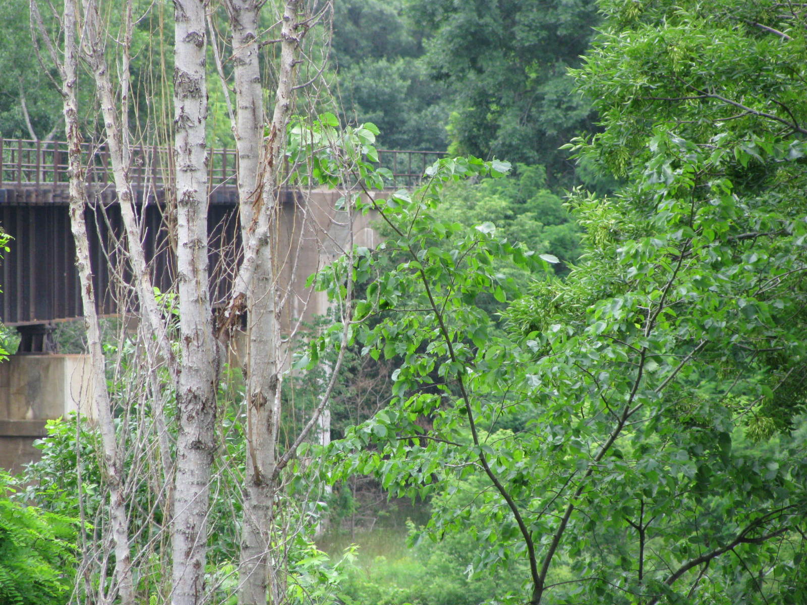
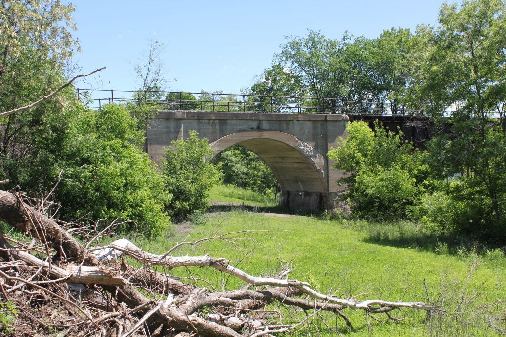
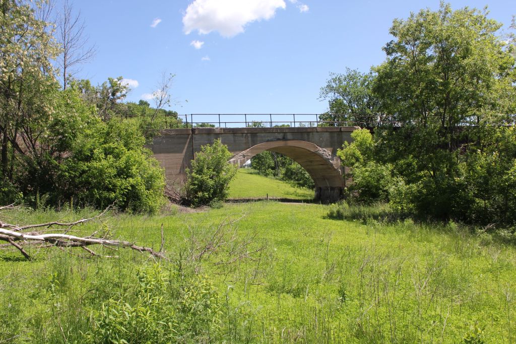
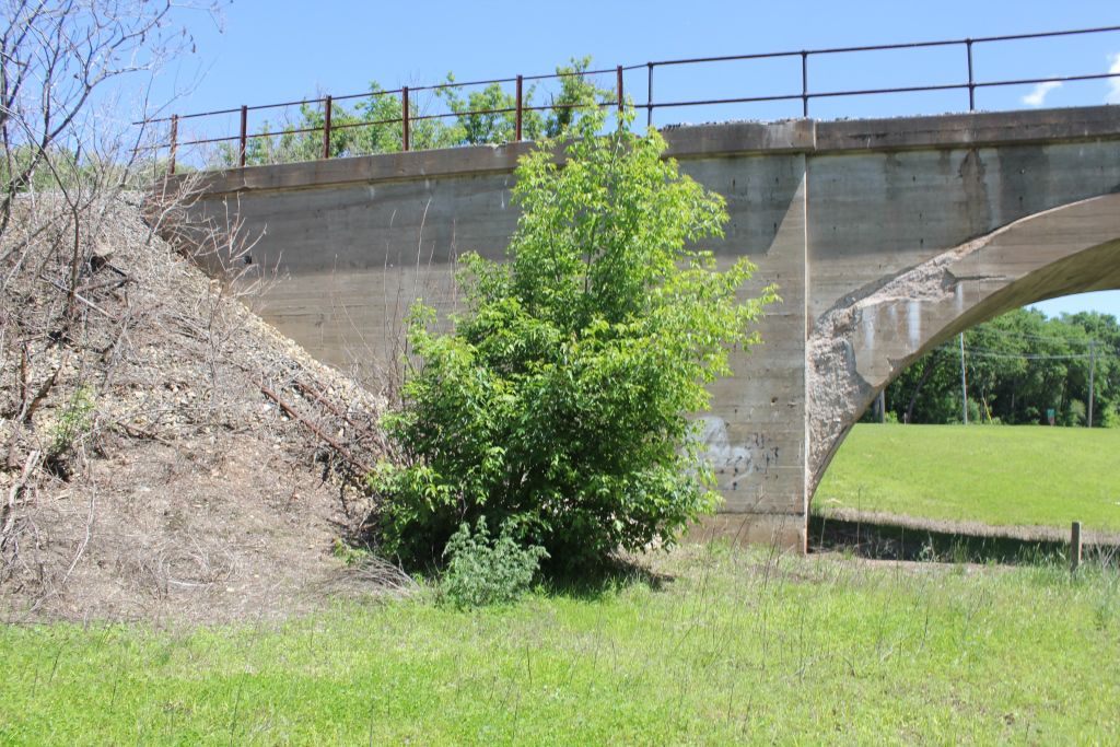
![]()
Status: Open to one-way traffic
Location: 44.936333,-91.390611
Carries Spring Street over Duncan Creek
Design: arch/through/concrete
Design Details: Concrete through arch
Total Length: 110.9 Feet
Span Length: 93.2 Feet
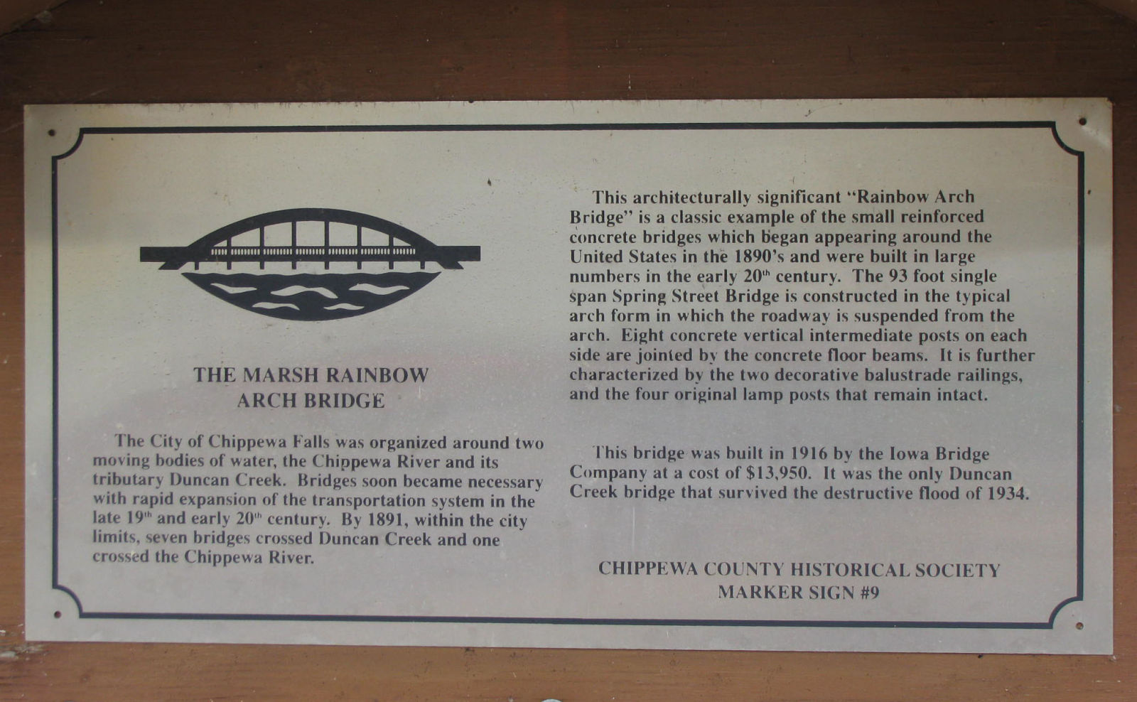
Overview: Rainbow arch bridge over Duncan Creek on Spring Street in Chippewa Falls
History: Built 1916; Placed on NRHP 1982
Built: 1916
Location: Chippewa County
View Bridge Information In Wayback Machine
![]()
119717
View Of Elevation, Looking West
Photo taken by Martin Stupich, June 25, 1987 for HAER
119718
Oblique View Of North Truss
Photo taken by Martin Stupich, June 25, 1987 for HAER
119719
View Of North Truss, Looking Southwest
Photo taken by Martin Stupich, June 25, 1987 for HAER
119720
View Of Northwest Corner With Light Standard, Looking Southeast
Photo taken by Martin Stupich, June 25, 1987 for HAER
119721
Detail View Of South Truss, West Abutment, Looking Northeast
Photo taken by Martin Stupich, June 25, 1987 for HAER
119722
View Of North Truss, With Bridge Plate
Photo taken by Martin Stupich, June 25, 1987 for HAER
166653
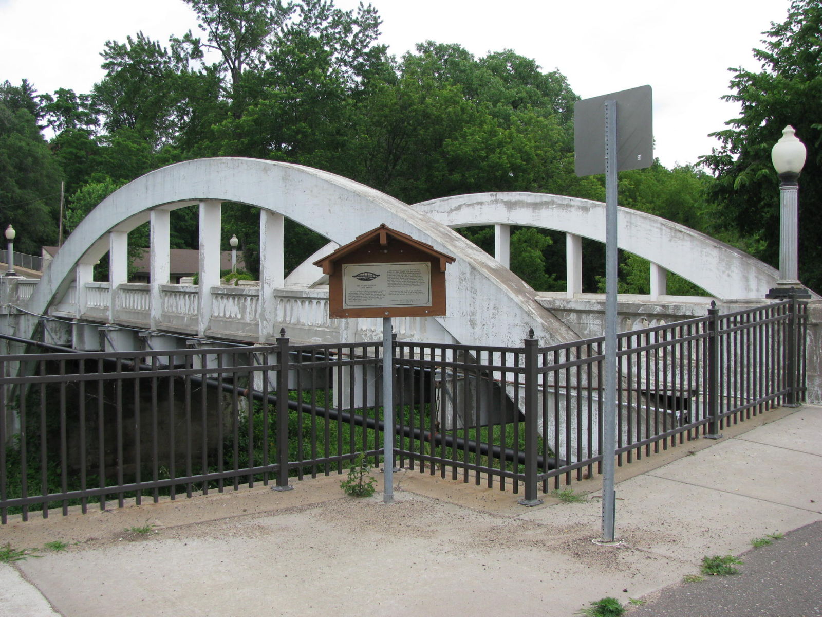
Oblique View Looking East
Note the historical marker in the forefront. Compare this photo to photo #4, taken by Martin Stuppich for HAER in July of 1987. In 1987, the sidewalk railing, like the hill on Spring Street, appears to have been salvaged from a truss bridge. In this photo, you can see that steel railing has been replaced sometime in the last 22 years with this black, modern fencing. (Mr. Stuppich also had his directions slightly askew, the bridge is oriented in a northeast to southwest direction across Duncan Creek, which flows in a southeasterly direction to the Chippewa River.)
Photo taken by J.R. Manning in July 2009
166654
Historical Maker
Photo taken by J.R. Manning in May 2010
166655
Oblique View Of Bridge, Looking South
The bridge, and this view, has not changed significantly since Martin Suppich took his photo (see #2) 22 years prior to this one.
Photo taken by J.R. Manning in July 2009
166656
Deck and South Arch
Photo taken by J.R. Manning in July 2009
166657
Barrel Shot Looking Southwest
Photo taken by J.R. Manning in July 2009
166658
South Arch Looking West
Photo taken by J.R. Manning in July 2009
166659
North Sidewalk, Downhill from Spring Street
The railing looks like it came from a truss bridge. It might have been salvaged from a truss bridge that was washed out in the flood of 1934,
Photo taken by J.R. Manning in July 2009
166660
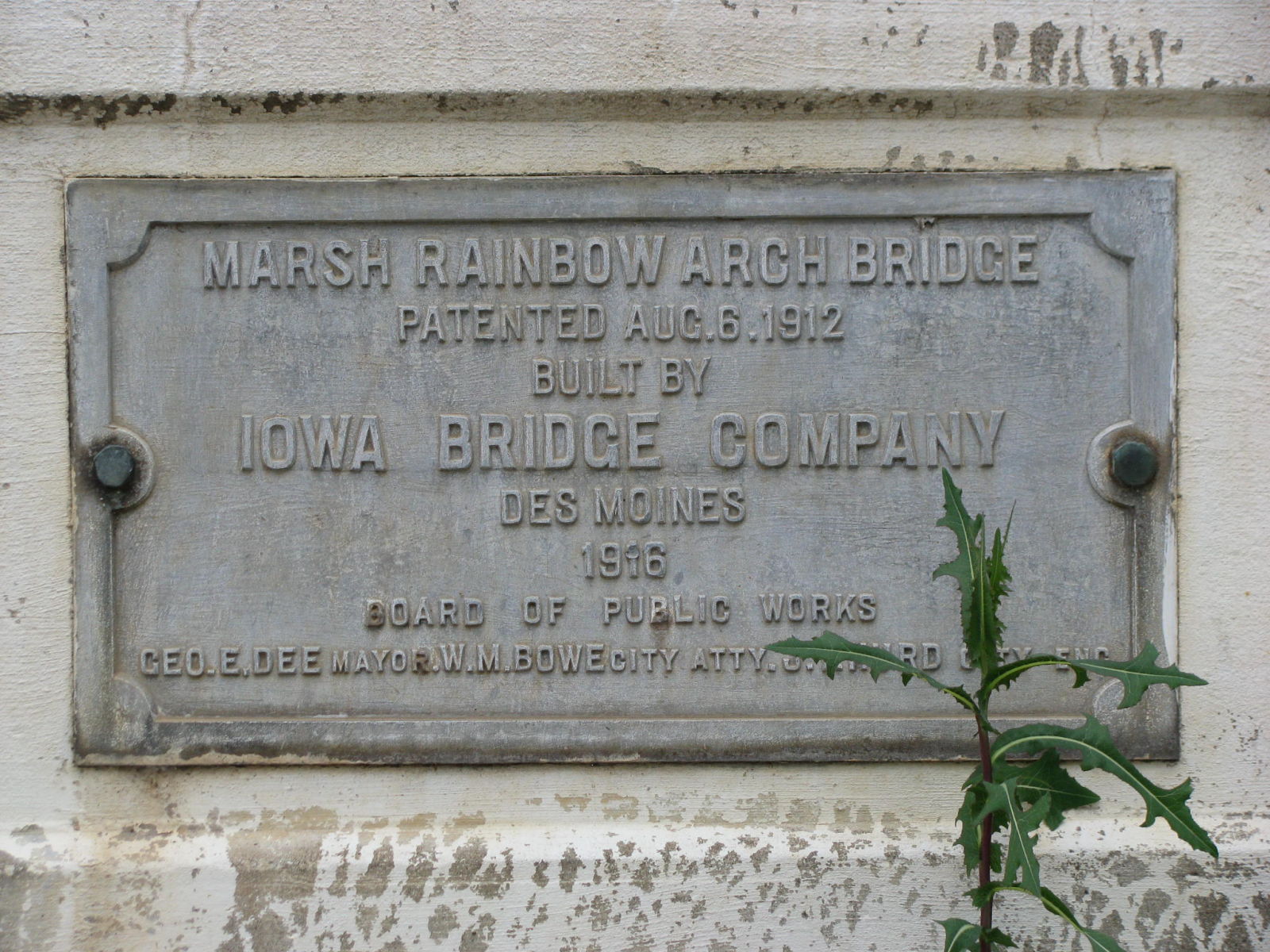
Manufacturer's Plaque
This plaque is located on the northeast quadrant of the bridge.
Photo taken by J.R. Manning in July 2009
166661
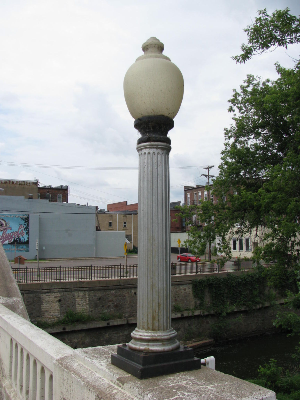
Typical light standard
The original four of these light standards remain intact, and (as of this visit) still function.
Photo taken by J.R. Manning in July 2009
166662
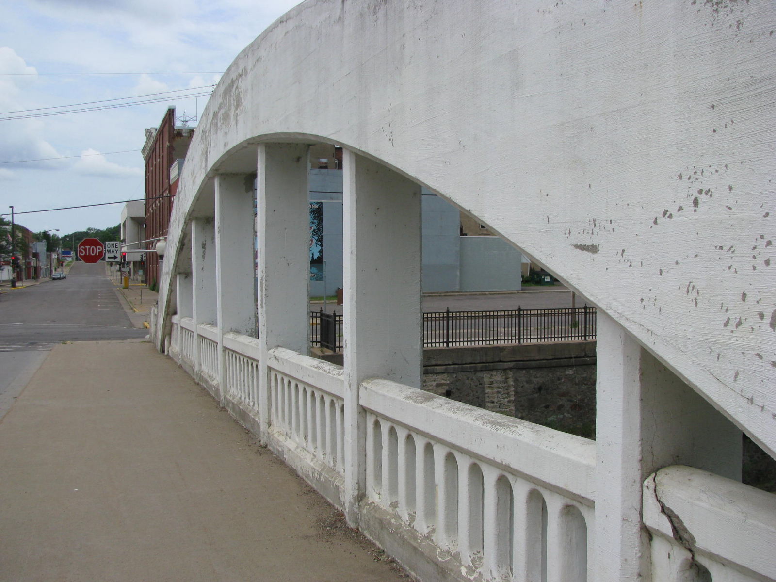
North Arch Detail
Again, the span has not changed much since Martin Stuppich took his photos in 1987, except for the crack in the railing.
Photo taken by J.R. Manning in July 2009
166663
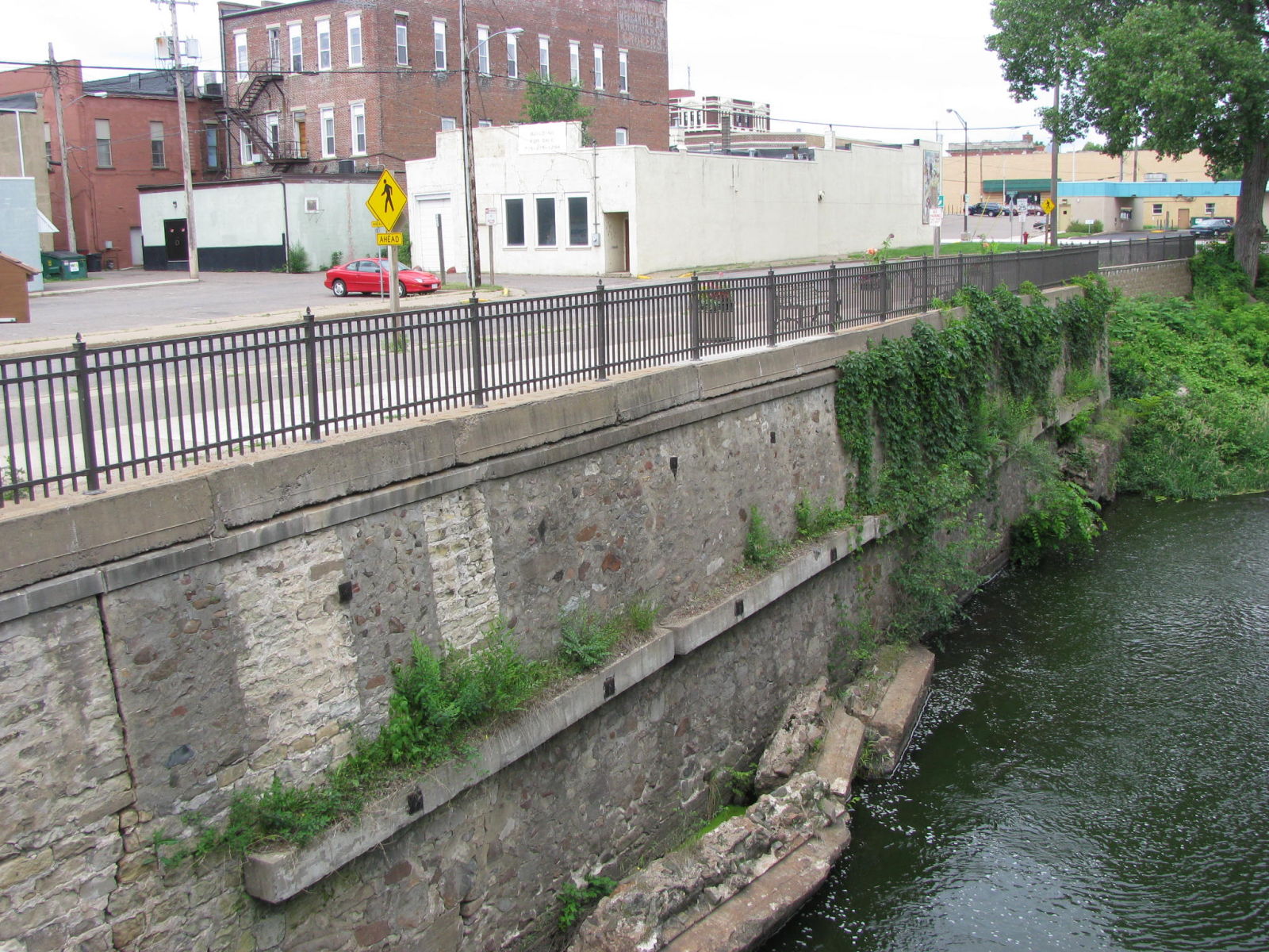
Retaining Wall
This is the southest side of Duncan Creek, along Rushman Drive, between the Spring Street Bridge and the Central Street Bridge.
Photo taken by J.R. Manning in July 2009
166664
Northwest Face
Photo taken by J.R. Manning in July 2009
166665

Oblique View Looking North
Photo taken by J.R. Manning in July 2009
166666
Barrel Shot Looking Northeast
Photo taken by J.R. Manning in July 2009
166667
Northwest Elevation
As seen from the Central Street Bridge.
Photo taken by J.R. Manning in July 2009
398701
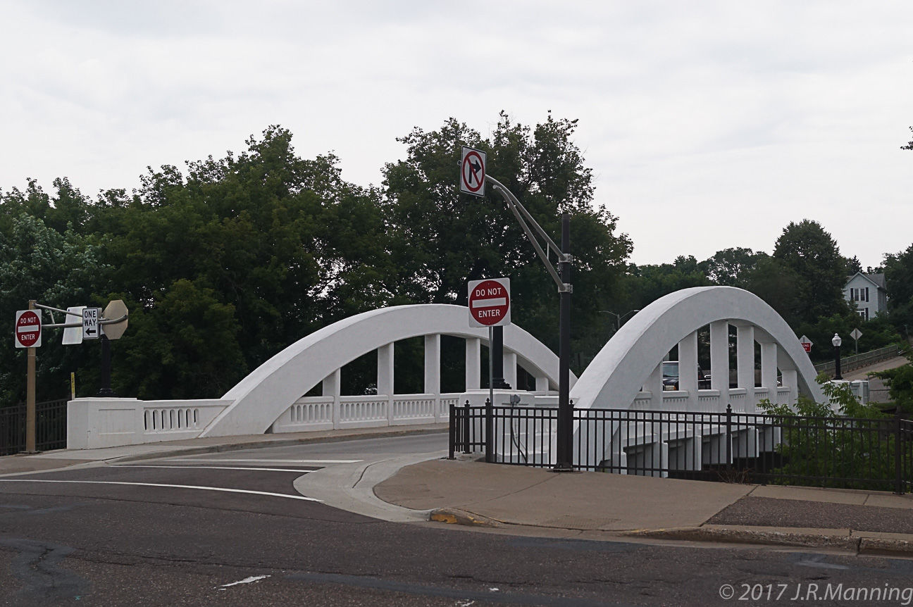
2016 Version
The bridge was cleaned up and painted in preparation of its centennial celebration in 2016. Spring Street has been changed to one way across the bridge.
Photo taken by J.R. Manning in July 2017
![]()
Status: Replaced by a new bridge
Location: 45.017459,-91.045232
Carries CTH D over Yellow River
Design: truss
Design Details: Truss
Total Length: 124.3 Feet
Span Length: 124.3 Feet
Overview: Lost truss bridge over Yellow River on CTH D
History: Built 1938; Replaced 2005
Built: 1938
Location: Chippewa County
View Bridge Information In Wayback Machine
![]()
![]()
Status: Open to traffic
Location: 45.122236,-90.997681
Carries CTH G over Yellow River
Design: truss/through/polygonal
Design Details: Polygonal Warren through truss
Total Length: 142.4 Feet
Span Length: 140.1 Feet
Overview: Through truss bridge over Yellow River on CTH G
History: Built 1939
Built: 1939
Location: Chippewa County
View Bridge Information In Wayback Machine
![]()
![]()
Status: Open to traffic
Location: 44.952624,-91.266975
Carries CTH K over Yellow River
Design: truss/through/polygonal
Design Details: Polygonal Warren through truss
Total Length: 154.5 Feet
Span Length: 149.9 Feet
Overview: Through truss bridge over Yellow River on CTH K
History: Built 1942; rehabilitated 1985
Built: 1942
Location: Chippewa County
View Bridge Information In Wayback Machine
![]()
![]()
Status: Open to pedestrians
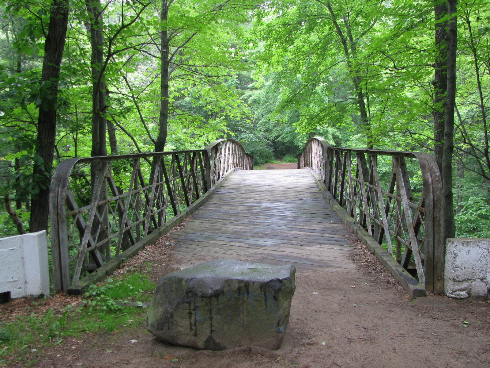
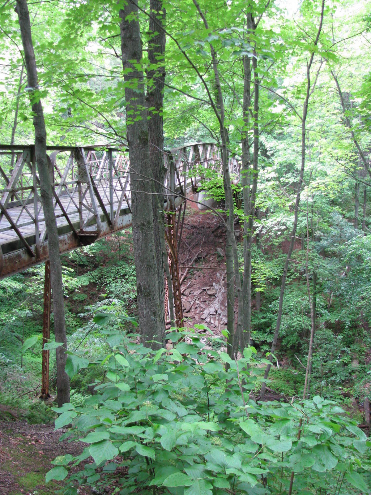
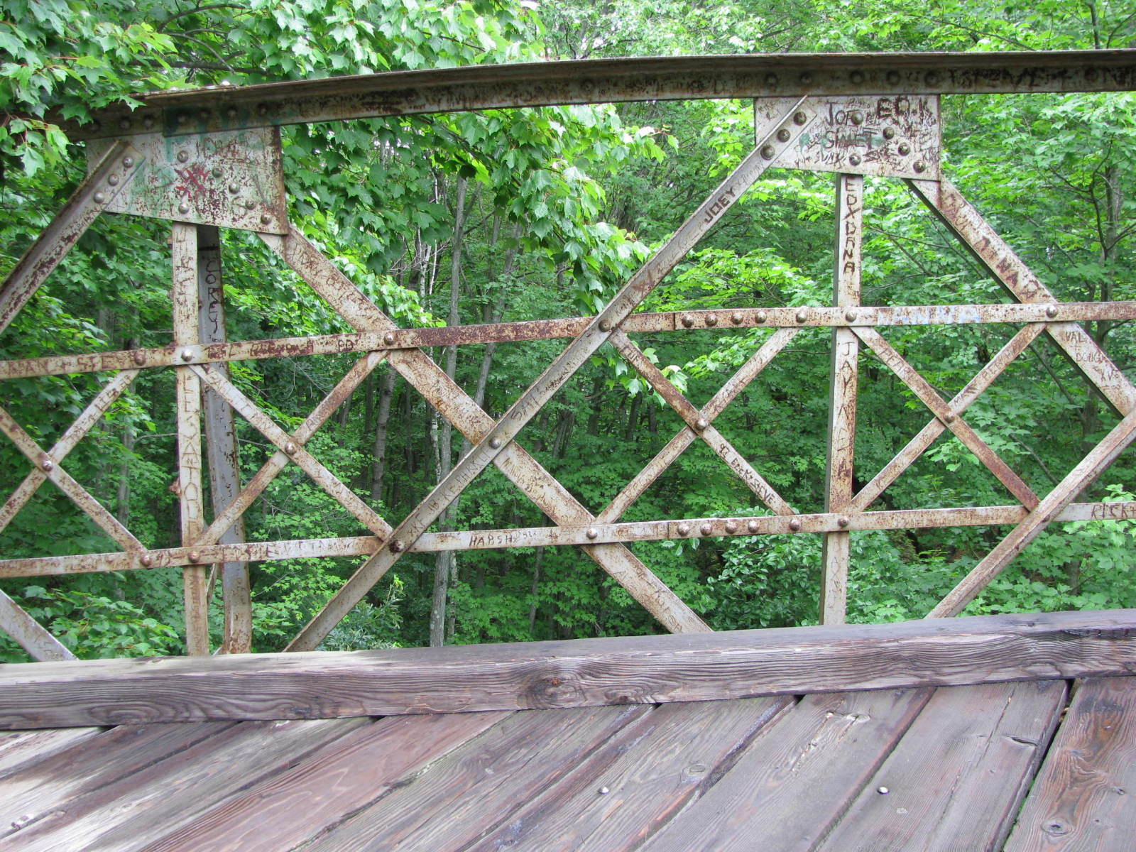
Location: 44.961240,-91.402851
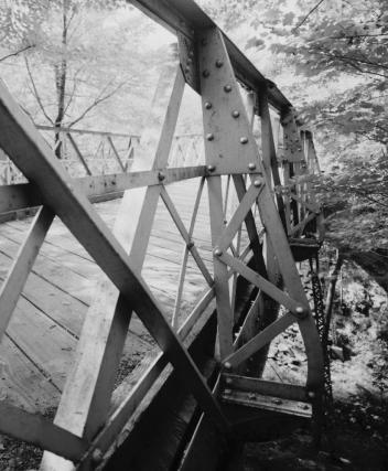
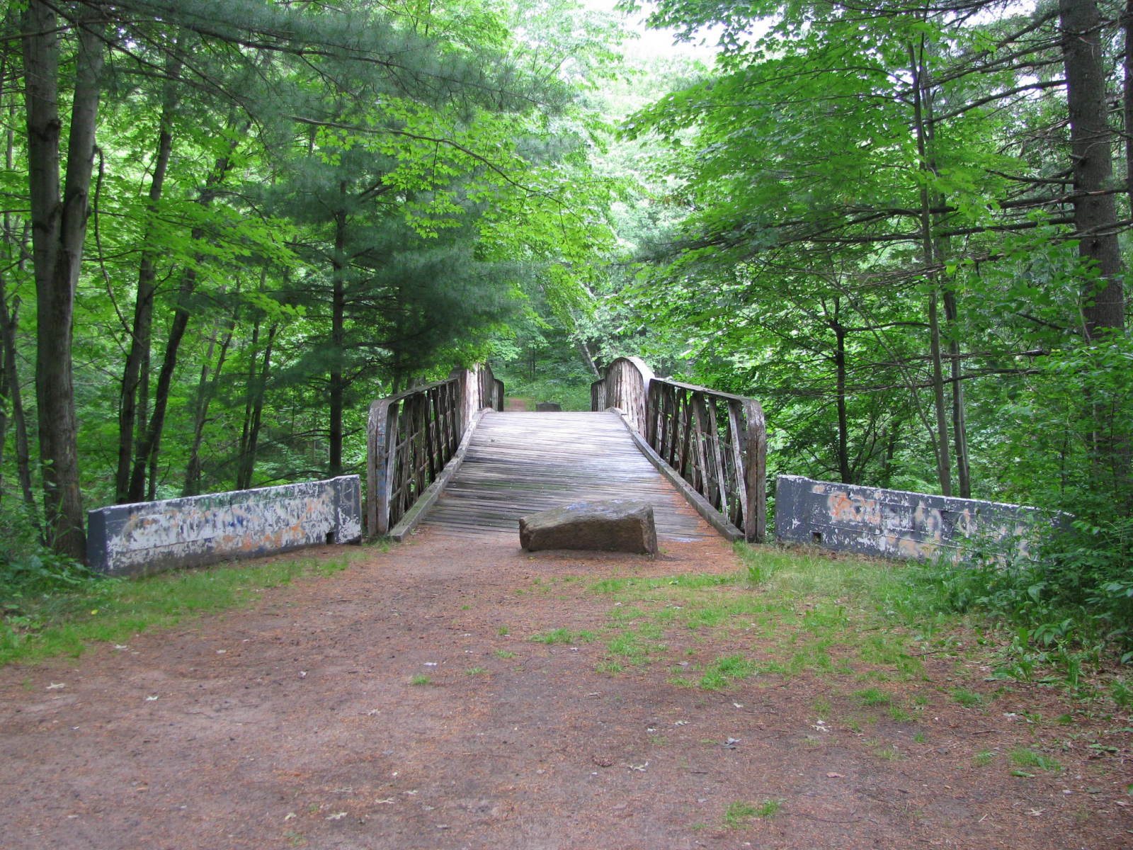
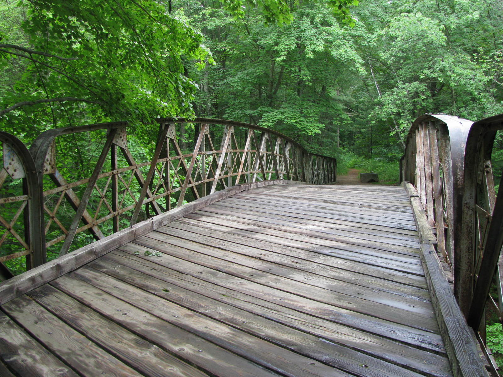
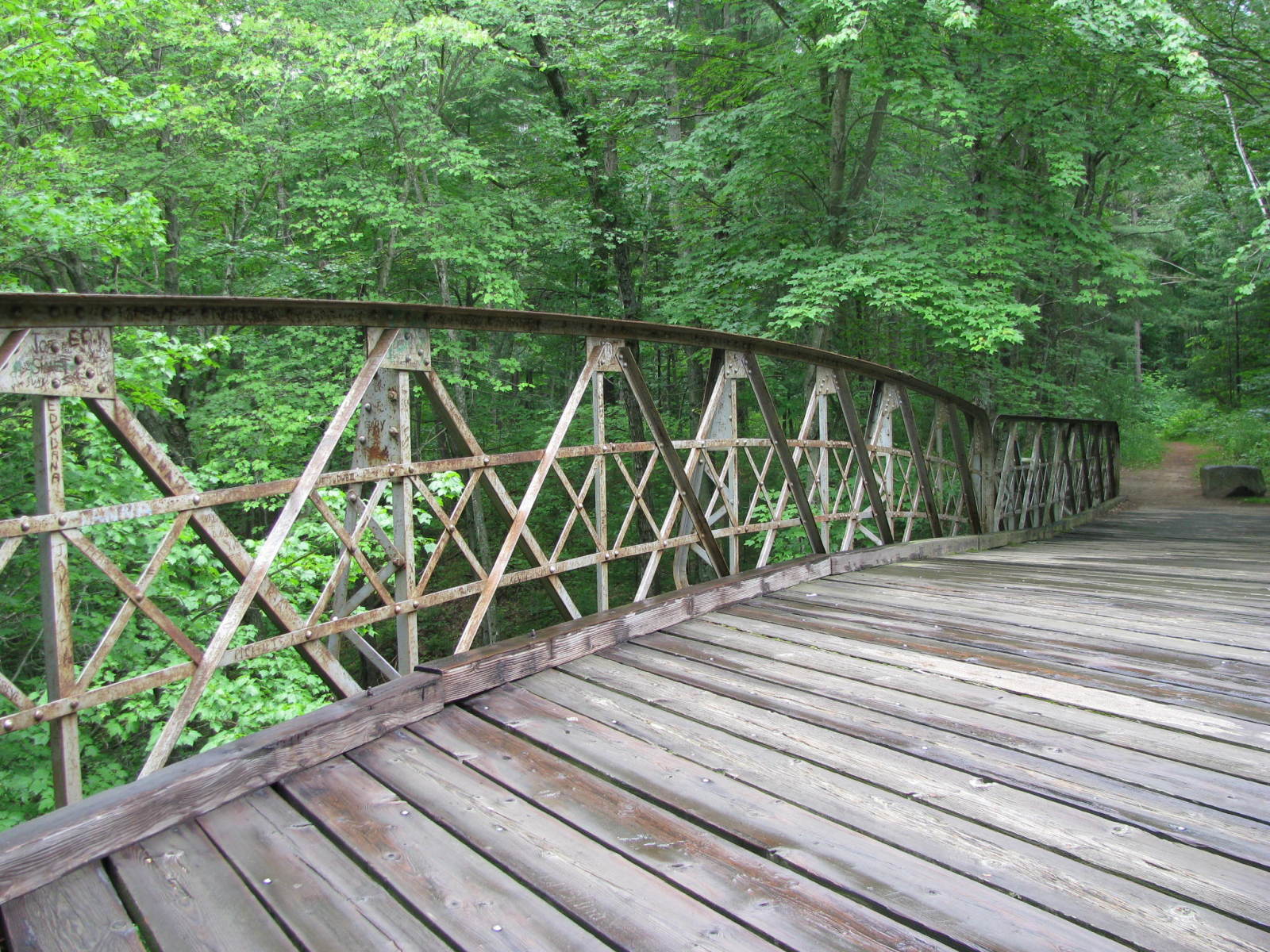
Carries Ermatinger Drive in Irvine Park over Ravine
Design: truss/pony/double-warren
Design Details: Double intersection Warren pony truss.
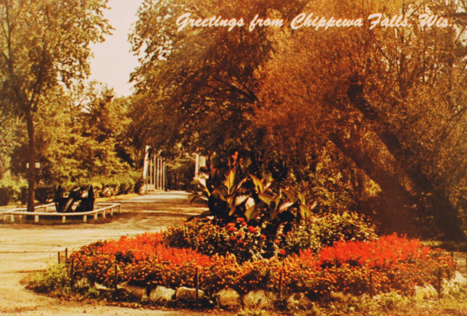
"In 1906, the city of Chippewa Falls established Irvine Park. The Bridge of Pines represents two phases of the park's development, In 1907m the Wisconsin Bridge and Iron Company erected a one-span arched Warren truss across Duncan Creek near the park's main entrance. In 1913, the Worden-Allen Company incorporated this bridge into a three-span structure crossing a ravine in a north addition. Both companies were prominent bridge-building firms that continued into the 1970s-1980s. The 146-foot structure incorporates the continuous top chord, a design apparently unique to these two companies. The Bridge of Pines is possibly the only remaining metal truss in Wisconsin specifically designed as an ornamental park bridge."
Diane Kromm, Wisc Historical Bridge Recording Project, Summer 1987
Total Length: 146.0 Feet
Span Length: 146.0 Feet
Overview: Pony truss bridge over Ravine on Erma Tinger Drive in Irvine Park in Chippewa Falls
History: Built 1907 by Wisconsin Bridge & Iron; Altered 1913 by Worden-Allen Co.
Built: 1907
Location: Chippewa County
View Bridge Information In Wayback Machine
![]()
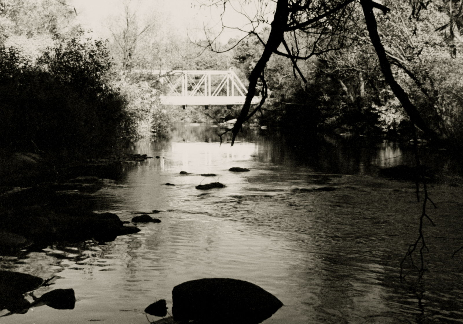
119723
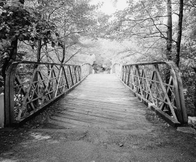
View Of Elevation, Looking North
The diagonal deck slats are attached on only one end, each other board to the opposite end. This caused the boards to create an odd noise when vehicles crossed, which is how it became known as, "The Rumbly Bridge." It is has been closed to vehicular traffic since 1981.
Photo taken by Martin Stupich, June 25, 1987 for HAER
119724
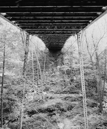
View From Below Deck, Showing Piers And Vertical Support Members
Photo taken by Martin Stupich, June 25, 1987 for HAER
119725
Detail View Of East Truss With Deck
Photo taken by Martin Stupich, June 25, 1987 for HAER
119726
Detail View Of East Truss, Showing Brace
Photo taken by Martin Stupich, June 25, 1987 for HAER
142196
Barrel Shot Looking South
Photo taken by J.R. Manning in July 2009
142197
Deck and East Railing
There are three spans here, two approach spans and the center span. This is the north approach and center span decks.
Photo taken by J.R. Manning in July 2009
142198
Center Span Deck and Railing
Photo taken by J.R. Manning in July 2009
142199
Barrel Shot Looking North
Photo taken by J.R. Manning in July 2009
142200
Oblique View Looking Northwest
Note the spindly-looking piers.
Photo taken by J.R. Manning in July 2009
142201
Railing Detail
Photo taken by J.R. Manning in July 2009
![]()
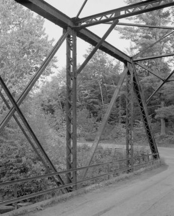
Status: Replaced by new bridge
Location: 45.192100,-91.127000
Carries 240th Avenue over Fisher River
Design: truss/through/pratt
Design Details: 6 panel, bolted rigid-connection, Pratt through truss
"The Bert Parsons Bridge is an excellent example of a steel, rigid-connected, Pratt through truss designed by the Wisconsin State Highway Commission. Constructed in 1914, it is one of the first bridges of its type in Wisconsin built according to a standardized state plan. In its design and material, the Bert Parsons Bridge exemplifies a once common bridge type. As one of the few remaining structures of this type, the bridge has been declared eligible for the National Register of Historic Places."
Chad J. Perkins and Charlene K. Roise
Hess, Roise and Company, Minneapolis, MN October 1994 for HAER
Total Length: 90.0 Feet
Span Length: 90.0 Feet
Overview: Lost Pratt through truss bridge over Fisher River on 240th Avenue in Town of Estella
History: Built 1914; Replaced 1995
Built: 1914
Location: Chippewa County
View Bridge Information In Wayback Machine
![]()
119727
Northeast Side, Looking Southwest
Photo taken by Jerry Mathiason, Sept 1994 for HAER
119728
Southwest Side, Looking Northeast
Photo taken by Jerry Mathiason, Sept 1994 for HAER
119729
Northwest Approach, Looking Southeast
Photo taken by Jerry Mathiason, Sept 1994 for HAER
119730
Southeast Approach, Looking Northwest
Photo taken by Jerry Mathiason, Sept 1994 for HAER
119731
Southeast Approach, Looking West-Northwest
Photo taken by Jerry Mathiason, Sept 1994 for HAER
119732
Interior Of Span: Northeast Side, Looking East
Photo taken by Jerry Mathiason, Sept 1994 for HAER
119733
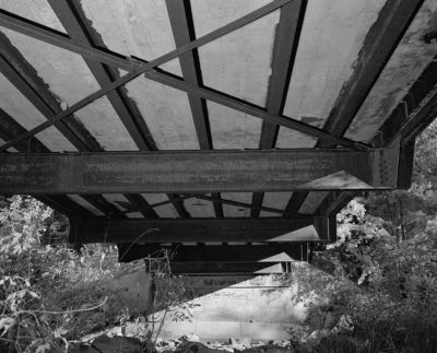
Underside Of Deck, Looking Southeast
Photo taken by Jerry Mathiason, Sept 1994 for HAER
119734
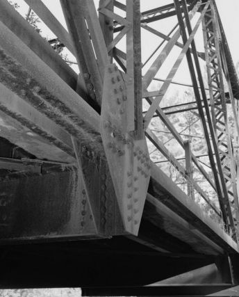
Detail Of Lower Chord Intersection With Floor Beam, Verticals, And Diagonals; Looking East
Photo taken by Jerry Mathiason, Sept 1994 for HAER
![]()
Status: In operation
Location: 44.932380,-91.389610
Carries over Chippewa River
Design: other
Design Details: Hydroelectric Dam
Total Length: 0.0 Feet
Span Length: 0.0 Feet
Overview: Hydroelectric dam over Chippewa River in Chippewa Falls
History: Built 1928 by Northern States Power Company
Built: 1928
Location: Chippewa County
View Bridge Information In Wayback Machine
![]()
142451
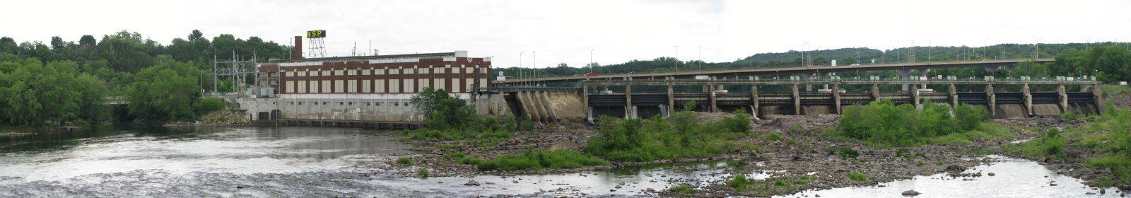
Chippewa Falls Hydroelectric Dam
The dam was built in 1928 by Northern States Power Company on the site of what was once one of the largest saw mills in the world. Within a distance of about a mile, the river is crossed by two highway bridges, two rail trestles and this dam. It is just downriver from the Lake Wissota Dam, which created Lake Wissota and is mentioned in the movie Titanic, although the dam, and Lake Wissota, were not completed until 1918. This photo was taken from the Main Street Bridge. (Which is a modern slab and is not listed here.)
Photo taken by J.R. Manning
142452
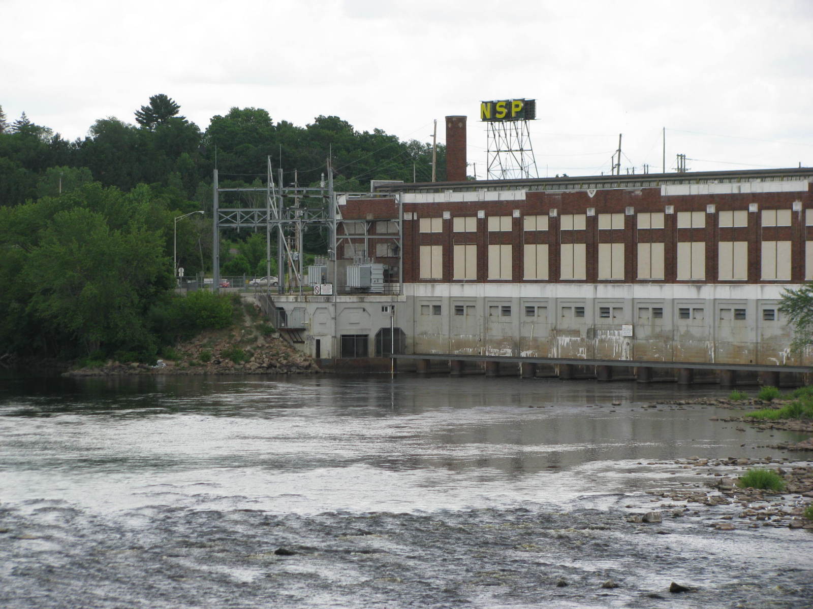
Hydroelectric Plant
Although the dam is now owned by Xcel Energies, the NSP neon sign still adorns the hydroelectric plant.
Photo taken by J.R. Manning in July 2009
142453
Dam
The bridge in the background carries WI 124.
Photo taken by J.R. Manning in July 2009
![]()
Status: Open to traffic
Location: 44.928610,-91.392840
Carries Canadian National (formerly Soo Line Railroad) over Main Street
Design: girder/pony/plate
Design Details: Pony/through plate girder
Total Length: 71.9 Feet
Span Length: 44.0 Feet
Overview: Pony/through plate girder bridge over Main Street on Canadian National Railway (formerly Soo Line Railroad) in Chippewa Falls
History: Built 1917
Built: 1917
Location: Chippewa County
View Bridge Information In Wayback Machine
![]()
142464
North Elevation
This right-of-way is a very busy stretch of track. It splits just to the west of this location with the main line crossing the Chippewa River. A branch line that runs from the split, south to Eau Claire, and is a candidate for Rails-to-trail.
Photo taken by J.R. Manning in July 2009
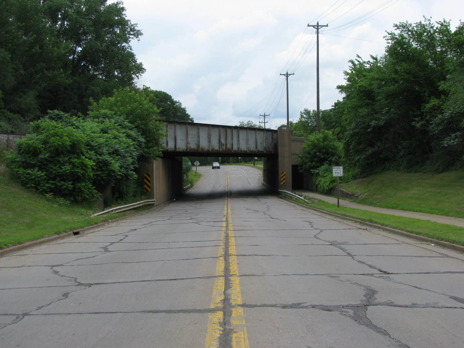
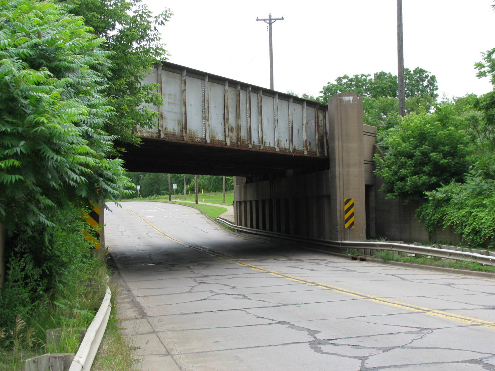
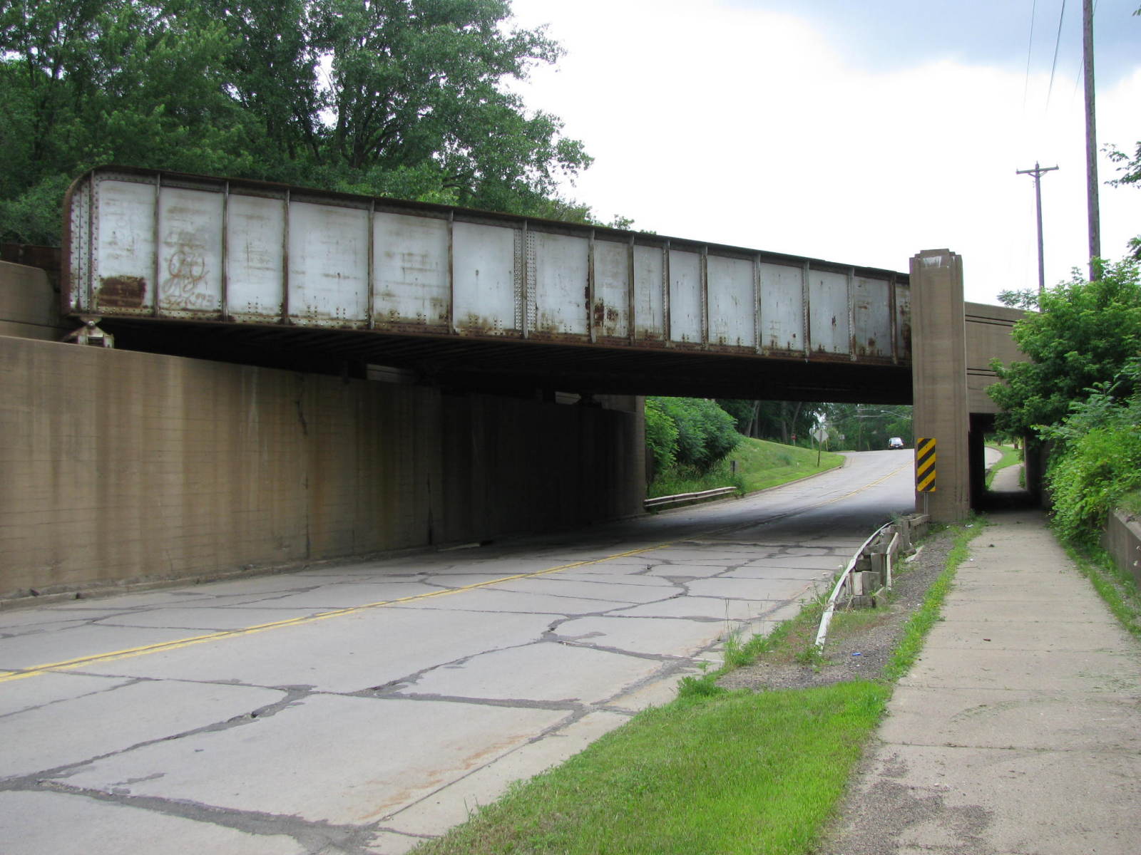
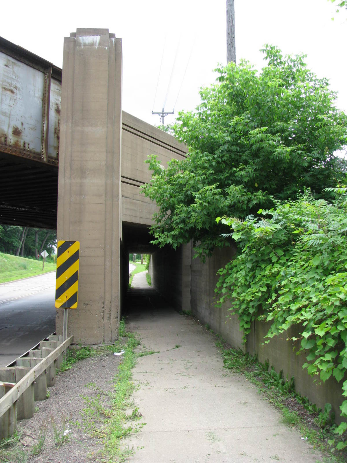
![]()
Status: Open to traffic
Location: 44.930000,-91.401667
Carries Canadian National Railway (former Soo Line Railroad) over WI Bus 29 / River Road
Design: girder/pony/plate
Design Details: Pony/through plate girder
Total Length: 81.4 Feet
Span Length: 79.1 Feet
Overview: Pony/through plate girder bridge over WI Bus 29 / River Road on Canadian National Railway (Formerly Soo Line) in Chippewa Falls
History: Built 1952
Built: 1952
Location: Chippewa County
View Bridge Information In Wayback Machine
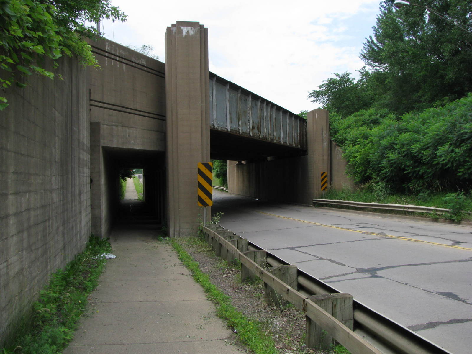
![]()
142773
West Approach
I was impressed by the Art Deco design of the abutments and facing of the approach spans. I was surprised to learn this bridge was built as late as it was because it appears like it might have been built 20 years prior.
Photo taken by J.R. Manning in July 2009
142774
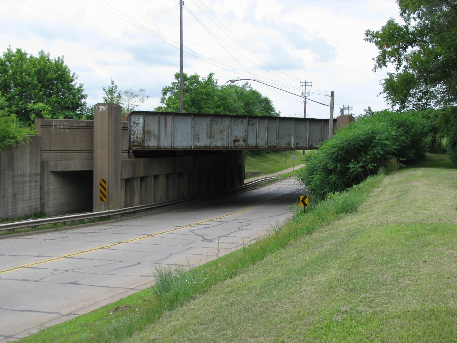
Barrel Shot Looking East
Photo taken by J.R. Manning in July 2009
142775
Oblique View Looking Southeast
Photo taken by J.R. Manning in July 2009
142776
West Elevation
Photo taken by J.R. Manning in July 2009
142777
Pedestrian Underpass
Photo taken by J.R. Manning in July 2009
142778
East Elevation
Photo taken by J.R. Manning in July 2009
142779
East Face
Photo taken by J.R. Manning in July 2009
142780
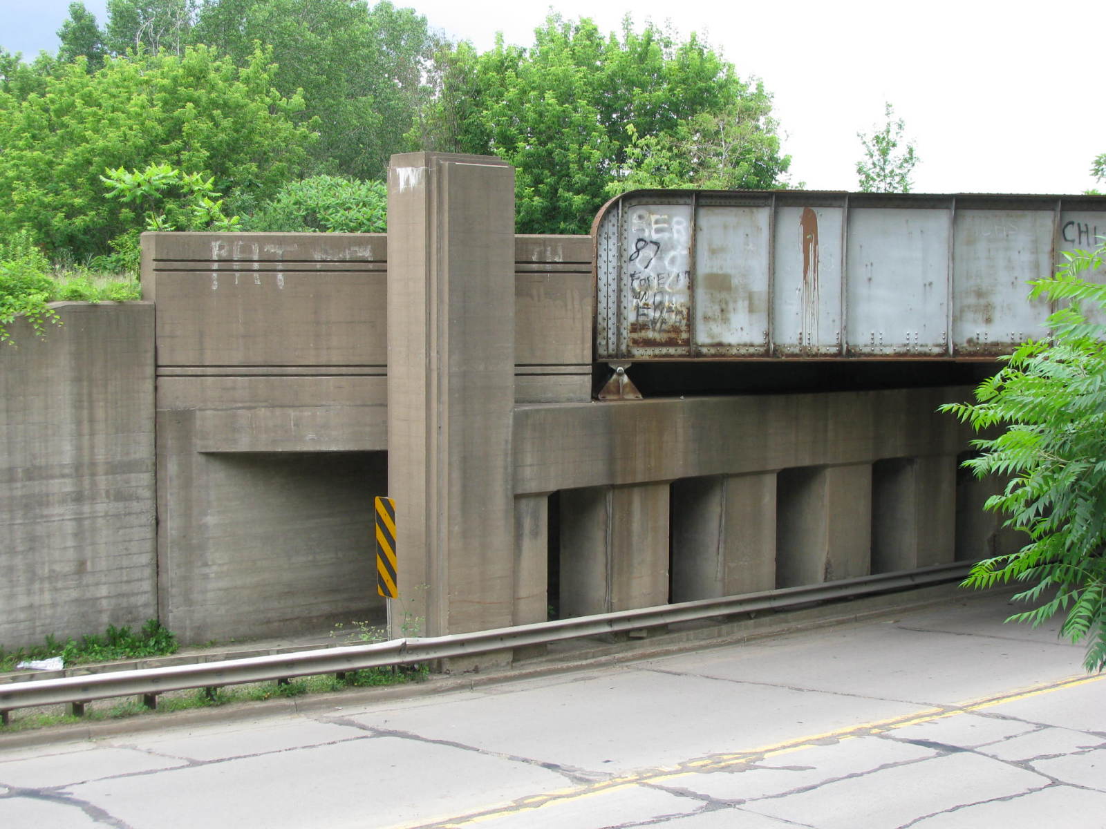
South Pier and Abutment
Note the Art Deco details of the pylon and on the facing of this short approach span.
Photo taken by J.R. Manning in July 2009
142781
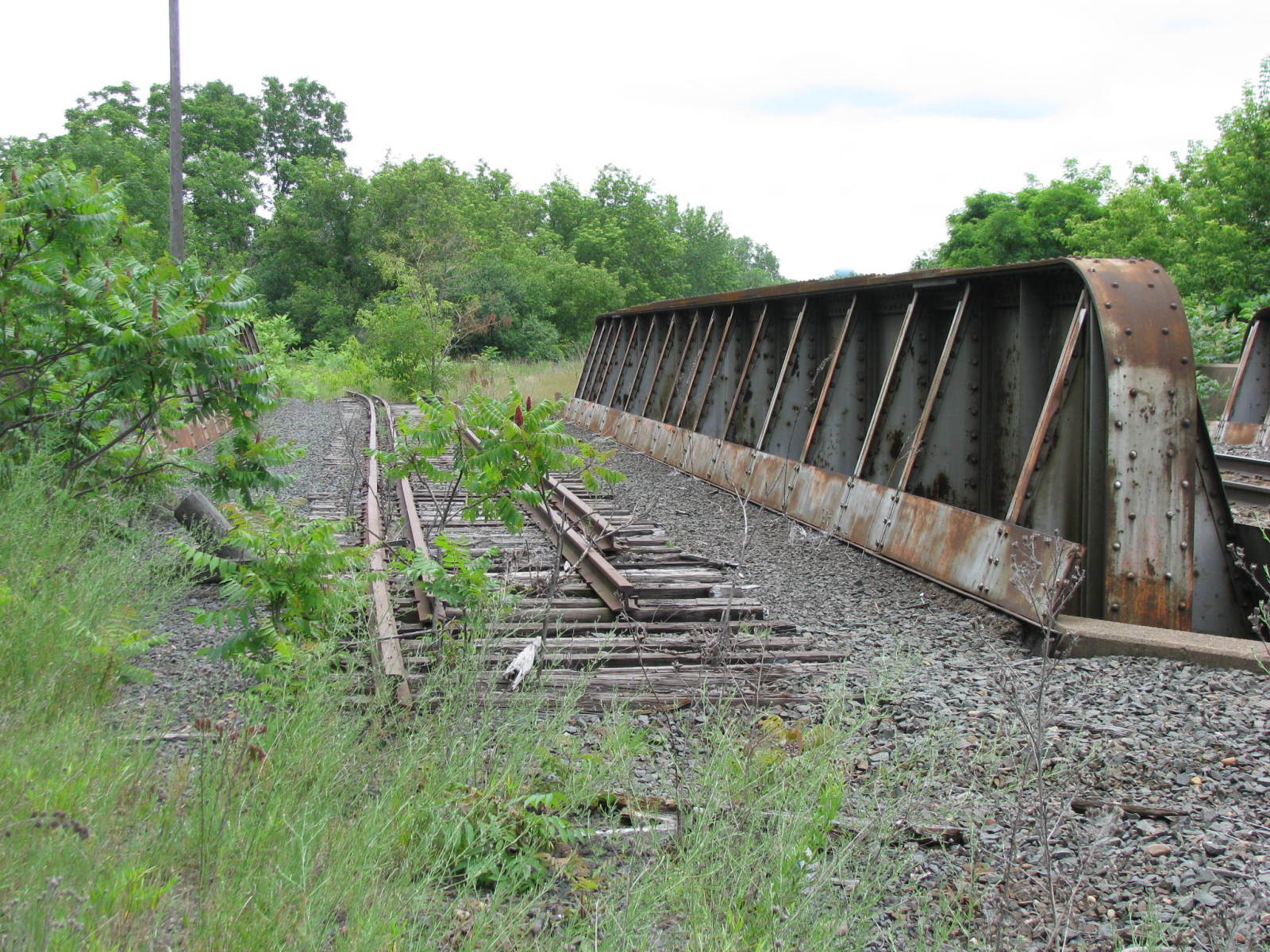
Deck
There are two spans here, which is not initially obvious. The east span carries a siding that is no longer in use.
Photo taken by J.R. Manning in July 2009
142782
Pier Cap Detail
Photo taken by J.R. Manning in July 2009
142783
West Deck
The west span carries the active track.
Photo taken by J.R. Manning in July 2009
142784
Deck of both spans
Looking northwest.
Photo taken by J.R. Manning in July 2009
142785
Active Deck
Looking northwest.
Photo taken by J.R. Manning in July 2009
256515

CN Riverside Street Bridge
Looking North
Photo taken by John Marvig in June 2013
256516
CN Riverside Street Bridge
Photo taken by John Marvig in June 2013
256517
CN Riverside Street Bridge
North Abutment
Photo taken by John Marvig in June 2013
256518
CN Riverside Street Bridge
South Approach
Photo taken by John Marvig in June 2013
256519
CN Riverside Street Bridge
North Abutment
Photo taken by John Marvig in June 2013
256520
CN Riverside Street Bridge
Photo taken by John Marvig in June 2013
256521
CN Riverside Street Bridge
Photo taken by John Marvig in June 2013
256522
CN Riverside Street Bridge
Photo taken by John Marvig in June 2013
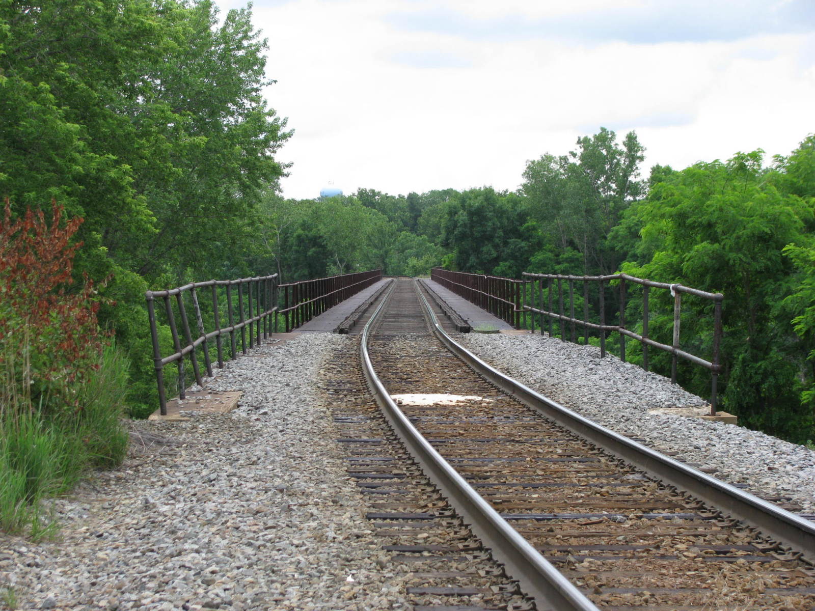
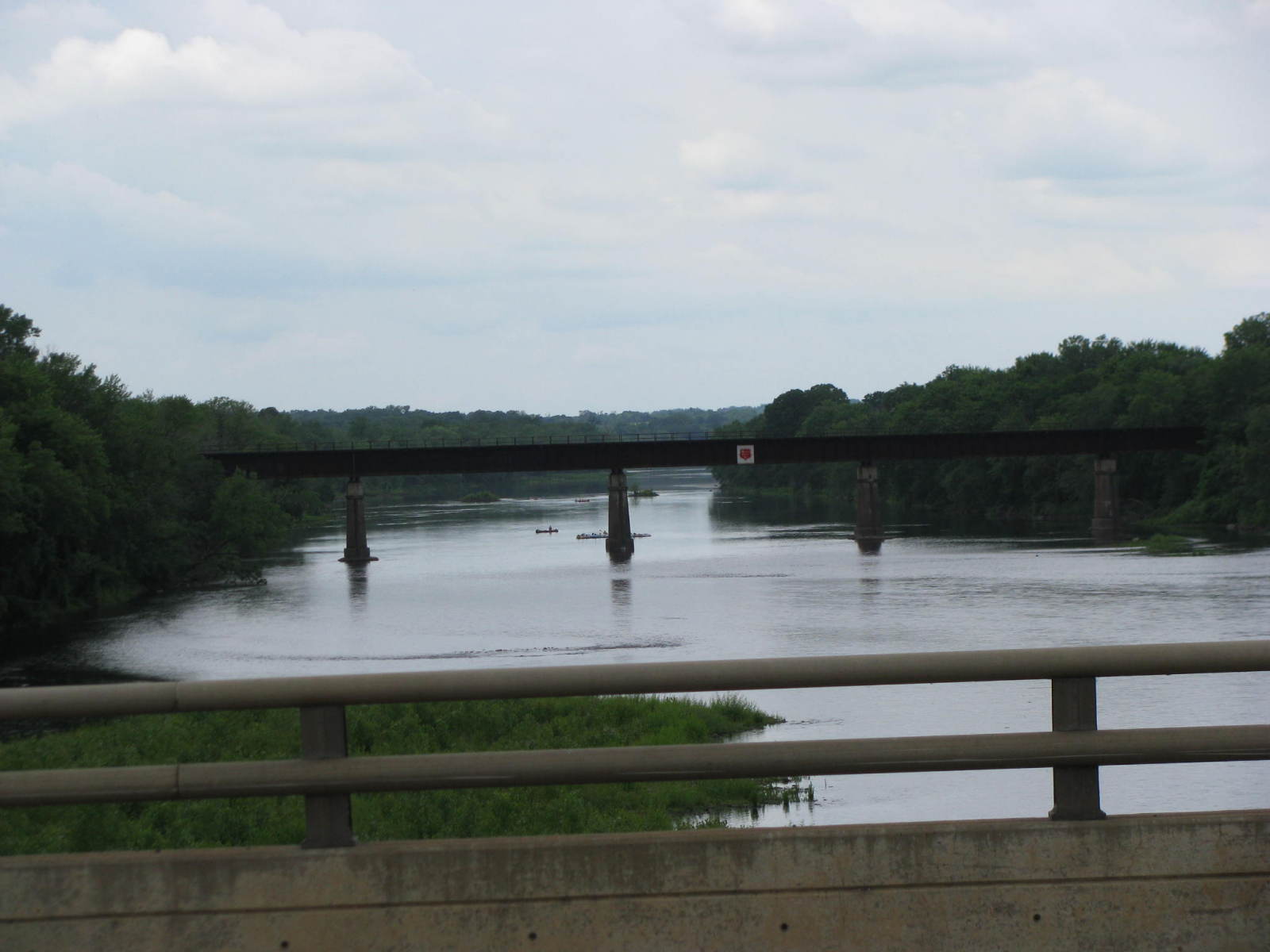
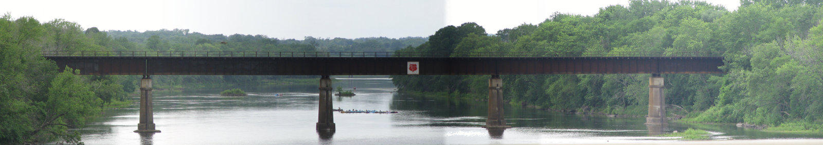
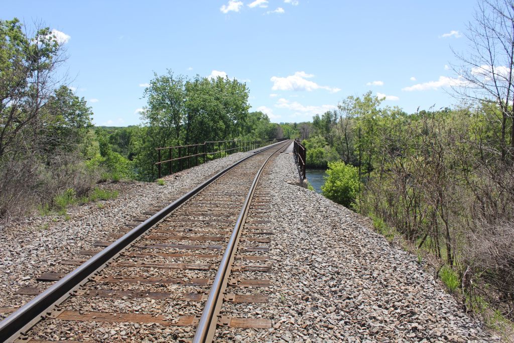
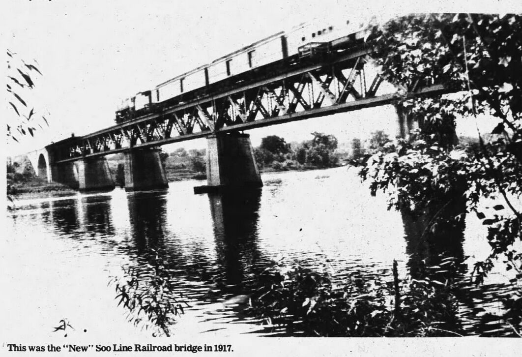
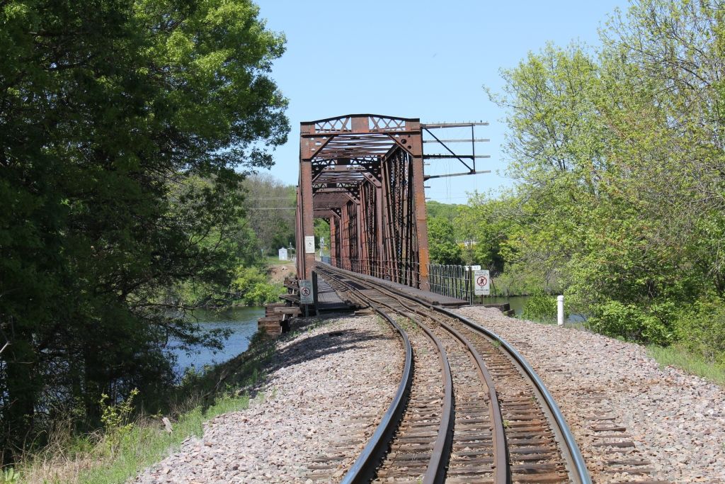
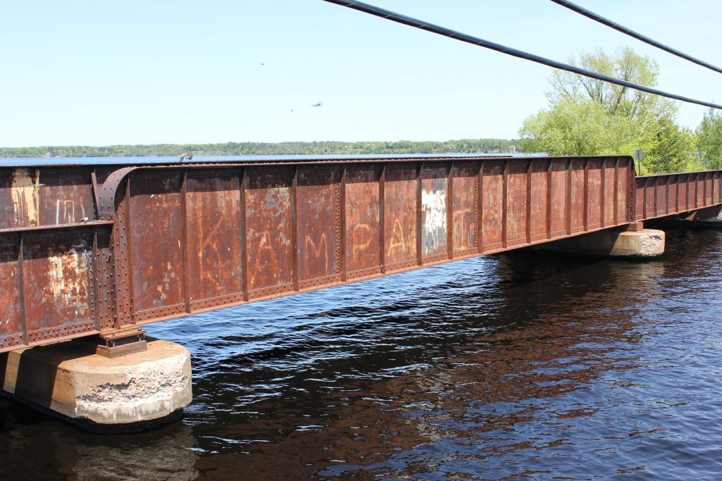
![]()
Status: Replaced by a new bridge
Location: 44.929160,-91.401630
Carries Canadian National Railway (former lyWisconsin Central Ltd., formerly Soo Line Railroad) over Chippewa River
Design: truss/deck/warren
Design Details: Warren deck truss
Total Length: 780.0 Feet
Span Length: 115.0 Feet
Overview: Deck plate girder bridge over Chippewa River on Canadian National Railway (formerly Soo Line Railroad, Wisconsin Central Ltd.) in Chippewa Falls
History: Built 1917 with Concrete arches and 5 Deck Plate Girder main spans, rebuilt 1998 with 5 new DPG main spans.
Built: 1917
Location: Chippewa County
View Bridge Information In Wayback Machine
![]()
142786
West Face and Railing
Photo taken by J.R. Manning in July 2009
142787
Deck
Looking southeast from the top of River Street Railroad Bridge.
Photo taken by J.R. Manning in July 2009
142788
East Elevation
Photo taken by J.R. Manning in July 2009
142789
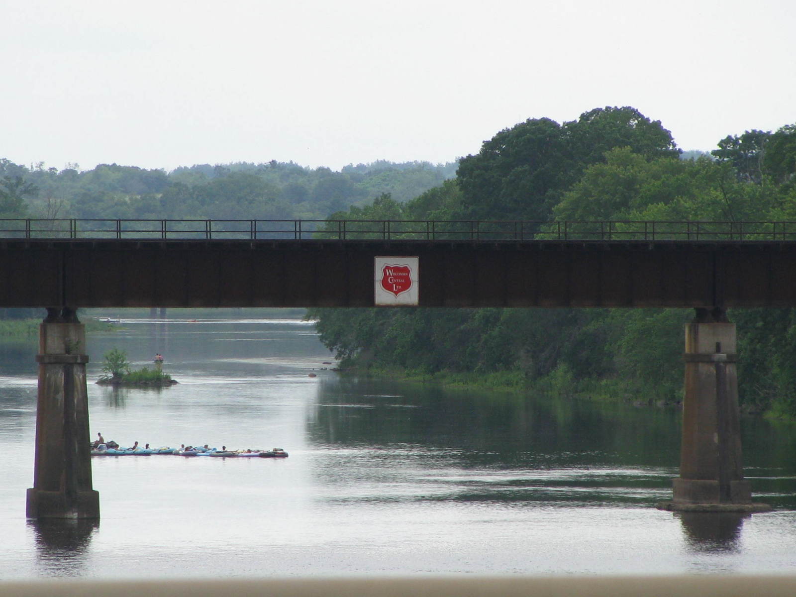
Center Span Logo
Even though the Soo Line spun off the Wisconsin Central in 1987 (operating it as a "railroad inside a railroad") and the Canadian National took controlling interest of the Soo Line in 1990, the Wisconsin Central Logo still adorns the center span of this trestle.
Photo taken by J.R. Manning in July 2009
142790
East Elevation
Without access to any official information, I estimate the length of this span to be greater than 750 feet but less than 800 feet in length.
Photo taken by J.R. Manning
142791
South Abutment
Sadly, I had to leaf without a clear photo of the end of the span.
Photo taken by J.R. Manning in July 2009
256507
CN Chippewa River Bridge
Arch Span
Photo taken by John Marvig in June 2013
256508
CN Chippewa River Bridge
Photo taken by John Marvig in June 2013
256509
CN Chippewa River Bridge
Photo taken by John Marvig in June 2013
256510
CN Chippewa River Bridge
Damage
Photo taken by John Marvig in June 2013
256511
CN Chippewa River Bridge
Photo taken by John Marvig in June 2013
256512
CN Chippewa River Bridge
Photo taken by John Marvig in June 2013
256513
CN Chippewa River Bridge
Photo taken by John Marvig in June 2013
256514
CN Chippewa River Bridge
Looking south
Photo taken by John Marvig in June 2013
495994
Courtesy of the Chippewa Herald-Telegram
![]()
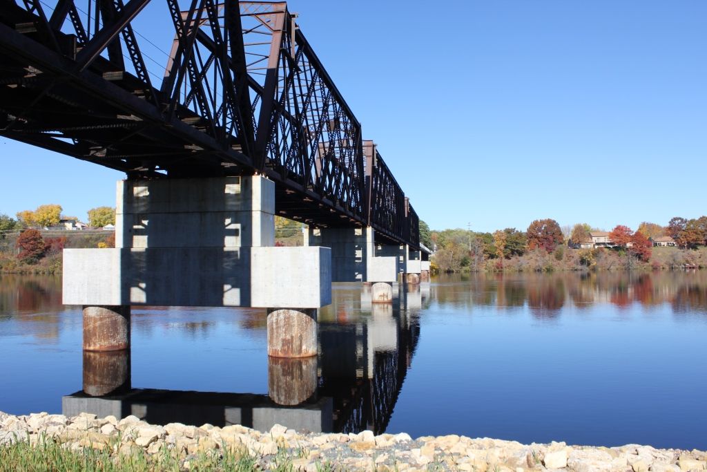
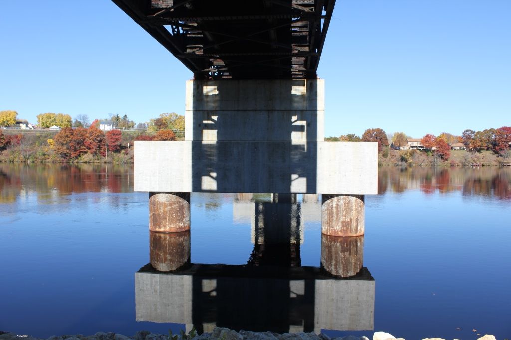
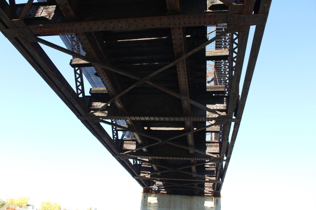
Status: Open to traffic
Location: 44.934793,-91.379199
Carries Union Pacific Railroad over Chippewa River
Design: truss/through/lattice/quadrangular
Design Details: From North to South:
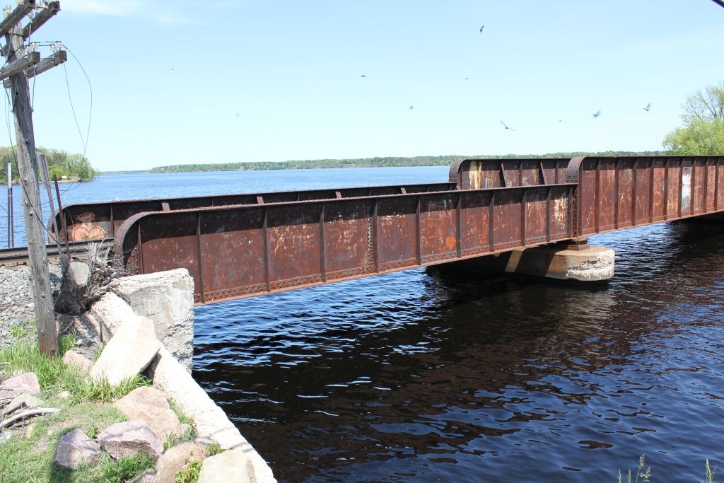
1-24' I-Beam Span (24')
3-100' Deck Plate Girder Spans (300')
1-12' I-Beam Span (12')
2-160' Quadrangular Truss Spans (320')
2-100' Quadrangular Truss Spans (200')
4 Spans Trestle (51')
Total Length: 907.0 Feet
Span Length: 160.0 Feet
Overview: Quadrangular lattice through truss bridge over Chippewa River on Union Pacific Railroad
History: Built 1891 as a 6-span bridge; two spans burned and replaced with secondhand girders in 1993, Piers Rebuilt 2014
Built: 1891
Location: Chippewa County
View Bridge Information In Wayback Machine
![]()
228543
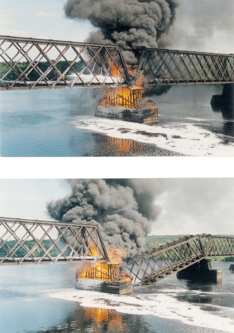
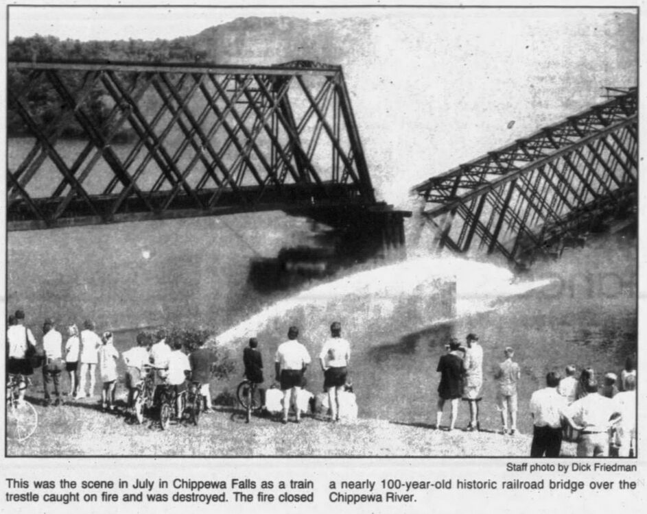
BrFire1
The bridge burns on July 21st 1993, and spans 5 and 6 collapse into the river...
Photo taken by Bob Gile
231880
Chippewa Falls Railroad Bridge
Looking north towards Bridge
Photo taken by John Marvig in May 2012
231881
Chippewa Falls Railroad Bridge
Looking North Across Bridge
Photo taken by John Marvig in May 2012
231882
Chippewa Falls Railroad Bridge
Trestle Approaches
Photo taken by John Marvig in May 2012
231883
Chippewa Falls Railroad Bridge
Looking North along Bridge
Photo taken by John Marvig in May 2012
231884
Chippewa Falls Railroad Bridge
South abutment
Photo taken by John Marvig in May 2012
231885
Chippewa Falls Railroad Bridge
Under bridge and Pier #7
Photo taken by John Marvig in May 2012
231886
Chippewa Falls Railroad Bridge
South Bank
Photo taken by John Marvig in May 2012
231887
Chippewa Falls Railroad Bridge
Pier #8
Photo taken by John Marvig in May 2012
231888
Chippewa Falls Railroad Bridge
South Bank
Photo taken by John Marvig in May 2012
231890
Chippewa Falls Railroad Bridge
Portal Detail
Photo taken by John Marvig in May 2012
231891
Chippewa Falls Railroad Bridge
Looking south along bridge
Photo taken by John Marvig in May 2012
231892
Chippewa Falls Railroad Bridge
Taken from top of hill
Photo taken by John Marvig in May 2012
231893
Chippewa Falls Railroad Bridge
Taken from top of hill
Photo taken by John Marvig in May 2012
231894
Chippewa Falls Railroad Bridge
Photo taken by John Marvig in May 2012
231895
Chippewa Falls Railroad Bridge
Pier #3
Photo taken by John Marvig in May 2012
231896
Chippewa Falls Railroad Bridge
Short beam span
Photo taken by John Marvig in May 2012
231897
Chippewa Falls Railroad Bridge
Pier(s) #4
Photo taken by John Marvig in May 2012
231898
Chippewa Falls Railroad Bridge
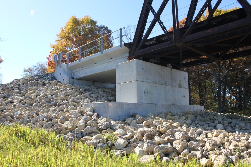
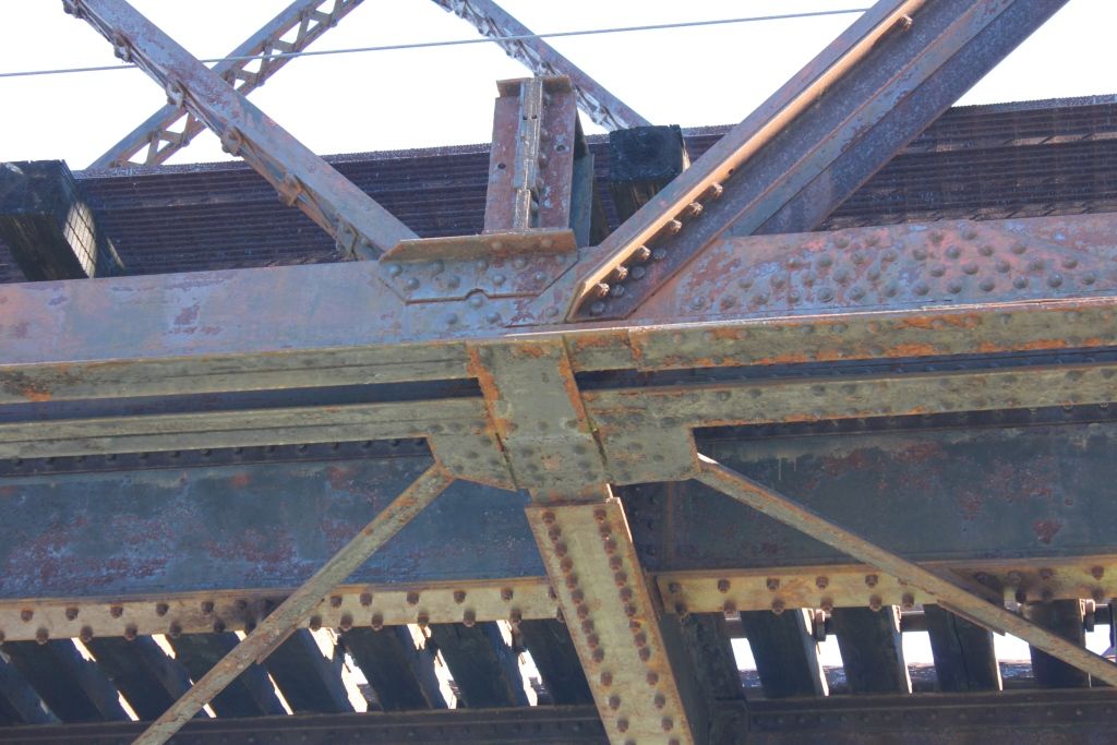
Deck Plate Girder span from Lake Wissota Bridge
Photo taken by John Marvig in May 2012
231899
Chippewa Falls Railroad Bridge
Looking south across bridge
Photo taken by John Marvig in May 2012
231900
Chippewa Falls Railroad Bridge
Looking south along bridge
Photo taken by John Marvig in May 2012
231901
Chippewa Falls Railroad Bridge
Pier #1
Photo taken by John Marvig in May 2012
231902
Chippewa Falls Railroad Bridge
North abutment
Photo taken by John Marvig in May 2012
280471
Chippewa Falls Rail Bridge
Crappy day to work
Photo taken by John Marvig in March 2014
280472
Chippewa Falls Rail Bridge
Trusses will be preserved
Photo taken by John Marvig in March 2014
280473
Chippewa Falls Rail Bridge
The timber on this bridge will not be preserved
Photo taken by John Marvig in March 2014
280474
Chippewa Falls Rail Bridge
Trusses will be shifted to completely do away with an east approach
Photo taken by John Marvig in March 2014
280475
Chippewa Falls Rail Bridge
Photo taken by John Marvig in March 2014
280476
Chippewa Falls Rail Bridge
There will be no east approach after work is complete
Photo taken by John Marvig in March 2014
336258
Chippewa Falls Rail Bridge
Looking North
Photo taken by John Marvig in October 2014
336259
Chippewa Falls Rail Bridge
South Approach
Photo taken by John Marvig in October 2014
336260
Chippewa Falls Rail Bridge
Overview
Photo taken by John Marvig in October 2014
336261
Chippewa Falls Rail Bridge
South Span
Photo taken by John Marvig in October 2014
336262
Chippewa Falls Rail Bridge
Overview
Photo taken by John Marvig in October 2014
336263
Chippewa Falls Rail Bridge
South Approach
Photo taken by John Marvig in October 2014
336264
Chippewa Falls Rail Bridge
Looking North
Photo taken by John Marvig in October 2014
336265
Chippewa Falls Rail Bridge
Pier
Photo taken by John Marvig in October 2014
336266
Chippewa Falls Rail Bridge
Under Bridge
Photo taken by John Marvig in October 2014
336267
Chippewa Falls Rail Bridge
Lower Connection
Photo taken by John Marvig in October 2014
336268
Chippewa Falls Rail Bridge
New Approach
Photo taken by John Marvig in October 2014
336269
Chippewa Falls Rail Bridge
Looking North
Photo taken by John Marvig in October 2014
336270
Chippewa Falls Rail Bridge
Lower Angle Connection
Photo taken by John Marvig in October 2014
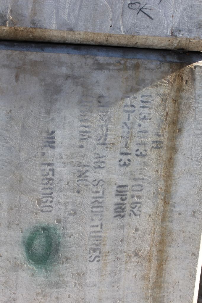
344370
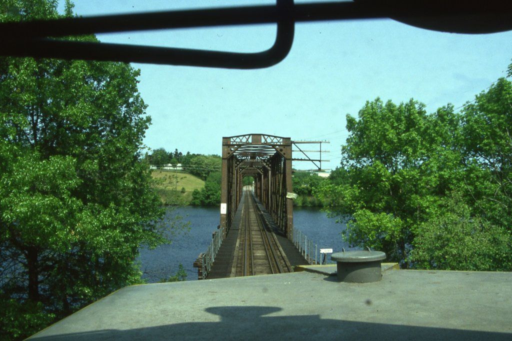
Photo taken by Charles Kuehn, May 2003
344371
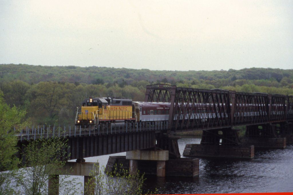
Photo taken by Charles Kuehn, May 2005
495992
Courtesy of the Eau Claire Leader-Telegram
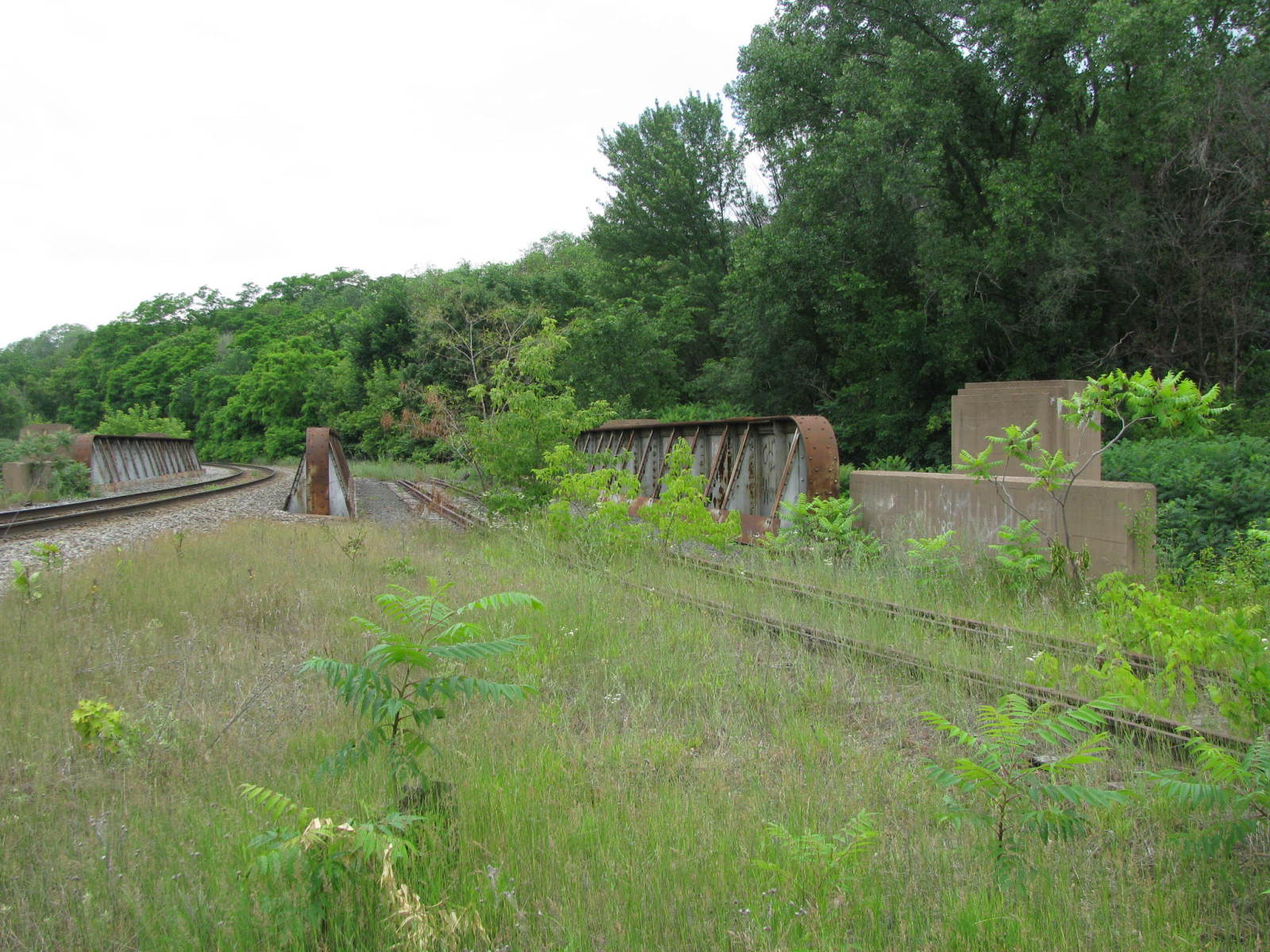
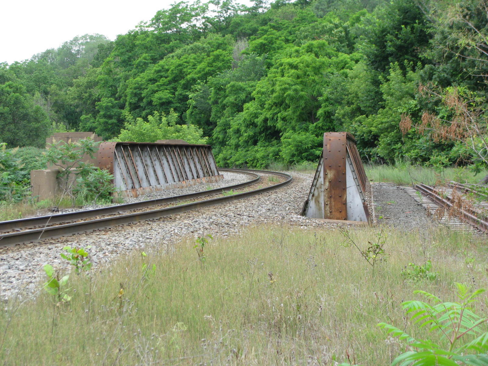
![]()
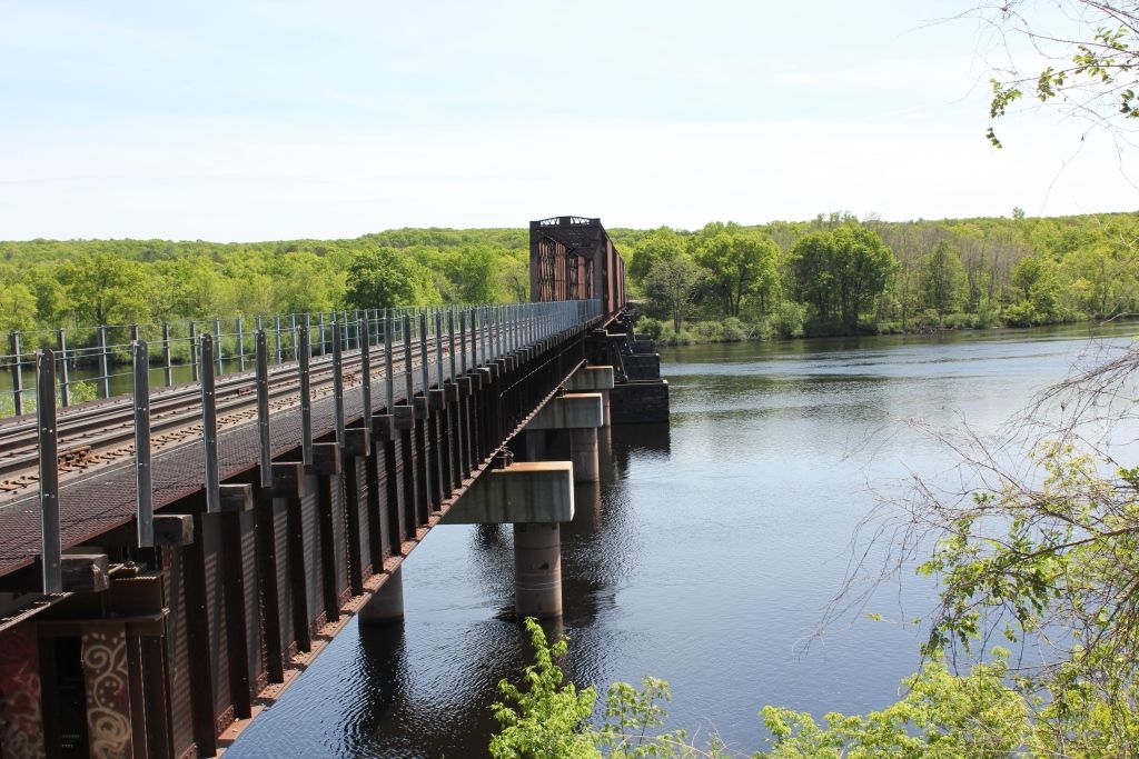
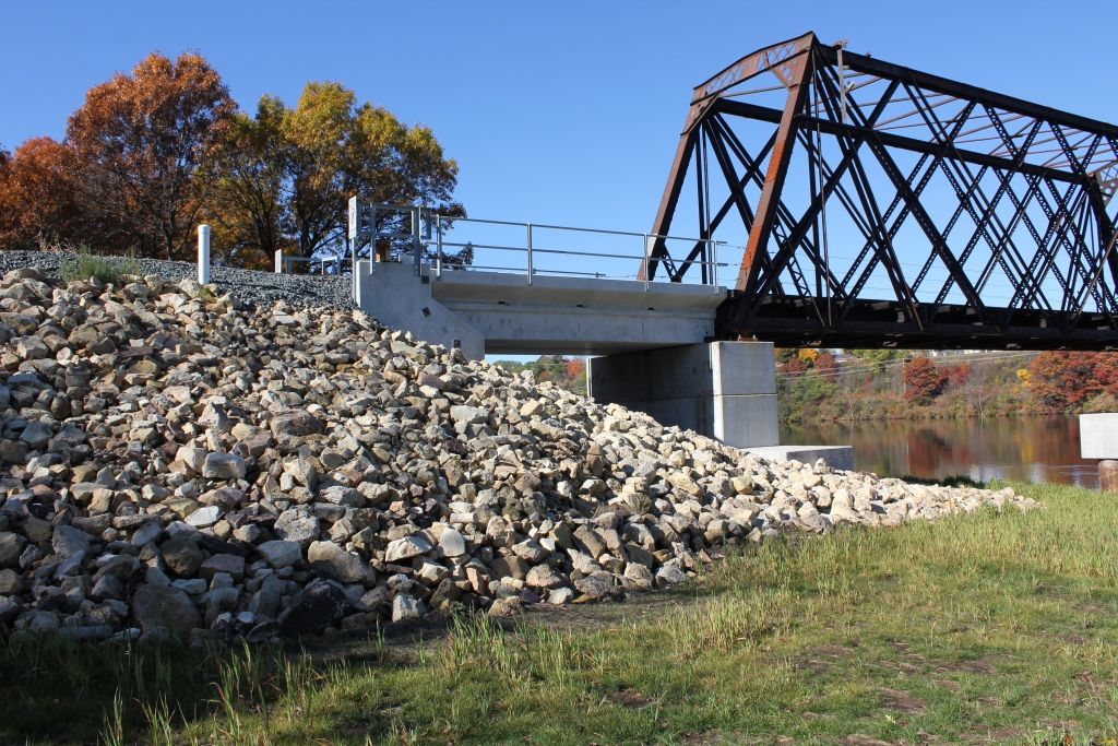
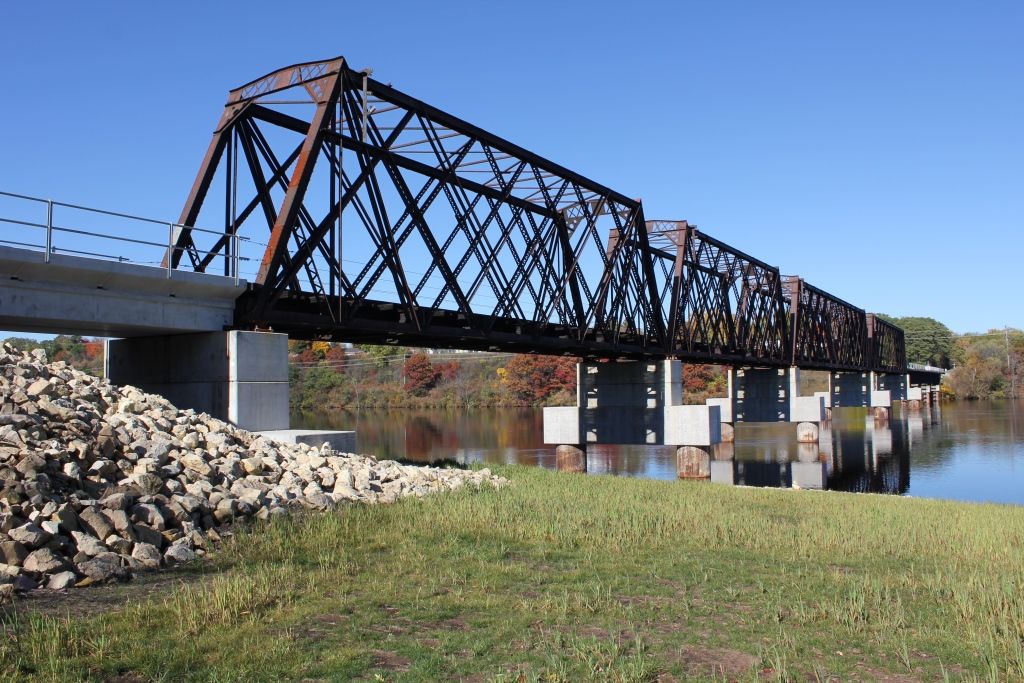
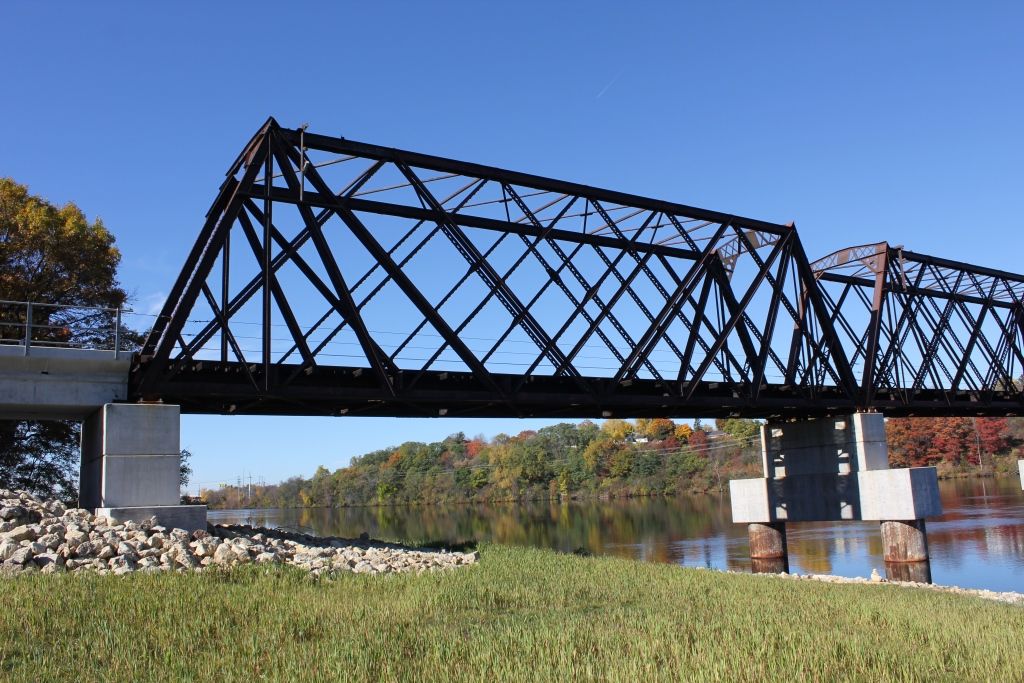
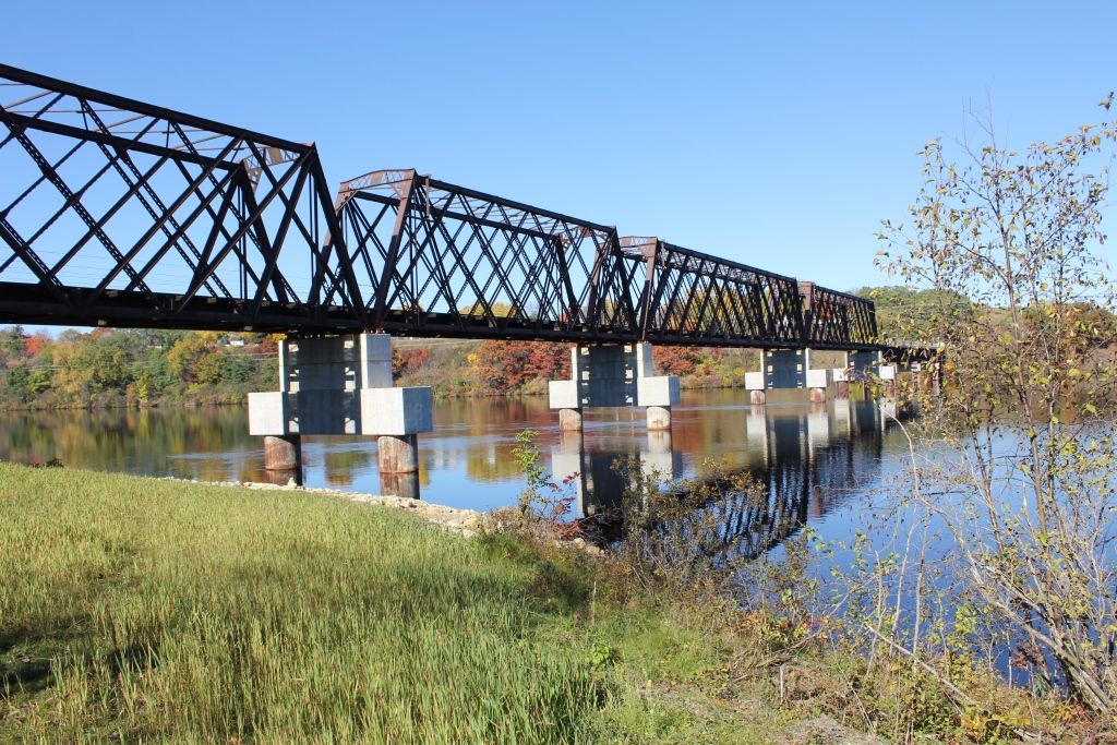
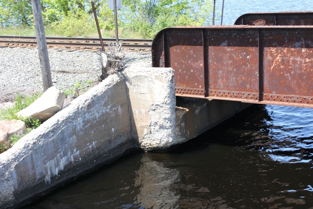
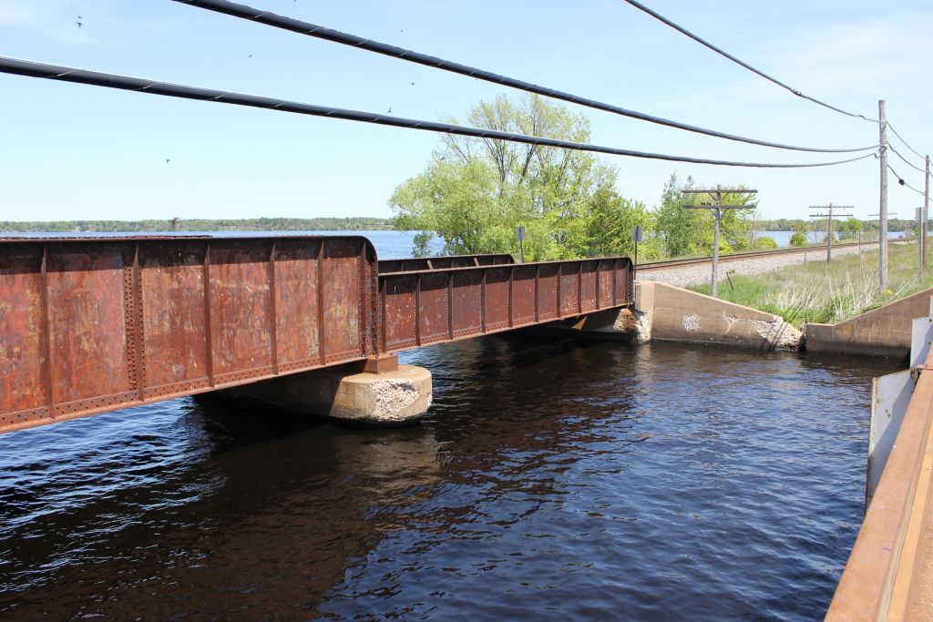
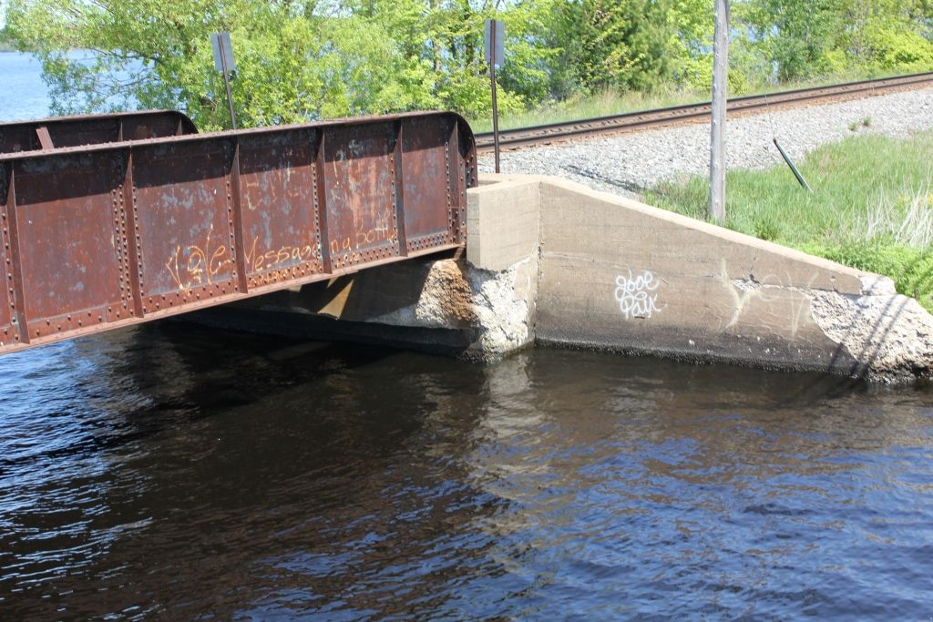
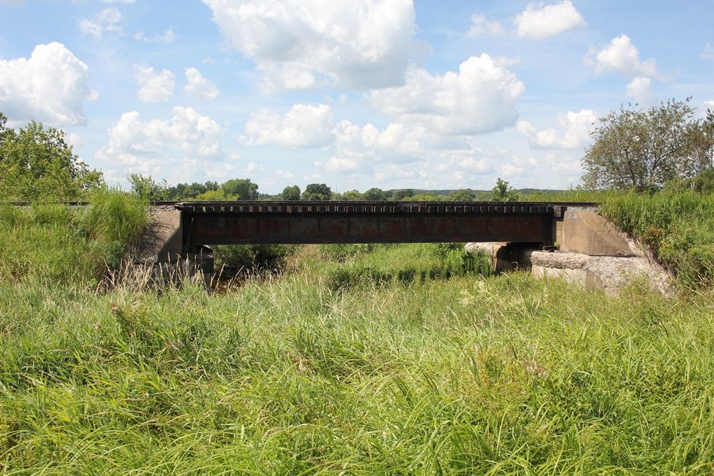
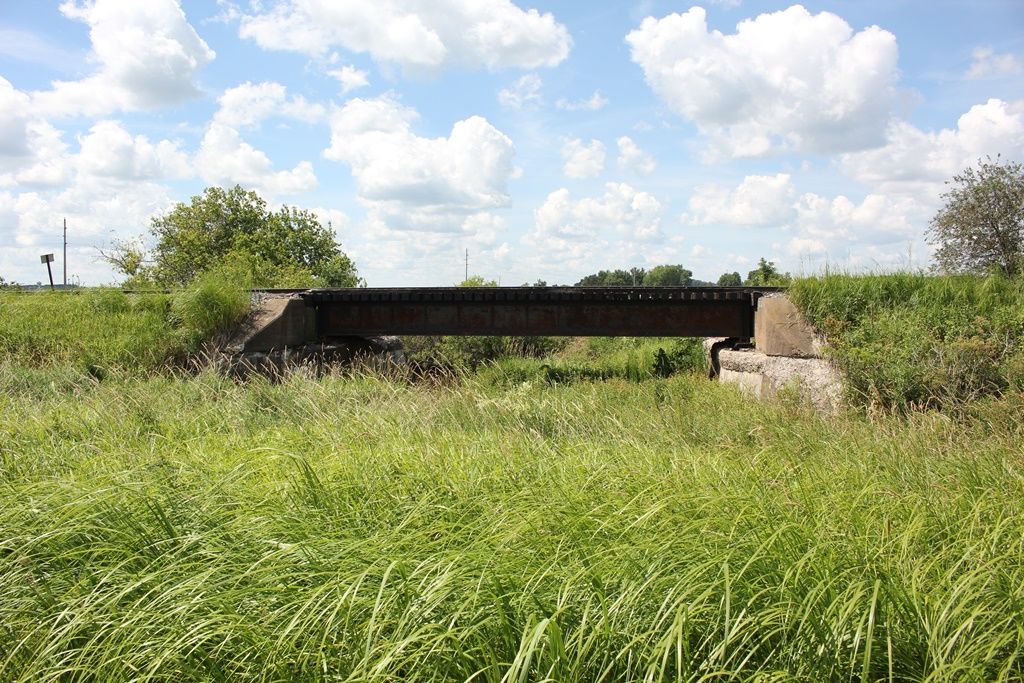
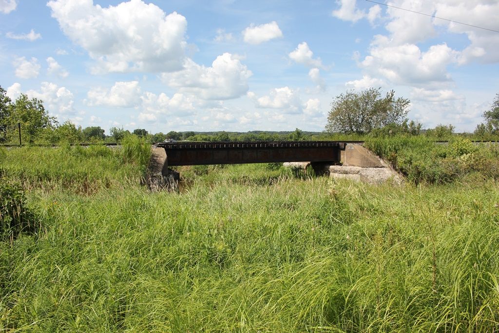
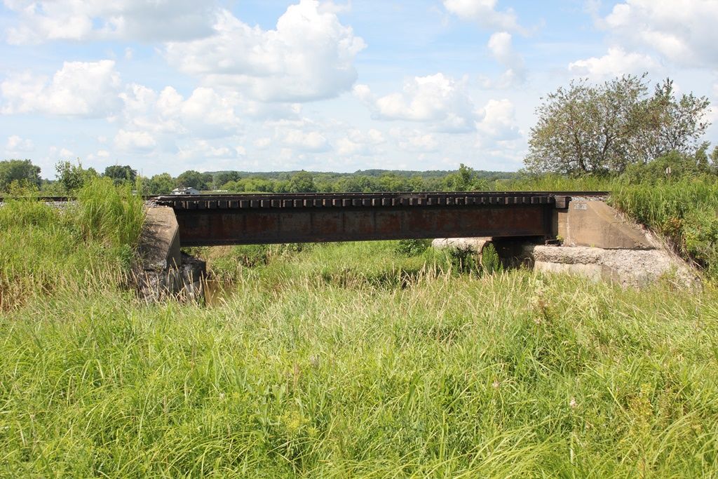
Status: Open to traffic
Location: 44.925891,-91.315469
Carries Canadian National Railroad over Lake Wissota
Design: girder/pony
Design Details: 1-52' Through Plate Girder
1-80' Through Plate Girder
1-52' Through Plate Girder
Total Length: 185.0 Feet
Span Length: 80.0 Feet
Overview: Pony/through girder bridge over Lake Wissota on Canadian National Railroad
History: Built 1910 during a line change
Built: 1910
Location: Chippewa County
View Bridge Information In Wayback Machine
![]()
232123

Lake Wissota Bridge
Overview from west bank
Photo taken by John Marvig in May 2012
232124
Lake Wissota Bridge
Span #1
Photo taken by John Marvig in May 2012
232125
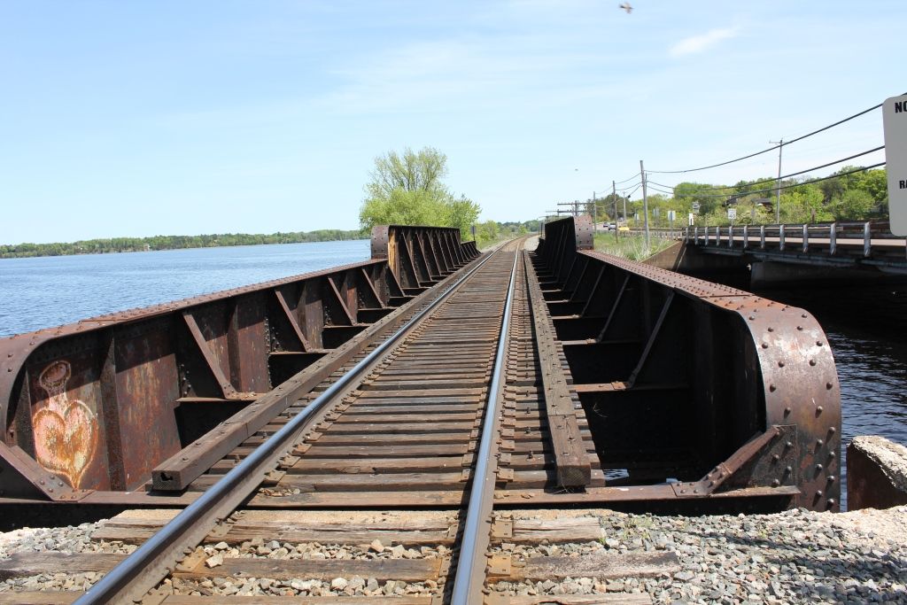
Lake Wissota Bridge
Looking East across bridge
Photo taken by John Marvig in May 2012
232126
Lake Wissota Bridge
Pier #1
Photo taken by John Marvig in May 2012
232127
Lake Wissota Bridge
West Abutment
Photo taken by John Marvig in May 2012
232128
Lake Wissota Bridge
Span #3
Photo taken by John Marvig in May 2012
232129
Lake Wissota Bridge
East Abutment
Photo taken by John Marvig in May 2012
232130

Lake Wissota Bridge
Looking from East Bank
Photo taken by John Marvig in May 2012
232131
Lake Wissota Bridge
Looking west
Photo taken by John Marvig in May 2012
232132
Lake Wissota Bridge
center span
Photo taken by John Marvig in May 2012
232133
Lake Wissota Bridge
Looking west along bridge
Photo taken by John Marvig in May 2012
![]()
Status: Open to traffic
Location: 45.099722,-91.488889
Carries Sth 40 / Main Street over Duncan Creek
Design: beam/stringer/steel
Design Details: Steel stringer
Total Length: 109.3 Feet
Span Length: 50.2 Feet
Overview: Steel stringer bridge over Duncan Creek on Sth 40 / Main Street
History: Built 1942; rehabilitated 1991
Built: 1942
Location: Chippewa County
View Bridge Information In Wayback Machine
![]()
![]()
Status: Open to traffic
Location: 45.024102,-91.393790
Carries Wisconsin Northern Railway over Highland Drive
Design: girder/pony/plate
Design Details: Pony plate girder
Total Length: 36.1 Feet
Span Length: 28.2 Feet
Overview: Pony/through plate girder bridge over Highland Drive on Wisconsin Northern Railway
History: Plate says 1912, NBI says 1929
Built: 1912
Location: Chippewa County
View Bridge Information In Wayback Machine
![]()
256483
WN Highland Drive Bridge
Photo taken by John Marvig in June 2013
256484
WN Highland Drive Bridge
North Abutment
Photo taken by John Marvig in June 2013
256485
WN Highland Drive Bridge
South Abutment
Photo taken by John Marvig in June 2013
256486
WN Highland Drive Bridge
Plate
Photo taken by John Marvig in June 2013
256487
WN Highland Drive Bridge
Photo taken by John Marvig in June 2013
256488
WN Highland Drive Bridge
Looking North
Photo taken by John Marvig in June 2013
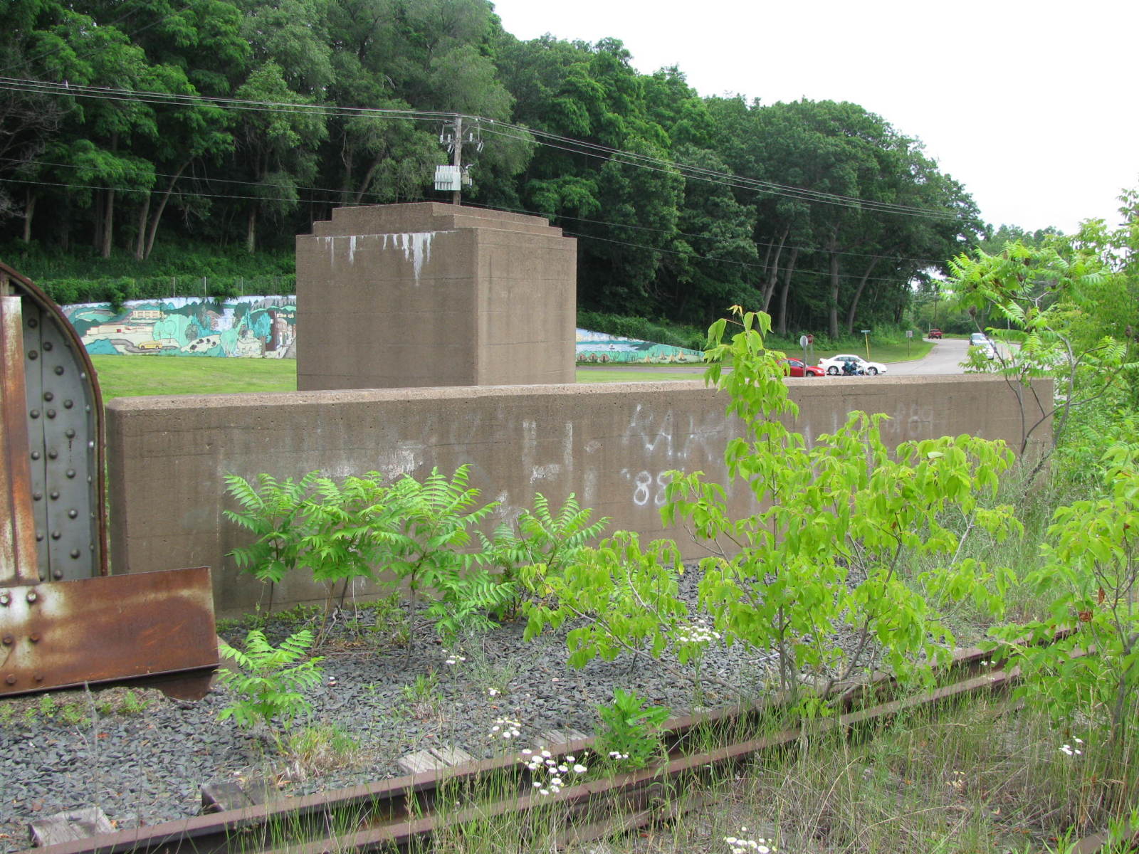
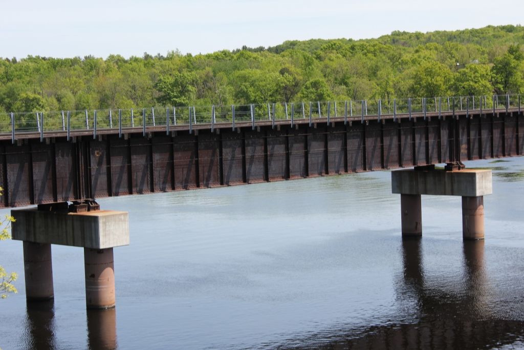
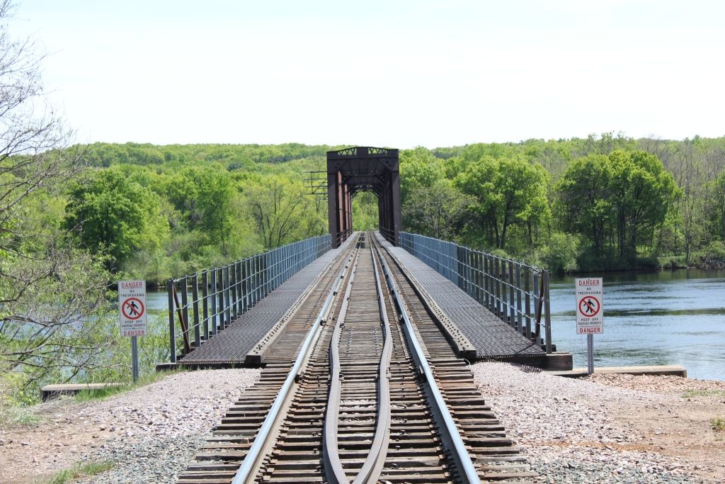
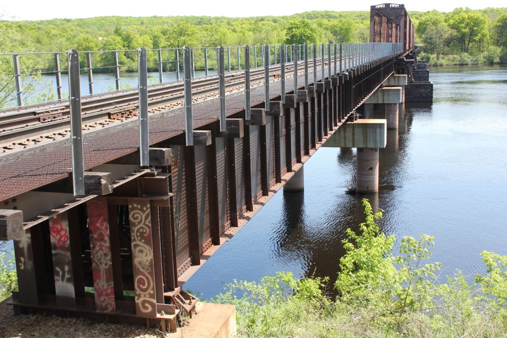
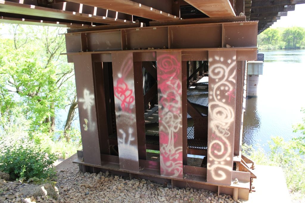
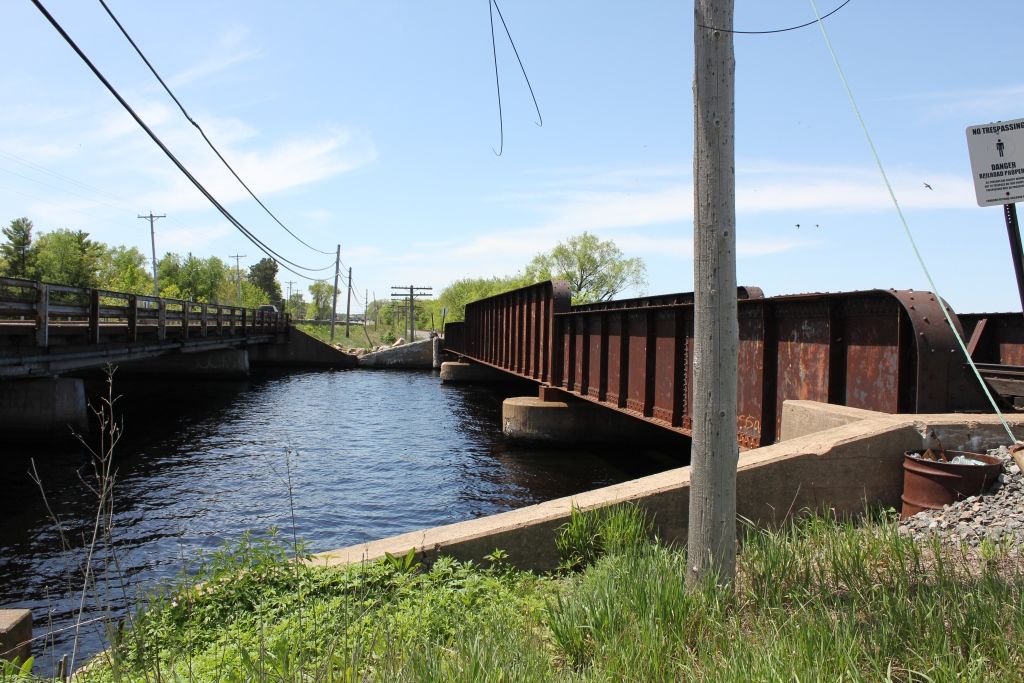
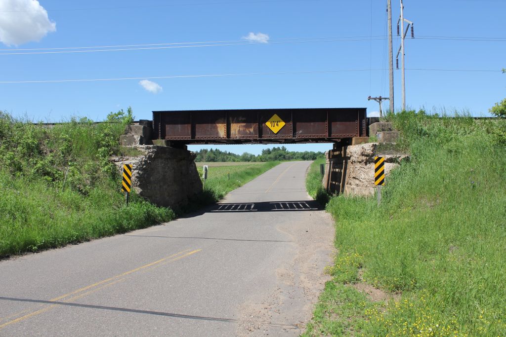
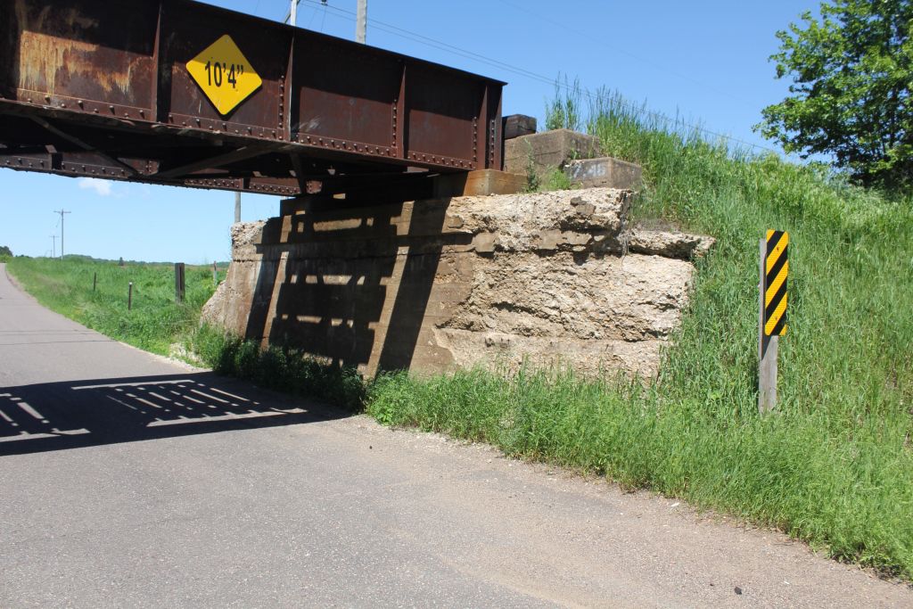
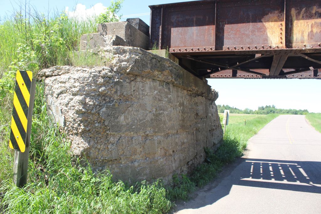
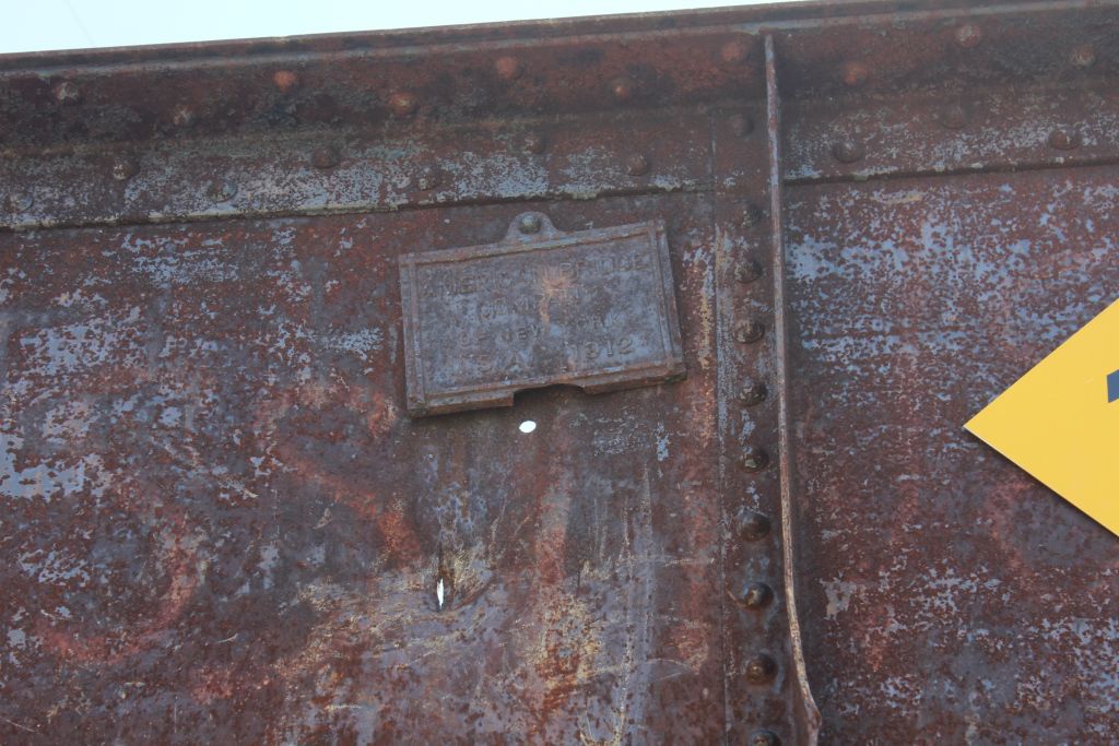
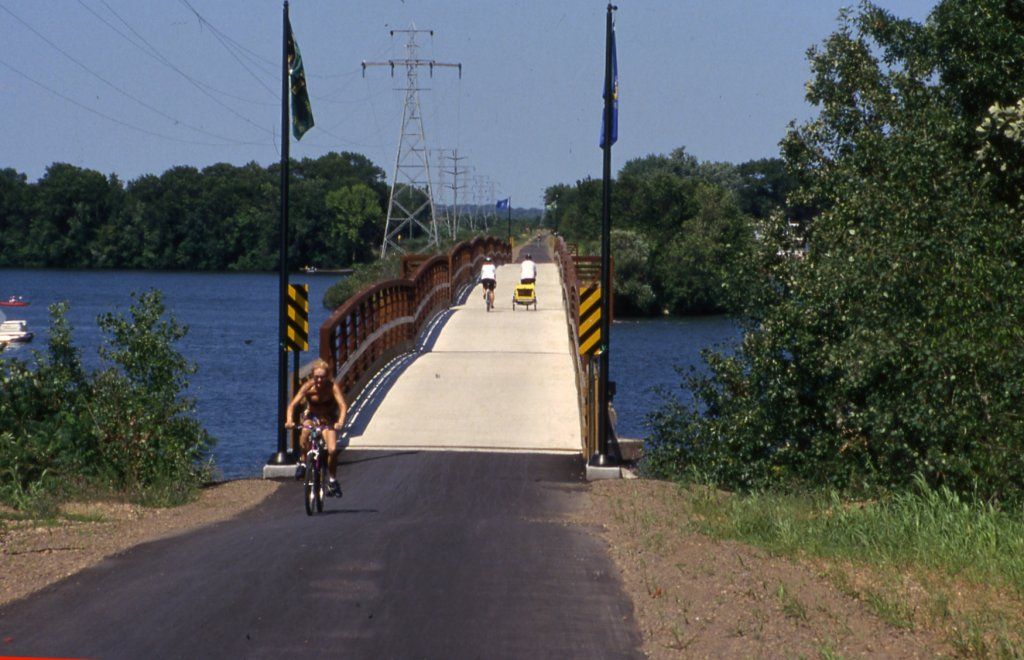
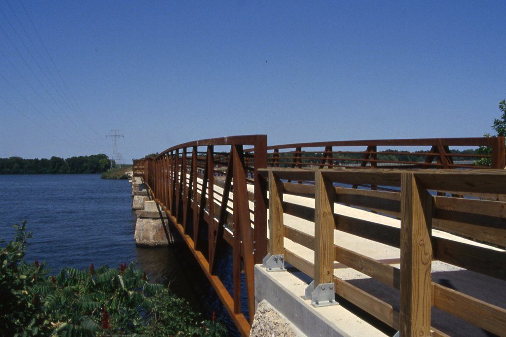
![]()
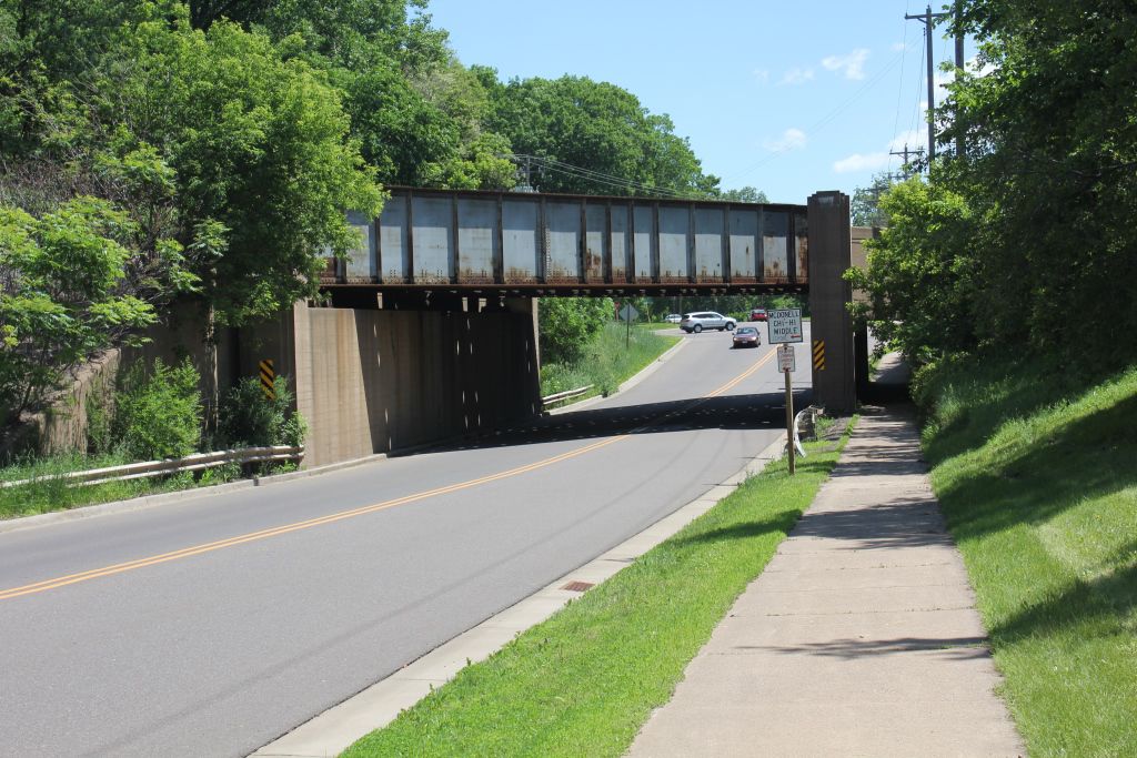
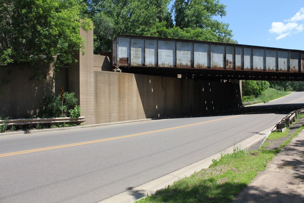
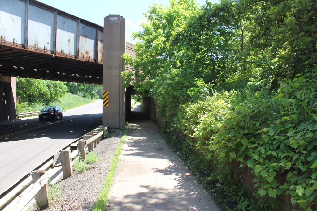
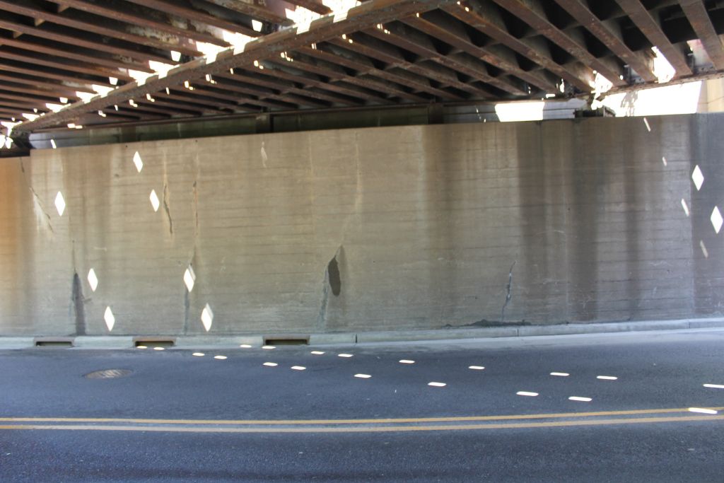
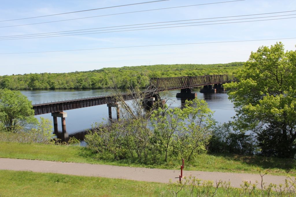
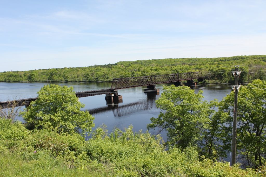
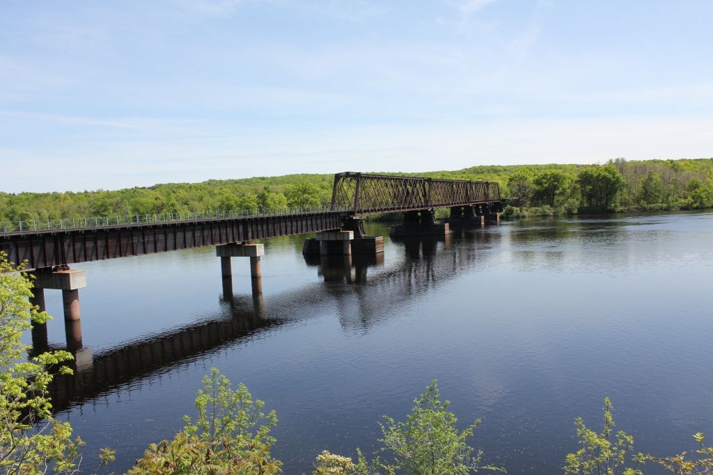
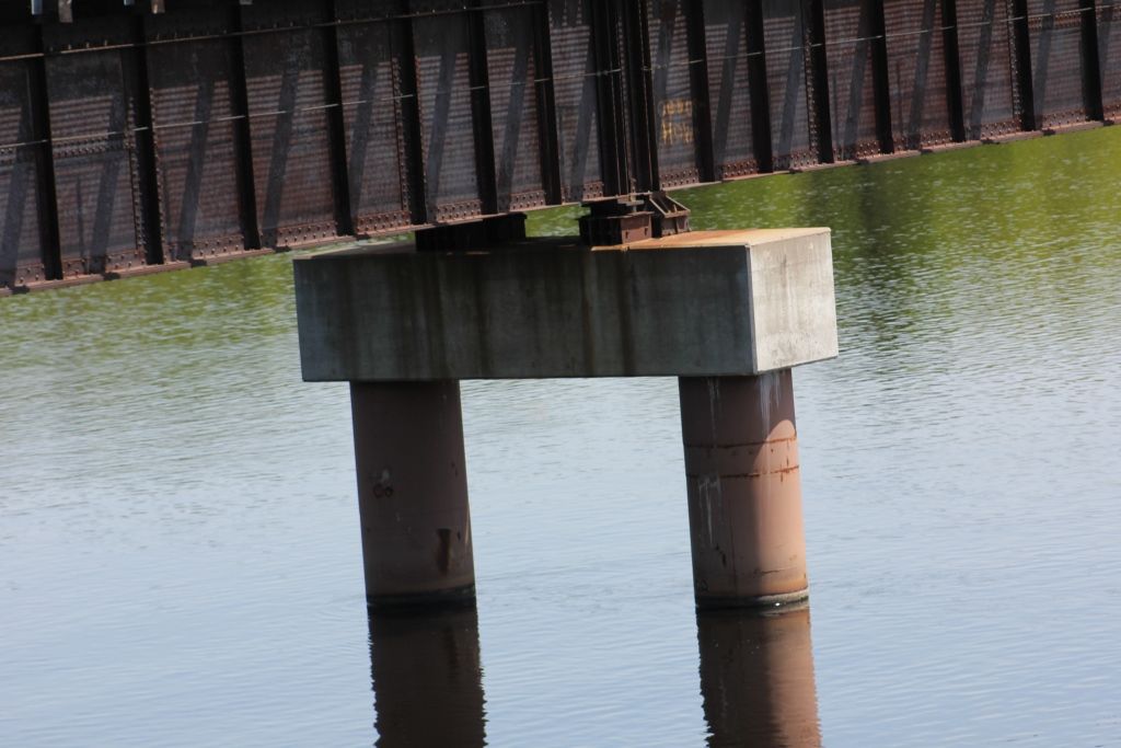
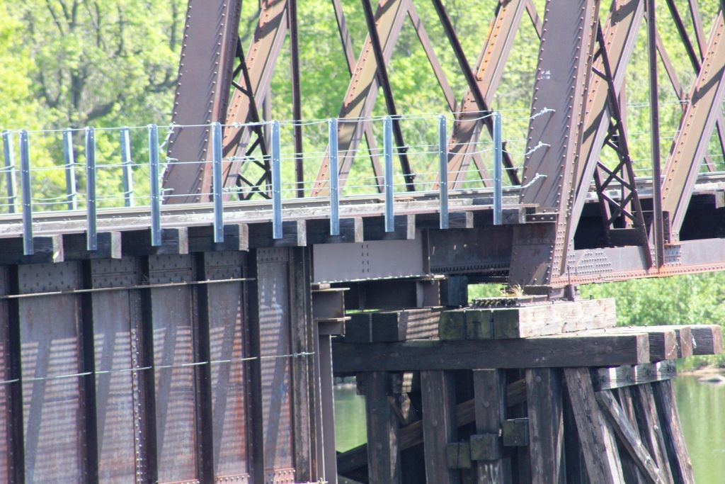
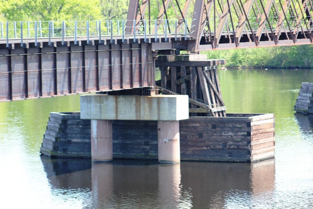
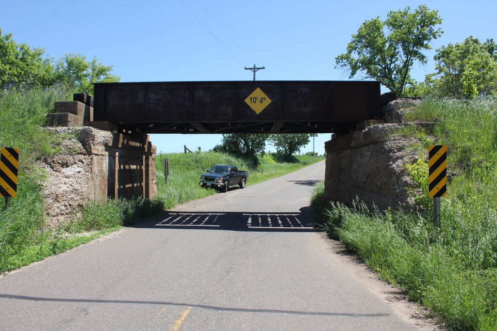
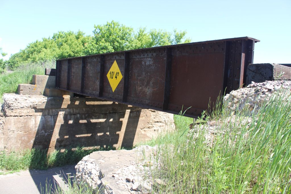
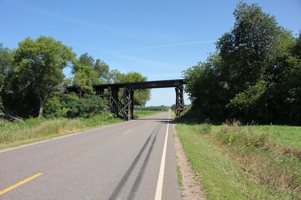
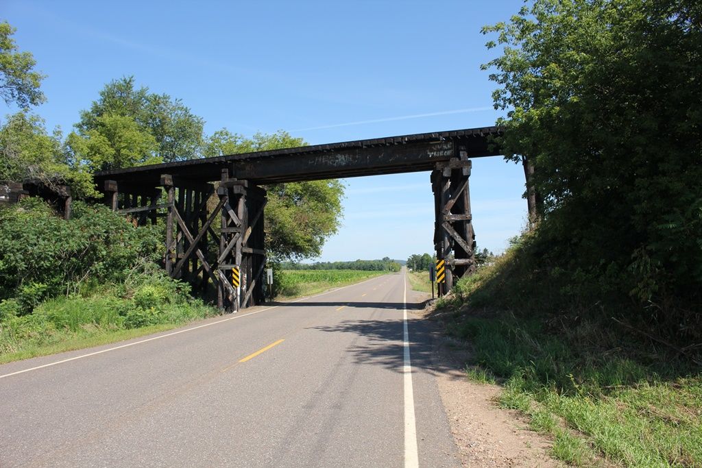
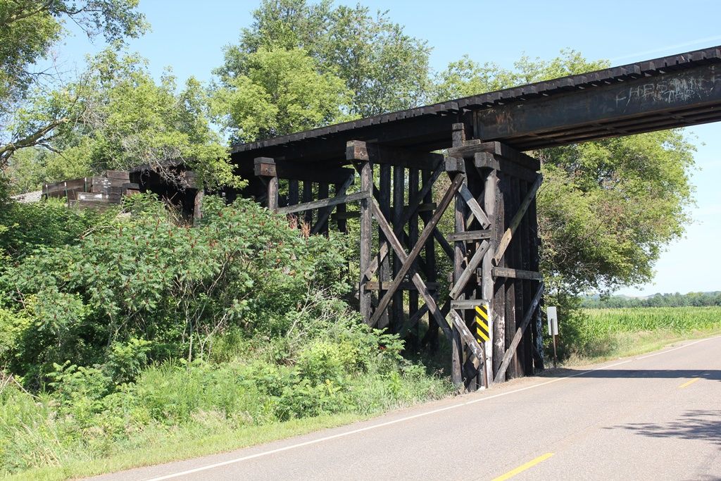
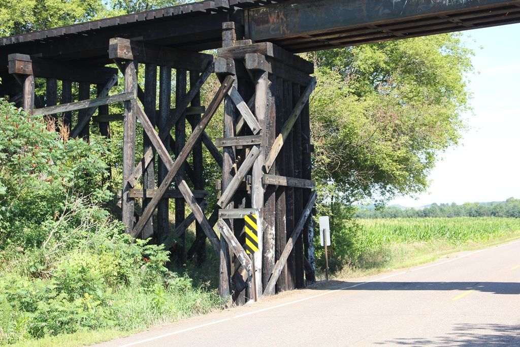
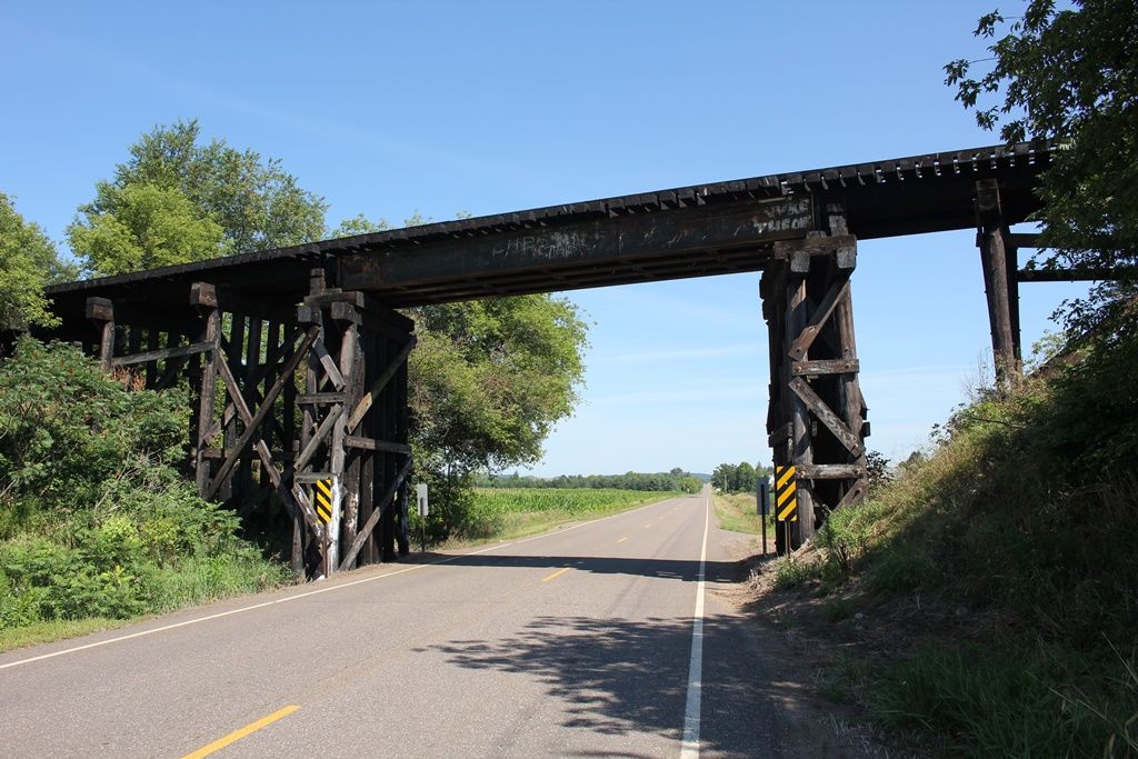
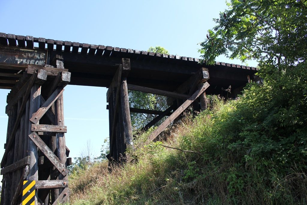
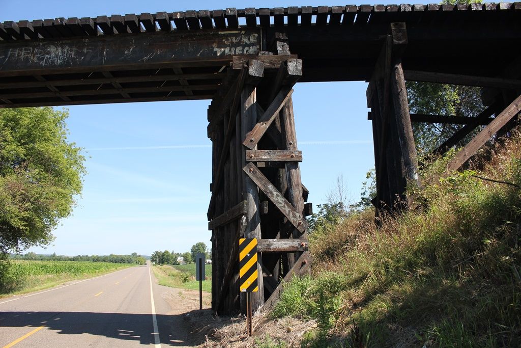
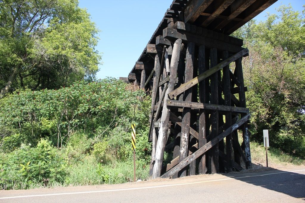
Status: Bicycle and Pedestrian trail
Location: 44.977530,-91.344242
Carries Old Abe Trail over Lake Wissota
Design: girder/deck/plate
Design Details: Deck plate girder
Total Length: 800.0 Feet
Span Length: 100.0 Feet
Overview: Bridge over Lake Wissota on Old Abe Trail
History: Built 1916; Some spans reused downstream 1993; Modern pedestrian bridge added later
Built: 1916
Location: Chippewa County
View Bridge Information In Wayback Machine
![]()
344538
Looking north
Photo taken by Charles Kuehn, August 2005
344539
Looking north
Photo taken by Charles Kuehn, August 2005
![]()
Status: Open to traffic
Location: 44.954252,-91.554610
Carries Canadian National Railway over County Road T
Design: beam/stringer/steel
Design Details: Steel stringer
Total Length: 125.0 Feet
Span Length: 45.0 Feet
Overview: Steel stringer bridge over County Road T on Canadian National Railway
History: Built 1930
Built: 1930
Location: Chippewa County
View Bridge Information In Wayback Machine
![]()
402024
CN County T Bridge
Overview
Photo taken by John Marvig in August 2017
402025
CN County T Bridge
Overview
Photo taken by John Marvig in August 2017
402026
CN County T Bridge
West Approach
Photo taken by John Marvig in August 2017
402027
CN County T Bridge
West Pier
Photo taken by John Marvig in August 2017
402028
CN County T Bridge
Overview
Photo taken by John Marvig in August 2017
402029
CN County T Bridge
East Approach
Photo taken by John Marvig in August 2017
402030
CN County T Bridge
East Pier
Photo taken by John Marvig in August 2017
402031
CN County T Bridge
Looking West
Photo taken by John Marvig in August 2017
402032
CN County T Bridge
Beam Pattern
Photo taken by John Marvig in August 2017
402033
CN County T Bridge
Overview
Photo taken by John Marvig in August 2017
![]()
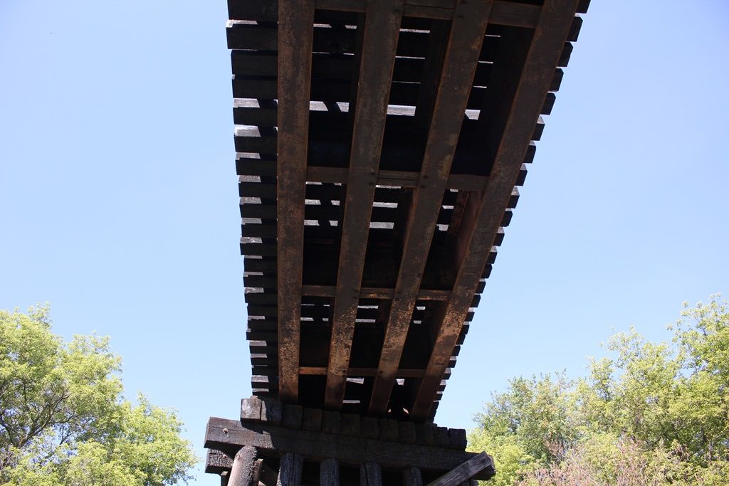
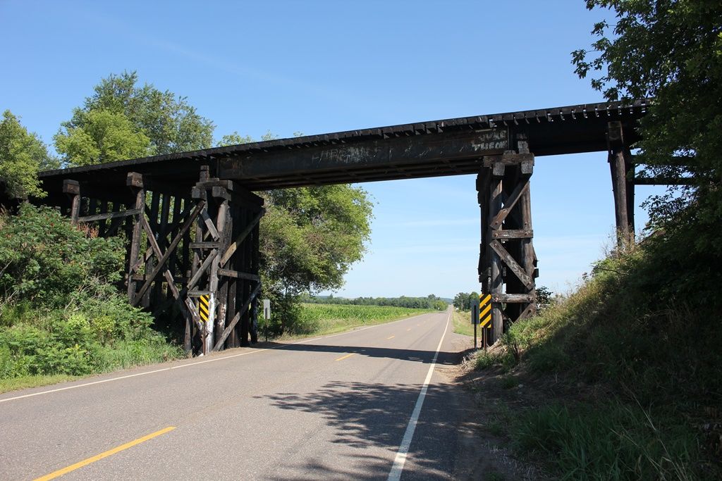
Status: Open to traffic
Location: 45.121803,-91.498632
Carries Union Pacific Railroad over Branch of Duncan Creek
Design: girder/deck/plate
Design Details: Deck plate girder
Total Length: 40.0 Feet
Span Length: 40.0 Feet
Overview: Deck plate girder bridge over Branch of Duncan Creek on Union Pacific Railroad
History: Built 1926
Built: 1926
Location: Chippewa County
View Bridge Information In Wayback Machine
![]()
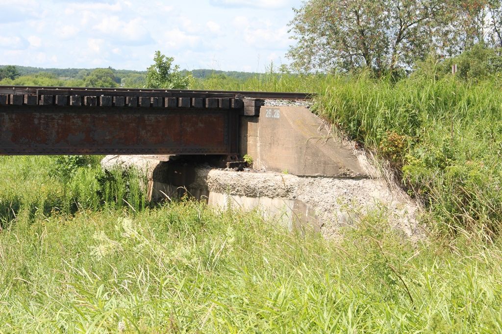
402017
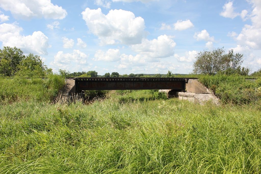
UP Bridge #26.26
Overview
Photo taken by John Marvig in August 2017
402018
UP Bridge #26.26
North Abutment
Photo taken by John Marvig in August 2017
402019
UP Bridge #26.26
Overview
Photo taken by John Marvig in August 2017
402020
UP Bridge #26.26
Overview
Photo taken by John Marvig in August 2017
402021
UP Bridge #26.26
Overview
Photo taken by John Marvig in August 2017
402022
UP Bridge #26.26
Overview
Photo taken by John Marvig in August 2017
402023
UP Bridge #26.26
Plate
Photo taken by John Marvig in August 2017
![]()
Status: Replaced by a new bridge
Location: 45.165281,-91.157719
Carries Bridge Street over Chippewa River
Design: truss/through
Design Details: Through truss
Total Length: 0.0 Feet
Span Length: 0.0 Feet
Overview: Lost Through truss bridge over Chippewa River on Bridge Street
History:
Built:
Location: Chippewa County
View Bridge Information In Wayback Machine
![]()
428048
Circa 1909
Old Postcard View
505845
Chippewa River Bridge (Old)
1940s view
Photo from old postcard
505846
Chippewa River Bridge (Old)
1940s view
Photo from old postcard
![]()
Status: Superstructure replaced
Location: 44.977310,-91.344523
Carries Chicago & North Western Railway over Lake Wissota
Design: girder/deck/plate
Design Details: Deck plate girder
Total Length: 800.0 Feet
Span Length: 100.0 Feet
Overview: Lost Deck plate girder bridge over Lake Wissota on Chicago & North Western Railway
History: Built 1916
Built: 1916
Location: Chippewa County
View Bridge Information In Wayback Machine
![]()
![]()
Status: Replaced by a new bridge in 1976
Location: 44.930240,-91.393380
Carries Main Street over Chippewa River
Design: truss/through/pennsylvania
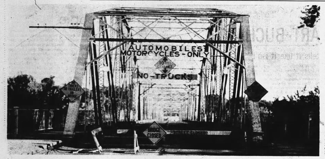
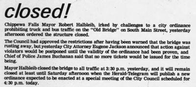
Design Details: (5)Pennsylvania through trusses with Camelback format upper-chord.
Total Length: 0.0 Feet
Span Length: 0.0 Feet
Overview: Lost Pennsylvania through truss bridge over Chippewa River on Main Street
History:
Built: 1901
Location: Chippewa County
View Bridge Information In Wayback Machine
![]()
453696
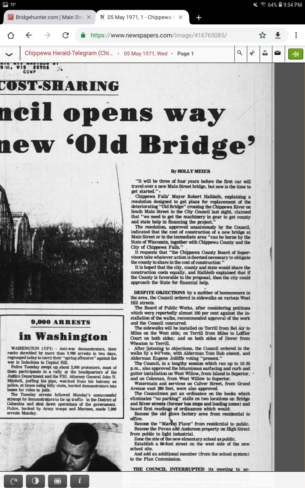
Main Street Bridge
Chippewa Herald-Telegram: May 5 1971
453697
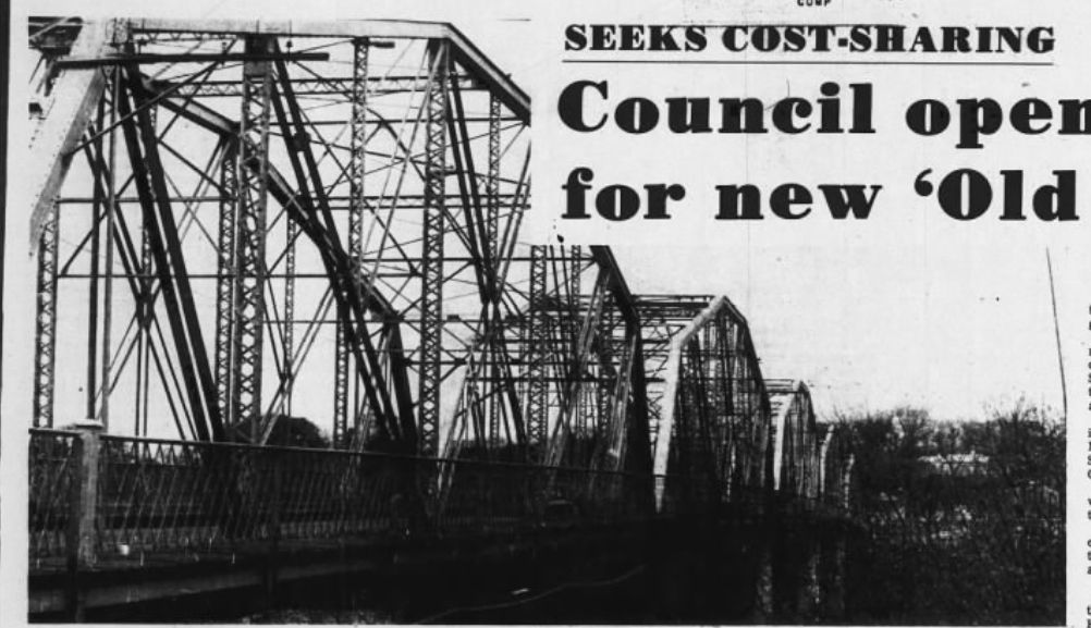
Main Street Bridge
Chippewa Herald-Telegram: May 5 1971
453698
Manchester Bridge
Chippewa Herald-Telegram: June 23 1972
453699
Main Street Bridge
Article
Chippewa Herald-Telegram: June 23 1972
453700
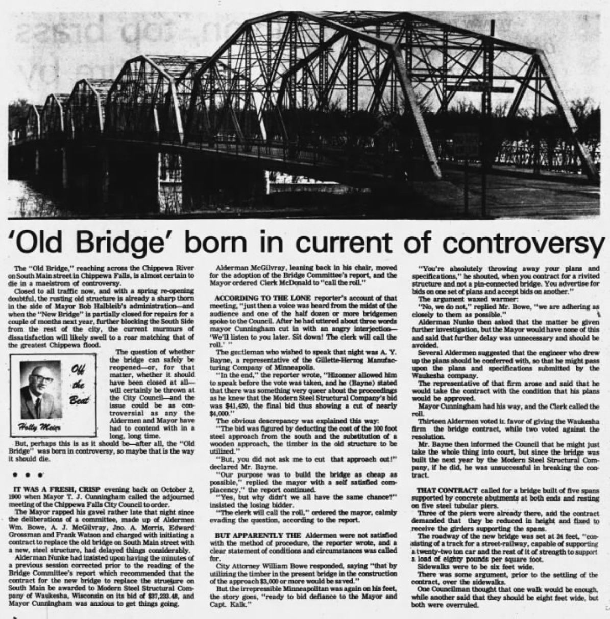
Main Street Bridge
Chippewa Herald-Telegram: November 29 1972
453701
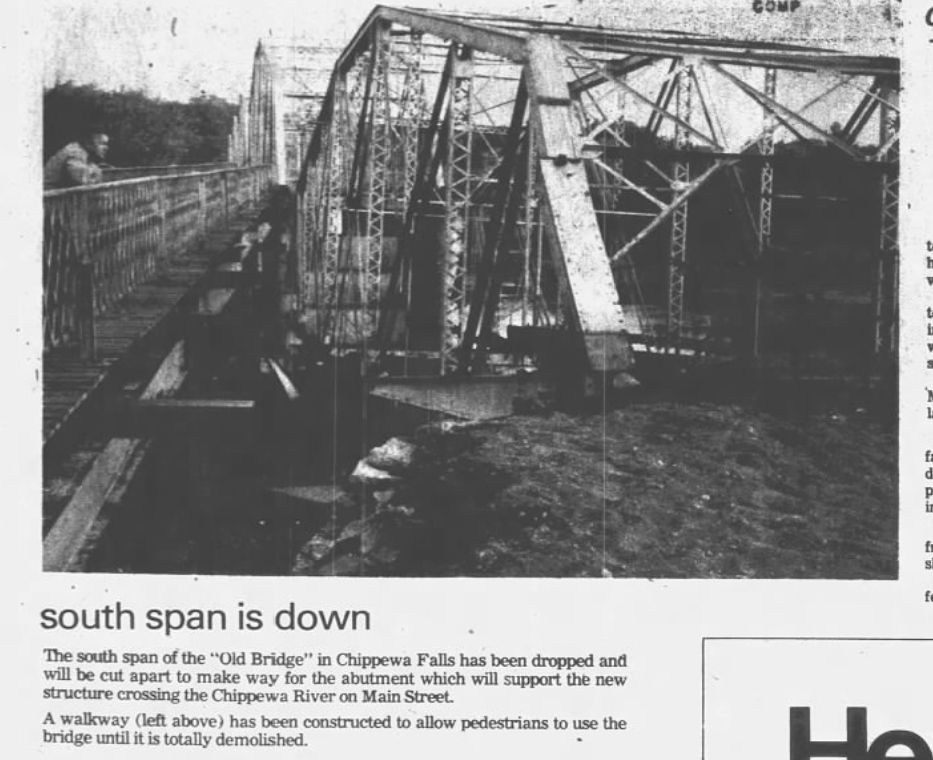
Main Street Bridge
Chippewa Herald-Telegram: August 8 1975
501590
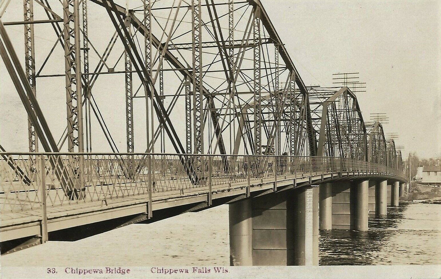
Main Street Bridge
1908 view
Photo from old postcard
![]()
Status: Replaced by a new bridge
Location: 44.931004,-91.387114
Carries Bridge Street over Chippewa River
Design: truss/deck
Design Details: Deck truss
Total Length: 0.0 Feet
Span Length: 0.0 Feet
Overview: Lost Deck truss bridge over Chippewa River on Bridge Street
History:
Built:
Location: Chippewa County
View Bridge Information In Wayback Machine
![]()
495209
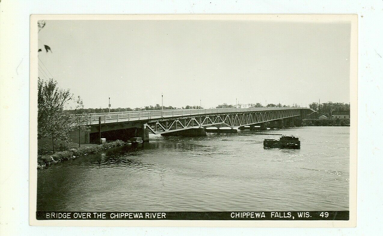
Bridge Street Bridge
Photo from old postcard
![]()
Status: Replaced by a new bridge
Location: 44.931190,-91.387836
Carries Minneapolis, St. Paul, & Sault Ste. Marie Railroad over Chippewa River Dam
Design: truss/through/pratt
Design Details: Pratt through truss
Total Length: 0.0 Feet
Span Length: 0.0 Feet
Overview: Lost Pratt through truss bridge over Chippewa River Dam on Minneapolis, St. Paul, & Sault Ste. Marie Railroad
History: Built 1882, Replaced 1917
Built: 1882
Location: Chippewa County
View Bridge Information In Wayback Machine
![]()
495995
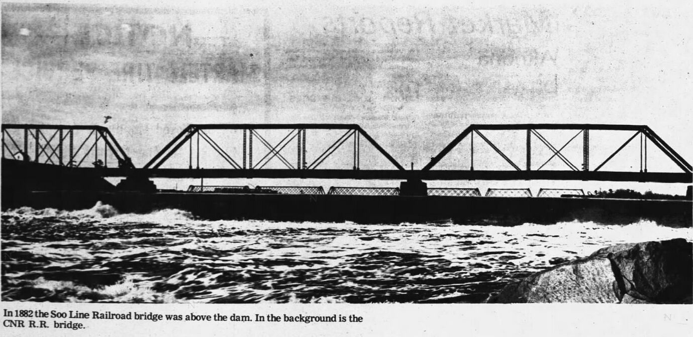
Courtesy of the Chippewa Herald-Telegram
![]()
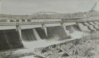
Status: Replaced by a new bridge
Location: 45.182427,-91.162604
Carries Park Road over Cornell Flowage
Design: truss/through
Design Details: Through truss
Total Length: 0.0 Feet
Span Length: 0.0 Feet
Overview: Lost Through truss bridge over Cornell Flowage on Park Road
History:
Built:
Location: Chippewa County
View Bridge Information In Wayback Machine
![]()
509178
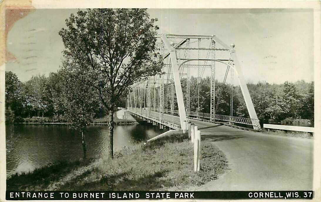
Brunet Island Bridge
view c1956; Burnet should be Brunet
Photo from old postcard
512412
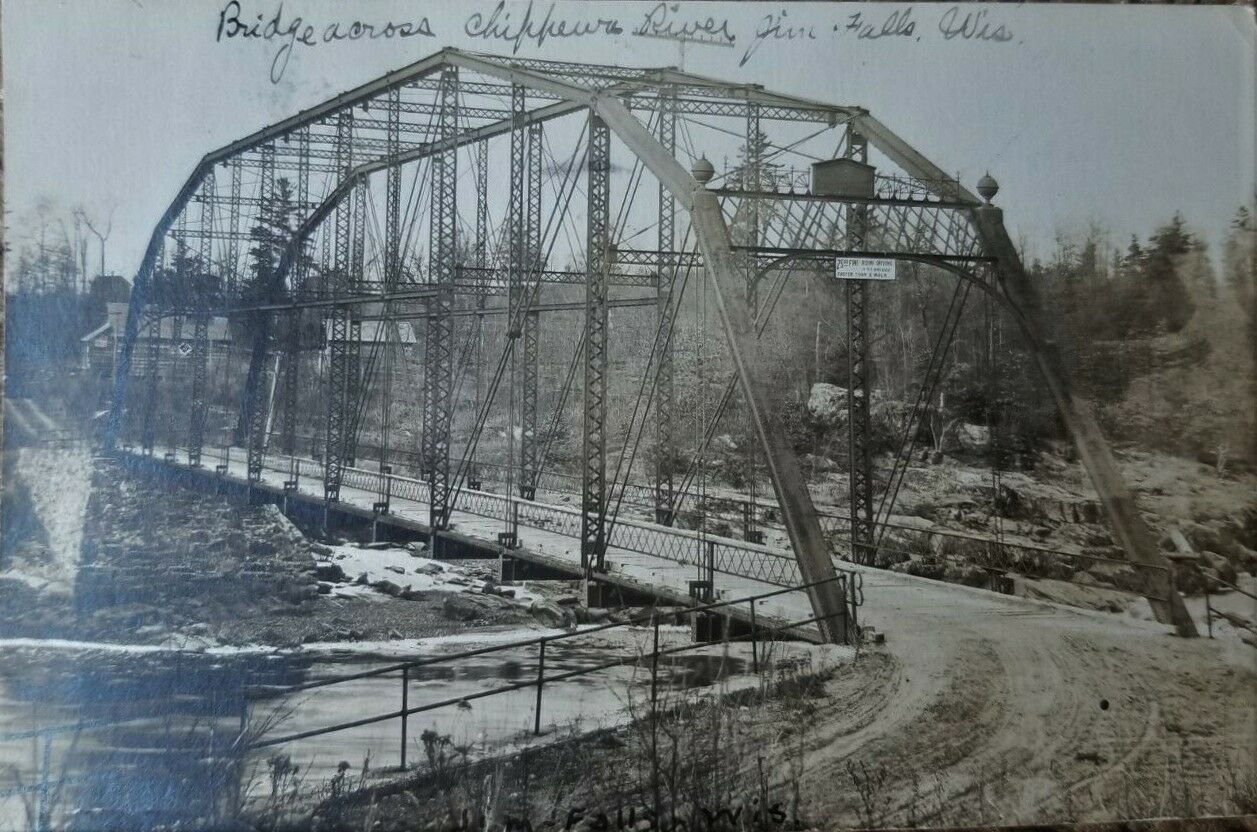
Brunet Island Bridge
view c1907
Photo from old postcard
![]()
Status: Open to traffic
Location: 45.053893,-91.274090
Carries Dam access road over Chippewa River
Design: truss/through
Design Details: Through truss
Total Length: 0.0 Feet
Span Length: 0.0 Feet
Overview: Through truss bridge over Chippewa River on dam access road
History:
Built: 1928
Location: Chippewa County
View Bridge Information In Wayback Machine
![]()
511606
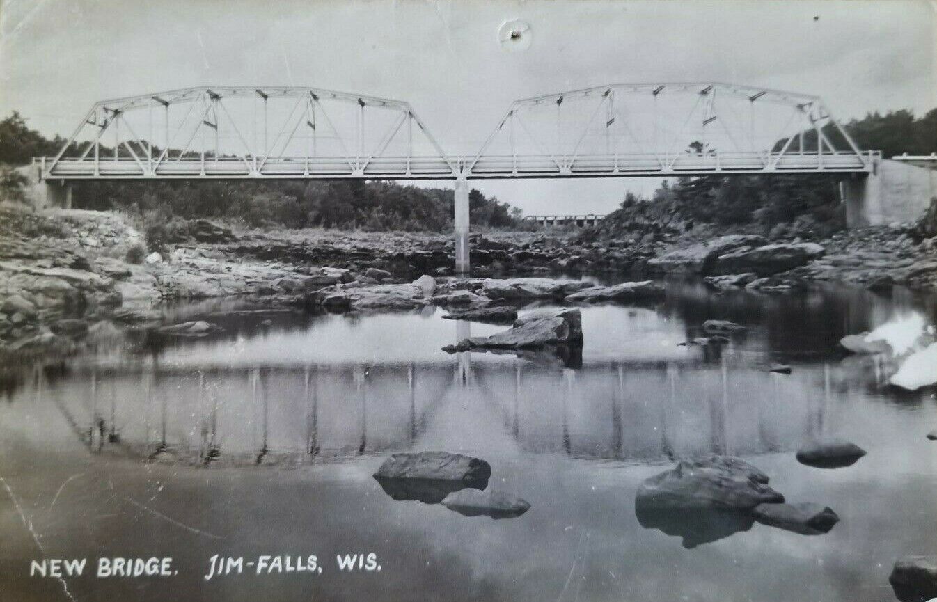
Cobban Bridge (Newer)
Photo from old postcard
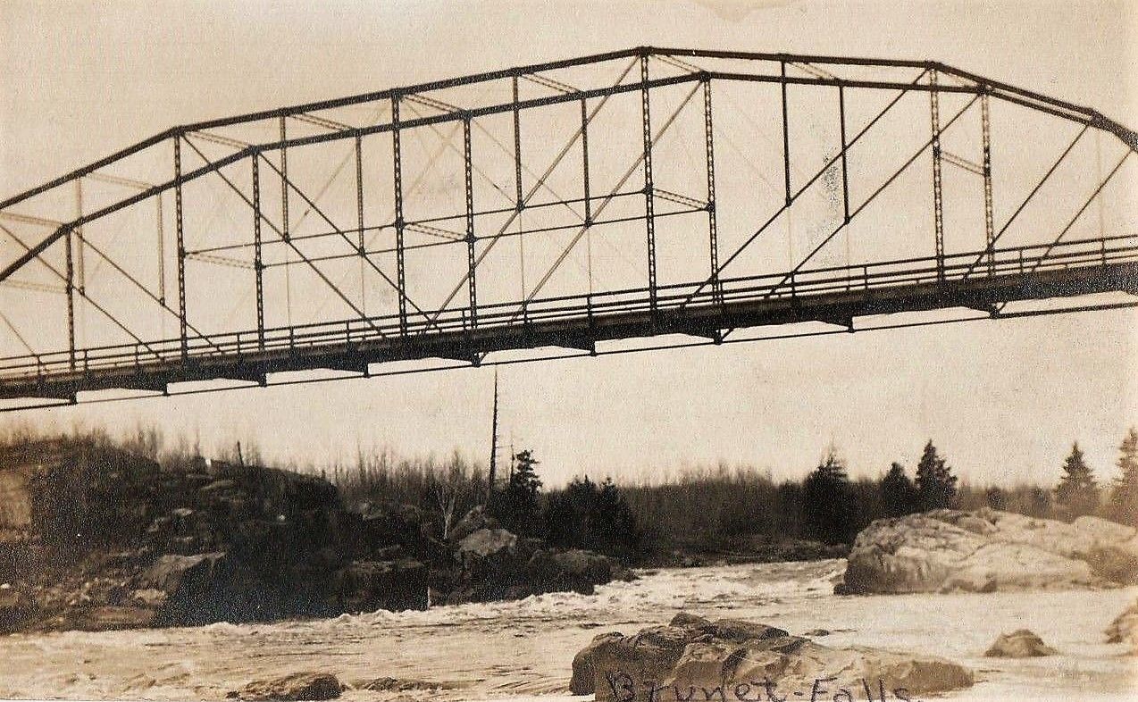
Special Bridge Conditions Legend: R - Former location of relocated bridge. ! - At risk for demolition or destruction. X - Confirmed demolished or collapsed. S - Dismantled and/or in storage. L - Severe loss of historic integrity due to alteration.
![]()

![]()