

View Information About HSR Ratings
Disclaimer: Generated with the aid of ChatGPT AI, the below narrative is based on sources provided by Nathan Holth and crafted to align with his research and passion for historic bridges.
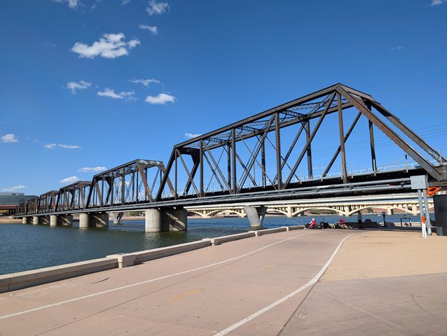
The Tempe Railroad Bridge, spanning the Salt River in Tempe, Arizona, has been a crucial transportation link since its construction in the early 20th century. Originally built as part of the Arizona Eastern Railroad, a subsidiary of Southern Pacific Railroad, the bridge was constructed between 1905 and 1915 to accommodate the increasing demand for rail transport in the rapidly growing Salt River Valley. The bridge replaced earlier wooden trestle structures that were vulnerable to the region’s frequent flooding events.
The initial design featured nine spans of Pratt truss construction, along with wooden trestle approaches. This style of truss, patented in 1844 by Thomas and Caleb Pratt, was a common and efficient choice for railroad bridges due to its ability to handle heavy loads with minimal materials. Over the years, the bridge underwent modifications, including the replacement of its wooden trestle approaches with concrete spans and a plate girder section, resulting in the seven-span steel truss bridge seen today.
The bridge played a vital role in the economic and infrastructural development of the Phoenix metropolitan area. It facilitated trade, commerce, and the movement of agricultural products, contributing to the valley's rapid growth. As one of the oldest and longest-standing railroad crossings in the region, it has endured multiple floods and structural challenges.
The Southern Pacific Railroad, which acquired the Arizona Eastern Railroad, operated the bridge for decades before merging into Union Pacific Railroad (UP) in 1996. Under Union Pacific, the bridge continued to serve as a primary rail link for freight and passenger services, including Amtrak.
On July 29, 2020, the Tempe Railroad Bridge partially collapsed after a Union Pacific freight train derailed while crossing over Tempe Town Lake. The derailment involved 12 railcars, including five carrying hazardous materials. Among these, two DOT-111 tank cars carrying cyclohexanone, a flammable liquid, fell from the bridge. One of the tank cars leaked approximately 2,200 gallons of chemicals, but no fire resulted from the spill. However, derailed lumber cars caught fire, creating a significant scene of destruction.
The National Transportation Safety Board (NTSB) investigation determined that the probable cause of the collapse was a broken rail located about 30 feet south of the first steel span, on the wooden trestle approach. The failure allowed the railcars to derail and strike a critical structural member, leading to the buckling and collapse of the bridge. A lack of an inner guard rail at the south end contributed to the severity of the accident, as it allowed derailed cars to shift laterally into the bridge’s structure.
Following the collapse, Union Pacific repaired the surviving trusses and reinstalled inner guard rails on both the north and south approaches to prevent similar derailments in the future. The reconstruction also included updated safety standards to improve track integrity and prevent structural failures.
The Tempe Railroad Bridge stands as a testament to railroad engineering evolution, adapting over time to meet modern demands. Despite its historical resilience, the 2020 collapse underscored the ongoing challenges of infrastructure maintenance. Its restoration ensures continued service for Arizona’s railway network while incorporating modern safety features to prevent future accidents. It is hoped these improvements will ensure the preservation of this bridge for the forseeable future.
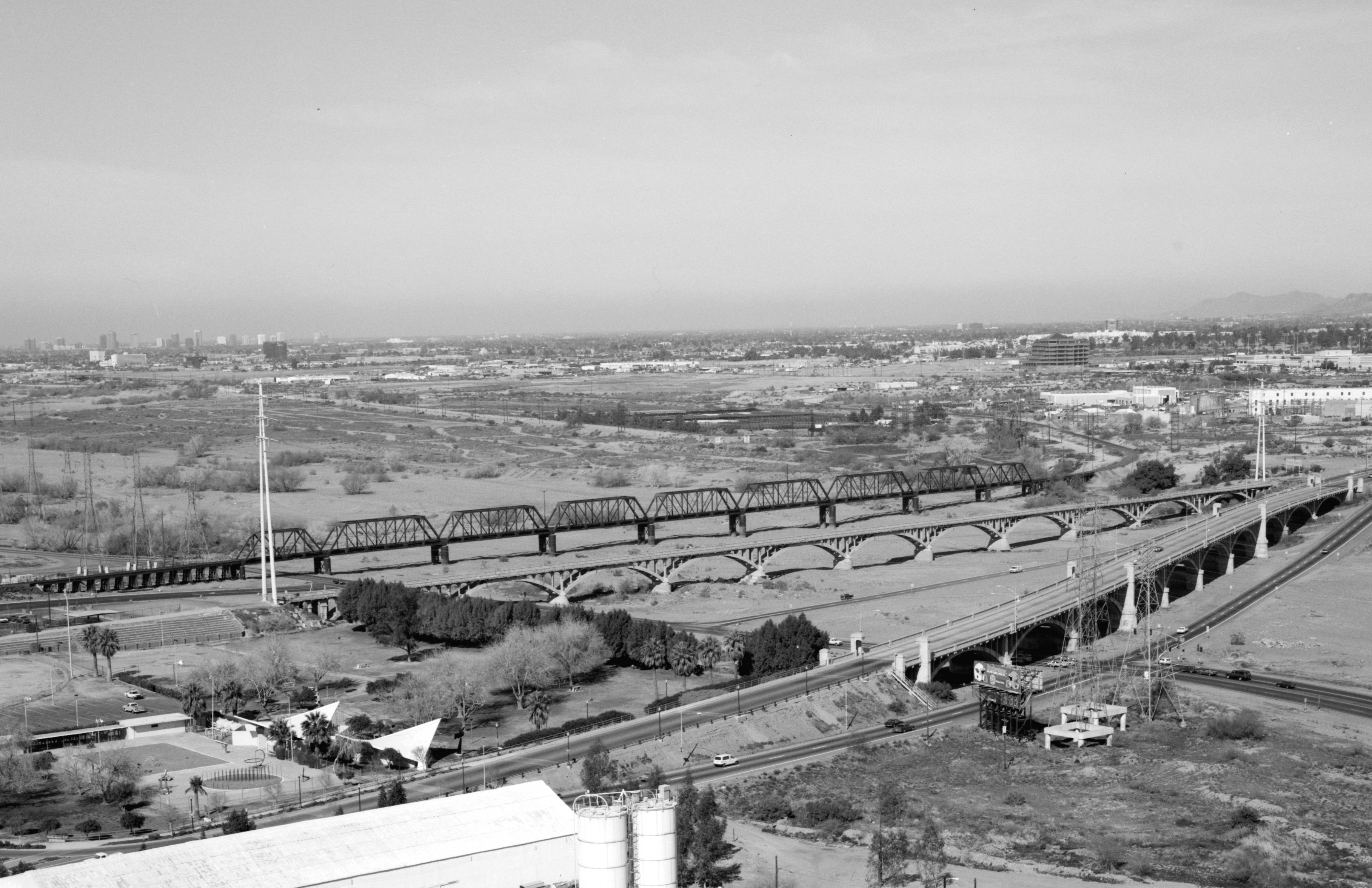
Above: HAER Photo showing the bridge when it still had nine spans.
![]()
![]()
![]()
Coordinates (Latitude, Longitude):
Search For Additional Bridge Listings:
Bridgehunter.com: View listed bridges within 0.5 miles (0.8 kilometers) of this bridge.
Bridgehunter.com: View listed bridges within 10 miles (16 kilometers) of this bridge.
Additional Maps:
Google Streetview (If Available)
GeoHack (Additional Links and Coordinates)
Apple Maps (Via DuckDuckGo Search)
Apple Maps (Apple devices only)
Android: Open Location In Your Map or GPS App
Flickr Gallery (Find Nearby Photos)
Wikimedia Commons (Find Nearby Photos)
Directions Via Sygic For Android
Directions Via Sygic For iOS and Android Dolphin Browser
USGS National Map (United States Only)
Historical USGS Topo Maps (United States Only)
Historic Aerials (United States Only)
CalTopo Maps (United States Only)

© Copyright 2003-2026, HistoricBridges.org. All Rights Reserved. Disclaimer: HistoricBridges.org is a volunteer group of private citizens. HistoricBridges.org is NOT a government agency, does not represent or work with any governmental agencies, nor is it in any way associated with any government agency or any non-profit organization. While we strive for accuracy in our factual content, HistoricBridges.org offers no guarantee of accuracy. Information is provided "as is" without warranty of any kind, either expressed or implied. Information could include technical inaccuracies or errors of omission. Opinions and commentary are the opinions of the respective HistoricBridges.org member who made them and do not necessarily represent the views of anyone else, including any outside photographers whose images may appear on the page in which the commentary appears. HistoricBridges.org does not bear any responsibility for any consequences resulting from the use of this or any other HistoricBridges.org information. Owners and users of bridges have the responsibility of correctly following all applicable laws, rules, and regulations, regardless of any HistoricBridges.org information.
![]()