


View Information About HSR Ratings
This bridge has been listed on HistoricBridges.org atypically due to the age and historical significance of the spans. Normally, the vertical lift span of this bridge would be considered the main span. However, because it dates to ca. 1970-1972 and is thus of limited significance, the approach spans are instead shown as the main spans. The approach spans were built along with a swing span (which was replaced by the lift span) in 1899. The approach spans are pin-connected truss spans of approximately 400 feet. As such, they are large and historically significant spans representing significant engineering achievements due to the long span length and complex Pennsylvania truss configuration.
In 2011, this railroad bridge was converted for pedestrian use. A unique solution enables the bridge to be permanently in the raised position. The original railroad deck was replaced with a pedestrian deck and it was installed in the fixed Pennsylvania truss spans as a ramp that leads up to the vertical lift span's raised deck. As such, at the ends of the Pennsylvania truss spans, the deck actually passes though where the portal and sway bracing was.
At night, dynamic color lighting can be seen on this bridge.
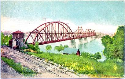
Above: Postcard showing bridge with original swing span.
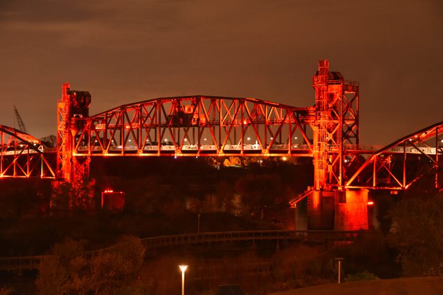
Above: Photo showing color lighting on the bridge at night.

Above: 1899 Drawing of bridge as it appeared in a magazine produced by the railroad.
![]()
![]()
![]()
Coordinates (Latitude, Longitude):
Search For Additional Bridge Listings:
Bridgehunter.com: View listed bridges within 0.5 miles (0.8 kilometers) of this bridge.
Bridgehunter.com: View listed bridges within 10 miles (16 kilometers) of this bridge.
Additional Maps:
Google Streetview (If Available)
GeoHack (Additional Links and Coordinates)
Apple Maps (Via DuckDuckGo Search)
Apple Maps (Apple devices only)
Android: Open Location In Your Map or GPS App
Flickr Gallery (Find Nearby Photos)
Wikimedia Commons (Find Nearby Photos)
Directions Via Sygic For Android
Directions Via Sygic For iOS and Android Dolphin Browser
USGS National Map (United States Only)
Historical USGS Topo Maps (United States Only)
Historic Aerials (United States Only)
CalTopo Maps (United States Only)

© Copyright 2003-2026, HistoricBridges.org. All Rights Reserved. Disclaimer: HistoricBridges.org is a volunteer group of private citizens. HistoricBridges.org is NOT a government agency, does not represent or work with any governmental agencies, nor is it in any way associated with any government agency or any non-profit organization. While we strive for accuracy in our factual content, HistoricBridges.org offers no guarantee of accuracy. Information is provided "as is" without warranty of any kind, either expressed or implied. Information could include technical inaccuracies or errors of omission. Opinions and commentary are the opinions of the respective HistoricBridges.org member who made them and do not necessarily represent the views of anyone else, including any outside photographers whose images may appear on the page in which the commentary appears. HistoricBridges.org does not bear any responsibility for any consequences resulting from the use of this or any other HistoricBridges.org information. Owners and users of bridges have the responsibility of correctly following all applicable laws, rules, and regulations, regardless of any HistoricBridges.org information.
![]()