

View Information About HSR Ratings
Please see the extensive historical articles linked to above for a detailed history of the design and construction of this bridge and the associated Florida East Coast Railway Extension, as constructed under the direction of the famous Henry Flagler. The project engineer was Joseph C. Meredith, although he died before construction was completed, and William J. Krome took his place.
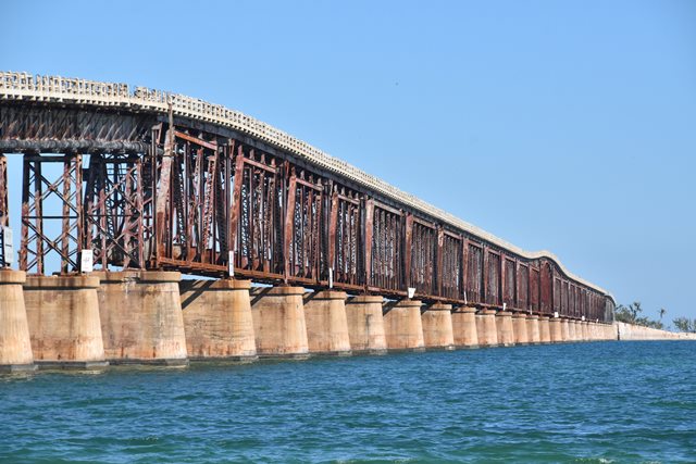
This is the most visually impressive bridge on the Florida East Coast Railway Extension due to its variety of spans that include deck plate girders, two sizes and designs of Pratt truss, and a Parker truss span. The bridge also has an unusual history because when the railroad was shut down and the former railroad bridges were converted to highway bridges for the Overseas Highway (US-1) this bridge was altered by placing the roadway deck on top of the through truss spans, where a wider roadway could be provided. To accommodate this unusual alteration, the road deck has to ramp up over the arch of the Parker truss span, and the approach deck plate girder spans had to have bents added to the concrete piers to raise them up to accommodate the higher roadway.
After a new highway bridge was built in 1972 and this bridge was abandoned a couple spans were removed to allow boats to pass through. The easternmost two truss spans were converted into a pedestrian lookout, however even these two spans were not maintained fully and have deteriorated and been closed to pedestrians, with plans for demolition and replacement.
Although some of the shorter Pratt truss spans use riveted connections, and the larger Pratt truss spans use a combination of pin and riveted connections, this bridge can be nevertheless considered one of the longest surviving pin-connected truss bridges in the United States.
Sitting abandoned over a salty ocean without a maintained paint system has been nothing short of catastrophic for this bridge. The bridge has an incredible number of members broken and/or fallen off completely, or still connected but with amazing amounts of widespread complete section loss visible even from a long distance away. Yet in 2018 the bridge still stood, even with the enormous dead load weight of the concrete deck on top of it. Many present-day engineers, particularly those who do not deal with metal truss bridges frequently like to condemn historic metal truss bridges as "fracture critical" meaning that if one member fails the entire bridge will collapse. In a classroom, and assuming a truss bridge with every member being exactly as strong enough as it needs to be to support the supposed loading, maybe this might happen. But in the real world, historic metal truss bridges are often not so easily destroyed. Certainly the design of a truss implies that each member plays a structural role. But this does not guarantee collapse in the real world. This bridge is a profound example of this. As impressive as this is, it is also tragic. As the most impressive section of the East Coast Railway Extension and as one of the longest surviving pin-connected trusses in the country, this is a bridge with immense historic significance. Left in its current condition, collapse will eventually occur, and this will mark the loss of one of the nation's most important historic metal truss bridges.
Due to its physical condition, and lack of any plans to preserve even a portion of the bridge, this bridge is considered at high risk for collapse or demolition.

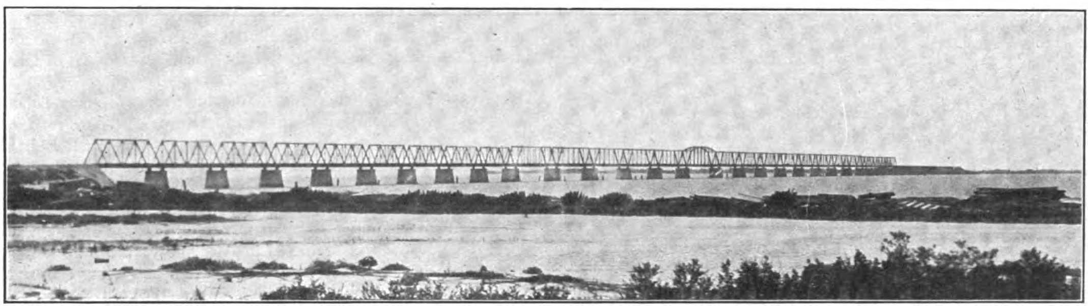
Above: Construction of the Parker truss span.

Above: Construction of the Pratt truss spans.

Above: Henry Flagler
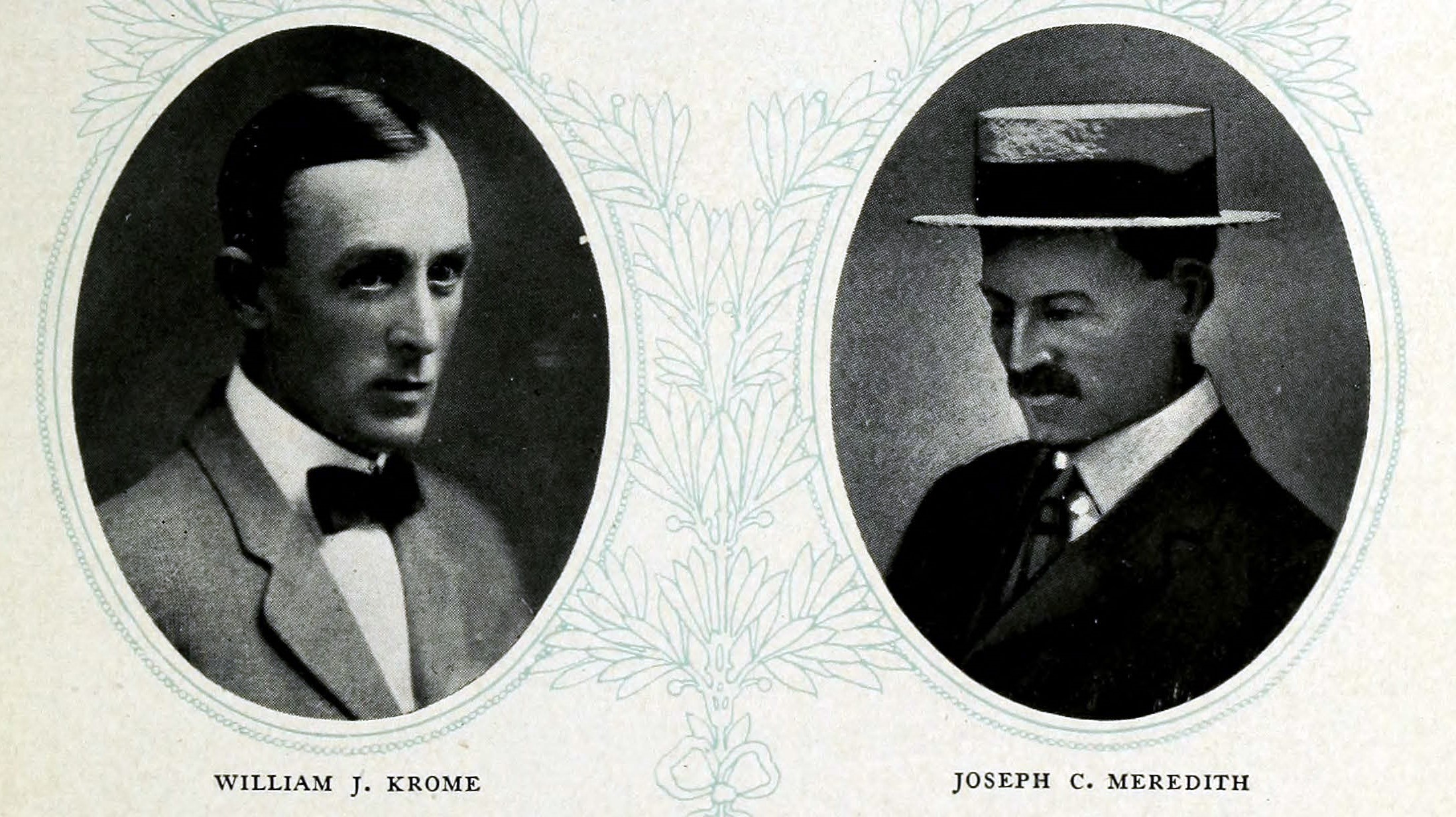
Above: Engineers William J. Krome and Joseph C. Meredith.
![]()
![]()
![]()
Coordinates (Latitude, Longitude):
Search For Additional Bridge Listings:
Bridgehunter.com: View listed bridges within 0.5 miles (0.8 kilometers) of this bridge.
Bridgehunter.com: View listed bridges within 10 miles (16 kilometers) of this bridge.
Additional Maps:
Google Streetview (If Available)
GeoHack (Additional Links and Coordinates)
Apple Maps (Via DuckDuckGo Search)
Apple Maps (Apple devices only)
Android: Open Location In Your Map or GPS App
Flickr Gallery (Find Nearby Photos)
Wikimedia Commons (Find Nearby Photos)
Directions Via Sygic For Android
Directions Via Sygic For iOS and Android Dolphin Browser
USGS National Map (United States Only)
Historical USGS Topo Maps (United States Only)
Historic Aerials (United States Only)
CalTopo Maps (United States Only)

© Copyright 2003-2026, HistoricBridges.org. All Rights Reserved. Disclaimer: HistoricBridges.org is a volunteer group of private citizens. HistoricBridges.org is NOT a government agency, does not represent or work with any governmental agencies, nor is it in any way associated with any government agency or any non-profit organization. While we strive for accuracy in our factual content, HistoricBridges.org offers no guarantee of accuracy. Information is provided "as is" without warranty of any kind, either expressed or implied. Information could include technical inaccuracies or errors of omission. Opinions and commentary are the opinions of the respective HistoricBridges.org member who made them and do not necessarily represent the views of anyone else, including any outside photographers whose images may appear on the page in which the commentary appears. HistoricBridges.org does not bear any responsibility for any consequences resulting from the use of this or any other HistoricBridges.org information. Owners and users of bridges have the responsibility of correctly following all applicable laws, rules, and regulations, regardless of any HistoricBridges.org information.
![]()