

View Information About HSR Ratings
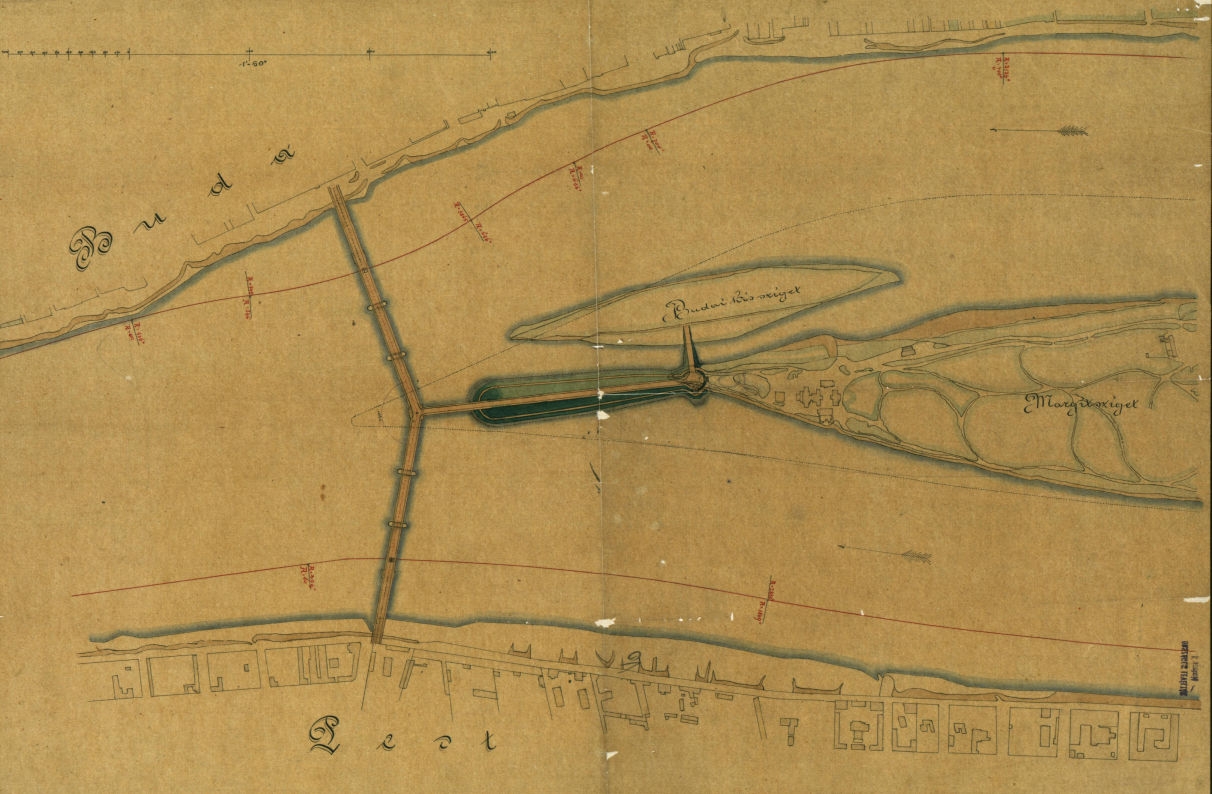
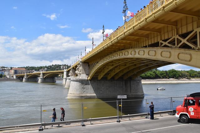
The Margaret Bridge (Margit h�d) was built in 1876 as a metal arch bridge. A drawing from the original plan is shown above. Note the extension to Margaret Island that branches off of the main bridge. This was not originally construction. The Margaret Island Extension was added ca. 1896 which turned the bridge into the T-shaped bridge that was originally proposed. This bridge was the first to be destroyed in the war, although its destruction was actually an accident. German troops were placing explosives on the bridge, preparing for a possible need to destroy the bridge in the future for defensive reasons. During this time, a boat passing under the bridge accidentally ignited a fuse that set off the explosives and collapsed the arch spans, killing 640 soldiers plus hundreds of civilians on the bridge as well. 73 days later, all the other bridges in Budapest were blown up during the Siege of Budapest. After the war, the Margaret Bridge was rebuilt in 1948 as a riveted steel deck arch bridge, and appears to have reused the original piers. Some changes were made however: the arch rise was reportedly increased, and the new bridge used 6 arch ribs instead of the original 8. Also, the span leading to Margaret Island is more ornamented that the other steel arches, which may indicate that this 1896 extension was spared destruction in 1944 and is what remains in use today. The bridge was restored with the intent of returning the bridge to a 1937 (pre-war) appearance in 2009-2011.
On a side note, there was also a railway bridge near this bridge. Historical pre-war photos appear to show a truss bridge crossing the river between the Margaret Bridge and the Chain Bridge, crossing the river at the southwest corner of Parliament. Little is known about this bridge. However, it likely was destroyed in the war. The Metro Subway under the river appears to be located where the bridge originally was.
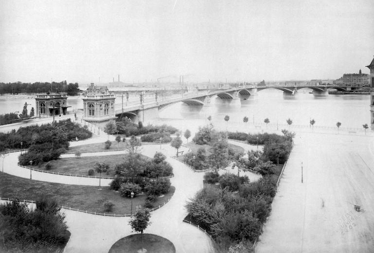
Above: Photo of the bridge in 1900.
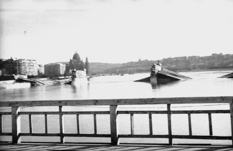
Above: Bridge after destruction. This photo is taken from the mystery railway bridge that no longer exists.
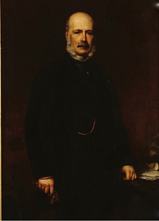
Above: Portrait of Ernest Go�in, designer of the bridge.
![]()
![]()
![]()
Coordinates (Latitude, Longitude):
Search For Additional Bridge Listings:
Additional Maps:
Google Streetview (If Available)
GeoHack (Additional Links and Coordinates)
Apple Maps (Via DuckDuckGo Search)
Apple Maps (Apple devices only)
Android: Open Location In Your Map or GPS App
Flickr Gallery (Find Nearby Photos)
Wikimedia Commons (Find Nearby Photos)
Directions Via Sygic For Android
Directions Via Sygic For iOS and Android Dolphin Browser

© Copyright 2003-2026, HistoricBridges.org. All Rights Reserved. Disclaimer: HistoricBridges.org is a volunteer group of private citizens. HistoricBridges.org is NOT a government agency, does not represent or work with any governmental agencies, nor is it in any way associated with any government agency or any non-profit organization. While we strive for accuracy in our factual content, HistoricBridges.org offers no guarantee of accuracy. Information is provided "as is" without warranty of any kind, either expressed or implied. Information could include technical inaccuracies or errors of omission. Opinions and commentary are the opinions of the respective HistoricBridges.org member who made them and do not necessarily represent the views of anyone else, including any outside photographers whose images may appear on the page in which the commentary appears. HistoricBridges.org does not bear any responsibility for any consequences resulting from the use of this or any other HistoricBridges.org information. Owners and users of bridges have the responsibility of correctly following all applicable laws, rules, and regulations, regardless of any HistoricBridges.org information.
![]()