

View Information About HSR Ratings
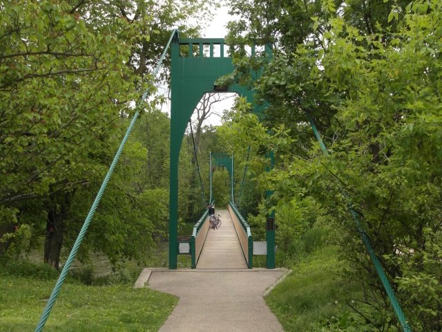
This suspension footbridge has a somewhat modern appearance, due to the use of early welded construction and possible deck and railing alterations. The original bridge at this location was built in 1893. That bridge was replaced by a suspension bridge in 1905. The existing suspension bridge was built in 1940 and rehabilitated in 2002.
Albert David provided the following additional information:
When I went to the Riverside Historical Museum, I did view a few photos of the bridge from before its renovation in 2002, as well as photos of other bridges in the town that are no longer standing. I also found out that the entire deck was replaced in 2002. However, none of these photos showed really clear views of this bridge's railings from prior to 2002, when the deck and railings were replaced. Based on what I could make out though, it appears that the current posts are patterned after the originals, though the current posts are taller. The end posts appear to be original, and I attached photos of them, along with photos of the brackets where the previous fencing (which appeared in the photos that I viewed to have been traditional chain link fencing) had connected to the end posts.

Above: Historical photo showing 1893 bridge at this location.
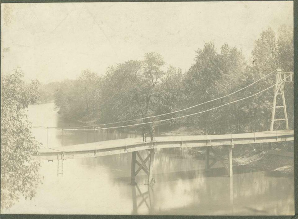
Above: Historical photo showing 1905 bridge at this location.

Above: Historical photo showing construction of the existing 1940 bridge.
This bridge is tagged with the following special condition(s): Unorganized Photos
![]()
![]()
![]()
Coordinates (Latitude, Longitude):
Search For Additional Bridge Listings:
Bridgehunter.com: View listed bridges within 0.5 miles (0.8 kilometers) of this bridge.
Bridgehunter.com: View listed bridges within 10 miles (16 kilometers) of this bridge.
Additional Maps:
Google Streetview (If Available)
GeoHack (Additional Links and Coordinates)
Apple Maps (Via DuckDuckGo Search)
Apple Maps (Apple devices only)
Android: Open Location In Your Map or GPS App
Flickr Gallery (Find Nearby Photos)
Wikimedia Commons (Find Nearby Photos)
Directions Via Sygic For Android
Directions Via Sygic For iOS and Android Dolphin Browser
USGS National Map (United States Only)
Historical USGS Topo Maps (United States Only)
Historic Aerials (United States Only)
CalTopo Maps (United States Only)

© Copyright 2003-2026, HistoricBridges.org. All Rights Reserved. Disclaimer: HistoricBridges.org is a volunteer group of private citizens. HistoricBridges.org is NOT a government agency, does not represent or work with any governmental agencies, nor is it in any way associated with any government agency or any non-profit organization. While we strive for accuracy in our factual content, HistoricBridges.org offers no guarantee of accuracy. Information is provided "as is" without warranty of any kind, either expressed or implied. Information could include technical inaccuracies or errors of omission. Opinions and commentary are the opinions of the respective HistoricBridges.org member who made them and do not necessarily represent the views of anyone else, including any outside photographers whose images may appear on the page in which the commentary appears. HistoricBridges.org does not bear any responsibility for any consequences resulting from the use of this or any other HistoricBridges.org information. Owners and users of bridges have the responsibility of correctly following all applicable laws, rules, and regulations, regardless of any HistoricBridges.org information.
![]()