We Recommend:
Bach Steel - Experts at historic truss bridge restoration.
BridgeHunter.com Phase 1 is released to the public! - Visit Now
Iroquois 1300 Bridge #2
TR-146 Bridge

Primary Photographer(s): Nathan Holth
Bridge Documented: August 13, 2006
Rural (Near Cissna Park): Iroquois County, Illinois: United States
1904 By Builder/Contractor: Massillon Bridge Company of Massillon, Ohio, Darst and Hughes of Chicago, Illinois Agents
Not Available or Not Applicable
98.8 Feet (30.1 Meters)
100.7 Feet (30.7 Meters)
15.7 Feet (4.79 Meters)
1 Main Span(s)
38413709090

View Information About HSR Ratings
Bridge Documentation
This bridge no longer exists!
View Archived National Bridge Inventory Report - Has Additional Details and Evaluation
This historic bridge was demolished and replaced in 2007!
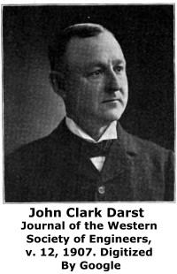
View A Biography of J. C. Darst
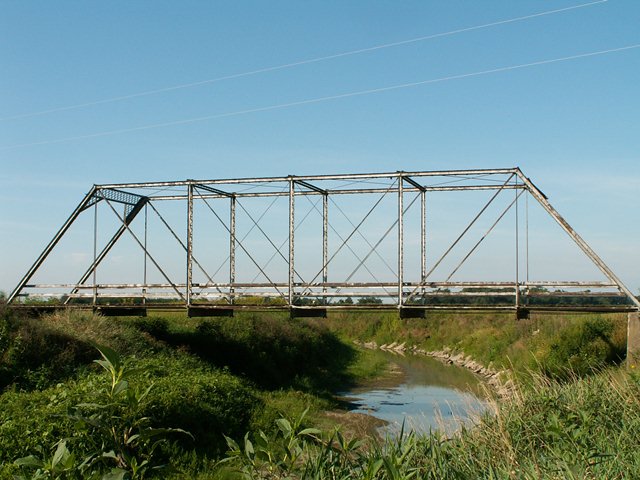
This was a perfect example of the traditional pin connected Pratt through truss that came to dominate the late 19th century and very early 20th century. It retained a high degree of historic and structural integrity. The only thing missing in 2006 was the builder plaques. These plaques credited the Massillon Bridge Company of Massillon, Ohio with building the bridge in 1904. Darst and Hughes of Chicago were listed as agents for the company. While the bridge may not exhibit any unusual or groundbreaking designs, the bridge was a good example of an increasingly rare structure type that was once common on the roadways of the United States. This bridge today is a rare structure type in general. It was an outstanding representative example of typical bridge building in the first decade of the 20th Century. As such, this bridge should have been preserved, or at least left standing as a non-functional exhibit somewhere. It did not deserve to be demolished and replaced with a two-lane bridge. The replacement two lane bridge likely cost a lot of taxpayer dollars and it has a tiny 150 Average Daily Traffic. The historic one-lane bridge could have been rehabilitated to serve the needs of only 150 cars a day, and likely for far less than the cost of replacement. Also, one cannot overlook the aesthetic value of the historic bridge regardless of the history it had. An otherwise undistinguished rural roadway was turned into a unique experience as one crossed this bridge. No modern bridge today can offer the same experience. This traditionally composed bridge featured six panels. The deck was timber and channel railings were present. There was v-lacing on the verticals, on the sway bracing, and under the top chord and end posts. Loop-forged eye bars were present on the bridge, including the bottom chord.

![]()
Photo Galleries and Videos: Iroquois 1300 Bridge #2
Bridge Photo-Documentation
Original / Full Size PhotosA collection of overview and detail photos. This gallery offers photos in the highest available resolution and file size in a touch-friendly popup viewer.
Alternatively, Browse Without Using Viewer
![]()
Bridge Photo-Documentation
Mobile Optimized PhotosA collection of overview and detail photos. This gallery features data-friendly, fast-loading photos in a touch-friendly popup viewer.
Alternatively, Browse Without Using Viewer
![]()
Maps and Links: Iroquois 1300 Bridge #2
This historic bridge has been demolished. This map is shown for reference purposes only.
Coordinates (Latitude, Longitude):
Search For Additional Bridge Listings:
Bridgehunter.com: View listed bridges within 0.5 miles (0.8 kilometers) of this bridge.
Bridgehunter.com: View listed bridges within 10 miles (16 kilometers) of this bridge.
Additional Maps:
Google Streetview (If Available)
GeoHack (Additional Links and Coordinates)
Apple Maps (Via DuckDuckGo Search)
Apple Maps (Apple devices only)
Android: Open Location In Your Map or GPS App
Flickr Gallery (Find Nearby Photos)
Wikimedia Commons (Find Nearby Photos)
Directions Via Sygic For Android
Directions Via Sygic For iOS and Android Dolphin Browser
USGS National Map (United States Only)
Historical USGS Topo Maps (United States Only)
Historic Aerials (United States Only)
CalTopo Maps (United States Only)


