We Recommend:
Bach Steel - Experts at historic truss bridge restoration.
BridgeHunter.com Phase 1 is released to the public! - Visit Now
Deering Bridge
Primary Photographer(s): Nathan Holth
Bridge Documented: 2008, 2010, and May 2012
Railroad (Metra Union Pacific North) Over North Branch Chicago River
Chicago: Cook County, Illinois: United States
Metal 6 Panel Rivet-Connected Warren Through Truss, Movable: Single Leaf Bascule (Heel Trunnion)
1916 By Builder/Contractor: Kelly-Atkinson Construction Company of Chicago, Illinois and Engineer/Design: Strauss Bascule Bridge Company (Strauss Engineering Company) of Chicago, Illinois
Not Available or Not Applicable
145.0 Feet (44.2 Meters)
186.0 Feet (56.7 Meters)
Not Available
1 Main Span(s)
Not Applicable

View Information About HSR Ratings
Bridge Documentation
View Detailed Historical Articles That Offer Detailed Information and Photos About This Bridge
View Short Historical Article With Photos That Offer Brief Discussion of the Bridge
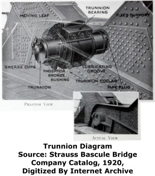
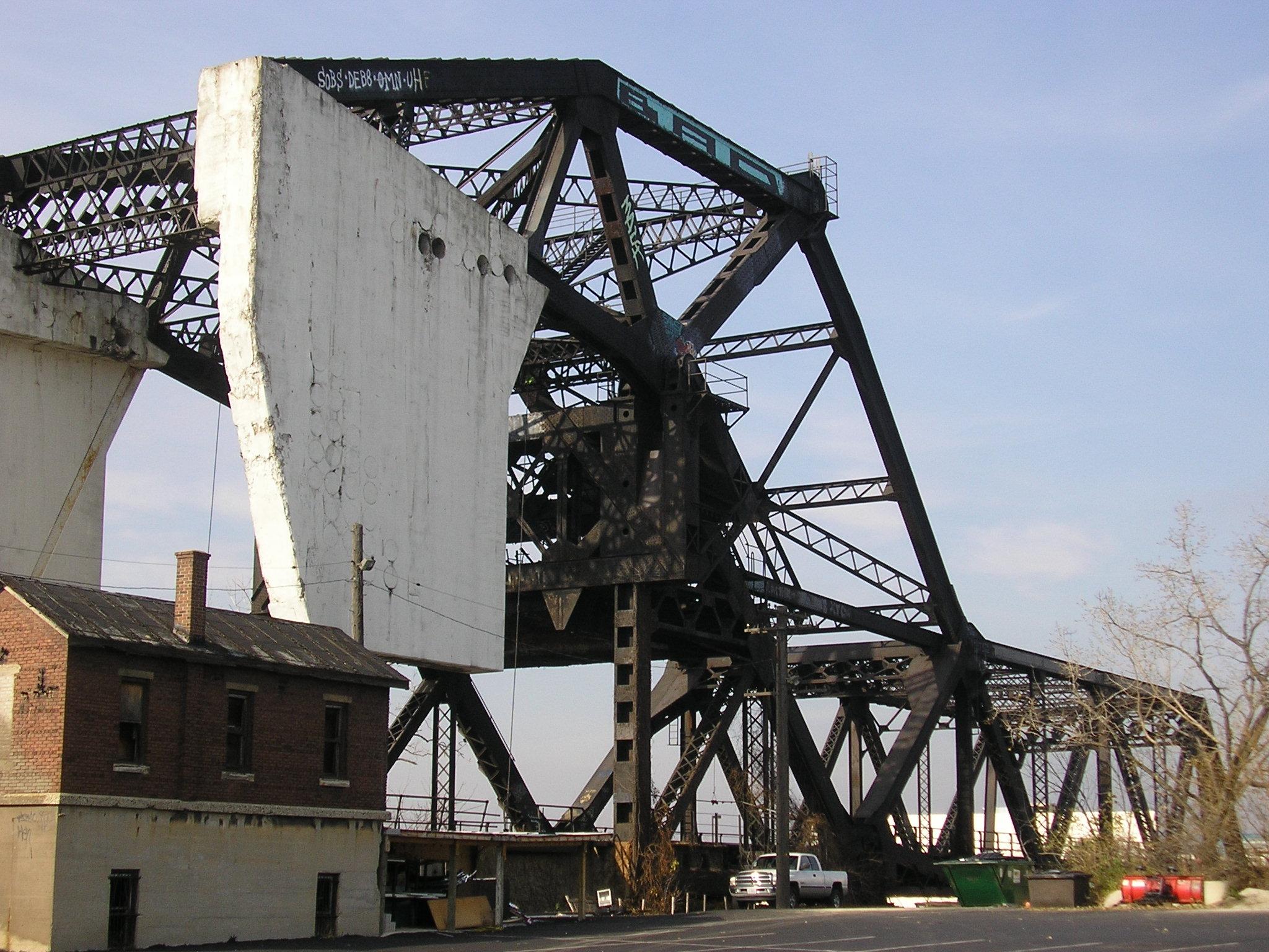
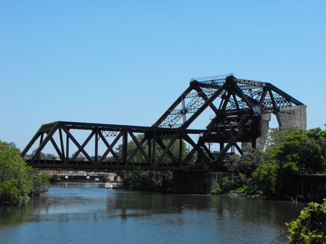
This is a massive railroad bridge that looms over anyone who looks at it. The bridge is not particularly long, it is just very massive because it was designed to handle three sets of tracks. There is v-lacing and lattice on various built-up beams of this bridge, which adds to the intricacy and aesthetic value of the bridge. Large concrete counterweights, located overhead, are clearly visible. The bridge is skewed and its two truss webs are of unequal length as a result. The bridge is a Strauss heel trunnion bascule bridge. The bridge was built for the Chicago and Northwestern Railroad, and today the railroad line is Union Pacific.
The Deering bascule bridge is at least the third railroad bridge at this site. A single track wooden bridge was replaced by an 1887 double-track swing bridge that was 176 feet in length, weighed about 400 tons, and was powered by steam.
The current bridge was opened to traffic July 30, 1916. Maintaining railroad traffic during construction was essential, and the bridge had to be designed so that it could be built without interrupting traffic. The bascule bridge was constructed in the raised position so as to keep everything away from the active tracks which carried 200 trains every 24 hours. However when the bascule bridge is in the raised position, the counterweights come down to track level. To prevent the counterweight from blocking traffic, the counterweights were designed as two sections off to the side, rather than a single counterweight spanning between the truss webs. During construction, the 1887 swing bridge remained in place, but temporary wooden approach spans for the railroad line were built to aid in the construction process. In order that the transition from the old bridge to the new bridge could be made in the least amount of time, a detailed plan was developed that enabled the transition from the swing bridge to the bascule bridge to take only 18 hours. Among the more interesting methods employed to meet this swift transition, the swing bridge was moved to the open position and the vertical members and top chords of the center panels of the truss were cut out, which made room to lower the bascule into place for the first time. Once lowered, trains could travel on the bascule bridge, and workers could then continue to demolish the swing bridge without disruption to rail traffic. See the photos below.

Great Lakes Dredge and Dock Company, who did work on many of Chicago's bridges was a contractor for this project. The Kelly-Atkinson Construction Company, another familiar Chicago bridge contractor, was also involved with this bridge's construction. The Strauss Bascule Bridge Company played at least some role in the design of this bridge.
Adam Kerman reports that "Deering Harvester Company was nearby (merged into International Harvester). Charles Deering was a director of the Chicago and North Western. It was built for the triple tracking project on what's now the Kenosha Subdivision." This explains the name of the bridge. Further research revealed that there was a train station at this area called Deering Station.
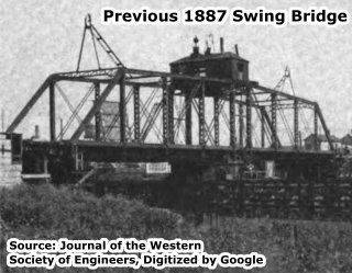
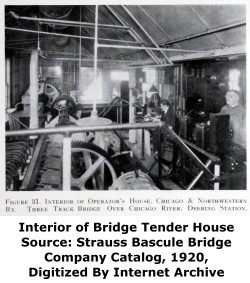
Be sure to follow the link at the top of this narrative to the PDF of articles about this bridge. There, you will find a fascinating and detailed discussion of the construction of this bridge. Included are photos showing the construction of the bridge and the previous swing bridge. Even the construction of the bridgetender building is described in detail right down to mention that the bathroom facilities were designed with "soil pipe discharging into the river below the water level," something that seems rather gross today but was not unusual in 1916.
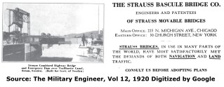
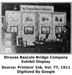
The Strauss Bascule Bridge Company, like many bridge companies in the late 1800s and early 1900s, found work by making extensive use of advertising to raise awareness of the company and the benefits of its bridges, while at the same time often citing all the things wrong with bridges built by other companies. This was an era where the success of a bridge engineering company was not just based on the quality of service provided; it was also based on the features of a unique product only offered by that particular company. The 1911 issue of Printers' Ink (Vol 77) included an article about advertising through the use of exhibit displays. The article touched on an exhibit that the Strauss Bascule Bridge Company. The discussion provides a rare look into some of the creative advertising methods employed by a bridge company. An excerpt from the article is shown below. Mr. Kaufman, mentioned in the article is Phillip L. Kaufman, an engineer with the company.
"In another booth, The Strauss Bascule Bridge Company of Chicago advertised a proposition ranging from $150,000 to $200,000, by means of miniature models of bridges. These models represented railway bridges, highway bridges and bridges of every description. Mr. Kaufman the bridge expert, in charge of this advertising exhibit, had the advantage of operating in a space hung with beautifully colored pictures of work successfully accomplished in all parts of the world. The booth represented a living advertisement. The space was filled with every element of a good advertisement plus the human equation. Mr. Kaufman said he believed that exhibit advertising was an excellent method of presenting an argument and having it clearly understood. He defined the exhibit ad as a combination of a display ad and a salesman's talk. The results received during the show proved that when a visitor left the booth he had seen the bridge operated, heard its construction and operation intelligently described and had seen actual photographs of bridges in practical use. This display, taken in its entirety, was a big, attractive and convincing advertisement."
Trunnion Diagram
![]()
Historic Bridges of Chicago and Cook County


Chicago and Cook County are home to one of the largest collections of historic bridges in the country, and no other city in the world has more movable bridges. HistoricBridges.org is proud to offer the most extensive coverage of historic Chicago bridges on the Internet.
General Chicago / Cook County Bridge Resources
Chicago's Bridges - By Nathan Holth, author of HistoricBridges.org, this book provides a discussion of the history of Chicago's movable bridges, and includes a virtual tour discussing all movable bridges remaining in Chicago today. Despite this broad coverage, the book is presented in a compact format that is easy to take with you and carry around for reference on a visit to Chicago. The book includes dozens of full color photos. Only $9.95 U.S! ($11.95 Canadian). Order on Amazon.
Chicago River Bridges - By Patrick T. McBriarty, this is a great companion to Holth's book shown above. This much larger book offers an extremely in-depth exploration of Chicago's movable highway bridges, including many crossings that have not existed for many years. Order Now Direct From The Publisher! or order on Amazon.
View Historic American Engineering Record (HAER) Overview of Chicago Bascule Bridges (HAER Data Pages, PDF)
Chicago Loop Bridges - Chicago Loop Bridges is another website on the Internet that is a great companion to the HistoricBridges.org coverage of the 18 movable bridges within the Chicago Loop. This website includes additional information such as connections to popular culture, overview discussions and essays about Chicago's movable bridges, additional videos, and current news and events relating to the bridges.
Additional Online Articles and Resources - This page is a large gathering of interesting articles and resources that HistoricBridges.org has uncovered during research, but which were not specific to a particular bridge listing.
![]()
Photo Galleries and Videos: Deering Bridge
Bridge Photo-Documentation
Original / Full Size PhotosA collection of overview and detail photos, taken in 2008 and 2010. This gallery offers photos in the highest available resolution and file size in a touch-friendly popup viewer.
Alternatively, Browse Without Using Viewer
![]()
Bridge Photo-Documentation
Mobile Optimized PhotosA collection of overview and detail photos, taken in 2008 and 2010. This gallery features data-friendly, fast-loading photos in a touch-friendly popup viewer.
Alternatively, Browse Without Using Viewer
![]()
Brian Teichert Gallery
Overview photos taken by Brian Teichert. Taken November 11, 2006. This photo gallery contains a combination of Original Size photos and Mobile Optimized photos in a touch-friendly popup viewer.Alternatively, Browse Without Using Viewer
![]()
Maps and Links: Deering Bridge
Coordinates (Latitude, Longitude):
Search For Additional Bridge Listings:
Bridgehunter.com: View listed bridges within 0.5 miles (0.8 kilometers) of this bridge.
Bridgehunter.com: View listed bridges within 10 miles (16 kilometers) of this bridge.
Additional Maps:
Google Streetview (If Available)
GeoHack (Additional Links and Coordinates)
Apple Maps (Via DuckDuckGo Search)
Apple Maps (Apple devices only)
Android: Open Location In Your Map or GPS App
Flickr Gallery (Find Nearby Photos)
Wikimedia Commons (Find Nearby Photos)
Directions Via Sygic For Android
Directions Via Sygic For iOS and Android Dolphin Browser
USGS National Map (United States Only)
Historical USGS Topo Maps (United States Only)
Historic Aerials (United States Only)
CalTopo Maps (United States Only)


