We Recommend:
Bach Steel - Experts at historic truss bridge restoration.
BridgeHunter.com Phase 1 is released to the public! - Visit Now
Bayertown Road Bridge
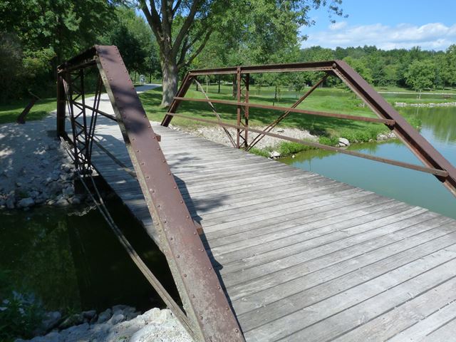
F. W. Kent Park Half Hip Pony Truss Bridge

Primary Photographer(s): Nathan Holth
Bridge Documented: August 10, 2013
Rural: Johnson County, Iowa: United States
By Builder/Contractor: King Bridge Company of Cleveland, Ohio
Not Available or Not Applicable
35.0 Feet (10.7 Meters)
Not Available
Not Available
1 Main Span(s)
Not Applicable

View Information About HSR Ratings
Bridge Documentation

Introduction
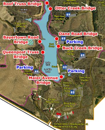
This webpage and narrative you are currently viewing is for one of the seven historic bridges that have been relocated to F. W. Kent Park on the Rod Dunlap Memorial Bridge Trail. This page provides a discussion of the individual bridge. Please also view the Dane Road Bridge page which includes a general overview discussion of F. W. Kent Park on the Rod Dunlap Memorial Bridge Trail. The map on this page shows F. W. Kent Park with all seven bridges labeled. You can click on the name of a bridge to switch to a particular bridge's page. Visit the official page for the park here. If you want to view an enlarged version of the bridge map to the left, click here.
About The Bridge
This bridge was previously located on Bayertown Road crossing Dirty Face Creek in Liberty Township. With only two panels, this is the least number of panels that a Pratt truss can have. As such, this is a short bridge with an estimated length of 35 feet. The bridge was reportedly built by the King Iron Bridge Company of Cleveland, Ohio, a prolific bridge builder in the late 1800s and early 1900s. This bridge is a traditionally composed example of its type. Little bridges like this are often overlooked for preservation because of their small size. As such, this is a rare example of such a small bridge being preserved. While preserving large bridges is important, it is also important to preserve small bridges like this one to ensure that a complete picture of our nation's transportation past is kept alive.
![]()
Photo Galleries and Videos: Bayertown Road Bridge
Bridge Photo-Documentation
Original / Full Size PhotosA collection of overview and detail photos. This gallery offers photos in the highest available resolution and file size in a touch-friendly popup viewer.
Alternatively, Browse Without Using Viewer
![]()
Bridge Photo-Documentation
Mobile Optimized PhotosA collection of overview and detail photos. This gallery features data-friendly, fast-loading photos in a touch-friendly popup viewer.
Alternatively, Browse Without Using Viewer
![]()
Maps and Links: Bayertown Road Bridge
Coordinates (Latitude, Longitude):
Search For Additional Bridge Listings:
Bridgehunter.com: View listed bridges within 0.5 miles (0.8 kilometers) of this bridge.
Bridgehunter.com: View listed bridges within 10 miles (16 kilometers) of this bridge.
Additional Maps:
Google Streetview (If Available)
GeoHack (Additional Links and Coordinates)
Apple Maps (Via DuckDuckGo Search)
Apple Maps (Apple devices only)
Android: Open Location In Your Map or GPS App
Flickr Gallery (Find Nearby Photos)
Wikimedia Commons (Find Nearby Photos)
Directions Via Sygic For Android
Directions Via Sygic For iOS and Android Dolphin Browser
USGS National Map (United States Only)
Historical USGS Topo Maps (United States Only)
Historic Aerials (United States Only)
CalTopo Maps (United States Only)

