

View Information About HSR Ratings
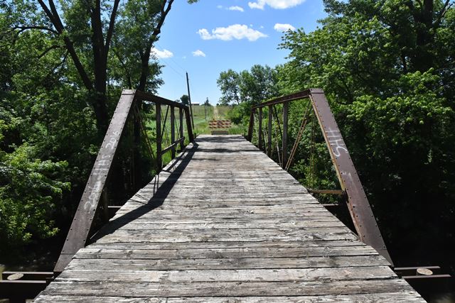
This pony truss is overall traditionally composed with two major exceptions. The bridge uses unique cast iron bearing shoes that fit to the shape of the built-up end post. Cast iron details such as these are typical of older truss bridges from the 1880s or earlier. Another detail usually found on bridges from the 1870s is the use of star iron, which on this bridge is used for the outriggers. Beyond these two details the rest of the bridge is traditionally composed and resembles a ca. 1890s bridge. The Missouri Valley Bridge and Iron Works is one company known to use star iron outriggers even after star iron had largely become obsolete for bridge use (such as the 1890s). It is possible that this bridge is the product of Missouri Valley Bridge and Iron Works, but this is not proven.
Regardless of exact age and builder, the unusual details on this bridge make this a unique and highly significant example of a Pratt pony truss bridge.
This bridge sits on a substructure that is not original. The bridge is closed to traffic, likely a permanant closure. Many counties in Kansas have decided the best thing to do with historic bridges is abandon and/or demolish them because they don't like to inspect them. As such, this bridge may be a good candidate for relocation and reuse for non-motorized use on a trail or in a park.
The National Bridge Inventory suggests a 1907 construction date, which is likely incorrect.
![]()
![]()
![]()
Coordinates (Latitude, Longitude):
Search For Additional Bridge Listings:
Bridgehunter.com: View listed bridges within 0.5 miles (0.8 kilometers) of this bridge.
Bridgehunter.com: View listed bridges within 10 miles (16 kilometers) of this bridge.
Additional Maps:
Google Streetview (If Available)
GeoHack (Additional Links and Coordinates)
Apple Maps (Via DuckDuckGo Search)
Apple Maps (Apple devices only)
Android: Open Location In Your Map or GPS App
Flickr Gallery (Find Nearby Photos)
Wikimedia Commons (Find Nearby Photos)
Directions Via Sygic For Android
Directions Via Sygic For iOS and Android Dolphin Browser
USGS National Map (United States Only)
Historical USGS Topo Maps (United States Only)
Historic Aerials (United States Only)
CalTopo Maps (United States Only)

© Copyright 2003-2026, HistoricBridges.org. All Rights Reserved. Disclaimer: HistoricBridges.org is a volunteer group of private citizens. HistoricBridges.org is NOT a government agency, does not represent or work with any governmental agencies, nor is it in any way associated with any government agency or any non-profit organization. While we strive for accuracy in our factual content, HistoricBridges.org offers no guarantee of accuracy. Information is provided "as is" without warranty of any kind, either expressed or implied. Information could include technical inaccuracies or errors of omission. Opinions and commentary are the opinions of the respective HistoricBridges.org member who made them and do not necessarily represent the views of anyone else, including any outside photographers whose images may appear on the page in which the commentary appears. HistoricBridges.org does not bear any responsibility for any consequences resulting from the use of this or any other HistoricBridges.org information. Owners and users of bridges have the responsibility of correctly following all applicable laws, rules, and regulations, regardless of any HistoricBridges.org information.
![]()