

View Information About HSR Ratings

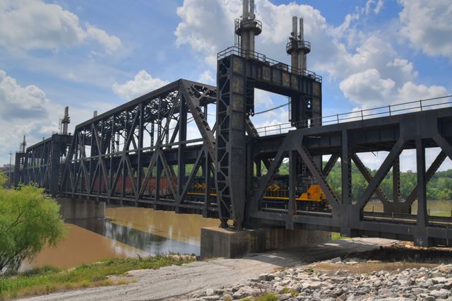
This bridge is a rare example of a double-deck railroad bridge, with each deck designed to serve railroad traffic. It was, like many railroad bridges in the period, constructed right around the older, smaller truss spans of the previous railroad bridge, which were removed after the new (existing) truss spans were completed. This process minimized closure for trains. This bridge became one of several truss bridges in Kansas City to recieve one of the most unusual alterations ever encountered in bridge history. In order to provide for potential flood events, this alteration was to add a lift system that made it possible to raise the truss spans by 10.5 feet during floods. It is assumed that this system was added after the 1951 flood as a screw jack system, but in 1963 a hydraulic jack system was installed.
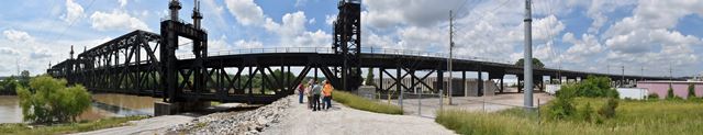
In addition to the large truss spans over the Kansas River, this bridge has an extremely long and sprawling approach system. One of the legs of this approach system north of the main spans includes some additional smaller through truss spans over a railroad yard. Photos of these spans are shown below and more photos are in the photo gallery.


Above: Historical photo showing bridge construction. The previous bridge can be seen still standing within the new construction.

Above: Historical 1963 article about adding the lift system.
This bridge is tagged with the following special condition(s): Double-Deck
![]()
![]()
![]()
Coordinates (Latitude, Longitude):
Search For Additional Bridge Listings:
Bridgehunter.com: View listed bridges within 0.5 miles (0.8 kilometers) of this bridge.
Bridgehunter.com: View listed bridges within 10 miles (16 kilometers) of this bridge.
Additional Maps:
Google Streetview (If Available)
GeoHack (Additional Links and Coordinates)
Apple Maps (Via DuckDuckGo Search)
Apple Maps (Apple devices only)
Android: Open Location In Your Map or GPS App
Flickr Gallery (Find Nearby Photos)
Wikimedia Commons (Find Nearby Photos)
Directions Via Sygic For Android
Directions Via Sygic For iOS and Android Dolphin Browser
USGS National Map (United States Only)
Historical USGS Topo Maps (United States Only)
Historic Aerials (United States Only)
CalTopo Maps (United States Only)

© Copyright 2003-2026, HistoricBridges.org. All Rights Reserved. Disclaimer: HistoricBridges.org is a volunteer group of private citizens. HistoricBridges.org is NOT a government agency, does not represent or work with any governmental agencies, nor is it in any way associated with any government agency or any non-profit organization. While we strive for accuracy in our factual content, HistoricBridges.org offers no guarantee of accuracy. Information is provided "as is" without warranty of any kind, either expressed or implied. Information could include technical inaccuracies or errors of omission. Opinions and commentary are the opinions of the respective HistoricBridges.org member who made them and do not necessarily represent the views of anyone else, including any outside photographers whose images may appear on the page in which the commentary appears. HistoricBridges.org does not bear any responsibility for any consequences resulting from the use of this or any other HistoricBridges.org information. Owners and users of bridges have the responsibility of correctly following all applicable laws, rules, and regulations, regardless of any HistoricBridges.org information.
![]()