

View Information About HSR Ratings
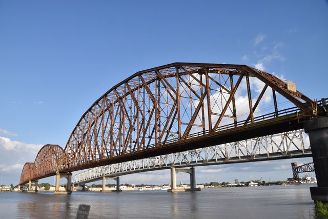
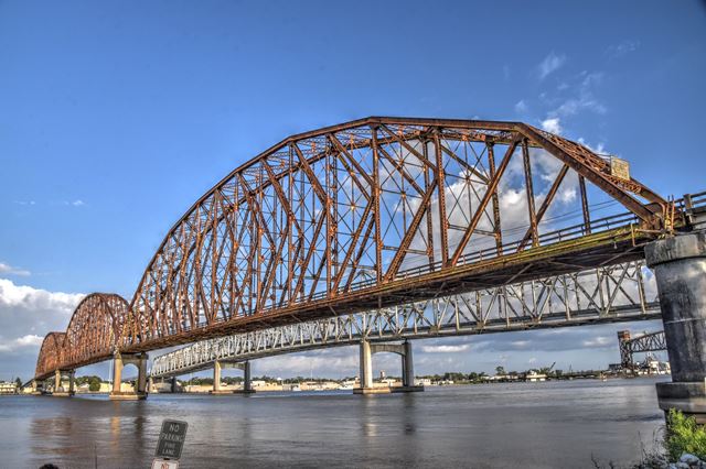
This bridge's long series of approach spans bring the roadway up to the elevation needed to cross the river, while three giant main through truss spans soar far above the roadway, making for an impressive bridge that is truly one of the most beautiful and significant historic bridges in the state. Each of this spans's three 607 foot main K-truss spans are the longest known K-truss spans in America. Indeed, these spans are among the longest simple span trusses of any configuration in the country. Spans in excess of 500 feet are rare, and represent major engineering achievements. Only a tiny number of truss bridges have spans ranging from 600 to just over 700 feet, which is the group this bridge falls into. The size of these spans and their beauty are hard to capture in photos, this is a bridge that truly has to be seen in person to fully experience how impressive it is. Louisiana is one of a small number of states that ever built bridges using the rare K-truss configuration. Some of the K-truss bridges that Louisiana built have been demolished; very few examples remain today. This bridge retains excellent historic integrity. There are no major alterations to the trusses, and the original railings remain in place with no modern additions. Original pedestrian stairways remain in place as well.
The Louisiana DOTD has in the past been a threat to the future of this bridge. In 2009, they threatened to demolish the bridge with no replacement claiming the nearby cantilever truss bridge was the only needed bridge for this area, and there was no reason (neither for historic preservation or utilitarian function) to keep the bridge standing and in use. This is a ridiculous position to take. This bridge should be the pride of the state, it should be preserved and it deserves a full restoration and long-term commitment to maintenance. Instead, it sits with a failing paint system that is more rust than paint today. This is shameful. It is not too late to rehabilitate and preserve this nationally significant historic bridge. When the bridge was threatened in 2009, thankfully, the St. Mary Parish Council and Morgan City Council stood up against plans for demolition. Beyond the bridge's national level of historic significance, these communities feel the bridge is an essential link during emergencies such as a hurricane evacuation. If the historic bridge were demolished any evacuation's success would rely on a single bridge only with no backup bridge. In this case, it would seem that preserving this historic bridge would also greatly increase safety for the community as well. The Louisiana DOTD needs to rethink its plans and move to fully restore this bridge.

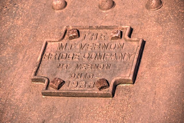
Above: Historical photo showing bridge construction. The bridge truss spans were assembled off-site then barged into place, an impressive feat for such large spans.

Above: Historical photo of bridge.
![]()
![]()
![]()
![]()
![]()
Coordinates (Latitude, Longitude):
Search For Additional Bridge Listings:
Bridgehunter.com: View listed bridges within 0.5 miles (0.8 kilometers) of this bridge.
Bridgehunter.com: View listed bridges within 10 miles (16 kilometers) of this bridge.
Additional Maps:
Google Streetview (If Available)
GeoHack (Additional Links and Coordinates)
Apple Maps (Via DuckDuckGo Search)
Apple Maps (Apple devices only)
Android: Open Location In Your Map or GPS App
Flickr Gallery (Find Nearby Photos)
Wikimedia Commons (Find Nearby Photos)
Directions Via Sygic For Android
Directions Via Sygic For iOS and Android Dolphin Browser
USGS National Map (United States Only)
Historical USGS Topo Maps (United States Only)
Historic Aerials (United States Only)
CalTopo Maps (United States Only)

© Copyright 2003-2026, HistoricBridges.org. All Rights Reserved. Disclaimer: HistoricBridges.org is a volunteer group of private citizens. HistoricBridges.org is NOT a government agency, does not represent or work with any governmental agencies, nor is it in any way associated with any government agency or any non-profit organization. While we strive for accuracy in our factual content, HistoricBridges.org offers no guarantee of accuracy. Information is provided "as is" without warranty of any kind, either expressed or implied. Information could include technical inaccuracies or errors of omission. Opinions and commentary are the opinions of the respective HistoricBridges.org member who made them and do not necessarily represent the views of anyone else, including any outside photographers whose images may appear on the page in which the commentary appears. HistoricBridges.org does not bear any responsibility for any consequences resulting from the use of this or any other HistoricBridges.org information. Owners and users of bridges have the responsibility of correctly following all applicable laws, rules, and regulations, regardless of any HistoricBridges.org information.
![]()