We Recommend:
Bach Steel - Experts at historic truss bridge restoration.
BridgeHunter.com Phase 1 is released to the public! - Visit Now
Chicago Drive Buttermilk Creek Bridge

Primary Photographer(s): Randy Mulder
Bridge Documented: August 22, 2010
Hudsonville: Ottawa County, Michigan: United States
1949 By Builder/Contractor: Getman Brothers and Engineer/Design: Michigan State Highway Department
Not Available or Not Applicable
35.0 Feet (10.7 Meters)
35.0 Feet (10.7 Meters)
122 Feet (37.19 Meters)
1 Main Span(s)
70170023000B060

View Information About HSR Ratings
Bridge Documentation
View Archived National Bridge Inventory Report - Has Additional Details and Evaluation
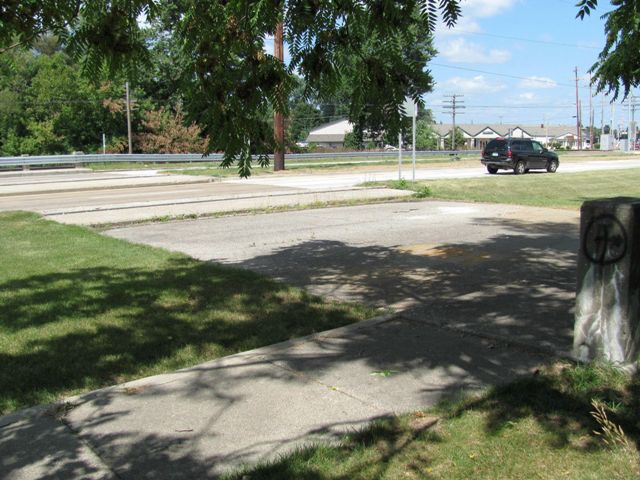
With a width of 137 feet, and a length of only 35 feet, this bridge is as wide as many bridges are long and as long as those same bridges might be wide. Aside from this oddity, the bridge itself is not very significant, but it does offer an interesting look into the history of the highway it serves.
Randy Mulder provided the following discussion about this bridge and the highway:
This route from Grand Rapids to Holland has been a state highway since the 1920's, originally as M-51 and then as M-21. In the 1950's an additional separate 2-lane surface was built to create a 4-lane divided route from Grandville to Zeeland, and this bridge was obviously built in preparation to carry the road through Hudsonville. However, a service road was also needed in town to access businesses, so this bridge had 3 2-lane roads crossing it (from underneath, it looks like 3 10-girder bridges side-by-side). In 1974, the I-196 freeway bypassed Hudsonville, and the M-21 designation was dropped. However, the county didn't want to take over the road, especially since some of the old road (current westbound lanes) was in bad shape (you can easily tell if you drive it- the 1950's side was designed to freeway grades and shoulders, while the other side is a roller-coaster that occasionally floods). The state kept control, and with increasing local traffic began to upgrade some of the busier intersections to indirect turns, one of which required taking over part of a section of the service road for a turning area. This made 1/3 of this bridge unnecessary, so now there is a grassy strip on either side of the bridge separating the sidewalk on the south from the highway. In 2007 MDOT designated this as M-121, and this year began upgrading the entire stretch to current specifications, which explains the shiny Armco railing covering the north R4 railing of the bridge. The south side, however, is so far from traffic that it escaped this fate, and remains in very good shape
![]()
Photo Galleries and Videos: Chicago Drive Buttermilk Creek Bridge
Bridge Photo-Documentation
Original / Full Size PhotosA collection of overview and detail photos. This gallery offers photos in the highest available resolution and file size in a touch-friendly popup viewer.
Alternatively, Browse Without Using Viewer
![]()
Bridge Photo-Documentation
Mobile Optimized PhotosA collection of overview and detail photos. This gallery features data-friendly, fast-loading photos in a touch-friendly popup viewer.
Alternatively, Browse Without Using Viewer
![]()
Maps and Links: Chicago Drive Buttermilk Creek Bridge
Coordinates (Latitude, Longitude):
Search For Additional Bridge Listings:
Bridgehunter.com: View listed bridges within 0.5 miles (0.8 kilometers) of this bridge.
Bridgehunter.com: View listed bridges within 10 miles (16 kilometers) of this bridge.
Additional Maps:
Google Streetview (If Available)
GeoHack (Additional Links and Coordinates)
Apple Maps (Via DuckDuckGo Search)
Apple Maps (Apple devices only)
Android: Open Location In Your Map or GPS App
Flickr Gallery (Find Nearby Photos)
Wikimedia Commons (Find Nearby Photos)
Directions Via Sygic For Android
Directions Via Sygic For iOS and Android Dolphin Browser
USGS National Map (United States Only)
Historical USGS Topo Maps (United States Only)
Historic Aerials (United States Only)
CalTopo Maps (United States Only)

