We Recommend:
Bach Steel - Experts at historic truss bridge restoration.
BridgeHunter.com Phase 1 is released to the public! - Visit Now
Cascade Road Bridge

Primary Photographer(s): Nathan Holth
Bridge Documented: March 11, 2007 and November 5, 2011
Rural: Kent County, Michigan: United States
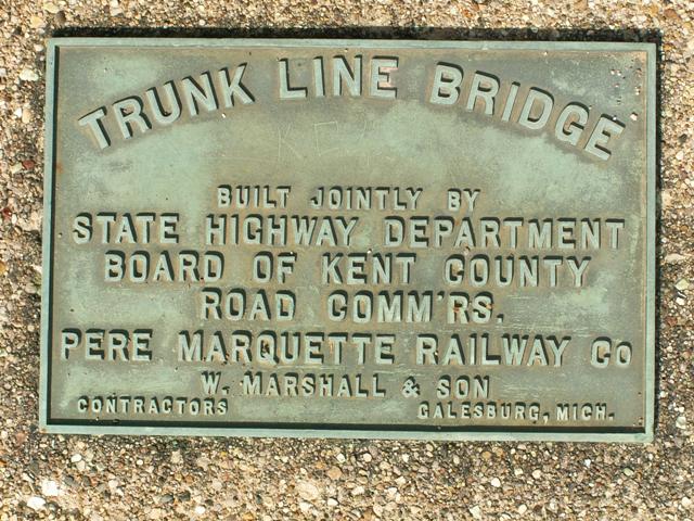
1926 By Builder/Contractor: W. Marshall and Son of Galesburg, Michigan
Not Available or Not Applicable
46.0 Feet (14 Meters)
137.8 Feet (42 Meters)
43 Feet (13.11 Meters)
3 Main Span(s)
41200013000R010

View Information About HSR Ratings
Bridge Documentation
This bridge no longer exists!
View Archived National Bridge Inventory Report - Has Additional Details and Evaluation

Cascade Road is a former trunk line that essentially follows the route of I-96 from Detroit to Grand Rapids today. In all counties but Kent, the road is known as Grand River Avenue. Grand River Avenue starts right in downtown Detroit.
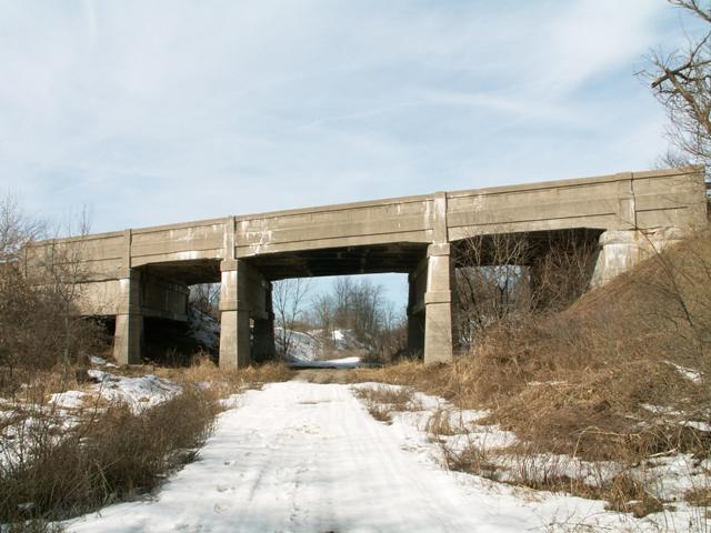
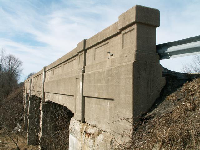
The Cascade Road Bridge is a bridge that is historically significant in a wide range of areas. Firstly, it is significant for using what appears to be a unique hybrid of design types. Under the deck of this bridge, concrete beams run both lengthwise, like a t-beam bridge, while an equal number of beams run transverse like floorbeams in a girder bridge. The girders (which double as railings) that support these transverse floorbeams are designed to a standard 1920s design that appeared on a standard design of concrete girder bridge that was built in the area of the 1920s in Michigan. Most of these girder bridges are generally 20 feet wide. The Cascade Road Bridge is much wider, and likely was designed to hold four lanes although it only features two today. The standard concrete girder bridge was discontinued in Michigan because it could not be widened to support increasing traffic needs. The Cascade Road Bridge appears to have been an attempt to deal with the problem of a wide concrete girder bridge. As such, it is likely that the concrete girder and floorbeam system on this bridge does half of the work of supporting it, while the beams that run the length of the bridge do the other half. Structurally, the bridge is essentially two bridges in one. Such a unique design means that this bridge enjoys an extremely high level of historic significance. It was likely the result of some sort of experimentation before the Michigan State Highway Department abandoned the girder completely in favor of other structure types.

In terms of appearance, the bridge has the look of a concrete girder bridge to the casual viewer, on account of the railings. If the Cascade Road Bridge is considered to be a concrete girder, then it is the longest example of a straight chord through girder in Michigan. Thus it is significant as a large example of this historic technology. Looked upon as a hybrid structure, it likely has no competition.
This bridge is also significant as a remnant of a former trunk line roadway, one that is likely quite old given the relative importance of a route between Michigan's two largest cities.
The Cascade Road Bridge is also significant and most worthy of preservation because of its relatively high levels of historic and structural integrity. The bridge is in good condition for a 1920s bridge that has seen little in terms of rehabilitation over its 75+ year life. The below chart identifies the relative strength of the bridge. Fair condition is actually quite high for a bridge of this age, and it suggest that the Cascade Road Bridge is a bridge that could easily be rehabilitated.
Unfortunately, this bridge doesn't really have a purpose now, as the railroad it once passed over has been removed and abandoned, although the road it carries is still in use. Such status makes seeking a preservation solution for this bridge difficult, when it might seem more sensible to demolish the bridge and bring in dirt fill to carry the road over the former location of the railroad. Thus the future for this bridge does not look good. However, given the structure's unusual design, looking at different options for preservation are still be a worthy consideration.
2010 National Bridge Inventory Structural EvaluationCascade Road BridgeDeck Condition: Fair Condition Superstructure Condition: Fair Condition Substructure Condition: Fair Condition Bridge Railing: Meets currently acceptable standards. Structural Evaluation: Somewhat better than minimum adequacy to tolerate being left in place as is. Bridge is NOT Listed As Structurally Deficient. Note: Conditions can range from Failed, Imminent Failure, Critical, Serious, Poor, Fair, Satisfactory, Good, Very Good, and Excellent. |
![]()
Photo Galleries and Videos: Cascade Road Bridge
Original / Full Size Gallery
Original / Full Size PhotosFor the best visual immersion and full detail, or for use as a desktop background, this gallery presents selected overview and detail photos for this bridge in the original digital camera resolution. This gallery offers photos in the highest available resolution and file size in a touch-friendly popup viewer.
Alternatively, Browse Without Using Viewer
![]()
Structure Overview
Mobile Optimized PhotosA collection of overview photos that show the bridge as a whole and general areas of the bridge. This gallery features data-friendly, fast-loading photos in a touch-friendly popup viewer.
Alternatively, Browse Without Using Viewer
![]()
Structure Details
Mobile Optimized PhotosA collection of detail photos that document the parts, construction, and condition of the bridge. This gallery features data-friendly, fast-loading photos in a touch-friendly popup viewer.
Alternatively, Browse Without Using Viewer
![]()
Maps and Links: Cascade Road Bridge
This historic bridge has been demolished. This map is shown for reference purposes only.
Coordinates (Latitude, Longitude):
Search For Additional Bridge Listings:
Bridgehunter.com: View listed bridges within 0.5 miles (0.8 kilometers) of this bridge.
Bridgehunter.com: View listed bridges within 10 miles (16 kilometers) of this bridge.
Additional Maps:
Google Streetview (If Available)
GeoHack (Additional Links and Coordinates)
Apple Maps (Via DuckDuckGo Search)
Apple Maps (Apple devices only)
Android: Open Location In Your Map or GPS App
Flickr Gallery (Find Nearby Photos)
Wikimedia Commons (Find Nearby Photos)
Directions Via Sygic For Android
Directions Via Sygic For iOS and Android Dolphin Browser
USGS National Map (United States Only)
Historical USGS Topo Maps (United States Only)
Historic Aerials (United States Only)
CalTopo Maps (United States Only)


