

View Information About HSR Ratings
Lapeer County used to have some of the most noteworthy railroad-related bridges in Michigan, one being the nationally significant Genesee Road Bridge, the other being the Summers Road Bridge through plate girder, a rare (for Michigan) highway plate girder which unfortunately was demolished before HistoricBridges.org was started.
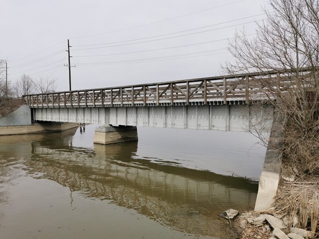
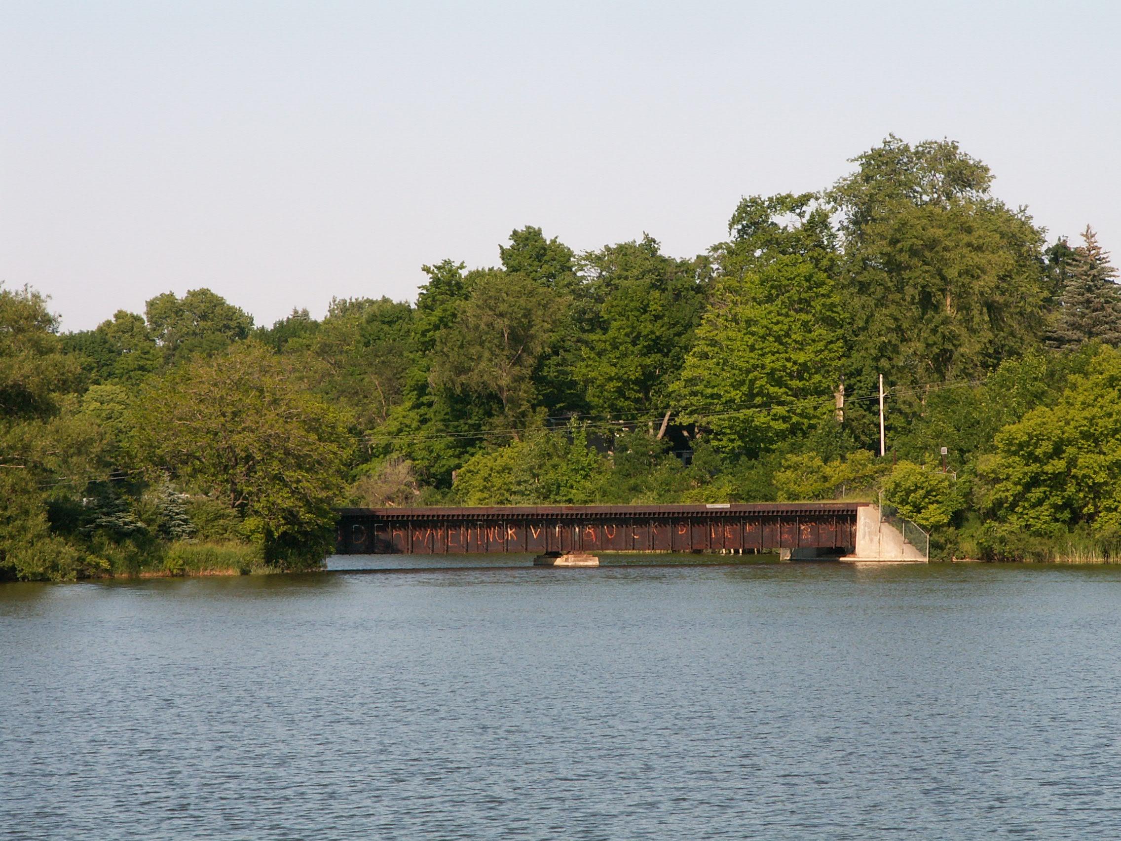
The Columbiaville Bridge is not particularly significant, and while a truss bridge would look nicer and have more value, for Michigan the scene in Columbiaville on the Flint River is a scenic one, and this long-abandoned bridge adds to the scene, telling a tale of a time when trains rolled through Columbiaville.
In 2007, the bridge is fenced off and rusting, but a new sign near the rail line suggested this might become a rail-trail. A revisit to the bridge in 2022 confirmed that this bridge has indeed been turned into a rail-trail bridge and has been repainted grey, which is noteworthy because rails-to-trails groups do not always do restoration work on the historic bridges their trails cross over.
This bridge is tagged with the following special condition(s): Unorganized Photos
![]()
![]()
![]()
![]()
Coordinates (Latitude, Longitude):
Search For Additional Bridge Listings:
Bridgehunter.com: View listed bridges within 0.5 miles (0.8 kilometers) of this bridge.
Bridgehunter.com: View listed bridges within 10 miles (16 kilometers) of this bridge.
Additional Maps:
Google Streetview (If Available)
GeoHack (Additional Links and Coordinates)
Apple Maps (Via DuckDuckGo Search)
Apple Maps (Apple devices only)
Android: Open Location In Your Map or GPS App
Flickr Gallery (Find Nearby Photos)
Wikimedia Commons (Find Nearby Photos)
Directions Via Sygic For Android
Directions Via Sygic For iOS and Android Dolphin Browser
USGS National Map (United States Only)
Historical USGS Topo Maps (United States Only)
Historic Aerials (United States Only)
CalTopo Maps (United States Only)

© Copyright 2003-2026, HistoricBridges.org. All Rights Reserved. Disclaimer: HistoricBridges.org is a volunteer group of private citizens. HistoricBridges.org is NOT a government agency, does not represent or work with any governmental agencies, nor is it in any way associated with any government agency or any non-profit organization. While we strive for accuracy in our factual content, HistoricBridges.org offers no guarantee of accuracy. Information is provided "as is" without warranty of any kind, either expressed or implied. Information could include technical inaccuracies or errors of omission. Opinions and commentary are the opinions of the respective HistoricBridges.org member who made them and do not necessarily represent the views of anyone else, including any outside photographers whose images may appear on the page in which the commentary appears. HistoricBridges.org does not bear any responsibility for any consequences resulting from the use of this or any other HistoricBridges.org information. Owners and users of bridges have the responsibility of correctly following all applicable laws, rules, and regulations, regardless of any HistoricBridges.org information.
![]()