HistoricBridges.org Menu: HistoricBridges.org Menu:


We Recommend:
Bach Steel - Experts at historic truss bridge restoration.

HistoricBridges.org: Bridge Browser

US-12 Michigan Avenue I-94 Bridge

US-12 Michigan Avenue I-94 Bridge

Primary Photographer(s): Nathan Holth

Bridge Documented: May 29, 2022

View Photos
and Videos
View Maps
and Links

Location
Dearborn: Wayne County, Michigan: United States
Construction Date and Builder / Engineer
1948 By Builder/Contractor: Darin and Armstrong, Inc of Detroit, Michigan and Engineer/Design: Hazelet and Erdal of Chicago, Illinois and Michigan State Highway Department
Rehabilitation Date
1996
Main Span Length
119.0 Feet (36.3 Meters)
Structure Length
224.0 Feet (68.3 Meters)
Roadway Width
90 Feet (27.43 Meters)
Spans
2 Main Span(s)
Inventory Number
11140

Historic Significance Rating (HSR)
View Information About HSR Ratings

Bridge Documentation

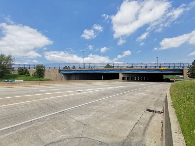
This bridge and interchange was found historic by the Michigan Historic Bridge Inventory for its significance as an early and important interchange in Michigan. The bridge retains good integrity except for the loss of original railing.

This page refers to the main bridge carrying US-12 over the mainline of I-94. However, this page also includes photos of three other bridges related to this interchange. One carries US-12 over the ramp from US-12 to Westbound I-94 is is located immediately west of the main bridge. Another carries the ramp from US-12 to Westbound I-94 over I-94. The other carries the ramp from US-12 to Eastbound I-94 over I-94. 

View Archived National Bridge Inventory Report - Has Additional Details and Evaluation

View Historical Articles About This Bridge

Information and Findings From Michigan Historic Bridge Inventory

Narrative Description

The Detroit Industrial Expressway and the Edsel Ford Expressway became models for freeway design throughout the country, helping to stimulate the construction of the modern interstate system. The U.S. Highway 12 Bridges qualify for the National Register as representative examples of the structures designed for these innovative highways. The bridges are also eligible under for their engineering significance. Standing where the two expressways merge, the bridges represent the successful solution to an intersection that was challenging to design and construct.

The potential of a crosstown thoroughfare following Harper and McGraw avenues was recognized by the 1920s, when Detroit helped prepare a regional road system master plan. The cost of upgrading this route to a consistent 120-foot width was estimated at $3.852 million. The same route was highlighted by a 1936 study, part of a nationwide traffic planning survey initiated by the federal Public Roads Administration. Participants of the Detroit study, including the city of Detroit, the Wayne County Road Commission, the Huron-Clinton Parkway Commission, and the state highway department, hoped to begin construction of the crosstown road soon, but the onset of World War II delayed plans. The war, however, catalyzed construction of the freeway to the west, the Detroit Industrial Expressway (DIE), which served the Willow Run bomber plant at Ypsilanti.

Planning for the Harper-McGraw route continued during the early 1940s, as the state and country anticipated post-war projects. In February 1941, the state highway department presented a preliminary report on the route to government officials in Detroit and Wayne County. Conducting surveys, acquiring right-of-way, negotiating with utility companies to relocate lines, and other pre-construction work took a considerable amount of time and expense, given the crosstown road's densely developed environs. One highway official claimed that the route "traverses a more or less blighted area"[Coons], underscoring the fact that early interstate development was seen as an urban redevelopment tool in addition to a transportation improvement. The Detroit route was originally known as the "Crosstown." The Detroit City Council approved a petition to christen it the "Edsel Ford Expressway" in April 1946.

By September 1946, final plans were drawn for a Pere Marquette Railroad overpass to the north of the DIE/Ford intersection. The state highway department had completed surveys for 13 of the Ford's vehicular bridges and prepared preliminary plans for an additional four. The 14-mile expressway would ultimately require 70 structures, not including pedestrian overpasses. The initial section extended east from the terminus of the DIE at Wyoming and Michigan avenues, at the Dearborn/Detroit border, to John R Street near downtown Detroit. Plans included an interchange with the north-south John C. Lodge Expressway, which Wayne County was developing concurrently.

Because the Ford Expressway was part of the federal system, half the cost was paid by the federal government, thanks to the Federal Aid Law of 1944 permitting states to dedicate federal highway funds to urban freeway construction. Responsibility for providing the remaining funds was split equally between the state and Wayne County. The first federal aid became available in October 1945, and was put towards acquisition of right-of-way. Initially, construction was completed on a "pay-as-you-go" basis. This led to frequent delays, which caused planners to explore other means of financing. In 1951, a controversial revenue bond sale generated $80 million to speed work on the Lodge and Ford expressways. The state, county and city dedicated income from gasoline and weight taxes to retire the bonds over a 25-year period.

Representatives from the federal Bureau of Roads, the state highway commission, the Wayne County Road Commission, and the city of Detroit formed an "Expressway Engineering Committee" to coordinate the myriad details required associated with the expressway's planning and construction. The state highway department alone, however, was responsible for completing the intersection between the Ford, the DIE, and Michigan Avenue (US-12), which was located in Dearborn and hence not included in the tri-partite agreement between the state, county and city.

A brochure issued by the state highway department in 1954 articulated the benefits of the new roads: "The Edsel Ford and John C. Lodge expressways will relieve greatly the present serious traffic congestion problem in the metropolitan area . . . [thus] reducing travel time and eliminating inconvenience and discomfort that go with driving on heavily congested streets. Because of the limited access features and elimination of cross traffic, it will be possible to drive safely on the expressways at speeds much greater than is possible on main traffic thoroughfares. . . . The expressways will add to the beauty of the city, will speed workers from homes to factories and return, and shoppers to and from the downtown area over the safest type of highway designed today." The brochure also notes: "No greater public program was ever undertaken in Michigan on a cooperative basis between units of government than the John C. Lodge and Edsel Ford expressway system."

Work began on the west end of the Ford and moved east, focusing first on the DIE/Ford/Michigan Avenue (US-12) interchange. The state highway department, which was responsible for preparing the plans, received assistance in the design of the US-12 Bridge from Hazelet and Erdal, consulting engineers from Chicago. When the highway department opened bids for the project's general contractor on 15 July 1948, Peter Darin and John Armstrong, principals of the Detroit construction firm Darin and Armstrong, won the award with the low bid of approximately $925,000. Construction began 4 August. Some 95,000 cubic yards of clay had to be excavated from the site. Progress was delayed in October by a ruptured high-pressure water main, and the structures were not finished until the following August. Other contractors involved in the project included Charles J. Rogers of Detroit (excavation) and the Great Lakes Steel Company.

State Highway Commissioner Charles Ziegler cut the ribbon at a well-attended opening ceremony on 17 August 1949. This event marked the completion of a major interchange linking two of the country's earliest limited-access freeways, the Detroit Industrial Expressway and the Edsel Ford Expressway. The combined route appropriated for Interstate 94 when the interstate system was established in the 1950s, illustrates how highways moved from serving wartime needs to fueling post-war prosperity.

Divider

Photo Galleries and Videos: US-12 Michigan Avenue I-94 Bridge


View Photo Gallery

Bridge Photo-Documentation

Original / Full Size Photos
A collection of overview and detail photos. This gallery offers photos in the highest available resolution and file size in a touch-friendly popup viewer.
Alternatively, Browse Without Using Viewer

Divider

View Photo Gallery

Bridge Photo-Documentation

Mobile Optimized Photos
A collection of overview and detail photos. This gallery features data-friendly, fast-loading photos in a touch-friendly popup viewer.
Alternatively, Browse Without Using Viewer

Divider

Maps and Links: US-12 Michigan Avenue I-94 Bridge

Coordinates (Latitude, Longitude):

Search For Additional Bridge Listings:

Bridgehunter.com: View listed bridges within 0.5 miles (0.8 kilometers) of this bridge.

Bridgehunter.com: View listed bridges within 10 miles (16 kilometers) of this bridge.

HistoricBridges.org Bridge Browser: View listed bridges within 0.5 miles (0.8 kilometers) of this bridge.

HistoricBridges.org Bridge Browser: View listed bridges within 10 miles (16 kilometers) of this bridge.

2021 National Bridge Inventory: View listed bridges within 0.5 miles (0.8 kilometers) of this bridge.

Additional Maps:

Google Maps

Google Streetview (If Available)

Bing Maps

OpenStreetMap

GeoHack (Additional Links and Coordinates)

Apple Maps (Via DuckDuckGo Search)

Apple Maps (Apple devices only)

MapQuest

HERE We Go Maps

ACME Mapper

Waze Map

Android: Open Location In Your Map or GPS App

Flickr Gallery (Find Nearby Photos)

Wikimedia Commons (Find Nearby Photos)

Directions Via Sygic For Android

Directions Via Sygic For iOS and Android Dolphin Browser

USGS National Map (United States Only)

Historical USGS Topo Maps (United States Only)

Historic Aerials (United States Only)

CalTopo Maps (United States Only)


Divider
 
Home Top

Divider

About - Contact

© Copyright 2003-2024, HistoricBridges.org. All Rights Reserved. Disclaimer: HistoricBridges.org is a volunteer group of private citizens. HistoricBridges.org is NOT a government agency, does not represent or work with any governmental agencies, nor is it in any way associated with any government agency or any non-profit organization. While we strive for accuracy in our factual content, HistoricBridges.org offers no guarantee of accuracy. Information is provided "as is" without warranty of any kind, either expressed or implied. Information could include technical inaccuracies or errors of omission. Opinions and commentary are the opinions of the respective HistoricBridges.org member who made them and do not necessarily represent the views of anyone else, including any outside photographers whose images may appear on the page in which the commentary appears. HistoricBridges.org does not bear any responsibility for any consequences resulting from the use of this or any other HistoricBridges.org information. Owners and users of bridges have the responsibility of correctly following all applicable laws, rules, and regulations, regardless of any HistoricBridges.org information.

Admin Login

Divider