

View Information About HSR Ratings
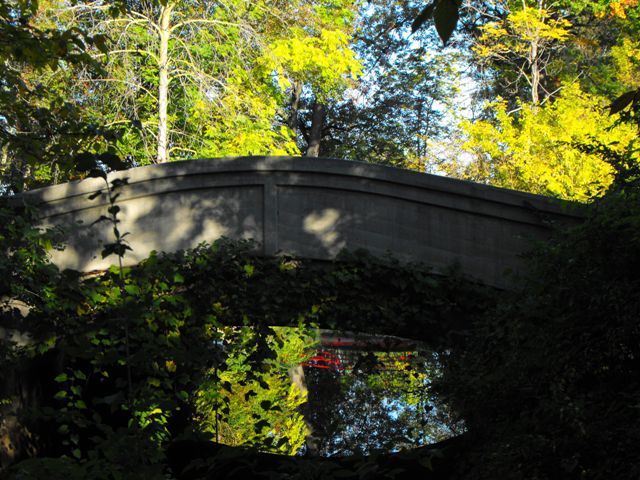
This bridge is an attractive structure that is very wide because it is located at a point where the road splits into two immediately north of the bridge. It is actually about twice as wide as it is long. The bridge displays significant aesthetic design, and its curved railing is designed to compliment the bridge arch, so views beside this bridge look like the entire bridge follows the same curve, although the deck in reality does not have a significant camber.
Below is a historical photo of a Belle Isle bridge that appears to be this bridge.

Information and Findings From Michigan Historic Bridge InventoryNarrative Description The 1913 Central Avenue Bridge, a concrete
filled-spandrel arch, is located towards the northeastern end of the
island, where Central Avenue winds through a heavily wooded area. The
1913 Central Avenue Bridge has a graceful arched solid parapet railing
with recessed panels. A projecting coping tops the railing A bas-relief
keystone over arch is incised with the date "1913." Original metal lamp
standards with fluted shafts stand on the southern railing; the original
globe is gone on the western fixture. |
![]()
![]()
![]()
Coordinates (Latitude, Longitude):
Search For Additional Bridge Listings:
Bridgehunter.com: View listed bridges within 0.5 miles (0.8 kilometers) of this bridge.
Bridgehunter.com: View listed bridges within 10 miles (16 kilometers) of this bridge.
Additional Maps:
Google Streetview (If Available)
GeoHack (Additional Links and Coordinates)
Apple Maps (Via DuckDuckGo Search)
Apple Maps (Apple devices only)
Android: Open Location In Your Map or GPS App
Flickr Gallery (Find Nearby Photos)
Wikimedia Commons (Find Nearby Photos)
Directions Via Sygic For Android
Directions Via Sygic For iOS and Android Dolphin Browser
USGS National Map (United States Only)
Historical USGS Topo Maps (United States Only)
Historic Aerials (United States Only)
CalTopo Maps (United States Only)

© Copyright 2003-2025, HistoricBridges.org. All Rights Reserved. Disclaimer: HistoricBridges.org is a volunteer group of private citizens. HistoricBridges.org is NOT a government agency, does not represent or work with any governmental agencies, nor is it in any way associated with any government agency or any non-profit organization. While we strive for accuracy in our factual content, HistoricBridges.org offers no guarantee of accuracy. Information is provided "as is" without warranty of any kind, either expressed or implied. Information could include technical inaccuracies or errors of omission. Opinions and commentary are the opinions of the respective HistoricBridges.org member who made them and do not necessarily represent the views of anyone else, including any outside photographers whose images may appear on the page in which the commentary appears. HistoricBridges.org does not bear any responsibility for any consequences resulting from the use of this or any other HistoricBridges.org information. Owners and users of bridges have the responsibility of correctly following all applicable laws, rules, and regulations, regardless of any HistoricBridges.org information.
![]()