We Recommend:
Bach Steel - Experts at historic truss bridge restoration.
BridgeHunter.com Phase 1 is released to the public! - Visit Now
7th Street Improvement Arches
7th Street Bridge

Primary Photographer(s): Nathan Holth
Bridge Documented: June 3, 2013
St. Paul: Ramsey County, Minnesota: United States
1884 By Builder/Contractor: McArthur Brothers of Chicago, Illinois and Engineer/Design: William Albert Truesdell
Not Available or Not Applicable
37.0 Feet (11.3 Meters)
90.0 Feet (27.4 Meters)
Not Available
2 Main Span(s)
90386

View Information About HSR Ratings
Bridge Documentation
View Archived National Bridge Inventory Report - Has Additional Details and Evaluation
View The National Register of Historic Places Nomination Form For This Historic Bridge
View The State Context For Masonry Bridges
View Detailed Historical Articles Discussing This Bridge and Its Designer
View A Short Historical Article Discussing This Bridge
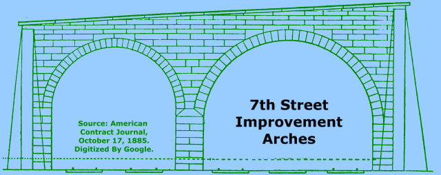
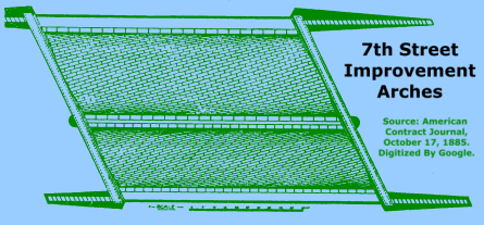
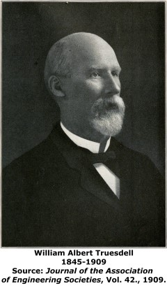
This bridge is a rare example, and the only known example in Minnesota, of a skewed stone arch bridge that follows the helicoidal method for producing the skewed arch bridge. This method was common on bridges in England, but not in the United States. In fact, skewed stone arch bridges of any type are exceedingly rare, and many of those that are skewed use a structurally inferior ribbed design method. Consult the above historical articles and National Register nomination for a detailed discussion on this skew, the form it take, and its reasons for use. In short, the skew helicoidal design of skew allows for the stones to be cut of consistent design and as such allowed United States stone masons who were not used to cutting more complex shapes of stone to construct the needed masonry. At the same time, the design avoids the structural inadequacies of a ribbed approach to producing a bridge skew. Adding to the bridge's complicated design is that its two spans are not the same length, and the bridge also was constructed with a grade. The bridge was designed by William Albert Truesdell. The contractors for the bridge included M. O'Brien of St. Paul who constructed the substructure, specifically that up to the spring line. The rest was built by the McArthur Brothers of Chicago, Illinois. The bridge was originally built as a grade separation to carry 7th Street over the St. Paul and Duluth Railroad. Today, it crosses a rail-trail, the railroad line having been abandoned. The historic integrity of the stone arch bridge is outstanding with no major alterations noted. With the rail-trail underneath, visitors can easily view the spiral pattern of stones in the barrel of the arch, testimony to the helicoidal skew design.
This bridge is tagged with the following special condition(s): Helicoidal Arch
![]()
Photo Galleries and Videos: 7th Street Improvement Arches
Bridge Photo-Documentation
Original / Full Size PhotosA collection of overview and detail photos. This gallery offers photos in the highest available resolution and file size in a touch-friendly popup viewer.
Alternatively, Browse Without Using Viewer
![]()
Bridge Photo-Documentation
Mobile Optimized PhotosA collection of overview and detail photos. This gallery features data-friendly, fast-loading photos in a touch-friendly popup viewer.
Alternatively, Browse Without Using Viewer
![]()
Maps and Links: 7th Street Improvement Arches
Coordinates (Latitude, Longitude):
Search For Additional Bridge Listings:
Bridgehunter.com: View listed bridges within 0.5 miles (0.8 kilometers) of this bridge.
Bridgehunter.com: View listed bridges within 10 miles (16 kilometers) of this bridge.
Additional Maps:
Google Streetview (If Available)
GeoHack (Additional Links and Coordinates)
Apple Maps (Via DuckDuckGo Search)
Apple Maps (Apple devices only)
Android: Open Location In Your Map or GPS App
Flickr Gallery (Find Nearby Photos)
Wikimedia Commons (Find Nearby Photos)
Directions Via Sygic For Android
Directions Via Sygic For iOS and Android Dolphin Browser
USGS National Map (United States Only)
Historical USGS Topo Maps (United States Only)
Historic Aerials (United States Only)
CalTopo Maps (United States Only)


