

View Information About HSR Ratings

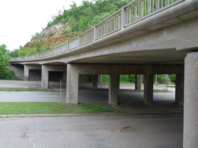
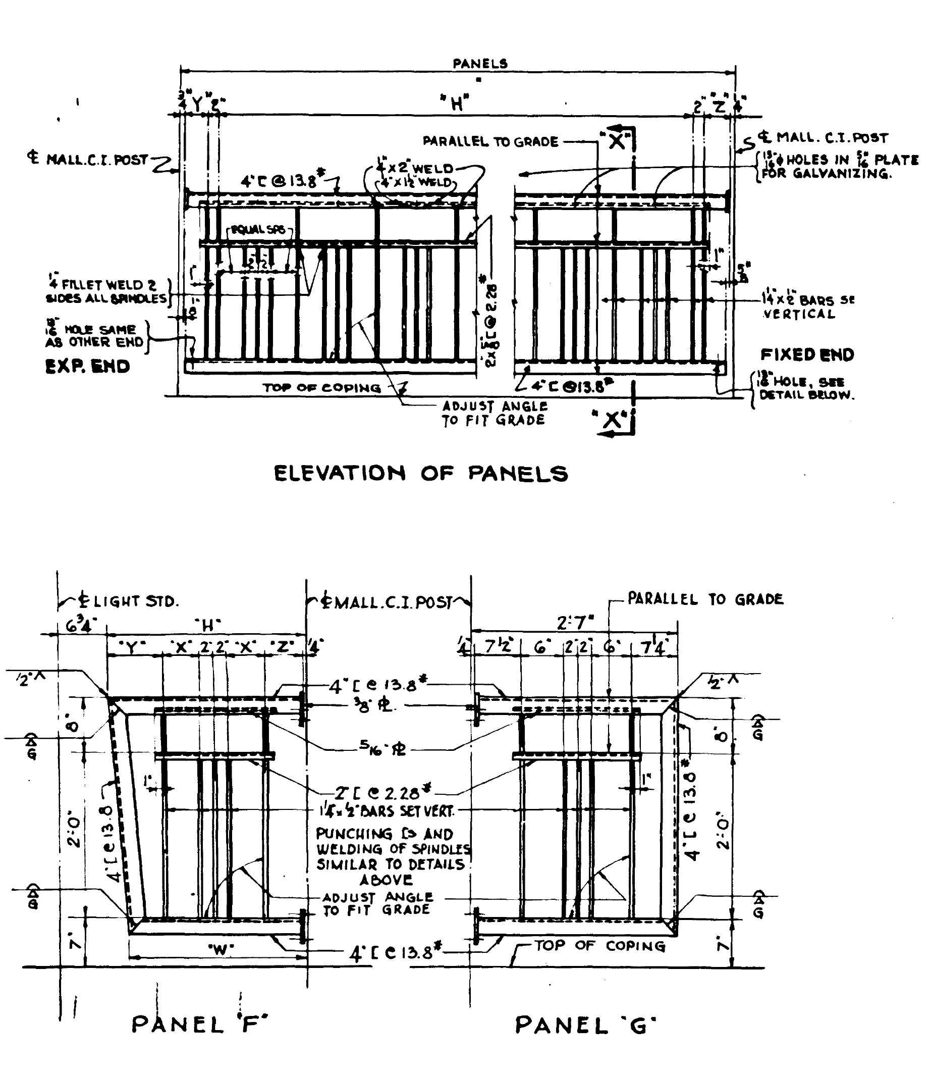
This historic bridge has been found officially eligible for listing in the National Register of Historic Places. While the reasons might not be apparent to a casual viewers, bridge historians will immediately see why this bridge is an important piece of transportation heritage: for a bridge of its size and type it has a lot of complexity and it is also unaltered. The bridge retains historic integrity including original ornamental railings. The superstructure is a concrete slab design, but the spans are variable depth giving each span a slightly arched appearance. The bridge's chief technological significance comes from its configuration. This is a bridge that is quite curved, and has super-elevation to compensate for this, and also has a 4% grade. These features introduce considerable complexity into the bridge design. Click on the overview drawing above for a copy of the first page of the original bridge plans and you can see all the notations that were needed to define the curve, super-elevation, and grade.
The historic Red Wing Bridge is immediately northwest of this bridge. The Red Wing Bridge is slated for demolition and replacement, and as part of this project, this historic overpass is also currently at risk for demolition and replacement by MnDOT. MnDOT's decision to demolish the Red Wing Bridge even though it has no substantial structural problems would seem to give this overpass bridge little hope of survival, despite the fact that this overpass is also in decent structural condition.
![]()
![]()
![]()
This historic bridge has been demolished. This map is shown for reference purposes only.
Coordinates (Latitude, Longitude):
Search For Additional Bridge Listings:
Bridgehunter.com: View listed bridges within 0.5 miles (0.8 kilometers) of this bridge.
Bridgehunter.com: View listed bridges within 10 miles (16 kilometers) of this bridge.
Additional Maps:
Google Streetview (If Available)
GeoHack (Additional Links and Coordinates)
Apple Maps (Via DuckDuckGo Search)
Apple Maps (Apple devices only)
Android: Open Location In Your Map or GPS App
Flickr Gallery (Find Nearby Photos)
Wikimedia Commons (Find Nearby Photos)
Directions Via Sygic For Android
Directions Via Sygic For iOS and Android Dolphin Browser
USGS National Map (United States Only)
Historical USGS Topo Maps (United States Only)
Historic Aerials (United States Only)
CalTopo Maps (United States Only)

© Copyright 2003-2026, HistoricBridges.org. All Rights Reserved. Disclaimer: HistoricBridges.org is a volunteer group of private citizens. HistoricBridges.org is NOT a government agency, does not represent or work with any governmental agencies, nor is it in any way associated with any government agency or any non-profit organization. While we strive for accuracy in our factual content, HistoricBridges.org offers no guarantee of accuracy. Information is provided "as is" without warranty of any kind, either expressed or implied. Information could include technical inaccuracies or errors of omission. Opinions and commentary are the opinions of the respective HistoricBridges.org member who made them and do not necessarily represent the views of anyone else, including any outside photographers whose images may appear on the page in which the commentary appears. HistoricBridges.org does not bear any responsibility for any consequences resulting from the use of this or any other HistoricBridges.org information. Owners and users of bridges have the responsibility of correctly following all applicable laws, rules, and regulations, regardless of any HistoricBridges.org information.
![]()