We Recommend:
Bach Steel - Experts at historic truss bridge restoration.
BridgeHunter.com Phase 1 is released to the public! - Visit Now
Stillwater Lift Bridge

Primary Photographer(s): Nathan Holth
Bridge Documented: June 2, 2013
Stillwater and Houlton: Washington County, Minnesota and St. Croix County, Wisconsin: United States
Metal 7 Panel Rivet-Connected Parker Through Truss, Movable: Vertical Lift (Span Drive) and Approach Spans: Metal 7 Panel Rivet-Connected Parker Through Truss, Fixed
1930 By Builder/Contractor: American Bridge Company of New York, New York and Engineer/Design: Ash, Howard, Needles, and Tammen of New York, New York
Not Available or Not Applicable
143.7 Feet (43.8 Meters)
1,070.0 Feet (326.1 Meters)
23 Feet (7.01 Meters)
1 Main Span(s) and 8 Approach Span(s)
4654

View Information About HSR Ratings
Bridge Documentation
View Archived National Bridge Inventory Report - Has Additional Details and Evaluation
View The Management Plan For This Historic Bridge
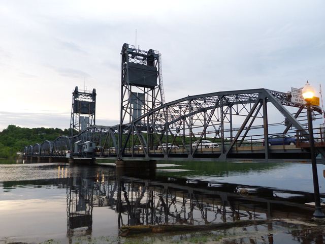
This bridge is a highly significant example of both a vertical lift bridge, and also as a multi-span truss bridge, both rare in Minnesota. The bridge still operates for boats and can be raised to provide up to 65 feet of clearance above normal water level. When lowered, there is only 17 feet of clearance. The bridge contains from west to east, two concrete t-beam spans, one fixed Parker truss span, one vertical lift Parker truss span, and five fixed Parker truss spans. The lift span towers are structurally integrated with the adjacent fixed truss spans.
One of the key aspects of this bridge is that it was designed to look beautiful. The bridge features a unique circular "concourse" at the eastern end, which is immediately west of two concrete t-beam approach spans. This concourse and t-beam span have attractive original balustrade railings and original lighting is retained here as well. The t-beams have an attractive haunched design. The truss spans have a clean appearance and the Parker configuration gives a pleasing arch shape. The numerous fixed approach truss spans take on a similar appearance and design as the lift span. The truss spans have lost their original railings, but these were replaced with modern railings that appear to closely replicate the original railings.
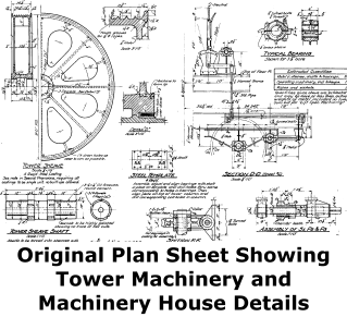
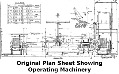
The bridge is a span drive vertical lift bridge meaning that the operating machinery is located on the lift span. However, unlike many bridges of this type, the machinery house is not located on top of the truss, but is instead cantilevered off of the truss at deck level. This allows for the uphaul and downhaul cables that transfer operating power to the lift span to be cleverly concealed along the bottom chord.
This bridge was designed by Ash, Howard, Needles, and Tammen, which was the successor to Waddell and Harrington, a major proponent of vertical lift bridges. Ash, Howard, Needles, and Tammen has evolved into HNTB Corporation today.
This bridge is an extremely busy bridge. As the early photos will show, rush hour backups on the bridge can reach almost across the entire length of the bridge! For a while, this bridge was at risk for demolition and replacement, despite its iconic appearance and historic significance. However, the current plan is to built a new high level fixed bridge in a new location in the area, and to preserve the historic lift bridge for pedestrian traffic. This is an outstanding solution that will address the traffic backups, while also removing this heavy traffic from the bridge, and making sure the bridge remains in existence for future generations to enjoy.
The previous bridge at this location was an unusual hodgepodge of timber spans, and included a pontoon span to allow boats through. This previous bridge was diagramed in the plans for the existing bridge as shown below.
![]()
Photo Galleries and Videos: Stillwater Lift Bridge
Bridge Photo-Documentation
Original / Full Size PhotosA collection of overview and detail photos. This gallery offers photos in the highest available resolution and file size in a touch-friendly popup viewer.
Alternatively, Browse Without Using Viewer
![]()
Bridge Photo-Documentation
Mobile Optimized PhotosA collection of overview and detail photos. This gallery features data-friendly, fast-loading photos in a touch-friendly popup viewer.
Alternatively, Browse Without Using Viewer
![]()
Maps and Links: Stillwater Lift Bridge
Coordinates (Latitude, Longitude):
Search For Additional Bridge Listings:
Bridgehunter.com: View listed bridges within 0.5 miles (0.8 kilometers) of this bridge.
Bridgehunter.com: View listed bridges within 10 miles (16 kilometers) of this bridge.
Additional Maps:
Google Streetview (If Available)
GeoHack (Additional Links and Coordinates)
Apple Maps (Via DuckDuckGo Search)
Apple Maps (Apple devices only)
Android: Open Location In Your Map or GPS App
Flickr Gallery (Find Nearby Photos)
Wikimedia Commons (Find Nearby Photos)
Directions Via Sygic For Android
Directions Via Sygic For iOS and Android Dolphin Browser
USGS National Map (United States Only)
Historical USGS Topo Maps (United States Only)
Historic Aerials (United States Only)
CalTopo Maps (United States Only)


