

View Information About HSR Ratings
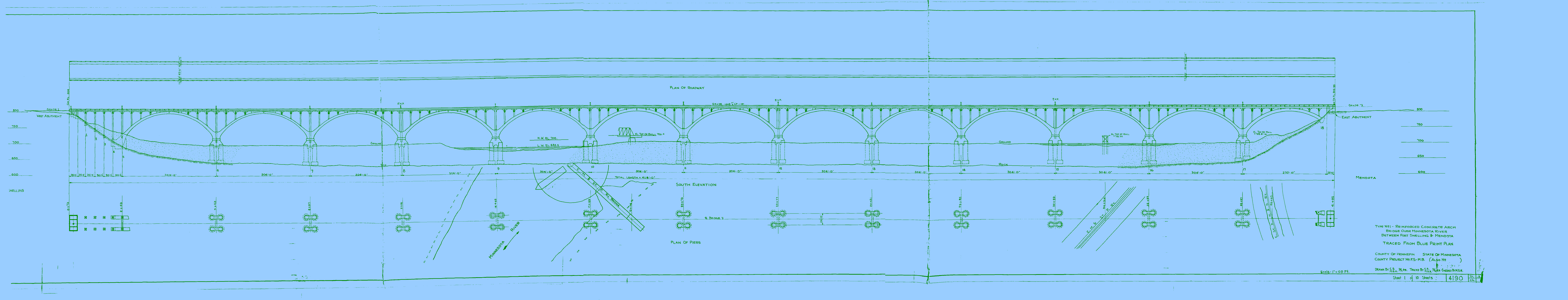
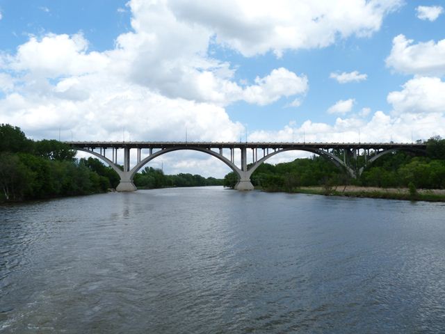
This bridge when completed was the longest concrete arch bridge in the world. Even today, it is an immensely long bridge. Its length is achieved not only by the quantity of its spans (13 main arch spans) but also from the substantial length of each span, which are 304 feet each. The bridge was sometimes known as the Mile Long Bridge, however it actually is under a mile in length. The bridge was designed by C. A. P. Turner, a famous bridge engineer known for his innovation in concrete bridge design, although he also invented the Turner truss configuration for metal truss bridges as well.
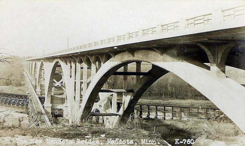
The bridge today has had its deck widened by a considerable amount as part of a 1992-1994 rehabilitation project. The widening was accomplished as part of a deck replacement project (arch columns were replaced as well) where the new deck was cantilevered out well beyond the original dimensions. As part of this project, the aesthetic details at the top of the arch columns, which originally featured four curved brackets at the top, were replaced with a design that has large hammerhead-like transverse beams that extend outward from the columns. The design of the original longitudinal brackets was retained, however. However, the transverse beams and loss of the transverse curved brackets is a substantial alteration from the original intended bridge aesthetic. Some sensitivity to the original details of the bridge was observed during rehabilitation however, because the distinctive metal railing panel and paneled concrete railing posts on this bridge appear to be replicas (or near replicas) of the original railing as shown in historical photos. The arch ribs of this bridge retain integrity of materials and design, as does the unusual bracing for this bridge. At the piers, heavy X bracing is found. There is also unusual (and quite attractive) transverse octagonal beams that act as bracing as they span between the arch ribs at various points along the arch.

Despite alteration, this bridge is highly significant as a record-breaking bridge of amazing length that was designed by a significant engineer.
The bridge is extremely difficult to photograph, because its length is caused by the fact that it crosses over a valley that extends well beyond the actual Minnesota River that the bridge also crosses. Away from the river, the valley is filled with trees that obstruct the view of the bridge. The only place on the ground where all the spans of the bridge can be seen at once to any decent extent is near a church parking lot at the east quadrant around the bridge. However, even from this angle, the bottom of the bridge is partially obstructed by trees.


The contractor for this bridge, Koss Construction Company was responsible for building a number of concrete arch bridges, in a variety of states. The Mendota Bridge however may have been their largest project. Koss Construction Company remains in business today although they appear to focus mostly on paving projects these days. Their website has an amazing digital archive of historical project photos that is well work checking out. Visit the archive and do a search for Mendota and nearly 100 items will pop up. These photos are an important historical record that offer insight into the sheer scale and effort required to build what was at the time the world's longest concrete arch bridge. Below, HistoricBridges.org has a selected a few of the photos from the collection that help illustrate some of the interesting aspects of this bridge's construction.

Above: The riveted steel truss-like centering which supported the construction of the concrete arch.


Above: These photos show how temporary towers and cables were put in place and attached to the arch centering (which consisted of two halves) to pull the centering halves up and into position where they could be connected together.

Above: This photo shows the arch rib completed and still resting on top of the arch centering. Note the falsework on top of the arch rib being used to help build the remaining portions of the arch span.
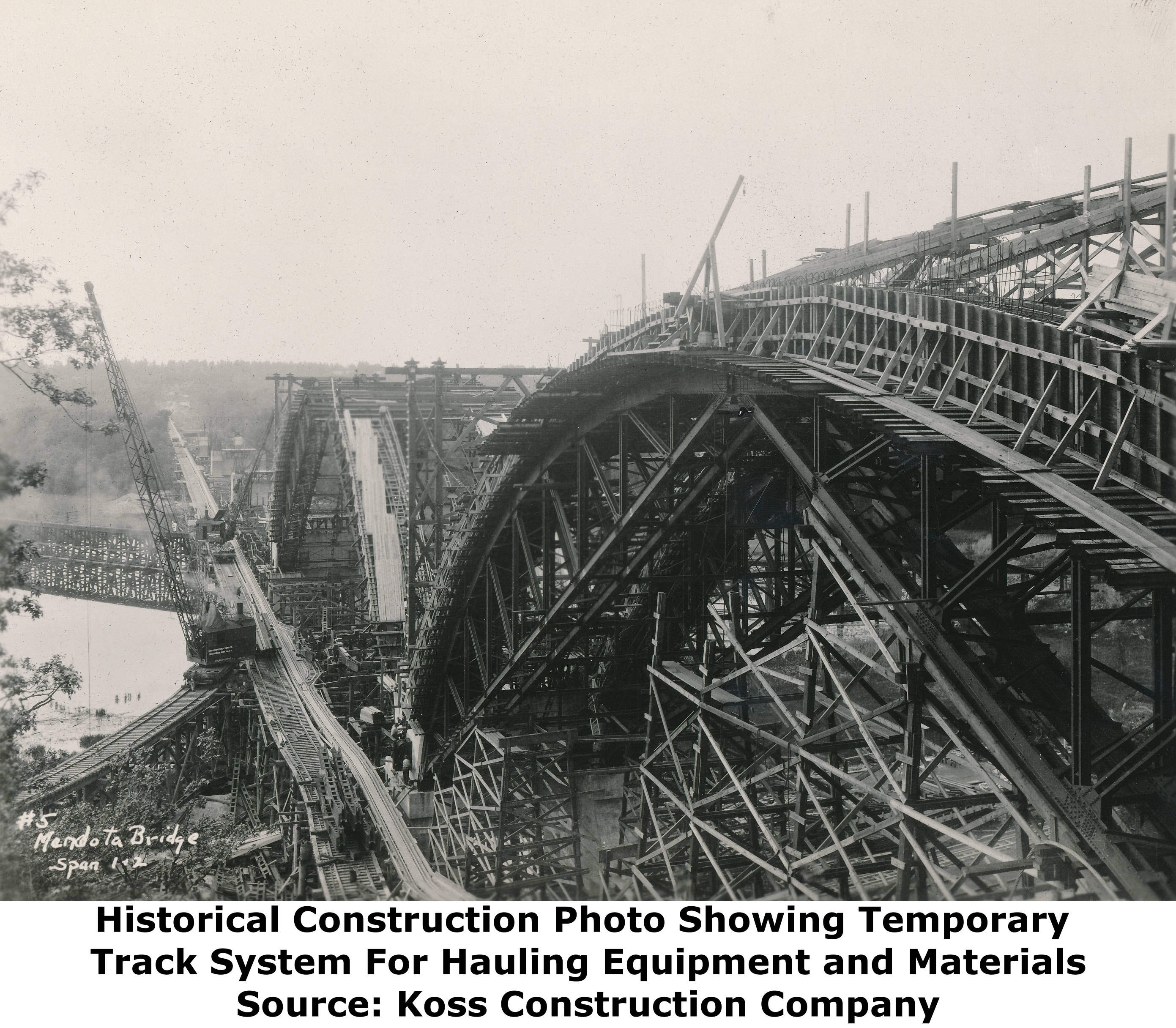
Above: This photo shows, to the left of the bridge, a temporary track system. It appears this track facilitated the movement of both construction equipment like cranes, as well as bridge construction materials.
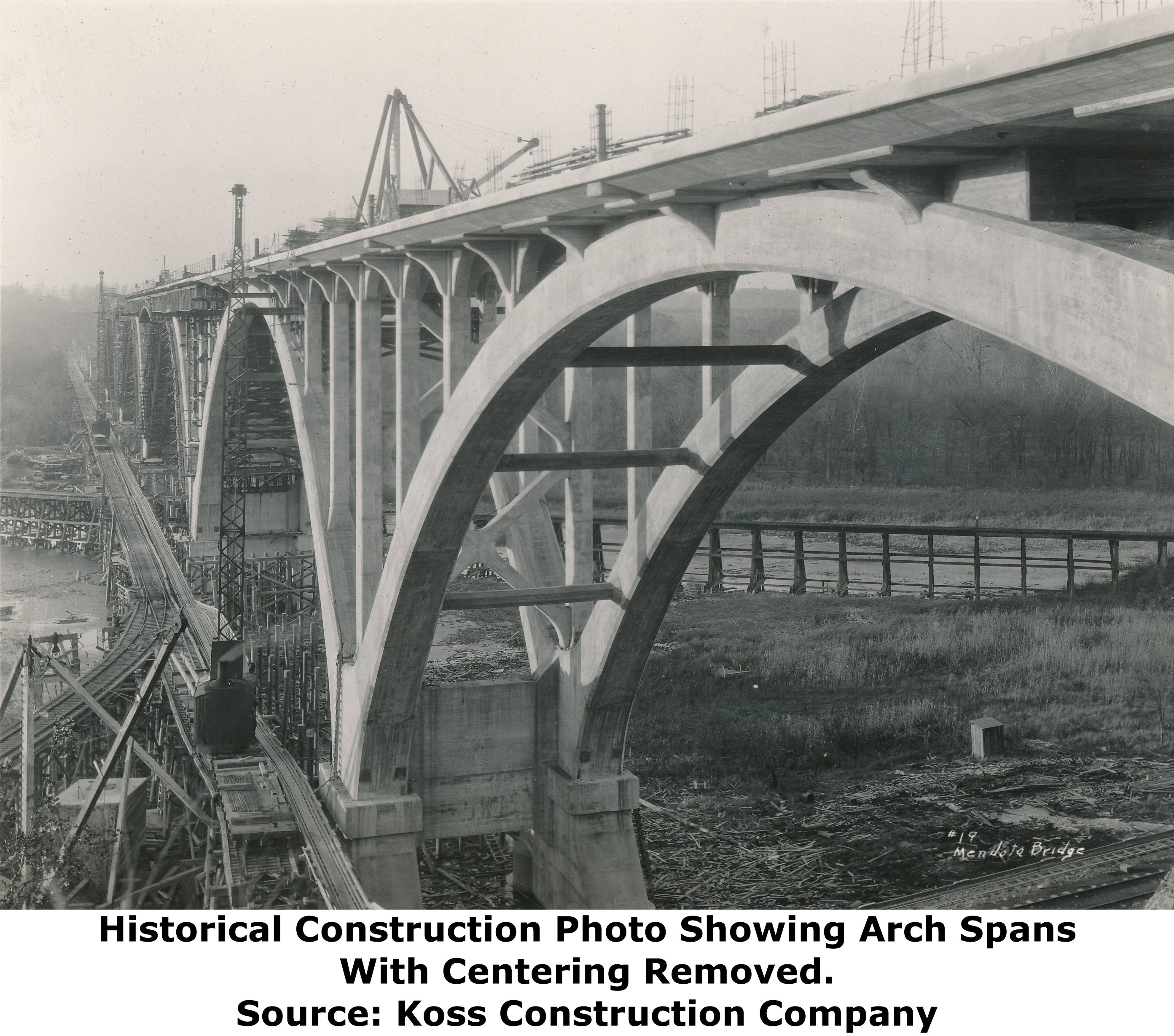
Above: This photo shows the bridge much closer to completion. Note that the centering has been removed. Deck work is still ongoing.


Above: These photos show the bridge just after it was completed.
![]()
![]()
![]()
Coordinates (Latitude, Longitude):
Search For Additional Bridge Listings:
Bridgehunter.com: View listed bridges within 0.5 miles (0.8 kilometers) of this bridge.
Bridgehunter.com: View listed bridges within 10 miles (16 kilometers) of this bridge.
Additional Maps:
Google Streetview (If Available)
GeoHack (Additional Links and Coordinates)
Apple Maps (Via DuckDuckGo Search)
Apple Maps (Apple devices only)
Android: Open Location In Your Map or GPS App
Flickr Gallery (Find Nearby Photos)
Wikimedia Commons (Find Nearby Photos)
Directions Via Sygic For Android
Directions Via Sygic For iOS and Android Dolphin Browser
USGS National Map (United States Only)
Historical USGS Topo Maps (United States Only)
Historic Aerials (United States Only)
CalTopo Maps (United States Only)

© Copyright 2003-2025, HistoricBridges.org. All Rights Reserved. Disclaimer: HistoricBridges.org is a volunteer group of private citizens. HistoricBridges.org is NOT a government agency, does not represent or work with any governmental agencies, nor is it in any way associated with any government agency or any non-profit organization. While we strive for accuracy in our factual content, HistoricBridges.org offers no guarantee of accuracy. Information is provided "as is" without warranty of any kind, either expressed or implied. Information could include technical inaccuracies or errors of omission. Opinions and commentary are the opinions of the respective HistoricBridges.org member who made them and do not necessarily represent the views of anyone else, including any outside photographers whose images may appear on the page in which the commentary appears. HistoricBridges.org does not bear any responsibility for any consequences resulting from the use of this or any other HistoricBridges.org information. Owners and users of bridges have the responsibility of correctly following all applicable laws, rules, and regulations, regardless of any HistoricBridges.org information.
![]()