

View Information About HSR Ratings

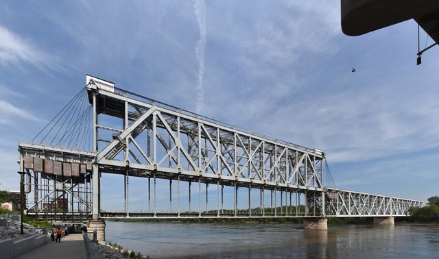
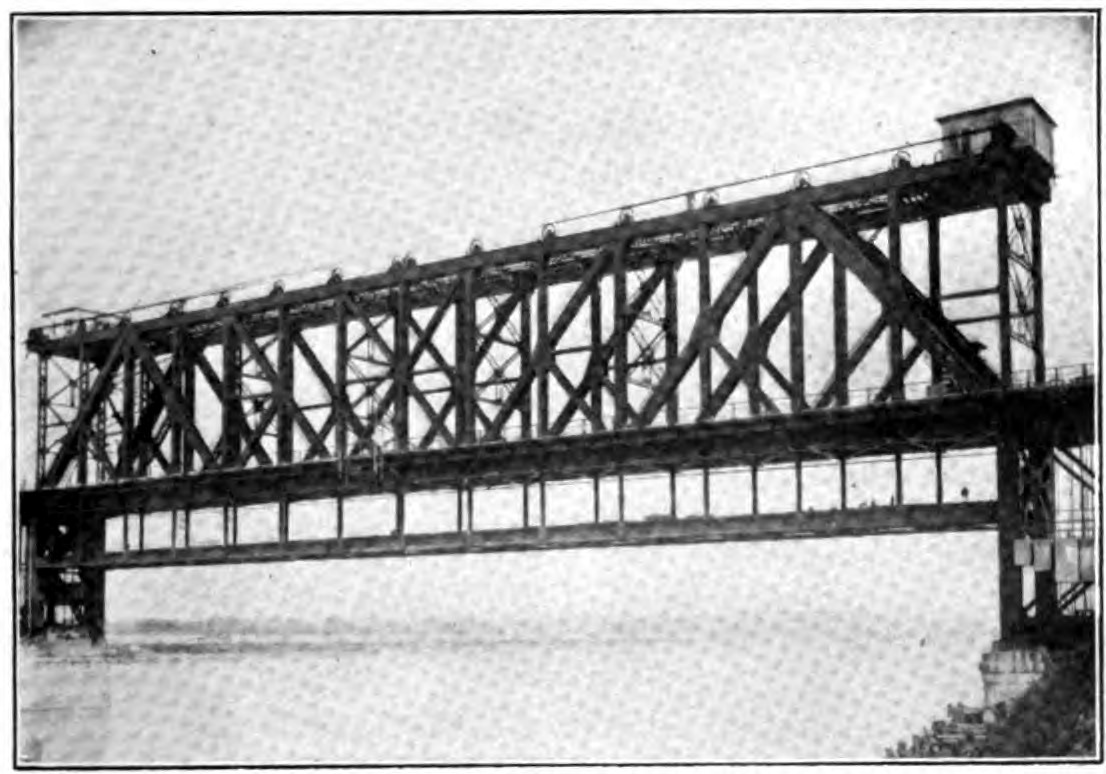
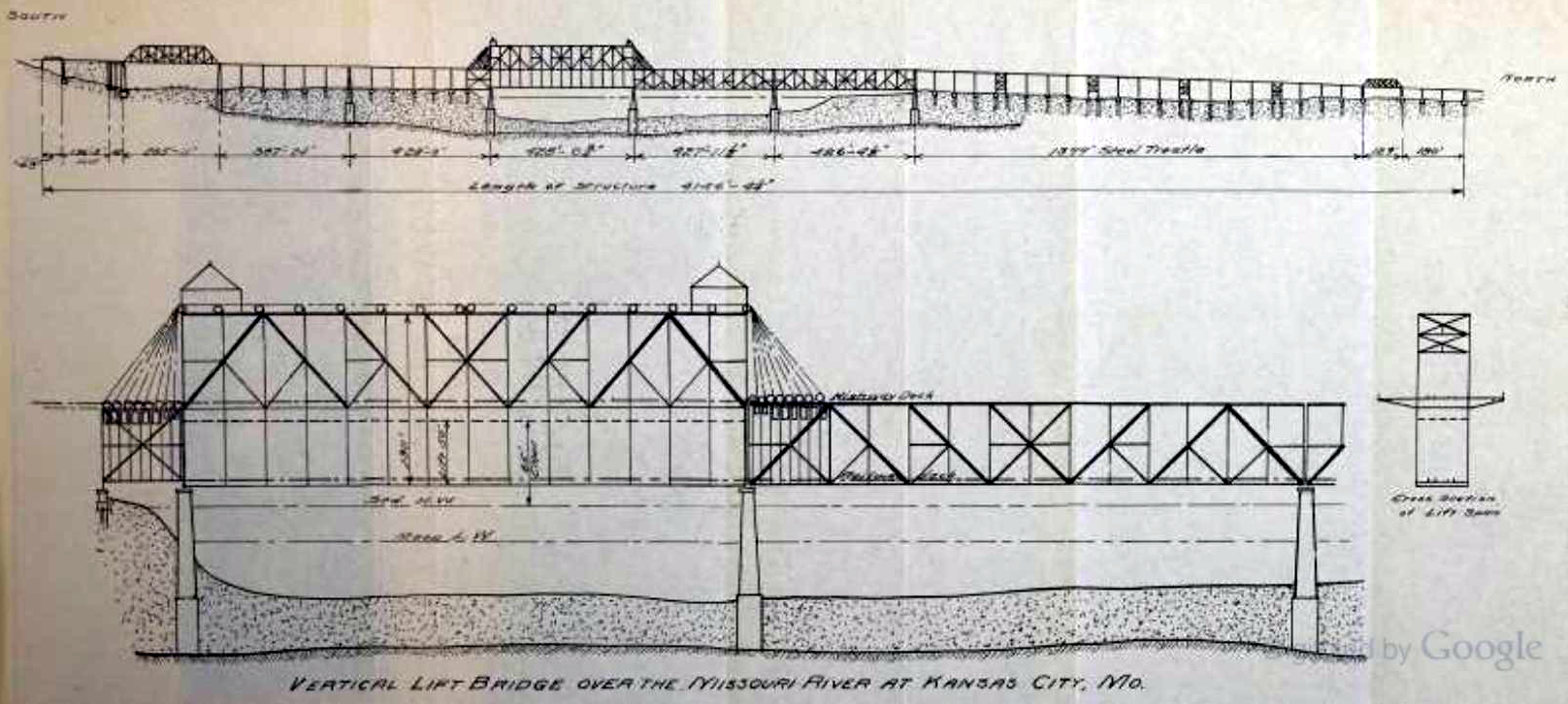
This bridge is the first example of a unique telescoping vertical lift bridge. Originally designed as a unique double-deck bridge, the upper highway deck was placed high enough to permit all boats to pass under. The lower railroad deck on the other hand would need to be raised for boats. The unique design suspended the railroad deck from telescoping vertical members, which can be raised up inside the vertical members in the main truss. In short, the railroad deck could be raised without any movement of the upper (highway) deck, preventing any disruption of highway traffic. Shortly after this bridge was built noted engineering firm Waddell and Harrington applied this patented design to a similar bridge in Portland, Oregon. The bridge in Oregon has the additional feature where after the railroad deck was lifted, the highway deck could also be lifted even further, to accomodate unusually tall boats.
The ASB Bridge has suffered a major detrimental alteration in that the highway deck has been removed. Not only does this make interpretation of this unusual design more difficult for visitors, it also resulted in removal of an immense amount of the bridge, considering the approach spans for the upper deck were much longer than the railroad deck.

Above: Historical photo of bridge.
Above: Historical photo of bridge.
![]()
![]()
![]()
Coordinates (Latitude, Longitude):
Search For Additional Bridge Listings:
Bridgehunter.com: View listed bridges within 0.5 miles (0.8 kilometers) of this bridge.
Bridgehunter.com: View listed bridges within 10 miles (16 kilometers) of this bridge.
Additional Maps:
Google Streetview (If Available)
GeoHack (Additional Links and Coordinates)
Apple Maps (Via DuckDuckGo Search)
Apple Maps (Apple devices only)
Android: Open Location In Your Map or GPS App
Flickr Gallery (Find Nearby Photos)
Wikimedia Commons (Find Nearby Photos)
Directions Via Sygic For Android
Directions Via Sygic For iOS and Android Dolphin Browser
USGS National Map (United States Only)
Historical USGS Topo Maps (United States Only)
Historic Aerials (United States Only)
CalTopo Maps (United States Only)

© Copyright 2003-2026, HistoricBridges.org. All Rights Reserved. Disclaimer: HistoricBridges.org is a volunteer group of private citizens. HistoricBridges.org is NOT a government agency, does not represent or work with any governmental agencies, nor is it in any way associated with any government agency or any non-profit organization. While we strive for accuracy in our factual content, HistoricBridges.org offers no guarantee of accuracy. Information is provided "as is" without warranty of any kind, either expressed or implied. Information could include technical inaccuracies or errors of omission. Opinions and commentary are the opinions of the respective HistoricBridges.org member who made them and do not necessarily represent the views of anyone else, including any outside photographers whose images may appear on the page in which the commentary appears. HistoricBridges.org does not bear any responsibility for any consequences resulting from the use of this or any other HistoricBridges.org information. Owners and users of bridges have the responsibility of correctly following all applicable laws, rules, and regulations, regardless of any HistoricBridges.org information.
![]()