

View Information About HSR Ratings
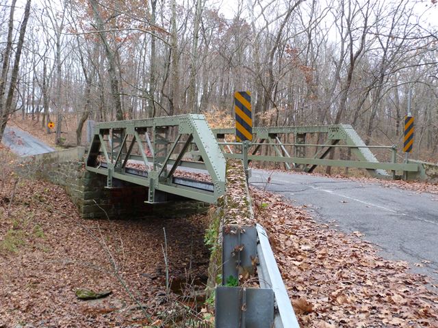
This is a short but heavy-built pony truss. It retains good historic integrity aside from replacement of the floor beams. The Historic Bridge Inventory listed Snook and Sons as the builder. This might refer to a firm that was known for building design and architecture. If so, names associated with the company were John B. Snook Curtis Pendleton Snook. Some sources list the company name as J. B. Snook and Sons.
Information and Findings From New Jersey's Historic Bridge InventoryDiscussion of Bridge The skewed 3-panel Warren with verticals riveted pony truss bridge bears on random ashlar abutments with wingwalls. The abutments have concrete caps. The upper railing is pipe, and the lower is welded channel. No welded repairs are apparent. Although well preserved, the bridge exhibits no distinctive details and is just a representative example of a well-represented local type. One of over 25 Warren pony truss bridges in the county, it is not historically or technologically distinguished. Discussion of Surrounding Area The bridge carries one lane of a lightly traveled country road over a minor stream. It is located in a wooded rural setting with sparse housing. Bridge Considered Historic By Survey: No |
![]()
![]()
![]()
Coordinates (Latitude, Longitude):
Search For Additional Bridge Listings:
Bridgehunter.com: View listed bridges within 0.5 miles (0.8 kilometers) of this bridge.
Bridgehunter.com: View listed bridges within 10 miles (16 kilometers) of this bridge.
Additional Maps:
Google Streetview (If Available)
GeoHack (Additional Links and Coordinates)
Apple Maps (Via DuckDuckGo Search)
Apple Maps (Apple devices only)
Android: Open Location In Your Map or GPS App
Flickr Gallery (Find Nearby Photos)
Wikimedia Commons (Find Nearby Photos)
Directions Via Sygic For Android
Directions Via Sygic For iOS and Android Dolphin Browser
USGS National Map (United States Only)
Historical USGS Topo Maps (United States Only)
Historic Aerials (United States Only)
CalTopo Maps (United States Only)

© Copyright 2003-2026, HistoricBridges.org. All Rights Reserved. Disclaimer: HistoricBridges.org is a volunteer group of private citizens. HistoricBridges.org is NOT a government agency, does not represent or work with any governmental agencies, nor is it in any way associated with any government agency or any non-profit organization. While we strive for accuracy in our factual content, HistoricBridges.org offers no guarantee of accuracy. Information is provided "as is" without warranty of any kind, either expressed or implied. Information could include technical inaccuracies or errors of omission. Opinions and commentary are the opinions of the respective HistoricBridges.org member who made them and do not necessarily represent the views of anyone else, including any outside photographers whose images may appear on the page in which the commentary appears. HistoricBridges.org does not bear any responsibility for any consequences resulting from the use of this or any other HistoricBridges.org information. Owners and users of bridges have the responsibility of correctly following all applicable laws, rules, and regulations, regardless of any HistoricBridges.org information.
![]()