We Recommend:
Bach Steel - Experts at historic truss bridge restoration.
BridgeHunter.com Phase 1 is released to the public! - Visit Now
Old Sandbank Road Bridge
Spencer Road Bridge

Primary Photographer(s): Nathan Holth
Bridge Documented: May 28, 2007 and 2018
Sandbank Road (Old Alignment) / Spencer Road Over Buttermilk Creek
Near Ithaca: Tompkins County, New York: United States
1881 By Builder/Contractor: King Bridge Company of Cleveland, Ohio
Not Available or Not Applicable
39.7 Feet (12.1 Meters)
42.0 Feet (12.8 Meters)
11.2 Feet (3.41 Meters)
1 Main Span(s)
3210040

View Information About HSR Ratings
Bridge Documentation
Despite its short length, this bridge is significant as an old 1881 example of a wrought iron bridge built by the King Bridge Company, and important and prolific bridge builder during the pin-connected truss bridge era. The bridge appears to have had its original deck stringers replaced with larger beams that actually bear the live load, with the trusses only supporting themselves.
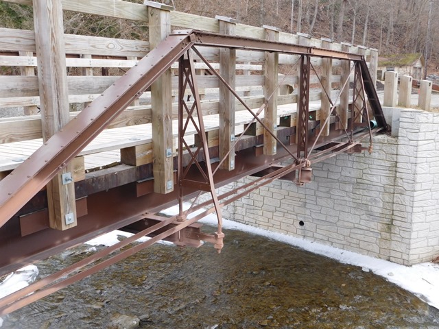
This is one of the most unique King Bridge Company Pratt trusses in existence today because despite being a Pratt truss, some of the company's bowstring truss details were carried over to this Pratt truss design. That includes the tapered hip verticals as well as the connection design for the outer portion of those hip verticals to the floorbeam, via threaded rod and steel strap. The bridge also uses rare massive square head bolts for the top chord pins rather than a standard threaded rod with nuts at each end. This design of pin is found on a limited number of King bridges.
This attractive historic bridge is located in an excellent place, in a park setting within view of the beautiful Buttermilk Falls.
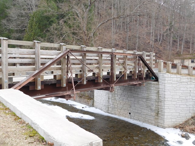
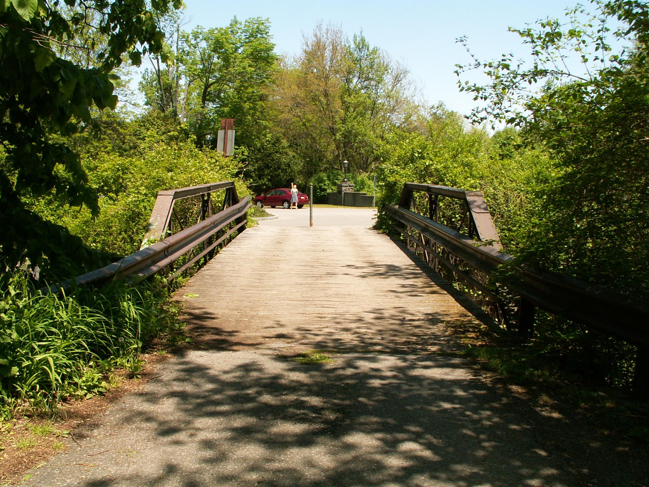
When visited in 2007, the bridge, although closed to vehicular traffic, retained modern Armco guardrail on the bridge. A revisit to the bridge by Marc Scotti revealed that the bridge had been redone with an eye toward its current pedestrian use. Which basically means hideous wooden bicycle code height railing was added to the bridge, all but completely hiding these unique historic trusses from all views except beside the bridge. For a small pony truss of this type, the use of a wire cable railing would have been a better choice.
View Archived National Bridge Inventory Report - Has Additional Details and Evaluation

Above: Bridge as seen ca. 2018. Photo Credit: Marc Scotti.

Above: View on bridge showing Buttermilk Falls in background.
This bridge is tagged with the following special condition(s): Unorganized Photos
![]()
Photo Galleries and Videos: Old Sandbank Road Bridge
Bridge Photo-Documentation
A collection of overview and detail photos. This photo gallery contains a combination of Original Size photos and Mobile Optimized photos in a touch-friendly popup viewer.Alternatively, Browse Without Using Viewer
![]()
Additional Unorganized Photos
Original / Full Size PhotosA supplemental collection of photos that are from additional visit(s) to the bridge and have not been organized or captioned. This gallery offers photos in the highest available resolution and file size in a touch-friendly popup viewer.
Alternatively, Browse Without Using Viewer
![]()
Additional Unorganized Photos
Mobile Optimized PhotosA supplemental collection of photos that are from additional visit(s) to the bridge and have not been organized or captioned. This gallery features data-friendly, fast-loading photos in a touch-friendly popup viewer.
Alternatively, Browse Without Using Viewer
![]()
Maps and Links: Old Sandbank Road Bridge
Coordinates (Latitude, Longitude):
Search For Additional Bridge Listings:
Bridgehunter.com: View listed bridges within 0.5 miles (0.8 kilometers) of this bridge.
Bridgehunter.com: View listed bridges within 10 miles (16 kilometers) of this bridge.
Additional Maps:
Google Streetview (If Available)
GeoHack (Additional Links and Coordinates)
Apple Maps (Via DuckDuckGo Search)
Apple Maps (Apple devices only)
Android: Open Location In Your Map or GPS App
Flickr Gallery (Find Nearby Photos)
Wikimedia Commons (Find Nearby Photos)
Directions Via Sygic For Android
Directions Via Sygic For iOS and Android Dolphin Browser
USGS National Map (United States Only)
Historical USGS Topo Maps (United States Only)
Historic Aerials (United States Only)
CalTopo Maps (United States Only)


