We Recommend:
Bach Steel - Experts at historic truss bridge restoration.
BridgeHunter.com Phase 1 is released to the public! - Visit Now
Detroit-Superior Bridge
Veterans Memorial Bridge
Primary Photographer(s): Nathan Holth
Bridge Documented: June 24, 2007, and October 1, 2021
Cleveland: Cuyahoga County, Ohio: United States
Metal Braced Ribbed Through Arch, Fixed and Approach Spans: Concrete Open Spandrel Deck Arch, Fixed
1918 By Builder/Contractor: King Bridge Company of Cleveland, Ohio
1997
591.0 Feet (180.1 Meters)
2,880.0 Feet (877.8 Meters)
72 Feet (21.95 Meters)
1 Main Span(s) and 12 Approach Span(s)
1800930

View Information About HSR Ratings
Bridge Documentation
View Archived National Bridge Inventory Report - Has Additional Details and Evaluation
View Historic American Engineering Record (HAER) Documentation For This Bridge
HAER Drawings, PDF - HAER Data Pages, PDF
View a PDF of a pamphlet describing this bridge.
View Historical Articles About This Bridge
View National Register of Historic Places Nomination Form For This Bridge
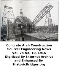
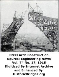
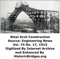
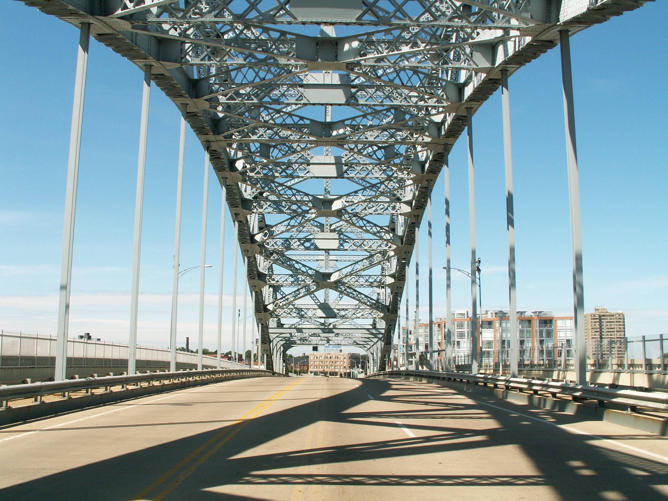
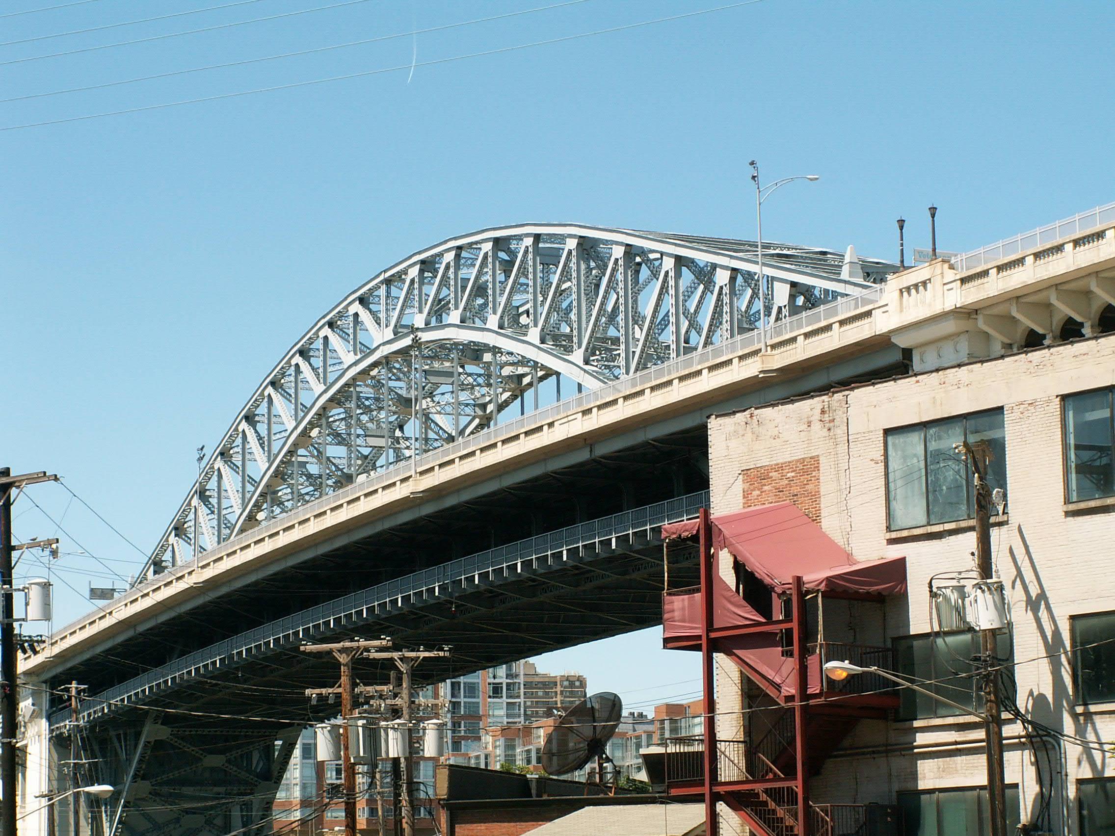
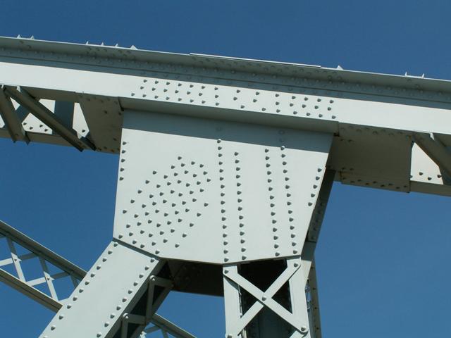
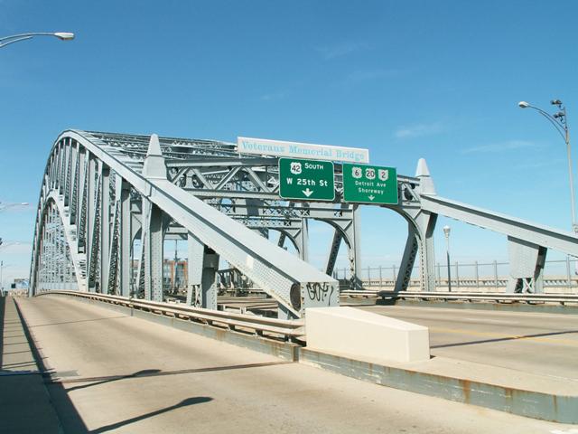
This bridge is the centerpiece and most recognizable of Cleveland's historic bridges. This bridge features a beautiful combination of span types. The main span is a cantilevered three-hinged steel arch that features a trussed arch built to the Pratt truss configuration. The bridge also features 12 large approach spans that are highly embellished concrete open-spandrel deck arches. Three of these approach spans are on the west side of the river, while the east side has nine. The bridge features a deck that includes a cantilevered section outside the arch, which is an alteration dating to the mid-1960s. The bridge also features a lower level that runs under the highway level, and original served a subway system, a function that ended in the 1950s.
This is a gorgeous bridges that features highly attractive design. The ornate concrete arch approach spans provide beauty to anyone traveling below the bridge. The graceful main arch span that thanks to the trussed arch design, also features a beautiful geometric arrangement of trusses to complement the arch shape, that combine to make crossing this bridge a pleasing experience as well.
This bridge is historically significant for being a significant engineering achievement. It also has had the sad distinction of becoming the last of the King Bridge Company landmark bridges to remain standing and not face demolition. As such, this bridge stands today as a critically important monument to the achievements of this nationally important bridge building company. Fortunately, the future of this bridge appears to be secure. The structure has been well-maintained and it enjoys the appreciation of both residents and visitors as a beautiful area landmark.
The total length of this bridge varies depending on which source is consulted. Lengths vary from 2656 Feet (809.6 Meters) to as long as 3112 Feet (948.5 Meters) long. The length in between these two figures 2880 appears to be the correct one, since it is listed in the original site plan for this bridge. The 3112 figure apparently relates to the distance from the east end of the bridge to 25th Street, since this distance is also referenced on the site plan.
Be sure to visit the HABS HAER page for this bridge since it features additional views of the original plans for the bridge, as well as a detailed history documented in the data pages. JPEG versions of the color photos on the HABS HAER pages are available in the HistoricBridges.org photo gallery. The HistoricBridges.org photo gallery offers over 100 photos of this bridge taken in beautiful sunny weather. Also be sure to enjoy photos of the lower deck level of this bridge in the Full / Wallpaper size gallery, courtesy of Steve Mathers.


Information and Findings From Ohio's Historic Bridge InventorySetting/Context When built in 1917-18, the double-deck bridge carried streetcars on its lower deck and pedestrian/automobile traffic on its upper deck. It was also a high-level bridge with 93'- clearance over the river, thus eliminating the delays associated with the prior movable bridges on this route. Physical Description The double-deck Detroit-Superior High Level Bridge is a 591'-long, three-hinge, trussed, steel thru arch main span with reinforced-concrete open-spandrel arch approach spans ranging in length from 58' to 181'. Integrity Widened in 1969 by adding a cantilevered deck section. Summary of Significance The Detroit Superior High Level Bridge is NR listed (1974). It was rehabilitated in 1997 and 2005 without adverse effect. It is technologically significant for its three-hinge trussed steel thru arch, as well as
its open-spandrel arch spans. It is also a historically important bridge in the development of Cleveland's roadway system as it adapted to the requirements of automobiles as reflected in the double-deck arrangement that was designed
to separate automobile from streetcar traffic. Justification The thru arch bridge ranks as not only the oldest examples of its type in the state, but is also one of the most distinguished architectonic bridges in the state. Bridge Considered Historic By Survey: Yes |
This bridge is tagged with the following special condition(s): Unorganized Photos
![]()
Photo Galleries and Videos: Detroit-Superior Bridge
Original / Full Size Gallery
Original / Full Size PhotosFor the best visual immersion and full detail, or for use as a desktop background, this gallery presents selected overview and detail photos for this bridge in the original digital camera resolution. This gallery offers photos in the highest available resolution and file size in a touch-friendly popup viewer.
Alternatively, Browse Without Using Viewer
![]()
Structure Overview
Mobile Optimized PhotosA collection of overview photos that show the bridge as a whole and general areas of the bridge. This gallery features data-friendly, fast-loading photos in a touch-friendly popup viewer.
Alternatively, Browse Without Using Viewer
![]()
Structure Details
Mobile Optimized PhotosA collection of detail photos that document the parts, construction, and condition of the bridge. This gallery features data-friendly, fast-loading photos in a touch-friendly popup viewer.
Alternatively, Browse Without Using Viewer
![]()
Additional Unorganized Photos
Original / Full Size PhotosA supplemental collection of photos that are from additional visit(s) to the bridge and have not been organized or captioned. This gallery offers photos in the highest available resolution and file size in a touch-friendly popup viewer.
Alternatively, Browse Without Using Viewer
![]()
Additional Unorganized Photos
Mobile Optimized PhotosA supplemental collection of photos that are from additional visit(s) to the bridge and have not been organized or captioned. This gallery features data-friendly, fast-loading photos in a touch-friendly popup viewer.
Alternatively, Browse Without Using Viewer
![]()
Maps and Links: Detroit-Superior Bridge
Coordinates (Latitude, Longitude):
Search For Additional Bridge Listings:
Bridgehunter.com: View listed bridges within 0.5 miles (0.8 kilometers) of this bridge.
Bridgehunter.com: View listed bridges within 10 miles (16 kilometers) of this bridge.
Additional Maps:
Google Streetview (If Available)
GeoHack (Additional Links and Coordinates)
Apple Maps (Via DuckDuckGo Search)
Apple Maps (Apple devices only)
Android: Open Location In Your Map or GPS App
Flickr Gallery (Find Nearby Photos)
Wikimedia Commons (Find Nearby Photos)
Directions Via Sygic For Android
Directions Via Sygic For iOS and Android Dolphin Browser
USGS National Map (United States Only)
Historical USGS Topo Maps (United States Only)
Historic Aerials (United States Only)
CalTopo Maps (United States Only)


