

View Information About HSR Ratings
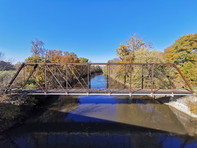
This is the last known surviving highway through truss in the county, and it has been bypassed and left in place for pedestrians.
This bridge has rare Eastern steel brands on the top chord and some verticals.
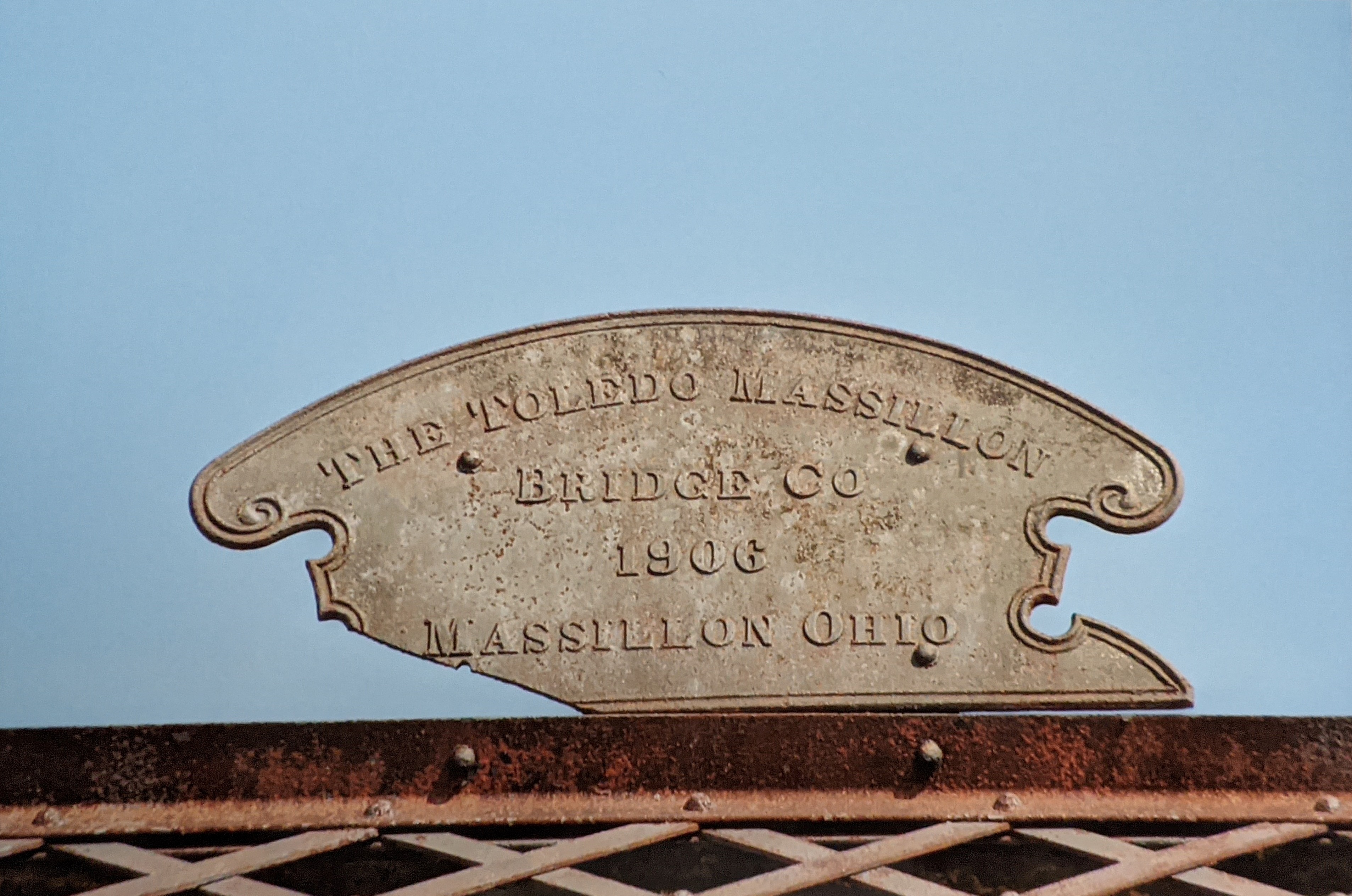
Above: Rick McOmber visited this bridge prior to the loss of the builder plaque.

Above: Rick McOmber visited this bridge prior to the loss of the builder plaque.
Information and Findings From Ohio's Historic Bridge InventorySetting/Context The bridge has been bypassed and closed to traffic. It is located in a rural setting. Physical Description The 1 span, pin-connected Pratt thru truss bridge is traditionally composed of built-up compression members and eyebar tension members. Summary of Significance The 1906 pin-connected truss was bypassed and taken out of service in 1992 with no adverse effect. It remains open as a pedestrian bridge. This is a conventional design, although it is fairly long span. There has been no significant change in the bridge's status since the prior evaluation. It is an eligible bridge from the prior inventory. It is a late example of a well-represented type and design in Ohio. Justification The bridge is one of over 150 extant pin-connected truss bridges dating from 1874 for pony trusses and 1876 for thru trusses. Twenty six predate 1888 and represent the era of experimentation that evolved into standardized designs by about 1888. This example has moderate significance because the genre and the fabricator are so well represented in Ohio. Bridge Considered Historic By Survey: Yes |
![]()
![]()
![]()
Coordinates (Latitude, Longitude):
Search For Additional Bridge Listings:
Bridgehunter.com: View listed bridges within 0.5 miles (0.8 kilometers) of this bridge.
Bridgehunter.com: View listed bridges within 10 miles (16 kilometers) of this bridge.
Additional Maps:
Google Streetview (If Available)
GeoHack (Additional Links and Coordinates)
Apple Maps (Via DuckDuckGo Search)
Apple Maps (Apple devices only)
Android: Open Location In Your Map or GPS App
Flickr Gallery (Find Nearby Photos)
Wikimedia Commons (Find Nearby Photos)
Directions Via Sygic For Android
Directions Via Sygic For iOS and Android Dolphin Browser
USGS National Map (United States Only)
Historical USGS Topo Maps (United States Only)
Historic Aerials (United States Only)
CalTopo Maps (United States Only)

© Copyright 2003-2026, HistoricBridges.org. All Rights Reserved. Disclaimer: HistoricBridges.org is a volunteer group of private citizens. HistoricBridges.org is NOT a government agency, does not represent or work with any governmental agencies, nor is it in any way associated with any government agency or any non-profit organization. While we strive for accuracy in our factual content, HistoricBridges.org offers no guarantee of accuracy. Information is provided "as is" without warranty of any kind, either expressed or implied. Information could include technical inaccuracies or errors of omission. Opinions and commentary are the opinions of the respective HistoricBridges.org member who made them and do not necessarily represent the views of anyone else, including any outside photographers whose images may appear on the page in which the commentary appears. HistoricBridges.org does not bear any responsibility for any consequences resulting from the use of this or any other HistoricBridges.org information. Owners and users of bridges have the responsibility of correctly following all applicable laws, rules, and regulations, regardless of any HistoricBridges.org information.
![]()