We Recommend:
Bach Steel - Experts at historic truss bridge restoration.
BridgeHunter.com Phase 1 is released to the public! - Visit Now
Horton Road Bridge

Primary Photographer(s): Nathan Holth
Bridge Documented: June 30, 2006 and May 6, 2013
Rural: Ashtabula County, Ohio: United States
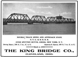
1899 By Builder/Contractor: King Bridge Company of Cleveland, Ohio
Not Available or Not Applicable
122.0 Feet (37.2 Meters)
129.0 Feet (39.3 Meters)
15 Feet (4.57 Meters)
1 Main Span(s)
432644

View Information About HSR Ratings
Bridge Documentation
This bridge's future is at risk!
View Archived National Bridge Inventory Report - Has Additional Details and Evaluation
Technical Description of the Horton Road Bridge
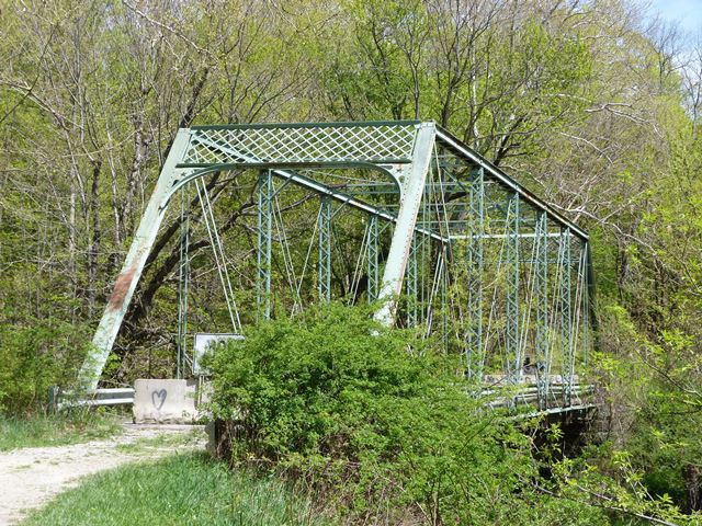
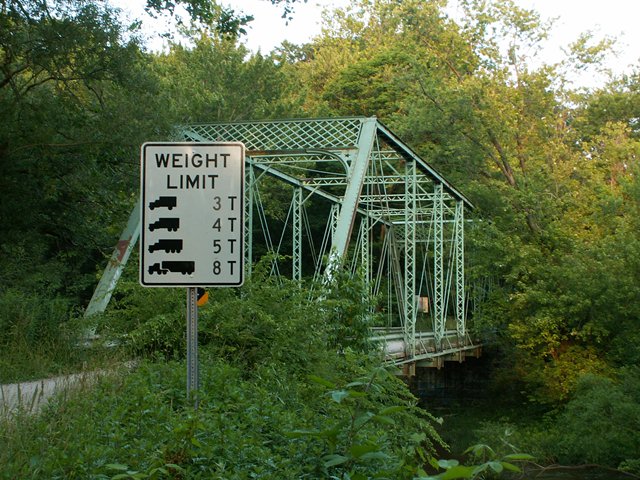
The Horton Road Bridge is a pin connected Pratt through truss bridge. It was constructed in 1899 by the King Bridge Company of Cleveland, Ohio. The bridge is composed of seven panels yielding a total length of 129 feet. The bridge is seated on stone abutments. V-lacing is present on the vertical members, and sway bracing. The portal bracing is composed of a large section of tight lattice, and the knee braces are a decorative star and teardrop design characteristic of the King Bridge Company. The builder plaque does not remain on the bridge, nor do original railings, which have been replaced with modern Armco railings. Typical of Ohio, the deck is wooden with an asphalt wearing surface. There have been some repairs to the bottom chord connections on the bridge. The bottom chord connections are also the section of the bridge that is in the worst structural condition. The remainder of the bridge is in decent shape, and the abutments are in great shape.
This bridge was apparently evaluated as not historic by the Ohio Historic Bridge Inventory this finding should be questioned in light of the recent demolition of pin-connected Pratt truss bridges as well as bridges built by the King Bridge Company in Ohio. In the opinion of HistoricBridges.org, this bridge exhibits qualities of a bridge eligible for listing in the National Register of Historic Places.
A Discussion of Ashtabula County's Bridge Program in General
 Ashtabula County appears to have
fallen into the discrimination trap that plaques historic bridge preservation.
This trap involves preserving covered bridges... even building new covered
bridges to replace historic metal truss bridges... and demolishing historically
significant and aesthetically pleasing metal truss bridges. Such is the case
with the Horton Road Bridge which has been at risk for demolition and replacement. The bridge sits in a condition that indicates the bridge needs to be rehabilitated, yet is not so deteriorated that rehabilitation is not feasible. Even more
frustrating is the fact that a mile or two
away from here, there is a one-lane wooden covered bridge on a paved road
preserved. Yet this one-lane metal truss bridge on a narrow dirt road that looks
like it sees maybe two cars a day is going to be demolished. The county certainly
can't use the standard excuses like "the bridge is too narrow and unsafe" or
"there is too much traffic on this road for a one-lane bridge" because of the
old covered bridge on a paved road near here. To consider the demolition of the
Horton Road Bridge is blatant discrimination. A beautiful structure, featuring
decorative portal knee bracing, and a delicate pin connected design, this bridge
is an asset to the surrounding area, which is a rather scenic scene of a
Conneaut Creek cutting through a rock ravine. The bridge is also locally
significant as an example of the King Bridge Company, who was based in nearby
Cleveland.
There are fourteen pre-1920 metal truss bridges remaining in the county as of 2006, plus a Bailey truss. This includes a bridge that is one span covered bridge and one span metal truss. There were a couple additional King Bridge Company bridges a few years back, but both were demolished. Of the bridges that remain, two are currently listed for demolition, and the Bailey truss as well, plus one bridge that is going to collapse if nothing is done for it, for a total of four bridges doomed or in danger of collapse out of 15. This may not sound bad, but a number of the remaining not-doomed bridges have not been restored, and so they may eventually be doomed also. But even if these four bridges were the last to be demolished, it seems that the ones they are demolishing are among the most significant. Moreover, the number of preserved wooden covered bridges currently being used for tourism value is a whopping sixteen! The fact that Ashtabula already has less than sixteen metal truss bridges, and is still moving to demolish some of the remainder is a perfect example of how wooden covered bridges are treated like the only thing worth preserving. Metal truss bridges are built of longer-lasting materials than wood and so the demolition rate should in reality be lower. Even worse, some of the wooden covered bridges are not even historic. People are traveling long distances to see "historic covered bridges" and some of them are not even historic! One bridge was built in 1998 and another in 1986 that replaced a metal truss bridge on Caine Road! Replacing a historic metal truss bridge with a modern covered bridge shows a lack of understanding and concern for genuine heritage. Four of the sixteen covered bridges are dated to after 1980. In addition, one of the bridges, the Harpersfield Bridge had a major non-historic modification done recently when a cantilevered sidewalk was added, drastically changing its appearance. This modification would, if done on a metal truss bridge, essentially forfeit any chance of the bridge being considered historic on a statewide historic bridge inventory. That shows that metal truss bridges have to pass a more rigorous checklist to be considered historic, which is unfair.
These doomed metal truss bridges are historic, and they do bring tourism to the county as well. They deserve to be preserved.
Information and Findings From Ohio's Historic Bridge InventorySetting/Context The bridge carries a 2 lane road over a stream in a sparsely developed, rural setting. Physical Description The 1 span, 129'-long pin-connected Pratt thru truss bridge appears to be conventionally composed. Summary of Significance Pratt trusses were undoubtedly the most popular truss design of the last quarter of the 19th century and continued to be built into the 20th century, although eventually superseded in popularity by Warren
trusses. The design, which initially was a combination of wood compression and iron tension members, was patented in 1844 by Thomas & Caleb Pratt. Ohio has three covered bridges that use this combination configuration, but they are
all modern reconstructions based on the Pratt patent. The great advantage of the Pratt over other designs was the relative ease of calculating the distribution of stresses. More significantly, it translated well into an all-metal
design in lengths of less than 200'. Significant surviving examples of all-metal Pratt trusses mostly date to the last quarter of the 19th century, and they are found with thru, pony, and the less common bedstead configuration.
Prior to about 1890, a variety of panel point connections were in widespread use (including bolts, cast-iron pieces, and pins), but engineering opinion was coalescing around pins as the most efficient and constructible. Many of the
connection details were proprietary and associated with individual builders or companies, and thus earlier examples are generally taken to be technologically significant in showing the evolution of the design. Later post-1890 Pratt
trusses show a progression toward less variation in their details such that by 1900 the design was quite formulaic with few significant differences between the designs of various builders. This marked the end of the pin-connected
Pratt's technological evolution and, in fact, it was soon waning and eclipsed in the highway bridge market by more rigid, rivet-connected truss designs, particularly the Warren but also riveted Pratts. The transition to riveted
connections, which happened even earlier with railroads than highways, was in no small part due to concerns about stress reversals at the pins under heavier loads and improvements in pneumatic field riveting equipment in the early
1900s. In Ohio, Pratt truss highway bridges, whether pinned or riveted, were almost always built under the auspices of counties and local units of government; the Pratt was not a standard design of the state highway department. Bridge Considered Historic By Survey: No |
![]()
Photo Galleries and Videos: Horton Road Bridge
2006 Bridge Photo-Documentation
Original / Full Size PhotosA collection of overview and detail photos. This gallery offers photos in the highest available resolution and file size in a touch-friendly popup viewer.
Alternatively, Browse Without Using Viewer
![]()
2006 Bridge Photo-Documentation
Mobile Optimized PhotosA collection of overview and detail photos. This gallery features data-friendly, fast-loading photos in a touch-friendly popup viewer.
Alternatively, Browse Without Using Viewer
![]()
2013 Bridge Photo-Documentation
Original / Full Size PhotosA collection of overview and detail photos. This gallery offers photos in the highest available resolution and file size in a touch-friendly popup viewer.
Alternatively, Browse Without Using Viewer
![]()
2013 Bridge Photo-Documentation
Mobile Optimized PhotosA collection of overview and detail photos. This gallery features data-friendly, fast-loading photos in a touch-friendly popup viewer.
Alternatively, Browse Without Using Viewer
![]()
Maps and Links: Horton Road Bridge
Coordinates (Latitude, Longitude):
Search For Additional Bridge Listings:
Bridgehunter.com: View listed bridges within 0.5 miles (0.8 kilometers) of this bridge.
Bridgehunter.com: View listed bridges within 10 miles (16 kilometers) of this bridge.
Additional Maps:
Google Streetview (If Available)
GeoHack (Additional Links and Coordinates)
Apple Maps (Via DuckDuckGo Search)
Apple Maps (Apple devices only)
Android: Open Location In Your Map or GPS App
Flickr Gallery (Find Nearby Photos)
Wikimedia Commons (Find Nearby Photos)
Directions Via Sygic For Android
Directions Via Sygic For iOS and Android Dolphin Browser
USGS National Map (United States Only)
Historical USGS Topo Maps (United States Only)
Historic Aerials (United States Only)
CalTopo Maps (United States Only)


