Information and Findings From Ohio's Historic Bridge
Inventory
Setting/Context
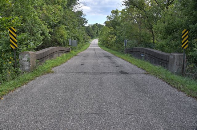
The bridge carries a 2 lane road over a stream in a
sparsely developed, rural setting.
Physical Description
The 1 span, 45'-long, reinforced-concrete thru
girder bridge has paneled, shaped girders with blocky end posts and
articulated floorbeams. It is supported on concrete abutments.
Summary of Significance
The ca. 1928 thru girder bridge is a late and
undistinguished example of a standardized bridge type in use from the
mid 1910s to 1930s. It is not technologically significant.
Reinforced-concrete thru girder bridges are composed of a pair of
cast-in-place longitudinal girders and transverse floorbeams or deck
slab (the former is the case with most Ohio examples) that are connected
by the arrangement of the steel reinforcing bars. The roadway passes
between the paired girders, which are the main supporting members and
also serve as railings. The girders are commonly very large in
appearance (18" to 30" wide and 4' to 6' deep) and have deep panels to
save on weight. The depth of the girders is related to span length with
the longer the span the greater the depth. In many cases, the girders
are shaped to achieve the greatest depth of beam at mid-span where it is
required to support the design moments (stresses). The shaped girder is
a design detail to accommodate longer and/or wider spans and/or heavier
design loads, it is not aesthetic.
Like other reinforced-concrete
bridge types, including the slab and T beam, the thru girder appeared
nationally and in Ohio during the first decade of the 20th century. The
oldest surviving example in the state, dated to 1905, is located in
Morrow County (5930669, Phase 1A Survey, 2008). In Ohio, the type does
not appear to have been widely used until after its adoption as a state
standard in 1915. Of the approximately 60 identified surviving examples,
only three are confirmed to predate 1915. Between 1915 and 1924, the
department issued standard plans for thru girder bridges in span lengths
ranging from 27' to 65' and roadway widths from 16' to 24', which
account for the vast number of Ohio's surviving examples. They also
developed an unusual, and perhaps unique to Ohio, cantilevered thru
girder design that was adopted as a standard in 1922. The only known
surviving example of the cantilevered design is in Gallia County
(2742322).
The thru girder bridge type played a prominent role in
state and county efforts to improve Ohio's roads and bridges in the
1920s, but over time it proved to be one of the least successful of the
standard designs and its use was diminishing by 1929 and had ended by
1940. The majority of Ohio's surviving examples (35 of 60) date from
1922 to 1930. Over time, the thru girder proved to be less economical
than T beams for the same range of span lengths and was limited to
relatively narrow roadway widths (about 24' max.). By 1928, George A.
Hool, a noted authority on reinforced-concrete bridge construction,
reported that "from a standpoint of economy, the thru girder should not
be built except where insufficient headroom or other local conditions
prevent the use of the deck girder [T beam]." Thru girders were also
difficult to widen, a concern that was increasingly on the minds of
bridge engineers by the late 1920s.
The body of engineering
knowledge soon reached the conclusion that thru girders were not as
successful or versatile as other standard types. The thru girder can be
viewed as a 'dead end' in the evolution of bridge technology, and this
limits the bridge type's significance. Many state highway departments
did not use thru girders or stopped building them in the 1920s. And even
though Ohio's engineers continued to use thru girders somewhat longer
than engineers in many other states, they reached the same conclusions
about their disadvantages. The thru girder's contribution to the
historical development of Ohio's highways simply was not as great as
many other standard types because of its limitations and shorter period
of use.
Original / Full Size Photos A collection of overview and detail photos. This gallery offers photos in the highest available resolution and file size in a touch-friendly popup viewer. Alternatively, Browse Without Using Viewer
Mobile Optimized Photos A collection of overview and detail photos. This gallery features data-friendly, fast-loading photos in a touch-friendly popup viewer. Alternatively, Browse Without Using Viewer