
View Information About HSR Ratings
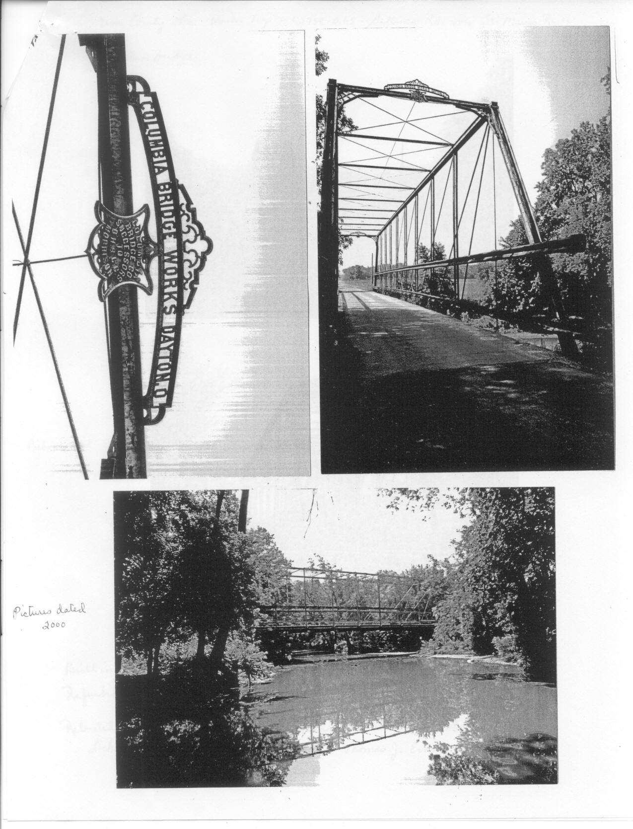
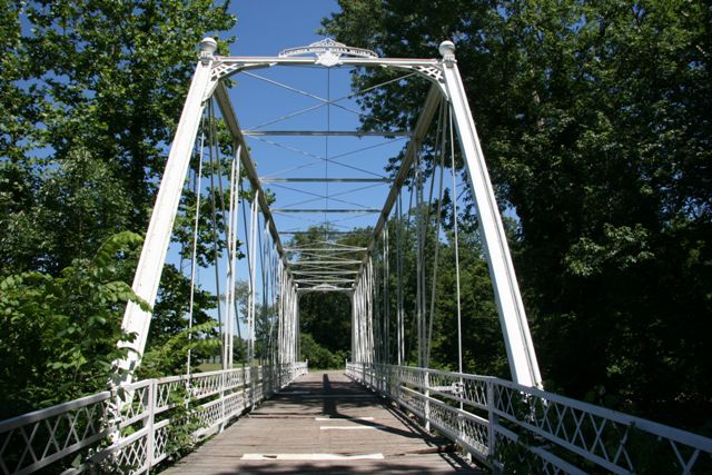
This bridge is an extremely rare and significant example of a Columbia Bridge Works Whipple truss. Both Whipple truss bridges and Columbia Bridge Works bridges are rare. Columbia Bridge Works bridges of any type are usually assigned a high level of significance because the company used so many unusual and non-standard construction and design details in its bridges. The company used very off built-up beams on its truss members, as well as very complicated and non-standard connection details. Indeed, this particular bridge displays some very unusual connection details. Most bridges built by the company are immediately recognizable, even if they don't have the distinctive ornate builder plaque mounted on the portal. This bridge however does retains its plaque. The bridge was relocated from Mercer County to this location in 2002.
Information and Findings From Ohio's Historic Bridge InventorySetting/Context The bridge carries a bike path over a stream in a park setting. Physical Description Major rehab 1987. Originally in Mercer Co. as SFN 5457467 over St. Mary's River. Moved to Licking County in 2002, on a Bikeway over Raccoon Ck near Reddington and Cherry Valley Rd. Integrity Relocated in 2002 from Gallman Road over St. Mary's River in Mercer County (former SFN 5457467). Summary of Significance The Whipple truss bridge, fabricated in 1887 by the
Columbia Bridge Works, is a technologically significant example of its
type/design that was relocated and rehabilitated in 2002 for re-use on a
bike path. Although relocated, it maintains integrity of design and
materials, and thus its technological significance. The eligible
recommendation of the prior inventory remains appropriate. Justification There are 13 examples of the bridge type important to the development and maturation of the pin-connected thru truss bridge. They date from 1881 and concentrated in the 1880s. Even though there are more than 12 extant examples in Ohio, each built in the 1880s has high significance based on overall scarcity (everywhere but in Ohio) of the design. This is a major and technologically significant bridge type. The bridge has high significance. Bridge Considered Historic By Survey: Yes View PDF Historic Bridge Inventory Sheet
|
This bridge is tagged with the following special condition(s): Reused
![]()
![]()
![]()
Coordinates (Latitude, Longitude):
Search For Additional Bridge Listings:
Bridgehunter.com: View listed bridges within 0.5 miles (0.8 kilometers) of this bridge.
Bridgehunter.com: View listed bridges within 10 miles (16 kilometers) of this bridge.
Additional Maps:
Google Streetview (If Available)
GeoHack (Additional Links and Coordinates)
Apple Maps (Via DuckDuckGo Search)
Apple Maps (Apple devices only)
Android: Open Location In Your Map or GPS App
Flickr Gallery (Find Nearby Photos)
Wikimedia Commons (Find Nearby Photos)
Directions Via Sygic For Android
Directions Via Sygic For iOS and Android Dolphin Browser
USGS National Map (United States Only)
Historical USGS Topo Maps (United States Only)
Historic Aerials (United States Only)
CalTopo Maps (United States Only)

© Copyright 2003-2025, HistoricBridges.org. All Rights Reserved. Disclaimer: HistoricBridges.org is a volunteer group of private citizens. HistoricBridges.org is NOT a government agency, does not represent or work with any governmental agencies, nor is it in any way associated with any government agency or any non-profit organization. While we strive for accuracy in our factual content, HistoricBridges.org offers no guarantee of accuracy. Information is provided "as is" without warranty of any kind, either expressed or implied. Information could include technical inaccuracies or errors of omission. Opinions and commentary are the opinions of the respective HistoricBridges.org member who made them and do not necessarily represent the views of anyone else, including any outside photographers whose images may appear on the page in which the commentary appears. HistoricBridges.org does not bear any responsibility for any consequences resulting from the use of this or any other HistoricBridges.org information. Owners and users of bridges have the responsibility of correctly following all applicable laws, rules, and regulations, regardless of any HistoricBridges.org information.
![]()