


View Information About HSR Ratings
This extremely rare surviving bedstead truss bridge was relocated and preserved on the Van Wert County Fairgrounds. The previous location of the bridge was 40.815093, -84.614479.

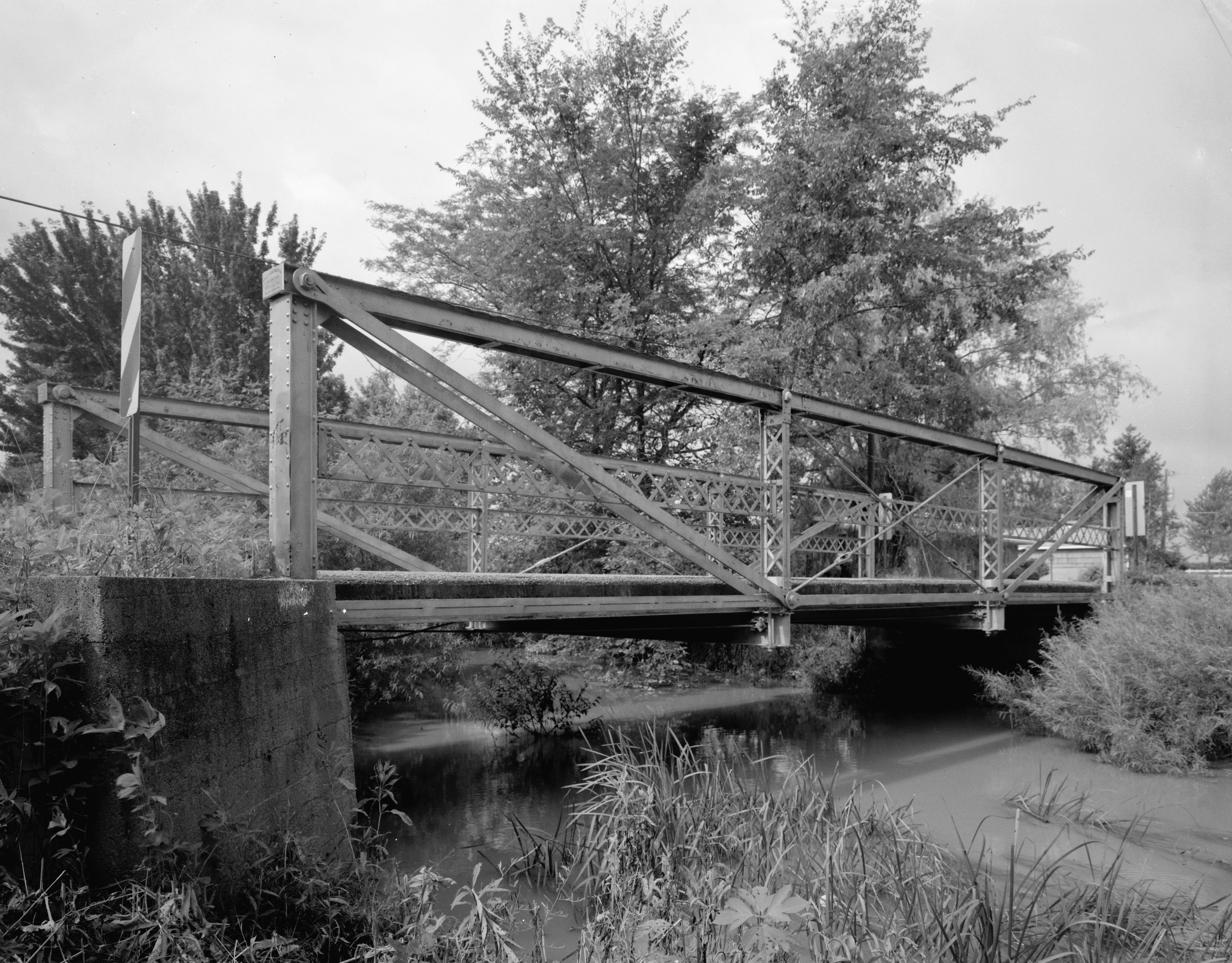
Above: HAER photo showing bridge in original location.
Above: HAER photo showing bridge in original location.
Information and Findings From Ohio's Historic Bridge InventorySetting/Context The bridge carries a pedestrian path over a stream at the Van Wert County fairgrounds. Physical Description The 1 span, 44'-long, pin-connected, bedstead Pratt pony truss bridge has built-up compression members and eyebar tension members. It is finished with lattice railings. Integrity Relocated 1996. Summary of Significance The 1894 pin-connected bedstead pony truss bridge was moved to the county fairgrounds in 1996 (ODOT survey form) from its original location on CR 82 over Town Creek (former SFN 8135150). The relocated bridge is a surviving example of an uncommon bedstead design and is technologically significant. The relocation project has not compromised its technological significance. The eligible recommendation of the prior inventory remains appropriate. Justification The bridge is one of 57 extant pin-connected truss bridges dating from 1874 for pony trusses and 1876 for thru trusses. Twenty six predate 1888 and represent the era of experimentation that evolved into standardized designs by about 1888. This example has moderate significance because the genre and the fabricator are so well represented in Ohio. Bridge Considered Historic By Survey: Yes |
![]()
![]()
![]()
Coordinates (Latitude, Longitude):
Search For Additional Bridge Listings:
Bridgehunter.com: View listed bridges within 0.5 miles (0.8 kilometers) of this bridge.
Bridgehunter.com: View listed bridges within 10 miles (16 kilometers) of this bridge.
Additional Maps:
Google Streetview (If Available)
GeoHack (Additional Links and Coordinates)
Apple Maps (Via DuckDuckGo Search)
Apple Maps (Apple devices only)
Android: Open Location In Your Map or GPS App
Flickr Gallery (Find Nearby Photos)
Wikimedia Commons (Find Nearby Photos)
Directions Via Sygic For Android
Directions Via Sygic For iOS and Android Dolphin Browser
USGS National Map (United States Only)
Historical USGS Topo Maps (United States Only)
Historic Aerials (United States Only)
CalTopo Maps (United States Only)

© Copyright 2003-2025, HistoricBridges.org. All Rights Reserved. Disclaimer: HistoricBridges.org is a volunteer group of private citizens. HistoricBridges.org is NOT a government agency, does not represent or work with any governmental agencies, nor is it in any way associated with any government agency or any non-profit organization. While we strive for accuracy in our factual content, HistoricBridges.org offers no guarantee of accuracy. Information is provided "as is" without warranty of any kind, either expressed or implied. Information could include technical inaccuracies or errors of omission. Opinions and commentary are the opinions of the respective HistoricBridges.org member who made them and do not necessarily represent the views of anyone else, including any outside photographers whose images may appear on the page in which the commentary appears. HistoricBridges.org does not bear any responsibility for any consequences resulting from the use of this or any other HistoricBridges.org information. Owners and users of bridges have the responsibility of correctly following all applicable laws, rules, and regulations, regardless of any HistoricBridges.org information.
![]()