We Recommend:
Bach Steel - Experts at historic truss bridge restoration.
BridgeHunter.com Phase 1 is released to the public! - Visit Now
Martindale Road Bridge

Primary Photographer(s): Nathan Holth
Bridge Documented: 2005
St. Catharines: Niagara Region, Ontario: Canada
Not Available or Not Applicable
Not Available
Not Available
Not Available
2 Main Span(s)
Not Applicable

View Information About HSR Ratings
Bridge Documentation
This bridge no longer exists!
Peter D.A. Warwick reported additional information on this bridge: The old Martindale Road bridge over the QEW once carried the St. Catharines - Port Dalhousie streetcar line of the Niagara, St. Catharines and Toronto Railway. When streetcar service ended in 1950 part of the line was kept in place for freight. Diesel engines took over from electric in 1960 and the line over the bridge was removed in 1965. You could still see where the tracks had been.
This heritage bridge was demolished around 2009!
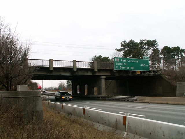
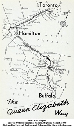
This bridge built in 1939, making it a dinosaur for an expressway bridge. Opened in 1937, the QEW is not only the oldest in Canada, but also among the oldest limited access highways in North America, and this bridge was a surviving example of the original construction of this freeway. The QEW was opened around the time that the Pennsylvania Turnpike was under construction in the United States. The Pennsylvania Turnpike was noted as the first long-distance limited access highway in the United States. Therefore a case could be made that the QEW was the first long-distance limited access highway in North America.
Although simple structurally, this bridge features the decorative lines and pier design that you might expect from a 1930s concrete bridge, making it a detailed and attractive structure. Also, it is unusual because in addition to two lanes, it appears to have also carried a railroad, which is long gone. The beams on this half of the bridge, now unused, are thicker, and the pier has more concrete, featuring a shorter arch on this half of the bridge. All of this makes for a fascinating and historically significant bridge.
The weather was poor during the documentation of this structure, yielding extremely poor photos. However poor photos are better than none. The bridge has been demolished and replaced, so it is no longer possible to ever photograph this bridge again.
![]()
Photo Galleries and Videos: Martindale Road Bridge
Bridge Photo-Documentation
A collection of overview and detail photos. This photo gallery contains a combination of Original Size photos and Mobile Optimized photos in a touch-friendly popup viewer.Alternatively, Browse Without Using Viewer
![]()
Maps and Links: Martindale Road Bridge
This historic bridge has been demolished. This map is shown for reference purposes only.
Coordinates (Latitude, Longitude):
Search For Additional Bridge Listings:
Additional Maps:
Google Streetview (If Available)
GeoHack (Additional Links and Coordinates)
Apple Maps (Via DuckDuckGo Search)
Apple Maps (Apple devices only)
Android: Open Location In Your Map or GPS App
Flickr Gallery (Find Nearby Photos)
Wikimedia Commons (Find Nearby Photos)
Directions Via Sygic For Android
Directions Via Sygic For iOS and Android Dolphin Browser


