

View Information About HSR Ratings
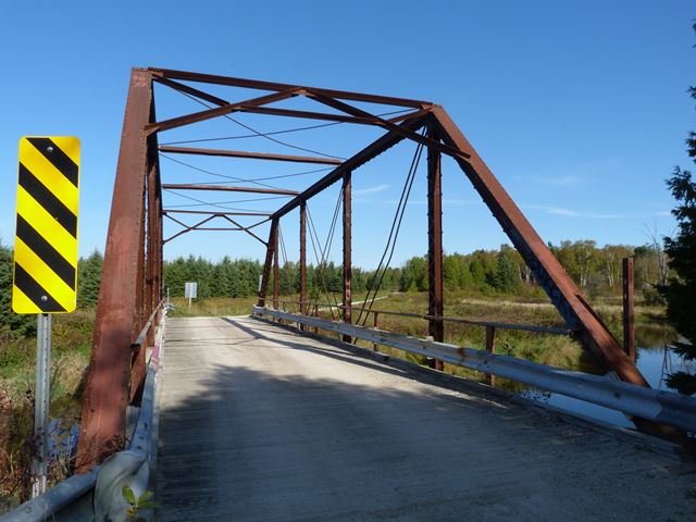
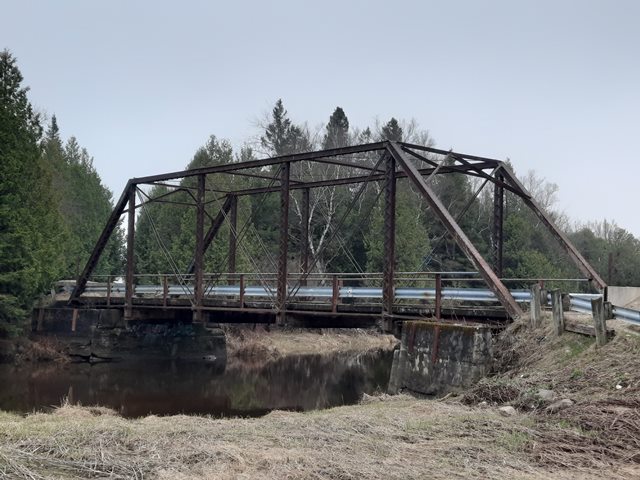
This heritage bridge was closed to all traffic only a few weeks after it was photographed by HistoricBridges.org. Its future is now uncertain and it may be at risk for demolition, despite the fact that pin-connected truss bridges represent one of the the oldest and rarest types of heritage bridge in Canada. Prior to closure, it was posted with a 12 tonne weight limit. Bridges of this type often were designed for roughly around 15 tonnes, and that being the case, the previous posting suggests that overall the bridge has not deteriorated heavily, but that a sudden isolated problem is of concern. It may be related to the concrete abutments. It may also be related to the condition of the pins; the pins are not in original condition. Some are actually crudely welded to the eyebars, which is neither appropriate (because the eyebar/pin interface is not meant to be a solid/rigid connection) or original.
The history of this crossing is unclear, although what is clear is that an interesting story is here, based on the clues present on-site. First, note that the Heritage Bridge Inventory gives a 1920 construction date for this bridge. As seen today, this bridge sits on concrete abutments, but directly in front of these abutments are older unused abutments that have a 1909 date cast into them. In other words, in 1909, abutments were constructed to hold a shorter bridge span, and then (presumably in 1920) new abutments were constructed to hold this longer truss span that was erected here. Given that 1920 is an extremely late construction date for a pin-connected truss bridge, it seems quite possible that the truss span seen here was moved from some other location and reused here in 1920, and that the truss itself may be older than 1920.
It appears that their used to be bracing knees for the overhead struts that were removed, as evidenced by unused holes on the vertical members.
As through truss spans go, this is a very short span. Given the striking rarity of pin-connected truss bridges in Ontario, this bridge should be considered to have a high level of heritage significance. If it is found to be insufficient for the road it serves, it would be a great candidate for relocation, restoration, and reuse on a trail system or in a park for pedestrian use.
This bridge is tagged with the following special condition(s): Unorganized Photos
![]()
![]()
![]()
![]()
![]()
Coordinates (Latitude, Longitude):
Search For Additional Bridge Listings:
Additional Maps:
Google Streetview (If Available)
GeoHack (Additional Links and Coordinates)
Apple Maps (Via DuckDuckGo Search)
Apple Maps (Apple devices only)
Android: Open Location In Your Map or GPS App
Flickr Gallery (Find Nearby Photos)
Wikimedia Commons (Find Nearby Photos)
Directions Via Sygic For Android
Directions Via Sygic For iOS and Android Dolphin Browser

© Copyright 2003-2026, HistoricBridges.org. All Rights Reserved. Disclaimer: HistoricBridges.org is a volunteer group of private citizens. HistoricBridges.org is NOT a government agency, does not represent or work with any governmental agencies, nor is it in any way associated with any government agency or any non-profit organization. While we strive for accuracy in our factual content, HistoricBridges.org offers no guarantee of accuracy. Information is provided "as is" without warranty of any kind, either expressed or implied. Information could include technical inaccuracies or errors of omission. Opinions and commentary are the opinions of the respective HistoricBridges.org member who made them and do not necessarily represent the views of anyone else, including any outside photographers whose images may appear on the page in which the commentary appears. HistoricBridges.org does not bear any responsibility for any consequences resulting from the use of this or any other HistoricBridges.org information. Owners and users of bridges have the responsibility of correctly following all applicable laws, rules, and regulations, regardless of any HistoricBridges.org information.
![]()