

View Information About HSR Ratings
This is one of a number of bridges in Toronto with obvious heritage significance and beauty that apparently receive little public attention, as least as of the time this bridge was added to HistoricBridges.org in August 2015. Like many of Toronto's impressive and fascinating bridges, this bridge can only be truly seen and appreciated when the leaves are off the trees, as the valley it crosses is thickly wooded.
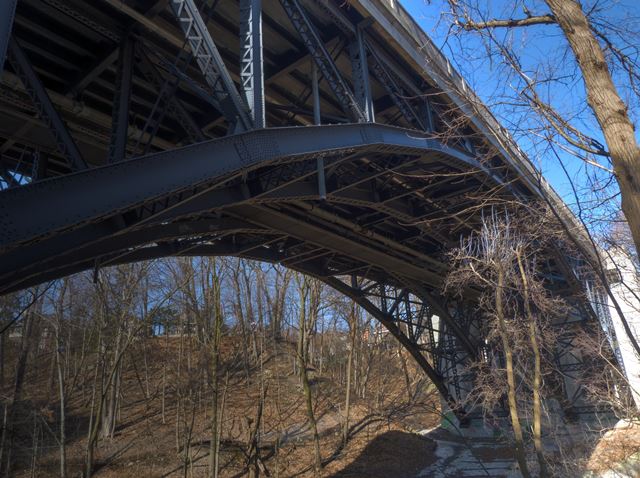
The bridge is both visually impressive and technologically significant as a heritage bridge. It consists of a single-hinged steel deck arch span span, with deck plate girder approach spans. The arch span is a noteworthy design, and incorporating both highway lanes and streetcar lanes originally was designed to be quite wide. As such, it is configured with four arch ribs. These arch ribs have their sway and lateral bracing arranged in a manner so as to create the appearance of two parallel arch structures. In other words, no bracing is present between the two center arch ribs. Aside from substantial deck alterations and reconfigurations, the actual steel superstructure including the historically significant arch span retains good historic integrity with no major alterations.
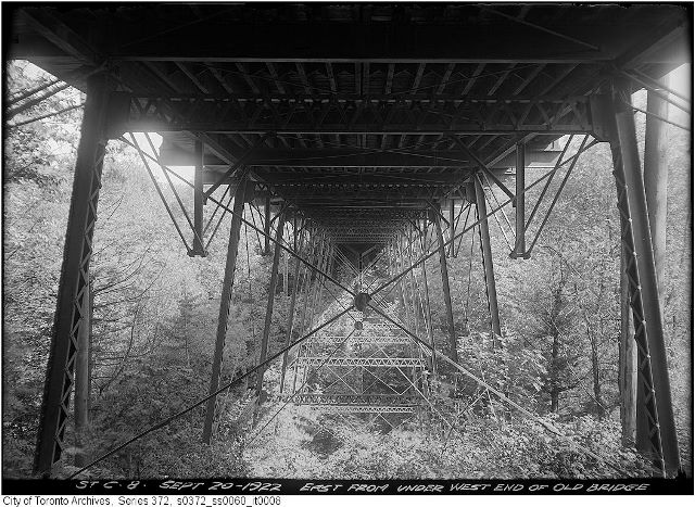
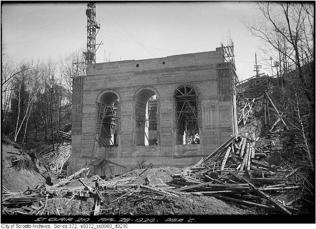
The City of Toronto Archives has a massive collection of construction photos for this bridge. The photos were presented unsorted and with limited description. HistoricBridges.org has selected just under 60 of these photos and added them to an unorganized photo gallery available below.
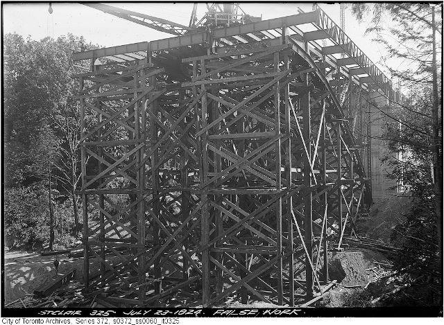
The historical photos provided some insight into who built this bridge, since companies featured their name in various places on the construction site. Ontario Foundation Company was a substructure contractor for the bridge. The Canadian Bridge Company of Walkerville, Ontario fabricated the superstructure and also erected the superstructure. As sign on the construction site advertised Russell Construction Company Limited of Toronto as Engineering Contractors. The placement of the sign near the railing concrete work, suggests they may have been involved with the deck and railing.
The historical photos also reveal that originally, the bridge had a deck that cantilevered out beyond the arches, and included a decorative concrete fascia near the deck level that was reinforced within by a lightweight riveted truss system. Original concrete railings were located on the edge of this fascia. Today, the deck is reconfigured, and original railings, cantilevered deck design, and fascia has all been removed and replaced. In opposition to the traditional "newer bridges must be wider" philosophy of the past 100 years, this bridge is today narrower than it was originally as a result. The railings are positioned closer to the actual arch ribs. This is presumably because originally the bridge accommodated two dedicated street car tracks in the middle, which no longer exist.
The previous bridge at this location dated to 1888-1890 and was on a slightly different alignment since it connected St. Clair Avenue at the east end to Pleasant Blvd. at the west end. The bridge featured an unusual pin-connected inverted Kingpost (deck kingpost) truss design and was supported on tall steel bents.
This bridge is tagged with the following special condition(s): Unorganized Photos
![]()
![]()
![]()
![]()
![]()
Coordinates (Latitude, Longitude):
Search For Additional Bridge Listings:
Additional Maps:
Google Streetview (If Available)
GeoHack (Additional Links and Coordinates)
Apple Maps (Via DuckDuckGo Search)
Apple Maps (Apple devices only)
Android: Open Location In Your Map or GPS App
Flickr Gallery (Find Nearby Photos)
Wikimedia Commons (Find Nearby Photos)
Directions Via Sygic For Android
Directions Via Sygic For iOS and Android Dolphin Browser

© Copyright 2003-2026, HistoricBridges.org. All Rights Reserved. Disclaimer: HistoricBridges.org is a volunteer group of private citizens. HistoricBridges.org is NOT a government agency, does not represent or work with any governmental agencies, nor is it in any way associated with any government agency or any non-profit organization. While we strive for accuracy in our factual content, HistoricBridges.org offers no guarantee of accuracy. Information is provided "as is" without warranty of any kind, either expressed or implied. Information could include technical inaccuracies or errors of omission. Opinions and commentary are the opinions of the respective HistoricBridges.org member who made them and do not necessarily represent the views of anyone else, including any outside photographers whose images may appear on the page in which the commentary appears. HistoricBridges.org does not bear any responsibility for any consequences resulting from the use of this or any other HistoricBridges.org information. Owners and users of bridges have the responsibility of correctly following all applicable laws, rules, and regulations, regardless of any HistoricBridges.org information.
![]()