


View Information About HSR Ratings
This bridge is an uncommon example of a multi-span pony truss bridge in Ontario. The bridge retains good historic integrity with no major alterations. The deck was replaced in 1988. The bridge is representative of the heavier, more massive truss bridges that were built in Ontario starting in the 1920s. These truss bridges were able be wider and hold more weight than older bridges. A bridge like this is cost-effective and easy to maintain and preserve. The key is to simply keep the paint on the bridge. The bridge has lost a lot of paint with rust taking over. However the bottom portion of the truss has paint in better condition than the rest of the truss. This indicates that the bottom of the truss was repainted more recently. This is a good, cost-effective strategy because the lower part of the truss gets all the moisture and winter deicing salt and deteriorates the fastest. However it has apparently been some time since the lower part of the truss was repainted. Even the lower portion is starting to show some rust, while the top of the truss has a lot of surface rust. Now would be a good time to plan a complete repainting. Any needed repairs to the truss could be carried out at this time as well.
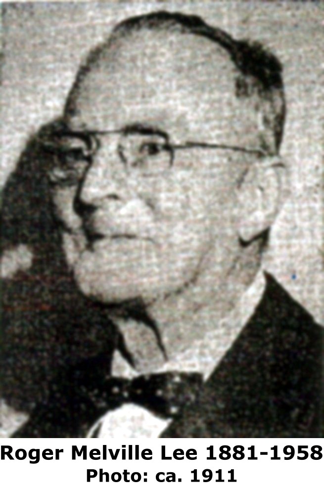
This bridge was designed by the firm Lee and Nash of Brantford, Ontario. The history of one of the two people who ran this firm, Roger Melville Lee, is documented here by the Saskatchewan Land Surveyors Association. Born in 1882 in Ontario, Lee ended up in Saskatchewan where he was part of a survey firm Phillips, Stewart and Lee. In 1915, he came back to Ontario and formed an engineering firm which was originally in association with A.M. Jackson, but later the firm was named Lee and Nash. Lee was a part of the firm until 1929 when he became County Engineer for the County of Brant. Therefore, the Woodlawn Bridge was constructed in Lee's final year of association with the firm. The ca. 1911 photo of Lee seen to the right was shown on the Saskatchewan Land Surveyors Association and apparently originally acquired from the Ontario Land Surveyors Association

![]()
![]()
![]()

![]()
Coordinates (Latitude, Longitude):
Search For Additional Bridge Listings:
Additional Maps:
Google Streetview (If Available)
GeoHack (Additional Links and Coordinates)
Apple Maps (Via DuckDuckGo Search)
Apple Maps (Apple devices only)
Android: Open Location In Your Map or GPS App
Flickr Gallery (Find Nearby Photos)
Wikimedia Commons (Find Nearby Photos)
Directions Via Sygic For Android
Directions Via Sygic For iOS and Android Dolphin Browser

© Copyright 2003-2025, HistoricBridges.org. All Rights Reserved. Disclaimer: HistoricBridges.org is a volunteer group of private citizens. HistoricBridges.org is NOT a government agency, does not represent or work with any governmental agencies, nor is it in any way associated with any government agency or any non-profit organization. While we strive for accuracy in our factual content, HistoricBridges.org offers no guarantee of accuracy. Information is provided "as is" without warranty of any kind, either expressed or implied. Information could include technical inaccuracies or errors of omission. Opinions and commentary are the opinions of the respective HistoricBridges.org member who made them and do not necessarily represent the views of anyone else, including any outside photographers whose images may appear on the page in which the commentary appears. HistoricBridges.org does not bear any responsibility for any consequences resulting from the use of this or any other HistoricBridges.org information. Owners and users of bridges have the responsibility of correctly following all applicable laws, rules, and regulations, regardless of any HistoricBridges.org information.
![]()