

View Information About HSR Ratings
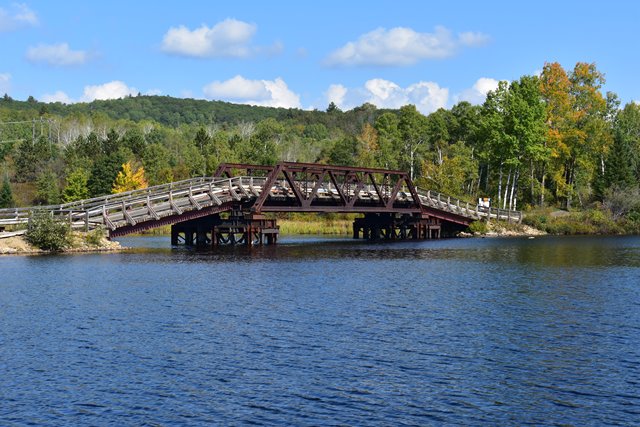
This is a rare example of a railroad pony truss bridge. It was built for the Ottawa, Arnprior and Parry Sound Railway, which reached the community in 1894. The rail line was abandoned on December 18th 1983, and a rail trail established in 1986. This appears to be the only pony truss in this township, and also the only pony truss built by this railway. The bridge previously had timber trestle approaches, which in 2009 were deemed unsafe and resulted in the bridge being closed to traffic. Around 2011, these approaches were replaced by a small causeway on the west side of the bridge and two steel stringer approaches with wood decks.
This bridge was originally constructed on masonry abutments at a lower elevation than it is today. Bark Lake, which is where the Madawaska flows into, is actually an artificial lake for hydroelectric storage. The creation of Bark Lake, which caused the rerouting of Highway 60 in order avoid the flooded area, (known as the Bark Lake Diversion) in 1942 saw the construction of two new highway bridges over the Madawaska and Opeongo River. This diversion resulted in cases where the water level on the river would be higher at time, although the water level in the late fall are brought down in the winter to prevent flooding. It was at this time that the railway bridge also had to be moved onto a new, higher, timber substructure and approach span system to accomodate the higher water levels.
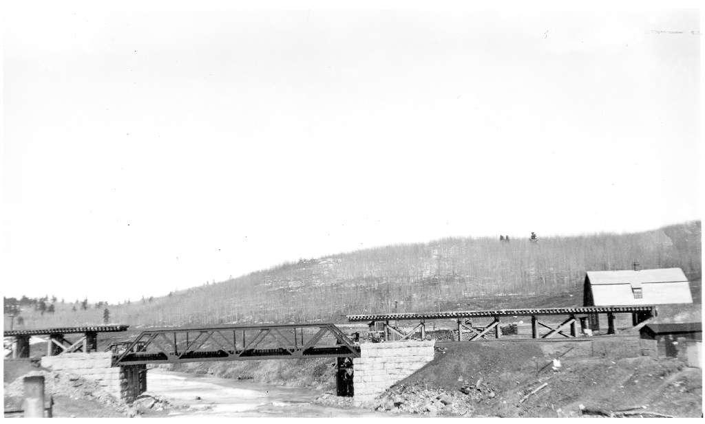
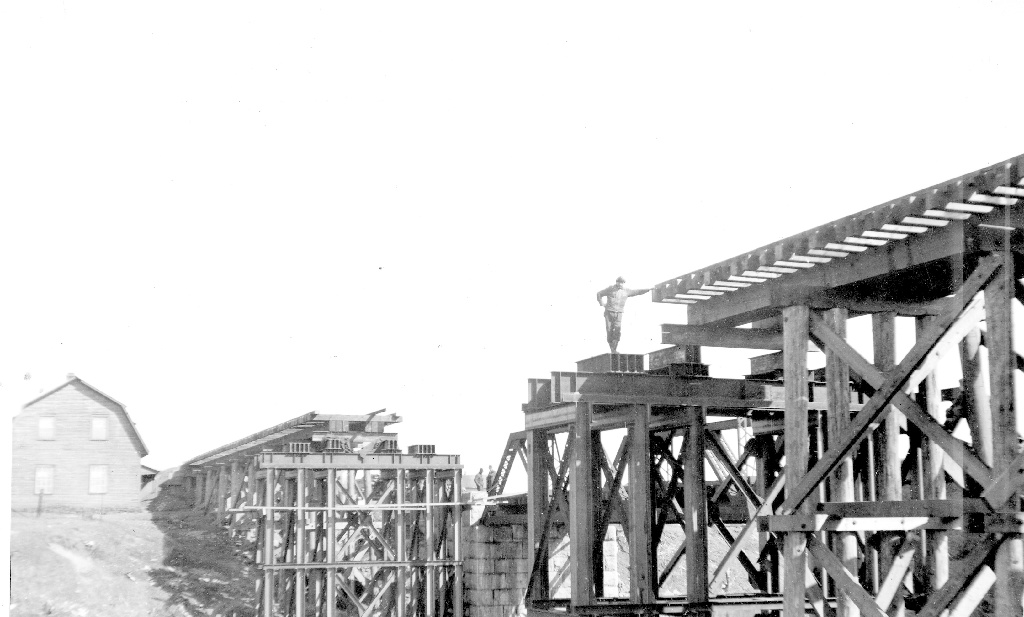
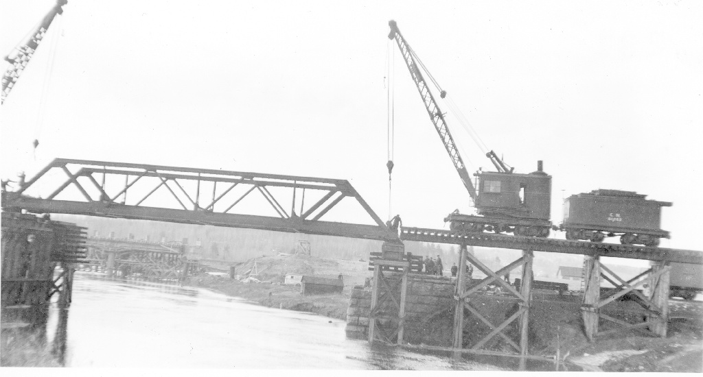
Thanks to Ian Graham for researching the history of this bridge. Historical photos shown below (Source: Aubrey Mattingly Transportation Collection, Ingenium Digital Archives) were determined to show the relocation of the railway bridge during this ca. 1942 period. In the last photo below, the other bridge being built in the background is believed to be a nearby highway bridge.

![]()
![]()
![]()
Coordinates (Latitude, Longitude):
Search For Additional Bridge Listings:
Additional Maps:
Google Streetview (If Available)
GeoHack (Additional Links and Coordinates)
Apple Maps (Via DuckDuckGo Search)
Apple Maps (Apple devices only)
Android: Open Location In Your Map or GPS App
Flickr Gallery (Find Nearby Photos)
Wikimedia Commons (Find Nearby Photos)
Directions Via Sygic For Android
Directions Via Sygic For iOS and Android Dolphin Browser

© Copyright 2003-2025, HistoricBridges.org. All Rights Reserved. Disclaimer: HistoricBridges.org is a volunteer group of private citizens. HistoricBridges.org is NOT a government agency, does not represent or work with any governmental agencies, nor is it in any way associated with any government agency or any non-profit organization. While we strive for accuracy in our factual content, HistoricBridges.org offers no guarantee of accuracy. Information is provided "as is" without warranty of any kind, either expressed or implied. Information could include technical inaccuracies or errors of omission. Opinions and commentary are the opinions of the respective HistoricBridges.org member who made them and do not necessarily represent the views of anyone else, including any outside photographers whose images may appear on the page in which the commentary appears. HistoricBridges.org does not bear any responsibility for any consequences resulting from the use of this or any other HistoricBridges.org information. Owners and users of bridges have the responsibility of correctly following all applicable laws, rules, and regulations, regardless of any HistoricBridges.org information.
![]()