

View Information About HSR Ratings

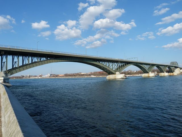
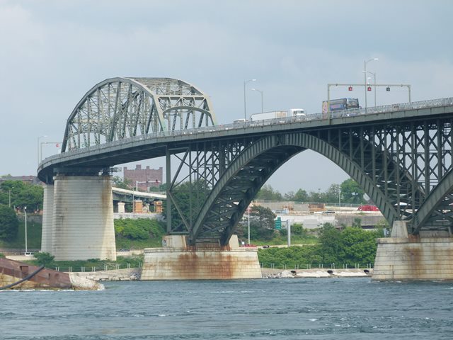
This signature bridge is a beautiful structure that derives its unique appearance from its combination of span types. The bridge consists of five steel deck arch spans ranging from 346 feet (105 meters) to 423 feet (129 meters) in length and a through truss span of 360 feet (110 meters) as well as some smaller girder approach spans. The arch spans carry the roadway over the Niagara River while the through truss carries the roadway over the Black Rock Canal. The largest span length is found in one of the deck arch spans, and as such the arch spans are considered the main spans of the bridge. However the through truss has the visual appearance of the main span of the bridge, with its prominent trusses rising above the roadway in impressive fashion. Additionally, because the through truss spans the navigable Black Rock Canal, the through truss span has the highest navigational clearance, giving it the appearance of a "main span" which all the other spans lead up to. Structurally, the through truss span is a traditionally composed example of a through truss, however its uncommonly wide (for the period it was built) roadway required that the trusses have more massive members than the average truss from this period in history. The steel deck arch spans of this bridge are less traditional. Steel deck arch spans are more commonly used in situations where the crossing is a deep gorge, such as that found north of the Niagara Falls, where steel deck arch spans are also used to bridge the river. In those traditional situations, the bridge is also generally a single span structure. The appearance of the Peace Bridge's arch spans here on the flat terrain surrounding this part of the Niagara River, combined with the multi-span design, make this an unusual and eye-catching application of steel deck arch spans. The spans gain additional distinctive appearance on account of the relatively shallow rise of the arches, giving them a more shallow, graceful curve than the traditional steel deck arch bridge. Including terminals, the total bridge length is 5,800 feet (1,770 meters).
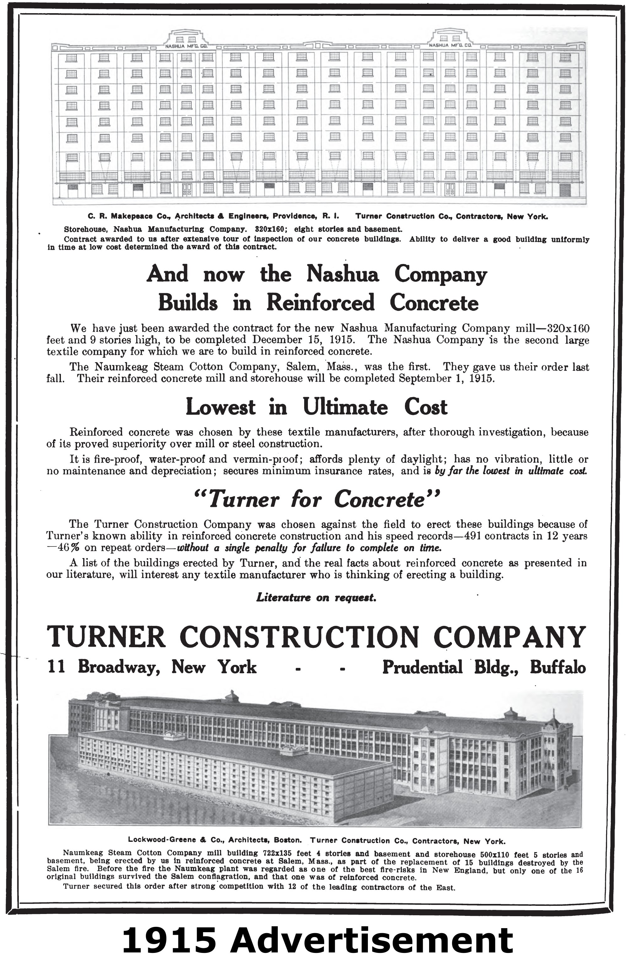
Niagara Falls Info states that contractors involved with the bridge were R.B. Porter of St. Catharines, Ontario, Turner Construction of Buffalo, New York, and Bethlehem Steel Company of Bethlehem, Pennsylvania. The chief engineer for the bridge was Edward P. Lupfer of Buffalo, New York, however findings for a Draft Environmental Impact Statement also states that William Russell Davis and John F. Stevens were consulting engineers for the bridge design as well. Bethlehem Steel Company would have been the superstructure contractor. Historical advertisements for Turner Construction indicate that this company nearly exclusively worked with reinforced concrete (their slogan was "Turner for Concrete"), therefore it seems logical that they were the substructure (piers and abutments) contractor. It is not known what role R. B. Porter may have played.
The bridge has beautiful high-tech colored flood lights that decoratively illuminate the bridge at night, making the bridge just as much of a visual icon for the region at night as it is during the day. The lights are capable of illuminating different parts of the bridge in many different colors in real time. The bridge follows a lighting schedule, so different lights offer a different lighting layout. Click here to view the schedule.
In the first decade of the 21st Century, a plan to either replace this bridge or add a companion span was studied extensively. Some of the alternatives considered were horrific: the demolition and replacement of the historic bridge was considered. Another plan that would have retained the arch spans at the same time would have demolished and replaced the through truss span, which while better than complete demolition, would have been a devastating alteration. By 2011, the plan appeared to have shifted to adding a companion bridge next to the historic bridge, which would leave the historic bridge in place and unaltered from its original span configuration. By 2012 however, the plan was shelved. While officials say that the studies and plans will be retained for possible implementation in the future, for now the historic bridge will remain preserved as it is today. Instead, a smaller project that will only focus on enlarging the customs plazas will take place. In reality, enlarging the customs plazas is the most important thing that can be done to reduce congestion on the bridge. With the Blue Water Bridge between Ontario and Michigan, a companion span was built and the customs plazas were also enlarged... but not enough. Even the enlarged customs plazas still failed to move traffic through efficiently. As such, the bridges back up with traffic during busy times just the same as they did when there was only one bridge.
Information and Findings From Draft Environmental Impact Statement (DEIS)Summary The Peace Bridge is "significant as an excellent example of an early 20th century, multiple-arch, and steel-plate girder bridge" that was constructed as an international crossing between Buffalo, New York, and Fort Erie, Ontario. Construction of the Peace Bridge was an event that originally commemorated a century of peaceful relations between the United States and Canada but has evolved, through continued active use, into a major transportation structure that has shaped social and economic conditions in the City of Buffalo and in a larger geographic area that includes the western New York area, the Niagara Peninsula, and southern Ontario from the early 20th century through the present. The concrete and steel approach spans are contributing elements of this property. Because the Peace Bridge is NRHP-eligible, it is considered a 4(f) resource for the purposes of this evaluation. Statement of Significance The Peace Bridge over the Niagara River in Buffalo, Erie County, is significant as an excellent example of an early twentieth-century, multiple-arch, steel-plate girder bridge. This bridge was built as an international crossing between Buffalo and Fort Erie, Ontario, Canada. The bridge can be divided into three sections: the predominant arch section is comprised of five braced open-spandrel arch sections varying in length from 346 feet (105 m) to 423 feet (129 m); a 360-foot (110 m) steel, riveted, Pennsylvania[sic]-through-truss section adjacent to the American shore that rises 106 feet over the Black Rock Canal to allow for shipping clearance; and a riveted steel-plate deck girder section adjacent to the United States plaza. The approximate length of the bridge and terminal is 5800 feet and the roadway is 36 feet wide with two additional six-foot-wide sidewalks. The spring lines of each arch attach to granite river piers that have upstream-end icebreaker protectors. Nearby Bethlehem Steel Company supplied the over 9000 tons of structural steel and the 36,000 cubic yards of concrete used for the construction of the bridge. One unusual feature of the bridge is the decorative concrete balustrade. Although some of it has been replaced with steel railings, there are still visible portions. Constructed between 1925-1927 by a team including the chief engineer, Edward P. Lupfer and consulting engineers William Russell Davis and John F. Stevens, the Peace Bridge commemorated a century of Peace between Canada and the United States. It also provided a direct automobile traffic connection between the two countries. Attending the dedication ceremony in 1927 were Vice President of the United States, Charles G. Davies; Secretary of State, Frank B. Kellogg; Prime Ministers Stanley Baldwin of Great Britain and W.L. Mackenzie King of Canada; and New York Governor Alfred E. Smith. With the exception of some alterations to the bridge approaches, the Peace Bridge is extremely intact and retains an exceptionally high degree of integrity. |


This bridge is tagged with the following special condition(s): Unorganized Photos
![]()
![]()
![]()
![]()
![]()

![]()
![]()
Coordinates (Latitude, Longitude):
Search For Additional Bridge Listings:
Bridgehunter.com: View listed bridges within 0.5 miles (0.8 kilometers) of this bridge.
Bridgehunter.com: View listed bridges within 10 miles (16 kilometers) of this bridge.
Additional Maps:
Google Streetview (If Available)
GeoHack (Additional Links and Coordinates)
Apple Maps (Via DuckDuckGo Search)
Apple Maps (Apple devices only)
Android: Open Location In Your Map or GPS App
Flickr Gallery (Find Nearby Photos)
Wikimedia Commons (Find Nearby Photos)
Directions Via Sygic For Android
Directions Via Sygic For iOS and Android Dolphin Browser
USGS National Map (United States Only)
Historical USGS Topo Maps (United States Only)
Historic Aerials (United States Only)
CalTopo Maps (United States Only)

© Copyright 2003-2025, HistoricBridges.org. All Rights Reserved. Disclaimer: HistoricBridges.org is a volunteer group of private citizens. HistoricBridges.org is NOT a government agency, does not represent or work with any governmental agencies, nor is it in any way associated with any government agency or any non-profit organization. While we strive for accuracy in our factual content, HistoricBridges.org offers no guarantee of accuracy. Information is provided "as is" without warranty of any kind, either expressed or implied. Information could include technical inaccuracies or errors of omission. Opinions and commentary are the opinions of the respective HistoricBridges.org member who made them and do not necessarily represent the views of anyone else, including any outside photographers whose images may appear on the page in which the commentary appears. HistoricBridges.org does not bear any responsibility for any consequences resulting from the use of this or any other HistoricBridges.org information. Owners and users of bridges have the responsibility of correctly following all applicable laws, rules, and regulations, regardless of any HistoricBridges.org information.
![]()