

View Information About HSR Ratings
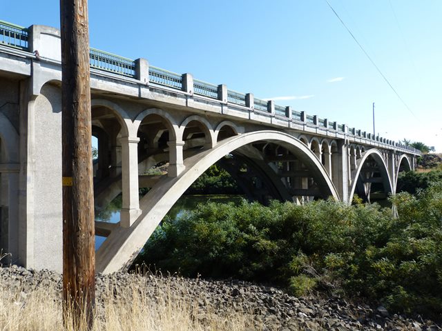
This bridge is an attractive arch bridge. It was built in 1925, however in 1950, it was widened by adding an arch structure to the south side of the bridge. The 1950 section replicated the architectural details of the 1925 portion. The only exception was that the railings were replaced with steel picket railings. In 2012, the bridge was rehabilitated again. Two-tube railing was place in front of the 1950 railing, which was retained.
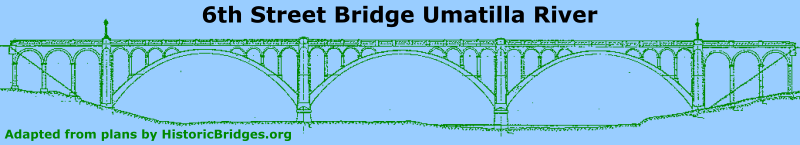
Information and Findings From Oregon's Historic Bridge InventoryDescription Three 110-ft reinforced concrete open-spandrel, rib-type deck arch spans with six reinforced concrete deck girder approach spans Additional Significance: This bridge, which was widened with a similar structure in 1950, features a number of decorative details, including arched spandrel walls and arched façades on the approach spans. The widening replicates these features, though it replaced the railing with picket rail. Designer Oregon State Highway Department under C.B. McCullough Significance In 1917, when the Oregon State Highway Commission first surveyed the route of the Columbia River Highway beyond the Columbia River Gorge, they intended for the highway to run along the river as far as the town of Umatilla, before turning south as the Old Oregon Trail Highway. Instead, when construction of the highway reached Umatilla County in 1926, they decided to extend it to the Washington State Line, eventually designating this last segment as US 730. There are very few bridges along this portion of highway, and only two retain any sense of that original era. Character Defining Features Location on historic Columbia River Highway, Decorative features and railings, Structure type Alterations In addition to the 1950 widening, this bridge received a rehab in 2012 which involved repairs to the concrete and a deck overlay. The railing has also been protected behind 2 Tube steel rail. Bridge Considered Historic By Survey: Yes |
![]()
![]()
![]()
Coordinates (Latitude, Longitude):
Search For Additional Bridge Listings:
Bridgehunter.com: View listed bridges within 0.5 miles (0.8 kilometers) of this bridge.
Bridgehunter.com: View listed bridges within 10 miles (16 kilometers) of this bridge.
Additional Maps:
Google Streetview (If Available)
GeoHack (Additional Links and Coordinates)
Apple Maps (Via DuckDuckGo Search)
Apple Maps (Apple devices only)
Android: Open Location In Your Map or GPS App
Flickr Gallery (Find Nearby Photos)
Wikimedia Commons (Find Nearby Photos)
Directions Via Sygic For Android
Directions Via Sygic For iOS and Android Dolphin Browser
USGS National Map (United States Only)
Historical USGS Topo Maps (United States Only)
Historic Aerials (United States Only)
CalTopo Maps (United States Only)

© Copyright 2003-2026, HistoricBridges.org. All Rights Reserved. Disclaimer: HistoricBridges.org is a volunteer group of private citizens. HistoricBridges.org is NOT a government agency, does not represent or work with any governmental agencies, nor is it in any way associated with any government agency or any non-profit organization. While we strive for accuracy in our factual content, HistoricBridges.org offers no guarantee of accuracy. Information is provided "as is" without warranty of any kind, either expressed or implied. Information could include technical inaccuracies or errors of omission. Opinions and commentary are the opinions of the respective HistoricBridges.org member who made them and do not necessarily represent the views of anyone else, including any outside photographers whose images may appear on the page in which the commentary appears. HistoricBridges.org does not bear any responsibility for any consequences resulting from the use of this or any other HistoricBridges.org information. Owners and users of bridges have the responsibility of correctly following all applicable laws, rules, and regulations, regardless of any HistoricBridges.org information.
![]()