We Recommend:
Bach Steel - Experts at historic truss bridge restoration.
BridgeHunter.com Phase 1 is released to the public! - Visit Now
Croswell Swinging Bridge

Primary Photographer(s): Nathan Holth
Bridge Documented: June 2, 2006
Croswell: Sanilac County, Michigan: United States
2006
139.0 Feet (42.4 Meters)
Not Available
Not Available
1 Main Span(s)
Not Applicable

View Information About HSR Ratings
Bridge Documentation
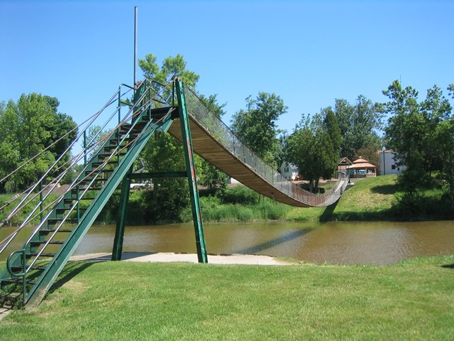
One of the notable landmarks of Croswell is the large factory that converts sugar beets into sugar. It is run by the Michigan Sugar Company which produces sugar sold under the Pioneer Sugar brand. Also memorable is the unusual scent frequently encountered in Croswell, which is produced by this factory as it converts the beets into sugar! The Michigan Sugar Company was also responsible for building a lightweight suspension foot bridge over the Black River in 1905 to provide workers at the factory who lived on the other side of the river with an easier way to get to work. Over the years, the foot bridge they constructed has evolved from a crude crossing for workers into a locally famous landmark that connects downtown Croswell to a park and is known as the Swinging Bridge, a name given to it because of how the bridge swings and bounces as people walk across it. At one time, the bridge had signs at each end. At the west end a sign read "Love Ye One Another" and at the east end a sign read "Be Good To Your Mother-in-law." Today, there is still a sign at the east end that reads "Be Good To Your Mother-in-law" but no sign is present at the west end.
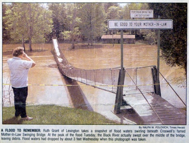
The above photo from the Port Huron Times Herald shows flooding at the bridge in 1996. The bridge has a deck of 128 wooden planks and they were replaced in 2006 for $1,300.
It is claimed that this is the longest spanning suspension foot bridge in Michigan, although Michigan really does not have many bridges of this type to begin with. There is one of substantial size in Owosso at Curwood Castle.
From a historic significance standpoint, this bridge has a limited amount of significance because it is severely altered from its original design, and it is unclear what if anything on the bridge today actually dates to 1905. As originally built, the bridge had two cables spanning the Black River, and wooden planks spanned between these two cables. This produced a functional but unstable and dangerous crossing that lacked any railings of any kind. Imagine walking across this bridge without any railing and even less stability than the bridge today has and you have an idea of what workers had to cross the river. It would not be for the faint of heart. The bridge cost $300 to build. Later, two additional cables were added, to act as handrails for the bridge. Today, cyclone fencing runs from the upper cable to the lower cable. However, none of the cables on the bridge really look like they date to 1905, they look newer. The stairway leading up to the bridge from the park is not riveted and does not look like something from 1905. The towers that hold the cables are the only things that look like they might at least in part be from 1905. Some parts of them look modern, other parts, like the cable saddles for the upper cables do look old. However the upper cables should be the newer cables, so if the upper saddles date to 1905, they must have originally held the lower cables, and would have had to be moved to serve the newer upper cables. All this is speculation based on a field visit to the bridge. While the bridge is locally famous (welcome signs for Croswell advertise it as "Croswell's Famous Swinging Bridge") its actual history and potential significance as a historic bridge is not well documented.
Above: Bridge as seen in 1936. Source: Detroit Free Press, Aug 22, 1936

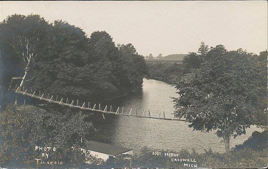
Above: Historical photo of the bridge.
![]()
Photo Galleries and Videos: Croswell Swinging Bridge
Bridge Photo-Documentation
Original / Full Size PhotosA collection of overview and detail photos. This gallery offers photos in the highest available resolution and file size in a touch-friendly popup viewer.
Alternatively, Browse Without Using Viewer
![]()
Bridge Photo-Documentation
Mobile Optimized PhotosA collection of overview and detail photos. This gallery features data-friendly, fast-loading photos in a touch-friendly popup viewer.
Alternatively, Browse Without Using Viewer
![]()
Maps and Links: Croswell Swinging Bridge
Coordinates (Latitude, Longitude):
Search For Additional Bridge Listings:
Bridgehunter.com: View listed bridges within 0.5 miles (0.8 kilometers) of this bridge.
Bridgehunter.com: View listed bridges within 10 miles (16 kilometers) of this bridge.
Additional Maps:
Google Streetview (If Available)
GeoHack (Additional Links and Coordinates)
Apple Maps (Via DuckDuckGo Search)
Apple Maps (Apple devices only)
Android: Open Location In Your Map or GPS App
Flickr Gallery (Find Nearby Photos)
Wikimedia Commons (Find Nearby Photos)
Directions Via Sygic For Android
Directions Via Sygic For iOS and Android Dolphin Browser
USGS National Map (United States Only)
Historical USGS Topo Maps (United States Only)
Historic Aerials (United States Only)
CalTopo Maps (United States Only)


