We Recommend:
Bach Steel - Experts at historic truss bridge restoration.
BridgeHunter.com Phase 1 is released to the public! - Visit Now
Denton Road Bridge

Primary Photographer(s): Nathan Holth
Bridge Documented: 2006 and October 8, 2015
Jackson: Jackson County, Michigan: United States
Not Available or Not Applicable
23.0 Feet (7 Meters)
24.0 Feet (7.3 Meters)
23 Feet (7.01 Meters)
1 Main Span(s)
384345000001B01

View Information About HSR Ratings
Bridge Documentation
This bridge no longer exists!
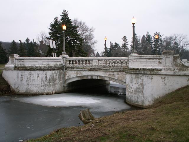
Bridge Status: This historic bridge was demolished in 2007.Designed as part of the large Sparks Foundation Park, this bridge served its original purpose of providing vehicles with an attractive crossing for three quarters of a century. The bridge's design was made to fit in with the nearby Cascades Fountain, which is a rather large artificial waterfall-like thing. The fountain was in excellent condition, but the bridge was in poor condition. The good condition of the fountain suggests the potential life that the bridge could have had as well, if it had been properly maintained. However, the bridge was not maintained, and the city of Jackson destroyed the bridge in 2007. This process of ignoring the maintenance of a bridge and then demolishing and replacing it when it becomes a serious issue reflects a problem with U.S. transportation funding and policy, which should instead focus on routine maintenance to prevent a bridge from deteriorating to the point that replacement is needed.
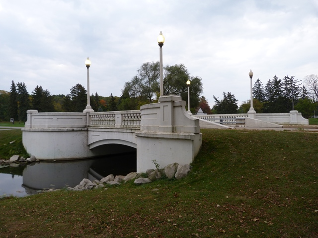
Jackson replaced the historic bridge with a modern bridge that they claim looks like the old bridge. Whether it looks like the old bridge is in the eye of the beholder. Also, the structure type has not been maintained. The original bridge was a steel stringer bridge, while the replacement bridge is a pre-stressed box beam bridge. Even if it looked exactly like the old bridge, which it does not, the new bridge is not noteworthy since it has no historic value whatsoever. While a major part of what makes historic bridges important is their beauty, the real heart of "historic" really has more to do with the old age of the bridge. The spirit of historic bridge preservation is not only to maintain a beautiful crossing, but also to marvel at the ability of a very old bridge to continue to be a functional object, and finally to also retain a record of construction for the period the bridge was built. Rebuilding a bridge completely, as Jackson did, is not a form of preservation in any sense.
View Archived National Bridge Inventory Report - Has Additional Details and Evaluation
Information and Findings From Michigan Historic Bridge Inventory
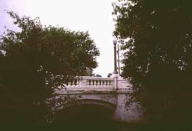
Narrative Description Sparks Foundation County Park and the Cascades Fountain are the creation of a local industrialist and former mayor of Jackson, William Sparks. He and his wife formed the William and Matilda Sparks Foundation to develop a recreation area from some swampland west of their home. Using engineers from their firm, the Sparks-Withington Company, as well as the American Park Builders of Chicago, they built an 18-hole golf course and Tudor-Revival-style clubhouse featuring sand-molded bricks and a roof sheathed with antique handmade tiles. The park's central attraction was the Cascades Fountain, which was modeled after similar fountains in Barcelona, Spain. The display consisted of a series of over a dozen artificial waterfalls, as well as fountains in three oval reflecting pools. At night, the scene was dazzlingly illuminated by multi-colored lights. In 1944, the 465-acre park was given to the county by Mrs. Sparks, by then a widow, and today continues to be one of the area's major tourist attractions. Statement of Significance Presumably constructed in 1931, during the park's development, the ornamental Denton Road Bridge was designed to complement its surroundings while providing access to the area from the south side of Jackson. Aside from minor repair projects, the bridge has remained virtually unmodified since its erection. As an important component of a significant park developed by a locally prominent family, the Denton Road Bridge is eligible for the National Register under Criterion A. Because of its aesthetic design, the bridge is also eligible under Criterion C. Information and Findings From Michigan Historic Bridge InventoryLocated within the boundaries of the Sparks Foundation County Park in Jackson, this bridge carries Denton Road over a narrow channel connecting two ponds. Landscaped grounds surround the site. The bridge features concrete balustrade railings along each side, with integrated posts at the corners where the bridge railings and wingwall railings meet. Curved wingwall railings, ornamented with recessed panels, form observation points at each corner at roadway level. Ornamented light standards stand on each endpost. The bases of the light standards display an incised Westinghouse logo. main span number: 1 main span length: 23.0 structure length: 24.0 roadway width: 32.0 structure width: 23.2 Located within the boundaries of the Sparks Foundation County Park in Jackson, this bridge carries Denton Road over a narrow channel connecting two ponds. Landscaped grounds surround the site. The bridge features concrete balustrade railings along each side, with integrated posts at the corners where the bridge railings and wingwall railings meet. Curved wingwall railings, ornamented with recessed panels, form observation points at each corner at roadway level. Ornamented light standards stand on each endpost. The bases of the light standards display an incised Westinghouse logo. |
This bridge is tagged with the following special condition(s): Unorganized Photos
![]()
Photo Galleries and Videos: Denton Road Bridge
Bridge Photo-Documentation
A collection of overview and detail photos. This photo gallery contains a combination of Original Size photos and Mobile Optimized photos in a touch-friendly popup viewer.Alternatively, Browse Without Using Viewer
![]()
Additional Unorganized Photos of Replacement Bridge
Original / Full Size PhotosA supplemental collection of photos that are from additional visit(s) to the bridge and have not been organized or captioned. This gallery offers photos in the highest available resolution and file size in a touch-friendly popup viewer.
Alternatively, Browse Without Using Viewer
![]()
Additional Unorganized Photos of Replacement Bridge
Mobile Optimized PhotosA supplemental collection of photos that are from additional visit(s) to the bridge and have not been organized or captioned. This gallery features data-friendly, fast-loading photos in a touch-friendly popup viewer.
Alternatively, Browse Without Using Viewer
![]()
Maps and Links: Denton Road Bridge
This historic bridge has been demolished. This map is shown for reference purposes only.
Coordinates (Latitude, Longitude):
Search For Additional Bridge Listings:
Bridgehunter.com: View listed bridges within 0.5 miles (0.8 kilometers) of this bridge.
Bridgehunter.com: View listed bridges within 10 miles (16 kilometers) of this bridge.
Additional Maps:
Google Streetview (If Available)
GeoHack (Additional Links and Coordinates)
Apple Maps (Via DuckDuckGo Search)
Apple Maps (Apple devices only)
Android: Open Location In Your Map or GPS App
Flickr Gallery (Find Nearby Photos)
Wikimedia Commons (Find Nearby Photos)
Directions Via Sygic For Android
Directions Via Sygic For iOS and Android Dolphin Browser
USGS National Map (United States Only)
Historical USGS Topo Maps (United States Only)
Historic Aerials (United States Only)
CalTopo Maps (United States Only)


