

View Information About HSR Ratings
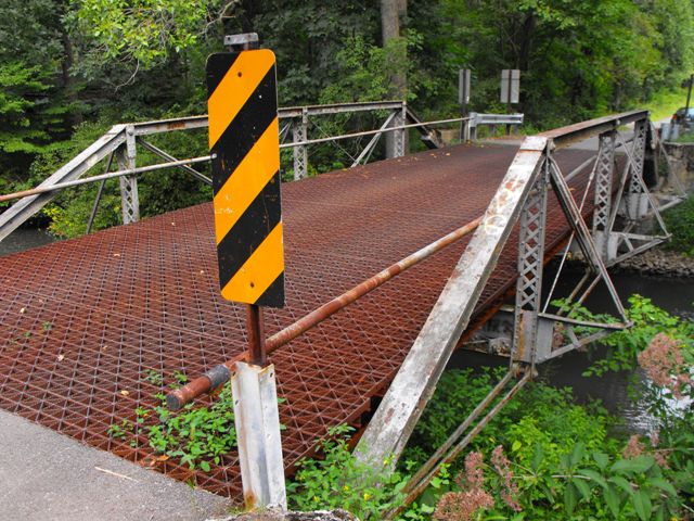
This bridge is a small but noteworthy historic truss bridge because of its age, lack of alteration, and presumed association with the Pittsburgh Bridge Company, a prolific and noteworthy regional bridge builder during the period. This bridge is also unusual in that the bottom chord at the end panels slope upward to meet the end post. The bridge's outriggers have cruciform beams (sometimes called star iron) which are a rare type of rolled beam normally only found on bridges dating to the 1870s and early 1880s. This brings the c. 1895 data offered by the Historic Bridge Inventory into question, suggesting the bridge could be older. The National Bridge Inventory lists a 1925 construction date which suggests that the bridge may have been relocated from another location to this site in that year. The bridge is in decent condition, but the paint has begun to fail in many areas. The time to plan for a rehabilitation of this bridge for continued light vehicular use is now. At this time, a rehabilitation would likely cost far less than replacing the bridge, representing two benefits: savings of tax dollars and historic bridge preservation.
Information and Findings From Pennsylvania's Historic Bridge InventoryDiscussion of Bridge The ca. 1895, pin connected, single span, 56'-long, Pratt pony truss bridge with the floor beams above the lower chords is supported on ashlar abutments with concrete wingwalls. The trusses are traditionally composed, and there are no innovative or distinctive details, but the bridge is complete, and it appears to have been fabricated by the Pittsburgh Bridge Company. It ranks as one of the oldest complete truss bridges in the district and it is historically and technologically significant based on its date of construction, which is based on its design, and its completeness. Discussion of Surrounding Area The bridge carries 1 lane of an unimproved road over a stream in a sparsely developed, forested setting. Bridge Considered Historic By Survey: Yes |
![]()
![]()
![]()
Coordinates (Latitude, Longitude):
Search For Additional Bridge Listings:
Bridgehunter.com: View listed bridges within 0.5 miles (0.8 kilometers) of this bridge.
Bridgehunter.com: View listed bridges within 10 miles (16 kilometers) of this bridge.
Additional Maps:
Google Streetview (If Available)
GeoHack (Additional Links and Coordinates)
Apple Maps (Via DuckDuckGo Search)
Apple Maps (Apple devices only)
Android: Open Location In Your Map or GPS App
Flickr Gallery (Find Nearby Photos)
Wikimedia Commons (Find Nearby Photos)
Directions Via Sygic For Android
Directions Via Sygic For iOS and Android Dolphin Browser
USGS National Map (United States Only)
Historical USGS Topo Maps (United States Only)
Historic Aerials (United States Only)
CalTopo Maps (United States Only)

© Copyright 2003-2026, HistoricBridges.org. All Rights Reserved. Disclaimer: HistoricBridges.org is a volunteer group of private citizens. HistoricBridges.org is NOT a government agency, does not represent or work with any governmental agencies, nor is it in any way associated with any government agency or any non-profit organization. While we strive for accuracy in our factual content, HistoricBridges.org offers no guarantee of accuracy. Information is provided "as is" without warranty of any kind, either expressed or implied. Information could include technical inaccuracies or errors of omission. Opinions and commentary are the opinions of the respective HistoricBridges.org member who made them and do not necessarily represent the views of anyone else, including any outside photographers whose images may appear on the page in which the commentary appears. HistoricBridges.org does not bear any responsibility for any consequences resulting from the use of this or any other HistoricBridges.org information. Owners and users of bridges have the responsibility of correctly following all applicable laws, rules, and regulations, regardless of any HistoricBridges.org information.
![]()