

View Information About HSR Ratings
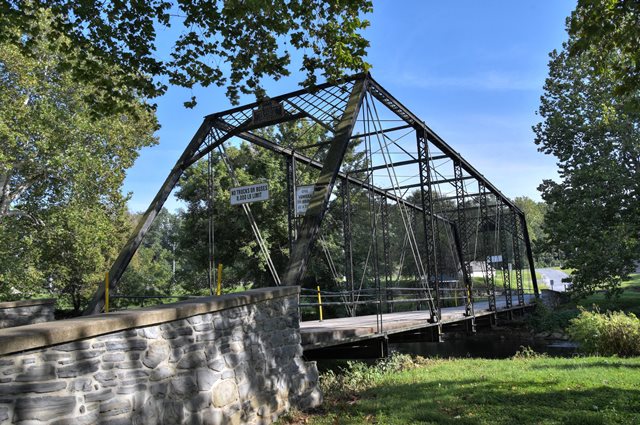
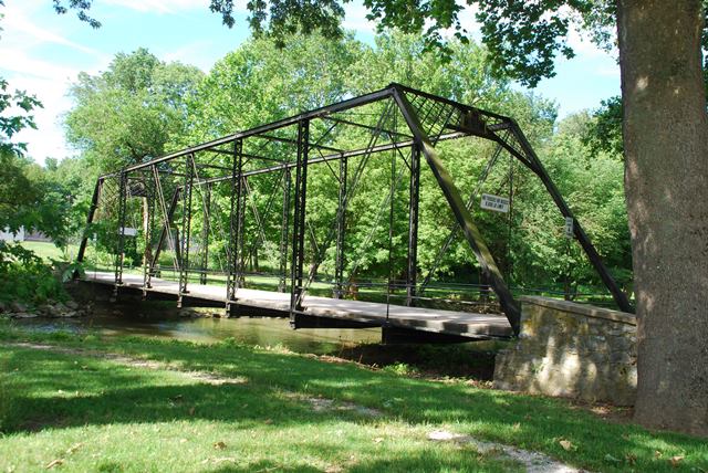
This bridge is an extremely rare surviving example of a bridge built by the notable Variety Iron Works. The company had purchased the Buckeye Bridge Works a year before this bridge was built, and the plaque on the bridge is in the form of a Buckeye Bridge Works plaque. Other details such as the latticed top chord (no cover plate), the pedimented struts, and design of the lattice portal bracing are all in the standard Variety Iron Works format.
The bridge has rare Oliver brands on some of the channel.
This bridge is one of the best preserved and few surviving examples of the Variety Iron Works. This company was true to its name, with bridges only being a portion of the structures fabricated by the company. This bridge displays design details typical for the company including the pedimented struts, lattice instead of cover plate on the top chord, lattice portal bracing, built-up fishbelly floor beams, and gas pipe railings that pass through the vertical members.
Lengths given are estimates. The bridge owned by the Lancaster Mennonite School and not on the National Bridge Inventory.
![]()
![]()
![]()
![]()
![]()
Coordinates (Latitude, Longitude):
Search For Additional Bridge Listings:
Bridgehunter.com: View listed bridges within 0.5 miles (0.8 kilometers) of this bridge.
Bridgehunter.com: View listed bridges within 10 miles (16 kilometers) of this bridge.
Additional Maps:
Google Streetview (If Available)
GeoHack (Additional Links and Coordinates)
Apple Maps (Via DuckDuckGo Search)
Apple Maps (Apple devices only)
Android: Open Location In Your Map or GPS App
Flickr Gallery (Find Nearby Photos)
Wikimedia Commons (Find Nearby Photos)
Directions Via Sygic For Android
Directions Via Sygic For iOS and Android Dolphin Browser
USGS National Map (United States Only)
Historical USGS Topo Maps (United States Only)
Historic Aerials (United States Only)
CalTopo Maps (United States Only)

© Copyright 2003-2026, HistoricBridges.org. All Rights Reserved. Disclaimer: HistoricBridges.org is a volunteer group of private citizens. HistoricBridges.org is NOT a government agency, does not represent or work with any governmental agencies, nor is it in any way associated with any government agency or any non-profit organization. While we strive for accuracy in our factual content, HistoricBridges.org offers no guarantee of accuracy. Information is provided "as is" without warranty of any kind, either expressed or implied. Information could include technical inaccuracies or errors of omission. Opinions and commentary are the opinions of the respective HistoricBridges.org member who made them and do not necessarily represent the views of anyone else, including any outside photographers whose images may appear on the page in which the commentary appears. HistoricBridges.org does not bear any responsibility for any consequences resulting from the use of this or any other HistoricBridges.org information. Owners and users of bridges have the responsibility of correctly following all applicable laws, rules, and regulations, regardless of any HistoricBridges.org information.
![]()