
View Information About HSR Ratings

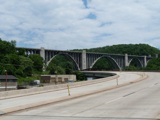
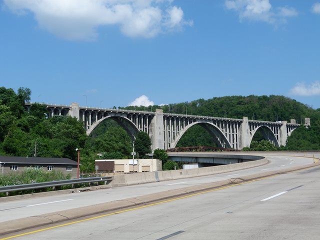
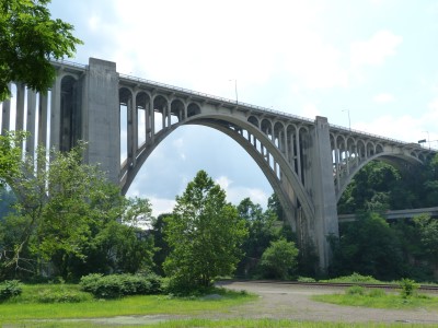
This bridge is perhaps one of, if not the most well-known of the many historic Allegheny County bridges that does not cross one of the big three rivers. Crossing Turtle Creek and other features as a high level bridge, this bridge was claimed to be the longest concrete arch bridge in the world when completed. Such a claim would have to exclude railroad bridges, since the older Tunkhannock Viaduct far exceeds the length of this bridge. Regardless, the bridge was and remains among the longest concrete arch bridges in the United States. However, the Westinghouse Bridge's largest central span does appear to have been the longest concrete arch span in the world when completed. The Pittsburgh area is noted for a number of concrete arch bridges with unusually long span lengths, yet the 460 foot length of this bridge's central span dwarfs all others in the Pittsburgh area. In addition to the length of the bridge, the height of the bridge, about 200 feet above the valley floor, adds to its significance and impressive appearance.

Of interest, this enormous bridge was not designed by an outside consulting engineer as was often the case with large, complicated bridges. Instead, Allegheny County Engineer Vernon Covell with the assistance of George Richardson designed the bridge. This bridge was constructed by Booth and Flynn Company. Visit the Ohio River Boulevard Spruce Run Bridge for photos, information, and biographies about the company and the important men who who ran it.
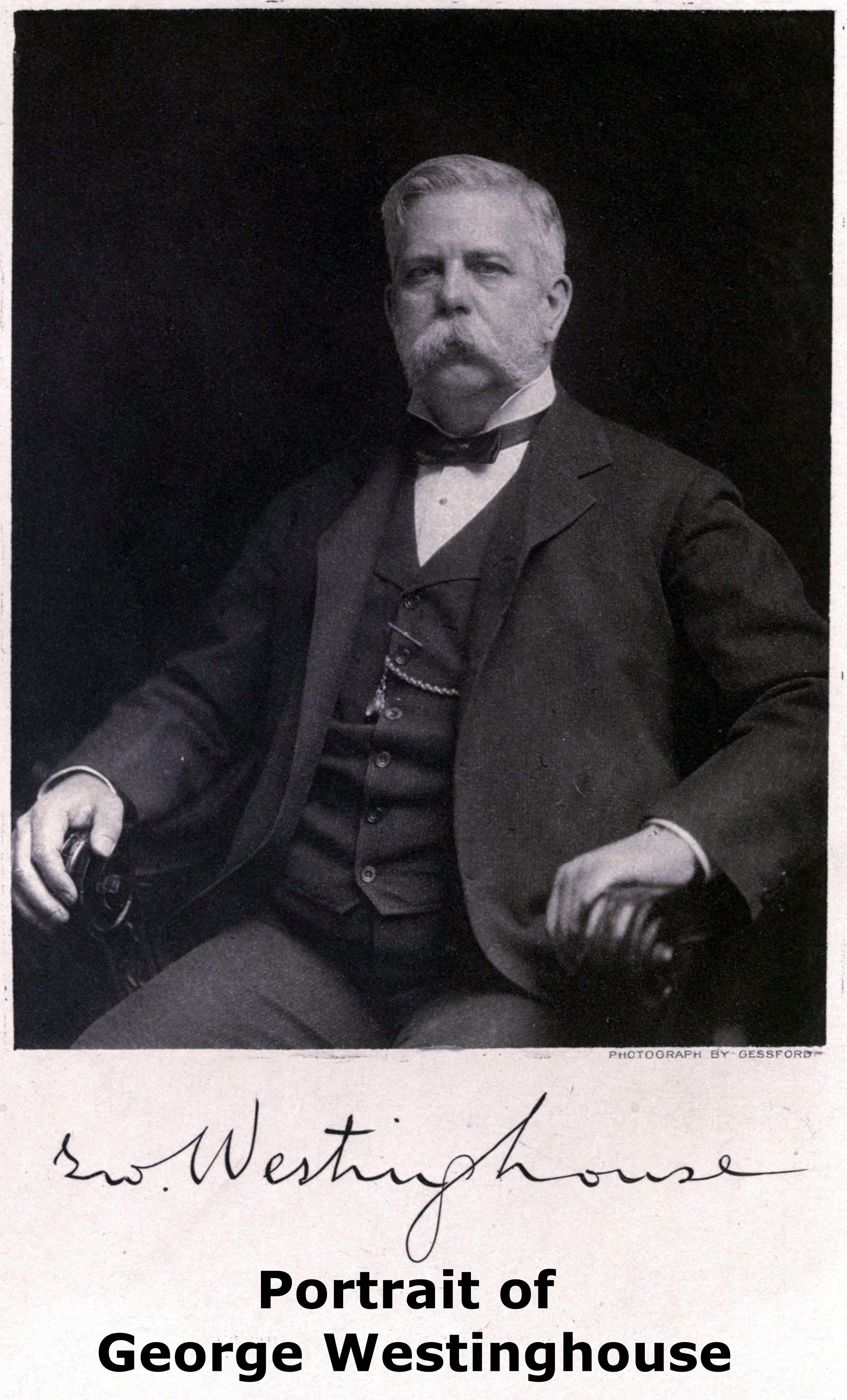
This bridge is apparently officially named the "George Westinghouse Memorial Bridge" even though the pillars at the ends of this bridge read simply "George Westinghouse Bridge." The bridge is commonly called the Westinghouse Bridge for short.
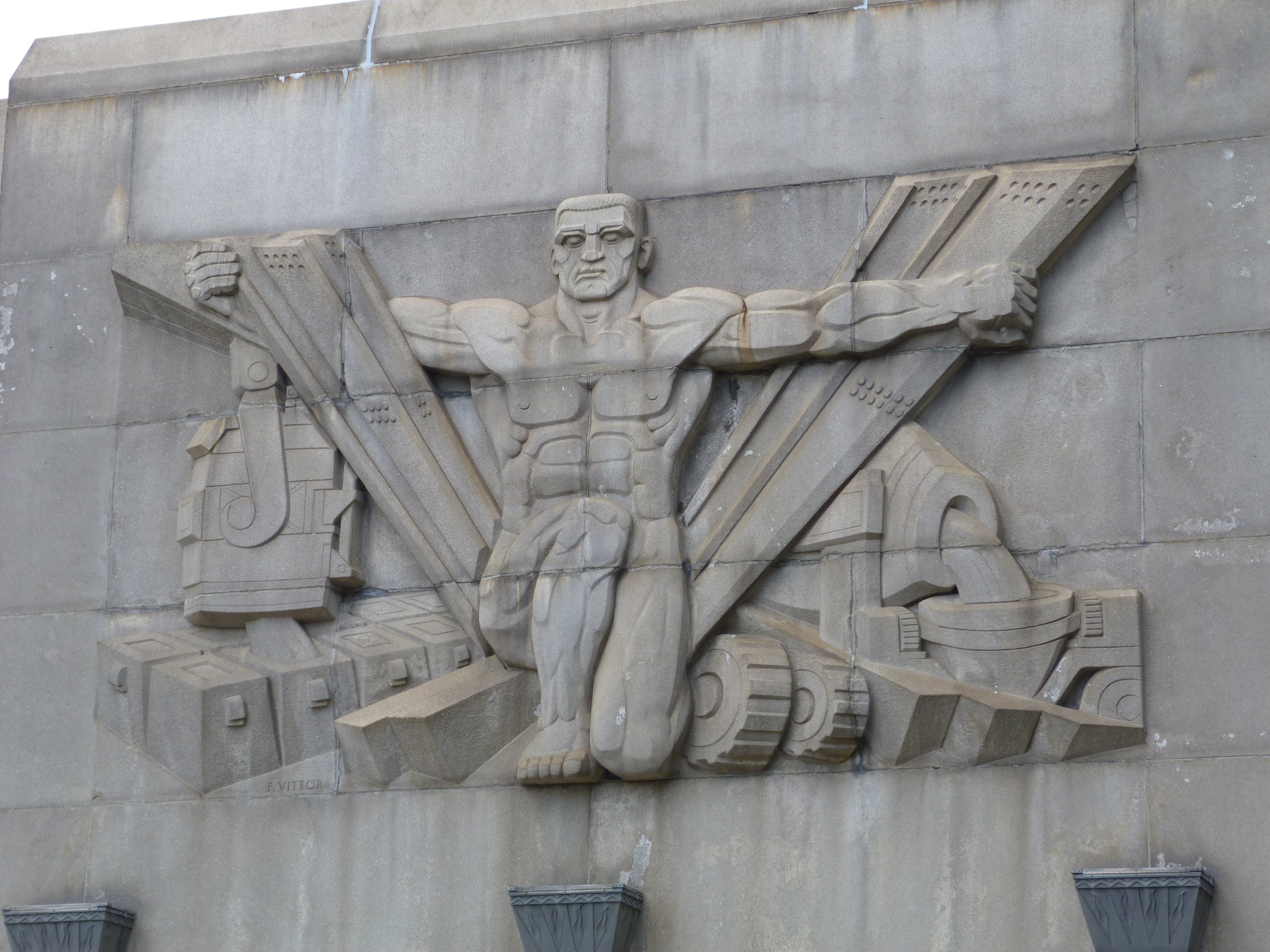
This bridge also includes enormous decorative pylons that depict area history through a series of sculptures. There are also sculptures showing the Allegheny County coat of arms. The four descriptive sculptures and the text below each sculpture is shown below.
 |
|
STEEL HERE IN THE TURTLE CREEK VALLEY, THE STEEL INDUSTRY STRUGGLED THROUGH ITS INFANCY AND HERE IT HAS BECOME FUNDAMENTAL TO MODERN CIVILIZATION |
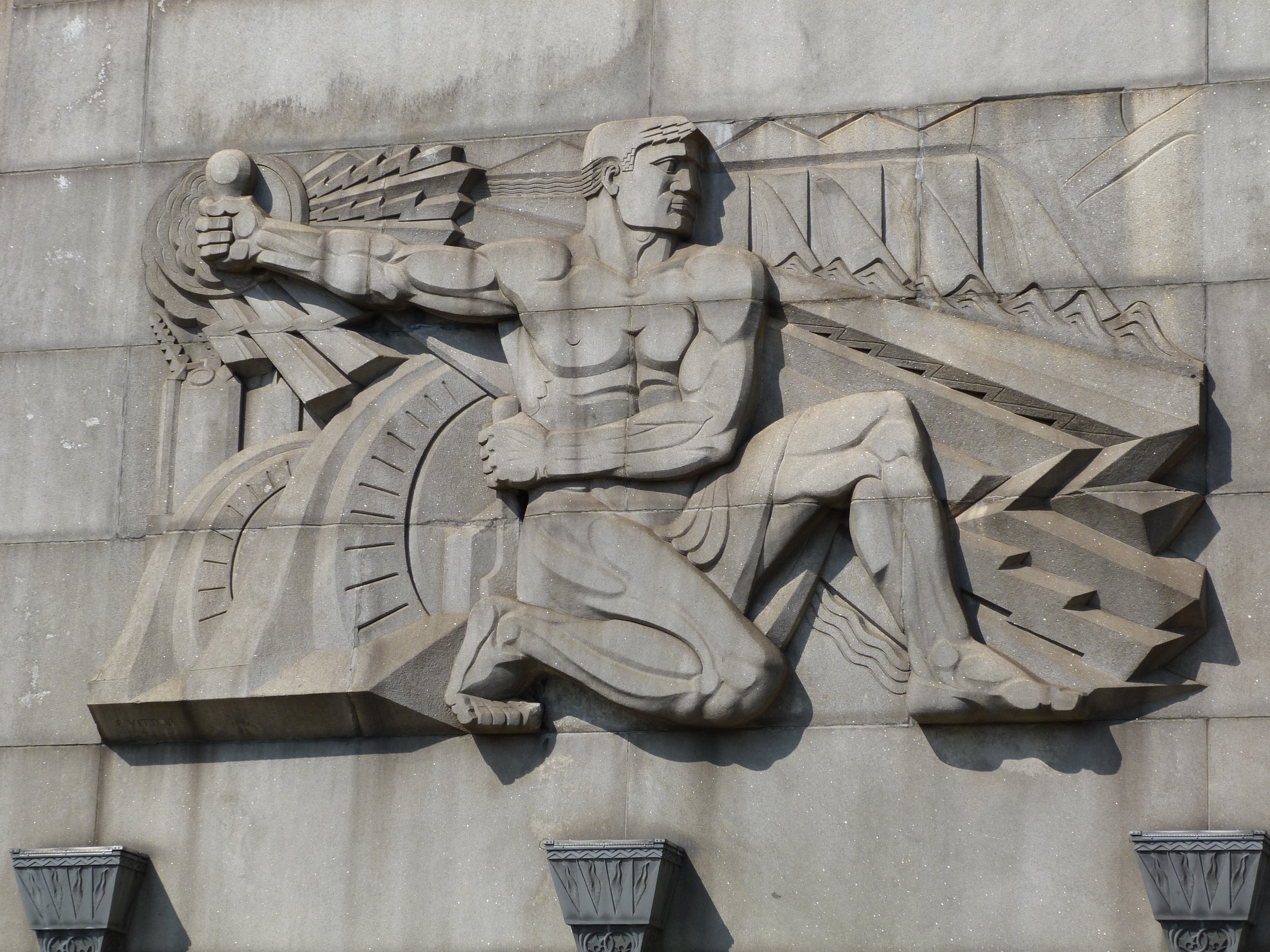 |
| ELECTRICITY WHEREVER ELECTRICITY HAS FLOWED, MAN'S EXISTENCE HAS BEEN ENRICHED AND INDUSTRY HAS GROWN |
 |
| TURTLE CREEK VALLEY AT THE ENTRANCE TO THIS HISTORIC VALLEY THE BRITISH FORCES UNDER GENERAL BRADDOCK WERE DEFEATED BY THE FRENCH AND INDIANS FROM FORT DUQUESNE 1755 |
 |
| GEORGE WESTINGHOUSE IN BOLDNESS OF CONCEPTION, IN GREATNESS AND IN USEFULNESS TO MANKIND THIS BRIDGE TYPIFIES THE CHARACTER AND CAREER OF GEORGE WESTINGHOUSE 1846-1914 IN WHOSE HONOR IT WAS DEDICATED ON SEPTEMBER 10, 1932 |

![]()
Coordinates (Latitude, Longitude):
Search For Additional Bridge Listings:
Bridgehunter.com: View listed bridges within 0.5 miles (0.8 kilometers) of this bridge.
Bridgehunter.com: View listed bridges within 10 miles (16 kilometers) of this bridge.
Additional Maps:
Google Streetview (If Available)
GeoHack (Additional Links and Coordinates)
Apple Maps (Via DuckDuckGo Search)
Apple Maps (Apple devices only)
Android: Open Location In Your Map or GPS App
Flickr Gallery (Find Nearby Photos)
Wikimedia Commons (Find Nearby Photos)
Directions Via Sygic For Android
Directions Via Sygic For iOS and Android Dolphin Browser
USGS National Map (United States Only)
Historical USGS Topo Maps (United States Only)
Historic Aerials (United States Only)
CalTopo Maps (United States Only)

© Copyright 2003-2026, HistoricBridges.org. All Rights Reserved. Disclaimer: HistoricBridges.org is a volunteer group of private citizens. HistoricBridges.org is NOT a government agency, does not represent or work with any governmental agencies, nor is it in any way associated with any government agency or any non-profit organization. While we strive for accuracy in our factual content, HistoricBridges.org offers no guarantee of accuracy. Information is provided "as is" without warranty of any kind, either expressed or implied. Information could include technical inaccuracies or errors of omission. Opinions and commentary are the opinions of the respective HistoricBridges.org member who made them and do not necessarily represent the views of anyone else, including any outside photographers whose images may appear on the page in which the commentary appears. HistoricBridges.org does not bear any responsibility for any consequences resulting from the use of this or any other HistoricBridges.org information. Owners and users of bridges have the responsibility of correctly following all applicable laws, rules, and regulations, regardless of any HistoricBridges.org information.
![]()