

View Information About HSR Ratings
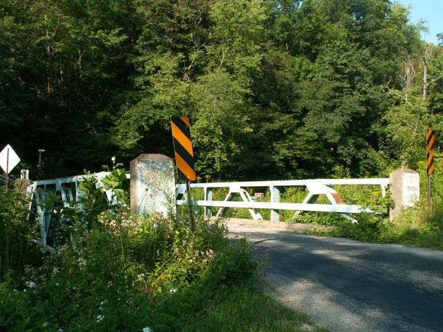
This bridge is a late example of a bridge fabricated by the Penn Bridge Company. The Penn Bridge Company built many bridges in the late 1800s that still remain in Pennsylvania. This 1929 bridge represents the work the company was doing long after bridge standardization had taken root. This traditional riveted pony truss bridge however does have one unusual detail, which is the concrete posts that extend from the abutments and connect to the main truss via a section of steel. These appear to have been placed mainly for decorative and protective purposes. They are not structural.
As of 2014, this bridge has been closed to traffic and may be at risk for demolition.
Information and Findings From Pennsylvania's Historic Bridge InventoryDiscussion of Bridge The one-span, 44'-long, riveted, Warren with verticals pony truss bridge built in 1929 is supported on concrete abutments with wingwalls. The floor beams are located above the lower chord. The trusses are traditionally composed with built up members throughout, and a channel traffic railing has been placed inside the truss lines. They connect to concrete end posts placed at the backwall of the abutments. There are minor bolted repairs. The bridge is a late example of what by 1910 was common technology, and neither the bridge nor its setting are historically or technologically significant. Discussion of Surrounding Area The bridge carries a single-lane road over a stream in a sparsely developed, rural area with scattered 20th century residences. Bridge Considered Historic By Survey: No |
![]()
![]()
Coordinates (Latitude, Longitude):
Search For Additional Bridge Listings:
Bridgehunter.com: View listed bridges within 0.5 miles (0.8 kilometers) of this bridge.
Bridgehunter.com: View listed bridges within 10 miles (16 kilometers) of this bridge.
Additional Maps:
Google Streetview (If Available)
GeoHack (Additional Links and Coordinates)
Apple Maps (Via DuckDuckGo Search)
Apple Maps (Apple devices only)
Android: Open Location In Your Map or GPS App
Flickr Gallery (Find Nearby Photos)
Wikimedia Commons (Find Nearby Photos)
Directions Via Sygic For Android
Directions Via Sygic For iOS and Android Dolphin Browser
USGS National Map (United States Only)
Historical USGS Topo Maps (United States Only)
Historic Aerials (United States Only)
CalTopo Maps (United States Only)

© Copyright 2003-2025, HistoricBridges.org. All Rights Reserved. Disclaimer: HistoricBridges.org is a volunteer group of private citizens. HistoricBridges.org is NOT a government agency, does not represent or work with any governmental agencies, nor is it in any way associated with any government agency or any non-profit organization. While we strive for accuracy in our factual content, HistoricBridges.org offers no guarantee of accuracy. Information is provided "as is" without warranty of any kind, either expressed or implied. Information could include technical inaccuracies or errors of omission. Opinions and commentary are the opinions of the respective HistoricBridges.org member who made them and do not necessarily represent the views of anyone else, including any outside photographers whose images may appear on the page in which the commentary appears. HistoricBridges.org does not bear any responsibility for any consequences resulting from the use of this or any other HistoricBridges.org information. Owners and users of bridges have the responsibility of correctly following all applicable laws, rules, and regulations, regardless of any HistoricBridges.org information.
![]()